Climbing into the South Sierras
Tehachapi Pass to Kennedy Meadows
141.9 miles
Welcome to the Sierra Nevada!
The word Sierra refers to a range that is serrated, or saw-toothed. The word Nevada means snowy. In 1542 a Spanish ship captain was sailing along the California coast and recorded seeing una gran sierra nevada to the east of Monterey. The mountains we today call the Sierra Nevada aren’t anywhere near Monterey—Captain Cabrillo was probably looking at the coastal range, although it is neither especially grand nor snowy—but for years the name was used on maps of California to indicate mountain ranges. It wasn’t until more than 200 years later, in 1772, that a Spanish expedition identified the mountains we today call the Sierra Nevada.

Climbing into the South Sierras
Running about 400 miles from Tehachapi Pass in the south to Mount Lassen in the north, the Sierra Nevada is the longest truly continuous mountain range in the 48 contiguous states. (The Appalachians and Rockies are subdivided into smaller ranges that have different geological histories.) But that 400 miles is crow-flying distance. If you happen to be measuring the distance on foot, switchbacking up and down countless mountains and meandering along the snakelike route of the PCT, you’ll rack up close to 800 miles on your pedometer.
More facts: The Sierra runs through three national parks, nine national forests, and one national monument. It contains the longest wilderness, deepest canyon, and highest mountain in the contiguous states, as well as some of America’s most spectacular scenery and most popular hiking trails.
The image of a trapdoor propped slightly open is often used to describe the shape of the range. The eastern side is short (as little as 6 miles from base to summit), steep, and dramatic; it forms one of the most striking escarpments in America. Mount Whitney, at 14,494 feet, looms two and a half vertical miles over the Owens Valley and is only 60 miles from Death Valley’s Badwater Canyon, 280 feet below sea level. The western slope is much gentler, sometimes as much as 60 miles wide. There is also asymmetry on the north-south axis; elevations are higher in the south than in the north.
According to most geologists, the PCT enters the Sierra Nevada at Tehachapi Pass, where the Garlock and San Andreas Faults meet, forming a border between the Sierra Nevada and the Mojave Desert. Nonetheless, on arriving at Tehachapi Pass, you might feel hard-pressed to see much difference between the landscape ahead and that behind. Scruffy brown mountains are still covered in chaparral, and populations of lizards and rattlesnakes scuttle in the dry rustling underbrush. The occasional jackrabbit zigzags up the trail; coyotes sing at night. Joshua trees provide the only shade, and bayonet-sharp yucca spears nip at exposed skin. Water remains scarce. For the first 16 miles of this section, there isn’t any at all. Geologists can say what they will; as a hiker, you may well feel that most of this section is far more like the familiar drylands to the south than like the dramatic pinnacles of the Sierra to the north.
THE ROUTE
Leaving Tehachapi Pass, the PCT crosses the Garlock Fault, California’s second-longest. With two major faults and significant land movement, seismologists predict that this region is ripe for a major earthquake.
Shortly after Tehachapi Pass the trail passes above the Walong Loop, a rail route that is, because of its circular tunnel, one of the most photographed railroad sections in the world.
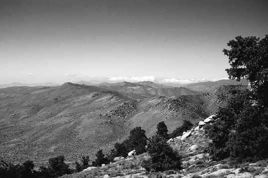
The trail climbs to the crest of the Sierra, leaving behind the Joshua trees and junipers and yuccas and rising to the cooler pinyon and oak woodlands. Once it reaches the crest, it pretty much stays there until Walker Pass, about 90 miles from Tehachapi Pass. Views alternate between mountain vistas and deep canyons, with the occasional panorama of the desert below, including Edwards Air Force Base, which has been used for landing space shuttles. Also along the route are windmill farms and the remains of old mines, testament to the mineral richness of the area.
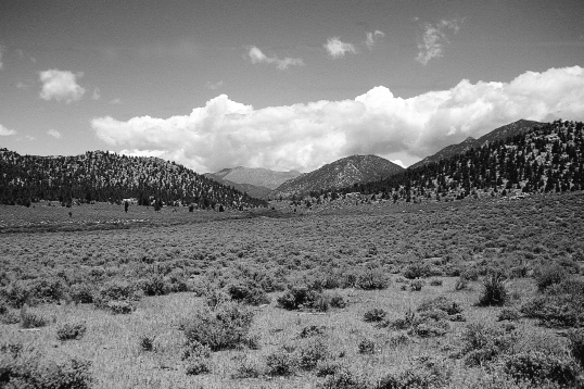
The terrain through the section is transitional—no longer desert, not yet high mountains. It can be hot here during the hiking season (despite the word Tehachapi, which means frozen in a local Paiute dialect). But as you progress north, ever so subtly changes appear. The trees are taller and the shade is cooler. North-facing views open to higher mountains, some of them tipped in white. Springs become more reliable. A number of them have been boxed, piped, and otherwise protected from pollution by the BLM and Forest Service. The risk of forest fires is not as great, and even in the dry season, campfires are sometimes permitted. Although the trail has not quite broken away from the fetters of the drylands to the south, it is entering the orbit of the mountains to the north.

Transition zone in the South Sierras
In this section, the PCT spends most of its time on public land and good cut trail. From Bird Spring Pass almost to Kennedy Meadows, the route is through a series of wilderness areas managed by either the BLM or the Forest Service. Nonetheless, like the previous section, this trail segment is primarily used by locals, by long-distance hikers, and by hikers trying to complete the PCT in sections. While it’s perfectly pleasant, most backpackers using plane tickets and vacation time gravitate to the more spectacular country to the north.
You get your first distant views of the Sierra high country about 20 miles in. Between Golden Oaks Spring and Robin Bird Spring, the views open to the bigger mountains ahead: Olancha Peak (likely snow-covered during thru-hiking season) and Mount Whitney among them. If you’re a thru-hiker, don’t panic at the snow. True, the white-tipped panorama is likely to look a little intimidating—maybe a lot! But there are still 250 miles—at least two weeks of hiking—before you reach the real High Sierra at 12,000-foot Cottonwood Pass. A lot of snow can melt in that time.
The trail descends to Walker Pass, where there is a campground, made more lively in recent years by the visits of resident black bears. It’s worth remembering that the Sierra Nevada is infamous for ursine campground robbers. If you haven’t thus far been hanging your food at night, Walker Pass is a good place to start.
From Walker Pass, the trail is in a true transition zone, but almost with every mile, you can feel the high country coming closer. Finally, the trail reaches to the South Fork of the Kern River. The sun might still be still blazing and the footway dusty dry, but there is something new here: Water. Running fast and ice-cold, the South Fork of the Kern is fed from the melted snow of the high peaks—the first tactile, physical evidence that your long traverse through southern California’s drylands is at last coming to an end.
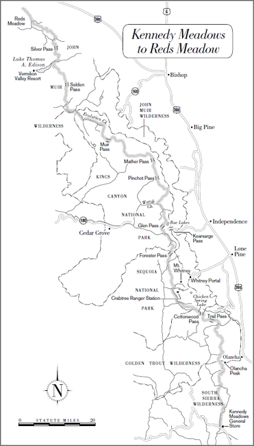
This section ends at Kennedy Meadows, a Forest Service campground with a store that accepts food drops for long-distance hikers.
WHAT YOU’LL SEE
The Walong Loop
Eight miles west of Tehachapi, and visible from the trail, is the Walong Loop, an unusual circular stretch of railroad that dates from 1875 and 1876. The Southern Pacific Railroad had decided to connect central California (Bakersfield) and southern California (Los Angeles) with a route through Tehachapi Pass. Small problem: The Tehachapi Mountains stood directly in the way, and the grade was too steep for a railroad.
Like a modern-day trail builder, road engineers switchbacked through gullies and along slopes, inching ever higher—but they were still short 77 vertical feet.
The solution was to construct a tunnel that ran in a full circle, so that by the time the train had completed its loop, it had gained the necessary elevation. The resulting loop is 3,799 feet long. Today’s freight trains can be more than a mile long, so frequently a locomotive going through the loop passes over (or under, depending upon direction) its own caboose.
The name Walong is of murky origin. It is thought to be the result of cultural and linguistic confusion between Americans and Cantonese railroad workers. There is no word Walong in Cantonese. One theory is that the name might be a combination of the Cantonese words for Chinese people and road. Another theory claims it means coiled dragon. Either seems appropriate.
Today the Walong Loop is operated by the Union Pacific and Santa Fe Railroads. It connects the San Joaquin Valley with Arizona and points east. As many as 40 freight trains a day execute the loop, carrying agricultural and petroleum products. It is the busiest single-track line in the United States.
Windmill Farms
Like San Gorgonio Pass, Tehachapi Pass is a natural wind tunnel that takes advantage of the fact that dry desert air rises and must be replaced by cooler air rushing in from eastward-blowing oceanic winds. Pressed against walls of ridges, air is compressed and wind speeds rise to more than 70 miles per hour. The region has been developed as one of the most extensive and productive wind energy systems in the world. More than 5,000 wind turbines are operated in the Tehachapi-Mojave Wind Resource Area and produce 1.3 terawatt-hours of electricity (or 1,300 million kilowatt hours)—enough for 500,000 residential users. Like the windmill farms in San Gorgonio Pass, the farms at Tehachapi Pass are considered by many to be an aesthetic nuisance.
A few miles north on the PCT, you’ll see newer wind farms with more modern and efficient blades. The Sky River’s 100-foot-high windmills occupy 5 miles of ridgelines and supply enough electricity for 300,000 people.
Pinyon Pines
Much of this area is dominated by pinyon pines, one of the more common trees in the transition zone. Pinyon nuts were an important Native American food. You’ll see them if you’re hiking in early autumn. Indians gathered the closed cones, heated them in a low oven, opened the cones, and then loosened and shelled the nuts. The protein-rich nuts can be eaten raw, or cooked. They can be used whole, but were more frequently ground into a flour.
Desert Protection
From Bird Spring Pass almost to Kennedy Meadows, the trail passes through the Kiavah, Dome Lands, Chimney Peaks, and Owens Peak Wildernesses. The California Desert Protection Act of 1994, which established new wilderness areas in semiarid environments, was designed to combat years of degradation due to mining, grazing, and more recently, off-road vehicles (you’ll see tracks and roads especially in the Jawbone Canyon area). The Jawbone area, which you’ll cross 35 miles past Tehachapi Pass, was of critical concern in the California Desert Plan because of its bird life. A total of 160 species of birds are protected there, including golden eagles.
Walker Pass
On the southern end of the Sierra, Walker Pass is the first reasonable opportunity to cross the mountains, and as such it was an ancient Native American route to the Kern River, which drains the Sierra. Natives fished along the Kern River in summer, then wintered along the coast. Later, in the 1860s, the pass was used by sheepherders driving herds of thousands of sheep into the high country for summer pasturage.
The pass was named by James Fremont in honor of Tennessean Joseph R. Walker, a guide with the 1843–46 Fremont Expedition. Earlier, in 1833, Walker had become the first European American to make an east-to-west crossing of the Sierra. (Jedediah Smith, who was the first European American to cross the Sierra, had gone the other way; see page 153.) Walker was leading an expedition of about 70 people in an exploration of areas west of Great Salt Lake. Traveling westbound, they first crossed the Sierra to the north, near Bridgeport. One member of the group, looking up at the eastern flank of the Sierra, is reported to have described it as a “dark and deathlike wall.” When Walker returned, this time traveling eastbound, he crossed over the pass that now bears his name.

South Fork Kern River
Walker’s exploration credits include being the first white person to see Yosemite. His expedition returned with the report of big trees: “16 to 18 fathoms around the trunk at the height of a man’s head from the ground.” It was the first description of the giant sequoia.
South Fork Kern River
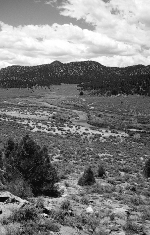
Perhaps the most compelling sign that you have finally and truly arrived in the Sierra is found near the end of this section, when you first encounter the ice-cold evidence of the heights ahead. The snowmelt-fed South Fork of the Kern River drains much of the southeastern Sierra. Starting near Cottonwood Pass (hikers continuing north will get there in another 140 miles) the free-flowing South Fork descends through deep gorges, roars past large granite outcroppings and domes, and meanders through open meadows. It offers refreshing (if chilly) bathing and good fishing in summer months. (The river is habitat for the California state fish, the golden trout.) But it can be dangerous to cross during the snowmelt. The South Fork is part of the National Wild and Scenic Rivers System. In spring and summer, its lower stretches offer rafting; it’s a popular whitewater destination. Outfitters can be found in Tehachapi.
 HIKING INFORMATION
Seasonal Information and Gear Tips
This section is best hiked in the spring, when water is (relatively) plentiful and temperatures not too hot. In character, this section’s terrain is much like the higher elevations of southern California. But there is more shade, less heat, more water—as you get ever closer to the higher mountains, the conditions become much less desertlike.
However, desert gear is still appropriate here: a sun-deflecting hat, clothes that protect you from the sun, and a tarp. In early spring and late fall, remember the origin of the word Tehachapi (frozen) and plan accordingly.
Thru-hikers’ Corner
This section presents no unusual challenges for thru-hikers. However, despite the fact that this section is technically in the Sierra Nevada Mountains, don’t expect to see the rocky pinnacles and snow-covered passes just yet. In many ways, hiking through this section is more like hiking in the San Jacinto and San Gabriel Mountains than it is like the heart of the High Sierra, just to the north.
Best Short Hikes
• Piute Mountain Road to Walker Pass on California Highway 178. This 40-mile stretch takes you through prime high-desert and transition-zone terrain.
• Walker Pass to Cranebrake Road. This 29-mile hike is mostly forested, with pleasant views and good camping. It ends 0.3 miles from the BLM-administered Chimney Creek Campground.
Resupplies and Trailheads
Highway 58 is the more commonly used.
Highway 58 (mile 0). From Highway 58, hitch to either Mojave or Tehachapi. Both have everything you’ll need to clean up, rest, resupply, and get on your way. Post offices: General Delivery, Mojave, CA 93501; General Delivery, Tehachapi, CA 93561
Walker Pass (mile 83.5). To resupply in Onyx, go west 17.6 miles on Highway 178. Post office: General Delivery, Onyx, CA 93255

Paul Woodward, © 2000 The Countryman Press