Wales
FOR THE NORMANS, WALES WAS A LAND OF TWO PARTS: THE LOWLANDS AND HILLS OF THE SOUTH, AND THE WILD, UNTAMEABLE MOUNTAIN LANDS OF THE NORTH. THEY CAME TO THE SOUTH EARLY, AND CLAIMED MUCH OF IT, BUILDING CASTLES AS THEY WENT. THE WELSH RETREATED TO THE HILLS AND MOUNTAINS AND FOUGHT ON UNTIL EDWARD I BUILT HIS ‘IRON RING’ OF CASTLES IN THE NORTH AT THE END OF THE 13TH CENTURY.
WIDESPREAD OPEN REVOLT AGAINST ENGLISH RULE BEGAN AGAIN UNDER THE 15TH-CENTURY CAMPAIGN OF OWAIN GLYN DWR. CASTLES WERE A CENTRAL FOCUS OF THIS REBELLION, BUT OWAIN’S OWN CASTLE HEADQUARTERS AT SYCARTH IS NOW A FORGOTTEN, INACCESSIBLE TREE-COVERED MOUND.
THE LEGACY OF CASTLES IN WALES IS TREMENDOUSLY RICH, WITH MANY EVOCATIVE RUINS IN OUTSTANDING LANDSCAPE SETTINGS.

Beaumaris
The ultimate in concentric castles, Beaumaris is the last of the fortresses built by Edward I. Started in 1295, it cost nearly £15,000 and took over 35 years to build, but it was never completed. At the peak of building, more than 2,500 people were working on the castle.
The master builder
Edward I commissioned Master James of St George to build the fortress shortly after an uprising by Madog ap Llywelyn. Edward brought James over from Europe: he had already been involved with the construction of several of the king’s great castles in Wales. Beaumaris, his final work in Wales, is considered by many to be the finest of all the Edwardian castles, and one of the most technically perfect in all Britain.
At Beaumaris James of St George oversaw the building of two perfectly symmetrical rings of walling with flanking towers and gatehouses surrounded by a broad wet moat fed by the tidal waters of the Menai Strait. A dock in the outer ring enabled seagoing supply vessels to unload their cargoes directly into the castle.
An unfinished project
The outer ring of walls, about half as thick as the walls of the inner ward, were built to an octagonal plan with cylindrical flanking turrets. Inside these, the 5m (16ft) thick walls of the inner ward were built to a square plan with six towers and two vast gatehouses. Both keep-like gatehouses were intended to contain opulent residential suites and to be the strongest parts of the castle. None of the towers or gatehouses was completed to full height.
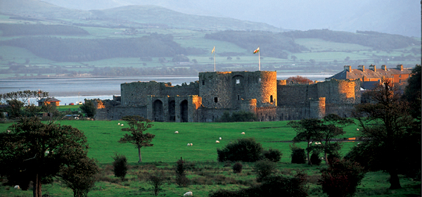
Despite grand intentions for Beaumaris, the initial flurry of construction lasted only about three years until 1298 when funds dried up. Small-scale building resumed again early in the 14th century but within 20 years Beaumaris was deteriorating. Edward’s plans for Beaumaris were never fulfilled but his legacy here is powerful enough to have earned the castle World Heritage inscribed status.
Exploring
This is a thoroughly satisfying castle to explore although finding your way around can be bewildering, but you are rewarded with an insight into the power and authority conveyed by the structure. The views of the Menai Straits from the castle are also wonderful.
| Location | Isle of Anglesey |
| Map ref | SH 607763 |
| Tel | 01248 810361 |
| Web | www.cadw.wales.gov.uk |
| Open | Daily 9.30–5 Apr–May & Oct; 9.30–6 Jun–Sep; Mon–Sat 9.30–4, Sun 11–4 Nov–Mar |
Caerphilly
This was the first concentric castle built from scratch in Britain. Its blend of land and water defences represented the highest sophistication in military architecture at the time of its construction. Despite sieges and long periods of neglect much of the castle has survived and it is now a spectacular ruin.
Earl Gilbert de Clare began the castle in 1268 and it was completed quite quickly.
Hugh Despenser
In 1316 Caerphilly was attacked during a Welsh uprising, but sustained little damage. The following year, the castle came to Edward II’s favourite, Hugh Despenser the younger, who rebuilt the great hall in the 1320s. The castle was threatened again in the winter of 1326 when the forces of Isabella, the estranged wife of Edward II, laid siege to the fortress where the king had earlier taken refuge and left much royal treasure. Caerphilly began to fall into disrepair later in the 14th century, but was extensively restored in the early 1930s by the 4th Marquess of Bute. Today, it is one of Britain’s most outstanding 13th-century castles.
What to see
On the south dam platform, once a tournament field, are working replica siege engines. Look out too for the leaning tower, a victim of subsidence, listing at a greater angle than the Tower of Pisa.
There are exhibitions, and spiral stairs reach those that are housed in the towers. Information panels are displayed in the castle.
| Location | Caerphilly |
| Map ref | ST 155870 |
| Tel | 029 2088 3143 |
| Web | www.cadw.wales.gov.uk |
| Open | Daily 9.30–5 Apr–May & Oct; 9.30–6 Jun–Sep; Mon–Sat 9.30–4, Sun 11–4 Nov–Mar |
Caldicot
Caldicot began as a motte castle with two baileys, built beside a stream, probably in the 11th century. The present castle was erected by the Earl of Hereford. It developed from the early 13th century into a large, stirrup-shaped stone enclosure with high walls, flanking towers, an unusual gatehouse and a cylindrical great tower erected on the motte in one corner. It stands on a splayed plinth and has a mural staircase to the basement and a spiral staircase up to the second floor.
More building took place during the next century and includes the 14th-century gatehouse. This is rectangular with square turrets at each end and – since it intended to be a residential structure – handsome accommodation. The castle was bought and restored as a family home in the middle of the 19th century.
Attractions for the visitor
The restoration made it even more picturesque and today the castle is the excellent focal point of a 22ha (55-acre) country park. A self-guided cassette tour provides visitors with a complete story of the castle. A large number of events take place throughout the summer, with many especially for children and the rare plants fair and Roman Britain re-enactment will appeal to visitors of all ages. There is a tea room for refreshments if required.
| Location | Monmouthshire |
| Map ref | ST 487885 |
| Tel | 01291 420241 |
| Web | www.caldicotcastle.co.uk |
| Open | Daily 11–5 Mar–Oct; Sat–Sun 11–4 Nov–Feb. Please visit website or telephone for winter school holiday closures. After October 2006, winter hours might change – please contact the castle for information |
Cardiff
Cardiff began as a motte castle, raised in about 1080 on the site of a Roman fort. In the 12th century a 12-sided shell enclosure was erected on the motte with a tower-like projection on one side.
The Black Tower
Medieval additions include the Black Tower built in the 1200s below the motte and connected to it by a wing wall, an octagonal tower, c.1420s, on the south side of the shell enclosure and a substantial gatehouse linked to the Black Tower by a wall across the bailey. Later apartments in the bailey included a range against the western wall, substantially remodelled in the 18th and 19th centuries.
Powerful families
Cardiff is a good example of how an earth-and-timber motte castle was converted to a stone fortress. It has belonged to some powerful families, including the de Clares and, in the 14th century, the Despensers. The castle was held by the Royalists for most of the Civil War. In the 19th century, the 3rd Marquess of Bute employed architect William Burges to remodel it in the Gothic Revival style.
A splendid place to visit
There are two military museums, and visitors will enjoy the magnificent Mediterranean gardens and the castle’s grounds, with their peacocks, ducks and geese. For refreshments there is a tea room. Regular events take place throughout the year.
| Location | Cardiff |
| Map ref | ST 180767 |
| Tel | 029 2087 8100 |
| Web | www.cardiffcastle.com |
| Open | Daily 9.30–6 Mar–Oct; 9.30–5 Nov–Feb. Last entry and last tour 1 hour before closing |
Carew
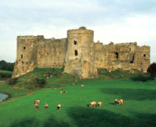
Carew stands on a rock above the shore overlooking a rare tidal mill where the River Carew enters the sea. It began as an earthwork castle early in the 12th century. Later that century the original gatehouse was altered to make a tower, and later still, a square-plan curtain wall was built round the tower. The curtain had four large flanking towers of various shapes, two of which were cylindrical on spur bases.
Late in the 13th century an outer ward with its own gatehouse into the main enclosure was added. This enclosure was altered in the 14th and 15th centuries when a great hall and imposing porch were built, thus converting the castle into a grand mansion. There were further alterations in the 16th century. Carew was badly damaged in the Civil War, and by 1685 it had been abandoned.
The setting, and nearby tidal mill (one of only four that have been restored in Britain) and beautiful Carew Cross, make this an excellent place to visit.
| Location | Pembrokeshire |
| Map ref | SN 045037 |
| Tel | 01646 651782 |
| Web | www.carewcastle.com |
| Open | Daily 10–5 Apr–Oct. Tours of the castle (no additional charge) are available at 2.30 each day |
Caernarfon
Caernarfon, part of Edward I’s defensive ring of castles, was intended as a powerful symbol of the conquest of Wales. The castle was never finished but it was the grandest of Edward’s Welsh structures. Edward’s son, the first English prince of Wales and the future Edward II, was born there in 1284.
Strategic importance
The position of Caernarfon, on the banks of the River Seiont where it flows into the Menai Strait, was strategically important. The site of the Roman fort of Segontium lay only a short distance away, and Edward raised his castle on the spot where Hugh of Avranches had erected a motte and bailey c.1090. Building began in 1283, overseen by Master James of St George: this included the huge polygonal Eagle Tower.
The castle was taken in 1294 during the revolt of Madog ap Llywelyn but was regained by the English in 1295 when work resumed on the unfinished defences, including the mighty twin-towered King’s Gate. Although Edward’s attention eventually turned to Scotland, building work at Caernarfon continued until 1330, but was never completed.

Caernarfon lost its defensive and administrative importance after the Act of Union in the 16th century.
Attractions for the visitor
The castle, along with the town walls, is a World Heritage Site. It is packed with interest and there is much to explore, including a military museum. The covered passageways and wall-walks will fuel your imagination of castle life in Edward I’s time, and the exhibitions and displays will fill in any gaps in Caernarfon’s history.
The regimental museum covers the history of the Royal Welch Fusiliers with exhibitions and interactive displays. In addition, the castle hosts several events throughout the year.
| Location | Gwynedd |
| Map ref | SH 477626 |
| Tel | 01286 677617 |
| Web | www.cadw.wales.gov.uk |
| Open | Daily 9.30–5 Apr–May & Oct; 9.30–6 Jun–Sep; Mon–Sat 9.30–4, Sun 11–4 Nov–Mar |
Carreg Cennen
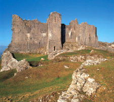
This powerful courtyard castle stands on a 91.5m (300ft) high limestone crag overlooking the Cennen valley. Although preceded by an earlier castle, the existing stronghold was begun in the late 13th century.
History of the castle
The inner ward, which is entered via an elaborate barbican and a strong gatehouse, has a long range incorporating the hall and other domestic buildings along the east wall. A covered gallery along the cliffside leads to a ‘secret’ cave that may have contained a source of fresh water.
Carreg Cennen is very much a ruin, but its layout and sophisticated defences are clear. It was severely damaged by Owain Glyn Dwr early in the 15th century. After repair during the reign of Henry V, it was a stronghold during the Wars of the Roses, but was finally rendered useless as a castle by the Yorkists after their victory at Mortimer’s Cross in 1461.
Visiting
This is one of the most beautifully set of all Welsh castles, with truly breathtaking views of Black Mountain across the valley from the parapets. Reaching the hilltop requires a somewhat invigorating climb, which may not be suitable for elderly people, but is well worth the effort for the more able-bodied.
| Location | Nr Llandeilo, Carmarthenshire |
| Map ref | SN 668191 |
| Tel | 01588 822291 |
| Web | www.cadw.wales.gov.uk |
| Open | Daily 9.30-6.30 Apr–Oct; 9.30-dusk Nov–Mar |
Castell-y-Bere
This Welsh-built castle was raised on a spur below Cader Idris, and resembles the medieval German hill castles such as Staufen. It was probably begun in 1221 by Llywelyn the Great (c.1196–1240), and comprised an irregular curtained enclosure with a D-shaped tower at the northern end and a rectangular, keep-like tower to the south.
The entrance to the castle was defended with two gate-towers, each equipped with a drawbridge, and overlooked by a nearby round tower on the curtain wall. Llywelyn the Great, or perhaps his grandson, Llywelyn ap Gruffydd (d. 1282), built another D-shaped tower, but it stood isolated a short distance south of the main enclosure.
Although the castle was formidable because of its position, it surrendered to Edward I’s men after a short siege in 1283. The English strengthened Castell-y-Bere with walls linking the isolated southern tower to the main part of the castle, but the stronghold was besieged again in 1294, during the revolt of Madog ap Llywelyn. The outcome of the siege is unknown, but occupation of the castle ceased around the end of the 13th century.
The remains are very ruinous, but impressive.
| Location | Abergynolwyn, Gwynedd |
| Map ref | SH 667086 |
| Tel | 01443 336 000 |
| Open | At all reasonable times |
Chepstow
Domesday Book records show that it was William FitzOsbern, Earl of Hereford who established the castle of Estriguil, or Chepstow, on the limestone cliffs towering above the River Wye. FitzOsbern has also been credited with the construction of the great tower – a substantial quadrilateral two-storey building, about 30.5 × 12m (100 × 40ft), standing on a splayed plinth – giving rise to the claim that it represents the earliest stone keep in Britain. A recent re-evaluation of the castle, however, suggests that William the Conqueror is a more likely candidate for builder of the great tower. Chepstow was in royal hands after 1075 and the king may have planned the tower, which has few domestic facilities or defensive features, as a great audience chamber where he could assert his regal authority in Wales.
Modernizing
William Marshal, one of the greatest knights of his age and later Earl of Pembroke (1199–1219), obtained Chepstow by marriage in 1189, and soon set about modernizing the castle, which had probably changed little during the 12th century. Work on the defences of the lower bailey was underway in the 1190s, and the design of the gatehouse, with two cylindrical towers flanking the gate-passage, was ahead of its time. Marshal also provided the middle bailey with a curtain wall with rounded mural towers, and rebuilt and strengthened the defences of the existing Norman upper bailey.
After his death, five of William Marshal’s sons held the castle in succession between 1219 and 1245. During that time, the great tower was remodelled and another storey was added at its west end. An upper barbican was added to bolster defences at the western end.
Marten’s Tower
Roger Bigod, 5th earl of Norfolk (1270–1306), completed the upper storey of the great tower, and built a sumptuous new domestic range in the lower bailey. He also added a huge D-shaped mural tower (19m/63ft) at the south-east corner of the lower bailey. It is known as Marten’s Tower because Henry Marten, a signatory to the death warrant of Charles I, was imprisoned there after the Restoration of Charles II.
Chepstow overlooked a harbour on the River Wye, which meant the castle could be provisioned by ships coming from Bristol. Never attacked in the Middle Ages, the castle was besieged twice in the Civil War as a Royalist stronghold. Much renovation was undertaken in the 17th century to equip the castle for guns and musketry.
Visitors
The ruins stretch magnificently along the Wye, with the Norman great tower still standing at the heart of the castle. Exhibitions are displayed in the castle today.

| Location | Monmouthshire |
| Map ref | ST 533941 |
| Tel | 01291 624065 |
| Web | www.cadw.wales.gov.uk |
| Open | Daily 9.30–5 Apr–May & Oct; 9.30–6 Jun–Sep; Mon–Sat 9.30–4, Sun 11–4 Nov–Mar |
Chirk
In the 1280s the Mortimer family began a lordship castle here with a view across Cheshire towards the Pennines. The fortress became a quadrangle with squat but substantial cylindrical corner towers and half-round towers, which remain in the present mansion. It is thought that the work went on into the 1320s when Roger Mortimer was disgraced and put to death. In 1595 the castle was sold to Thomas Myddleton who remodelled it; his descendants still live here. Chirk was besieged in the Civil War but was surrendered to prevent destruction.
Visitor attractions
The castle, gardens and parkland, in the care of the National Trust, are open in summer. The castle’s interior is magnificent, with sumptuous furnishings and decoration that reflect the changing styles over Chirk’s 700-year history. Visitors can see the fine tapestries on display, and the medieval dungeon, as well as the magnificent wrought-iron gates. A tea room provides refreshments.
| Location | Wrexham |
| Map ref | SJ 275388 |
| Tel | 01691 777701 |
| Web | www.nationaltrust.org.uk |
| Open | Castle Wed–Sun 12–5 mid-Mar to Sep; Wed–Sun 12–4 Oct. Gardens Wed–Sun 11–6 mid- Mar to Sep; Wed–Sun 11–5 Oct |
Cilgerran
Built on a rocky promontory of great natural strength overlooking the Teifi Gorge, with rock-cut ditches at the south end, Cilgerran probably began as a Norman enclosure castle with an outer bailey early in the 12th century.
Expansion and rebuilding
In 1223, William Marshal the younger began a major rebuilding of the castle by inserting the cylindrical east tower into the circuit of the Norman enclosure. During the next two decades, William and his brothers, who succeeded him as lords of Cilgerran, constructed the masonry defences of the outer ward and added the imposing west tower and a strong gatehouse to the inner ward.
By the 1320s the castle was ruinous. To counter a threatened French invasion, Edward III ordered repairs in 1377 and the north tower and various domestic buildings were raised in the inner war. Cilgerran was attacked during the Owain Glyn Dwr’s uprising in the early 1400s, and may have been briefly held by the rebels; records indicate that considerable damage was done to the castle.
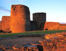
The castle’s surviving features include the mighty twin round towers and the curtain wall.
| Location | Ceredigion |
| Map ref | SN 195431 |
| Tel | 01239 615007 |
| Web | www.cadw.wales.gov.uk |
| Open | Daily 9.30–6.30 Apr–Oct; 9.30–dusk Nov–Mar |
Conwy
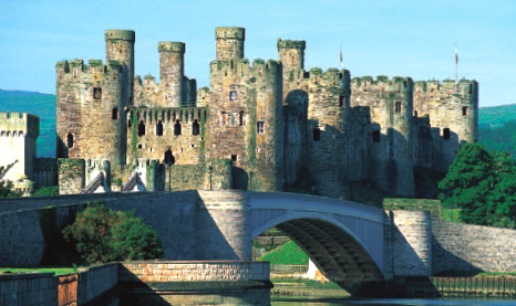
One of Edward I’s second tranche of castles in Wales, Conwy’s construction was overseen by the Master of the King’s Works in Wales, James of St George. Work began in 1283 and proceeded quickly, so the castle was virtually complete by 1287. The bill came to nearly £20,000, the biggest sum spent on any castle in Wales between 1277 and 1304. At the end of it, Edward I was presented with an almost perfect structure, the most compact agglomerate of turretry in the British Isles.
Strength, terror, dominion
Tailored to fit the rock site chosen for guarding the entrance to the River Conwy, the castle was a vast enclosure divided into an inner and an outer ward, separated by a thick wall with, at each end, one of the eight flanking towers. The towers themselves are massive, over 21.5m (70ft) tall, well over 10m (33ft) in diameter with walls up to 4m (13ft) thick, and they have several storeys equipped with rooms and staircases. The castle was part of an impressive walled town with its circuit of walls guarded by 21 towers and three twin-towered gatehouse, and the entire massive construction represented all that Edward I stood for – strength, terror, dominion and permanence.
Decay
The Welsh hated the castle, yet it was not besieged until the Civil War. Conwy was used sporadically during the 14th century and then began to decay over the years. In 1609 it was described as ‘utterly decayed’ and after its slighting it was left as an impressive shell.
For visitors
This extraordinary building is a World Heritage Site and one of Britain’s most impressive ruins. Don’t miss the opportunity to walk the town walls, the most complete surviving such fortifications in Europe.
| Location | Conwy |
| Map ref | SH 783774 |
| Tel | 01492 592358 |
| Web | www.cadw.wales.gov.uk |
| Open | Daily 9.30–5 Apr–May & Oct; 9.30–6 Jun–Sep; Mon–Sat 9.30–4, Sun 11–4 Nov–Mar |
Criccieth

In the decade before his death in 1240, Llywelyn the Great established Criccieth on a high peninsula in the northeast corner of Cardigan Bay. The site was naturally strong, with impressive sea cliff defences, and further strengthened with ditches and banks. Llywelyn erected a pentagonal enclosure with a rectangular tower to the southeast and an impressive twin-towered gatehouse overlooking the approach from vulnerable landward side.
Llywelyn ap Gruffudd (d. 1282) added the outer ward with substantial rectangulars towers to the southwest and north and a south-facing outer gatehouse. Substantial works, which may have included the remodelling of the towers and the construction of new buildings within the castle, were undertaken during the reigns of Edward I and Edward II. Criccieth was captured by Owain Glyn Dwr in 1404, and appears to have been burned.
A splendid seaside setting makes the site well worth a visit but note that there is a steep climb up to the entrance.
| Location | Gwynedd |
| Map ref | SH 500377 |
| Tel | 01766 522227 |
| Web | www.cadw.wales.gov.uk |
| Open | Daily 10–5 Apr–May, Oct; 10–6 Jun–Sep; Mon–Sat 9.30–4, Sun 11–4 Nov–Mar |
Dolbadarn
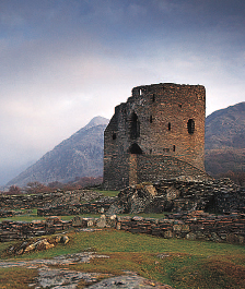
From its boomerang-shaped platform between the Peris and Padarn lakes, Dolbadarn Castle commanded the entrance to the Llanberis Pass. The east side is protected by steep slopes above the Peris and the gentler approach from the west is covered by two towers. The cylindrical great tower, sitting astride the curtain round the site, is of slate and grit rubble. Its walls are 2–2.5m (7–8ft) thick and contain a spiral staircase. The height once reached nearly 15m (50ft).
Erected by Llywelyn the Great, Dolbadarn took shape in three phases of construction during the period between the second and fourth decades of the 13th century. It lost its strategic significance after the Edwardian conquest of Wales and was partially dismantled, but it continued in use as the centre of a royal manor.
| Location | Nr Llanberis, Gwynedd |
| Map ref | SH 586598 |
| Tel | 01443 336000 |
| Web | www.cadw.wales.gov.uk |
| Open | Open access |
Flint
Flint was the first of the Edwardian castles to be begun in North Wales during the king’s campaign of 1277. It was planned, like Rhuddlan, to be associated with a fortified town near by and, also like Rhuddlan, was given direct access to tidal waters for easy delivery of supplies by water.
The great tower
The roughly rectangular stone enclosure has three substantial cylindrical corner towers and, on the fourth corner, separated by its own moat, was a huge great tower protected by the River Dee. The cylindrical great tower was the dominating feature and it was designed to a unique plan; above a basement stood two, or perhaps three, storeys, each with ring of wedge-shaped mural chambers surrounding a central circular shaft. The mural chambers included a chapel, kitchen, garderobes and residential rooms. Construction was spread mainly over the years 1277–86 and cost about £7,000.
In 1399 Henry Bolingbroke (soon to be Henry IV) captured Richard II at Flint before forcing him to return to London and abdicate. During the Civil War the castle changed hands several times, surrendering finally to Parliament in 1646.
Visiting
Flint was slighted so thoroughly that, according to an eyewitness writing six years later, it was ‘almost buried in its own ruins’. There is, however, enough left to see the general plan
of the castle and the cylindrical great tower and to explore the remnants of buildings and walkways.
| Location | Flintshire |
| Map ref | SJ 247733 |
| Tel | 01443 336000 |
| Web | www.cadw.wales.gov.uk |
| Open | Open access at reasonable times |
Grosmont
Grosmont is an interesting castle built on a main border route between Wales and England. The compact masonry enclosure is on the large mound of its Norman earth-and-timber precursor, encircled by a deep ditch.
Grosmont consists of a compact enclosure of stone surrounded by a moat which contained a rectangular hall tower, a gatehouse building at the southeast corner and a rectangular building with a D-ended tower at its west end. A stone curtain with two semi-cylindrical flanking towers completed the enclosure.
History
The earliest surviving structure is the hall tower, built in the opening years of the 13th century by Hubert de Burgh, who held the ‘Three Castles’ of Grosmont, Skenfrith, and White Castle at Llantilio. The erection of the hall tower swept away a section of the existing timber defences, and, between about 1219 and 1232, Hubert replaced the rest with a stone curtain wall with three round mural towers and, in the southeast corner, a gatehouse abutting the hall tower
Further building work took place in the 14th century when the castle was held by the house of Lancaster. The northernmost of de Burgh’s mural towers was demolished to ground level to make way for two rectangular blocks of apartments, and other parts of the castle were remodelled. Grosmont was attacked by Owain Glyn Dwr in 1404–5 but the Welsh attackers were defeated as reinforcements arrived. Grosmont was ruinous by the 16th century.
Today the ruins are accessed via a wooden walkway over the moat.
| Location | Nr Abergavenny, Monmouthshire |
| Map ref | SO 405244 |
| Tel | 01443 336000 |
| Web | www.cadw.wales.gov.uk |
| Open | Open access at reasonable times |
Harlech
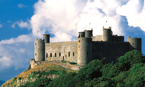
The second phase of Edward I’s fortress-construction programme in Wales in the 1280s embraced four of the biggest castles in Britain – Beaumaris, Caernarfon, Conwy and Harlech.
A splendid construction
One of the two concentric castles, Harlech, was completed between 1283–90. Master James of St George directed its building and from 1290–93 he was its constable, a post that enhanced his status while he continued to act as Master of the King’s Works in Wales.
The design of Harlech was simple yet immensely formidable: the dominant structure is the gatehouse, a massive, oblong structure like a great tower with three storeys and, at the front, flanking twin cylindrical towers. The upper storeys of the gatehouse contained fine residential apartments, which were reached by staircases in small cylindrical towers placed at the corners of the gatehouse’s inner face. A wide external stair also gave direct access to the first floor from the inner ward.
History
Harlech’s impregnability was tested in 1294, when it was attacked by Welsh patriots led by Prince Madog ap Llywelyn – just 37 men beat off the assault. However, Owain Glyn Dwr had more success when he besieged the castle in 1404. Harlech was the last Royalist stronghold to fall during the Civil War and when it fell the Royalist cause was lost and the Parliamentary forces slighted it.
For visitors
This World Heritage Site is well worth a visit for its superb architecture and setting, best appreciated from the wall-walk which gives tremendous views. The castle offers a wide variety of events and theatre performances are also staged regularly.
| Location | Gwynedd |
| Map ref | SH 581312 |
| Tel | 01766 780552 |
| Web | www.cadw.wales.gov.uk |
| Open | Daily 9.30–5 Apr–May & Oct; 9.30–6 Jun–Sep; Mon–Sat 9.30–4, Sun 11–4 Nov–Mar |
Kidwelly
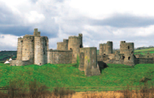
The striking ruins of Kidwelly Castle stand on a bluff beside the River Gwendraeth. The castle began as a large Norman ringwork of c.1106. A deep curving ditch defined the D-shaped site, with the straight, eastern, side protected by the steep slope to the river.
History
The outer curtain wall preserves evidence indicating that the first moves to replace the earth-and-timber fortifications with stone were probably made in the late 12th or early 13th century. However, much of the credit for the great stronghold that now stands must go to the de Chaworth brothers, Payn and Patrick, who transformed Kidwelly into a concentric castle in the 1270s and early 1280s. They built a square inner ward with cylindrical towers on the four corners, and rebuilt the outer curtain with four half-cylindrical mural towers and a gatehouse to the north and, presumably, to the south. In c.1300, the fine chapel tower, supported on a spur base and built into the slope of the bluff, was added, along with domestic buildings in the inner ward. The substantial south gatehouse was begun at the end of the 14th century and not completed until 1422. It had three storeys and spacious accommodation, probably for the constable. By then Kidwelly was an administrative centre for the Duchy of Lancaster. The castle withstood an attack in 1403 by Owain Glyn Dwr.
| Location | Carmarthenshire |
| Map ref | SN 409701 |
| Tel | 01554 890104 |
| Web | www.cadw.wales.gov.uk |
| Open | Daily 9.30–5 Apr–May & Oct; 9.30–6 Jun–Sep; Mon–Sat 9.30–4, Sun 11–4 Nov–Mar |
Visiting
Today, there is a site exhibition and audio tours guide visitors around this splendid castle, one of the best preserved in Carmarthenshire.
Laugharne
A castle was built here in the 12th century. Later, in the mid-13th century, Guy de Brian IV reconstructed the inner ward of castle, placing a cylindrical great tower and another circular tower astride the curtain wall. His successor, another Guy, added the inner gatehouse and improved the defences of the outer ward. The inner ward was converted to a mansion in the 16th century by Sir John Perrott, also the owner of Carew Castle. During the Civil War, Laugharne was held by the Royalists but fell to Parliament and was slighted. In the 18th century, the castle grounds were landscaped and turned into a garden.
Dylan Thomas
The ruins, in a beautiful setting by the River Taf estuary, have recently been restored, as have the Victorian gardens. Laugharne has a link with Dylan Thomas who lived and worked there near the castle from 1949 to 1953.
| Location | Carmarthenshire |
| Map ref | SN302107 |
| Tel | 01994 427906 |
| Web | www.cadw.wales.gov.uk |
| Open | Daily 10–5 Apr–Sep |
Llansteffan
Llansteffan was an imposing double enclosure castle and its ruins make a dramatic gesture standing high above the golden sandy beaches of the coast below. The promontory upon which the Normans founded the castle had been the site of an Iron Age hill fort. A double ditch protected the castle on the west, while steeply sloping ground provided strong natural defences on the other three sides.
History
The inner enclosure, shaped like an irregular polygon, was the first part of the castle to have its earth-and-timber defences replaced in stone. Its masonry curtain wall was raised in the late 12th century, and a round mural tower and gatehouse were added in the early to mid-13th century.
The outer enclosure was fortified in the 13th century with a stone curtain, flanking towers and a bastion at the eastern corner. Late in the 13th century, the great gatehouse was erected on the north side and much of it stands today. It was turned into a grand residence in the last years of the 15th century.
The castle was frequently attacked and sometimes held by the Welsh, but for much of the Middle Ages it was in the hands of the de Camvilles. It briefly fell to the Welsh during the revolt of Owain Glyn Dwr in the early 15th century. In later years it became a farmyard.
For visitors
Access to the castle is along a steep, fairly uneven path. The wide, sandy beach below will please children, but unfortunately swimming is not permitted.
| Location | Carmarthenshire |
| Map ref | SN 352102 |
| Tel | 01443 336000 |
| Web | www.cadw.wales.gov.uk |
| Open | Open access at reasonable times |
Manorbier
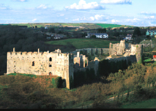
This was the birthplace in 1146 of Giraldus Cambrensis (Gerald of Wales), the celebrated Welsh scholar and chronicler who served Henry II, Richard I and John. The castle began as an earthwork of the late 11th century, and in the 12th century it received a square three-storeyed great tower. Other stone buildings were added, including a hall block, and by the 13th century it consisted of two high stone curtain enclosures in line, with flanking towers (cylindrical in the case of the outer enclosure) and with a strong square gatehouse. Giraldus described the castle as ‘excellently well defended by turrets and bulwarks’. Manorbier’s residential features were manifest, notably the state apartments in the inner enclosure, the fishpond and the park.
Visiting the castle
The castle is superbly sited on the beautiful Pembrokeshire coast, and thanks to a relatively peaceful history and the attentions of a 19th-century tenant, is in a good state of repair. Exhibitions are held throughout the year in the keep, and there are audio-visual displays and guided tours. A tea room is open for refreshments.
| Location | Nr Tenby, Pembrokeshire |
| Map ref | SS 064978 |
| Tel | 01834 871394 |
| Open | Daily 10.30–5.30 Easter–Sep |
Newcastle
A stone enclosure of the mid- to late 12th century was raised here on a steep spur overlooking the River Ogmore, probably upon the site of an earthwork castle of c.1106. The plan is polygonal with nine unequal sides and two almost square-plan towers in the curtain, one at the west angle, one at the south. The second tower was residential (with fireplaces, windows, staircases) and rose to three storeys. Further buildings were also residential; the footings of a detached structure lie to the north, and the foundations of two halls are against the east curtain wall. The entrance to the enclosure was adjacent to the south tower, through an decorated round-headed arch.
| Location | Bridgend |
| Map ref | SS 902801 |
| Tel | 01443 336000 |
| Web | www.cadw.wales.gov.uk |
| Open | Access at reasonable times |
Old Beaupre
An Elizabethan quadrangular mansion, which incorporates stonework of a late 13th- to early 14th-century structure. The medieval remains include a gatehouse, which may have led to other buildings now vanished. There are other segments of the same wing, which are now part of the Elizabethan structure, and a block projecting north along the east wing. The different periods of masonry can best be seen in the medieval gatehouse and the splendid inner porch of c.1600.
| Location | Nr Cowbridge, Vale of Glamorgan |
| Map ref | ST 009721 |
| Tel | 01443 336000 |
| Web | www.cadw.wales.gov.uk |
| Open | Access at reasonable times |
Pembroke
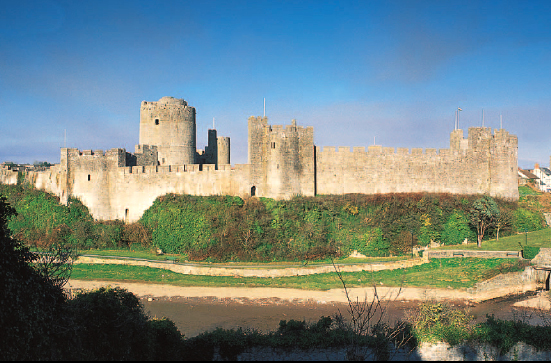
Pembroke began as an oval earthwork enclosure builtin the 1090s by Roger de Montgomery on a rocky promontory by the river. It grew into one of the grandest of the earlier castles in Wales with stonework added during the 12th and 13th centuries by William Marshal, one of King John’s staunchest allies.
A massive great tower
Pembroke’s dominating feature was, and still is, its cylindrical great tower built c.1200–10 by Marshal. It is a massive, four-storey structure rising from a splayed plinth to almost 24.5m (80ft) with thick walls and capped by a remarkable stone dome. The castle’s enclosure was divided into two, an inner smaller bailey of triangular plan, two sides of which were cliffs overlooking the River Pembroke. The third side was a substantial curtain wall with flanking towers (a trapezoid-shaped stone hall was built in this bailey in the 12th century) and the larger outer bailey. This was enclosed with a stone curtain and several cylindrical corner towers on the angles, a twin rectangular-towered gatehouse and a powerful postern tower. Part of the southern curtain wall along the outer bailey was of double thickness for extra defence.
History
Pembroke escaped attack by Owain Glyn Dwr in the 15th century, but the castle was severely slighted after the Civil War and the local people plundered it for stone. For centuries it languished as an ivy-covered ruin, and it wasn’t until the 19th century that the restoration of this great castle began. Henry Tudor, later King Henry VII, was born here in 1457.
In summer the castle stages historical re-enactments there are audio-visual exhibitions.
| Location | Pembrokeshire |
| Map ref | SM 982016 |
| Tel | 01646 681510 |
| Web | www.pembrokecastle.co.uk |
| Open | Daily 10–5 Mar & Oct; 9.30–6 Apr–Sep; 10–4 Nov–Feb |
Picton
A motte castle was built here c.1087–1100 at the top of rising ground. About 150 years later a second castle was raised near the original site. The new castle was a quadrangular enclosure with strong corner towers and mid-wall towers. The castle is still a home, and its last major remodelling was in the 1750s.
Visitor attractions
The property is sumptuously furnished and there are extensive woodland gardens. In the courtyard the gallery houses exhibitions. A restaurant is open for visitors.
| Location | Haverfordwest, Pembrokeshire |
| Map ref | SN 011135 |
| Tel | 01437 751326 |
| Web | www.pictoncastle.co.uk |
| Open | Castle & Gardens Tue–Sun 10.30–5. Entrance to castle by guided tour only (12–4) |
Powis
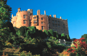
Powis is a graceful residence of towers and battlements, mullioned windows and turrets incorporated into the site of a 13th-century castle. The original castle was destroyed by Llywelyn the Last in the 1270s because its Welsh owner sided with the English. It had two baileys, with a twin-towered gatehouse.
In the 16th century Powis came into the hands of Sir Edward Herbert, in whose family it remained until late in the 20th century. During the 16th century and again after the Civil War the buildings underwent extensive restoration and remodelling.
World famous gardens
Further work was carried out in all of the following centuries and Powis today houses an extensive collection of items from India in the Clive Museum, fine paintings and furniture. The world-famous garden has superb planting schemes, with Italian and French influences. Powis Castle has been under the care of The National Trust since 1952. There is a restaurant on site.
| Location | Nr Welshpool, Powys |
| Map ref | SJ 216064 |
| Tel | 01938 551929 |
| Web | www.nationaltrust.org.uk |
| Open | Thu–Mon 1–5 May–early Sep; 1–4 late Mar to early Apr & early Sep–Oct. Garden, days as castle, 11–5.30/6 |
Raglan
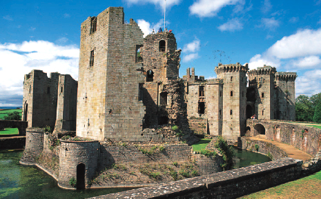
Raglan Castle may stand on the site of a Norman motte-and-bailey castle of c.1070. In the late 12th century, Raglan was granted to the Bloet family and a manorial complex, including a lord’s hall, chapel and other domestic buildings was developed.
The Yellow Tower of Gwent
In 1432, it became the property of Sir William ap Thomas, a Welsh knight who had fought at Agincourt, and he started the structure whose magnificent ruins still dominate the landscape. His first building was a hexagonal-plan great tower, known as the Yellow Tower of Gwent. It was built c.1435–45, and stood surrounded by its own wide and deep ditch.
When the castle was enlarged by William Herbert c.1460–69, a great gate was built and an approach into the newer parts was created in the form of a three-storey forebuilding. The main gatehouse and the huge adjoining Closet Tower had gunports at parapet level. Ranging round two courtyards and with lavish domestic accommodation and polygonal towers, the castle became a fortress-palace.
The Civil War
In the early 16th century, Raglan Castle passed to Charles Somerset, who became the 1st Earl of Worcester. Succeeding earls transformed the castle into a great Tudor house with stunning gardens. The 5th earl sided with Charles I in the Civil War and Raglan was besieged from June to August 1646. It sustained a devastating bombardment for several weeks before surrendering. The castle was slighted and the Somersets used Raglan as a quarry for their new home at Badminton in Gloucestershire.
For visitors
Interpretative displays help explain the castle and this substantial ruin is a joy to visit.
| Location | Monmouthshire |
| Map ref | SO 415083 |
| Tel | 01291 690228 |
| Web | www.cadw.wales.gov.uk |
| Open | Daily 9.30–5 Apr–May & Oct; 9.30–6 Jun–Sep; Mon–Sat 9.30–4, Sun 11–4 Nov–Mar |
Rhuddlan
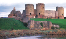
A motte-and-bailey castle was raised here in 1073: the mound can still be seen south of the second of Edward I’s great fortifications in North Wales, built between 1277–86 under the supervision of Master James of St George.
History
This later concentric castle has a lozenge-shaped inner stone enclosure with towers at the north and south corners and substantial gatehouses at the east and west corners. Most of the polygonal outer curtain, which had flanking rectilinear turrets on every angle and occasionally mid-wall, was surrounded by a wide moat, the rest by the River Clwyd.
Four kinds of stone were used in the construction of Rhuddlan Castle: purple sandstone from a quarry near St Asaph, a red sandstone from Cheshire, yellow sandstone from Flint and a local grey limestone. The river was diverted to create a deep-water channel running for 3km (2 miles) from the sea and this ‘canal’ meant that building materials could be brought from many sources by ship.
Rhuddlan served as a civil administration centre. In the Civil War, it surrendered to Parliament in 1646; it was later slighted.
| Location | Denbighshire |
| Map ref | SJ 024779 |
| Tel | 01745 590777 |
| Web | www.cadw.wales.gov.uk |
| Open | Daily 10–5 Apr–Sep |
St Fagans
A small castle of two enclosures, little remains of the original works, as they have been obscured by the 16th-century mansion built on the site.
Attractions for visitors
The superb Museum of Welsh Life in the parkland surrounding the castle includes over 40 buildings from across Wales, re-erected here. There are many activities and events which provide visitors with an insight into the language and culture of Wales. The castle itself is a magnificent manor house with tapestries and dark wood furniture while its grounds offer an important guide to gardening through the centuries. There is also a restaurant.
| Location | Cardiff |
| Map ref | ST 120771 |
| Tel | 029 2057 3500 |
| Web | www.nmgw.ac.uk |
| Open | Museum of Welsh Life daily 10–5 |
Skenfrith
Skenfirth is a quadrilateral enclosure with corner cylindrical towers, surrounding a round great tower with a semi-cylindrical buttress on its western side. The 13th-century tower had three floors. The first-floor entrance was reached by an external staircase. A trap-door gave access to ground level and a spiral stair in the buttress led to the second floor.
| Location | Monmouthshire |
| Map ref | SO 457202 |
| Tel | 01443 336000 |
| Web | www.cadw.wales.gov.uk |
| Open | Access at reasonable times |
White Castle
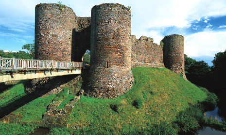
Originally called Llantilio Castle and then named White Castle because of its masonry coating of white plaster, this was predominantly a defensive structure with little attempt to make it very generous as a residence.
An impressive stronghold
This castle, together with Skenfrith and Grosmont, was built to protect one of the main routes between England and South Wales. While the others were rebuilt when they came under the control of Hubert de Burgh in the early 13th century, White Castle, the first of the three to have been rebuilt in stone, was left unchanged, an impressive military stronghold. The central pear-shaped enclosure is flanked on the northwest and southeast by two outer enclosures, and all three are moated. The northern enclosure, or outer ward, has a 13th-century curtain wall with flanking cylindrical towers and an outer gateway; impressively, these outer defences are largely still intact.
The stone curtain of the central enclosure was erected c.1184–6, and at about the same time a square great tower was built. In the 13th century, the great tower was demolished (its foundations are still visible), and flanking towers and a towered gatehouse were added to the existing curtain wall.
Later, various buildings were erected, including a hall, a solar and a kitchen and oven block. The castle’s importance declined after the end of the Glyn Dwr campaign, and by the end of the 16th century it was becoming a ruin.
Visiting
Access to the outer ward is by a wooden bridge over the dry ditch and to the inner ward by a longer wooden bridge over the water-filled moat. Magnificent views and castle defences can be seen from the gatehouse.
| Location | Llantilio-Crossenny, Monmouthshire |
| Map ref | SO 380168 |
| Tel | 01600 780380 |
| Web | www.cadw.wales.gov.uk |
| Open | Wed–Sun 10–5 Apr–Sep; Mon–Tue (except Bank Holidays) Apr–Sep open and unstaffed; open access Oct-Mar |