DISTANCE: 28km (17 miles)
TIME: A full day
START/END: Thompson Bay
POINTS TO NOTE: Take a ferry from Perth (90 minutes, Barrack Street Jetty), Fremantle (25 minutes, Victoria Quay), North Fremantle (25 minutes, Rous Head) or Hillary’s Boat Harbour (45 minutes, Victoria Quay). Reasonable bikes and snorkelling equipment are available for hire on the island. Diving can be arranged from the mainland via operators including Perth Ocean Diving (www.perthocean.com). Don’t touch the quokkas. More info: www.rottnestisland.com
Rotto, as the locals affectionately call Rottnest Island, is just 19km (12 miles) from Fremantle, yet it could be in another universe. A stunning place for visitors to explore, a surprisingly dark history hides behind the beautiful beaches, with the island having been used as a prison for indigenous men until 20th century.
Getting around
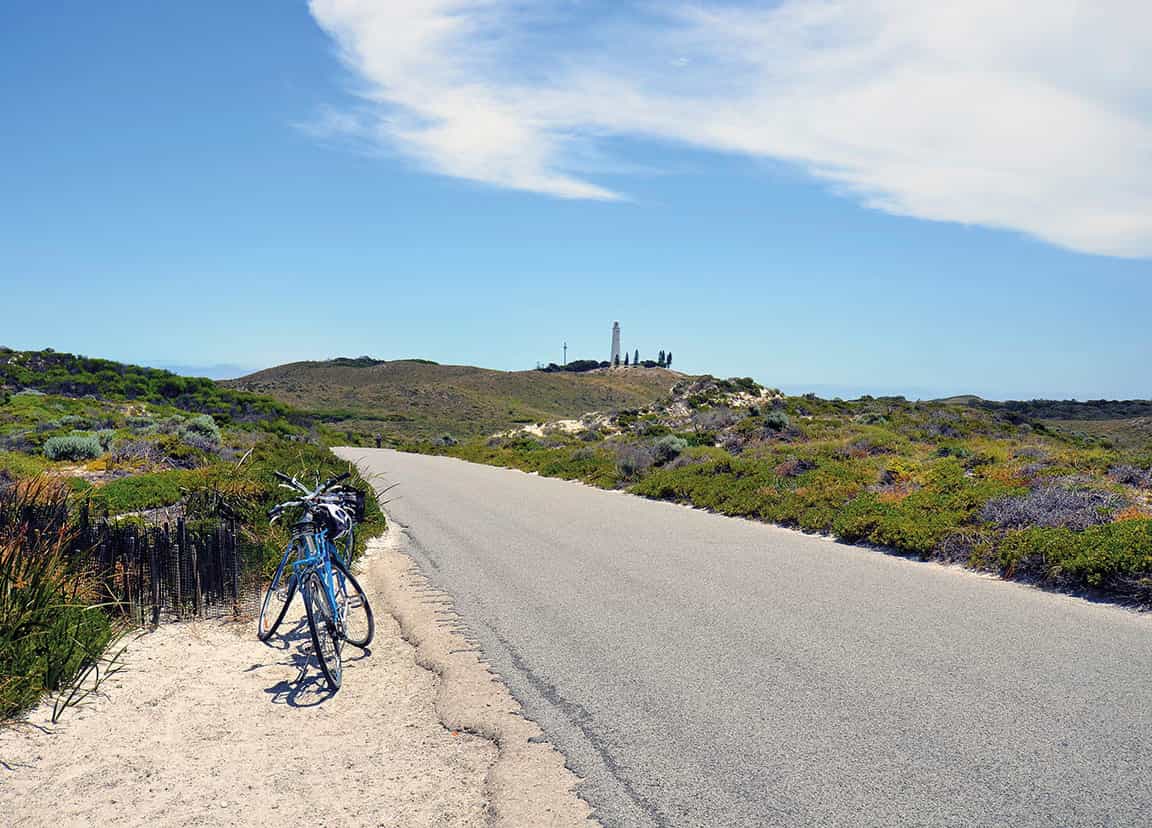
The island is about 11km (7 miles) long and 4.5km (3 miles) at its widest, and is best enjoyed on two wheels. With virtually no traffic, cycling is a real pleasure, and the stunning views make the hills worth the effort. Bikes can be hired through boat companies, but the best option is to pick up a steed from Pedal and Flipper once you’re on the island (note: helmets are compulsory), where you can also hire snorkelling gear. You could get around the entire island in under three hours if you rushed, but what would be the point of that, when surrounded by such riches?
Non-bikers can loop Rottnest on the Island Explorer hop-on/hop-off bus service operated by Sealink (tel: 08-9325 9352; www.sealinkrottnest.com.au; tickets from visitor centre, last bus leaves at 3pm), or hike the still-evolving Wadjemup Walking Trail (five sections, totalling 45km/28 miles).

Cycling on Rottnest Island
Shutterstock
Thompson Bay
Starting from the main jetty, you’ll see a small cluster of buildings ahead, known as the Thomson Bay settlement. The buildings here are among the oldest on the island, built by indigenous prisoners incarcerated on Rottnest during the 19th century. Among these, the former hayshed and mill has been converted into an excellent museum (daily 10am–3pm).
Directly opposite the end of the jetty is the Visitor Centre (tel: 08-9372 9732; www.rottnestisland.com; buses pick up from the central bus stop behind here), an excellent resource for planning all aspects of your visit. Behind this is a pedestrian shopping mall with a general store, post office, newsagent and cafés. To the left of the jetty are Hotel Rottnest, the Rottnest Tea Rooms and the Dome Café.
Grab a coffee here, or for something more substantial, try Frankie’s on Rotto (see 1 [map]) slightly further north on Somerville Drive.

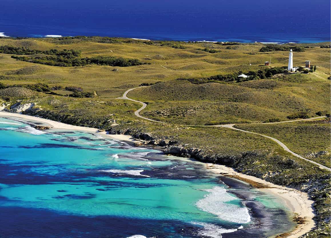
Wadjemup Lighthouse
Alamy
Loop the loop
Rottnest has 63 beaches, so the main problem is deciding which one to head to first. One advantage of staying for two days is the ability to do a round-island riding recce on the first day, before returning to your favourite spot the next. Even if you’re here for one day only, though, a cycling circumnavigation is the best way to get a taste of the island.
Taking a clockwise route and heading south along Parker Point Road will lead you past turnings to Kingstown Barracks and Bickley Battery, military remnants from when Rottnest was on high alert during World War II (see box), tasked with protecting the port of Fremantle, which was a secret submarine base. Both are worth a look. Bickley once bristled with two 6-inch guns, and the Barracks offers budget accommodation.
The first sand of note is at Paterson Beach. Continue around to Henrietta Rocks 1 [map], where the wreck of The Shark lies within easy swimming distance (50 metres/yds) of the beach. It can be viewed from the beach too, from where it looks like a drowned crane, but snorkellers can obviously get closer, and meet the myriad sea creatures that now live amid The Shark’s skeleton (always be extremely careful around artificial structures in the water).

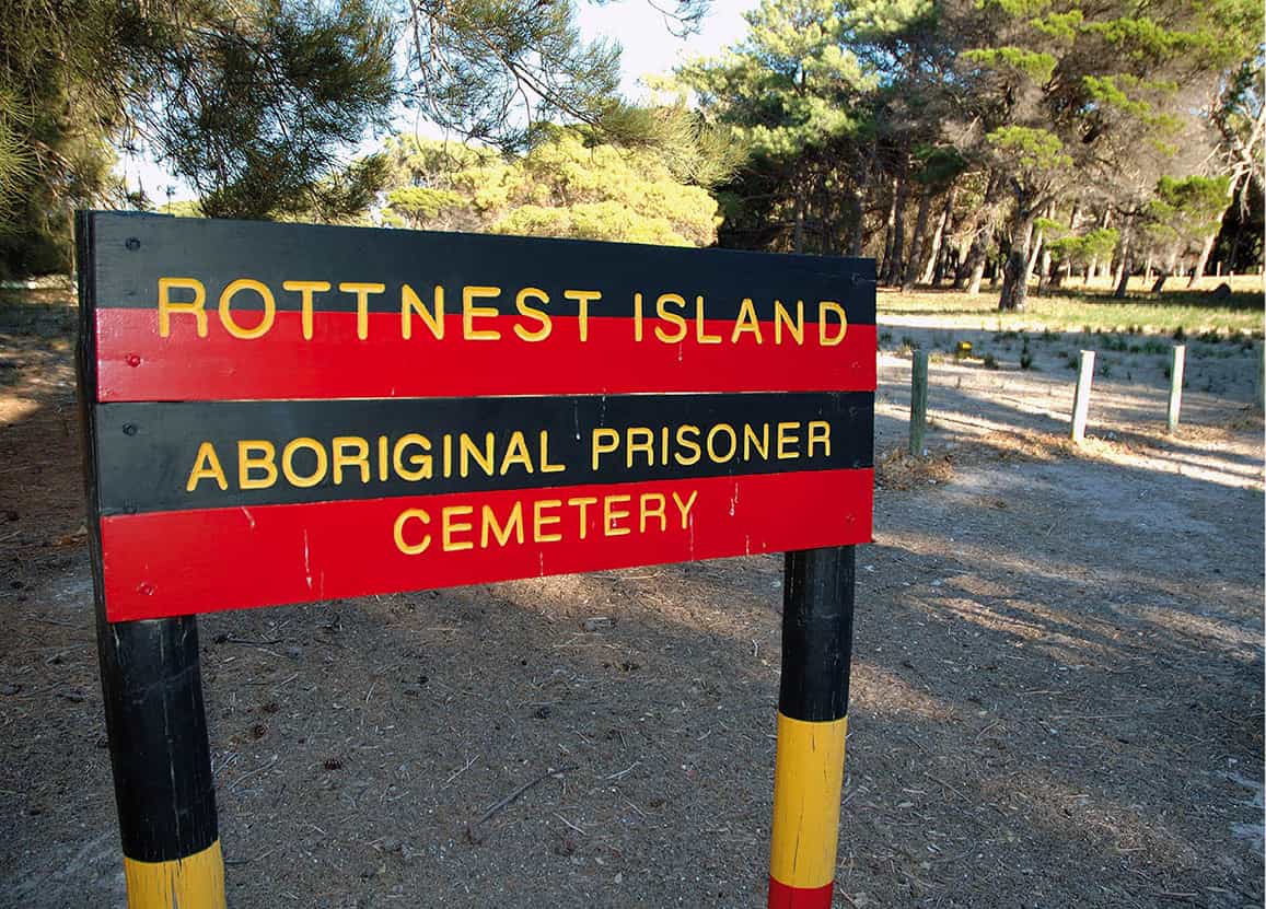
Aboriginal prisoner cemetery
Alamy
Rottnest rewound
Aboriginal habitation of Rottnest dates back 30,000 years, well beyond the island’s separation from the mainland 6,500 years ago. Nyungar call the island Wadjemup (place where spirits come to rest) and it’s enormously culturally significant.
Dutchman Willem de Vlamingh put the island on European maps in 1696. Mistaking quokkas for rodents he named it ‘Rottenest’ (rats’ nest).
Early English settlers from the Swan River Colony arrived in 1829. Skirmishes with the Nyungar became frequent and soon large numbers of indigenous men were imprisoned.
From 1838, Aboriginal prisoners from the mainland were sent to Rottnest, and in 1841 it officially became an open prison, which operated until 1904. During this time, 3,700 men and boys (8–80 years of age) were incarcerated. Hundreds died and were buried in unmarked graves.
When the prison closed Rottnest opened to the public. In 1917 the island was declared an A-Class Reserve, so land couldn’t be leased or sold. Campsites were built in the 1920s, along with a general store and tearooms. By the 1930s, ferries were delivering hundreds of holidaymakers.
During World War II the military occupied Rottnest. Guns were installed at Bickley Battery and Oliver Hill, to protect Fremantle, and barracks and a railway were built. Troops withdrew in 1945, and visitors returned.
On the other side of Porpoise Bay, just past Jeannies Lookout (a stunning viewpoint) is Parker Point 2 [map], where a 2km (1.2-mile) -long snorkelling trail has been laid out beneath the waves, featuring plaques on the seabed with information about the abundant flora and fish life in the area. Little Salmon Bay 3 [map] is another sensational swimming and snorkelling spot.
Continue around the broad arc of big Salmon Bay, where conditions are good for surfing. Just past Fairbridge Bluff there’s a turning right, leading inland and up a hill, to Wadjemup Lighthouse 4 [map] (tours available; children under five not permitted inside). There’s been a lighthouse here since 1849, but when the current tower was built in 1896, it became Australia’s first rotating-beam lighthouse. The view is cracking, and there’s a café next door.

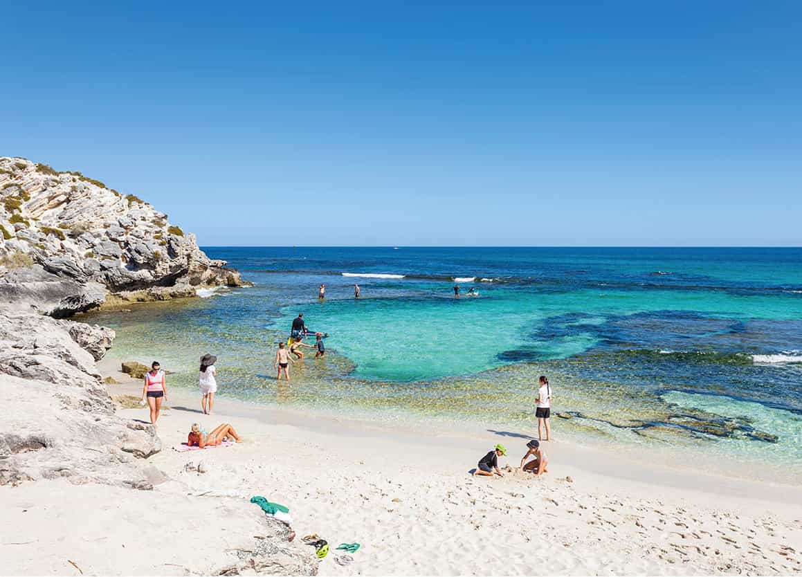
Beach fun at The Basin
Shutterstock
Return to the coast and continue west around the island, skirting Strickland Bay 5 [map], which boasts Rottnest’s most reliable surf break. Cross the Narrowneck, where you’ll see the dunes of Lady Edeline Beach and Roland Smith Memorial, dedicated to a local man who saved many ships from coming to grief on the treacherous rocks that surround the island, by installing navigation markers.
Along Digby Drive and beyond Conical Hill is the island’s most westerly point: barren, exposed and evocative Cape Vlamingh 6 [map], the very extremity of which you can reach via a boardwalk, which curls around Fish Hook Bay. After doing a little lap of Aitken Way head back across the Narrowneck and begin the return route.
Beyond Rocky Bay and Stark Bay (the latter with an exposed reef break and consistent surf), just past Crayfish Rock, is Ricey Beach 7 [map], a sensational swimming and snorkelling spot.
A golden chain of beautiful, reef-ringed beaches extends along the island’s north shore, including City of York Beach named after a three-masted sailing ship that sank here in 1899, almost in eyeshot of Fremantle, having sailed all the way from San Francisco, (its anchor is on display by Rottnest’s Main Jetty) and Catherine Beach. Continue over Armstrong Hill to Little Parakeet Bay and Geordie Bay 8 [map], where more sheltered swimming conditions can be found.
Past Point Clune is Longreach Bay 9 [map], where The Basin is the closest really decent beach to Thompson Bay, and consequently the place for which many day visitors make a beeline.
Near Pinky Beach you’ll see Bathurst Lighthouse ) [map], established in 1900 in response to the City of York disaster. Off to the right here is the Aboriginal cemetery, a sombre spot where the remains of an estimated 370 Nyungar men and boys are buried – some victims of disease, others who were hanged (see boxed text).
If time permits, head over View Hill, wend through the lakes along Digby Drive, then take a left to reach Oliver Hill ! [map], where you can explore the gun battery and a maze of tunnels used by the military in World War II (tours daily 10am, 11am, noon, 1pm and 2pm).
Food and drink
1 Frankie’s on Rotto
342 Somerville Drive; tel: 0431 735 090; www.frankiesonrotto.com.au; 8am–8pm; $$
A top spot for coffee, breakfast, lunch or dinner with a selection of pizzas, pastas and salads made on site. Eat in, with BYO wine, or order take-away (delivery across the island, 4–7pm autumn–winter, longer in spring–summer). Try the loaded fries for a carb hit after cycling and swimming all day.
