24
Cedar Bluff Nature Preserve
While only 1 mile long, this trail is by far the most challenging in the guide because it involves rocky, uneven terrain and a few steps of climbing. If you’re daring enough to take on this hike you will experience remarkable rock formations and beautiful views from the high, limestone bluff that overlooks Clear Creek. This hike is recommended for only strong, healthy hikers. And even then, you would be wise to go with a partner.
Start: From the small parking pullout off Ketcham Road
Distance: 1 mile out and back
Hiking time: About 1 hour
Difficulty: Difficult due to extremely rocky terrain with some rock crawling
Trail surface: Some natural surface singletrack and a lot of uneven limestone
Best season: May, when the wild columbine is in bloom on the cliffs
Other trail users: None
Canine compatibility: Leashed dogs permitted, but it would be wise to leave your dog at home for this one
Fees and permits: None
Schedule: Open daily from dawn to dusk, year-round
Maps: No trail maps available. DeLorme: Indiana Atlas & Gazetteer: Page 50 D3
Trail contact: The Nature Conservancy, 1505 N. Delaware St., Suite 200, Indianapolis, IN 46202; (317) 951-8818; www.nature.org/indiana
Special considerations: The trail is extremely rugged and not very suitable for children or dogs. Consider hiking with a partner for safety reasons.
Finding the trailhead: From Bloomington head south on IN 37, traveling about 3 miles from the city’s southern limits to Smithville Road. Turn right onto Smithville Road. After about 0.5 mile, pass under Old IN 37 and come to a T. Turn left and then take an immediate right onto Ketcham Road. After about 3 miles you’ll pass Cedar Bluff Road. Stay straight on Ketcham Road for another 0.5 mile until you come to a power-line right-of-way. There is parking on the right side of the road underneath the power lines for about three cars. The trailhead is on the opposite side of Ketcham Road, identified by a large wooden sign. GPS: N39 02.119' / W86 34.054'
THE HIKE
The Nature Conservancy acquired this 23-acre preserve in southwestern Monroe County in 1963, and thirteen years later it was dedicated a state nature preserve. While small in size, the preserve is prized for its 75-foot limestone bluff, capped with gnarled and weather-beaten red cedars that reach horizontally into midair from their rocky base. The cliff overlooks scenic Clear Creek below.
The hike features a lot of rock hopping and even a few seconds of what is best described as rock climbing. It is wise not to bring small children on this hike. This hike is better left to strong, healthy hikers. Because of the potential for danger, it would also be smart to avoid hiking in this preserve alone.
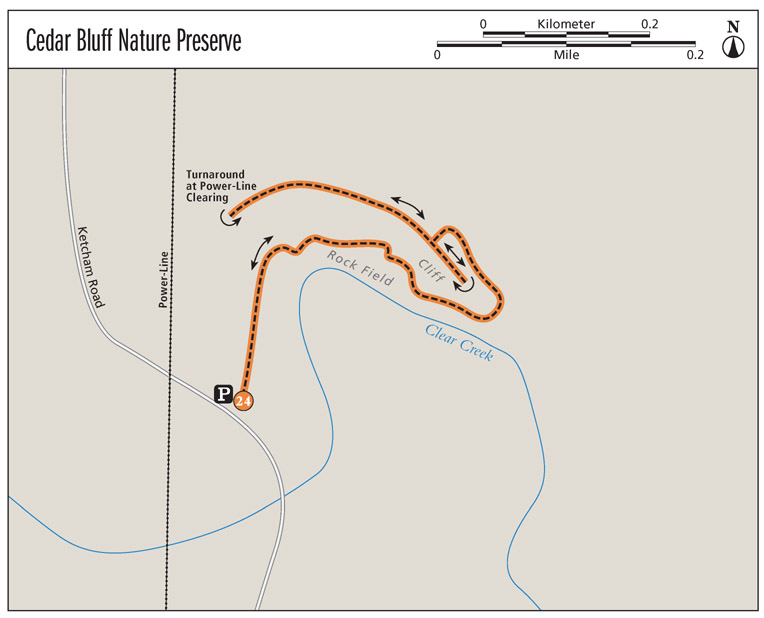
The hike starts alongside Ketcham Road. Stay straight past an unmarked trail junction at 200 feet, as the formal path meanders through a floodplain area along Clear Creek. At mile 0.2, the well-worn singletrack trail ends at an area where limestone slabs have collected at the base of the cliff alongside Clear Creek. This is where things begin to get difficult. With the cliff to your immediate left and Clear Creek to your immediate right, you have no choice but to pick your own path through a narrow, jagged corridor of boulders as you try to avoid sliding into the water. The occasional sycamore provides support; use them to brace yourself with a spare hand as you navigate this tricky section. You’ll begin to notice the rocky cliff emerging from the mostly oak woods overhead.
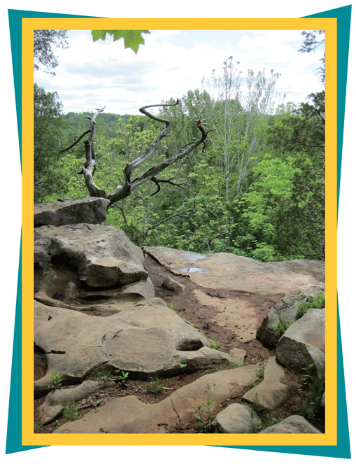
A gnarled cedar stretches into midair over the edge of the limestone cliff at cedar Bluff Nature Preserve.
At mile 0.4, turn left at the directional marker and end of the bluff, where an unnamed tributary flows into Clear Creek, to follow a narrow footpath uphill. As the path curves around the backside of the bluff, you’ll have great views of the sheltered, rock-walled valley cut by the unnamed tributary. The steep slopes behind the bluff are covered with delicate wild columbine during the springtime. Wild columbine is found on rocky slopes and cliffs and are a real treat to see for hikers from flatland Indiana.
At the 0.5-mile mark, the trail crests the rim of the cliff, requiring a step or two of rock climbing. The flat cliff top offers panoramic views of the Clear Creek valley. The dry, rocky summit is also home to plenty of fire pink and some other more uncommon flowers, including flowering spurge, nodding onion, and hoary puccoon. Take the time to enjoy the view and the gnarled cedars as you walk along the cliff top.
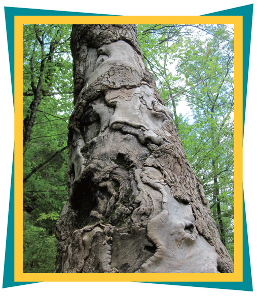
A weathered tree trunk stretches skyward along the northern bank of Clear Creek at Cedar Bluff Nature Preserve.
The trail heads west along the cliff top to a power-line clearing. If you exit the woods and enter the clearing, you are trespassing. Turn around at the edge of the woods and head back to the trailhead.
It’s important to note that a trailside map and other hiking book maps describe this trail as a loop and identify a turn somewhere along the cliff top that would lead you back down to the floodplain area, where you would then retrace your steps to the trailhead. If this turn exists, it wasn’t noticeable when this book was researched. It is advisable, therefore, to simply turn around and retrace your steps around the cliff. Make sure to stay on the trail because Cedar Bluff is vulnerable to erosion.
MILES AND DIRECTIONS
0.0Start from the trailhead on the east side of Ketcham Road, near the power-line right-of-way.
0.2The singletrack ends and you have to make your own path through the jagged limestone boulders that line the bank of Clear Creek.
0.4Turn left away from Clear Creek at the confluence with an unnamed tributary and head up around the end of the limestone bluff, following a narrow route around to the backside of the bluff.
0.5Climb up on top of the bluff and enjoy the view. (Note: The trail continues to the west, but follow it no farther than the power-line right-of-way at mile 0.6. If you step out of the woods and into the right-of-way, you will be trespassing.) Turn around and retrace your steps.
1.0Arrive back at the trailhead.
HIKE INFORMATION
Local information: Bloomington Convention and Visitors Bureau, 2855 N. Walnut St., Bloomington, IN 46013; (800) 800-0037; www.visitbloomington.com
Local attractions: Upland Brewery, 350 W. 11th St., Bloomington; (812) 336-2337; www.uplandbeer.com. Thirsty after a long hike? Upland Brewery offers seven year-round brews and a variety of seasonal flavors. The brewery offers free tours from 3 to 5 p.m. every Sat and Sun.
Restaurants: Snow Lion, 113 S. Grant St., Bloomington; (812) 336-0835. Snow Lion serves up hard-to-come-by Tibetan cuisine in downtown Bloomington and is owned by the nephew of the Dalai Lama. Open for lunch Mon to Thurs from11 a.m. to 3 p.m. and for dinner from 5 to 10 p.m. Open for lunch and dinner Fri to Sun from 11 a.m. to 10 p.m.
More on Limestone
Hoosiers are awfully proud of their limestone. Given that the Cedar Bluff hike focuses on a limestone cliff just outside Bloomington, it offers the perfect opportunity to draw attention to the beautiful limestone architecture on Indiana University’s campus. In his book Campus as a Work of Art, Thomas A. Gaines recognized Indiana University (IU) as one of the five most beautiful campuses in America, largely because of its limestone. IU’s limestone architecture includes examples of Gothic, collegiate Gothic, art deco, Romanesque revival, modern, and post-modern styles. Take a break from the trails and give the self-guided Limestone Walking Tour a shot. Better yet, go during June, which is Limestone Month in Indiana. For more information on the walking tour, visit the Bloomington Convention and Visitors Bureau at www.visitbloomington.com.


