Three
THE RAILROAD AND RAILROAD TOWNS
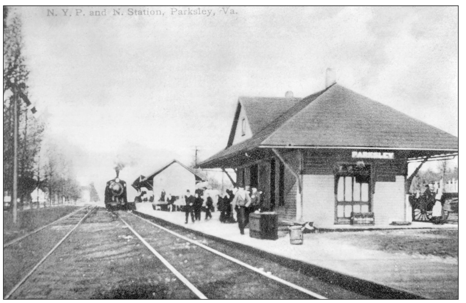
No single event had such a profound impact on Accomack County as the opening of the New York, Philadelphia, and Norfolk Railroad (NYP&N) in 1884. The railroad changed the way goods were shipped to market. It changed the way people traveled. It created business potential across much of the eastern United States and Canada for farmers and seafood producers. It built towns, and it ended generations of isolation, making Accomack part of a world that suddenly had become smaller and more accessible. Chincoteague oysters were on the menu in New York restaurants; local white potatoes were being shipped all the way to Toronto. What did local people think when that first steam engine rattled through? Was it a noisy curiosity, or did folks realize that a revolution was taking place, that the focus of their commerce would move from sea to land, that towns would be created and others forgotten? When steam replaced sail, it did so gradually. Long after the first steamship docked here, potatoes and cabbage were still being shipped to Baltimore by sail. But the railroad not only changed the way people shipped their produce, it also shifted their attention away from the water and to the land, specifically to that narrow ribbon down the spine of the Eastern Shore where the railroad ran, where each rutted wagon road it crossed had the potential of being a center of commerce. From the time it opened in 1884 until the mid-20th century, the railroad brought about the most prosperous years Accomack County knew. Newspapers in the late 19th and early 20th centuries reflected this. Each week, there were stories of new businesses being opened, of grand new homes being constructed, of distinguished visitors spending time on its resort beaches. It clearly was a time of optimism, a period of growth and change like none other. The railroad gave the county Parksley, Tasley, Onley, Melfa, Keller, and Painter, among others. While some of those towns had modest commercial activity before the railroad, the NYP&N set off a building boom never before seen in Accomack County.
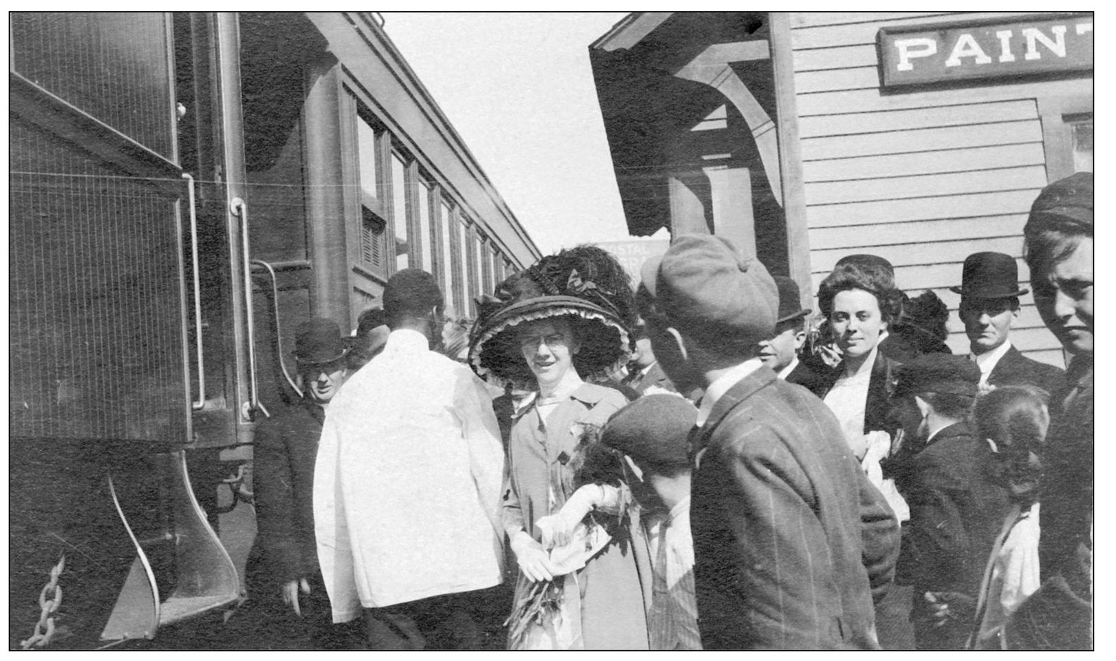
Loleta Boggs and Vernon Burton were married in the Painter Garrison United Methodist Church in 1910, and here the wedding party at the Painter station sends them off to a honeymoon at Niagara Falls. Lucille Boggs (left, in hat) was maid of honor. To her right are Grace Floyd and Will Waters, wearing the derby hat. (Courtesy of Helen Vincent.)
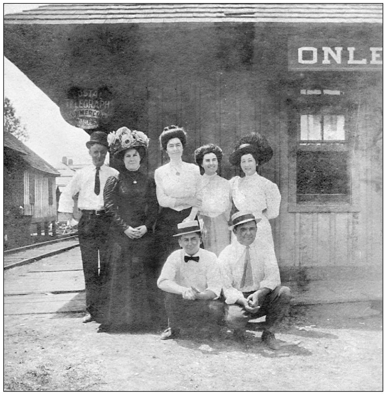
Passengers gather at the Onley station around 1910. The railroad served as a critical link to the rest of the country, providing a means of reaching markets for produce as well as more comfortable transportation for travelers. Vernon Burton is standing at left. (Courtesy of Helen Vincent.)
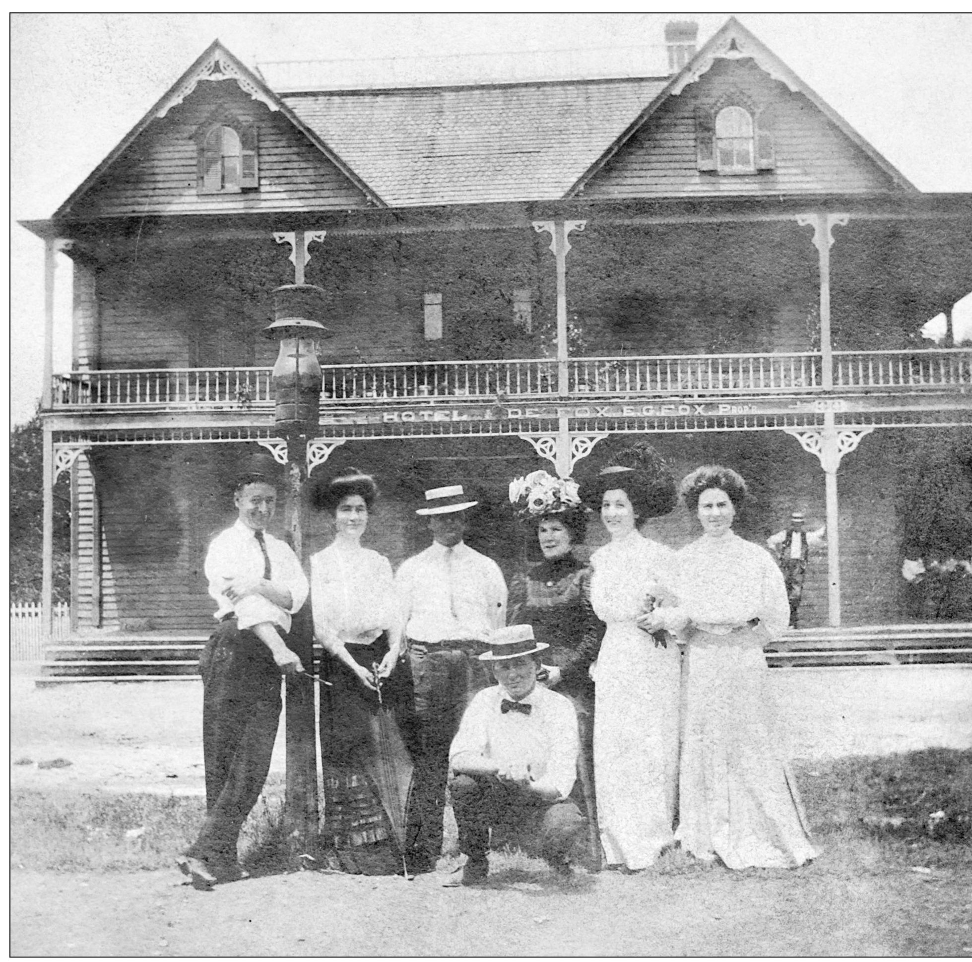
The same group poses in front of the Hotel de Fox in Onley. Hotel de Fox was an Onley landmark at the beginning of the 20th century. The hotel was built by E. G. Fox in 1896 to take advantage of railroad traffic, and the hotel was situated just across the tracks from the station. Soon after the hotel was built, it became a favorite destination among drummers, or traveling salesmen. The hotel business closed around 1915, and the building later was used as a pool room, restaurant, and apartment building. It burned to the ground in the summer of 1950, taking with it a neighboring produce business. The fire began on the hotel roof, and the blaze is believed to have been ignited by a spark from a passing train. (Courtesy of Helen Vincent.)
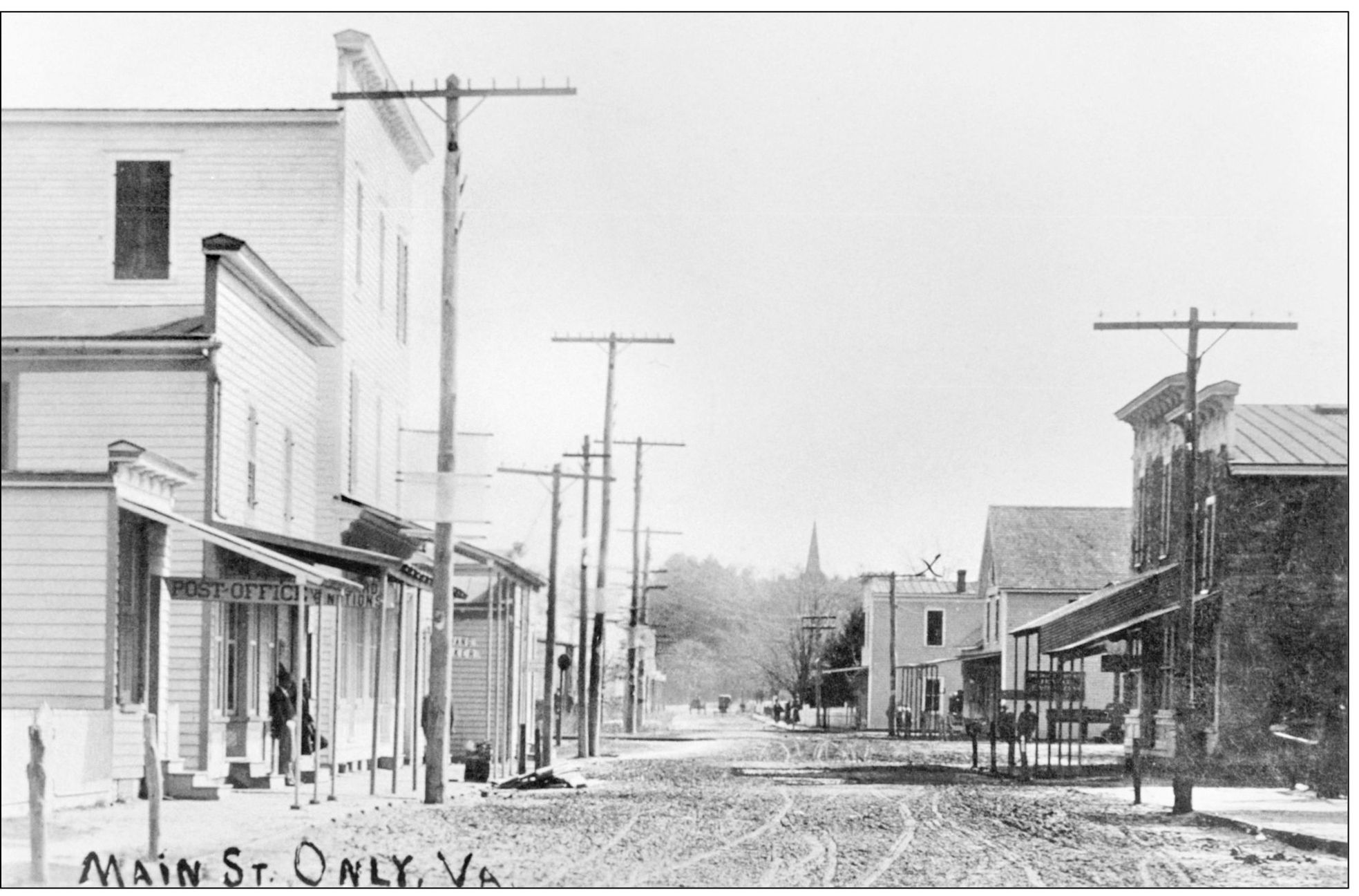
Taken around 1900, this photograph shows Main Street in downtown Onley. The post office is on the right in the foreground, and the Rogers Brothers Store, which had general merchandise ranging from clothing to farm tools, is the last building on the right. The Hotel de Fox is behind the buildings on the right. The town of Onley was largely a product of the railroad. Prior to the railroad, Onley was a small community called Crossroads, so named because it was at an intersection of roads connecting Onancock, Accomac, Locustville, Wachapreague, and other nearby villages. Things changed forever for Onley on the first Monday of June 1885. That is when the NYP&N Railroad opened its freight house and ticket office, and the name Crossroads was forever deleted from the Eastern Shore map. The origin of the name Onley is uncertain. The conventional belief is that the town was named for the plantation Only on Onancock Creek, home of Virginia’s only governor from the Eastern Shore, Henry A. Wise. Early documents spell the town name without the “e.” (Courtesy of authors’ collection.)
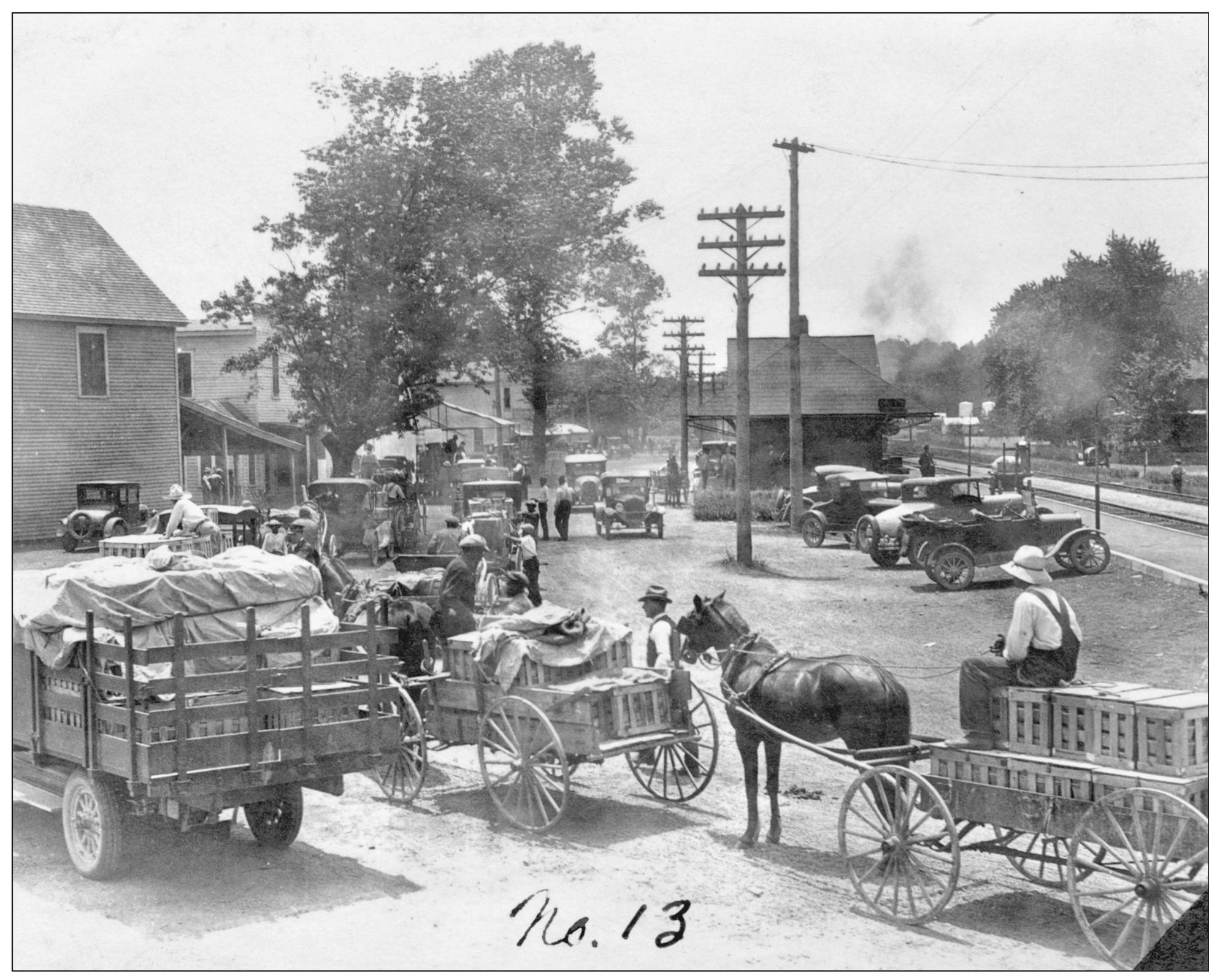
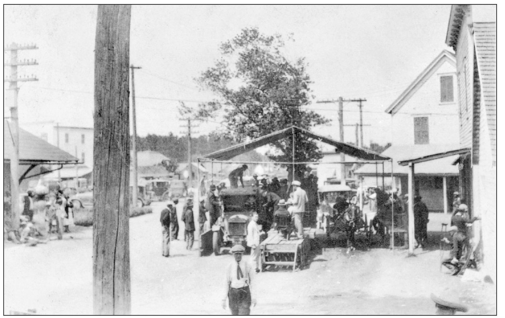
The strawberry auction block was a busy place in early summer. Taken on May 26, 1926, this photograph shows local farmers lined up in Onley, waiting to sell their strawberries. Farmers would pick the ripe strawberries in late spring and load them in crates to be taken into town for the auctions. Many still used horse carts to transport the fruit, while some farmers were fortunate enough to have trucks. The sheets spread over the crates were to protect the valuable produce from the sun in order to keep the berries looking as fresh as possible. The strawberries were sold at auction to representatives from large produce companies from cities along the East Coast. After the sale, the strawberries were usually taken across the street to the rail terminal to be shipped in refrigerated rail cars. (Courtesy of authors’ collection.)
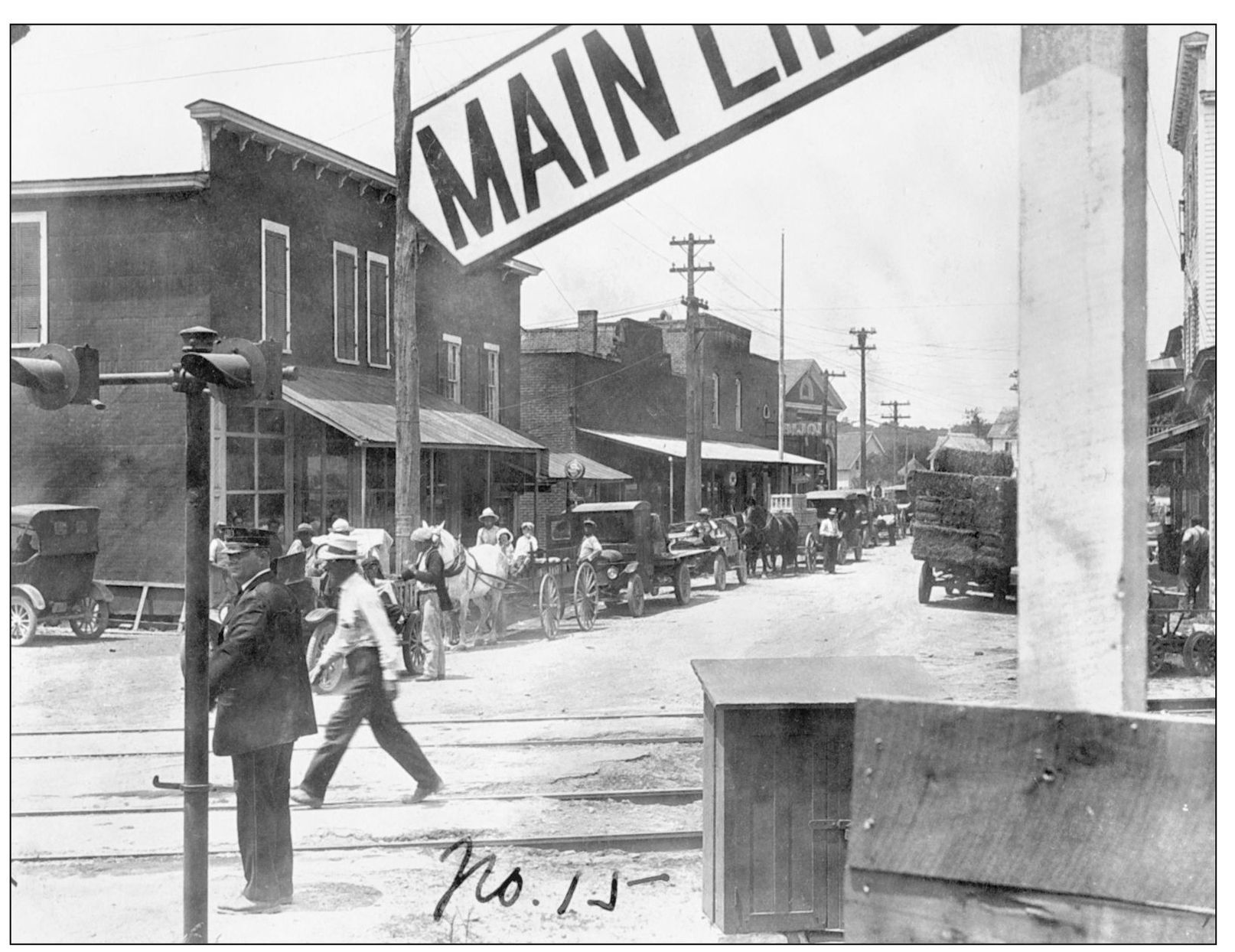
The line at the auctions would often extend for several blocks, as this 1926 photograph of Main Street in Onley shows. The rail tracks can be seen in the foreground, and the auction blocks are toward the left, beyond the edge of the photograph. (Courtesy of authors’ collection.)
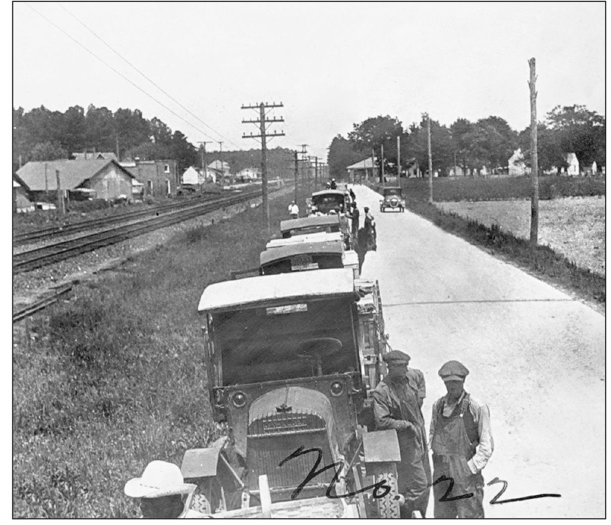
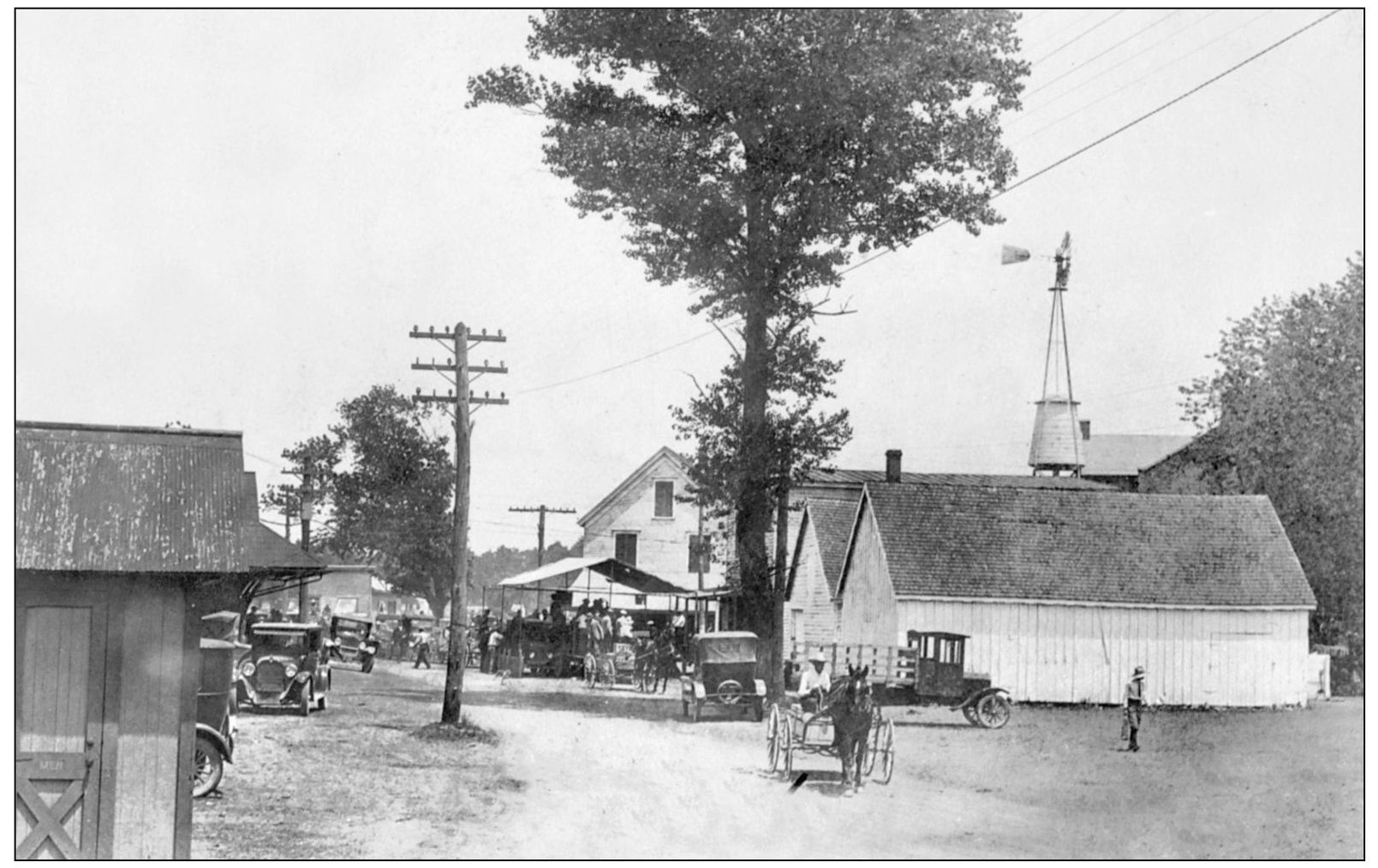
This is another view of the line at the strawberry auctions in Onley in 1926. Farmers are seen here lined up along Church Road, which connects Onley with Accomac. (Courtesy of authors’ collection.)
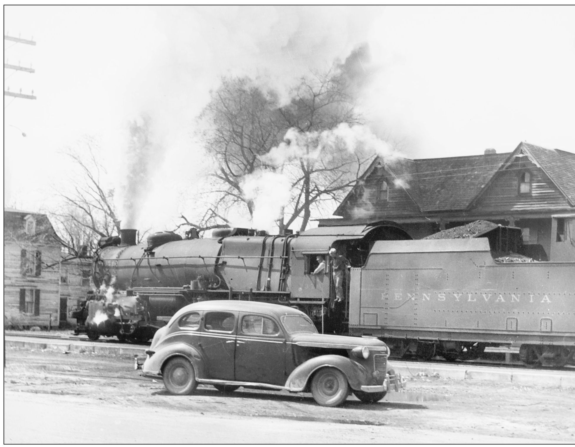
Here a locomotive steams through Onley, likely in the 1940s. The rail system on the shore was built by the New York, Philadelphia, and Norfolk Railroad between 1884 and 1885. By the time this photograph was taken, that company had merged with the Pennsylvania Railroad, the largest railroad company in America in the 20th century and also once the largest publicly traded company in the world. The locomotive in this photograph is an L1 model, which was used extensively by the Pennsylvania Railroad to haul freight trains until 1957, when diesel power replaced steam. The Hotel de Fox can be seen in the background. The car in the foreground is a late-1930s Dodge. (Robertson Collection, courtesy of ESVHS.)
Growers and buyers gathered at the Onley strawberry block in May 1926. The railroad station is on the extreme left, and the Produce Exchange building is behind the buildings on the right. With the railroad providing reliable transportation, and with aggressive marketing by the exchange, it was a time of prosperity for local farmers. (Courtesy of authors’ collection.)
This more distant view of the Onley block in May 1926 shows the storage buildings, stores, and other facilities associated with the railroad and exchange. All are now gone with the exception of the exchange building, which can be seen behind the tree on the right. (Courtesy of authors’ collection.)
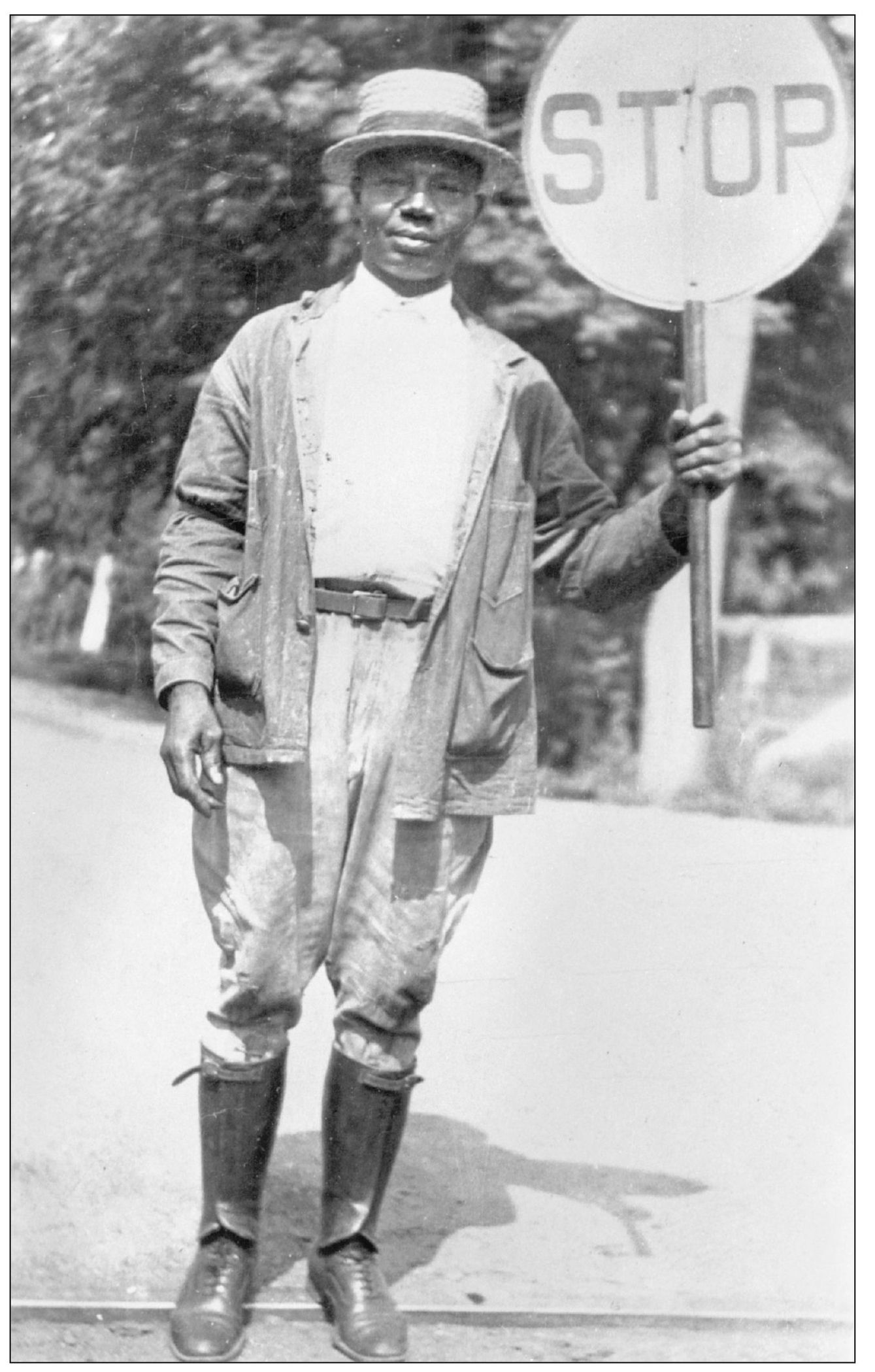
In the early days of the railroads, crossings were not marked with electric gates, flashing lights, and bells. Crossing guards, such as this man, were used to alert people when a train was approaching. The guards used signs and lanterns to attract the attention of traffic. Crossing guards were provided small shacks as a place to rest and shelter from the weather. The construction of the railroad brought an enormous boom to the economy of the Eastern Shore. Not only did farmers benefit from being able to export large amounts of produce, but the railroad provided jobs for many people, from store owners to laborers on the railroad. (Courtesy of authors’ collection.)
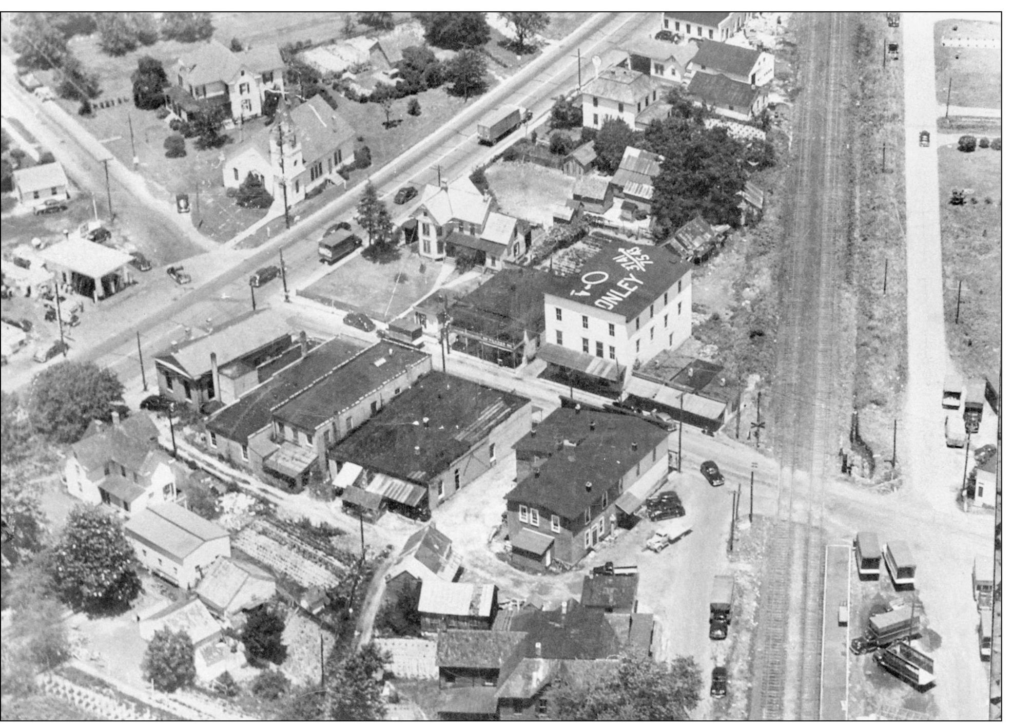
These aerial photographs show how Onley changed between the late 1940s and late 1960s. The house at the upper center was moved west on Main Street around 1950 by James A. Rew, who owned the Esso station on the far left. The Onley Baptist Church is across from the home. (Courtesy of authors’ collection.)
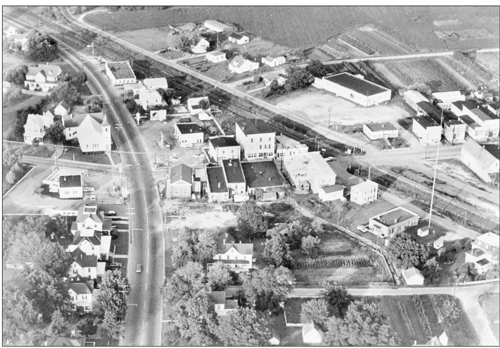
By the late 1960s, a Texaco station had replaced the Rew home, the Baptist church had added a Sunday school building, and the awnings had been removed from the businesses along Main Street. (Courtesy of authors’ collection.)
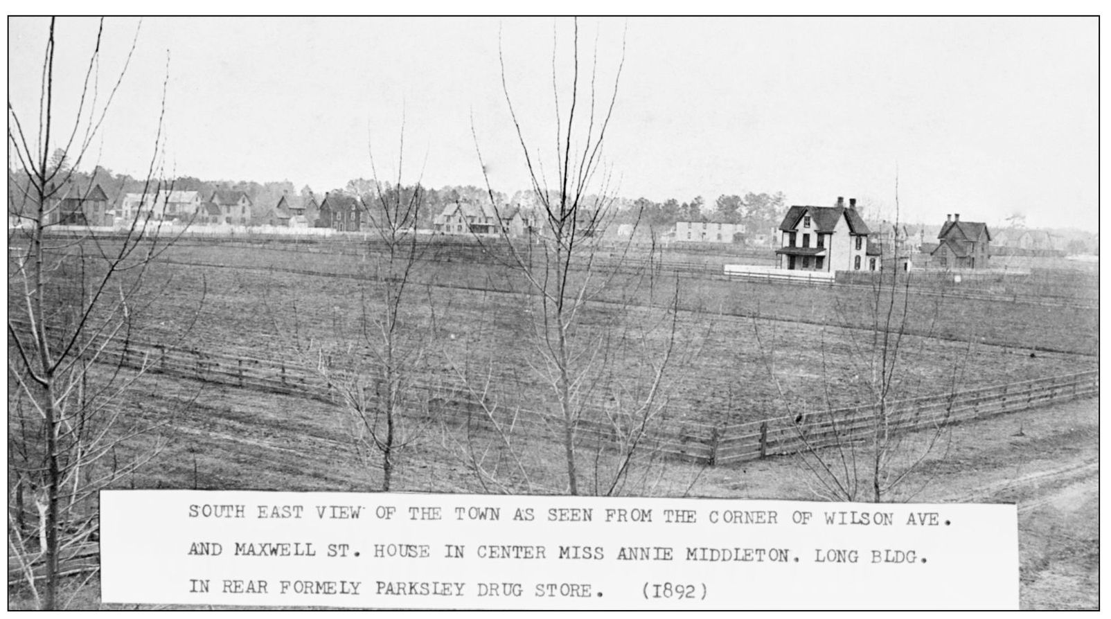
No Accomack County town was so profoundly affected by the railroad as Parksley. In 1883, the site where the town now stands was farmland owned by Benjamin Parks, but within months, it would become an embryonic community of people, a town elaborately planned to the last street, park, church, and schoolyard. This photograph, taken in 1892, shows the town in its early life, as homes and businesses began to replace open farm fields. (Courtesy of the Town of Parksley.)
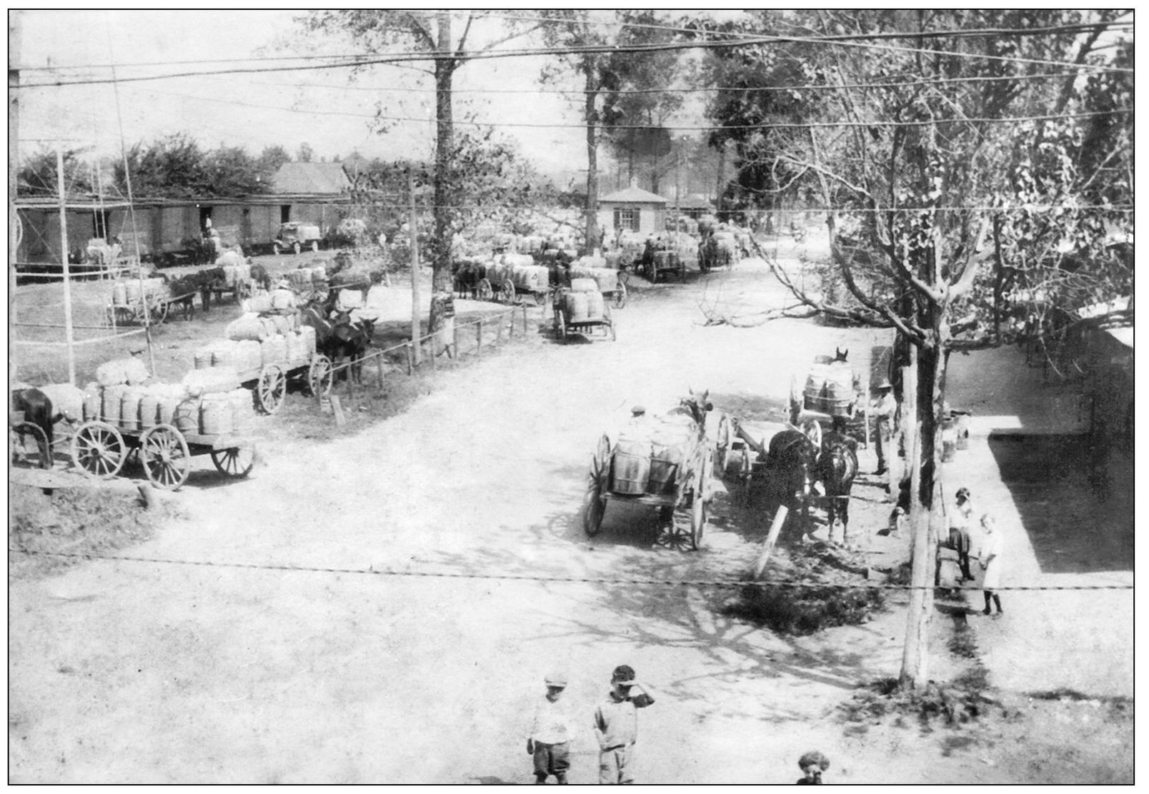
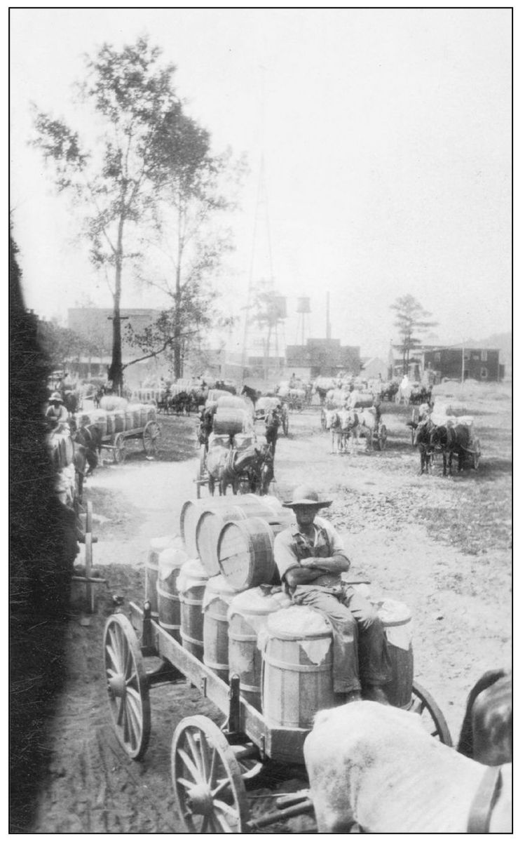
Seen here is the Parksley railroad yard in 1927. Farmers would pack their produce, typically potatoes, in wooden barrels for shipping. Numerous horse carts loaded with barrels are lined up around the railroad yard here, waiting to ship their produce off to cities along the coast. (A. Parker Barnes Collection, courtesy of the Eastern Shore Public Library.)
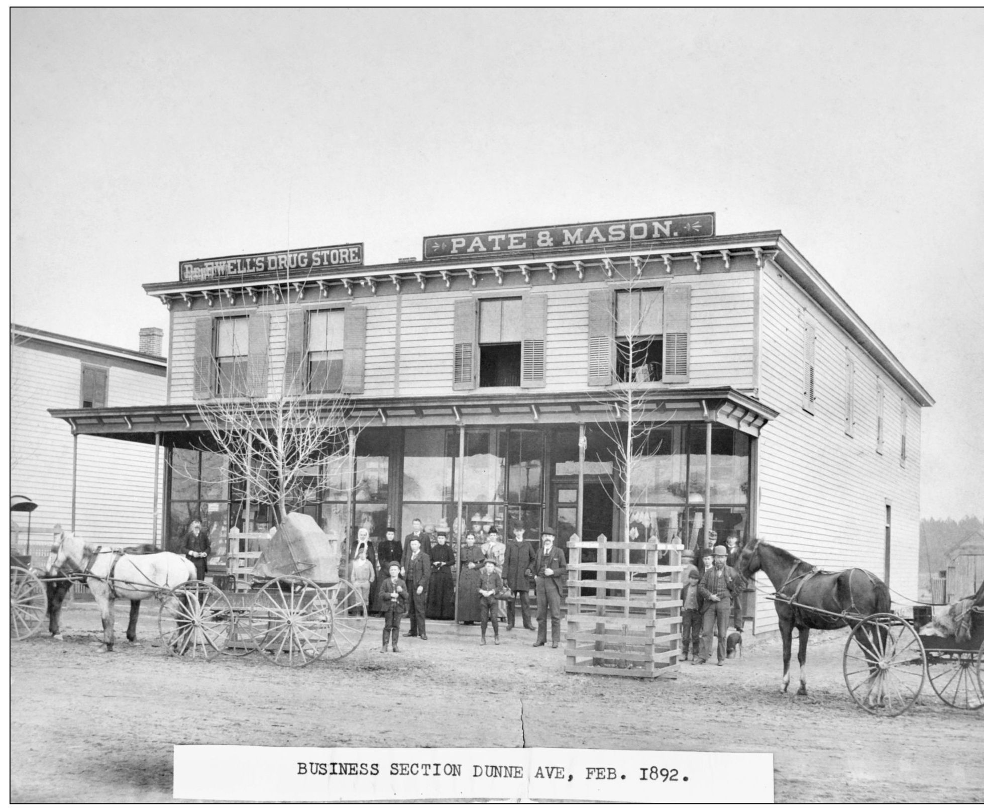
Parksley quickly became a boomtown once the railroad was built. Businesses sprang up around the railroad, and residential lots found willing buyers and investors. Although Parksley’s founders were “Northern capitalists,” many Eastern Shore residents relocated there from nearby towns. Newspaper accounts of the day chronicled lot sales and business openings almost on a weekly basis. The developers of the community took an active part in the growth of the town. W. C. Wilson, secretary of the Parksley Land and Improvement Company, bought a parcel and planted it in fruit trees. The company president, S. T. Jones, shipped his herd of Jersey cattle to Parksley. One of the early businesses in Parksley was the Pate and Mason store on Dunne Avenue. Pate and Mason originally had a store in nearby Leemont but moved to the booming new town of Parksley in 1889. The building on the left was a Dr. Augustus D. F. Ewell’s office and drugstore in this 1892 photograph. (Courtesy of the Town of Parksley.)
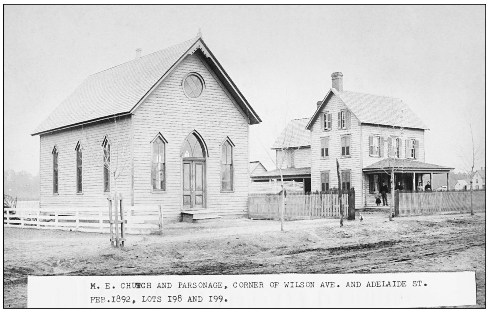
The Methodist Episcopal church and parsonage, on the corner of Wilson Avenue and Adelaide Street, was under the eldership of one of the founders of Parksley, Dr. J. A. B. Wilson. The church and the parsonage are seen here in this photograph taken in February 1892. (Courtesy of the Town of Parksley.)
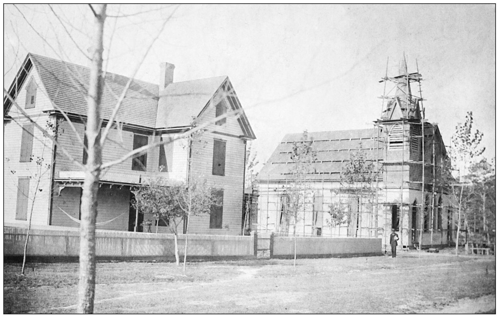
The cornerstone laying of the Parksley Methodist Protestant Church and parsonage took place in September 1892, and this photograph shows the buildings near completion on the corner of Wilson and Catherine Streets. Parksley residents celebrated the event with music, speeches, and a “bounteous supper,” according to newspaper reports. (Courtesy of the Town of Parksley.)
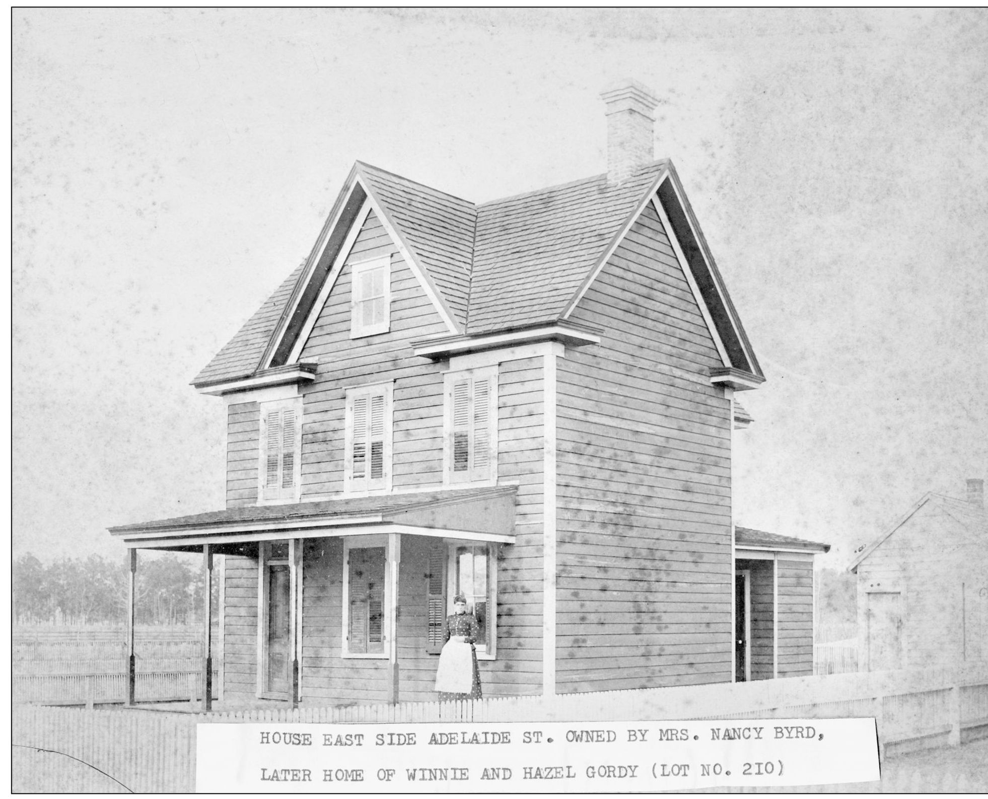
This house on the east side of Adelaide Street was owned by Nancy Byrd and later Winnie and Hazel Gordy. Parksley has street names that seem unusual for Accomack County, and the reason is most streets were named for railroad officials or for friends and relatives of principals of the Parksley Land and Improvement Company. Dunne Avenue, Patton Street, and Cassatt Avenue were named for railroad executives (Alexander J. Cassatt was elected president in 1885). The town’s main developer, Henry Bennett, was once engaged to Mary Cooke, who died before the wedding. Two streets in Parksley were named after Bennett’s late fiancée. Catherine Street, Maxwell Street, and Adelaide Street were also named for family and friends of the developers. (Courtesy of the Town of Parksley.)
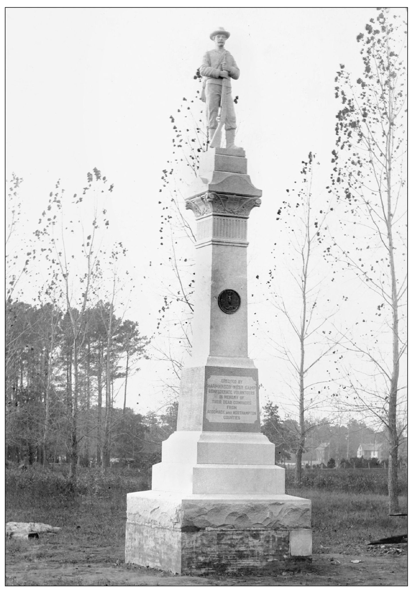
In the center of Parksley stands a prominent monument to fallen Confederate soldiers from Accomack and Northampton Counties. The location of this monument is rather surprising, considering the town was built by a group of “Northern capitalists,” but, as often happens, a story is involved. When the railroad was built, a number of businessmen lobbied to have the county court moved from Accomac to Parksley, conveniently located on the rail line. The matter was put to vote, and by a narrow margin, the majority favored keeping the court in Accomac. Shortly thereafter, Parksley, as something of a consolation prize, was chosen as the site of the Confederate monument. (Courtesy of the Town of Parksley.)
The railroad helped make potatoes the most lucrative crop in Accomack County. Most communities had barrel houses (Parksley had three), and farm workers would load potatoes into barrels in fields, cover the openings with cloth to protect the potatoes from the sun, and drive the barrels to the nearest railroad station for shipment. (Courtesy of Carl Thornton.)
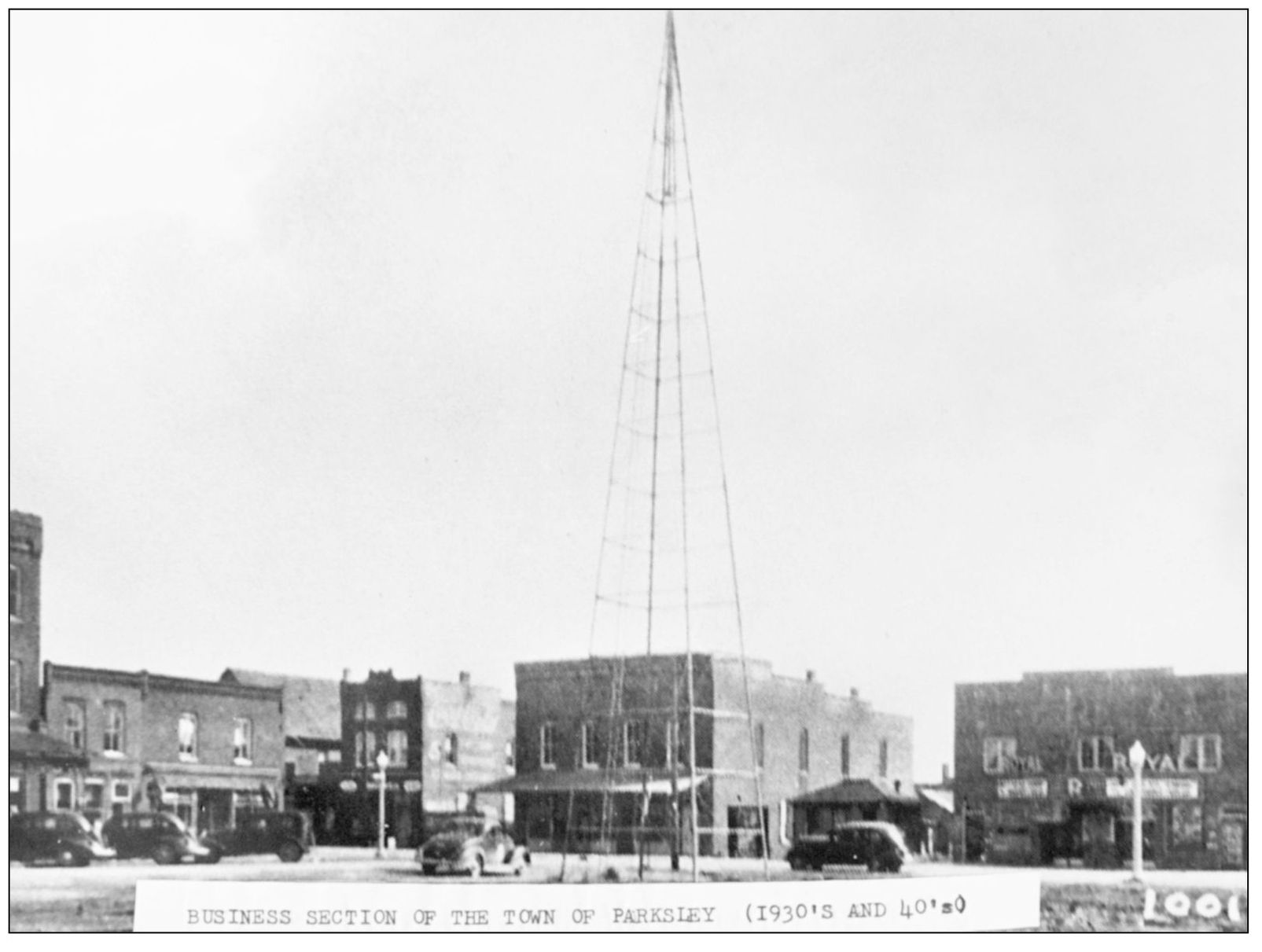
By the early 20th century, Parksley was one of the busiest towns on the Eastern Shore. Banks, stores, manufacturing businesses, hotels, restaurants, theaters, dairies, feed stores, a mortuary, and more grew up around the railroad. A generating station made Parksley the first town in Accomack to enjoy electricity. Times were good, and local residents constructed fine homes with the most modern conveniences. This is a view of downtown Parksley sometime in the 1930s. (Courtesy of the Town of Parksley.)
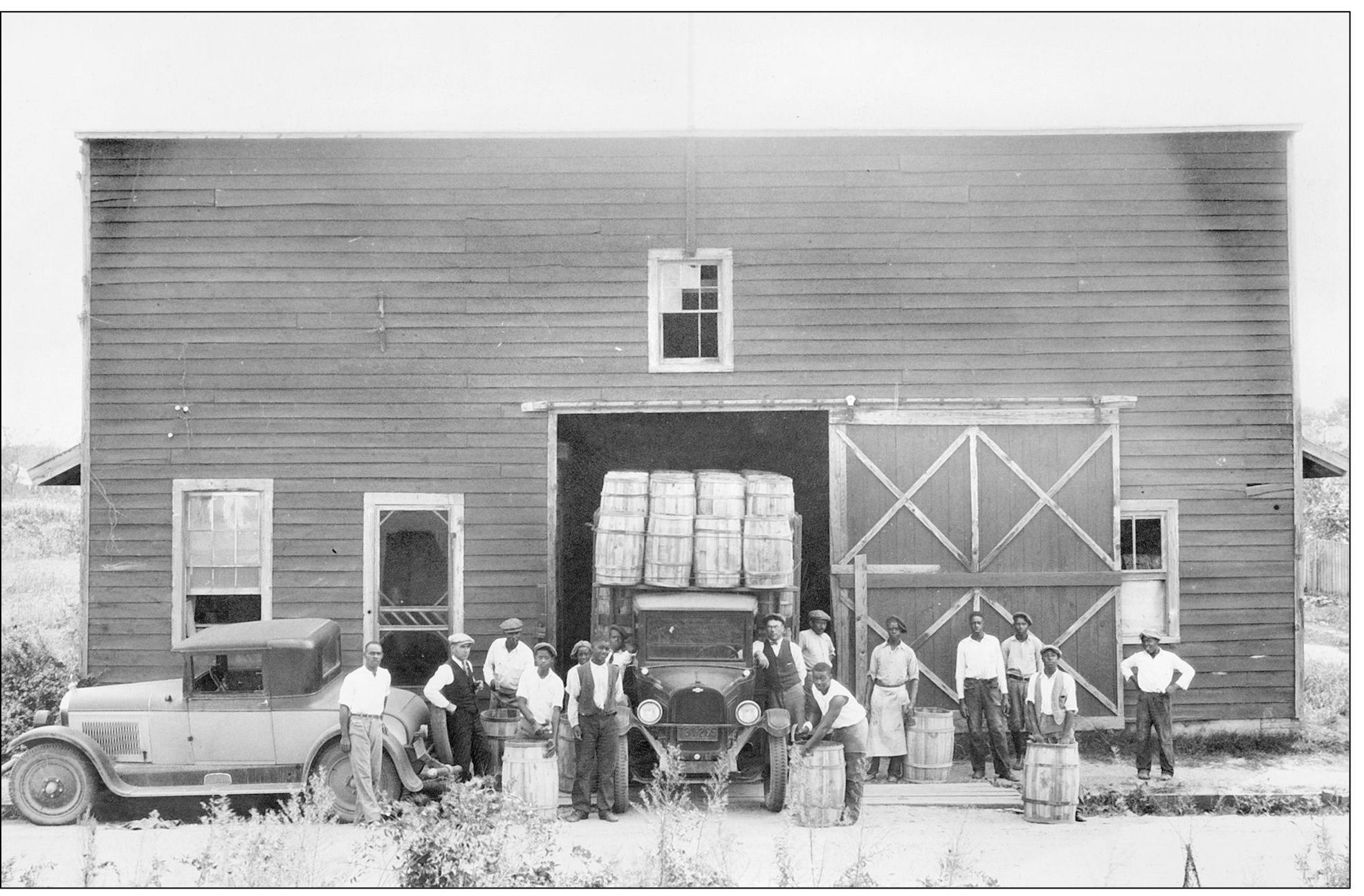
At one time, Parksley was home to three barrel houses. This one is believed to have been on Bennett Street, in the area where Paddock Automotive is today. Barrel houses such as this one produced thousands of barrels used by farmers to ship their valuable produce to large cities. Most major towns had at least one barrel house, and towns like Parksley, which were major stops along the railroad, had more. The barrel making trade gradually died out, however, as burlap bags and cardboard boxes began to replace barrels. (Courtesy of the Parksley Railroad Museum.)
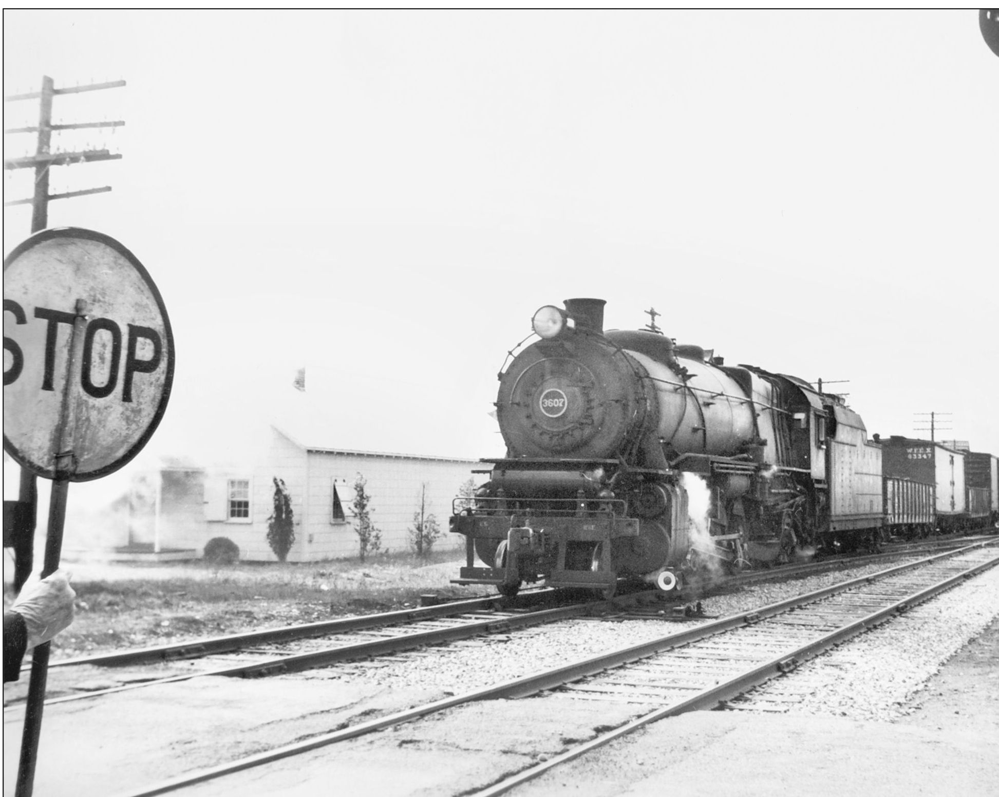
Here Pennsylvania Railroad L-1 Mikado No. 3607 approaches a crossing in Parksley in 1946. This particular locomotive was built in 1916 by the Baldwin Locomotive Works for the Pennsylvania Railroad. The L-1 was used extensively across the central and eastern United States during the 1920s. During the Great Depression in the 1930s, however, the locomotives were in a great surplus, and many were kept in storage for the decade. World War II, industrial growth, and a need for massive transportation in the 1940s fueled a new demand for these old machines, and they soon populated tracks all over the country once again. (Robertson Collection, courtesy of ESVHS.)
In this photograph, likely taken around 1910, passengers wait to board the approaching train at the Parksley station. Most towns along the tracks had a station, providing residents a vital link to cities along the coast. The ease of travelling brought on by the railroad helped boost tourism to the area, as well as providing residents with a means of traveling. (Courtesy of Webster Martin.)
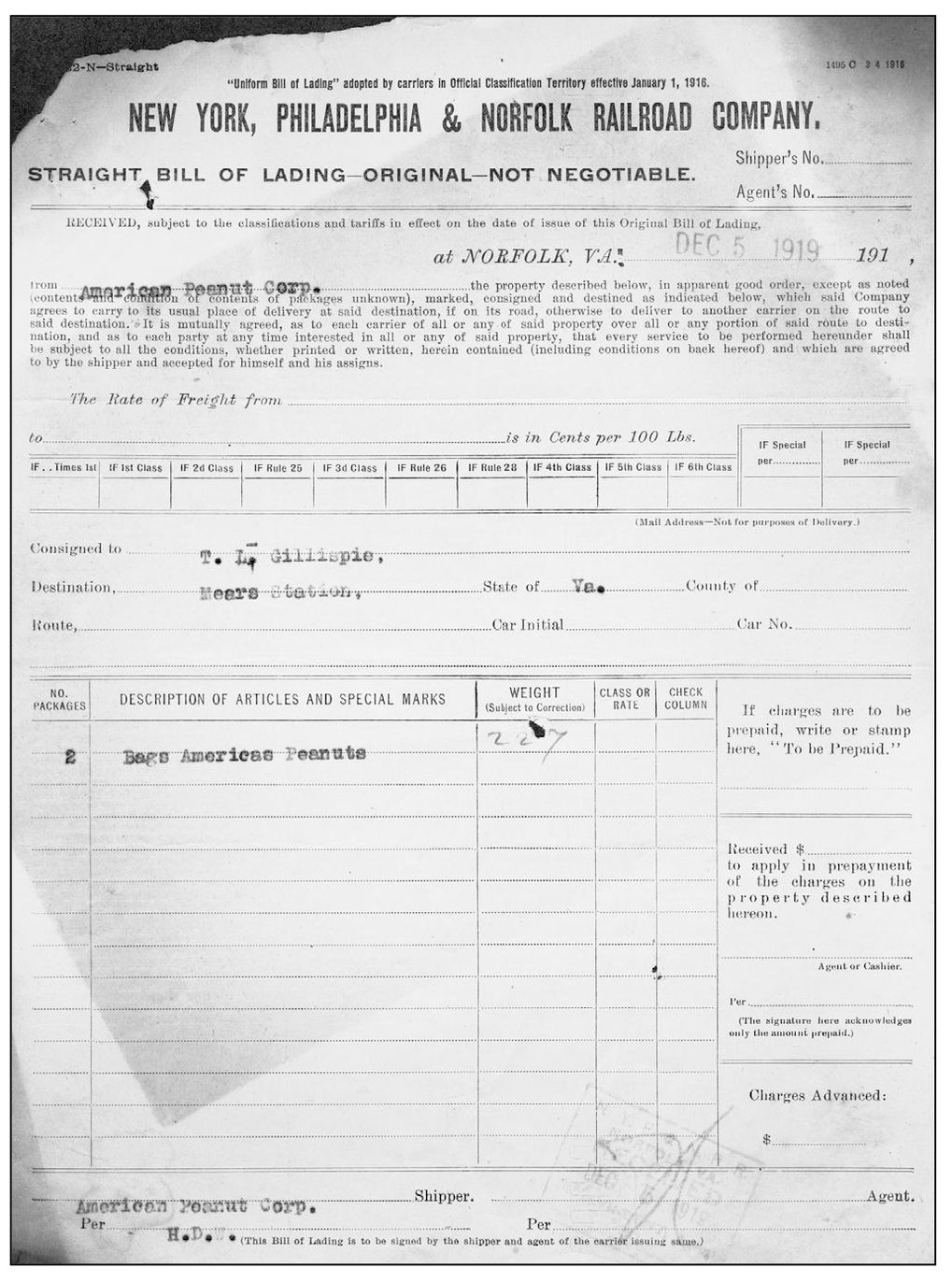
This is a bill of lading between the American Peanut Corporation and the New York, Philadelphia, and Norfolk Railroad Company. A bill of lading is an agreement showing that goods have been received as cargo for transport to a specific destination. This December 5, 1919, bill of lading is for the shipment of two bags of peanuts from Norfolk, Virginia, to Mears, Virginia. (Courtesy of the Parksley Railroad Museum.)
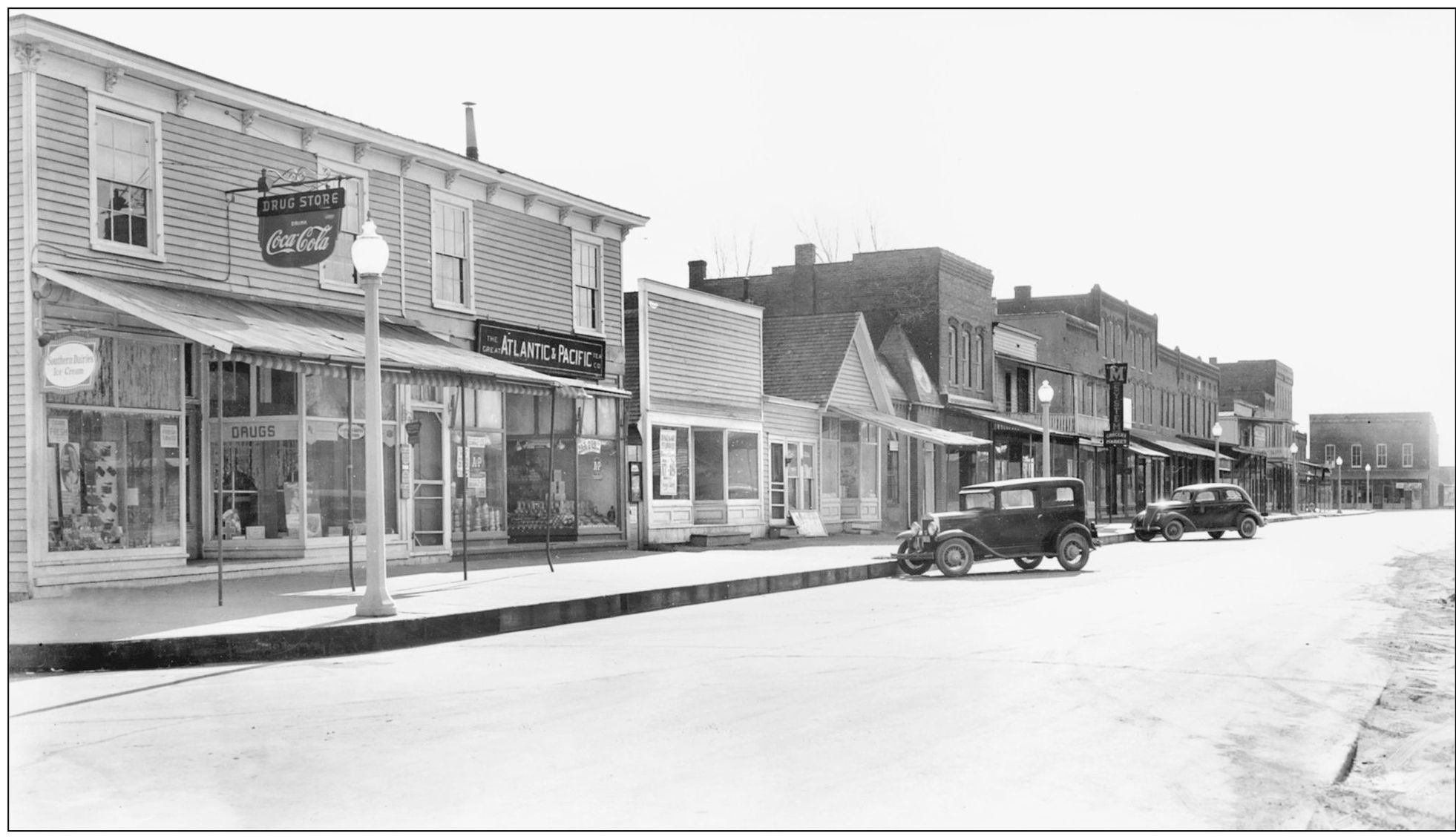
Parksley was one of the busiest and most progressive towns in Accomack in the early 1900s. These businesses along Dunne Avenue included Henderson’s Drug Store, the Great Atlantic and Pacific Tea Company, and the Watts Brothers men’s shop. The streetlamps were an elegant touch in 1940. (Courtesy of authors’ collection.)
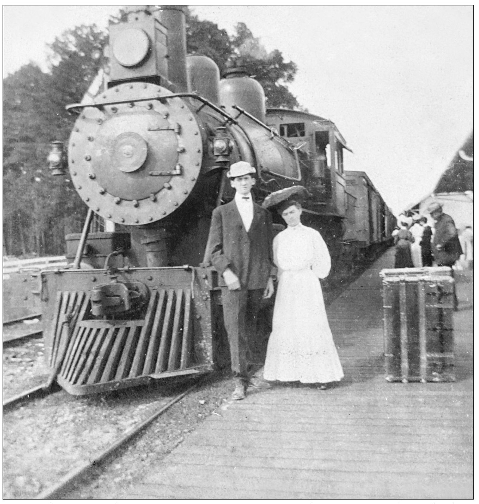
Accomack was one of the most prosperous counties in Virginia between 1900 and 1930 thanks to the railroad, the Produce Exchange, and thousands of acres of farmland planted in potatoes. The railroad made the world smaller. Passengers could embark in Melfa or Parksley in the morning and enjoy dinner in a fine restaurant in Philadelphia that evening. Many local couples like this one took advantage of rail travel. (Courtesy of ESVHS.)
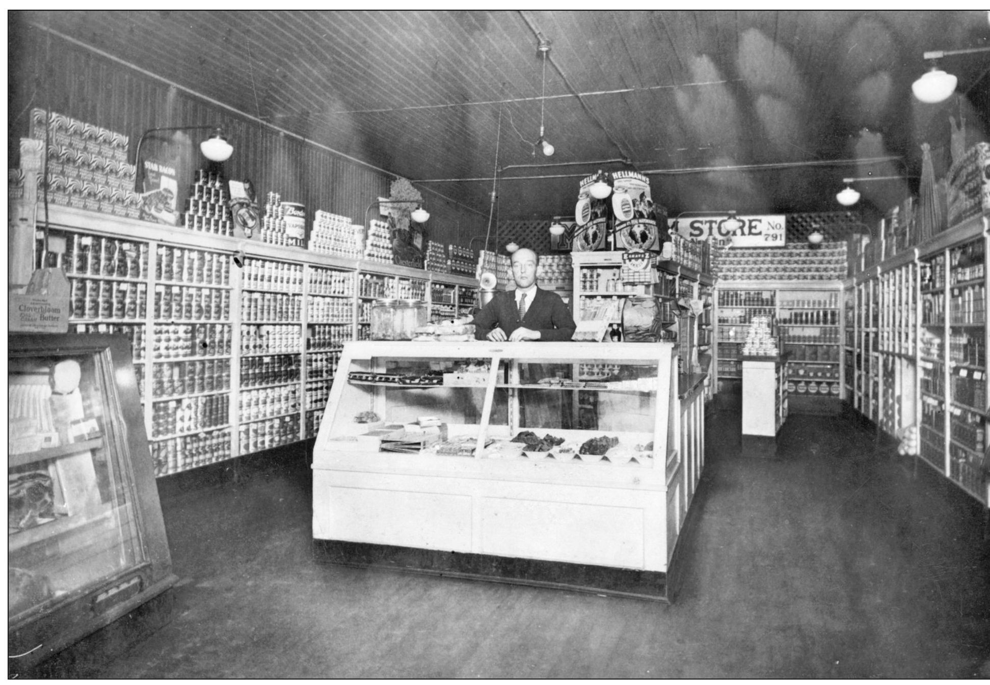
This was Bruce Eaton’s well-stocked grocery store on Dunne Avenue in Parksley. The store was originally a Pender’s market, but Pender’s moved to a larger building on Bennett Street. Grocers continued to do business here for many years. Bruce Eaton (behind counter) followed Pender’s, and Eddie Core also operated a store at the location. (Courtesy of Carl Thornton.)
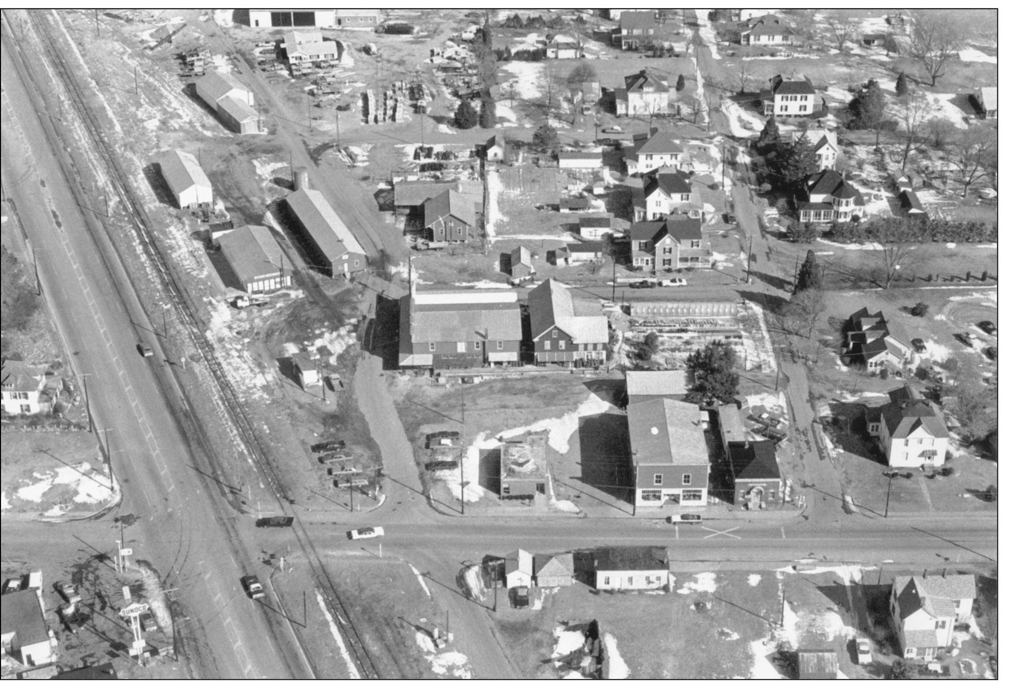
Like Parksley, the town of Melfa was a product of the railroad. While not nearly as large or as prosperous as Parksley, Melfa was still a planned town, at least to a degree. The streets are set in a grid pattern and it surrounds the railroad tracks conveniently. The origin of the name “Melfa” is unclear. Several towns were named for railroad executives, but the name Melfa does not appear in any list of railroad principals. A possible source for the name is the Melfa River in Italy. Quite a few Italians were involved in construction of the railroad, and the station could have been given the name of the river in a worker’s homeland. In this c. 1970 aerial photograph, the Economy Feed and Milling business is in the center. (Courtesy of authors’ collection.)
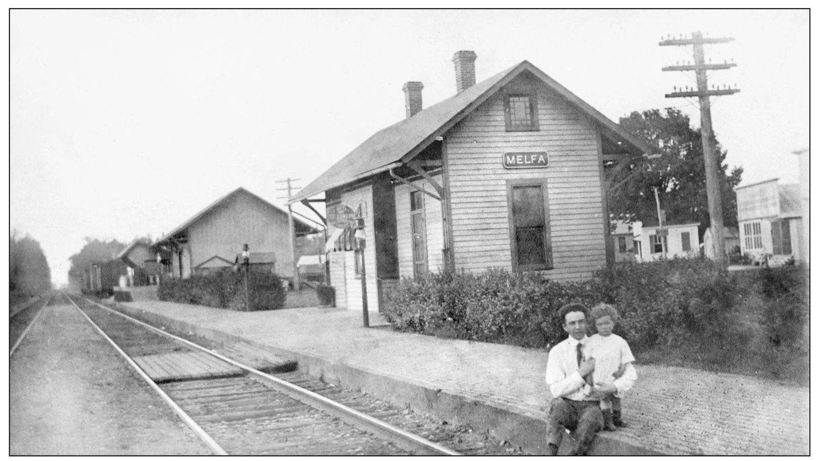
Here a father and child wait at the Melfa train station, sometime around the beginning of the 20th century. The sign on the building advertises the telegraph office. Many of these small stations have been abandoned and destroyed over the years. Such was the fate of this one in Melfa. (Courtesy of the Parksley Railroad Museum.)
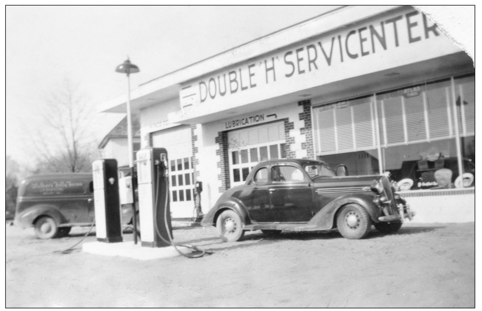
The Double “H” Servicenter was a car service station located in Melfa. Two brothers, Bill and Dennard Harmon, built the business, hence the “Double ‘H’.” A Walker’s Folly Farms milk truck can be seen in the background of this photograph, which was likely taken in the late 1940s. (Courtesy of Jack Marsh.)
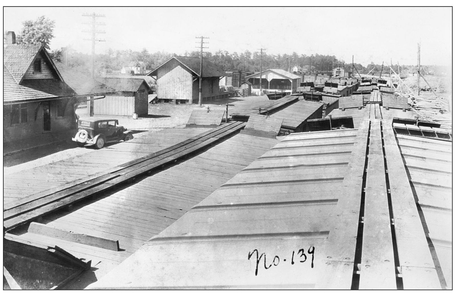
Tasley was one of the main shipping points in central Accomack County in the early 1900s. These boxcars lined up at the Tasley railroad yard are likely filled, or soon to be filled, with barrels of potatoes. This photograph was taken in the late summer of 1930. (Courtesy of authors’ collection.)
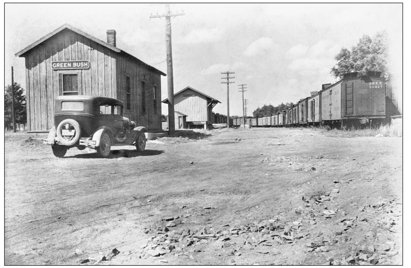
Pictured here is the Greenbush siding in 1930. Greenbush provided rail access for shippers between Tasley and Parksley. Even small towns such as Greenbush had stations for the convenience of farmers who lived in the area. (Courtesy of authors’ collection.)