It was in seventeenth-century France that canal engineering entered a new age of ambitious projects requiring unprecedented engineering works, beginning with the Canal de Briare. Plans were drawn up as early as 1603 for a canal to link two of the country’s most important waterways: the Seine and the Loire. The idea was to improve the little River Trezée from the point where it joined the Loire at the village of Briare, so that it was navigable for 16km. At the opposite end, the River Loing was to be made navigable for some 45km from its junction with the Seine near Montargis. This left a gap in between that was to be closed by a canal crossing the watershed in a 12m deep cutting. The plans were approved and tenders were invited for completing the work that was to involve constructing a total of 48 locks, roughly 27m long and 4.8m wide. The canal was to be 12m wide and 1.4m deep. It seemed feasible, and the contract was awarded to Hugues Cosnier, an engineer born in Tours in 1573.
When Cosnier began his own survey of the proposed route he discovered there had been a major error in the original plans. The plans assumed that the two rivers were at the same height above sea level at the points where they were to be joined: they were not and the difference was a substantial 12m. Not only was this a major surveying error but also no means had been provided for supplying the summit with water. This is essential for any canal that joins two watersheds. A vessel travelling along a canal with a summit such as this climbs up one side by means of locks. To fill the first lock, the water is drawn from the section of canal – the pound – between that lock and the next and so on right up to the top, when the final lockfull has to be drawn from the summit itself. Similarly, when descending the other side, the first lock has to be filled from water in the summit level. In other words, each boat crossing the summit uses two lockfulls of water, which if not replaced leaves the summit dry. As originally planned, the canal was inoperable and a further problem was that no allowance had been made for flooding on the rivers.
Cosnier’s new plans were radically different.
The idea of making the rivers navigable was abandoned, and instead Cosnier proposed making a true canal all the way from Briare to Montargis. The Trezée valley would only be followed for 11km, and from that point the canal would head north to a plateau and a 6km summit level. At the same time he proposed building larger locks using substantial masonry. Another engineer, Jean Fontaine, approved them and passed them to the Duke of Sully. Sully had enjoyed a successful career in the military before being appointed by Henry IV to take charge of the country’s financial affairs. He was later made Grand Commissioner for Public Works, in charge of roads and waterways. He also approved the plans and arranged for 6,000 soldiers to be seconded to build the new canal. Sully took a personal interest in the progress of the works, making regular visits and even shared his enthusiasm with the King, who made a royal visit accompanied by the Queen.

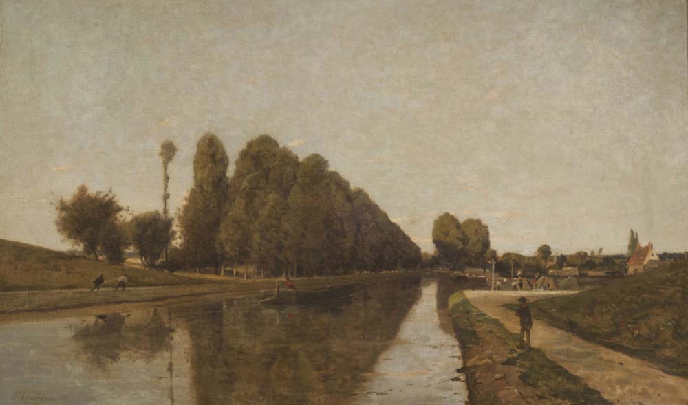
The Canal de Briare in the Loire district of France was a pioneering venture, involving many imposing engineering features. Construction began in 1604 and was completed in 1642, after a long period when work stopped altogether, and the final construction phase only began in 1638. This painting by the nineteenth-century French landscape artist Henri-Joseph Harpignies gives a good impression of the grand scale. (Anthony Burton)
Work started in 1604 and continued at a good pace. Over the next few years, more than 40km of the 55km canal had been completed and thirty-five substantial locks had been built. These were far more substantial than any allowed for in the original plan, with 2m thick masonry walls and devices that were still a novelty at the time: sluices within the lock chamber, ground sluices, as well as openings in the gates. Where the old plans called for falls of about 1m on average, Cosnier had been far bolder and the largest of the locks had a fall of more than 4m. Yet, because of the new ground sluices, operation still took only ten minutes. His boldest venture was in the sharp drop from the plateau to join the River Loign at Rogny. Here, instead of individual locks, he arranged seven interconnected locks as a staircase: for a boat starting at the top, the bottom gate of the first lock would also be the top gate of the next lock, and so on to the bottom – a total fall of 20m. He had already laid plans for supplying the summit with water, by means of a feeder from a small lake at the head of the River Trezée, the Étang de la Gazonne, that would act as a reservoir. The end was in sight, but a violent change in French politics brought everything to a halt. Henry IV was assassinated and Sully, whose policies may have been sound but whose overbearing manner had made him many enemies, was forced to resign in January 1611.
A commission was set up to decide what to do next, and despite describing the work already done as ‘nearly perfect’, the project was abandoned. Cosnier offered to finish the work at his own expense in exchange for collecting the tolls during the first six years of operation. His proposal was rejected and the canal languished until 1628 when another survey was carried out by yet another engineer, M. Francini, and the architect Jacques Lemercier. Not much is known about Francini, but Lemercier became famous for his buildings in Paris, notably the reconstruction of the Louvre, including the prominent Pavillon de l’Horloge. They recommended completing the work, but were concerned that the water supply would be inadequate at the summit level. They proposed another feeder from an intake on the Loing to another small lake that would again act as a reservoir. Although Cosnier had been busy on other projects in the meantime, he was still anxious to see this, his most prestigious project, to a conclusion. He volunteered to construct the feeder channel in exchange for the payment of the rest of his fee that the government had owed him all those years. This was agreed, but Cosnier died in 1629 aged just 58. He had been a tireless enthusiast for canal construction and among his unrealised dreams was a ring of canals circling Paris. Although not quite completed during his lifetime, the Canal de Briare remains an impressive monument to his originality and ability. Once again the work was abandoned.
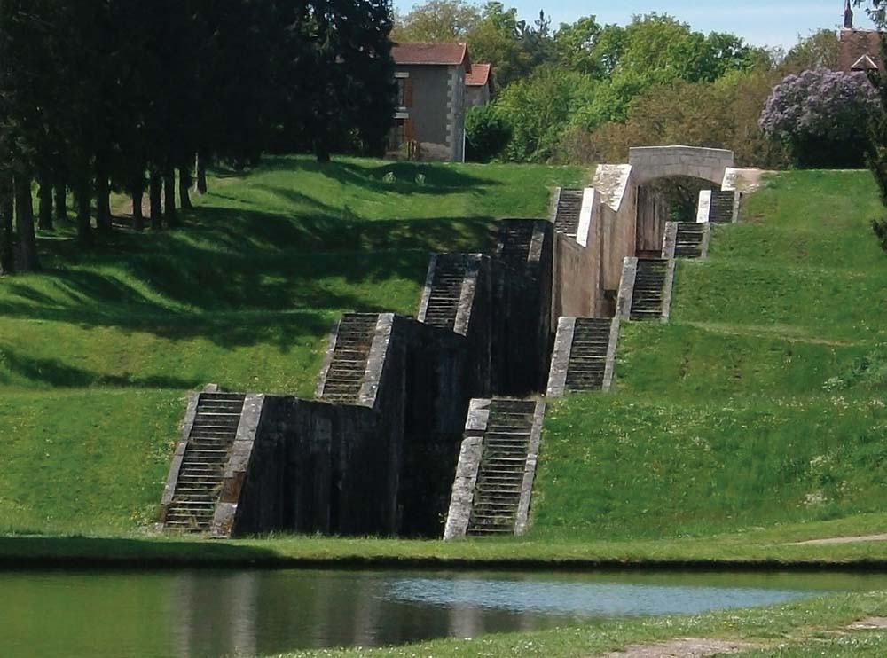
The most impressive feature of the Canal de Briare was the seven-lock staircase that brought the canal down the steep slope to join the Loire at Rogny. Having all the locks interconnected in this way was new and was the work of the original engineer employed on the canal, Hugues Cosnier. The locks were bypassed, when the Briare canal was connected directly to the Canal Lateral de Loire by an aqueduct over the river. (Anthony Burton)
In 1638 work finally got under way again when Guillaume Boutheroue and Jacques Guyon obtained letters patent from Louis XIII to complete the works. The actual construction was entrusted to Boutheroue’s brother François. His first task was to restore the damage done by decades of neglect. He built the remaining locks and the feeder channel from the lake by the Loing. The feeder channel was constructed with an accuracy that would have impressed even the Roman hydraulic engineers, with a fall of just 165cm in 21km.
The canal was a great success, with the company formed by Boutheroue and Guyon regularly receiving dividends of 13 per cent. Among the more mundane and important trades in timber and coal, there was also a flourishing business in bringing wine from the great vineyards of Burgundy and Languedoc to the cities of the north. By the middle of the eighteenth century there were about 500 wine barges working on the canal, each of them bow-hauled by men. Briare grew in importance and developed a handsome canal basin, but it was destined to be overtaken by events. In 1860 the canal was taken over by the state and it was decided to join it to the Canal Latéral à la Loire. In the 1890s the latter was extended by a very impressive aqueduct across the Loire, then continued south for 2.6km to join the Briare. As a result, the section down to the old basin was gradually abandoned and Cosnier’s masterpiece, the seven-lock staircase, survives only as dry, empty chambers, retained as an industrial monument.
It is worth noting, even if the chronology is upset, that the French have persevered with their use of canals with far more diligence than the British. The Briare and the Latéral now form part of the Bourbonnais system of canals that link the Seine to the Saône, forming part of a north-south system that crosses from coast to coast. The Briare is just one of many canals improved in the latter part of the twentieth century as we shall see shortly.
The usefulness of the Briare Canal was greatly increased by the construction of a short cut between the Loire at Orléans and the Loing at Montagris. The Canal d’Orléans was started in 1682 and completed in 1692. It was 74km long with twenty-eight locks, but for much of its length runs over a flat plateau at the summit. As with the Briare this needed to be supplied with water, which involved building a very long feeder, 32km long, with a fall of little more than a metre through its whole length. The canal fell into disuse, but for many years it was an important part of the timber trade. It is currently being restored for leisure use and is partially open.

The nineteenth-century aqueduct across the Loire at Briare. Built in the 1890s, the water is carried in a 662m long steel trough. The masonry abutments with their elaborate plinths and carvings were the work of one of the most famous engineers of the day, Gustav Eiffel, designer of the famous tower in Paris that bears his name. (Missot)
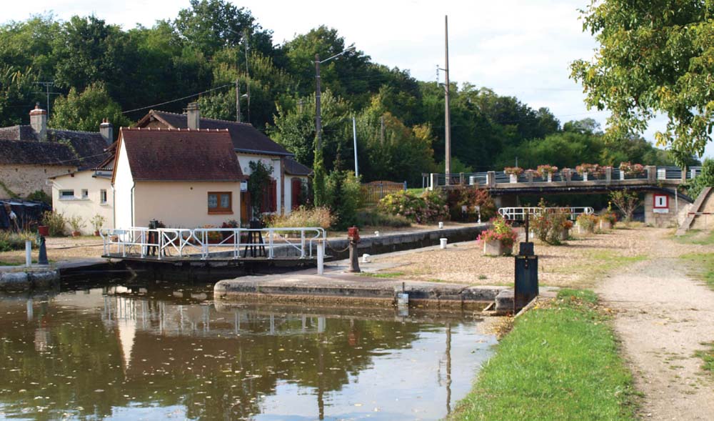
The Canal de Briare’s days as a busy commercial waterway have ended, and today it is a peaceful canal enjoyed by holiday boaters. (Anthony Burton)
The Briare set a new standard for canal construction and introduced many important innovations. But one seventeenth-century canal stands above all others, not just for the sheer scale of its operation but for its importance in the whole story of canal development – the Canal de Languedoc or, as we know it today, the Canal du Midi.
The idea of a canal that would cut across the whole of France from the Mediterranean to the Atlantic was not new. There was an obvious route to follow that would link the Garonne and the Atlantic port of Bordeaux to the Aude that flowed through Toulouse to the Mediterranean. In the early sixteenth century, Francis I was not only King of France but also ruled over Milan. He was impressed by Milan’s canal connections and invited the engineer who had done much of the work, Leonardo da Vinci, to accompany him back to France. Leonardo looked at various routes, appears to have favoured the Garonne-Aude link and proposals were put forward on just how this could be achieved. The first suggestion was for a canal from Toulouse to Carcassonne, put forward by Nicolas Bachelier with a colleague, Arnaud Casanove. Their plans described a lock-free canal together with improvements to the Garonne, either by using the river itself or by building a parallel canal to Bordeaux. Francis I approved the plans, but they were never carried out, and were never really practical.
The plans were dusted off in 1598, when the Duc de Sully ordered a new survey from a Dutch engineer with a very un-Dutch name – Humphrey Bradley. His plans were even less acceptable than Bachelier’s and Sully abandoned the idea, turning his attention to the realisable scheme that became the Briare Canal. The great difficulty of finding a route between the two rivers lay in the very dry section at the summit, where there was no obvious way of supplying the canal with water. The solution was eventually found by a man with no previous engineering experience, Pierre-Paul Riquet.

The statue of Pierre-Paul Riquet in Toulouse, erected to honour the man who was the driving force behind the construction of the Canal du Midi that ran from here to Carcassonne. He originally worked as a collector of the salt tax, a lucrative position that allowed him to retire in 1654 aged 50. Instead of idling away his remaining days, he was soon at work surveying the route for the proposed canal. (Anthony Burton)
Riquet was born at Béziers in 1604. The family, originally from Florence, were wealthy and influential and Riquet improved his own position aged 18 when he married Catherine de Milhau. She came to him with a dowry big enough to allow him to buy a chateau and estate, aptly named Bonrepos, near Toulouse. In 1630, thanks to family influence, he was appointed as collector of the salt tax for Languedoc. Salt was an essential commodity, not just for seasoning but also for preserving food in the days before refrigeration. Tax rates were high – and hugely unpopular – but the collector received a commission on what he gathered in. Riquet was soon promoted from local collector to collector for the entire province and made a fortune. He went into partnership with his brother-in-law Paul Mas as a military contractor, and made even more money, enough to retire aged 50 and buy a town house in Toulouse to add to his country estate. In modern France he would have been a euro multi-millionaire. He could have lived the quiet life of a country gentleman but instead devoted all his energies to canal construction. His work as tax collector involved travelling all over that region of France, so he knew the country intimately and recognised the great value a canal would bring. He was also sure such a scheme was practical.
There were various alternative routes being canvassed at the time, one of which had a great deal of backing. This involved a canal from the summit to head northwards via the Rivers Agoût and Tarn to the Garonne. Riquet preferred a canal that would begin at Toulouse. But whichever route was chosen, there was still that awkward problem to overcome – how to supply the summit with water.
Riquet had always preferred his country home, Bonrepos, to the town and got on well with the local villagers. It was to one of these men he turned for help. Pierre Campmas was a fontainier, literally translated as the man in charge of springs. He was responsible for looking after water supplies in the district so had invaluable knowledge of all the local watercourses. They set out together to explore the summit level, first establishing the point on the watershed where one set of streams flowed east, the others west. This was the Col de Narouze and the nearest sources of water were the streams that fell down the southern slopes of the Montaigne Noire. Riquet realised that these alone would not answer the question and he conceived of damming one or more of the narrow mountain valleys to create reservoirs.
Riquet was astute and visionary, but he was certainly not a qualified engineer and he needed someone who could turn his plans into practical realities. A young man called François Andréossy was recommended by his friend the Bishop of Castres, Monsignor d’Anglure de Bourlemont. Andréossy had studied science and engineering in Paris and had visited Italy in 1660 to see the canal works there. Like Riquet he was convinced that canals would be of ever-greater importance and was anxious to be involved in a major project – and there was no more major scheme than that of the Canal du Midi.
There has been controversy as to who should take the credit for building the canal. There are two separate accounts of the construction, written by descendants of the two men and, not surprisingly, each give the laurels to their own ancestor. L.T.C. Rolt in his excellent history of the canal, From Sea to Sea, first published in 1973 and updated by David Edwards-May in 1994, discusses the issue at length. He plumps for Riquet on the grounds that it was his idea and if it had failed he would have had to take the blame so, as it succeeded, he should take the credit. But does there have to be a choice? The idea was certainly all Riquet’s, but it could only become a reality with the expertise of his young associate. With such a magnificent venture there is honour enough to share.
Riquet had the support of his old friend Bourlemont who had recently been appointed as Archbishop of Toulouse and now had considerable influence. It was at his suggestion that Riquet wrote to the King’s chief minister, Jean-Baptiste Colbert, in November 1662. One of the more surprising aspects of the letter is Riquet’s apology for it being clumsily written. He writes that he knows neither of the scholarly languages of the time – Latin and Greek – and admits that his French isn’t very good either. In fact he used the local language of Languedoc, Occitan. The main point he wants to get across is that he had a solution to the problem that had scuppered all previous schemes – how to supply the summit with an adequate water supply. He had calculated that the River Sor flowing out of the mountains is 16½m above the summit level and that the river is only 1,500 paces away from a brook known as the Lampy, which in turn connects with other brooks. It would be a simple matter to connect these to provide sufficient water to supply a canal 16½m wide and 1.80m deep. These are generous dimensions, but the canal was not intended just for inland barge traffic: one of its main purposes was to provide a route for coastal shipping to avoid the long and expensive journey round Gibraltar.
Colbert was an ambitious man who was anxious to turn rural France into a modern industrial nation. He was well aware that good communications were the key to success, so the scheme appealed. Riquet and the Archbishop were invited to Paris, arriving in style in the Archbishop’s private coach. The meeting was a success and Colbert began getting official approval. He approached Louis XIV who was enthusiastic and authorised a Royal Commission to investigate the proposal. Like most such commissions it was made up of dignitaries, most of whom knew nothing of the subject upon which they were to pronounce judgement. The exception was Henri de Boutheroue, whose father had completed the work on the Briare Canal. Together he and Riquet finalised the plans for the new canal, which was even more ambitious than Riquet had originally planned.
In the new version, the canal would no longer have a terminus at Carcassonne. It would be extended to the Mediterranean at Étang de Thau, where a new port was to be created, originally called Cette but now Sète. Riquet proposed building a whole string of reservoirs, but eventually the system was simplified. There were to be two main feeder canals, or rigoles: the Rigole de la Montaigne, 24km long, rising high in the hills, which would connect with the main feeder, the 35km Rigole de la Plaine, which would meet the summit at the Col de Naurouze. As well as the natural springs and streams feeding the rigoles, there was to be a dam across the Laudot at St. Ferreol to create a large reservoir.
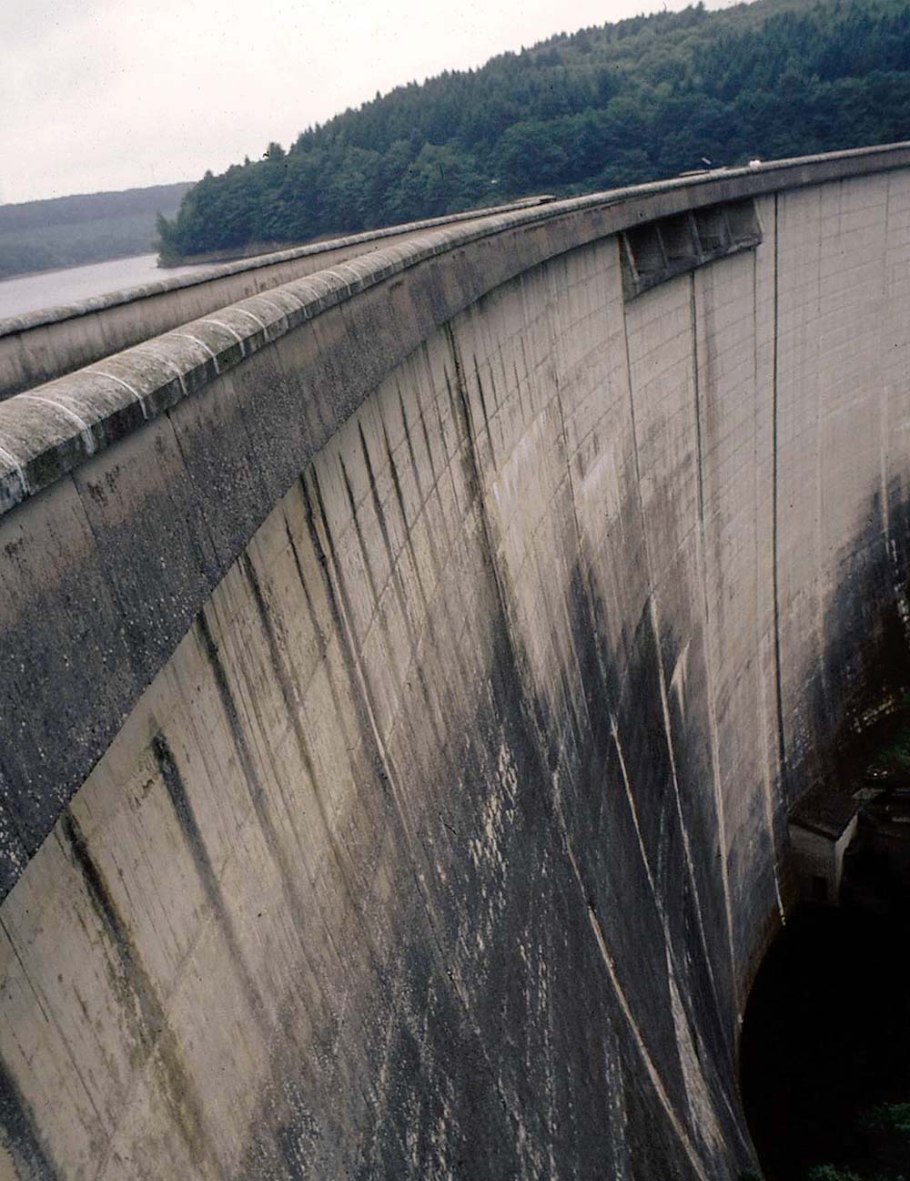
The first problem Riquet had to solve was how to provide water to supply the summit level of the Canal du Midi. He found what he needed in the rivers that flowed off the slopes of the Montaigne Noire. To ensure there was always sufficient water available, he arranged for the building of a vast dam across the Laudot at St. Ferréol. The photograph shows the dam today, rising 42m above the bed of the river. Water from the reservoir held behind the dam was fed to the canal through narrow channels, the rigoles. (Anthony Burton)
The Commissioners niggled away at details for almost a year and, in particular, they doubted the success of a feeder from the Sor being practical. Riquet’s bold response was to prove its practicality by digging the feeder at his own expense. Not surprisingly, the Commissioners agreed and sent their approval on 27 May; by July Riquet had worked out a plan. Instead of taking a direct route, which would have involved costly earthworks, he followed the natural contours of the land – a technique that would be used by later generations of canal engineers. This saved a lot of work – and a lot of Riquet’s money – and in October of that year the waters of the Sor had reached the summit. It seemed that there were now no more obstacles and work could get under way, but Riquet had not allowed for the cautious workings of the official mind. Another committee was set up to decide who should pay for what. Eventually it was agreed that the state would buy the land, the Province of Languedoc would be authorised to use revenue from the salt tax to pay for construction and, for his contribution, Riquet and his successors would collect the tolls. At last, in October 1666, the King issued an edict authorising construction, which was to be completed in eight years at a cost of 3,360,000 livres, roughly 17 million euros at today’s prices.
By winter 1667, there were 12,000 ‘head’ at work. This curious figure was calculated on the basis of both men and women being employed: each man counted as one head, but three women were required to make up two heads. In fact, men represented by far the greater number of workers. The first task was to build the water-supply system. The most important work was the construction of the dam at St. Ferreol. This was to be a massive structure, rising 42m above the bed of the Laudot, with a base that was 140m thick and with a curved crest with a total length of 780m. Everything had to be built by hand, with two outer stone walls, an inner core wall and the spaces between were then packed with earth. Most of the labour of bringing earth for the core onto the site was done by the female workers carrying it in wickerwork baskets. Riquet was immensely proud of this structure and the area around it was landscaped to show it off. The slopes below the dam were planted with trees, the overflow was turned into a series of cascades and the water pressure created an imposing fountain at the bottom of this ornamental parkland. At the base of the dam is a tunnel, known as the arch to the entrance to hell. It is certainly dramatic, but hardly infernal. It provides access to sluices, which wash silt away from the reservoir high above. The various rigoles were not that dramatic, but they too included major engineering works, including a 120m long tunnel. They were built to generous dimensions, and for a time were used by small boats.
Work now began on the canal itself. The workers were organised into twelve divisions, each division having a supervisor. More engineering challenges soon appeared. Five deep locks were to be built at the Toulouse end. To accommodate coastal craft the locks, a hundred of them, were built to generous dimensions, mostly 30m long by 5.6m wide. The first locks were begun with conventional rectangular chambers, but one of them collapsed so Riquet used a different design. The new locks had vertical walls, but curved in plan to resist the pressure of the earth. The various rivers met along the way were originally crossed on the level, which must have been an interesting experience for the boatmen, but were mostly later replaced by aqueducts. The Cesse crossing was replaced by a three-arched aqueduct shortly after the opening of the canal. The grandest of the aqueducts, across the River Orb, was built as recently as 1857 and is a magnificent structure of seven arches, with an arcade of smaller arches above carrying the masonry trough.
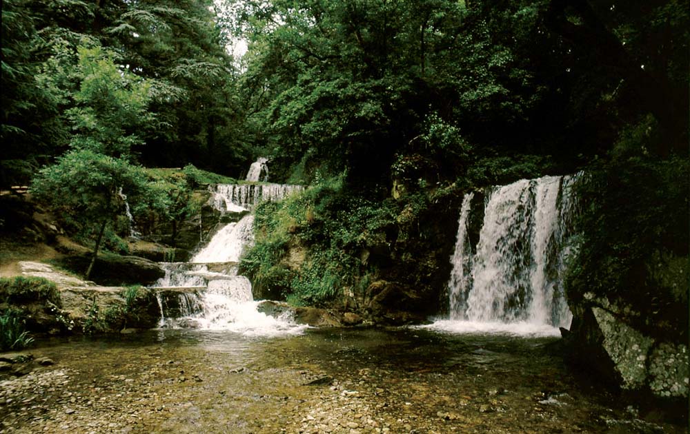
The overflow from the dam was formed into this series of ornamental waterfalls, turning the surroundings into a delightful park with a fountain also fed from the reservoir at the bottom. (Anthony Burton)
There were specific technical problems to overcome. In places the canal had to be dug through porous material and made watertight. The solution was puddling. This involved making a semi-fluid mixture of clay and water, which was stamped onto the ground and added in layers until it formed a perfect seal. Other difficulties had nothing to do with the works themselves. Financing the project depended on the salt tax income, a tax that the citizens of Roussilon were not merely reluctant to pay but, according to Riquet, resorted to violence to avoid. In a letter to Colbert he described the locals as famously violent and the area as one in which murder was as common as bread and wine, cheerfully adding that his tax collectors were prepared to kill rather than be killed. The money continued to be collected in spite of sporadic riots.

This aerial view shows a typical lock on the Canal du Midi, crowded with pleasure boats. Lock construction was still in its infancy, and Riquet had problems creating conventional locks as the sides tended to collapse under the pressure. To give them extra strength he built the locks with curved sides which, being in effect arches turned on their side, offered greater resistance. (Edition Laubatièras)
Work proceeded more slowly than anticipated – a familiar problem with major engineering projects, but one not always understood by officials in Parisian offices. An exasperated Colbert threatened to send in new men to take over. Riquet had just begun to face a unique challenge, driving a tunnel through a hill at aptly named Malpas (bad step). He received word that a Commission was about to descend on the works and if they were dissatisfied then everything would stop until a new organisation was in place. Riquet called in all the men engaged in other work in the district and set them to work tunnelling. As one crew advanced hacking their way through the rock, another crew followed on behind them erecting wooden beams to support the roof. Masons were kept busy lining the side walls. The tunnel is not very long, just 165m, but is of imposing size, more than 7m wide and with the crown of the roof arch 5.8m above the water line. Amazingly, according to legend, all this work was completed in just six days. The tunnel has a distinctly odd appearance even today. The western end is lined and faced by an imposing portal; the eastern end remains as natural rock with an entrance that looks more like the opening to a cave than a canal tunnel. Was this the state of the tunnel when the Commission made the inspection and, once that was over, did Riquet simply leave things as they are, having made his point? There is no evidence one way or another.
The critics were temporarily silenced. However, the approach to the River Orb was so steep they decided that the canal would never reach it. Riquet had already used double locks in other parts of the canal, but this time he produced a truly spectacular solution to the problem – a seven-lock staircase with a total drop of 21.5m in 280m. The critics were confounded. But it was Riquet’s final triumph. In October 1680 he died aged 76, just seven months before the canal officially opened. His obituarist compared him to Moses who didn’t live to enter the Promised Land.
The opening of the canal on 15 May 1681 was a grand affair, presided over by the Governor of Languedoc. A fleet of cargo boats from the Garonne set off from Toulouse with goods from the fair at Beaucaire, reaching Sète ten days later. It marked the end of one stage of the canal’s history. Improvements continued in the following years and included the construction of the Canal Latéral à la Garonne, providing far better communication from the Midi at Toulouse to Bordeaux.
Financially the canal was a great success. At its most active there were some 250 boats using the canal, each capable of carrying loads of about 60 tonnes. There was a regular mail service on the canal, and the mail boats also carried passengers from 1684, with 30,000 a year using the service. By the middle of the nineteenth-century goods traffic had peaked at 110 million tonne-kilometres per annum. But a competition had appeared – the steam railway. To fight it off a new fast mail service was introduced, with teams of horses changed at regular intervals and travelling day and night. The journey time was reduced to 35 hours from Toulouse to Sète. It was all in vain, and in the twentieth century the motor age brought even more fierce competition. By this time the canal was under state control and there were serious attempts to modernise it to keep trade flowing. Improvements failed to halt the drift of cargo traffic away from the canal, which today thrives as a busy holiday route for pleasure boating. Traffic may have changed, but the canal remains in use more than three centuries after it was built. Riquet would surely have approved. He had originally planned to have an ornate statue of the King placed at the summit where the rigole meets the canal. It was never built, but there is a monument there, not to royalty but to the man who made the canal a reality – Pierre-Paul Riquet.
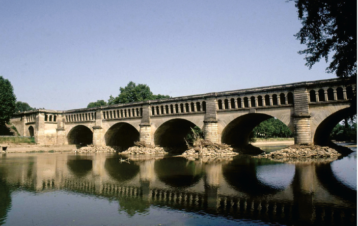
The aqueduct carrying the Canal du Midi across the River Orb at Béziers. Originally the canal entered the river directly, and boats had to make their way downstream for several hundred yards before joining the next section of canal. This proved dangerous, especially when the river was in flood, and improvements were considered as early as the eighteenth century, including building a tunnel under the river. The solution finally arrived with the construction of the aqueduct, completed in 1858, together with two extra locks to reunite the new and old routes. (Anthony Burton)
Canal construction in the seventeenth century was not limited to France. The Prussian ruler Friedrich Wilhelm ordered the construction of a 15-mile waterway to connect the Rivers Sprey and Oder. Completed in 1669, it was the first major canal built in what is now Germany.
A far more complex network was developed in the Netherlands. The whole system of government changed in the 1590s with the formation of the United Provinces, which were largely autonomous. This presented something of a problem when it came to constructing waterways that would inevitably need to cross provincial boundaries – basically little could be done until everyone agreed. The Dutch had been improving their navigation system based on the dykes and rivers for many years, but in the seventeenth century they embarked on the construction of a complex of canals known as trekvaarten built specifically for passenger traffic. The first trekvaart, joining Haarlem and Amsterdam, was completed in 1631 and was soon followed by other intercity links: Leiden was joined to Haarlem and Delft; Amsterdam to Weesp and Naarden. The new system could take market boats and passenger boats, but not large cargo barges, and they spread throughout the country. Passenger boats (trekshuits) ran to a strict timetable. They were generally long and narrow craft, with room for up to thirty passengers. They were pulled by horses, usually ridden by a young boy, and the boats were run by a captain and mate. Going under bridges was a juggling act. The towlines were generally attached to tall masts. The British engineer John Smeaton travelled on one of these vessels and described how they coped. The rope was unhooked, allowed to run over the bridge and caught on the other side, when it could be reattached. The routes were immensely popular. Charles Hadfield in his World Canals (1986) gives the number of passengers using the Amsterdam-Haarlem route in the 1660s as 288,000 a year.

The Canal du Midi had one very original feature – a tunnel. This early photograph shows the Malpas tunnel in the early part of the twentieth century, and clearly shows how it was carved out of solid rock. No attempt has been made to line most of the tunnel, but today the surroundings have been greatly tidied and no longer have the rough and ready appearance of a century ago. (Anthony Burton)
Visitors were most impressed. Richard Castle, in an essay of 1730, described the Dutch as having ‘exceeded all nations we know of, in works of this kind’ and noted that: ‘The Province of Holland in effect is but one continued cluster of cities by means of their canals alone.’
One other country built a summit-level canal in the early eighteenth century, a country that is often ignored when discussing the development of canals in the British Isles – Ireland. The impetus for constructing the Newry Canal came with the discovery of an important coalfield in Tyrone, although the idea of a canal had been around for a long time. It looked as if things might really get under way when the Commissioners for Inland Navigation for Ireland were appointed in 1729 and gave their approval. Construction was to be controlled by the Surveyor General, Thomas Burgh, but as he had a financial interest in another coalfield nothing was done. He died, however, the following year, but his successor had more interesting architectural projects to work on, including new parliament buildings, so he in turn handed on the task to Richard Cassels, who fared no better. It seemed that the canal was doomed to fail simply because no one would give it their full attention. Then in 1736 the job was passed to Thomas Steers, a man of considerable experience. Born in 1672, he built Liverpool’s first dock and worked on many important navigation schemes, including the Mersey & Irwell and the Weaver. Under his direction, work finally got under way. The 14 mile long canal linked the coalfield, via Lough Neagh and the River Bann to the Irish Sea, allowing coal to be taken round the coast to Dublin. There were fourteen locks designed for vessels 44ft long and 15ft 6in beam.
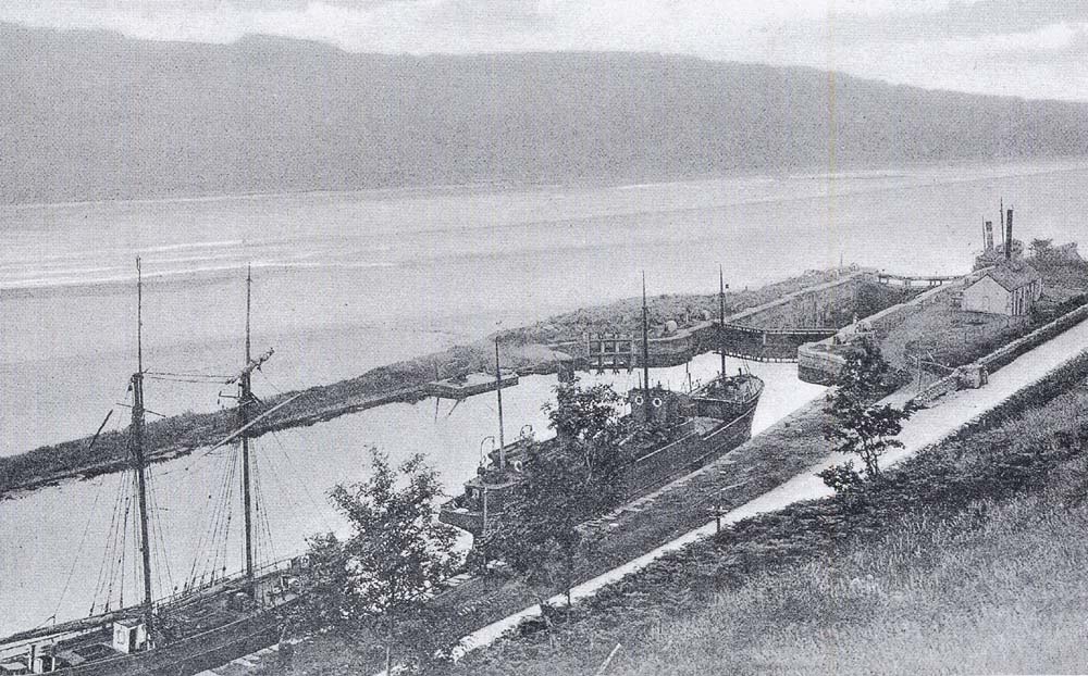
The British Isles got a canal in the early eighteenth century with the building of the Newry Canal. After a couple of false starts, Thomas Steers was appointed chief engineer in 1736. The canal was designed for barges to bring coal from pits in Tyrone to Lough Neagh and the Irish Sea and had a total of fourteen locks in 14 miles. This early photograph shows the basin and the lock that linked the canal to the open water, with a schooner and a small steamer tied up at the quay. The main trade was in coal for Dublin. (Michael Pollard)
The canal was a success in regard to trade but was not well constructed. The original brick walls of the locks had to be replaced by stone and there were constant problems of water supply at the summit. Thomas Omer was the next engineer brought in to improve matters, and his main contribution was an improvement of the 2-mile section between Newry and the sea lough that allowed large ships to reach the town. Newry profited from its new role as a major port. Nothing on this scale was attempted in mainland Britain for many years.
By the early eighteenth century, canals had spread through many of the countries of Western Europe and were much admired. But among all the schemes, none attracted as much attention as the Canal du Midi. It became a regular stopping off point for young British aristocrats embarking on the Grand Tour, a welcome change for many from an unending diet of antique ruins. Among those impressed was a young Englishman, Francis Egerton, third Duke of Bridgewater. It changed his life and that of his country.