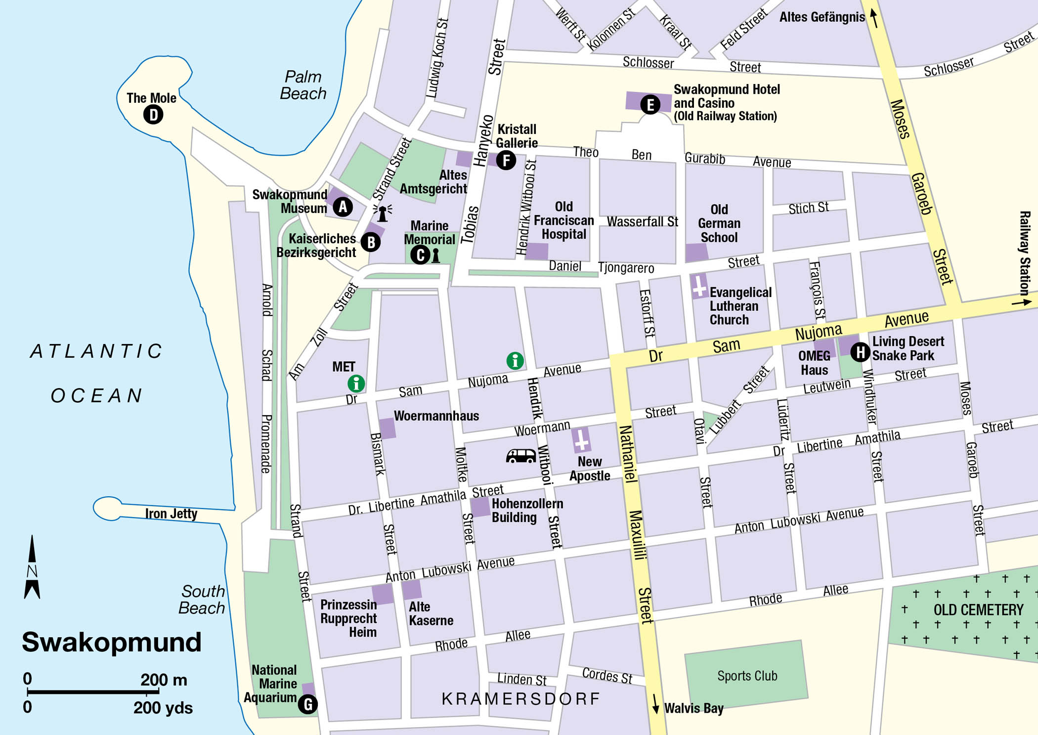
Namibians calculate the vast distances between destinations in their country in hours rather than kilometres, and those in the know will tell you it is a three-and-a-half-hour drive from Windhoek to the historic port of Swakopmund 1 [map], a small slice of Bavaria sandwiched between the deserts of the Namib-Naukluft National Park to the southeast and the more northerly Skeleton Coast. Incredibly, Swakopmund is just one of three moderately substantial settlements along Namibia’s 1,600km (1,000-mile) Atlantic coastline (the other two being Walvis Bay and Lüderitz, respectively 33km (20 miles) and 400km (240 miles) to the south), and the only one that could conceivably be described as a resort.
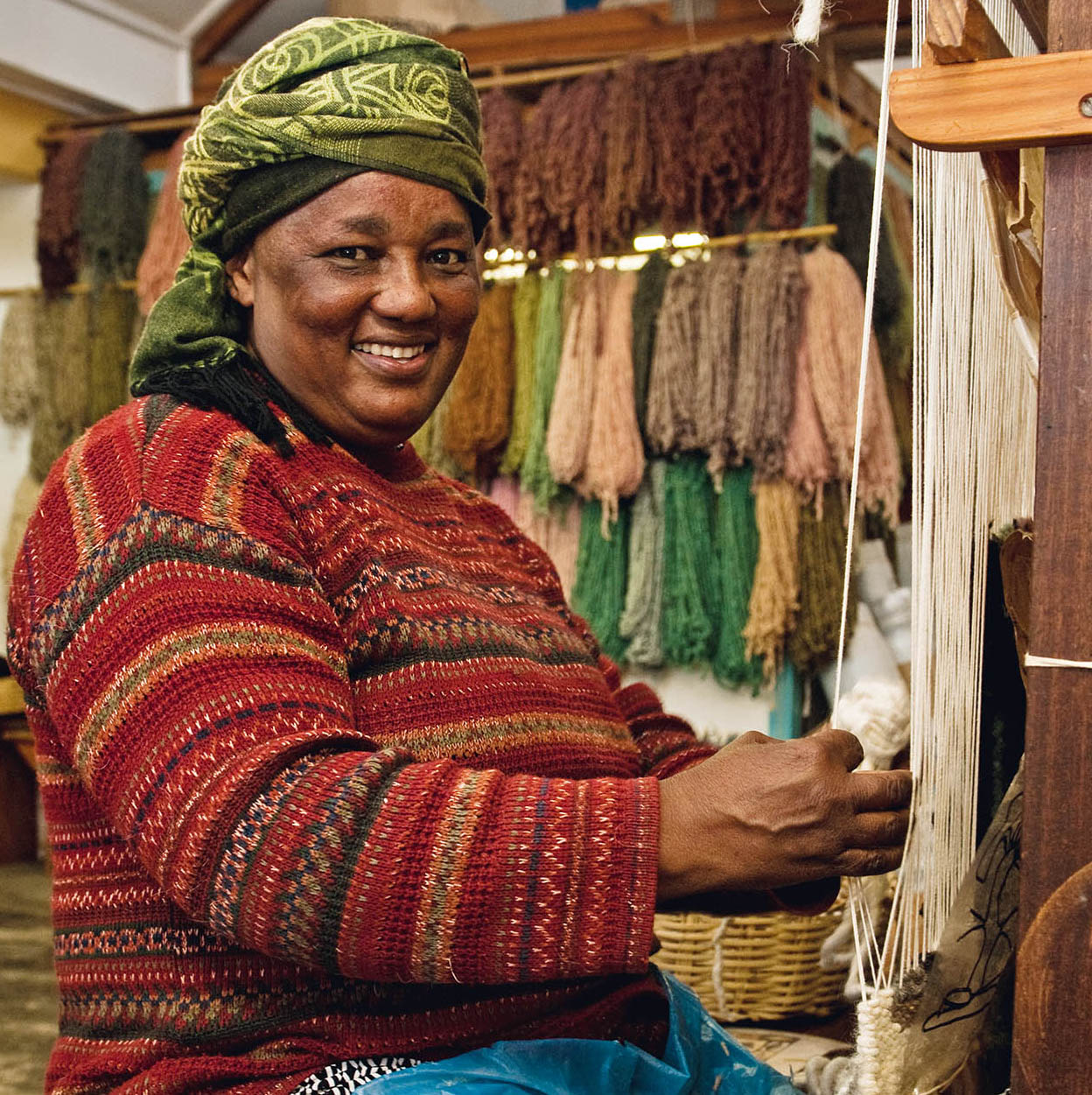
Karakulia weaver in Swakopmund.
Clare Louise Thomas/Apa Publications
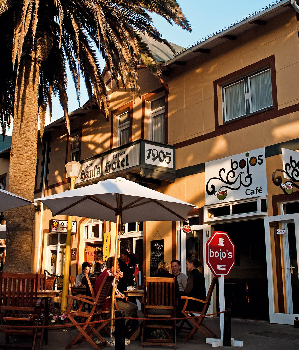
Bojos café in Swakopmund.
Clare Louise Thomas/Apa Publications
Lying directly due west of Windhoek, Swakopmund offers the closest coastal access to the capital, and as such it attracts thousands of domestic holidaymakers over the peak Christmas season. But it’s not hard to see why this pretty little port is also popular with foreign visitors – the town centre has retained much of its colonial character, and it also boasts some of the best tourist facilities in the country. In addition, Swakopmund is the main springboard for exploration of the dramatic Skeleton Coast, while more immediate attractions include the bird-rich lagoon at nearby Walvis Bay, the adventure activities operating along the dunes that separate the two ports, and Welwitschia Drive in the nearby northern Namib.
Swakopmund
The Schutztruppe captain Curt von François founded Swakopmund in 1892 as a competitor to nearby Walvis Bay, which remained under British control even after the rest of present-day Namibia was declared a German Protectorate in 1884. The first settlers were 120 German soldiers and 40 civilians who excavated caves on the beach as protection from the harsh weather prior the constructing the Alte Kaserne (Old Barracks) in late 1892. A breakwater, later known as the Mole, was built in 1898, but it silted up within a few years, and was replaced by a wooden jetty in 1904.
Tip
Especially if you’re not exploring the more remote reaches of the Namib-Naukluft, a half-day trip from Swakopmund or Walvis Bay to Welwitschia Drive – with its fine examples of this oddball plant – is highly recommended (for more information, click here).
Swakopmund was granted municipal status in 1909. Six years later, however, during World War I, when South African forces occupied German Southwest Africa, all harbour facilities were transferred from Swakopmund to the more inherently suitable Walvis Bay, which was already controlled by South Africa. The town received an economic boost in 1976 with the controversial opening of the world’s largest opencast uranium mine at Rössing, 60 km (36 miles) inland, and it has also benefited greatly from the post-apartheid tourist boom. The population today stands at around 45,000.
Swakopmund retains much of its German character and continental atmosphere. There’s a good sprinkling of houses built in the Jugendstil (Art Nouveau style so popular in Germany at the turn of the last century, many of which merit a closer look, For more in-depth historical background, a visit to the Swakopmund Museum A [map] (Strand St; tel: 064 402046; daily 10am–5pm; charge) is a good starting point. Founded in 1951 by an itinerant German dentist, Dr Alfons Weber, it provides a comprehensive perspective of the town and its surroundings and possesses considerable historical and ethnological collections. The museum also offers half-day tours of the Rössing Uranium Mine, starting at 10am on the first Friday of every month.
Close by in Strand Street is the Kaiserliches Bezirksgericht B [map], a stately mansion originally built as a magistrate’s court but now serving as the holiday residence of Namibia’s President. It is backed by municipal gardens, which are home to a 21-metre (69ft)-high stone lighthouse as well as an imposing Marine Memorial C [map], dedicated to the German soldiers sent in to suppress the Herero uprising in 1904. Also of interest is The Mole D [map], the original breakwater built in 1898, and the metal jetty, which replaced its wood precursor in 1914, fell into disuse a year later, was boarded up as unsafe in the 1980s, but reopened in 2006 after extensive renovations.
Heading away from the beach, Daniel Tjongarero Street is due east across Tobias Hanyeko Street and lined with historical buildings. Then there’s the old railway station E [map] in nearby Theo-Ben Gurabib Avenue, an excellent example of Wilhelmenian-style architecture; it’s now part of the Swakopmund Hotel and Casino complex.
Situated right on the corner of Theo-Ben Gurabib Avenue and Tobias Hanyeko Street, the Kristall Galerie F [map] (Crystal Gallery; tel: 064 406080; www.namibiangemstones.com; Mon–Sat 9am–5pm; charge) houses a superb collection of semi-precious stones and other geological wonders from all around Namibia. The gallery’s centrepiece is a remarkable 500-million-year-old quartzite crystal that stands twice as tall as a person – indeed, weighing in at more than 14,000kg (30,000 lb), it is credibly claimed to be the largest such formation in the world.
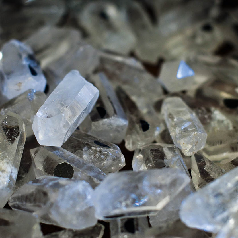
Stones in a gem shop.
Clare Louise Thomas/Apa Publications
In terms of shopping, eating out, and entertainment, Swakopmund is – after Windhoek – the best-equipped town in Namibia, with an excellent selection of supermarkets and other shops, restaurants, delicatessens, banks, internet cafés and tour operators concentrated on and around the main drag through the town centre, Sam Nujoma Avenue. At the heart of this urban bustle, abutting the venerable Hansa Hotel on the corner of Sam Nujoma Avenue and Roon Street, an upmarket mall (simply called The Arcade) houses several good art and craft shops, the top-notch Swakopmund Buchhandlung (Bookshop), several coffee shops, and even a modern cinema complex showing recent western releases.
The Swakop River
Swakopmund – literally “Swakop Mouth” – is named after the Swakop River, a normally dry watercourse that rises in the interior near Okahandja, and whose valley supports low volumes of agriculture, including olives and tomatoes, even in years when little or no water flows. After heavy flooding, the river sometimes breaks through the sandbars on the southern outskirts of Swakopmund to flow into the Atlantic – a phenomenon that occurred most recently in 2000 (and almost happened again in the 2009 floods). The name Swakop is a bastardisation of the Nama “Tsoaxoub”, literally “flowing excrement”, a reference to the muddy appearance of the floodwaters when they reach the ocean laden with vast amounts of brown desert sand and other accumulated debris.
Sharks and sidewinders
The waterfront National Marine Aquarium G [map] (Strand St; tel: 061 244558; Tue–Sun 10am–4pm; shark-feeding 3pm Tue, Sat, Sun; charge) on the southern outskirts of town is well worth a visit, especially on those afternoons when a diver descends into the main tank to feed the sharks. Tanks fed by saltwater pumped directly from the ocean house a rich variety of species associated with the chilly Atlantic, including four species of shark, great white pelican, African penguin, Cape fur seal, green and hawksbill turtle, and smaller curiosities such as anemones, sea cucumbers and sponges.
To see a very different but equally engaging animal collection, visit the Living Desert Snake Park H [map] (Sam Nujoma Avenue; tel: 064 405100; Mon–Fri 8.30am–5pm, Sat 8.30am–1pm, feeding time 10am Sat only; charge) immediately east of the city centre. Privately owned and managed, this herpetological zoo includes specimens of several species associated with the sandy and rocky terrain of the surrounding Namib, including the spectacular horned adder, the sidewinder-like southern dune adder, and the beady-eyed Namaqua chameleon.
Aside from being an attractive resort town, Swakopmund is now entrenched as Namibia’s main centre for adventure tourism. Indeed, a good half-dozen reputable local operators scattered around town now offer visitors a wide range of day trips and activities – skydiving, quad-biking, sand boarding, dolphin cruises and deep-sea fishing, as well as township tours, nature drives into the brooding Namib dunes, or kayak excursions through choppy seas to the seal and penguin colonies around Walvis Bay – in short, enough variety to keep the most active traveller busy for days!
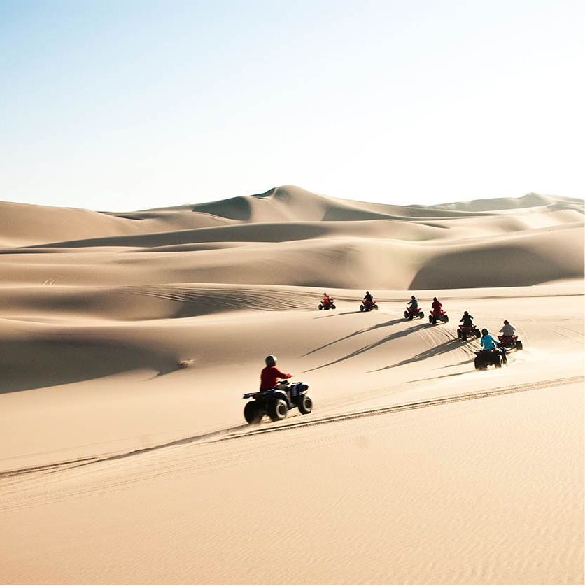
Quad-biking on the dunes near Swakopmund.
Clare Louise Thomas/Apa Publications
Walvis Bay
Driving south from Swakopmund, the road crosses the Swakop River by way of the longest bridge in Namibia (688 metres/2,250ft) to Walvis Bay 2 [map], a mere 33km (20 miles) distant. With a population of around 85,000, this is probably the second-largest town in Namibia, though it feels altogether less cosmopolitan than nearby Swakopmund, and suffers from something of a character deficit.
Despite appearances, Walvis Bay isn’t lacking in historical significance. The Portuguese explorer Bartholomeu Diaz, who later pioneered a sea-route around Africa’s southern tip, anchored here on 8 December 1487. If not Diaz, then it was certainly one of the many 16th century Portuguese mariners who followed in his wake that would have coined the name from which Walvis Bay derives ie Bahia das Bahleas (Bay of Whales). However, thanks to the absence of freshwater supplies, nearly three centuries were to pass before the European powers started to take an interest in this splendid natural harbour.
In 1840, Britain staked a claim on Walvis Bay and its immediate vicinity as an outpost of the Cape Colony. The port remained a British enclave in German South West Africa following the Scramble for Africa in the 1880s, but it was co-opted into the newly created Union of South Africa in 1910. Seized briefly by German troops after the outbreak of World War I, Walvis Bay was recaptured by South African troops in 1915, along with the rest of South West Africa, and it remained a South African possession until 1994, some four years after Namibia became an independent state.
Reflecting this long association with Namibia’s southern neighbour, the grid-like layout of central Walvis Bay is reminiscent of many a South African small town, as are the unmemorable architectural landmarks.
The sole attraction in the town centre is the Walvis Bay Museum (Nangolo Mbumba Dr; tel: 064 2013111; www.walvisbaycc.org.na; Mon–Fri 9am–12.30pm and 3–4.30pm; free) is the only real point of interest in the city centre, with displays relating to the harbour’s history along with the geology and wildlife of the neighbouring Namib Desert.
Lagoons and deserts
Whatever Walvis Bay lacks for in urban charm, the immediate vicinity compensates for it terms of natural interest. Declared a Ramsar Site in 1995, Walvis Bay’s lagoon offers some excellent opportunities for birdwatching – indeed, it’s considered to be one of the most important wetlands in southern Africa, supporting, among others, almost half of the region’s flamingo population. The sight of thousands of these graceful birds feeding in the shallow waters – or better still, flying overhead like thin sticks with black and pink wings – is quite breathtaking. A motorboat or canoe trip on the lagoon will not only provide good birdwatching, but may also reveal seals and dolphins too.
The lagoon can also be explored by road, heading southwest from the town centre along an extension of Nangolo Mbumba Drive. Almost immediately upon exiting the town, this road is flanked by a shallow lagoon on one side and tall dunes on the other, with a rich marine birdlife dominated by large flocks of great white pelican, the localised Damara tern, and a profusion of waders. Continue southward for another 10km (6 miles), turning right at the salt-processing plant, and you’ll reach a car park (popular with local fishermen), from where a very sandy track (suitable to experienced 4x4 drivers only) leads to Pelican Point, the site of a lighthouse and a colony of around 100 Cape fur seals.
More birdlife can be seen at Sandwich Harbour, which is situated almost on the Tropic of Capricorn about 40km (25 miles) south of Walvis. This wetland plays host to a considerable number of migratory birds en route from their nesting grounds in the northern hemisphere to the warmer climes of the Cape’s west coast. In a good year, up to 50,000 wintering birds can be found here, while the occasional brown hyena, jackal or even oryx may also be seen along the shoreline.
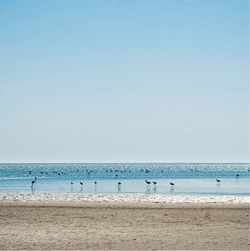
Flamingos on the way to Sandwich Harbour.
Clare Louise Thomas/Apa Publications
This lagoon can only be reached by four-wheel-drive vehicle and a special permit is required, obtainable from Namibia Wildlife Resorts offices in Swakopmund and Windhoek as well as their rest camps. No vehicles are allowed beyond the northern fence of the lagoon, and visitors wishing to explore the area must do so on foot. Great care must be taken that vehicles do not get stuck.
Fact
Birders may be lucky enough to spot the rare Gray’s Lark in the Kuiseb Canyon area; it’s endemic to the gravel plains of Namibia and Angola.
