· · ·
The muskeg lying over the bog was springy and at times seemed as though it must surely give way and let me down into the water and muck underneath. Labrador tea, swamp laurel, Andromeda, sedges, and sphagnum, all woven through with the tiny grass-like stems of cranberry; here was a stable ecological community, more ancient perhaps than the forests surrounding it.
SIGURD OLSON, Runes of the North, 1963
MOST ORGANISMS HAVE TWO BASIC requirements for life: air and water, and in the Great Lakes basin those elements are abundantly present just about everywhere. But often the quality of life depends on other, secondary needs—sunlight, soil, nutrients, the companionship and interaction of other individuals and species— and these ingredients are not always available in equal measure. In some habitats, there might be ample sunlight but thin soil; in others, the soil may be rich but poorly drained, or too loose to hold water, or heavily shaded, or too exposed. Such habitats still support life, but plants, animals, birds, insects, reptiles, and amphibians have had to adapt their requirements to fit their environments.
The ecosystems in this chapter exist between the simple categories of forest and lake, some quite literally: wetlands and sand dunes, for example, are situated at the interface of water and land, exhibiting aspects of both and supporting life that exploits that dual inheritance. Alvars, those strange areas of extremely thin or nonexistent soil atop layers of flat, sedimentary bedrock, are unique to the Great Lakes basin in North America and produce fascinating ecological communities found nowhere else on the continent. And urban forests, struggling to survive in the unnatural context of concrete, debris, and the enforced monoculture of our major cities, are often the last remnants of the great natural forests that once covered the continent. While each of these ecosystems exists in the margins of the major realms discussed earlier, none of them is “marginal” in the sense of being inferior or achieving less than its full potential: all are rich in biodiversity and highly important for the creatures and plants that inhabit them.
SWAMPED
The word swamp has an unhealthy sound to it, something suggestive of death and decay. Malaria is called swamp fever because the disease was contracted by people who lived or worked in swampy areas where mosquitoes bred. In the Sherlock Holmes story “The Speckled Band,” the most venomous snake in the world is the Indian swamp adder. The word comes from the Old Scots, where it meant “sunken” or “subsided”; a seventeenth-century Scottish medical text warned that “if in a woman with childe the breasts suddenly fall swampe, then will shee abort or miscarry.”
Pilgrims in New England were the first to use the word to refer to wetlands: they called tree-covered wetlands “swamps,” meaning ground that supported vegetation but was too low and wet to be plowed. To the Pilgrims, however, swamps weren’t all bad. Captain John Smith, leader of the Virginia Colony, wrote in 1624 that “some small Marshes and Swamps there are, but more profitable than hurtfull.” They were profitable because they could be drained and cleared and turned into workable farmland.
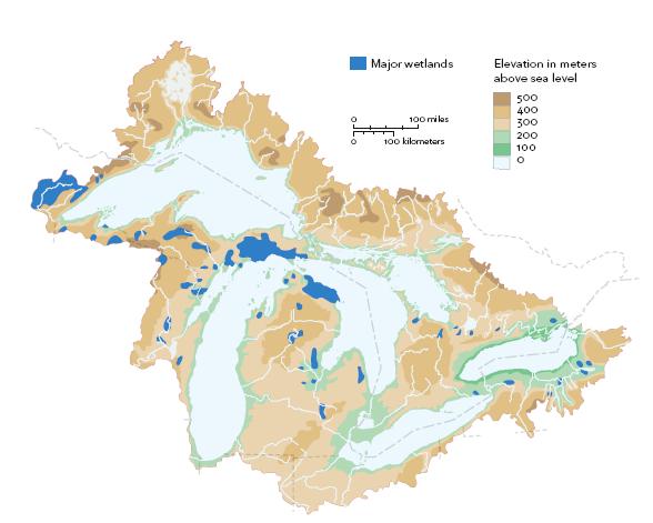
MAJOR WETLANDS OF THE GREAT LAKES BASIN
As the continent’s western regions opened to colonization, swamps were considered impediments to settlement. In 1850, the United States passed the Swamp Lands Act, which ceded 64 million acres (26 million hectares) of publicly owned land that was deemed “wet and unfit for cultivation” to state governments on condition that those governments drained them and made them fit for farming. In the Great Lakes area, Minnesota received 2 million hectares (5 million acres), Illinois 600,000 (1.5 million acres), and Wisconsin 1.4 million (3.5 million acres). In most cases, any citizen who went to the trouble of draining the swamps could assume title to the land. By the 1930s, virtually all of the huge wetlands in Illinois, Pennsylvania, Michigan, and Wisconsin had been drained. Similar attitudes to swamps existed in Canada; more than 70 percent of southern Ontario’s wetlands have been drained since pioneer days. Drained wetlands are often referred to euphemistically as “reclaimed land,” as though wetlands originally belonged to us and were somehow stolen by water, but have now been returned to their rightful owners.
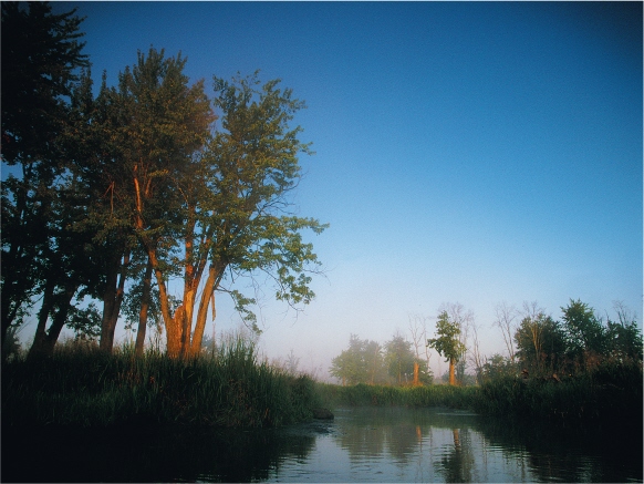
A typical coastal wetland of Ontario’s Bruce Peninsula provides important wildlife habitat and acts as a settling pond for spring runoff.
Occasionally, wetlands suffered a different fate: instead of being drained, they were turned into lakes or reservoirs. Northern Pennsylvania’s Pymatuning Swamp, for example, was a 10,000-hectare (25,000-acre) wetland that was once the home of the mysterious Mound Builders, a people who are thought to have lived at the time of the Paleo-Indian culture, 10,000 years ago. In 1934 it was flooded to make a reservoir lake 25 kilometers (15.5 miles) long and 10 meters (33 feet) deep, to help control spring floods on the Shenango River. Although this former swamp still provides resting space for migrating Canada geese and other waterfowl, in general much biodiversity is lost when wetlands disappear.
After the retreat of the glaciers, the Great Lakes shorelines were fringed by extensive coastal wetlands. The basin of the western end of Lake Erie, between Point Pelee and the tip of the lake, was a vast, soggy plain bordered by massive swamps and marshes. The twenty-one islands (six Canadian, fifteen American) that make up the Erie Islands today were then high points of land surrounded by reeds and low shrubs. As water levels rose, the islands remained as a corridor for many southern species of plants, birds, and animals working their way north with the warming climate. Similarly, only a few hundred years ago, the south shore of the Detroit River and much of the land surrounding Lake St. Clair and the St. Clair River was marsh and prime wild-rice habitat. The Great Black Swamp in northern Ohio comprised nearly 4,000 square kilometers (1,500 square miles) of fertile, life-giving wetlands. In 1922, the naturalist Elliot Rowland Downing described the tamarack bogs at the southern end of Lake Michigan as “one of the most striking associations of plants and animals to be found in the Chicago area,” fascinating because they were remnants of an ecosystem that was widespread in the region immediately following the glacial period, and still containing organisms not usually found so far south. Downing encountered a subarctic mosquito species, for example, trapped in water held by the leaves of a pitcher plant.
Wetland is an imprecise term. It refers to any one of four types of transitional zones in which the water table is at the same height as or slightly higher than the surrounding land, and where there is persistent water less than 2 meters (6.5 feet) deep. A marsh is usually associated with a pond or a stream or the shallow edge of a lake, is typified by shallow standing water, and contains bulrushes, cattails, reeds, and water lilies. Swamp still denotes its original meaning: a wooded area of standing water or saturated soil that may or may not dry up in summer, often with cedars and low conifers or hardwoods such as swamp white oak that like wet feet. Bogs are stagnant and acidic vessels of trapped water, an environment that supports sphagnum moss and such shrubs as blueberries, cranberries, and some orchids. Finally, fens, which are like bogs but less acidic (that is, more alkaline), enjoy some minimal water flow and encourage sedges, grasses, and low shrubs throughout, rather than just around the edges.
All wetlands are important wildlife habitats for fish, reptiles, songbirds, and amphibians, as well as vital links in the routes of migrating waterfowl, offering resting places, food sources, and protection from predators during stopovers. In the Great Lakes basin, more than a dozen species of ducks, grebes, and geese nest in wetland habitats and feed on the tender roots of aquatic plants. One species of water plantain is called the duck potato, since its tubers are a favorite of ducks and muskrats. The health of waterfowl is so closely tied to that of wetlands that in Lakes Erie, Michigan, and Huron the populations of American coots, least bitterns, marsh wrens, pied-billed grebes, soras, and swamp sparrows rise and fall with fluctuations in the lakes’ water levels, which naturally affect the depth and extent of coastal wetlands.
Wetlands are the spawning grounds for as many as a hundred species of Great Lakes fish, from muskellunge and northern pike to minnows and deepwater sculpins, and the breeding grounds for many species of birds. Great blue herons, black-crowned night herons, and ospreys build nests in the (often dead) trees standing in swamps and feed on frogs and small fishes. Such at-risk species as the king rail and the least bittern shelter and nest among the reeds. And dabbling ducks such as pintails and blue-winged teals are often seen with their tails in the air and their heads beneath the surface as they search the shallow bottom for shoots.
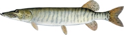
MUSKELLUNGE
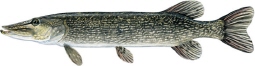
NORTHERN PIKE
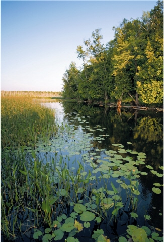
Minesing Swamp, southern Ontario’s largest remaining wetland, is home to dozens of species of birds, reptiles, amphibians, and plants.
Southern Ontario’s Minesing Swamp is a major wetland that has been spared the drainer’s trench, one that gives a glimpse into what wetlands must have been like when settlers first arrived. Situated between Lake Simcoe and Georgian Bay, it is southern Ontario’s largest wetland, 6,000 hectares (15,000 acres) of water, aquatic plants, and standing forest in an 80-meter (260-foot) depression left by the retreating Wisconsinan glaciers. At its center is a vast waterfowl staging area, where, when spring floodwaters inundate large areas of grassy fens, a swaying expanse of sedges and cattails provides ideal habitat for a diverse array of migrating birds. Soras, which are small, short-billed rails, pad about silently in the dense vegetation, foraging for seeds and snails. More than 220 species of birds have been recorded in the swamp, 66 of which are spring and fall migrants: whistling swans, snow geese, and ducks and duck-like birds of many kinds—pintails, wigeons, gadwalls, buffleheads and scaup, goldeneyes and redheads—all pass through on their way to their northern breeding grounds. Sandhill cranes stop over on their spring migration to western and northern Canada. Many other wetland species nest here, including wood ducks, American black ducks, mallards, grebes, and several members of the heron family, including American and least bitterns.
The swamp also contains one of the oldest great blue heron colonies in the Great Lakes basin. The herons, large, gray, long-legged, long-necked, gracile wading birds, build their stick nests atop the trunks of flooded silver maples. They fly down from their aeries to stand motionless in the shallow water at the swamp’s edge, blending with the greenery, waiting for unsuspecting small fish or frogs to swim by. Underwater, their legs must look like plant stems. Herons also eat snakes, small birds, and even young muskrats. In the air, they look like feathered pterodactyls. They hold their necks in a tight S position when flying, and their black feet trail visibly behind them. During breeding season, the heads of both males and females are adorned with long black plumes that hang down along the backs of their necks. (These plumes, or aigrettes in French, provide the name of the heron’s closely related cousins, the egrets.)
In the 1980s, great blue herons were placed on the American Audubon Society’s Blue List, suggesting that they were in decline. Though it is not officially endangered, the bird’s status still bears watching. According to Byron Wesson, director of land management and stewardship services for the Nottawasaga Valley Conservation Authority, the number of heron nests in Minesing Swamp has gone down in recent years, for reasons unknown. Similar declines have been observed in Minnesota’s Peltier Lake, which in 1989 was home to 1,137 nesting pairs of great blue herons, black-crowned night herons, and great egrets. By 2003 those numbers had dropped alarmingly, with few chicks reaching maturity and many nests abandoned. Cameras placed in the marsh caught evidence that the damage was being done by marauding raccoons and great horned owls.
There are raccoons in Minesing, as well as great gray owls, but herons may be declining because their food is becoming scarcer. The swamp is home to thirty fish species and ten frog and toad species, including the delightfully named pickerel frog, the mink frog, and the northern chorus frog. But frog populations are falling in many waterways; in the Great Lakes region, the Fowler’s toad and the Blanchard’s cricket frog are at risk. And, as Wesson says, “something is happening to the walleye population” as well.
Jack’s Lake, north of the swamp, contains a unique variety of walleye that lays its eggs on lake-bottom vegetation, like its close cousin the yellow perch, rather than on bare gravel, as walleyes normally do. In 2000, a survey of the lake found only sixteen specimens and no clue to the cause of the decline. Another variety, the blue walleye, once abundant in Lakes Erie and Ontario, has been extinct since 1985 because of overfishing and declining water quality. Trouble in the frog and fish populations could account for trouble higher up, in the heronry.
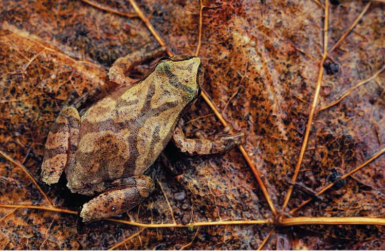
Frogs are amphibians—from Greek words meaning “two lives,” in this case lives spent on land and in water. Sometimes these habitats are occupied sequentially, in different stages of the animal’s life cycle. The yellow-spotted salamander, for example, another common Great Lakes basin amphibian, lays its eggs in water but spends its adult life on the forest floor, keeping cool and moist under leaf litter and in rotting logs, and returning to its natal pond in the spring to mate and spawn. Frogs are in and out of water all their lives but deposit their eggs in water and spend their first few tadpole stages entirely in water, breathing through fishlike gills. The most common frogs in the Great Lakes basin are the bullfrog, he of the bulbous vocal sac; the spring peeper, a thumbnail-sized frog whose high, piping chorus is one of the first signs of spring; and the northern leopard frog, whose vocal sacs appear to bulge between its ears and its shoulders. Although all three are still common, pollution and habitat loss are taking their usual tolls, and numbers are down.
A healthy wetland is a botanist’s dream. Many prize plants are found on the spongy ridges that form string fens, a boreal-like network of sedges and grasses studded with long, thin stands of cedars, tamaracks, and alder thickets growing between long, narrow ponds, like a miniature version of New York State’s Finger Lakes. The trees grow on hummocks formed by the root-balls of predecessor trees that have fallen and decomposed; the holes left by their falling have filled with water and support aquatic plant life such as the broadleaf arrowhead, a water plantain whose edible roots were harvested by First Nations peoples and used as a poultice for wounds, and bog buckbean, a member of the striking gentian family.
Spring peepers breed as early as March in temporary woodland ponds formed by melting snow or rain.
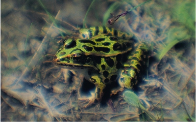
The decline in populations of amphibians like the leopard frog may be caused by exposure to herbicides.
Fens are less acidic than bogs but still support a number of orchid species, all of them beautiful when flowering and some of them rare. In the fens in Minesing Swamp, there are Hooker’s orchids, prairie white-fringed orchids, and small purple-fringed orchids. Arethusa, also called dragon’s mouth, which Roger Tory Peterson calls a “bizarre flower, with its three erect sepals and the hood over its blotched and crested lip,” looks a bit like a pink lady’s slipper (which, though rare, is found in some swamps, as is the extremely rare ram’s-head lady’s slipper), except the slipper appears to have been mangled by an overzealous puppy. In all, ten orchid species, ten different violets, and twenty-three types of grasses are among the more than four hundred plant species found in wetlands throughout the Great Lakes basin.
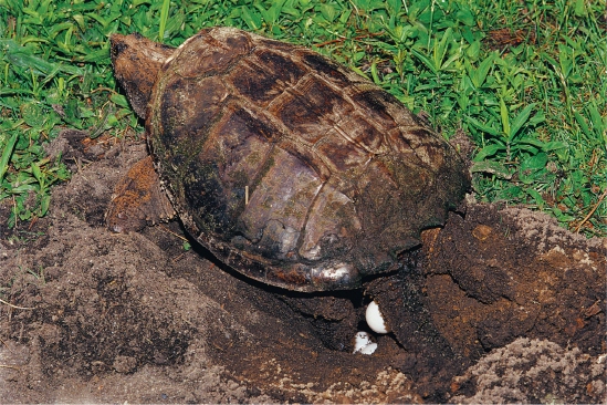
A female snapping turtle lays up to forty eggs in holes dug in sand with her powerful forelimbs.
Wetlands are home to a large number of rare and sensitive reptiles, including the globally threatened spotted turtle, at under 10 centimeters (4 inches) in length one of the basin’s smallest and daintiest turtles. The wood terrapin, or wood turtle, is a heavily chiseled, 20-centimeter (8-inch) brownish turtle once found throughout eastern North America except in Indiana and Illinois, but now scarce. So too is the Blanding’s turtle, the only box turtle of the genus Emys, in fact referred to as a “semibox.” Box turtles are so called because their plastron, the underside of their shell, is divided into two movable halves, hinged in the middle by ligaments. When threatened, the turtle can draw in its head, limbs, and tail and close up its plastron like a box, so tightly, writes one herpetologist, that not even a broom straw can be inserted between the halves. Wood turtles are largely terrestrial, and have been for so long that they re- tain traces of webbing only on the hind feet. Indifferent swimmers, they prefer damp woods or the margins of swamps, half burying themselves in mud. They are herbivores and love berries but will occasionally eat insect larvae, snails, slugs, and earthworms.
All turtles are fairly long-lived; some box turtles don’t reach sexual maturity until they are fourteen years old. Generally speaking, the larger the animal, the longer it lives, and the largest reptile in any swamp, in fact the largest terrestrial reptile in the northern part of the continent is the common snapping turtle. Snappers can live for a hundred years. Adult snappers grow to about 20 kilograms (45 pounds), and really old ones grow so fat on their diet of fish that their flesh oozes out through the openings in their plastrons and carapaces—at which point they were once considered a delicacy. They certainly don’t look delicate; they look like armored tanks.
A snapper can measure 71 centimeters (28 inches) in length with head and tail outstretched, and its encrusted brown-to-black shell and yellow plastron seem too small for its body, which in fact is the case, since the adult cannot withdraw its enormous head or long tail into them. It is a strong swimmer, able to remain submerged for long periods and, some say, unable to eat except underwater: it forages for food by lying on the river or swamp bottom ready to dart its head out to grab passing fish. The snapper is lightning fast, especially when it senses danger; it can strike with the speed, if not the range, of a rattlesnake, and its head can reach halfway back along its shell. It is not wise to pick up a snapper by the shell: experts recommend lifting it by its tail, and if it’s too big to be picked up that way, leave it alone. Seasoned turtle watchers keep large grain shovels in their cars for sliding recalcitrant snappers off the roads.
In April and May, females leave the water to lay their eggs, preferably in sand or rough gravel in riverside sand spits or along country roadsides. They scoop deep holes with their strong, clawed forelimbs, then turn and wiggle their way into the holes and cover themselves with sand to deposit their eggs in peace. About forty eggs are laid, sometimes as many as eighty, looking like bright white ping-pong balls; on average, 65 percent of them hatch in August or September. (Deflated ping-pong balls on the roadside mean a skunk or raccoon has found the clutch.) Hatchlings claw their way up through the natal sand and migrate instinctively to water, crawling the gauntlet of raccoons, skunks, crows, and great blue herons as they go.
Because they are so long-lived, have large amounts of fat, and feed principally on fish, snapping turtles have been studied as indicators of local contamination in rivers and wetlands. Swamps and marshes act as water filters, and many of the fertilizers and pesticides picked up by runoff through farmland end up in sediments at the bottom of wetlands. In coastal wetlands, high levels of PCBs bioaccumulate—that is, collect in progressively higher concentrations—in the turtles’ flesh, causing severe reproductive problems. In one study, conducted in Wheatley Harbour on Lake Erie, only 12 percent of snapping turtle eggs hatched and only 2 percent of those lived to become adults. Those adults were found to have reduced concentrations of calcium and globulin. Snapper populations are not threatened, but only because they are doing much better in inland wetlands, such as Minesing Swamp, than they are in those connected directly to the Great Lakes.
The small swamp near a cabin we once rented, not far from eastern Ontario’s Charleston Lake, was home to muskrats, painted turtles, damselflies (similar to dragonflies except that, when at rest, their wings remain in a dihedral, or V formation), and many birds. A pair of wood ducks regularly broke into panicked flight whenever we walked near their nest. Unlike most ducks, which are open-water birds that nest in aquatic vegetation, wood ducks prefer shallow water and nest in the hollows of trees (or, sometimes, in large man-made nesting boxes), close to the ground or as much as 15 meters (50 feet) above it. Migrating wood ducks arrive in the Great Lakes area in April, where they congregate in swamps and on beaver ponds, choose mates, and select nesting sites. They do not bring material to the nest but soften whatever they find in the cavity with down feathers. More than one female may lay eggs in a nest; up to thirty-one eggs have been found in a single brood. The young have sharp claws on their webbed toes and a hook at the end of their bills, useful at fledging time for climbing out of the nest cavity and jumping to the ground, where the female (the drake having long abandoned the nest) leads them to water. Apart from eating tree, sedge, and water lily seeds that float in the water, wood ducks wander into the woods in search of berries and nuts—especially acorns, which they swallow whole. Their gizzards are capable of crushing and grinding chestnuts, beechnuts, acorns, and even bitter pecan nuts, which are as hard as hickory nuts. They are also very fond of spiders.
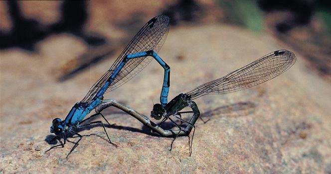
Damselflies are unusual in the insect world, having short antennae, superb eyesight, and long wings that cannot be folded out of the way when resting or, as seen here, mating.
The adults are brightly and conspicuously patterned, especially the male, with its white-striped, crested head, bright red and white bill, white throat, and iridescent green plumage. The wood duck’s beauty has worked against it in the past, as it was one of the most popular birds in the feather trade of the late nineteenth century, when it almost became extinct. It was protected from hunting from 1918 to 1941 in the United States, and there are now estimated to be 3 million in North America; the population is considered secure.
Another marsh or surface-feeding duck, and perhaps the most recognizable member of the duck family, is the mallard. Again, the predominant color of the male’s head is iridescent green with purplish highlights, with a white neck ring, brownish back, and white tail feathers. Mallards are often seen close to human habitations and are so easily tamed that they are the progenitors of almost all domestic ducks. In the wild they frequently interbreed with other duck species, including pintails, gadwalls, and their nearest relative, the American black duck. (The females of mallards and American black ducks are difficult to tell apart, so that may account for the interbreeding.) In the east, the Great Lakes basin is the northern extent of their breeding range, although in the west they breed as far north as Alaska. Like wood ducks, mallards eat acorns and hickory nuts but subsist mainly on seeds: the stomach of one specimen contained 102,400 primrose willow seeds. Vegetation provides 90 percent of their diet, but the other 10 percent is varied and even includes meat. They have been known to eat salmon carcasses in the Northwest and also, presumably, in the Great Lakes area, and they will perform a “rain dance” in which they pat their feet rapidly on wet ground, making a sound that imitates the patter of rain and brings earthworms to the surface. A report published in Pennsylvania in 1914 noted that twenty mallards completely cleared a large pond of mosquito pupae and larvae in forty-eight hours. Ironically, wild mallards could be the solution, rather than the spark, to the spread of avian flu.
There are two species of marsh wrens in the Great Lakes basin, the long-billed (now known as the marsh wren) and the short-billed (now called the sedge wren). Although their ranges overlap, they are not even the same genus. The marsh wren is found in the Great Lakes region but is more a western bird, and is slightly larger than the sedge wren. Both weave small, ball-like nests of dry grass in wet areas (marsh wrens usually nest in cattail marshes, sedge wrens in sedge marshes and wet meadows). The males of both species build a number of dummy nests, sometimes as many as twenty-two, of which only two or three are occupied—by different females; wren males are polygynous (that is, they have more female mates). This may be meant to deceive predators and nest parasitizers, such as cowbirds, or it may simply be the males’ way of showing the females how industrious they are.
Marsh wrens are further divided into western and eastern subgroups, differentiated by their singing. Eastern marsh wren males have a song repertoire of 30 to 70 songs each, while their western counterparts sing up to 210 songs; the divide between these two populations is Lake Superior. In The Nature of Birds, Adrian Forsyth notes that western marsh wren males devote 50 percent more brain area to vocalization than do their eastern conspecifics: “This fits with what we know about polygynous mating systems,” Forsyth writes, “which favor males with the most developed courtship and territorial displays.” Western males are more polygynous than eastern males, which suggests that eastern males are chosen by females not so much for their song repertoires as for their competence as providers. “A diverse repertoire is less useful [in a less polygynous system], and the valuable brain space that could be devoted to a large repertoire would be better employed in other tasks, such as finding food.”
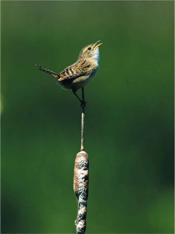
A male sedge wren delivers its repertoire of songs atop a narrow-leaved cattail flower.
However, females of some other wetland bird species are attracted to males with large repertoires, just as female moose respond well to male moose with large antlers. If a male has enough brain space to devote a large part of it to learning new songs, he must have the intelligence that also makes him a good provider. Female red-winged blackbirds, at least in captivity, show a more vigorous courtship display when a recording of multiple song types is played to them, and female swamp sparrows go into a frenzy of nest building when they hear a male with a seemingly inexhaustible repertoire of songs. As studies of the Carolina wren, described in the previous chapter, suggest, choosing a mate on the basis of his musical repertoire means that birdsong is more than an expression of contentment; it’s also a language that communicates intelligence and therefore knowledge of the territory’s optimum food sources and nesting sites.
Creeping or flitting about the margins of wetlands are many smaller birds, either spring and fall migrants or breeding residents adapted to swampy conditions. Two species of waterthrushes are found in the Great Lakes region. One of the most common, the northern waterthrush, is a small warbler (waterthrushes only look like thrushes), dark brown above with a pale yellowish, black-striped underbelly and a ringing voice. They prefer densely wooded swamps with slow-moving water, and spend most of their time on the ground, foraging under the leaf litter for insects and other invertebrates. The Louisiana waterthrush, a southerly species that barely extends its range into the Great Lakes basin, is very similar to the northern, but it is whitish behind the streaked breast rather than yellowish. Both species continually bob their short tails, in the manner of phoebes, while walking or perching.
The spotted sandpiper breeds across North America and has been found to nest in the Great Lakes region. A robin-sized, plain brown shorebird, found usually on mudflats and beaches but also in shallow wetlands, it is distinguished by the large spots on its white breast and throat (in breeding season, which is April to August) and the small hook of white that appears on its shoulder ahead of its wing. It is the most common sandpiper in the region during breeding season, but during the spring and fall migrations it may be mistaken for the similar solitary sandpiper, although the solitary lacks the dark spots on the breast. Its legs are slightly longer than those of the spotted, and the spotted bobs continuously, even when it appears to be resting.
Recently, increased awareness of the importance of wetlands to the environment—they are the kidneys and liver of the Great Lakes ecosystem—has many groups working to restore ailing wetlands to health. Part of healing a wetland involves removing organisms that are contributing to their decline. A project begun in 1995 to restore the Cootes Paradise Marsh, at the western end of Lake Ontario, called for the expulsion of Asian carp, an introduced species of large, bottom-feeding fish that disturbs the natural breeding habitat of smaller, native fish by constantly rooting out aquatic plants and stirring up sediments. Within two years of their exclusion, phytoplankton—microscopic aquatic plant material that provides much of the food for small fish and many benthic, or lake-bottom, organisms and, incidentally, contributes roughly half of all the oxygen produced on the planet—increased from about 2 individuals per liter (quart) of water to more than 400 per liter. A total of twenty-five fish species were found to be using the marsh, the most common being pumpkinhead sunfishes and brown bullheads in the vegetated sections, and gizzard shad and alewives in the open areas. As well, some populations, such as yellow perch, fathead minnows, and emerald shiners, increased in number.
Similar projects are taking place around the Great Lakes shores and offer hope that the Lakes’ delicate aquatic habitats will once again flourish as the spawning and breeding grounds for many of the region’s native species.
SUN ON ROCK
From a distance, the Stone Road alvar on Pelee Island looks like an ordinary meadow, perhaps a former pasture that has been recently reclaimed by nature. Low shrubs and an occasional red cedar dot the savannalike landscape. The few trees around the edges are low and stunted and full of birds. There’s an indigo bunting and a rufous-sided towhee in the grove of Carolinian chinquapin oaks and hickories at the start of a graveled path that curves off through the field, passing more Carolinian tree species, some of them quite rare. The hoptree, the seeds of which may have floated to the island from Point Pelee or been dropped to the ground in the guano of a migrating bird, is found only along the shores of Lake Erie and on the Erie Islands, and its presence here promises a sighting of a giant swallowtail butterfly, which in its caterpillar stage feeds on the hoptree’s trifoliate leaves.
Signposts along the path soon make it apparent that this is no ordinary meadow. The plaques draw attention to the plants, many of which are scarce even in the Carolinian zone: hoptree, so unusual it’s not listed in Peterson Field Guide; corn speedwell, so called because it grows beside paths to greet the traveler; small skullcap, which is a mint; and false pennyroyal, which also has a minty fragrance. There are also a few blue ashes, among the rarest trees in the Great Lakes basin and an endangered species. Though an ash, the blue ash grows so slowly (on Pelee Island, a growth rate of about 2 millimeters a year, or less than a tenth of an inch, is common) that its wood can be as dense and heavy as oak. Savanna sparrows and yellow-billed cuckoos feed on its seeds.
ALVAR COMMUNITIES IN THE GREAT LAKES BASIN
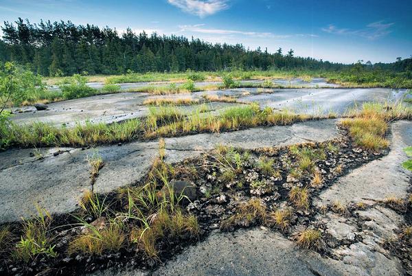
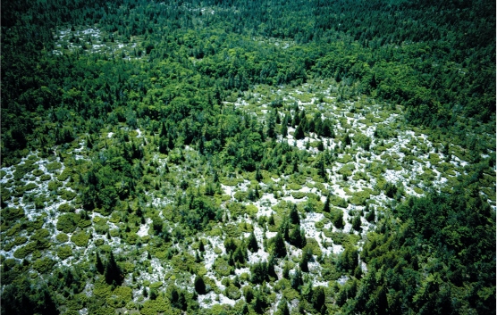
Though nearly without soil, alvars, like this one on the Bruce Peninsula, support an amazing variety of plants, including grasses, mosses, and trees.
In fact, the Stone Road Alvar is a 220-hectare (540-acre) ecological wonderland at the center of the island, one of the most biologically diverse habitats in all of Canada and the United States. It is a close association of six different kinds of communities: oak-hickory woodland; oak savanna; red cedar savanna; old-field thicket; prairie; and open alvar. According to Mary Celestino’s definitive Wildflowers of the Canadian Erie Islands, it is home to 396 plant species, including 44 that are provincially rare and 33 regionally rare. At least four species occur nowhere else in Canada: downy wood mint, corn salad, yellow horse gentian, and Leavenworth’s sedge.
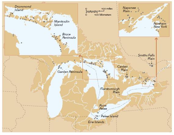
Alvars themselves are rare. Defined as ecosystems of grasses and other herbaceous plants and sparse, shrubby vegetation growing in extremely thin soil on beds of limestone or dolostone, they exist in North America only in the Great Lakes basin. The International Alvar Conservation Initiative, working with the Nature Conservancy, has identified and assessed 121 alvar sites, comprising a total of 11,000 hectares (27,200 acres), or about a fifth of one percent of the total Great Lakes basin landmass. Two-thirds of the alvars are in Ontario; most of the rest are equally divided between Michigan (on Drummond Island and nearby areas) and New York (Jefferson County), with a few small sites distributed throughout the Erie Islands and Marblehead Peninsula in Ohio. They form an arc from Michigan’s Upper Peninsula, across Drummond and Manitoulin islands, down the Bruce Peninsula, and in patchy areas of exposed limestone in southern Ontario and upstate New York—roughly following the limestone and dolostone cuesta of the Niagara Escarpment.
There are alvars in northern Europe: the word is from Sweden, where they were first described, and is applied to sites on several islands in the Baltic Sea. Wherever alvars are found, they are important and endangered habitats; with the harsh growing conditions they offer, the plants found on them have to be tough. Celestino calls them “disjuncts,” because they exist on alvars often far from their native habitats, such as on the western plains. They are capable of surviving the extreme freezing and thawing, floods and droughts, that are the usual alvar cycles.
Alvars haven’t always been valued, which partly explains why they are so rare today. In eighteenth- and nineteenth-century land surveys, designed to encourage agricultural settlement, areas with less than 10 centimeters (4 inches) of soil over solid bedrock were variously described as “prairies,” “plains,” or “meadow,” if the alvar was of the grassland type, or “rocky barrens” if the limestone pavement was exposed. In 1845, the Maxton Plains alvar on northern Michigan’s Drummond Island was uninvitingly described as “naked rock with scattering of small trees in crevices”; an 1856 survey identified Flamborough Plains in southern Ontario as “broken land.” Carden Plain, also in southern Ontario, was described in 1856 as “soil burned off to rock.”
Fire has played a significant role in the formation of some alvars. At the best of times, alvars are extreme environments—extremely hot in the summer, when the sun can heat the underlying limestone to 43˚C (109 ˚F), nearly hot enough to fry an egg, and extremely cold in the winter, when ice crystals fragment and perturb the unlayered soil. They often flood in the spring, sometimes retaining meltwa- ter for weeks, and parch in late summer, when the water has evaporated and the plant and animal life in the soil sizzles. Fire can exacerbate these conditions by destroying microbes and root systems that would otherwise nourish and hold the soil together.
But fire can also create alvars. Judith Jones, a botanist living on Manitoulin Island, has studied the fire history of most of the alvars in the Great Lakes basin. She became interested in the subject when she heard a native oral history account of an episode from the early 1600s when a group of Iroquois seized possession of Manitoulin Island from the Ottawa nation that had been living there seasonally for many generations. To discourage the Iroquois, the Ottawa set fire to the island, and much of its cover of northern hardwoods and spruce was destroyed. Jones wondered if the legend explained the extensive alvars on Manitoulin, and if fire had played a role in creating other alvars in the basin.
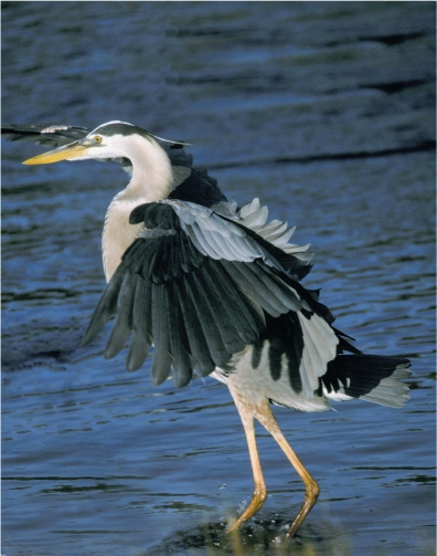
A great blue heron, the largest of the North American herons, comes in for a graceful landing.
Assessing charcoal found in alvar soil, and cores from trees still growing in the limestone crevices, she found that several types of alvars were, in fact, initiated by fire. Alvars originally covered by trees all seemed to have been associated with burning. All the bur oak– limestone savannas she investigated, all the white cedar–jack pine– shrubby cinquefoil savanna alvars, and 83 percent of the mixed conifer-juniper alvars showed signs of fire initiation. The grassland alvars, however, seemed always to have been alvars. The grasslands alvar on Great La Cloche Island, between Manitoulin Island and the mainland, for example, had existed for 4,000 to 5,000 years and in that time had accumulated only 12 centimeters, or less than 5 inches, of soil. It showed no signs of having been started by fire.
Virtually all of the Lake Huron side of Manitoulin Island, from the shore to up to 4 kilometers (2.5 miles) inland, is a series of alvars. Two of them are forested with jack pine and white cedar interspersed with open spaces sporting such rare but exquisite wildflowers as lance-leaved coreopsis, a yellow-flowered daisy that grows as high as 60 centimeters (2 feet) above unusual, grasslike leaves. Alvar woodlands often don’t look like alvars at all, with such large trees as white pine, white spruce, and white cedar growing up to 40 meters (130 feet), until a tree falls and exposes the shallowness of its roots and the bare rock on which it was growing. And alvar grasslands such as are found on Great and Little La Cloche Islands are treeless meadows in which field mice and voles delve beneath the tall grasses and sedges.
The Belanger Bay Alvar on Manitoulin Island is heavily treed, despite being watered only by rain and spring runoff.
Another species that favors alvar grasslands is the loggerhead shrike, a largish (20 centimeters, or 8 inches) gray, black, and white bird with a hooked beak and a peculiar predatory habit. Shrikes nest in hawthorn or red cedar trees and hunt mice and insects in the grass, then impale their prey on the thorns of their nest trees before eating them, because their weak songbird feet cannot hold them. Native to the prairies and the southern United States, loggerhead shrikes migrated east as early settlers cut down forests and created savanna grasslands—which they called farms—and allowed thorn trees to grow along the fencerows. Encroaching suburbs have subsumed much of this habitat, and the loggerhead shrike is now listed as endangered in its eastern range. It can still be found on the Carden and Napanee alvars, where extensive ranchlands create short-grass prairie conditions and thorn trees provide nesting sites and larder posts.
As is the case with Pelee Island’s Stone Road Alvar, the rich species diversity and distinctive life-forms that alvars maintain have come to the attention of many citizens’ g roups in the basin, and steps are being taken to preserve and restore these unique and significant habitats. No longer dismissed as “broken land,” alvars are now recognized for their vital contribution to the life of the region.
THE URBAN FOREST
One day in the winter of 1872, the historian Henry Scadding stood on Toronto’s Queen Street bridge, which spans the Don River slightly to the east of the city’s center, and recorded what he saw. The frozen river, he wrote in Toronto of Old (1873), reminded him of a rural English lane. Horses and sleighs were using it as a thoroughfare, and it was “bordered on each side by a high shrubbery of wild willow, alder, wych-hazel, dog-wood, tree-cranberry, and other specimens of the lesser brushwood of the forest.” Up the slope there grew “numerous elm trees, very lofty, with gracefully- drooping branches.” Looking higher he saw that oaks and “pines of a great height and thickness crowded the tops of the hills.”
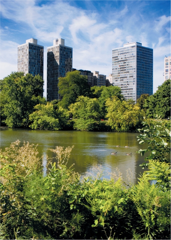
The population of Toronto at the time was about 35,000, and so it is understandable that much of the city seemed rural. It was situated between two rivers, the Don and the Humber, that meandered into Lake Ontario. Their valleys were joined by a great number of deep ravines that remained treed well into the mid-1900s. The valleys are still wooded and the view from the Queen Street bridge is not so different from that of 1872. The pines are gone—even in Scadding’s day many of them had been blown down by tornadoes— and the white elms have succumbed to Dutch elm disease. But to a remarkable degree, Toronto’s urban forest has remained intact since the city was founded. If a modern Scadding were to look over Toronto from the top of the CN Tower, he would see a city built around more than 1,000 treed parks, comprising 10,000 hectares (nearly 25,000 acres) of land, or 17 percent of the total city area. The city’s residential areas are also hidden under an almost continuous canopy of green.
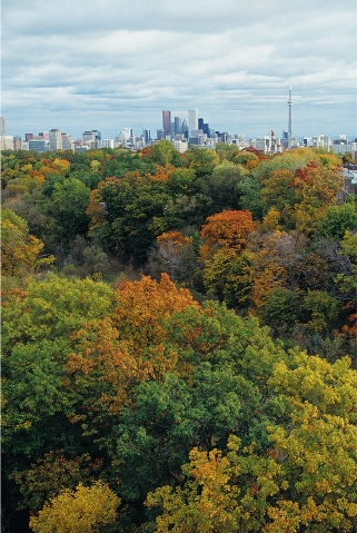
Toronto’s urban forest, covering more than 17 percent of the city, cools and cleans the air and preserves diminishing native tree species.
Toronto is not unique. The urban forest in Buffalo, New York, maintained in the park system and broadened tree-lined avenues designed by Frederick Law Olmsted in 1868, covers about 1,600 hectares (4,000 acres) in the heart of the city. Milwaukee, also hit hard by Dutch elm disease in the 1960s (the city lost 200,000 elms), is once again 42 percent covered by forest canopy in some areas, and urban foresters are working toward increasing that figure. Chicago can almost be described as a forest with buildings scattered among the trees: it has 50.8 million trees, roughly twenty for each citizen. The average American city is 33 percent shaded by its urban canopy. Twenty-five percent of the forested area in the United States, one out of every four trees, is found in cities. In many cases, the trees in city parks, along waterways, and on boulevards represent all that is left of the original forest that existed in presettlement days. Remnants of the virgin forest that once covered all of New England still exist in downtown New York City, for instance: one tulip tree in Queens is estimated to be 450 years old.
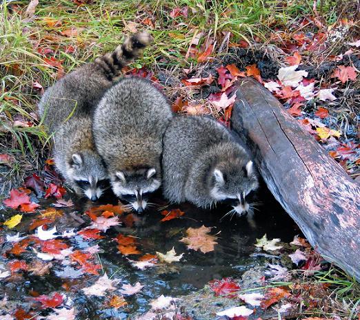
Raccoons have adapted well to city life: they are larger and have different social habits than their wilder counterparts.
“Urban forestry is not just about looking after trees,” says a former chief forester of Toronto, Willem Morsink, one of the pioneers of a scientific field that until recently sounded, to many ears, like an oxymoron. “We look after all aspects of the natural environment: water, wildlife, as well as the people who live in the forest.” Before moving to Toronto, Morsink was the chief forester in Windsor, Ontario, where less than 2 percent of the original forest remained in the countryside surrounding the city, and most of that was in hedgerows. The forest canopy was denser within city limits than outside them. Many of the urban species, however, were European imports, either accidentals or ornamentals, like the horse chestnut. When the ancient elms along Windsor’s Ouellette Avenue died in the 1960s—the first diseased elm in Canada was identified in Windsor in 1958—Morsink replaced them with the rare but native Kentucky coffee tree. On other sites he favored such native shade species as silver maple and sycamore, whose hollow trunks were used by settlers as food storage coffers.
Part of an urban forester’s job is to restore to areas within the city the kind of trees that naturally grew there, by matching soil and drainage types to specific tree species. In Toronto, Morsink identified six forest ecosystems: wet, swampy forests on poorly drained soil and bottomlands, where willows and alders do well; wet-moist elm-ash forests on loam and clay soils that become saturated in the spring; sugar maple forests on sloping clay and loam terrain, which held enough water to maintain the trees’ supply in the summer without drowning them in the spring; dry oak-pine forests, on well-drained sandy soils with less than 10 percent water retention by soil volume, such as the black oak savanna in High Park; edge-of-forest species, such as yellow and paper birches; and Carolinian-zone trees that do well in dry, sandy areas, such as hoptree, shagbark hickory, and sassafras. By planting native trees in the kind of habitat they prefer, Morsink and his successor, Richard Ubbens, have created a variety of habitats that are as close to natural as it is possible to come in a man-made environment.
Toronto’s urban forest supports a full complement of forest wildlife. More than a thousand red foxes live within the city limits, cruising the golf courses and the ravines, as does an entire deer herd and a pack of eastern coyotes that keep the deer in check. At least two hundred species of birds have been spotted in the Don Valley, including thirty-five species of waterfowl at the river’s mouth in Toronto Harbour. In some years 30,000 birds have been counted feeding in the shallow nearshore water. There are more skunks per square kilometer in downtown Toronto than there are in Algonquin Park, and the city’s urban raccoons may be evolving their own separate subspecies: they are bigger, live longer, and have different feeding, denning, and reproductive habits than their wild counterparts.
When Willem Morsink began working in Toronto in 1985, he was an oddball adjunct to the city’s parks division. Today Richard Ubbens heads a department with 230 full-time employees; more foresters work for him than for the provincial government’s Ministry of Natural Resources, “and we’re still underresourced,” he says.
Urban forests benefit cities in many ways. Some of them are simply aesthetic: real estate agents know that a house with a tree in the yard will sell for more than an identical house without one. But, as is often the case, there are links between aesthetics and psychological health: people may want trees in their yard because trees make them feel better. As E.O. Wilson puts it in The Future of Life, “What we call aesthetics may be just the pleasurable sensations we get from the particular stimuli to which our brains are inherently adapted,” and our brains are adapted to natural, not artificial, habitats. Results of a nine-year study published in 1984 in Science magazine by Roger S. Ulrich of the Harvard Cancer Center reported that surgery patients in a Pennsylvania hospital recovered faster and required less medication if their rooms afforded a view of trees rather than of brick walls.
When researchers from the University of Illinois looked at the role of trees in Chicago’s Robert Taylor Homes—the largest public housing project in the world, consisting of twenty-eight high-rise apartment buildings, some on treed lots but most on land that was paved—they found that residents who lived among trees experienced better relationships with their neighbors and a stronger sense of community. They felt safer; they gathered at night more and their children played outside more often, forming relationships with other children. The researchers also found that there was significantly less domestic violence in homes in areas where there were trees. “Without vegetation,” said Frances Kuo, one of the researchers, “people are very different beings.”
Urban trees benefit the environment as well as the soul. During summer months, the cooling effect of trees reduces the need for air-conditioning, and therefore the demand for electricity, which in turn decreases carbon emissions from coal-burning power plants. A recent study in Milwaukee determined that shade trees saved the city’s homeowners $650,000 a year in energy bills and calculated that if a tree were planted beside every house in the city so that its shade fell on air conditioners, the annual savings would be more than $1.5 million. A similar study in Chicago found that while deciduous trees provided shade in the summer, coniferous trees reduced wind speed in the Windy City, and that increasing both types of tree cover by 10 percent would save each resident $50 to $90 a year in heating and cooling costs.
Chicago’s North Pond in Lincoln Park, a former shoreline wasteland, is now a healthy home to 160 species of birds, as well as an important buffer for runoff from the city’s streets.
Urban green spaces, such as Toronto’s High Park, provide city residents with important links to nature.
Trees also act as retention reservoirs for water. They are constantly transpiring water vapor into the air, and an average-size 12-meter (40-foot) tree holds 67 liters (17.7 gallons) of water in its roots, trunk, branches, and leaves. During rainstorms, then, trees absorb water that would otherwise enter storm drains or urban creeks, eroding soil and flushing pollutants into the Lakes. The Milwaukee study found that the urban forest in that city reduces storm-water flow by 22 percent, saving the city $1.5 million a year by eliminating the need to build extra stormwater retention facilities.
Trees live by turning carbon dioxide into carbohydrates (which they ingest) and oxygen (which they exhale). Carbon dioxide is a greenhouse gas, produced by the burning of wood and fossil fuels, and so in removing carbon from the air, trees reduce the buildup of carbon dioxide in the atmosphere and slow global warming. The amount of carbon sequestered by a single tree can be astonishing. A 1993 study found that a 12-meter (40-foot) tree with a crown area of 113 square meters (1,216 square feet) sequesters 47 kilograms (104 pounds) of carbon from the atmosphere per year—that’s 2,350 kilograms (5,180 pounds) of carbon over the fifty-year average life span of a tree.
Morsink has measured the amount of carbon a tree takes from the air and the amount of carbon its shade saves a power plant from having to produce. He has calculated that one urban tree cleans 149.2 kilograms ( 329 pounds) of carbon each year from the air. Since each person in the Great Lakes basin produces approximately 4.3 tonnes (4.7 tons) of carbon dioxide emissions each year, it takes about twenty-eight trees per person (slightly more than there are in Chicago) to offset our annual carbon contribution to the atmosphere. Cities are where the most carbon is produced; therefore, urban forests are our first lines of defense against carbon dioxide buildup in the atmosphere. Chicago’s trees take 141,000 tonnes (155,000 tons) of carbon out of the Chicago’s air per year and turn it into life-giving oxygen. They also remove more than 5,400 tonnes (6,000 tons) of air pollutants, saving the city $9.2 million a year in atmospheric cleanup.
It’s partly for the body, but also largely for the soul that urban forests are attracting so much attention among town planners, administrators, and even developers. People—including people who vote and buy houses—are beginning to understand that trees are more than accessories to an urban building lot. Richard Louv, the child development guru whose book The Last Child in the Woods is subtitled Saving Our Children from Nature-Deficit Disorder, charted the growing movement toward increasing the amount of natural habitats in cities. “A denatured urban or suburban environment,” he writes, “is not good for children or the land.” Truly grassroots initiatives such as green urbanism, landscape urbanism, and the “zoopolis movement”—which seeks to integrate wild animal populations into city cores by means of wildlife corridors—are gaining in popularity with urban planners and architects, and urban forestry is becoming a vital component of these trends. “We’re getting to the point at which we can tell the city planners what we want the city to look like four or five decades from now,” says Richard Ubbens. And the city planners are beginning to listen.
· · ·
Those dunes are to the midwest what the Grand Canyon is to Arizona and the Yosemite to California. They constitute a signature of time and eternity: once lost the loss would be irrevocable.
CARL SANDBURG, 1958
LEOPARD FROGS AND ATRAZINE
Frogs, fish, and mammals share many of the same types of genes that regulate reproduction, and consequently biologists look to frogs for the early warning signs of genetic change brought on by exposure to pesticides.
Globally, frogs have been in decline since the early 1990s, and scientists have been searching for a cause. In 1997, Tyrone Hayes of the University of California, Berkeley, conducted a series of experiments with African clawed frogs, subjecting them to increasing concentrations of the universal herbicide atrazine. He found that 80 percent of adult male frogs reared in water containing atrazine in concentrations greater than 1.0 part per billion (ppb) had smaller than normal laryngeal dilator muscles—the muscles that control the frogs’ mating calls—and 30 percent had deformed reproductive organs. Some had both testes and ovaries. When he repeated the experiments using northern leopard frogs, he found “sex reversal” in males reared in water with only 0.1 ppb atrazine; some of these had eggs growing in their testes. He also found similar deformities in frogs in the wild. Hayes believes that atrazine triggers genes that cause male frogs to convert testosterone into estradiol—a naturally occurring form of estrogen—turning them into hermaphrodites, and he refers to the effect of atrazine as “chemical castration and feminization.”
Atrazine is one of the world’s most ubiquitous herbicides and has been found in most waterways bordering agricultural land, including those flowing into the Great Lakes. Water quality tests in the Great Lakes have shown concentrations of atrazine ranging from 1.0 to 1.2 ppb in Lakes Erie, Ontario, and Michigan. The current concentration of atrazine in water for human consumption considered acceptable by the United States Environmental Protection Agency is 3 ppb, but water with up to 350 ppb atrazine is deemed safe for aquatic life.
SPIRIT ISLAND
Manitoulin Island—the name means “spirit island” in Ojibway—is an oasis of plenty in the north end of Lake Michigan. A long, narrow chunk of the Niagara Escarpment between Michigan’s Upper Peninsula and Ontario’s Bruce Peninsula, Manitoulin Island was created when Lake Algonquin, the geologic precursor of Lake Superior, drained eastward through Lake Nipissing and the Ottawa Valley, thereby scouring out the North Channel that now separates Manitoulin from the mainland. The island shelters more than 1,200 of Canada’s 5,000 species of vascular plants.

LAKESIDE DAISY
“We have a great diversity of habitat,” says the Manitoulin botanist Judith Jones. “We have shoreline, cliffs, bogs, fens, alvars. We are a microcosm of southern Ontario that hasn’t been developed—yet.”
Many of the threatened or endangered plant species on the island are alvar species, including dwarf lake iris, Lakeside daisy, Gattinger’s agalinis, cylindric blazing star, and Houghton’s goldenrod. The endangered loggerhead shrike still nests some years in the low shrubs, red-headed woodpeckers bore holes in the island’s red pines, and sharp-tailed grouse form leks, or breeding congregations, on remnant prairie meadows, which are often covered with prairie dropseed grass. Other plants, such as Pitcher’s and Hill’s thistles, are dune and open sand plants found on one of the island’s nature reserves at Misery Bay.
“Of the twenty-six sites in Canada with Pitcher’s thistle,” says Jones, who is a spirited island enthusiast, “twenty-two of them are on Manitoulin Island. Gattinger’s agalinis is found naturally only on Manitoulin and the North Channel Islands. And the Lakeside daisy, which is named for Lakeside, Ohio, should be called Manitoulin gold, because we have far more of them here than there are in Ohio and Michigan combined.”

PITCHER’S THISTLE
STORMWATER PONDS
Urban sewer systems now do two jobs: they direct both sewage and stormwater, or spring runoff, into a city’s water treatment plant. During storms or after heavy snows, so much water can flow into a sewer that the treatment plant floods and overflows; raw sewage as well as runoff contaminated with salt, oil, lawn fertilizers, and other chemicals spills directly into the nearest lake or river.
With precipitation expected to increase as a result of climate change, federal, state, or provincial, and municipal governments are investing in stormponds, artificial wetlands situated between storm drains and sewage plants. The stormponds handle runoff, leaving the treatment plants to deal only with sewage. Wetlands hold water for days and weeks, directing it by means of constructed swales and weirs into a series of sedimentation ponds, where contaminants settle out before the cleared water is allowed to continue into the natural system. The area is planted with native species of plants and attracts birds, rabbits, amphibians, and other wildlife—including local citizens seeking contact with a relatively natural environment. And the city saves millions of dollars in cleanup and treatment costs.
In 2000, the governments of Canada and Ontario allocated more than c$2.5 billion for urban water treatment improvements around Lake Ontario, and stormponds feature prominently in the planning. The city of Toronto is spending another c$1.5 billion on waterfront regeneration, including upgrades to Grenadier Pond, in the city’s High Park, which already functions as a stormpond.
The citizens of Duluth, Minnesota, are lobbying for a stormpond to be built in Bayfront Park, between Duluth’s downtown and its harbor. The city has allocated 0.2 hectare (0.5 acre) for the project, but the planners want at least 0.8 hectare (2 acres), enough to contain a wetland designed in the shape of the Great Lakes, with each lake planted with wetland species native to that lake. They anticipate the pond will cost us$1 million per acre, but they expect the cost to be offset by much lower expenditures on sewage treatment improvements. “What the stormpond will do is educate people to the importance of wetlands,” says Kurt Leuthold, a project engineer. “With awareness comes protection, and that’s the ultimate goal.”
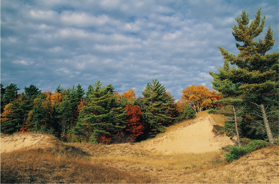
GREAT LAKES SAND DUNES
Coastal sand dunes around the Great Lakes constitute vital and distinctive environments that support more unique species of plants, insects, and animals than any other ecosystem in the Great Lakes basin. The dune system on the eastern shore of Lake Michigan is the largest in the world, covering more than 111,000 hectares (275,000 acres); the eastern shore of Lake Ontario also contains an extensive dune system, stretching 27 kilometers (17 miles) along the New York State coastline, as does the south shore of Lake Superior. Sand dunes in the basin support 315 species of vascular plants; 36 species of mites as well as flies, beetles, springtails, book lice, and fungi; 32 species of mammals; and 68 species of shorebirds and passerines.
Dunes are made of sand deposited in the basin 10,000 years ago by melting glaciers. They are found primarily at the mouths of rivers, which carry sand from the higher land to the lakeshores. High water levels 6,000 to 4,000 years ago sifted and sorted the sand particles, pushing the smaller grains inland and leaving larger pebbles at the water’s edge. Over the past 3,000 years, lake currents, meltwater, and wind have formed the sand into the four basic dune types found in the basin: parabolic, or U-shaped dunes; perched dunes sitting atop glacial moraines; linear dunes running parallel to the shoreline, formed by rising and falling lake levels; and transverse dunes, from sand deposited in shallow bays along the glaciers’ retreating edges.
Without vegetation, sand dunes would quickly be dispersed by wind. The Great Lakes dunes have become the habitat for a number of grass species specifically adapted to survival in the dunes’ rugged environment, where nutrients are few, moisture is low, and temperatures at sand level can soar to 82˚c (180˚f). American beach grass, or marram grass, for example, actually requires burial by sand to propagate. Its rhizomes, or root tendrils, extend 3 meters (9.8 feet) into the sand, and can absorb silica to strengthen the plant’s stalks and render them resistant to blasting sandstorms. Great Lakes wheatgrass also reproduces by means of rhizomes, flourishing on the leeward sides of dunes on Lakes Huron, Superior, and Michigan. Long-leaved reed grass, sand cherry, and wormwood are other hardy species found around the Great Lakes.
Lakeside dunes in Hiawatha National Forest, Michigan.
More than 2,000 hectares (5,000 acres) of Lake Michigan’s unique dune system have been mined since the 1900s, and many of its more famous locales—Pigeon Hill, Creeping Joe, and Maggie Thorp dunes, to name a few—have disappeared. Dune sand is nearly 80 percent quartz and is used primarily in foundries and for glass production; it sells for less than us$11 per tonne (us$10 per ton). Efforts by the Lake Michigan Federation and the West Michigan Environmental Action Council to preserve the dunes have heightened public awareness and slowed the dunes’ human-caused erosion. A 1991 study, for example, found that more than 1 million people visit Sleeping Bear Dunes National Park every year to see the dunes, and the park has generated us$39 million since its creation. As appreciation for these magnificent and ecologically significant habitat increases, so do chances for their long-term survival.

Water ripples over glacial deposits at Lake Ontario’s Whitby Marsh. Only 1 percent of Great Lakes water is renewed each year.