Dramatic, rugged and mountainous, Kefaloniá is the largest and highest Ionian island, rising to 1,627m (5,338ft) at the summit of Mount Énos. Although, or perhaps because, tourism is a relatively recent phenomenon on the island, sparked off in part by the book and film, Captain Corelli’s Mandolin, Kefaloniá has one of the least spoilt environments and some of the best beaches in the Ionian Islands. The south is dominated by the heights of Mount Énos, bordered on the west by the Livathó Plain. In the west is the quiet Pallíki Peninsula, while the stunning north coast is fringed by dramatic cliffs.
Kevin Cummins/Apa Publications
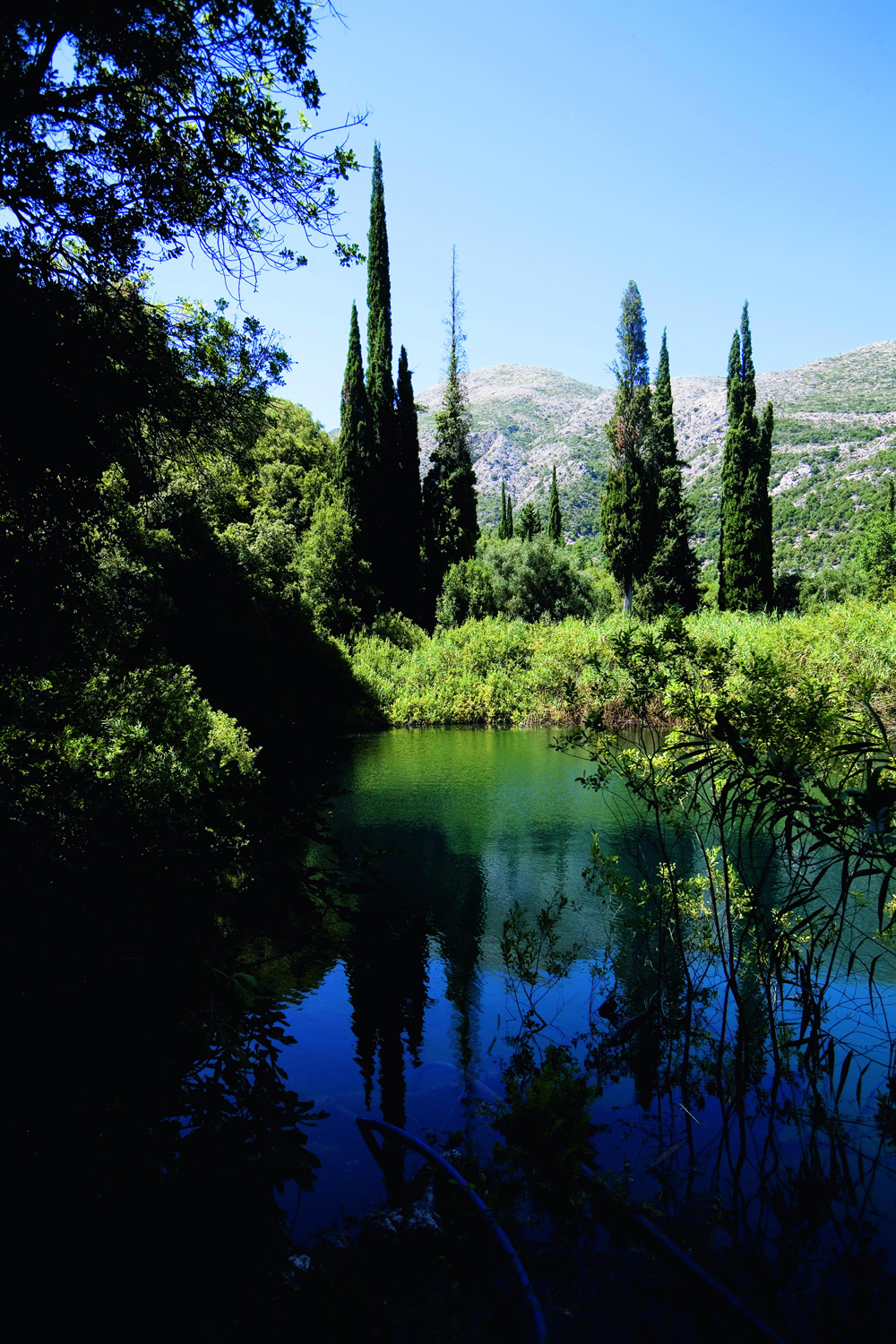
The Ávythos lake, between Póros and Sámi
Seismic emigration
The 1953 earthquake devastated almost all of Kefaloniá – except the far north – causing a huge exodus of refugees. Many settled in Australia, Canada and the US, although recent years have seen families returning to the island.
Argostóli
The island’s capital, and also its largest town, Argostóli 1 [map] was completely destroyed in the 1953 earthquake and has been rebuilt largely with modern concrete buildings. Although it is essentially a port and administrative centre, the town is not entirely devoid of charm. It has a great position on the Argostóli Gulf surrounded by mountains, has a number of interesting museums, and makes a good base for exploring the rest of the island. Life in Argostóli centres around Platia Valiánou (the central square) and the pedestrianised shopping street of Lithóstroto.
Ancient trade link
One of the most interesting exhibits in Room 2 of the Archaeological Museum is an Egyptian scarab from the reign of Tuthmosis III (1504–1450BC). It was found in a Mycenaean site at Kráni, indicating that there was trade between Kefaloniá and pharonic Egypt.
The Archaeological Museum
On P. Vergóti, close to the theatre and opposite the beginning of Lithóstroto, is Argostóli’s Archaeological Museum A [map] (Tue–Sun 8.30am–3pm; charge). Although small – the museum has just three rooms – the finds are well displayed and help to build up a picture of Kefaloniá’s ancient history.
The first room has artefacts from the Palaeolithic to Mycenaean periods and on the left-hand wall are some interesting archive photos (1899–1933) of excavations on the island. The pieces on display range from very early flint hand tools (100,000–40,000 years old), to clay figurines (c. 3rd century BC) from the cult centre of the Nymphs at the Drákinas Cave near Póros. The cave had been a settlement from late Neolithic times (8,000BC onwards). The final case has finds (mostly kantharos, or double-handled pots) from the late-middle Helladic cist (box-shaped) graves (1750–1700BC) and Mycenaean tholos (beehive) tombs at Kokkoláta, southeast of Argostóli.
Room 2 is given over to finds from Mycenaean, or Mycenaean-influenced sites. By now the visitor will have noticed a certain grave and tomb theme to the exhibits. Perhaps the most important finds in this room come from the tholos tomb at Tzannáta near Póros. These include some delicately beaten gold, one piece of which shows the Mycenaean double-axe, clay figurines and an intriguing bronze buckle, indicating the existence of a powerful Mycenaean centre, probably related to Homeric Ithaca. It is thought that this will be vital evidence in pinpointing the exact location of the mythical kingdom.
The third and final room has displays of pieces from the Classical and Roman eras. On the left are a few larger exhibits, including a charming trident and dolphin floor mosaic from the 2nd-century BC sanctuary of Poseidon at Váltsa, on the Pallíki Peninsula. The cases on the right mostly contain pieces from the four ancient cities of Kefaloniá. Notable exhibits include an exquisite gold, winged Niké from Menegáta, a marble head of Silenus from Skinías and a Roman 3rd-century AD bronze male head from Sámi.
The Korgialénios Museum
Up the hill, past the theatre, is the fascinating Korgialénios Museum and Library B [map] (Ilía Zervoú; Mon–Sat 9am–2pm; charge). Set up after the 1953 earthquake to house objects salvaged from the wreckage, the museum gives an overview of 19th-century Kefalonian domestic life. One of the refreshing aspects of the museum is its concentration on the lives and world of Kefalonian women, albeit mostly of the urban middle class. To this end, the displays start with a case of household linen, as well as items such as kid gloves, silk stockings and hairpins. What follows is an amazing collection of urban women’s costume between 1878 and 1910. They are displayed in period interiors, which give an excellent impression of the life of the Kefalonian aristocracy at the end of the 19th century.

A 19th-century view of Argostóli by Joseph Cartwright
For the most part, the dresses are highly elaborate and beautifully made in lace, silk and satin, with appliqué. There is a lovely pair of bridal shoes from 1905 and particularly exquisite is a young girl’s ball gown of 1894, with silk tulle and embroidered roses. There are also a great number of accessories, including shawls, fans, parasols and gloves.
Kevin Cummins/Apa Publications
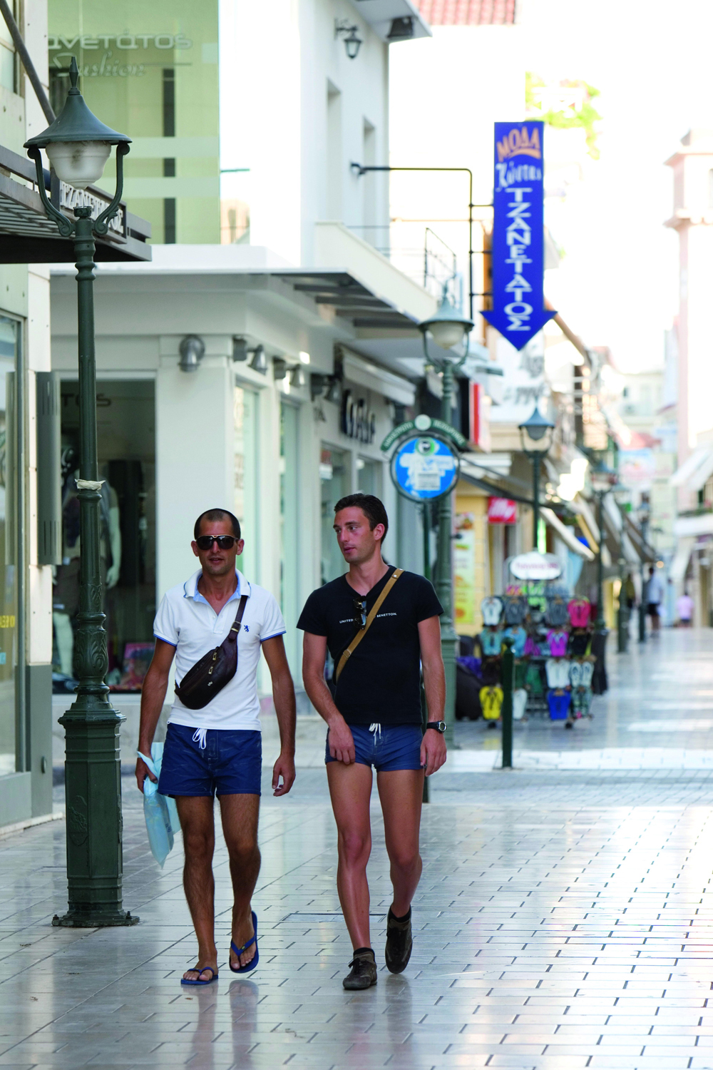
Strolling down Lithóstroto, Argostóli
The museum also has a good display of photographs of pre-1953 Argostóli. The earliest, from 1904–6 and taken by local photographer N. Trikardos, show it as a neat, provincial town. Some of the later (1930s) pictures were taken by two members of the Kosmetatou family. More disturbing are the images showing the total devastation of the town after the 1953 earthquake.
No-nonsense praise
‘The buildings of Argostóli are handsome, and the town, though not remarkable for its liveliness, possesses many good streets and public edifices.’
Edward Lear, Views in the Seven Ionian Islands, 1863
Other displays include a room with some rather dark and heavy furniture and portraits of local worthies, a lovely 18th-century carved and painted wooden iconostasis from the church of Agíou Georgíou, and a case with the effects of Dimitrios Korgialenios (died 1861), a member of the secret pro-independence Filikí Etería (Society of Friends). Finally, after a cluttered but cosy reconstruction of a traditional bedroom, there are displays of agricultural implements.
The Foká-Kosmetátou Foundation
Back towards the central platía, at the far end of Valliánou, is a beautifully restored neoclassical mansion housing the Foká-Kosmetátou Foundation C [map] (May–Oct Mon–Sat 9.30am–1pm; charge). The foundation, which was established in 1984 from the estates of three brothers, turned their family home into a museum to display their private collections and to publish studies on Kefaloniá; it has also established the Votanókypos Kefaloniás on the outskirts of town.
The museum consists of just one room with, on the right, a display of Greek numismatics and, opposite, a number of lithographs of the Ionians and some pieces of furniture that belonged to the family. Of greatest interest are the lithographs by Joseph Cartwright, Edward Lear and Henry Cook, all of whom published volumes of paintings and engravings of the Ionians. Close by is a fine icon of Ágios Vikédios attributed to Theodoros Poulakis. Also look out for the 10 drachma bank note from the 1890s, cut in half; each half then became worth five drachmas. The small but pretty garden at the back is used to hold temporary exhibitions.

Kevin Cummins/Apa Publications
Drápono Bridge
Lithóstroto and the Drápano Bridge
The main shopping street of Argostóli is the pedestrianised Lithóstroto, which runs south from P. Vergóti, the site of the town’s theatre. Reconstructed after the 1953 earthquake, during the 19th and early-20th century the theatre, with its largely Italian opera productions, was the centre of the social life of Argostóli’s middle class. Lithóstroto is lined with cafés, rivals to those in the central platía, and pricey clothing and shoe shops. About halfway down, on the right-hand side, is the town’s Catholic church. Heavily restored following the earthquake, its chief claim to fame is the 14th-century icon of the Panagía Prevezána. Beyond the church is the Pýrgos Kabánas (Kabána Tower). This reconstructed late 18th-century Venetian bell tower now houses a pleasant café decorated with pre-earthquake photographs of Argostóli. The café was created by the municipality and is run as part of the ROTA Cooperative, which places people with mental illness in jobs in the community. On offer are a few local specialities, such as soumáda and the Kefalonian amygdalópita (almond pie).
At the end of the pedestrianised section of Lithóstroto, turn left down towards the harbour. On the left is the town’s produce market. Depending on the season it is piled high with all kinds of colourful agricultural produce.
Walking south along the water brings you to the Drápano Bridge. This stone-built causeway crosses the shallow Koútavos Lagoon but is closed due to structural damage. Built by the British in 1810, it was overseen by Major de Bosset, Commandant of Kefaloniá, a Swiss soldier in the service of the British army. The obelisk in the centre has an inscription to the supposed glories of the British Empire.
The Katavóthres
Rizospáston heads north from the central platía. On your right you will pass Argostóli’s Filarmonikí Skholí (Philharmonic School), and opposite, on the corner of the next block, the only building to have survived the 1953 earthquake intact. The streets running off to the right will take you down to the harbour.
Column of light
On a short promontory at Cape Ágios Theódoros is a Doric-colonnaded lighthouse dating from 1820. It was commissioned by Charles Napier, who was the British Governor of Kefaloniá between 1822 and 1830.
By the port authority buildings (near where the ferries depart) is Argostóli’s helpful EOT (tourist information office). Further along, past the place on the quay where you catch the ferry for Lixoúri, is a line of estiatória (restaurants), the best of which is Kyani Akti. Before that, on the left, is a small square. On a small patch of grass is the marble base of a Venetian fountain, with carved lions’ heads. The column above it is of later (19th-century) provenance.
iStockphoto
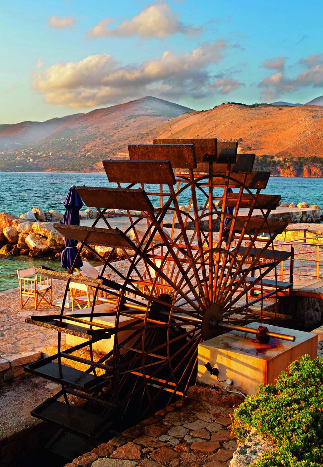
The katavóthres (sea mills) near Argostóli
Continue along the coast, past a couple of very pleasant tavernas and down a pine-shaded footpath beside the rocks, where local people swim in the evening. After about a kilometre (0.6 miles), you reach the tip of the cape. The views here over the mountains and the Argostóli Gulf are spectacular. Also here are the katavóthres 2 [map], or sea mills, which are the product of a bizarre geological phenomenon. Seawater from the gulf disappears down a series of small sinkholes, only to re-emerge in the cave of Melissáni and under the Gulf of Sámi on the opposite side of the island. The water passes through channels cut by subterranean fresh-water streams during the last ice age, when seawater levels were lower. Fresh water filtering down through the limestone hills increases the flow. As the channels widen the now-brackish water slows, before its resurgence.
The current at the Argostóli end was strong enough in the past to drive mills, built by the British to grind grain. After the 1953 earthquake the flow was disrupted and slowed to the gently running channels you see today. The original mills were destroyed in 1953 and replaced by a fake water wheel and a café, very popular with locals for Sunday lunch. Further on, around the cape, are a series of small bays where you can swim.
Leaving town to the south, following Leofóros Georgíou Vergóti, brings you to a fork in the road. The left carries on to Peratáta, the right-hand turn has a signpost to the Votanókypos Kefaloniás 3 [map] (Cephalonia Botanica; Tue–Sat 10am–2pm, 6pm–8pm; charge). Follow the signs and don’t be put off by the rough track, as it soon levels out. Bear left at the top of the rise and the site is 50m (160ft) along on your right. Entrance is free with a ticket to the Foká-Kosmetátou Foundation, otherwise leave your money in the honesty box in the hut at the entrance.
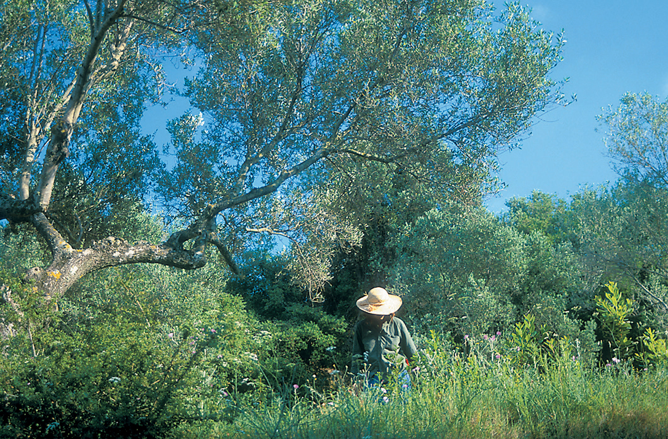
This botanical garden was established in 2000 in an old olive grove. Its aim is to represent the rich flora of the different environments found on Kefaloniá, as well as seeking to preserve rare and endangered Kefalonian plants. The garden is allied to the Millennium Seed Bank at London’s Kew Gardens. The site is beautiful and a world away from the nearby warehouses on the main road. An artificial stream runs through the centre of well laid-out and labelled areas, while in spring and early summer it is lovely to see the floor of the remaining olive grove carpeted with flowers, rather than the ploughed-up versions usually seen from the roadside.
Mockford & Bonnetti/Apa Publications
The gardens at Votanókypos Kefalonías
The Livathó and South Coast
To the south of Argostóli is the Livathó Plain, one of the few level areas on the island. Not surprisingly it is largely given over to agriculture. The road out of town bisects the plain, passing the castle of Agíou Georgíou above the villages of Peratáta and Mazarakáta (site of a Mycenaean necropolis), before, dominated by the bulk of Mount Énos to the east, it hugs the southern coast along to the resort of Skála.
Kástro Agíou Georgíou
Towering above the plain is the Kástro Agíou Georgíou 4 [map] (mid-June–Oct Tue–Sun 8am–2.30pm; charge), constantly being renovated and liable to closure. The fortress stands on a pine-clad hill, and can be reached from the north by the turn-off for the Robola Wine Cooperative or via the hairpinned road from Peratáta. Either route brings you up to the Bórgo, the village outside the castle’s walls. The view from the top is spectacular, and either the Castle or Memories café/bar is a good place to take it in, particularly if you have just walked up in the heat and are in need of refreshment.

Mockford & Bonnetti/Apa Publications
Kástro Agíou Georgíou
There has been a fortress on the site since Byzantine times, centred around the church of Agíou Georgíou from which the castle takes its name. In 1185 the island was taken by the Franks, and the fort was controlled by them until 1485. After a brief period of Turkish rule, the castle passed to the Venetians in 1500 following a three-month siege. The fortifications seen today largely date from the period of Venetian occupation. At this time the castle was the centre of the island’s administration, but in 1757 the Venetians moved their official headquarters down to Argostóli, heralding the fort’s decline. Like all buildings in southern Kefaloniá, the castle suffered great damage in the 1953 earthquake. However, it is well worth a visit for the view and renovated walls.
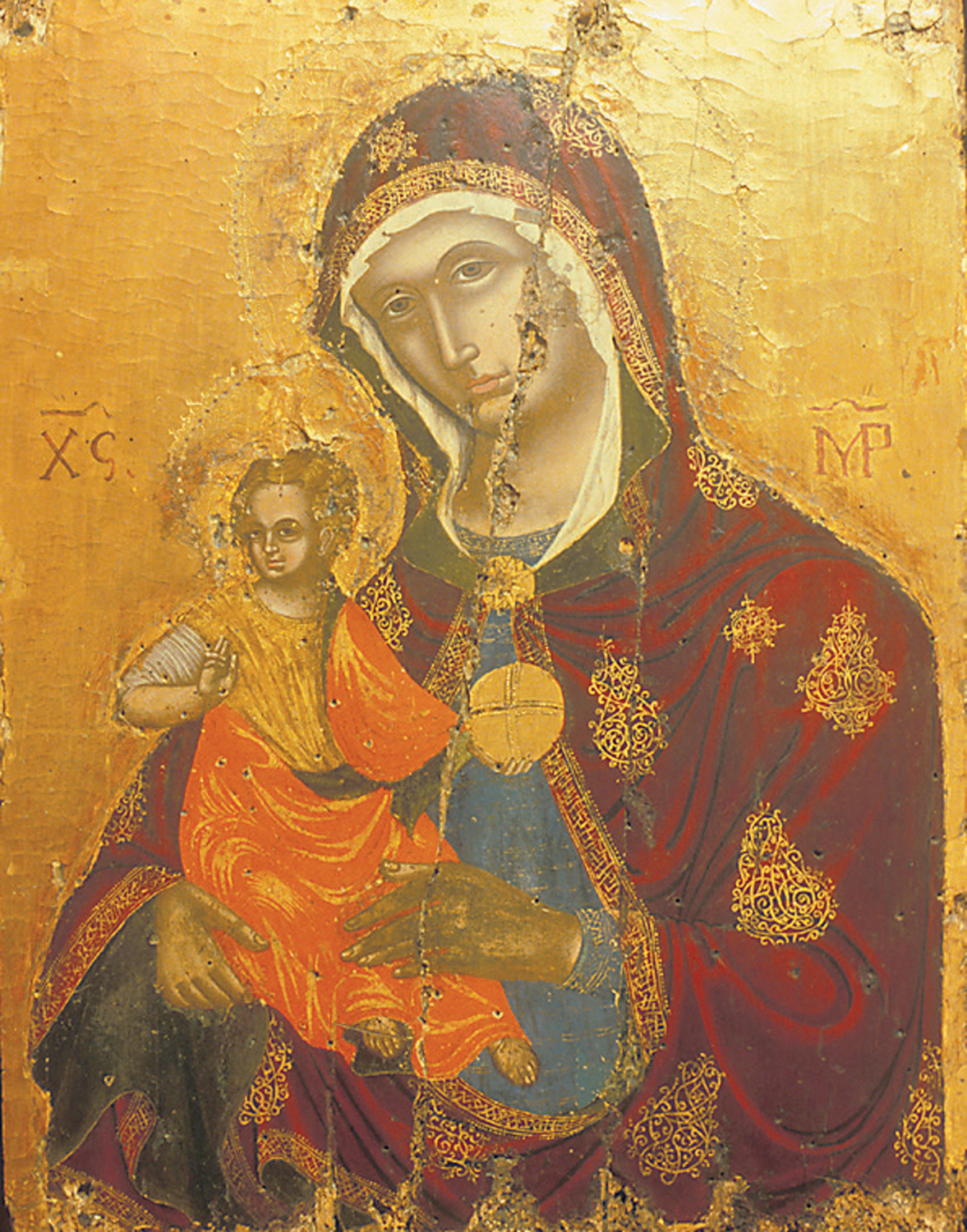
Mockford & Bonnetti/Apa Publications
Icon from Moní Agíou Andréou
Back down in Peratáta, just beyond the village, is the turn for Moní Agíou Andréou (also confusingly known as Moní Milapidiás). The convent is now housed in modern (post-1953) buildings. Opposite these is the old church of Ágios Andréas, home to important 16th- to 18th-century icons by, among others, Immanuel Lambardos and Athanassios Anninos (1713–48). These are now part of the Ecclesiatical Museum (daily 9am–1.30pm, 5pm–8pm; charge). As well as good Ionian School paintings, the well-laid-out museum has reliquaries allegedly containing remains of Ágios Andréas and some ecclesiastical vestments.
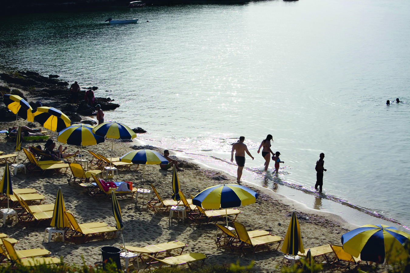
Kevin Cummins/Apa Publications
The beach at Lássi
Lássi and Metaxáta
A low but steep range of hills separates the Livathó Plain and Argostóli from the west coast. This hides some pretty villages, a couple of good wineries and, on the western side, attractive beaches. From Argostóli take either the main road out towards Lakíthra (then follow the signposts to the airport), or go around the cape via Ágios Theódoros and a number of bays, along a pleasant pine-flanked road. Both routes are walkable and will bring you to Lássi, the closest resort to Argostóli.
By Greek island standards Lássi is fairly low-key, although it does get crowded in high season. The star beaches here are Makrýs and Platýs Gialós, both with fine sand and clean, blue water. The latter has a small island attached to the beach by a short isthmus. The coastal road continues south above cliffs with lovely views. After a couple of kilometres (1.2 miles) is the Gentilini Winery (tours and tastings May, June and mid-Sept–Oct, Tue, Thur and Sat 5.30–8.30pm; July–mid-Sept Mon–Sat 10am–2.30pm and 5.30–8.30pm). Owned by the Kosmetatou family, the winery was established in 1984 and specialises in high-quality organic wines, including a fine Robola.
Above Miniá, close to the airport, is the pretty village of Sarláta, topped by a rather Gothic, ivy-clad ruin. There are a number of rooms and villas to let here. Just along from Sarláta is Domáta, with an impressive church and houses spilling down the hillside. The church of the Panagía here contains the coffin in which the remains of Patriarch Grigoris V were transported from Istanbul to Odessa. It also has an interesting 19th-century wooden iconostasis.
The next village is Metaxáta, chiefly famous as the place where Byron stayed for four months in 1823 before leaving for Mesolóngi on the mainland, where he died. A bust of the poet can be seen in the main square, close to the site of the house where he stayed (destroyed in 1953). Below Metaxáta and Domáta is Kourkoumeláta, close to the lovely beach of Ávythos. The attractive village was rebuilt by Andreas Vergotis after 1953. At Pesáda, where seasonal ferries leave for Ágios Nikólaos on Zákynthos, is the Divino Winery (summer daily 10am–8pm) which produces a traditional Muscat, made from sun-dried grapes.
Lourdáta to Skála
From the long beach at Lourdáta, just past Pesáda, to the village of Markópoulo there is little apart from Moní Theotókou Sisíon, believed to have been founded by St Francis of Assisi. The road south from here is fairly bleak, though towards the coast the land appears more fertile. After the right turn-off to Skála, the road rises towards Markópoulo 5 [map]. The church of the Panagía here is the scene of a bizarre festival. Between the 6th and 15th of August hundreds of small, harmless snakes appear, said to bring good luck to the village.
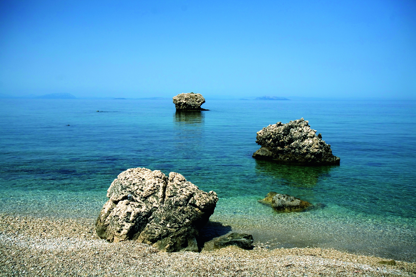
Kevin Cummins/Apa Publications
Pebbled shoreline between Póros and Skála
Taking the left-hand turn to Skála takes you first past Kateliós, and then the long sweep of sand of Kamínia. Before reaching Kateliós you might want to call in at the Metaxas Wine Estate (May–Oct daily 10.30am–6pm) and taste their excellent Robola. Kateliós is a tiny, laid-back resort with a lovely sandy beach, on the opposite side of the bay from Kamínia. This is Kefaloniá’s most important nesting beach for loggerhead turtles, although fewer nest here than on Zákynthos. Visitors should treat this area with respect and follow the national park guidelines. In truth it shouldn’t be necessary to disturb the turtles as just along the coast is Skála, a popular, but relatively tasteful resort on a huge sandy beach backed by pine-clad hills. Also here, a little inland, are the excavated remains of a Roman villa with some fine, preserved mosaics.
Mount Énos
The highest mountain in the Ionian islands is Mount Énos 6 [map]. At 1,627m (5,338ft) it dominates the southern part of Kefaloniá. Also known by its Venetian name of Monte Nero (the black mountain), its upper reaches are covered by the Greek fir (Abies cephalonica), giving the mountain a dark cap. The fir was first identified on the island (hence its Latin name) and the Énos population is particularly important due to its lack of hybridisation. It is generally found at altitudes of between 800 and 1,600m (2,600–5,250ft) and grows up to 30m (100ft) high. It was an important tree to the ancient Greeks, who used it extensively in shipbuilding.
Énos National Park
The indigenous population of firs is now protected by the Énos National Park. This takes in the summit of Mount Énos above 1,000m (3,280ft) and the northern flanks of neighbouring Mount Roúdi (also called Gioúpari; 1,124m/3,687ft). The two mountains are divided by a high saddle, which is marred by a NATO radar station bristling with satellite dishes. A new tarmac road runs up to the saddle from the main road between Argostóli and Sámi. From the telecom masts it’s another 1km (0.6 miles) downhill on an unpaved road to a slightly wider stretch where you can park (be warned it is rough going; don’t drive any further). A signposted footpath ascends to the summit, Megas Soros. If it is not too hazy the views from the top are incomparable.

Mockford & Bonnetti/Apa Publications
Goats on the flanks of Mount Énos
Feral ponies
The semi-wild ponies of Mount Énos are descended from animals abandoned after World War II. They initially formed communities of up to 100 animals but are now highly endangered, numbering only some 12–14 individuals. If you are lucky enough to spot them, be careful not to disturb them.
The turn-off towards Valsamáta will take you to the Cephalonian Robola Producers Cooperative 7 [map] at Frangáta (summer daily 7am–8.30pm, winter daily 7am–3pm). The Robola grape is cultivated on the high altitude limestone soils found in the region and is used to produce a fine white wine. The cooperative makes two Robola wines, both of which can be tasted in the visitors’ centre.
Close to the winery, just beyond Valsamáta, is Moní Agíou Gerasímou. Ágios Gerasímos is the patron saint of Kefaloniá, and the convent, founded in the 16th century, is the most important pilgrimage site on the island. The (male) saint founded a female order in 1554 and was beatified in 1622.
Inside the new convent church, consecrated in 1992, is the saint’s silver shrine, inside which is the reliquary containing his bones; his funeral robes are draped over the shrine. Although the church is new, it still contains many fine original works of art, as well as a staircase that descends to a couple of small chambers, thought to be the saint’s sanctuary.
Sámi and Póros
The road from Argostóli over the flanks of Mount Énos descends past fir-clad slopes to the small port of Sámi. Ferries leave from here for the island of Itháki and Pátra, on the mainland. Sámi is a pleasant, quiet town with a few eating places along the harbourfront. This town was the location for much of the filming of Captain Corelli’s Mandolin in 2000. For the filming, much of Sámi’s pre-earthquake architecture was reconstructed, only to be destroyed during the subsequent battle scenes.
Over the headland of Cape Dihália (also known as Mýtikas) is the beautiful white shingle beach of Andísamos 8 [map], also used as a location for the film. Surrounded by steep, maquis-clad hills, the deep inlet looks out on the southern coast of Itháki. The clear water is great for swimming; the furthest little bay of the beach is nudist.
The Drogaráti and Melissáni Caves
On the road from Argostóli, about 3km (2 miles) before Sámi, is the turn for the Drogaráti Cave 9 [map] (Apr–Oct daily 9am–5pm; charge). The cave was discovered about 300 years ago, after an earthquake opened up the present entrance. A steep series of steps leads down into a cool fissure, at the bottom of which is a concrete viewing platform overlooking the huge chamber. Occasionally used to hold concerts, it has an impressive array of stalactites. Some of these are damaged, broken off by unthinking souvenir hunters, but there is still a huge amount of flowstone left. From the platform you can make your way down on to the floor of the chamber, where you can explore the nooks and crannies. To see the chamber at its best, wait until the tour groups have departed, when you can explore on your own.

Kevin Cummins/Apa Publications
Melissáni cave lake
Perhaps even more impressive is the cave lake at Melissáni ) [map] (May–Oct daily 9am–5pm, Nov–Apr Fri–Sun 10am–4pm; charge), north of Sámi. A short artificial tunnel brings you to the edge of a large underground lake, partly open to the sky due to the collapse of the cavern’s roof; the sunlight on the deep, clear water turns it an iridescent blue. Visitors are rowed around the lake by waiting boatmen.
The cave was formed between 20,000 and 16,000 years ago, during the last ice age. The roof of the cavern collapsed some 5,000 years ago, the debris from which still lies in the centre of the lake. Perhaps the most fascinating aspect of its geology is that it is the point of resurgence for the water that sinks at the katavóthres near Argostóli, hence the water in the cave is brackish. It enters the lake at its deepest point (32m/104ft) on the left-hand side, and sinks again at the far point of the covered section of the cave which lies to your right.
It was in the still intact section of the cavern that archaeological finds were made, dating from the 4th–3rd century BC, confirming that the cave had been the site of a cult of Pan and the Nymphs. These are now in Argostóli Archaeological Museum.
From the cave, near Karavómylos, the coast road runs north around the bay of Sámi, to the small port of Agía Efimía Ierous. This attractive yachting harbour has a great location, with steep, bare mountainsides looming behind and a sweeping view over the bay to Itháki. The town’s narrow shingle beach, north of the yachting harbour – now backed by rather brutal concrete sea walls – has wonderfully clear water and the swimming here is excellent.
Póros
The main road south from Sámi passes through some beautiful countryside, as well as the attractive mountain villages of Digaléto and Ágios Nikólaos, which are close to the Ávythos Lake. Just beyond Ágios Nikólaos, on the hairpin bends, are the ruins of a monastery. From here the road runs straight down to the village of Tzanáta.
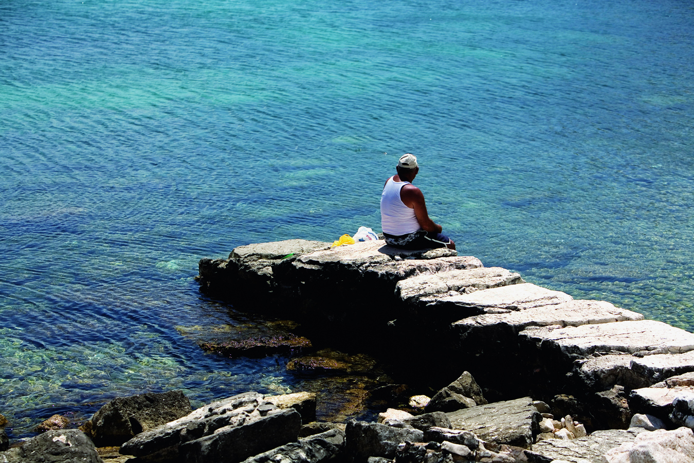
Kevin Cummins/Apa Publications
At Agía Efimía
Tzanáta lies in a fertile bowl. On a small rise in the vale is a Mycenaean tholos (beehive) tomb, excavated in 1992–4. The earliest finds date from c. 1350BC and the high quality of the artefacts – including jewellery, pottery and seals – points to the existence of a powerful Mycenaean centre. It is thought that this may identify Tzanáta as the location of Homeric Ithaca.
Between Tzanáta and Póros the road passes through the short but impressive 80-m (260-ft) deep Póros Gorge ! [map], the channel for a seasonal river. The town of Póros is divided by a rocky headland, on the far side of which is the port and fishing harbour. Ferries sail from here to Kyllíni on the mainland. The Remetzo café/bar at the foot of the jetty is pleasant and also has surprisingly good toilets. As a resort, Póros has a quiet, pleasantly run-down air. The 2-km (1.2-mile) long pebbly town beach has very clear water and there are some secluded rocky bays around the headland.
Captain Corelli’s Mandolin
This novel, by the British author Louis de Bernières and set in Kefaloniá during World War II, was first published in 1994 and became a bestseller through word of mouth. The book concerns the exploits of Antonio Corelli, a mandolin-playing captain in the occupying Italian army, and Pelagia, daughter of the local doctor. The core of the text is a love story but this is also set against the German invasion of 1943, after the capitulation of the Italians, and the subsequent massacre of Italian troops, and any islander found helping them, by the German army. Add in the Greek communist resistance, a ridiculous upper-class English intelligence officer who can only speak ancient Greek and a film tie-in starring Nicolas Cage and Penélope Cruz, shot on location on Kefaloniá, and you have the Captain Corelli phenomenon.
Although the book has been an international success with the reading public (despite being famously slow to get into), it has stirred up the passions of locals and historians alike. Their major objection is the book’s portrayal of the communist resistance (known by the acronym ELAS). Well-loved and regarded as national heroes by many Greeks – and aided in this case by Italian fighters – its portrayal in the book is suspect. The strong anti-communist – and historically inaccurate – bias to the text slanders not only the movement as a whole, but, more specifically, a surviving partisan, Amos Pampaloni, on whose life it seems to have been based, and who objected strongly to this historical mistreatment.
To the north of town is the long beach of Rágia, above which is Moní Theotókou Átrou (take the right turn just after the gorge on leaving town). This is said to be the oldest monastery on Kefaloniá, first mentioned in 1264. The beautiful road south to Skála runs along the deserted coastline. Before reaching Skála, at Ágios Geórgios, there are the (minimal) remains of a classical temple to Apollo.
The Pallíki Peninsula
On the opposite (western) side of the gulf from Argostóli is the large Pallíki Peninsula, which, away from its south coast, is barely touched by tourism. On the southeast coast is its major town, Argostóli’s traditional rival Lixoúri.
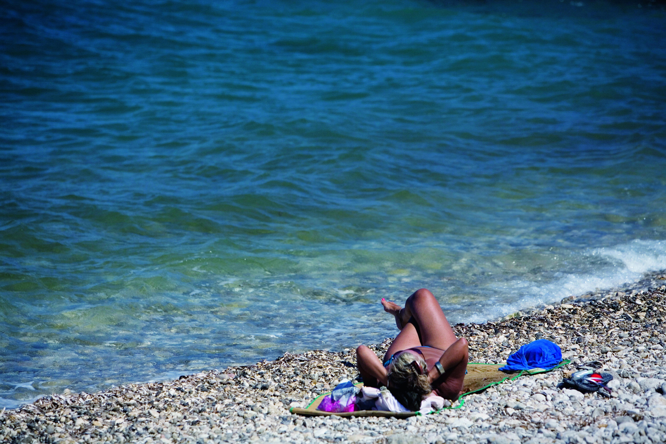
Kevin Cummins/Apa Publications
Soaking up the rays on Póros beach
Lixoúri
Easily reached by an hourly ferry (around 20 minutes), Lixoúri now plays second fiddle to Argostóli and is a sleepy, laid-back place. However, it’s worth taking the ferry for the views of the gulf alone and there are a number of sights worth seeing in the town. It is also a good jumping off point for other places on the peninsula.
Lixoúri developed under Venetian rule (becoming officially recognised in 1534), but about 1.5km (1 mile) north of town is the site of ancient Pali, one of the four ancient city states of the island. Much of Lixoúri was destroyed in 1953 but a few major buildings have been reconstructed as before. The earliest of these is the collonaded Markáto, just behind the seafront where the Argostóli ferry docks. It was built in 1824 by the British governor, Charles Napier, and was Kefaloniá’s first courtroom.
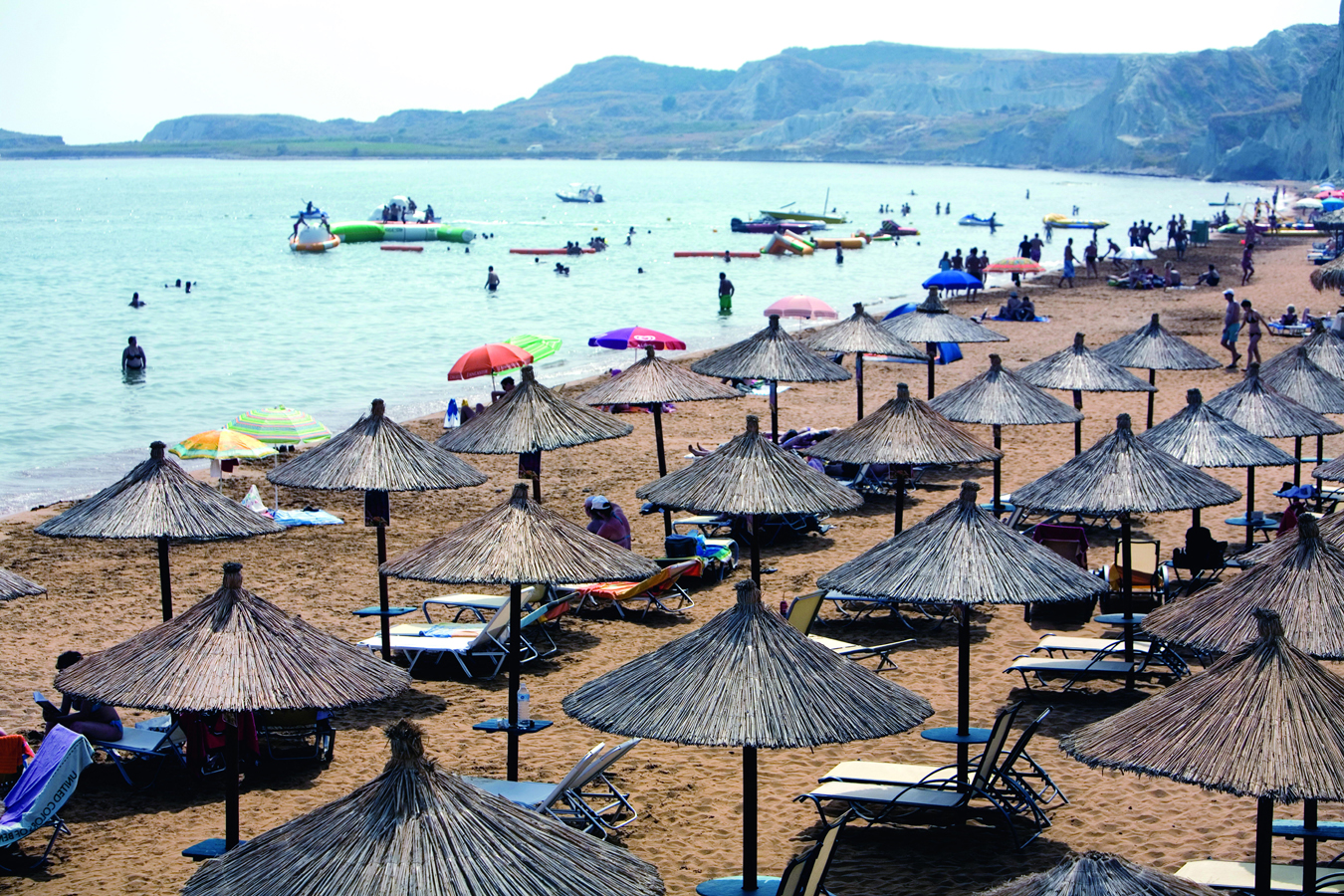
Kevin Cummins/Apa Publications
Xí beach
Further along, on Grígoris Labráki, is the Filarmonikí Skholí Pállis (Philharmonic School), in a fine neoclassical building dated 1836 (rebuilt in 1963). There are four such ‘schools’ – wind and brass ensembles, a legacy of British rule – on the island: here, in Argostóli, and in Sámi and Póros. Wind instruments including the flute of founder, Petros Skarlatos (1820–1904), are on show in the prettily decorated first-floor rehearsal room.
Also in the town, up the hill on Ekaterínis (from the port walk up Pávlou Dellapórta, then Mihaïl Avílhou) is the Lixoúri Museum and Library (Tue–Sat 9.30am–1pm; charge). Set in an attractive 1866 neoclassical building with a shady garden, the library holds around 25,000 volumes. The attached museum has three early gospels, as well as 18th- and 19th-century ecclesiastical vestments.
On the waterfront is a statue of local satirical writer and poet Andreas Laskaratos (1811–1901), his back turned on Argostóli across the water. The early nationalist writer Elias Miniates (1669–1714) was also born here.
No more rocking
Just along from Xí beach, close to Cape Akrotíri, is the Kounópetra (the name literally means, ‘rocking stone’). This flat slab of stone used to rock in the waves, but the 1953 earthquake disturbed its balance, so that it no longer moves.
The South and East Coasts
To the south is the plain of Katogís, the most fertile area on the island, planted with wheat and vines. This suffered greatly in the 1953 earthquake and the effect on the now-fractured topography is obvious. The southern coast has some lovely beaches, and the most popular and spectacular are the red sand stretches of Mégas Lákkos and its continuation, Xí @ [map].
North of Xí is the village of Madzavináta, unremarkable except for the Vitoratos Winery (summer daily 10am–2pm and 6–8pm). Beyond Madzanináta is Havriáta. As well as the church of Iperagías Theotókou, it is the location of the school of Vikentiou Damodou (1700–52), one of the first on the island. Back towards Lixoúri is Soullári, with its church of Agías Marínas, dating from 1600 and containing icons by the Cretan painters Immanuel Moskos and Theodoros Poulakis. The water dripping down in the cave at Moní Agías Paraskevís, by the beach at Lépeda, allegedly cures eye infections.
North of town, past the port of ancient Pali at Karavostási, is the monastery of the Panagías at Kehriónos; a festival is held here on 23 August. Opposite is the Sclavos Winery (daily in summer, 7pm–9pm). Some 5km (3 miles) further on is a small but important wetland area near the village of Livádi.
Anogí
The northern and western mountainous part of the peninsula is known as Anogí. At the southern end of the wild and deserted west coast is the monastery of Theotókou Kipouríon, founded in 1759. Perched high on the cliffs, this can be a spectacular place to watch the sunset. Below is the sea cave of Drakospilía (dragon’s cave). There is a spring at the nearby ruined church of Agía Paraskeví that is said to cure stomach ailments. Some 10km (6 miles) up the coast – longer by the winding roads – is undoubtedly the finest beach on the peninsula, Petaní £ [map], a beautiful stretch of pebbles backed by steep cliffs.
Before reaching Petaní you pass through the village of Kodogenáda. In addition to its restored 18th- and 19th-century vernacular architecture, the village is home to two important churches, the 12th- to 13th-century Agíou Georgíou and Agíou Ioánni tou Theológou, with its impressive carved iconostasis.
The North
The north of Kefaloniá escaped the worst of the ravages of the 1953 earthquake and so has much surviving traditional architecture. The landscape is barren and spectacularly steep, particularly along the west coast road, which is the best, if most alarming, ride on the island.
Northwest Coast Villages
From Argostóli the road takes you past the turning for the village of Davgáta, the location of the Museum of Natural History (summer Mon–Fri 9am–1.30pm,, Sat–Sun 9am–1pm; winter Sun–Fri 9am–1.30pm; charge). Set up as an educational centre and library, it provides a useful introduction to the local geology, flora and fauna.
The coast road continues to Fársa, where it starts to climb. Above is the old village, ruined in 1953. Below, and along this whole stretch of coast, you can see rows of fish farms. Beyond Angónas the view along the northwest coast opens up – a steep line of cliffs falling into blue sea. Down to the west are the beaches of Agía Kyriakí and Voúti. The long, exposed stretch of sand at Agía Kyriakí can attract flotsam but the small bay at Voúti, down a rough unmade road from the village of Zóla, is cleaner. Although the water isn’t the island’s clearest, it can get very warm here, even in early summer.
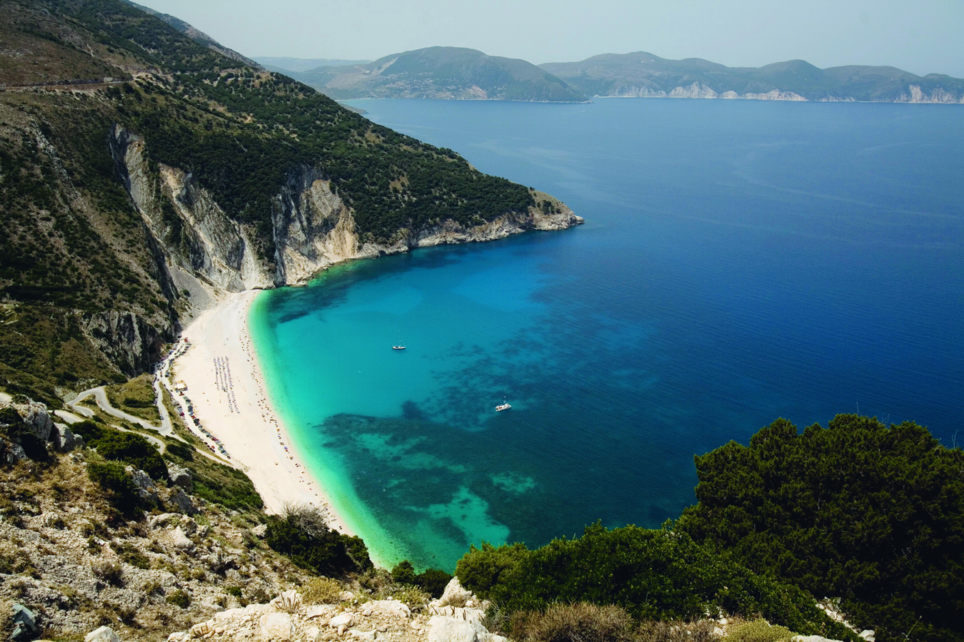
Kevin Cummins/Apa Publications
The bay of Mýrtos
From here onward the sharp hairpins of the road hug the cliff edges. This is Kefaloniá’s equivalent of the oceanside Highway 1 in California. The views – back to the largely inaccessible north coast of Pallíki and forward to Ássos – are wonderful.
Mýrtos and Ássos
Some 10km (6 miles) beyond Angónas the road turns sharply inland, forming a large hairpin around the truly spectacular bay of Mýrtos $ [map]. The best place to see the beach and cliffs is from the lay-by on the main road on the northern side of the bay. Looking down, you see a crescent of bright white beach bordered by the cornflower blue of the sea and surrounded by sheer cliffs. The way down to the beach is via the steep but well-paved road from Divaráta. Once there, it does not quite live up to its view from above. What appeared to be white sand turns out to be small pebbles, and it can get very busy. The beach also feels too organised, with sunbeds, a café and lifeguards – essential, as the sea can be dangerous here.
From Divaráta the road continues east (turn left before the village to go north). The road crosses the island, through a gap in the mountains, to Agía Efimía, passing on the way a couple of now derelict Venetian windmills that were previously used for pumping water up from wells.
The road north carries on in a similarly spectacular fashion. About 3km (2 miles) after a viewpoint lay-bay is the steep descent to Ássos % [map]. At the bottom is Ássos village, with its charming natural harbour. The village retains much of its traditional architecture (reconstructed with the help of the City of Paris, commemorated by a plaque in Platía Parísion), and in spring and early summer is covered in flowers. The small beach in the harbour is fairly clean but just round the coast are some beautiful coves, only accessible by boat.

Kevin Cummins/Apa Publications
View of Ássos
Picturesque prison
Dating from the late 16th century, the fortress at Ássos was used as a prison until 1953. The prisoners tended the vines that covered the hillsides and clifftops above Ássos village.
Connected to the village by a short isthmus is an enormous Venetian kástro (fort) on top of a hill. Begun in 1593, it served to protect the Venetian fleet and island from attack by the Ottomans and pirates. In more recent history it was used as a prison (see box). The winding path takes you up through pine woods and gives fine views over the harbour and neighbouring coast. Apart from the walls and the lovely curving entrance, little remains inside the fort, although a new visitors’ centre has been sensitively built in the middle.
Around Fiskárdo
The road beyond Ássos ends up at the harbour of Fiskárdo at the northeastern tip of the island. This is perhaps the most immediately attractive part of the island, with much surviving traditional vernacular architecture. Two of the most attractive hill villages here are Vasilikiádes, on the main road 10km (6 miles) before Fiskárdo, and Mesovoúnia. The latter is on the eastern road to Agía Efimía. This passes through a string of very pretty mountain villages – Varý, Karyá and Komitáta – and the views over to the neighbouring island of Itháki are magnificent. The only sounds across this landscape, with its dry stone walls and abandoned stone houses, are the tinkling of cow and sheep bells. Water is at a premium here, and there are a number of rainwater cisterns with concrete covered catchments above. The view down to Agía Efimía from Komitáta is breathtaking.
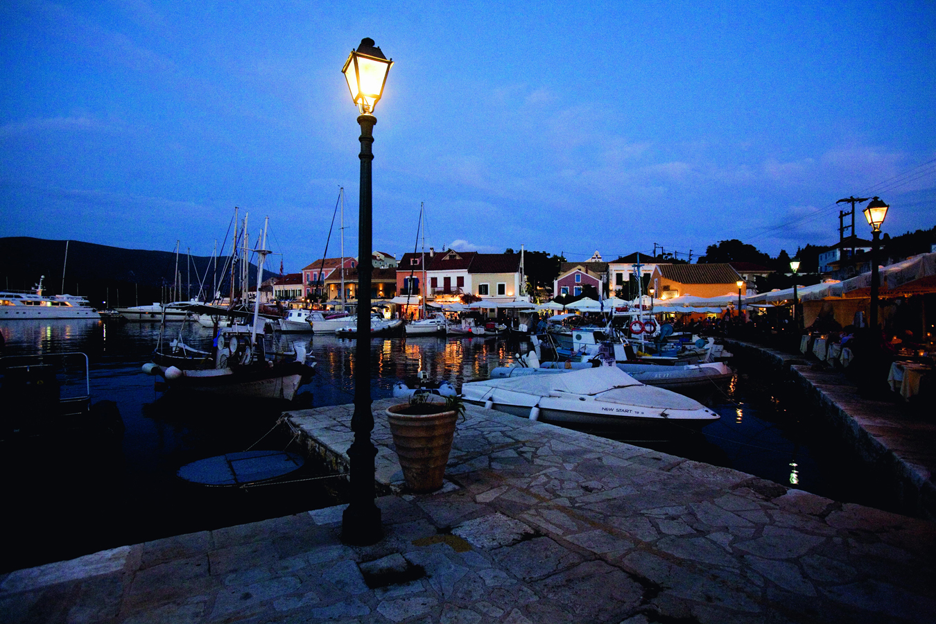
Towards Fiskárdo itself you pass through Mánganos, with its excellent greengrocer (O Manganaras), full of wonderful local fruit and vegetables, and olives, oil and wine, and Andipáta Erísou, location of a superb estiatorío, To Pefko, and the turn-off for Dafnoúdi beach. Fiskárdo ^ [map] itself survived the 1953 earthquake intact, and has cashed in on this with a vengeance. The admittedly very attractive harbourfront is backed by pastel-shaded housing, now largely expensive restaurants, cafés and boutiques. The harbour, for better or worse, is also greatly beloved by yachters, particularly those on flotilla holidays (it’s fun to sit on the quayside watching novice sailors try to bring their boats in for mooring).
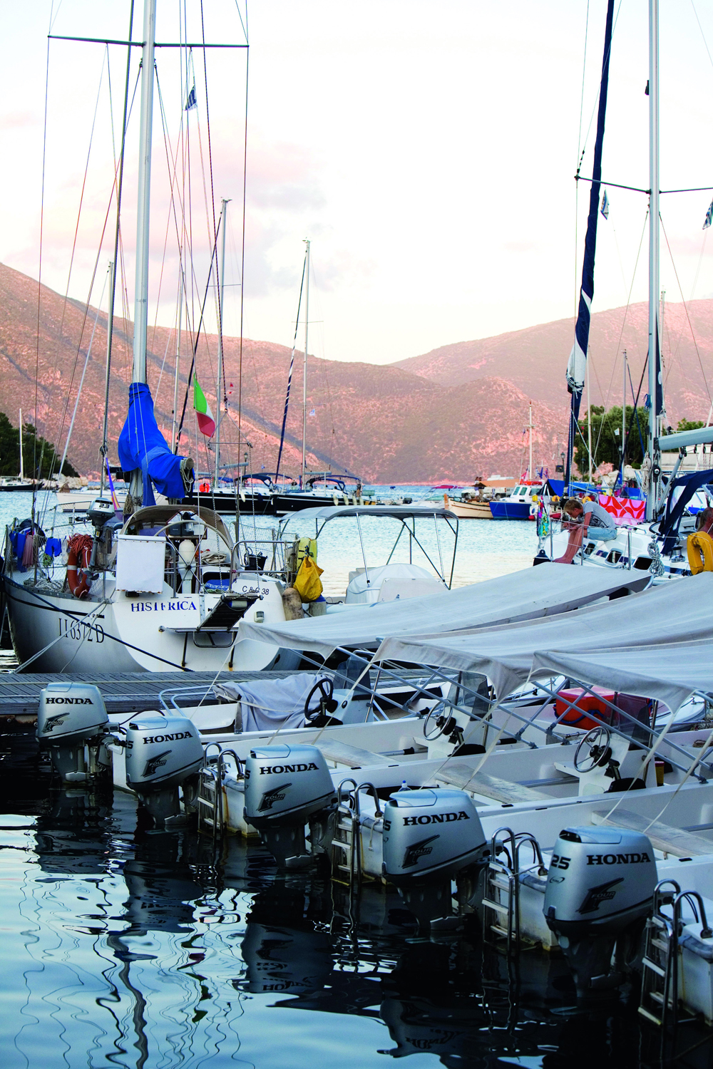
Kevin Cummins/Apa Publications
Fiskárdo harbour
The port takes its name from Robert Guiscard, a Norman soldier who died here in 1085, but is thought to be the location of ancient Panormas. There is also a Roman cemetery (2nd–4th centuries AD). Towards the Venetian lighthouse, on the northern headland, is an interesting church, started by the Byzantines, but largely Norman in execution (c.12th century). At the southern end of the harbour is the Nautical and Environmental Museum (summer Mon–Fri 10am–6pm, Sun 10am–2pm; donations encouraged). Run by volunteers from the FNEC European exchange programme, it consists of one room with some interesting exhibits, including the skeleton of a Cuvier’s beaked whale, found dead on Émblisi beach in 1995, and displays describing local birds and mammals and their habitats.
The northern coast has some wonderful small and quiet beaches, all of which have the clearest imaginable water. Some of the little bays, with their white pebble beaches, are only accessible by boat (easily hired for the day in Fiskárdo from Regina’s boats). The two most easily accessible from Fiskárdo are, to the north, Émblisi and, to the south, the beautiful bay of Fóki. Heavenly Dafnoúdi is reached by a 20-minute walk down through pine trees from the village of Andipáta Erísou. Tiny Alatiés, to the south of Dafnoúdi, could be lovely, but attracts tar (and an unfortunate smell), but nearby Agía Ierousalím & [map] is a lot cleaner and has one of the friendliest tavernas on the island, Odisseas.
Kevin Cummins/Apa Publications
Fiskárdo waterfront by night