West of Nakuru, the Uganda Highway climbs the western wall of the Rift Valley by a less spectacular route than its descent on the eastern side. It is a steep climb nonetheless since Nakuru 1 [map], Kenya’s fourth largest town, lying on the valley floor, is around 1,800 metres (6,000ft) above sea level, while the highest point the road reaches above the western wall is well over 2,700 metres (9,000ft).
At that point, 8km (5 miles) off the main trunk route, the small farming town of Molo 2 [map] is set in open high-altitude downs reminiscent of Scotland – more so with the chill and mists of the morning. It’s not surprising that the area attracted the early white settlers, who saw it as prime sheep country. The result is the superb ‘Molo’ lamb, a staple on many Kenyan dinner tables.
Close by Molo, near Mau Summit, the trunk route splits. The Trans-Africa Highway heads northwest across the highland plateau west of the Rift to Eldoret, eventually reaching the Uganda border at Malaba. The other road heads southwest as the main route to Lake Victoria.
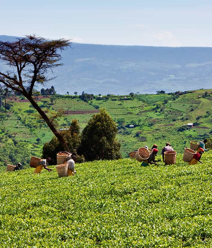
Tea plantation, Kericho.
AWL Images
Eldoret
Not far from the fork, the highway crosses the equator and the wide level plain of the Uasin Gishu Plateau to the town of Eldoret 3 [map] – or ‘64’ as it’s sometimes called, since it was set up by milepost 64 of an ox-wagon route from Londiani forged by voortrekkers – Dutch-speaking farmers – from South Africa.
When these settlers arrived, prior to World War I, the plateau was teeming with wildlife, rather like the Athi Plains around Nairobi or the Mara-Serengeti. The game soon disappeared, however, since the farmers turned the Uasin Gishu into Kenya’s main granary. Maize and wheat fields stretched from horizon to horizon, and still do in parts. Founded to service this agricultural wealth, Eldoret may be somewhat lacking in character, but it is now the fifth largest town in Kenya, and the fastest growing, boasting a mushrooming industrial belt, and an airport of international standards. To the northeast of Eldoret, the breathtaking but little visited Kerio Valley/Kamnarok National Reserve 4 [map] is bisected by a nippy asphalt road that descends into the Rift Valley near Lake Baringo.
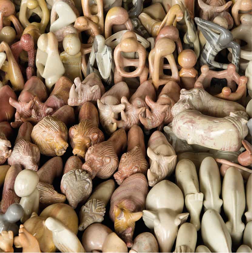
Soapstone carvings, Kisumu.
Ariadne Van Zandbergen/Apa publications

Mount Elgon
Northwest of Eldoret, Mount Elgon 5 [map] dominates the horizon, at least on the rare occasions when it is not shrouded in cloud. At 4,321 metres (14,178ft), Elgon is around 880 metres (3,000ft) short of Mount Kenya in terms of altitude, but the circumference of its base makes it a bigger massif. The upper slopes of this extinct volcano support a cover of lush montane forest giving way to moorland at higher altitudes, and are protected within Mount Elgon National Park (www.kws.go.ke; daily 6am–6pm), one of the country’s least-developed sanctuaries.
Tip
The dense tall forest and a lack of roads inhibit game viewing on the mountain, but it is possible to hike up to the summit, across moorlands of giant heather. Mount Elgon Lodge, a converted farmhouse with wonderful views, midway between Kitale and the peak, makes a serviceable base, though the self-catering Kapkuro Bandas at the park entrance are much better value. There is also a campsite.
Misty morning on the footslopes of Mount Elgon.
Ariadne Van Zandbergen/Apa publications
While the volcanic soils of Kenya’s mountain ranges are fertile, they don’t seem to yield the minerals the elephants crave – except at rare salt-licks, one of them in the distinctive Kitum Cave 6 [map], which has attracted the big mammals for centuries. Quite literally, the elephant mine the cave, gouging out the walls and extending the shafts hundreds of feet into the mountain.
At the foot of Elgon stands Kitale 7 [map], the northernmost of the agricultural towns built by the settlers in the colonial era. With Elgon’s slopes to the west and the high Cherangani Hills to the east, the agriculture about Kitale is as diverse as it can get in Kenya. Beef and dairy farms, coffee estates, wheat and maize fields surround the town, and on the higher slopes are orchards of temperate European fruits, like apples. It is a more subdued and greener town than Eldoret, though sightseeing is limited to the Kitale Museum (www.museums.or.ke; daily 8.30am–6pm), whose indoor ethnographic and natural history displays are supplemented by a snake pit housing two massive crocodiles, and a pleasant walking trail through a patch of riverine where a variety of monkeys and birds might be seen. In addition, the privately run Treasures of Africa Museum (tel: 0722 547 765) showcases the personal collection of African artefacts of the owner-cum-curator John G. Wilson, while the Kitale Nature Conservancy (www.kitalenature.or.ke) is located on the road to Lodwar.
Swamps and forests
About 30km (18 miles) northeast of Kitale, Saiwa Swamp National Park 8 [map] (www.kws.go.ke; daily 6am–6pm) is Kenya’s smallest, at only 300 hectares (740 acres). It was opened in 1974 to protect the semi-aquatic sitatunga antelope, notable for its wide-splayed hooves, which allow it to walk on the soggy surface of the swamp. Though it is not teeming with big game, Saiwa is also home to several other forest and swamp dwellers. These include the De Brazza’s monkey, which (like the sitatunga) has a very limited distribution in East Africa, along with the African clawless otter, giant forest squirrel, black-and-white colobus, bushbuck and grey duiker.
Unusually for a national park, Saiwa can be explored only on foot. A nature trail runs through the heart of the park, incorporating a long footbridge across the swamp, and several elevated viewing platforms overlooking it. The most productive spot for wildlife viewing is Platform Four, where you are almost certain to see sitatunga if you arrive before 8am, and might also glimpse African clawless otters and De Brazza’s monkeys. The birdlife here, generally most active between 8am and 10am, is amazing: Saiwa is the best place in Kenya to look for the spectacular Ross’s turaco, the secretive grey-winged robin-chat (sometimes seen on the footpath close to Platform Four) and the yellow-billed barbet, while other specials include the double-toothed barbet, blue-headed coucal, crowned crane and black sparrowhawk.
From Elgon, the country to the south falls away fairly gently towards Lake Victoria and the Nile Valley. The highway passes Webuye 9 [map], which has heavy-chemical and sugar manufacturers. The area features dense settlement, principally of the Luhya peoples. Their headquarters are in the township of Kakamega, which is 42km (26 miles) to the south of the highway.
Not far from the town is the Kakamega Forest ) [map], a jungle-like centre of significant ecological interest since it is a relic of the equatorial rainforest that once spread from West Africa to the East African coast. Though it lies somewhat off the main tourist trail, Kakamega is an increasingly popular destination for butterfly lovers, birdwatchers and other specialists looking for species more normally associated with central and west Africa. Sykes monkey and black-and-white colobus are both very common, and overnight visitors with a spotlight stand a good chance of picking out the nocturnal potto, a sloth-like primate distantly related to the better-known bushbabies. In addition, around 10 percent of the reserve’s 300 bird species occur nowhere else in Kenya, most alluringly perhaps the great blue turaco, flocks of which fly clumsily between the trees like psychedelic turkeys.
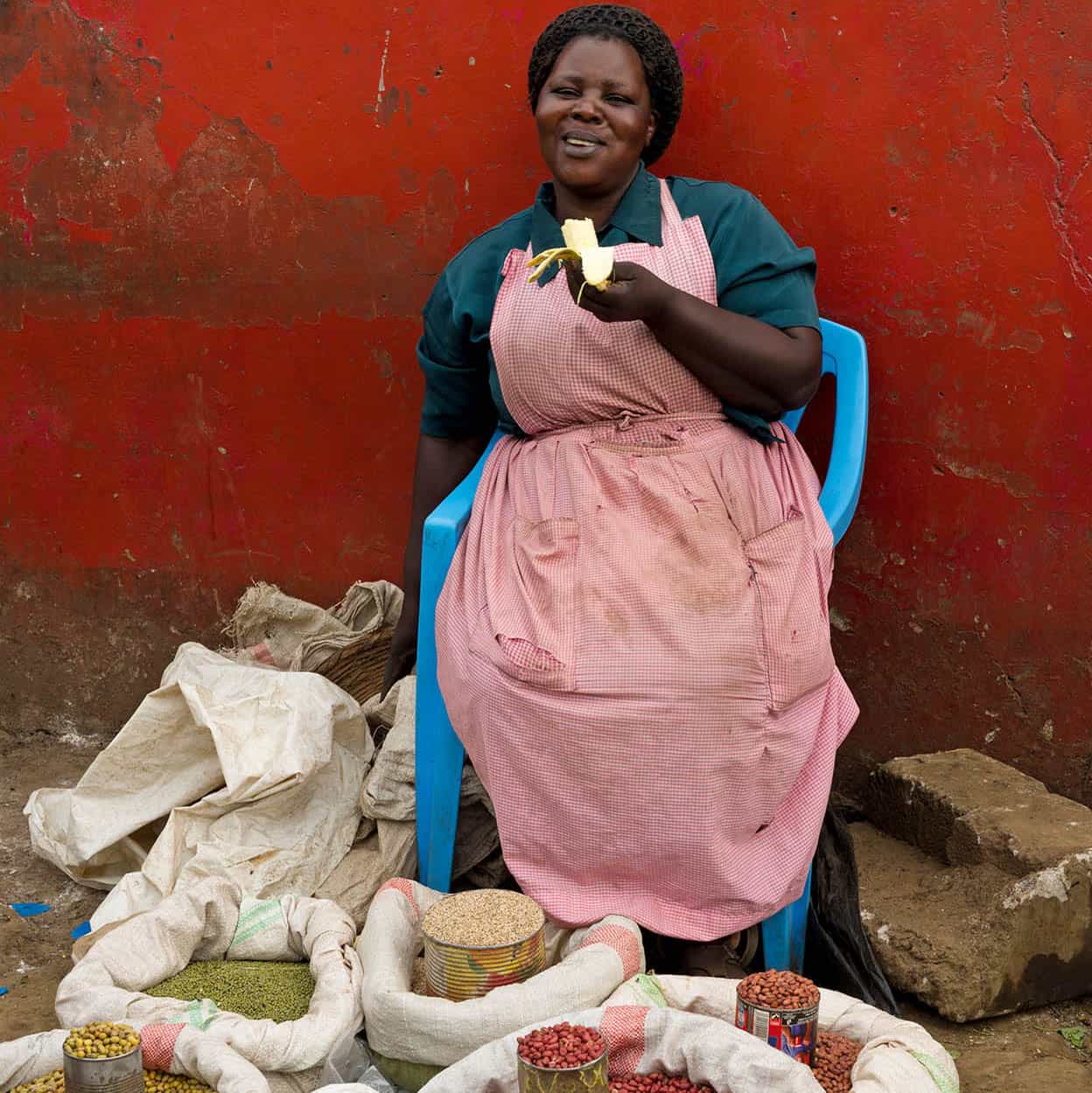
Stallholder, Kisumu municipal market.
Ariadne Van Zandbergen/Apa publications
Around 200 sq km (72 sq miles) of undisturbed forest remains, divided into the two main sectors. These are the Kakamega National Reserve (www.kws.go.ke; daily 6am–6pm), which is managed by Kenya Wildlife Service and lies to the north of Kakamega on the east side of the Webuye Road, and the Kakamega Forest Reserve (www.kws.go.ke; daily 6am–6pm), which falls under the Department of Forestry and lies to the east of town along a dirt road through Isecheno. The forest reserve is generally regarded to offer the best birding, and it is also where the bulk of the accommodation lies, including the upmarket Rondo Retreat (www.rondoretreat.com) and very affordable KEEP Bandas (www.kakamegaforest.com/bandas.html). However, dedicated birders will also want to check out the national reserve, which protects a slightly different selection of bird species, and has a small banda and camping site.

Kakamega Forest Reserve.
Ariadne Van Zandbergen/Apa publications
Kisumu
Kenya’s third-largest city, with a population of around 500,000, Kisumu ! [map] stands on the shores of Lake Victoria about 48km (30 miles) south of Kakamega, where it forms the main centre of economic activity for the region’s four million Luo people. Founded in 1901 as the lakeshore terminus for the Uganda Railway, the town was originally known as Port Florence (after Florence Preston, the wife of a railway engineer), but later reverted to its original Luo name, which means ‘Place of Barter’. The town was developed not only as the major administrative centre for most of western Kenya, but also as an important regional port with shipbuilding and repair facilities.
Following the dissolution of the original East African Community – a political and economic arrangement whereby Kenya, Uganda and Tanzania shared steamer and general communications services – in 1977, Kisumu fell into economic decline. For much of the rest of the 20th century, the once bustling town centre, all potholed roads and flaking walls, exuded an atmosphere of economic stagnation, and even today the port and associated railway station, though still functional, are barely more than that. However, Kisumu itself has undergone a major post-millennial revival, thanks to its diversification into light industry and communications, to the extent that it now comes across as a real city, with a genuine buzz of energy about its streets.
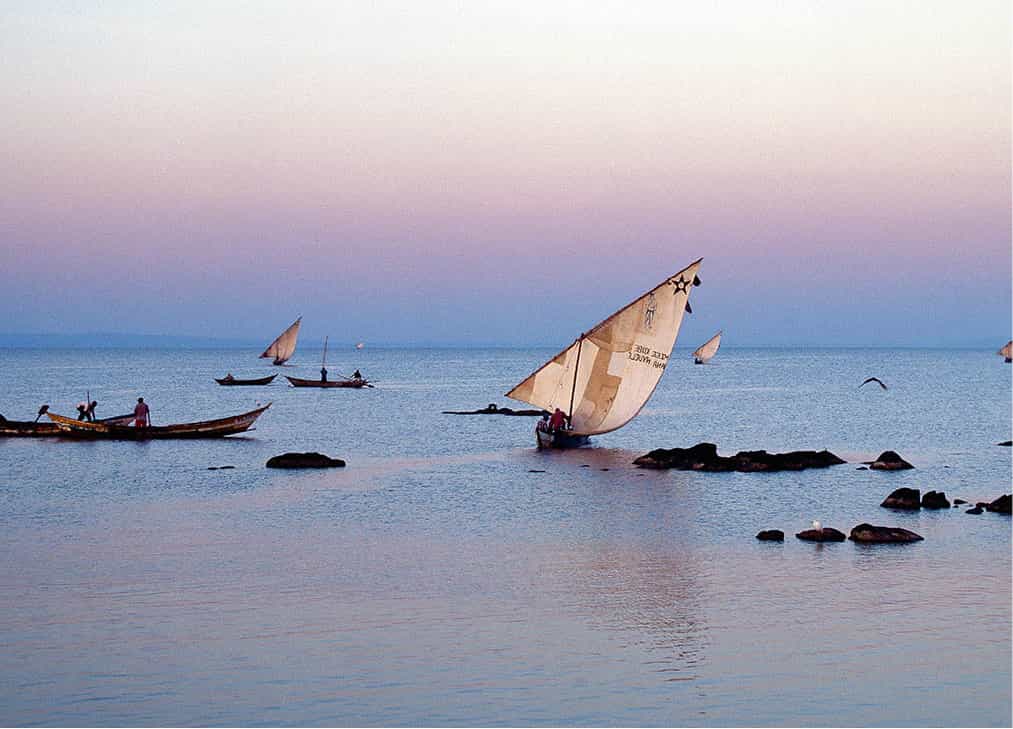
Luo fishing boats off the eastern lakeshore of Lake Victoria.
AWL Images
As with so many Kenyan towns, Kisumu is not exactly over-endowed when it comes to scintillating sightseeing opportunities. Despite its location on Africa’s largest lake, it has no waterfront worth talking about, and the architectural highlights amount to a pretty Jamia Mosque and Hindu Temple in the city centre. There is also an excellent central market, at the junction of Kenyatta Avenue and the main road to Nairobi, while the nearby Kisumu Museum (www.museums.or.ke; daily 8.30am–6pm) incorporates an aquarium housing several cichlid and other fish species associated with Lake Victoria. About 2km (1.2 mile) south of the city centre, the Kisumu Impala Sanctuary (www.kws.go.ke; daily 6am–6pm) is home to a small herd of the eponymous antelope (which you are certain to see in larger numbers and less-contrived circumstances in almost any of the country’s savannah reserves or national parks) and a thoroughly depressing small zoo.
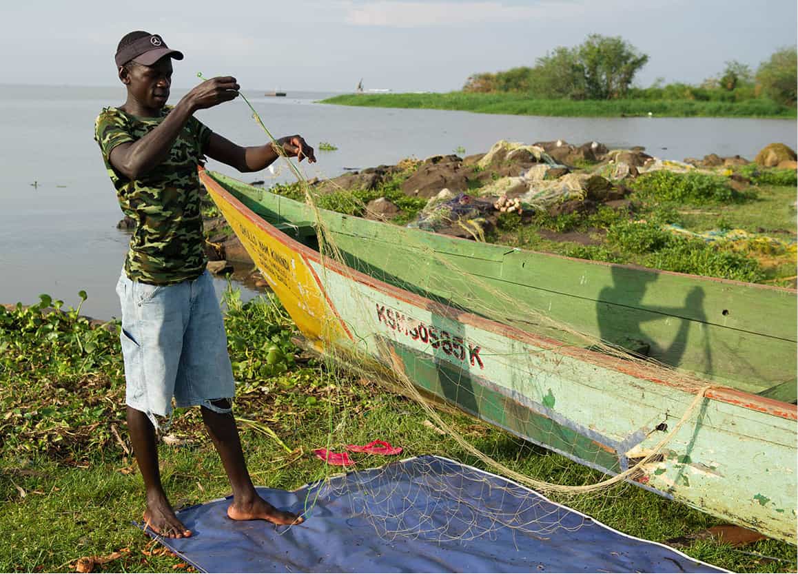
Fisherman fixing nets, Dunga Bay, Lake Victoria.
Ariadne Van Zandbergen/Apa publications
An attractive alternative base to Kisumu, only 5km (3.1 miles) south of the city centre, is the small village of Dunga @ [map], where the pleasant Kiboko Bay Hotel offers tented accommodation in a lakeshore location that attracts plenty of water-birds and occasional hippo visits. The centre of activity here is the Dunga Beach fisheries compound, where you can watch traditional dhows glide serenely onto the water at dusk, usually to return at around 11am with the day’s catch – attracting hordes of very habituated egrets, storks and hamerkops. It is also a good place to arrange boat trips to look for hippos and to see the abundant water birds in a protected breeding colony in the nearby marshes.
Arab sails on Lake Victoria
Lake Victoria is not only the largest lake in Africa, but also the second-largest freshwater body anywhere in the world, extending over some 68,500 sq km (26,500 sq miles), an area comparable to that of the Republic of Ireland. Shared between Kenya, Tanzania and Uganda, the lake supports several million people, including the Luo of Kenya, many of whom are still fishermen. Dunga is one of many places on the lake where you can see their fleets of traditional fishing dhows, whose white lateen sails, set against a deep blue background, appear to be out of the romantic myths of the Sinbad coast. And there is, in fact, a connection to the coast, dating back to the time when the Arab slavers were marauding around Victoria, building boats for the lake in the same style as their dhows on the ocean.
President Obama’s Kenyan roots
Former US President Barack Hussein Obama II is the son of Barack Hussein Obama Sr, a Luo economist born in 1936 to a mixed Islamic-Christian family near Kendu Bay, and raised in the village of Kogelo to the west of Kisumu. In 1959, Obama Sr became the first foreign African student to enrol at the University of Hawaii, on a scholarship organised by the renowned Luo politician Tom Mboya. It was here that Obama Sr met President Obama’s mother Ann Dunham, who he married bigamously, claiming untruthfully to be divorced from his Kenyan wife Kezia, with whom he had already had two children.
Obama Sr returned to Kenya in 1964, three years after the birth of the future president. There, he worked for several years as a senior government economist, an initially promising career derailed by the combination of a severe drinking problem and the unspoken anti-Luo policy pursued by President Kenyatta in the aftermath of Tom Mboya’s assassination in 1969.
Direct contact between Barack Obama Sr and Jr was limited to the father’s one-month visit to the US in 1971, an encounter to which the US president attributes his lifelong enthusiasm for basketball and jazz. In 1982, Obama Sr died in a car accident at the age of 46. However, several members of the president’s extended family live in Kenya, among them his step-grandmother Sarah Onyango Obama.
A good place to watch the fishing dhows in action is the small town of Kendu Bay £ [map], about an hour’s drive south of Kisumu. Try to be at the out-of-town jetty at noon, when dozens of dhows land there, complete with the day’s catch. Kendu Bay boasts two other diverting attractions. The first is a handsome and surprisingly large Tawakal Mosque, set along the road between the town centre and the jetty. The other, about 2km (1 mile) south of town, is Simbi Nyaima, a pretty green crater lake whose shallows occasionally support large numbers of flamingo. Simbi Nyaima means ‘Village That Sank’, an allusion to the Luo legend that the lake was created when a fearful storm engulfed what was formerly a village, to punish its inhabitants for refusing to help an old woman who had arrived there looking for food and shelter.

Tawakal Mosque, Kendu Bay.
Ariadne Van Zandbergen/Apa publications
If you want the (somewhat limited) challenge of tackling one of Lake Victoria’s giant Nile perches, the place to stay is Rusinga Island $ [map], where there is a comfortable lodge for fishermen in idyllic surroundings, or Mfangano Island % [map], where there is a tented camp. The introduction of these huge fish into the lake in the 1950s has been controversial. In the 1980s there was an explosion in their numbers and, as a result, many indigenous species of fish have since disappeared, particularly the small cichlids: Nile perch now account for about 80 percent of the fish in the lake. In commercial terms, this has been a great success, generating a multi-million dollar processing and export industry. However, scientists maintain that it has had a disastrous impact on the lake’s ecosystem.
Kenya’s main sugar-growing area lies close to Kisumu, in the Nyando Valley at the head of the Winam Gulf. Production is from both large estates as well as from smallholders in a policy unusual in Africa for its tolerant flexibility.
On the north side of the gulf, about 30km (19 miles) from Kisumu, is one of Kenya’s smaller national parks, the 4-sq-km (1.5-sq-mile) Ndere Island, which has been a sanctuary since 1986.
On the far side of the gulf from Kisumu, in the lee of Homa Bay town, lies the Ruma National Park ^ [map] (www.kws.go.ke; daily 6am–6pm). This is mostly uninhabited because of tsetse fly and the sleeping sickness it carries, which is no worry to in-and-out tourists. Although it is the refuge for Kenya’s remaining roan antelope, the park is rarely on tourist itineraries.
Tea plantations at Kericho
Back to the fork at Mau Summit, the southern highway runs some 50km (30 miles) through forest reserve and plantations before reaching the ‘tea capital’ of Kericho & [map]. High ground, temperate climate and high rainfall off Lake Victoria make the district ideal for the production of tea.
When the Europeans first arrived, much of the area was under tall montane forest. With a massive import of capital, the land was cleared and planted so that ridge after ridge is now patterned a bright, almost apple-green as one of the most productive tea areas on earth. A relict of the original forest can be seen at the Chagaik Arboretum, which lies on a tea estate a few kilometres out of town along the Nakuru Road, and supports an impressive range of natural (and introduced) trees inhabited by a conspicuous troop of black-and-white colobus monkey and plentiful forest birds.
From Kericho a major road descends to Kisumu, while another holds to the high ground through Sotik, Kisii * [map] and eventually to the Tanzanian border. The Kisii Highlands, the home of the Gusii people, are exceptionally rich, although very little of their land is now left fallow. As in other areas of the Western Highlands, the population growth is exceptionally high and causes a constant migration of people to other parts of the country in search of employment or new land to cultivate.
Hidden away in Southwest Kenya, the agricultural contribution that the Gusii people make to the country’s economy is often overlooked. Yet they produce tea, coffee and pyrethrum – major foreign exchange earners – in considerable quantity. Unlike in Kericho, where the tea plantations are owned and run by large commercial concerns backed by international capital, production by the Gusii and their neighbours is mainly from smallholdings. For a century or more, conventional wisdom held that tea could only be efficiently grown on large plantations. This was challenged by Leslie Brown, famous as an authority on birds of prey, but also Kenya’s senior agriculturalist at the close of the colonial era.
He was right: Kenya is now the world’s third-largest tea producer after China and India, and more than half the output is being collected from thousands of individual African planters on small plots of tea-growing land. As a result, the local tea economy is particularly robust and the same policy is now being applied to the country’s sugar production.
Because Kisii and the southwest of Kenya generally are so densely populated, it’s not wildlife country and thus off the main tourist circuits. The visitor is unlikely to have any contact with the Gusii or their culture, except through their soapstone carvings, attractive if somewhat stereotyped artefacts, mostly animal figurines dyed black, red or blue, or left in the natural pinks, whites and greys of the soft stone.
From Kisii, it is possible to travel south to the Tanzanian border, which is 98km (61 miles) away at Isebania. However, most visitors turn off east on the way – at Suna, 77km (48 miles) from Kisii – and then head through Lolgorien (the scene of a minor gold rush in the interwar years), down the Siria escarpment and into the Maasai Mara.
The Luo
Kenya’s second most numerous ethnic group, the Nilotic-speaking Luo are traditionally fishermen and farmers, as well as being the main rivals to the politically dominant Kikuyu.
The most populous of the non-Bantu-speaking ethnic groups in Kenya, the 6 million-strong Luo of the Central and South Nyanza districts, around the Winam Gulf of Lake Victoria, represent the most vigorous of several southward drives of Nilotic-speakers from the Sudan.
The first wave of Luo immigrants probably arrived in Nyanza about five centuries ago. The arrival of the last of the Luo groups in the 18th century coincided with the thrust into South Nyanza, which caused the Gusii, Kuria and Suba to retreat and also brought the Luo people into contact with the Maasai and the Kipsigis.
Cattle and constant migrations in search of pastures for their herds dominated the life of the first Luo immigrants. But they adjusted to growing population pressures by adopting a sedentary way of life in relatively isolated homesteads. Although cattle continued to dominate ritual and economic activities, agriculture and fishing became increasingly important for subsistence. These people still maintain their migratory instincts – tens of thousands seeking employment have flooded the major towns, especially Nairobi and Mombasa.
Foremost among Kenya’s people in their fishing skills, the Luo today mainly use gill nets and long-line fishing to catch tilapia and other fish. Extensive use is still made of basket traps, either on their own or in conjunction with the osageru fish maze and the kek river fence at the mouths of rivers. The Luo formerly used crude log and bundle rafts of papyrus or saplings on Lake Victoria. In deeper water, hollowed-out log canoes or plank-built craft of considerable complexity and size are employed.
The dhow-type fishing boats used in offshore fishing were first constructed on the Winam Gulf by Arabs and later adapted and built by the Luo people themselves. They have also adopted the more advanced Ssese canoe of the Baganda, and many are now moulded in glass-fibre and often powered by outboard motors.
The head of a homestead has his own hut (duol) built near the cattle enclosure. Here, important matters relating to the household and community are discussed among the clan elders. Wives have their individual huts and may not sleep in the duol. Traditionally, a young woman whose suitor had given her parents enough cattle would be carried off by force by the bridegroom and his friends. Today, bride prices are often paid in cash in lieu of cattle and marriages are formalised by Christian rite.
Political activity
The Luo are an articulate, community-conscious people, and were prominent in Kenya’s struggle for independence, providing many leading trade unionists and politicians, including the late Tom Mboya and former Vice-President of Kenya, Oginga Odinga. This political activity has extended into the modern era, with rivalry between the Kikuyu supporters of Mwai Kibaki and followers of his Luo rival Raila Odinga having been the major cause of the outbreak of lethal violence that followed the 2007 elections. The son of the former Vice-President, Odinga took office as Prime Minister of Kenya between 2008 and 2013.
Luo folklore has been imaginatively captured in the modern fiction of Tom Okoya and Grace Ogot, whose 1966 novel The Promised Land was the first published by a Kenyan woman.
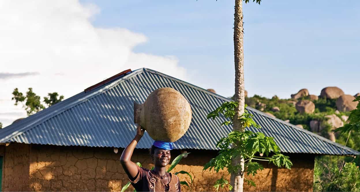
Luo woman near Kit Makayi.
AWL Images