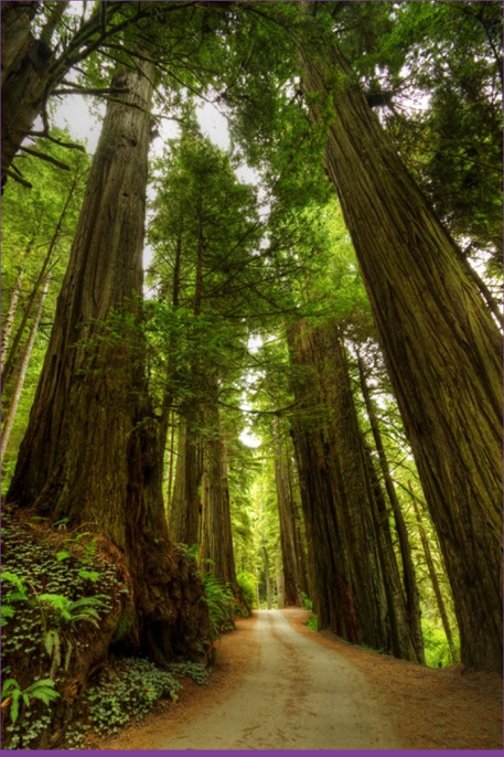
Tall Trees © Shutterstock
There are more than 200 miles of hiking trails at Redwood National and State Parks. The best of the bunch explore the Pacific coastline or old-growth redwood forests.
Coastal Trail traces the coast almost continuously for some 35 miles. There’s one major gap at the US-101 Bridge over the Klamath River. The rest of the trail is broken into seven distinct sections that provide great opportunities for beach-combing, whale-watching, tidepool exploring, and birding. Farthest north is the Crescent Beach Section. Before you reach the trail, Crescent Beach Overlook provides an excellent vantage point to survey the ocean for gray whales during their spring migration. Continuing south are the Last Chance and Demartin Sections. Longer and more strenuous, they provide greater solitude. Backcountry campsites are available along these trails. Further south are the 5.5-mile Klamath Section and Klamath River Overlook (another excellent perch to peer across the Pacific). The 4.5-mile Flint Ridge Section provides a unique combination of old-growth redwood forests and ocean vistas. (Most redwoods grow at least a mile or two away from shore as salty water inhibits growth.) Gold Bluffs (4.8 miles)—where hikers pass through a 30-foot high wall of ferns at Fern Canyon and spend the night at Ossagon Camp—is the next stretch. Last is the Skunk Cabbage Section. If you can put up with the smell of the trail’s namesake, you will be rewarded with views of grassy hills, massive redwoods, and wildflowers (seasonal) along this 5.25 mile trail.
At 379-feet, Hyperion is the world’s tallest tree, but you won’t find a trail leading to it. It’s location is kept secret so visitors do not trample the surrounding soil. Still, there are plenty of great hiking trails with trees that tower more than twice as high as the Statue of Liberty. Tall Trees Trail, located off Bald Hills Road just north of Orick, is the best choice for giant redwoods. A free permit, obtainable at Thomas H. Kuchel Visitor Center, is required to visit the area. Only 50 permits are given out each day on a first-come, first-served basis. If you’re unable to secure a permit, check out Boy Scout or Stout Memorial Grove Trails in Jedediah Smith Redwoods State Park. Another alternative is Lady Bird Johnson Grove Trail, which begins just off Bald Hills Road. For a longer hike, the 12-mile James Irvine/Fern Canyon/Davison Road/Miners Ridge Loop in Prairie Creek Redwoods State Park is as good as it gets. Temporary footbridges are removed from some trails during the winter rainy season.
North
Trail Name | Region | Trailhead (# on map) | Length (One-way distances, except loops) | Notes
Leifer – Ellsworth Loop | JS | Off Walker Road (1) | 2.6 miles | Follows old Crescent City Plank Road
Simpson – Reed | JS | US-199 (North Side) (2) | 1.0 mile | Loop trail through old-growth redwoods
Little Bald Hills | JS | Howland Hill Road (3) | 3.3 – 8.0 mi | Backpack • Bikes and horses allowed
Stout Memorial Grove (favorite) | JS | Howland Hill Road (4) | 0.5 mile | Short loop with fantastic old-growth redwoods
Boy Scout Tree (favorite) | JS | Howland Hill Road (5) | 2.8 miles | Old-growth, with spur to a double redwood
Mill Creek | JS | Howland Hill Road (6) | 3.0 miles | Hike provides access for fishing or photos
Trestle Loop | DN | Mill Creek Campground (7) | 1.0 mile | Follows old railroad trestles, berries
Damnation Creek | DN | Milepost 16 on US-101 (8) | 2.2 miles | Ancient redwoods and Pacific Coast
Yurok Loop | DN | Lagoon Creek Picnic Area (9) | 1.25 miles | Family-friendly views of False Klamath Cove
South
Ossagon | R/PC | Newton B. Drury Scenic Pkwy (10) | 1.8 miles | Old rough road • Bikes allowed
Fern Canyon/Friendship Ridge/West Ridge/Coastal | PC | Fern Canyon Parking Area off Davison Rd (11) | 7.0 miles | Loop these trails together for a moderate 4-hour hike into the north region
South Fork/Rhododendron/Brown Creek (favorite) | PC | Newton B. Drury Scenic Pkwy (12) | 3.5 miles | Loop these trails together for a moderate 2-hour hike (South Fork is steep)
Circle | PC | Big Tree Wayside Parking Area (13) | 0.3 mile | Easiest access to the Big Tree
Cathedral Trees | PC | Big Tree Wayside Parking Area (13) | 1.4 miles | Family friendly access to big trees
Prairie Creek | PC | Prairie Creek Visitor Center (14) | 4.0 miles | Moderate hike along creek • Spur to Corkscrew Tree
James Irvine/Fern Canyon/Davison Rd/Miners Ridge (favorite) | PC | Prairie Creek Visitor Center (14) | 12.0 miles | Combine trails to form a moderate loop
Revelation | PC | Prairie Creek Visitor Center (14) | 0.3 mile | Trail designed for visually impaired
Elk Prairie | PC | Elk Prairie Campground (15) | 2.8 miles | Opportunities to see Roosevelt elk
Streelow Creek | PC | Davison Road (16) | 2.8 miles | Connects Davison Road and Tr • Bikes allowed
Davison | PC | Elk Meadow Day Use Area (17) | 3.0 miles | Follows old logging road • Bikes allowed
Trillium Falls | R | Elk Meadow Day Use Area (17) | 2.5 miles | Loop Trail through old-growth to 10-ft cascade
Lost Man Creek | R | Lost Man Creek Picnic Area (18) | 10.0 miles | Big trees and big ferns • Bikes allowed
Lady Bird Johnson Grove (favorite) | R | Bald Hills Road (19) | 1.5 miles | Self-guiding loop trail • Very popular
Redwood Creek | R | Bald Hills Road (20) | 8.0 – 14.0 mi | Gravel bars available for camping in summer
MacArthur Creek Loop | R | Orick Rodeo Grounds (21) | 14.0 miles | Backcountry camps • Horses allowed
Elam Loop and Horse Camp | R | Orick Rodeo Grounds (21) | 20.0 miles | Backpacker friendly system of trails
44 Loop and Horse Camp | R | Orick Rodeo Grounds (21) | 32.0 miles | Section of backpack trails closed to horses
Tall Trees (favorite) | R | Bald Hills Road (22) | 3.5 miles | World’s Tallest Trees, semi-loop • Permit Req’d
Dolason Prairie | R | Bald Hills Road (22) | 5.9 miles | Forests, clear-cut, and panoramic views
Coastal Trail Sections
Crescent Beach (favorite) | R | Crescent Beach Picnic Area (23) | 3.5 miles | Beachcombing, Roosevelt elk sightings
Last Chance | R/DN | Enderts Beach Road (24) | 6.5 miles | Strenuous and Steep • Bikes allowed
Demartin | R/DN | Mile Marker 15.6 of US-101 (25) | 6.0 miles | Moderate • Backcountry campsites
Klamath (favorite) | R | Wilson Creek Picnic Area (26) | 5.5 miles | Moderate • Klamath Overlook for whale-watching
Flint Ridge | R | Coastal Drive (27) | 4.5 miles | Strenuous • Flint Ridge Camp Access
Gold Bluffs | PC | Davison Road (11) | 4.8 miles | Steep then flat • Ossagon Camp access
Skunk Cabbage | R | Davison Road (28) | 5.25 miles | Moderate • Wide variety of plants and trees
Regions: JS = Jedediah Smith Redwoods State Park (RSP), DN = Del Norte Coast RSP, PC = Prairie Creek RSP, R = Redwood National Park