National Parks
National Parks in Lapland (and in Scandinavia in general) are maintained by the states. Most parks have signposted trails for hiking and skiing. Maps are available in the parks’ nature centers, but the most popular short trails are especially well marked, and they are easy to follow even without a map. Many parks also have fireplaces, sheds and public cabins that are free to use. Everyone is welcome to national parks, but without motorized vehicles. Mountain biking is allowed on marked trails in some parks.
Most parks instruct visitors to leash dogs from April until August, but in areas where reindeer move, dogs have to be leashed at all times. Reindeer herders in Lapland don't tolerate any dogs (except for their own dogs who know what they doing) running free in areas where reindeer roam. Herders have the right to protect their animals by force. Lapland is full of sad stories of dogs that disturbed reindeer.
Here are some common rules for national parks across the states in Lapland:
Most parks allow you to go wherever you want on foot or on skis. A few parks with sensitive vegetation or because of erosion have restricted visitors' access to marked trails only.
Anything with an engine is banned from parks (even though reindeer herders have their own privileges).
Stop where you want, and camp for the night, but tidy up when you leave. Take all rubbish with you. If a park has designated areas for camping, they must be used for overnight stays.
The safest place to make a fire is at a purpose-built fireplace, but some parks allow making fire elsewhere as well. Restrictions may apply if a warning has been issued because of dry conditions. Norway has a general ban on fires in woodland areas from April 15 to September 15. Take care when you gather firewood from the ground. Dead or growing trees must not be damaged.
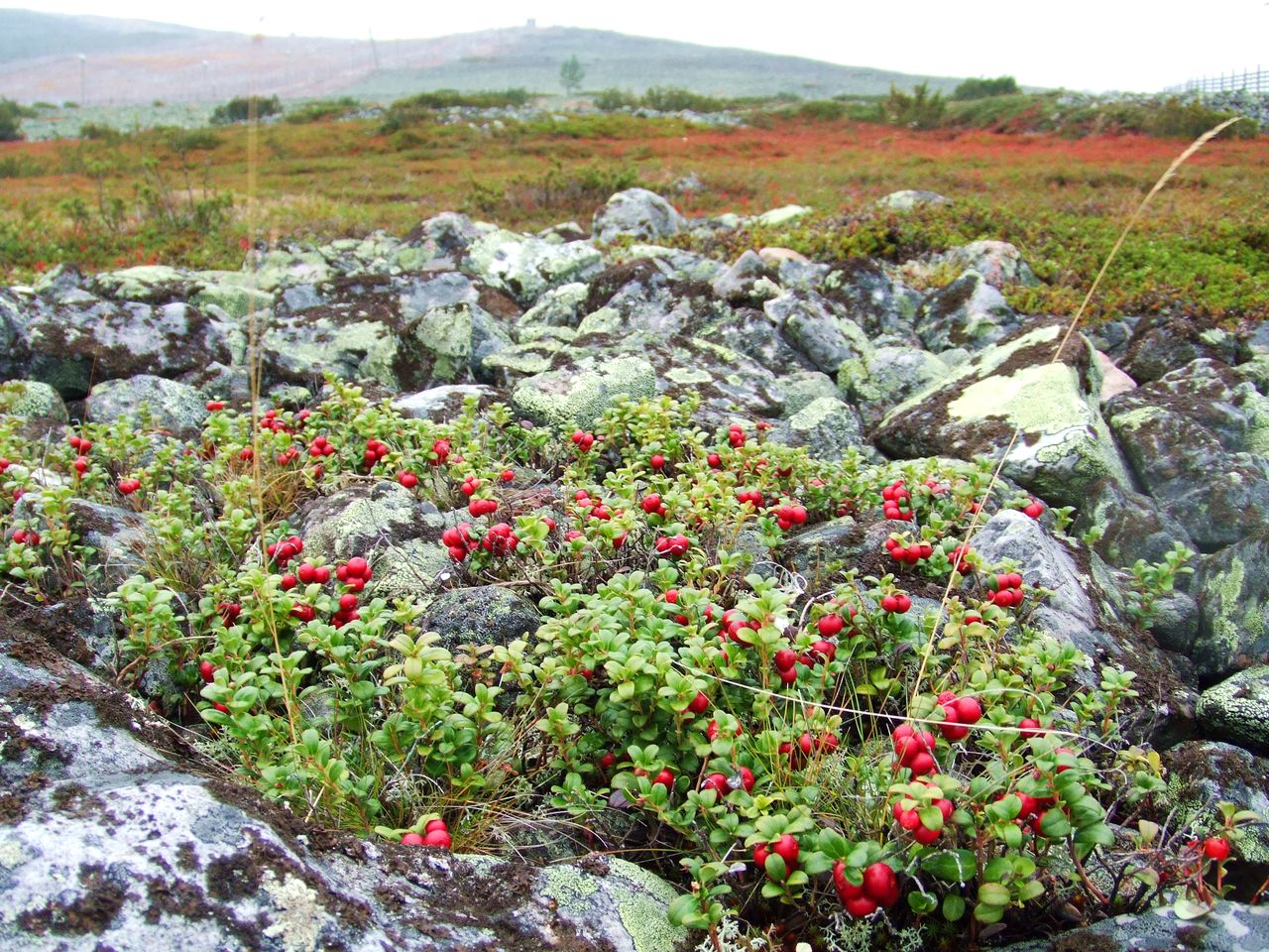
You may pick berries and mushrooms for your own use.
Don't damage vegetation or disturb animals.
Take extra care during breeding season.
If you want to fish, acquire necessary fishing licenses before heading to the park. It is strictly forbidden to move live fish from one river or lake to another.
Show consideration for grazing reindeer, especially in the calving season in May and June.
The home pages for national parks in Lapland:
Finland www.nationalparks.fi
Norway www.nasjonalparkstyre.no (in Norwegian)
Sweden sverigesnationalparker.se
Finland
In addition to a number of national parks in Finnish Lapland, other areas with unique or exceptional natural values have been established in Lapland. Wilderness areas (erämaa-alue) and trekking areas (retkeilyalue) are marked on maps. They are public spaces, but they often lack services, like cabins, fireplaces and marked trails that are maintained in national parks. All wilderness destinations in Finnish Lapland are listed at www.nationalparks.fi/en/destinations.
Finnish national parks, wilderness areas and trekking areas are typically large. It is possible to roam in wilderness for days without seeing another human or traces of human life (not to mention without a trace of mobile phone signal).
Kevo
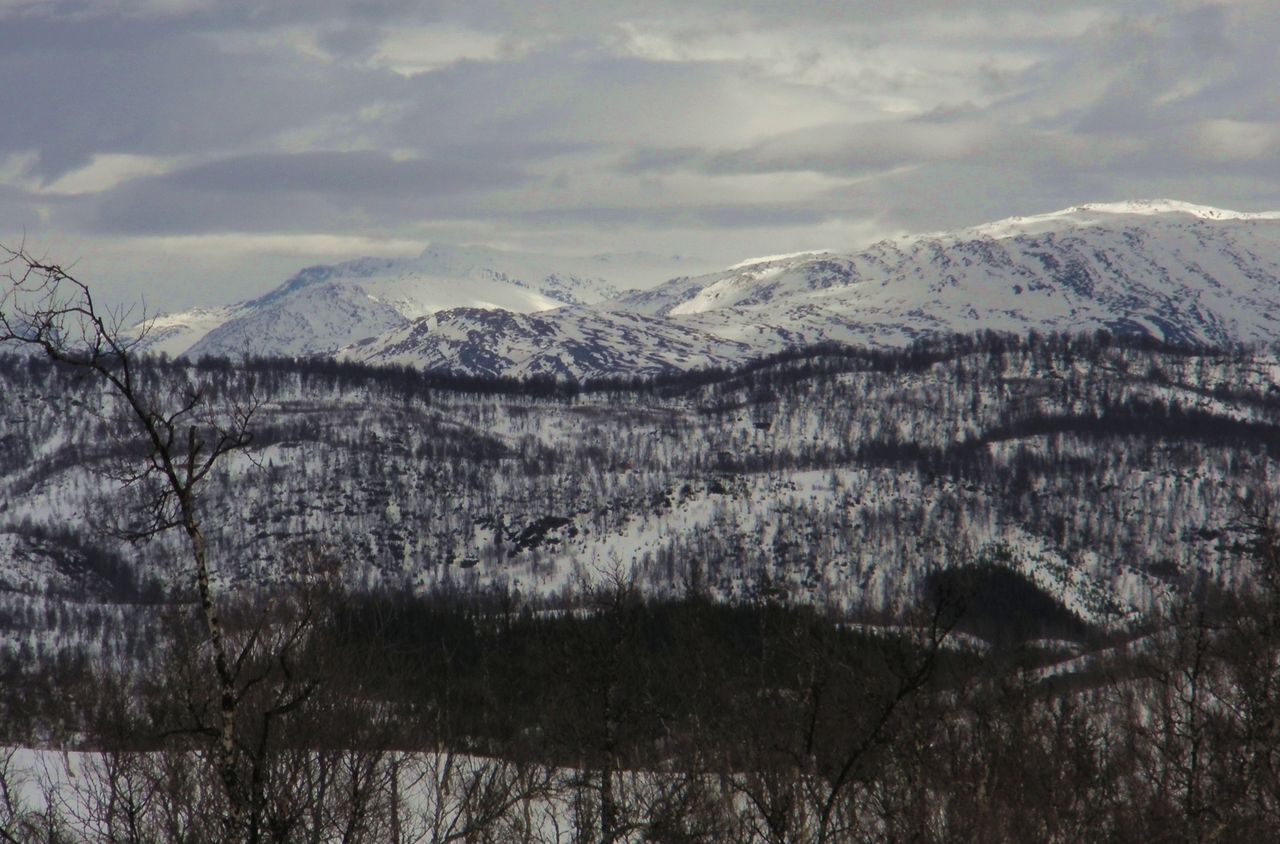
Kevo is categorized as a Strict Nature Reserve, where visitors are only allowed on marked trails. Kevo is renowned for a long canyon that stretches 40 kilometers/25 miles across a mountain plateau. Two signposted trails zigzag in the canyon. Kevojoki River flows at the bottom of the canyon. Even though the hike from one end to other end of the canyon is quite popular, it is a demanding exercise that requires hikers to cross the river. If the water level in the river is high, the trails are closed.
The rest of the nature reserve area is mostly flat highlands with forests, large tundra-like open mires, small lakes, and swamps. The Kevo area is scientifically valuable. The University of Turku has established a subarctic research station in Kevo.
Most hikers access Kevo from the canyon's south or north end. The entrance to the south end is from a car park along the road number 92. Large signs by the road between Karigasniemi and Kaamanen can't be missed. Access from the north is from a car park near Kenestupa along road E75. Entrance from the north side is a popular day hike. In two or three hours you can reach the canyon, get a view of it, and experience many types of Lapland landscape and nature along the way.
The Utsjoki Nature Center in the village of Utsjoki is a good source of information on Kevo, hiking, Tenojoki fishing, and the whole region. Friendly local personnel can help you with maps, guides, weather forecasts and with other information.

Ponds and marshland along the way to the Kevo Canyon.

Kevo Canyon is carved in plateau.
Lemmenjoki
Lemmenjoki is a legendary place in Lapland: it is one of the key places for Lapland's gold rush. River shores have been inhabited by Sami for hundreds of years (some old buildings are still standing). Rivers, fells, forests and mires dominate the landscape in the Lemmenjoki park.
Today, Lemmenjoki is a popular hiking, skiing and fishing destination. Several marked trails lead to rapids, waterfalls, old Sami sites, and gold digging sites. Gold digging still goes on in the park, even though the peak of the gold rush was in the 1950s. Some gold diggers welcome visitors, some don't. Whatever you do, don't reach for anything on the ground, in the water, on the table, or anywhere else if you are at a digging site.
Lemmenjoki can be accessed from Inari. Road number 955 leads southwest towards the park, and road number 9551 takes road travelers to the end of the road at the village of Njurkulahti. Marked trails start from the car park or you can get a boat ride on the river. Sallivaara reindeer round-up site is in the vicinity, accessible via road 955 as well. The Information Center in the Siida museum in Inari provides maps and other material on the region. In summer, daily taxi service transfers visitors between Njurkulahti and Inari.
The Hammastunturi, Muotkatunturi, Pulju and Pöyrisjärvi Wilderness Areas are located next to the Lemmenjoki park, making this corner of Finnish Lapland a large consistent wilderness region of its own.
Malla
Malla Nature Reserve (Mallan luonnonpuisto) is a relatively small park with two attractions that draw visitors to the area: rare plants that strive in its calciferous soil and the intersection of the borders of three Scandinavian states. Treriksröset marks the point of the three borders.
Hiking is allowed only on marked paths, but skiing is allowed anywhere in the park. Camping is not allowed.
Malla is located in Kilpisjärvi, a few kilometers/miles towards Norway from the village. A car park by E8 road is the access point to the park. Kilpisjärvi Visitor Center in the village provides maps and tips. Kilpisjärvi Hiking Center at the foot of the Saana fell has friendlier opening hours and provides information for visitors as well.
Pallas-Yllästunturi
The Pallas-Yllästunturi is a popular destination both in summer and in winter because it offers one of the best fell sceneries in Lapland, an extensive trail network and a good selection of services in Ylläs and Levi resorts and in Hetta village. Ylläs and Levi are major downhill skiing resorts, but provide fine facilities for cross-country skiing and hiking as well. Mountain biking is also allowed on trails marked for it.
The park is an important research destination because of its varying landscape, vegetation and ancient fell formations. Three billion years ago, mountains similar to the Alps stood in Lapland. The foothills of these forgone mountains are the fells we can see today. The fells are comprised of the most common rock types in Finland´s fells: quartzite and granite rocks that are very resistant to wear. They weren’t swept away by the ice age that covered the region.
Along trails in the park, fireplaces, sheds and public cabins are available for visitors. Tour operators at resorts take visitors into the wilderness in summer and in winter. Ylläs, consisting of the villages Äkäslompolo and Ylläsjärvi, is the largest center in the area. Hetta is a more peaceful place than the bustling Ylläs. Visitor Centers in Äkäslompolo village and Muonio (Pallastunturintie 557) provide maps, information and lets you book wilderness cabins.

Pyhä-Luosto
The Pyhä-Luosto National Park features low, gently rising fells, mires, forests, and ravines. For many hikers, the deep Isokuru ravine is a key reason to explore the area. The highest fell of the park Noitatunturi (Witch Fell) at 540 meters/1770 feet is a traditional Sami place.
Pyhä-Luosto is located in the center of a triangle formed by Rovaniemi, Sodankylä and Kemijärvi. From E75, turn to the park in the village of Torvinen. If you are approaching Pyhä-Luosto along E63, turn to the park in the village of Vuostimo. Bus transportation from Rovaniemi to the park center is available as well.
Oulanka
The Oulanka National Park features the most popular hiking trail in Finnish Lapland: Karhunkierros (the tour of the bear - you can only guess what the origin of the name is). The short day trail is so popular that during summer months there can be more people than reindeer in the park.
The full-length trail is 80 km/50 miles long (one way), and the very popular Pieni Karhunkierros (the short tour of the bear) is a 12 km/7.5 miles long loop.
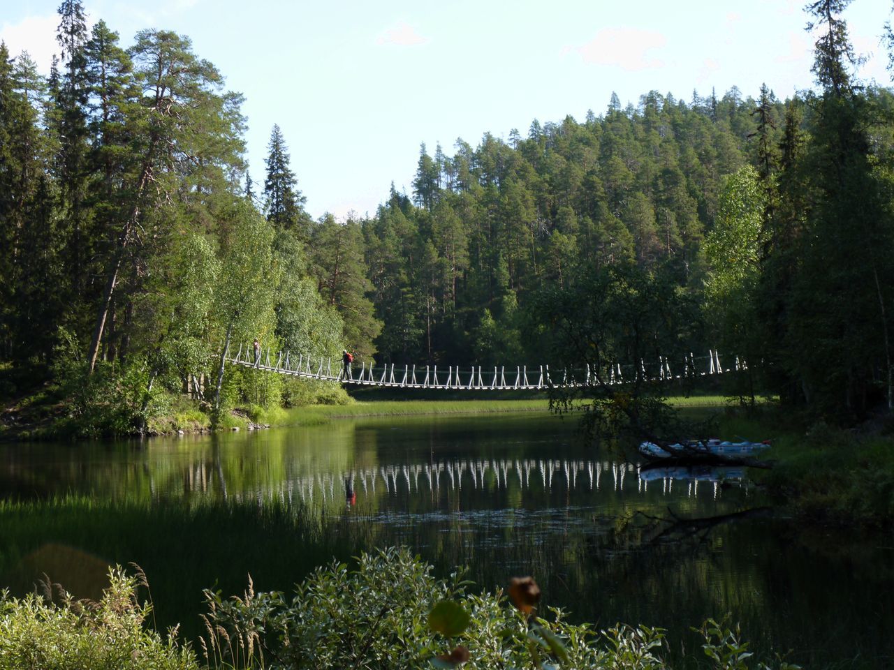
The start place for the short tour is in the village of Juuma (at the camp site, to be exact). The place is easy to find by driving 33 km/20 miles along E63 north from Kuusamo, and then, following Pieni Karhunkierros signs. The trail is a circular route that follows river banks, canyon edges, rapids, cuts through forests and swamps, and takes you across rivers along hanging bridges. A couple of deep ascents and descents are the toughest part of the tour. In July and August, the trail can be somewhat busy with hikers, but there is definitely space for everyone.
The full-length Karhunkierros is a one-way trail that starts or ends in Ruka Village. The common direction is from north to south. You can take a bus ride to the northern start point, which is located at Karhunkierros Nature Center in Hautajärvi.
Oulanka National Park is dominated by rocky hills, canyons, rivers, and lush forests. Many other trails,spectacular rapids, and canyons exist outside the Karhunkierros trail, but Karhunkierros gives you a perfect overview of the nature and landscape of the region.
The Visitor Centre for the Oulanka National Park is located in the park, but it can be reached by car. Signs direct drivers from E63 to the Visitor Centre. From Kuusamo, drive 38 km/24 miles north towards Kemijärvi along E63. Turn right to road 950 towards Salla. After 7 km/4.3 miles, turn to road 8693 in Käylä. From the intersection, it is 13 km/8 miles to the center.


Urho Kekkonen National Park
The National Park of Urho Kekkonen (Urho Kekkosen kansallispuisto) is dedicated to the former president of Finland who held the position from 1956 to 1981. The president was born in Kainuu province, south of Lapland, but was a Lapland enthusiast who often invited other decision makers for a hike or a ski tour in Lapland to negotiate and to relax.
The region where the park is located is dominated by relatively low, gentle-sloped fells, forests and rivers.
The large Saariselkä resort and smaller Kiilopää and Kakslauttanen resorts are located along E75 next to the park. An extensive network of marked trails zigzag in forests and fells near the resorts. Visitors who want peace and quiet may venture deeper into the park where public cabins are available. Tour operators from resorts organize trips into the wilderness as well.
A dedicated information center for the Kekkonen park is open in Tankavaara in conjunction with the gold mine museum.
The Sompio Nature Reserve and Kemihaara Wilderness Area are located next to the Urho Kekkonen park, effectively extending the area of the national park. Public access in Sompio Reserve is restricted to marked trails only.

Information Center for Urho Kekkonen National Park in Tankavaara.
Wilderness Areas
Kaldoaivi is a vast, completely roadless wilderness in Utsjoki and Inari municipalities. It is a mountain plateau area with low fells, steep river valleys and scarce vegetation. Access to the area is via road number E75 (west side of Kaldoaivi), 971 (south), or 970 (north). Siida Visitor Center in Inari and Utsjoki Nature Center have maps to the area.
Käsivarsi Wilderness Area (Käsivarren erämaa-alue) covers a large area east of Kilpisjärvi. Finland's highest fell Halti (1324 meters /4344 feet) stands here. Most marked trails to Halti (55 km/34 miles from Kilpisjärvi) and to the other parts of the wilderness area start from Kilpisjärvi Visitor Center.
Paistunturi is a vast area of low fells, large mires, low-growth forests, lakes, and rivers in the northernmost corner of Finnish Lapland. It is bordered by the mighty Tenojoki and Kevo Nature Reserve. Common access points to the area are Utsjoki Nature Center and the same access points as the Kevo Reserve.
Tarvantovaara is a tundra area with low fells and large wetlands. It is a coveted destination among birdwatchers who have discovered its rich birdlife. Tarvantovaara is located in Enontekiö, west of Hetta village and resort center. Marked trails start from the villages of Leppäjärvi and Karesuvanto.
Tuntsa has the reputation of being the destination of trekkers who seek total peace and quiet. Tuntsa is located far away from any villages or towns, next to the Russian border. Low fells and forests allow fairly easy trekking in the area. Road number 9671 from Pelkosenniemi is the closest road to Tuntsa.
Vätsäri covers the eastern shores of the mighty Inarinjärvi Lake and a rugged, rocky landscape of pine forests and mires all the way to the Russian border. Vätsäri belongs to the large Pasvik-Inari (www.pasvik-inari.net) wilderness area that covers both Norway and Russia. Road number 971 is the only road that goes anywhere near the area which is recommended for experienced trekkers and fishermen who can move in a relatively demanding, rocky terrain with plenty of wet obstacles.
Norway
Fifteen national parks invite visitors to explore the nature in Norwegian Lapland. The parks are fairly compact in size, but nothing stops outdoors lovers from venturing into the wilderness outside parks too.
Junkerdal
Junkerdal National Park connects the already large Saltfjellet-Svartisen Park to even larger parks in the Swedish side of the border: Sarek and Stora Sjöfallet. The park stretches from Junkerdal (south) to Sulitjelma (north) along the Swedish border. Accommodation services are available at both ends. The park is renowned for its rich vegetation in valleys and Sami culture.
Lahko
Lahko National Park is located in the same region as Saltfjellet-Svartisen Park. Lahko is renowned for its mountains, caves, canyons, rivers, and lakes. Water has carved many attractive sights into the chalky ground in the park. Signposted trails and cabins are available.
Southern access to the Lahko Park is via Glomfjord, and northern access via Sundsfjord.
Möysalen
Möysalen National Park is an ideal place to get a view of the nature and spectacular sceneries of Lofoten archipelago. The highest peak rises to 1262 meters/4140 feet height. Trails lead to the top, but Möysalen National Park Center organizes guided trips to the top as well. In summer, a guide leads a group through the park to the mountain and back in ten hours. Head to Gullesfjord, follow E85 north until road number 822 branches west and follow it south until you reach the village of Hennes.
Rago
If you want to explore the same mountain range from the Norwegian perspective as Sarek, Stora Sjöfallet and Padjelanta parks let you do in Sweden, Rago National Park is your choice. Rago is all about mountains, valleys, lakes, and rivers. Ragotoppen at 1312 meters/4304 feet is the highest summit in the park.
Most visitors park at Laksholv which is located about 6 km/3.7 miles from E6. Signed trails start from there. Cabins area available for hikers.
Reisa
The highlight of the Reisa National Park is the Reisadalen valley carved into the fell by Reisaelva River. The river is popular among fishermen and paddlers who can admire mighty waterfalls that flow from mountains to the valley. Cabins are available in the park.
Reisa is a remote park without road access. It is located on the Finnmark plateau next to the Finnish border. Road number 865 reaches near the park. It branches off the main road E6 in Storlett.
Rohkunborri
The landscape in the Rohkunborri National Park is quite spectacular: from the deep gorge in Sørdalen to mountains with glaciers. The Rohkunborri massif protects the valley of Stordalen where old birch forests and birds enjoy life around the lake Geavdnjajávri. Some lakes in the park have plenty of fish, whereas others are only inhabited by crustaceans. The area is traditional Sami land where their culture and reindeer husbandry is also visible today. Cabins are available for hikers and skiers.
Rohkunborri is located in the same mountainous area as Abisko in Sweden. Rohkunborri is a remote park, but the road number 847 leads near it. The road towards Altevatn and the park branches off from E6 in village of Setermoen.
Saltfjellet-Svartisen
Saltfjellet-Svartisen is Norway's second largest national park. It is a high mountain area that features the famous Svartisen glacier. The sceneries in the western side of the park reward hikers with deep fjords and high mountains. An extensive network of marked trails help trekkers to navigate, and to find cabins to stay in. Sami culture is present in the park as well.
Saltfjellet-Svartisen is located between Mo i Rana and Fauske. The large park can be accessed from many places, also from E6.
Seiland
Seiland National Park is located on an island that has the same name as the park. The mountainous area with forests and glaciers is practically untouched by man. The highlight of the park is its northernmost glacier Seilandsjøkule, where snow capped summits, fjords, and green forests meet. Seiland also draws fishermen who want to try their luck on big catches from the sea.
Hammerfest is the nearest town to Seiland.
Sjunkhatten
The landscape in the Sjunkhatten National Park varies: pointed peaks, fjords, rounded mountains, rivers, lakes, and valleys. Signs of human life from the Stone Age have been discovered in the park. The oldest relics are up to 9000 years old. Marked trails help visitors move around in the park.
The city of Bodø is near the Sjunkhatten Park. Three common access points to the park are Røsvik in the north, Fridalen (coming from Fauske) and Vatnvatnet (from Bodø).
Stabbursdalen
Stabbursdalen is a mountainous national park with a unique feature: it has the world's northernmost pine forests. The oldest trees are 500 years old. The highest summit (Cohkarášša) in the park is 1139 meters/3737 feet tall. Wildlife is abundant in the park, birds and fish especially thrive here. The park is easy to reach from Lakselv.
Varangerhalvöya
Varangerhalvöya park is a place to explore the wildlife on the coasts of the Arctic Ocean. The area does not rise high above the sea, but it lies so far north that only tiny trees grow in its valleys. Tundra vegetation covers the land. For many visitors, rich bird life is the primary reason to explore the area. Cabins have been built for hikers, but there are no marked paths. Vadsö on the shores of Varangerfjorden is the nearest place to find accommodations and services. The road E75 leads to the park.
Ånderdalen
Ånderdalen National Park is located on Senja, which is a large island southwest of Tromsö. Coastal pine forests and vegetation that thrives on rocky landscape are common on the island. Signposted trails help hikers navigate in the park. Archeological findings indicate that people have lived on the island since the Stone Age. Sami people and people of other cultures have simultaneously inhabited the island. Ancient objects have been discovered on the west side of the park near the sea.
The nearest (small) town to the park is Bardufoss. From Bardufoss, road number 86 leads to Senja where most visitors turn to road number 860 for the park. Camping sites and cottages area available in Senja for accommodations.
Övre Anarjohka
Övre Anarjohka National Park is located between Karasjok and Kautokeino communities. The park is the next door neighbor to the Lemmenjoki National Park on the other side of the Tenojoki River in Finland. Övre Anarjohka is a relatively flat area dominated by wetlands and low forests on the Finnmark mountain plateau. A wide range of Lapland wildlife thrives in this remote region: bears, wolves, elk, birds and fish.
There is only gravel road access to the park. Just before road number 92 crosses the border from Norway to Finland, a tiny gravel road turns to Anarjohka. One cabin is available for visitors.
Övre Dividal
Övre Dividal is a large forest and fell area near the place where borders of three states (Norway, Sweden,Finland) meet. Kistefjell is the highest summit in the park at 1632 meters/5354 feet. Large birch forests dominate the valley. A few overnight cabins are available in the southern part of the park.
This is a remote park where most visitors arrive via road number 84 and turn to Dividalen. Drive as far as the road goes to reach the park. Bardufoss is the nearest town.
Övre Pasvik
Övre Pasvik is a low land area dominated by lakes, rivers, and swamps. It is rich in wildlife. The area can thank its peaceful location on being one of the remotest regions in Lapland: it is located in a triangle bordered by Russia, Norway and Finland. Bears, foxes, birds, fish and a range of other wild animals live in this area. There are no services or marked trails in the park.
The park is located about 100 km/62 miles south of Kirkenes, Norway and 100 km/62 miles northeast of Ivalo, Finland.
Sweden
The national parks in Swedish Lapland are located relatively close to one another in an area whose primary urban centers are Kiruna, Gällivare and Jokkmokk.
Abisko
Abisko National Park is an excellent destination for hardcore trekkers and urban dwellers alike. Especially in summer, the unique landscape of the region is a constant source of wonder. Its landscape with fells, rivers, rapids, lakes, and largely barren land is like a scene from another world. A ski lift carries visitors who want to enjoy spectacular sceneries without physical effort to the top of the fell next to the Abisko Mountain Station
Abisko is located next to the road that connects Narvik in Norway and Kiruna in Sweden. Both towns are well connected to the rest of the world.
Even located faraway from civilization between Kiruna and Narvik, Abisko is still fairly easy to reach. Road travelers may enjoy beautiful sceneries along the E10 road, and train passengers can admire the same sceneries because the railway track follows the road most of the way. You can board a train in Kiruna or Narvik and jump into the Arctic wilderness at Abisko station. Kiruna airport has multiple flights a day from Stockholm, and a bus connection from the airport to Abisko.
In winter, cross-country skiers, and Northern Light spotters arrive in Abisko. Downhill skiers have only one lift to take them up the fell, but cross-country skiers have plenty of tracks to choose from. Other winter activities include dog sledding and taking a course in Northern Light photography.
In summer, hikers and nature explorers enjoy the short but light-filled days without snow in Abisko. July and August are the best months to enjoy the summer. The midnight sun rises in late May and sets in mid-July, but even in August nights are not completely dark.
The famous Kungsleden hiking trail passes Abisko, but there are many short trails from one hour hike to a half day or full day treks as well. Even if you only have a couple of hours to spare, you can experience the wilderness. The marked trails start from the mountain station, and you don't have to go far to find some rapids or get a view of the fells. The chair lift that goes to the top of the fell also operates in the summer, making it easy to conquer the fell, enjoy the scenery, and perhaps descend by foot back to the mountain station. Advice and trail maps are available at the Information Center building next to the Mountain Station reception.
More details about the activities and trails in Abisko are available at the Swedish National Parks web site sverigesnationalparker.se.
Accommodation options at the Abisko Mountain Station are a hotel, a hostel and cottages. The hotel rooms are in the main building where the reception is located. Keron hostel is a separate building with two or four beds in simple rooms. Kitchen, showers and toilets in the hostel are shared. Cottages are modern, fully-equipped family-size small houses. A camp ground is available for tents as well, but it doesn't seem to be a popular option since nights are cold even in the summer at this elavation. Details and booking www.svenskaturistforeningen.se.
The Mountain Station is only one of the places in the national park where travelers can stay for a night. In the outskirts of the national park, Björkliden resort and Riksgränsen provide additional accommodations and services for visitors.


Björkliden (bjorkliden.com/en) is located a few minutes drive west from Abisko Mountain Station. Hotel Fjället, cabins, a traditional ski lodge and a caravan/motor home site, three restaurants and three bars serve visitors. Golf may not be one of the first activities associated with Lapland, but in Björkliden you can play a round of golf in an exceptional landscape.
Next to the border between Norway and Sweden lies the village of Riksgränsen. It has developed into a downhill skiing center because the slopes get plenty of snow already early in the season, and skiing continues until late May. Riksgränsen is renowned for its off piste skiing, but 29 pistes and 6 lifts are in service for skiers who want to stay on groomed slopes. A hotel, chalets, ski lodge and a hostel provide accommodations for skiers and hikers. More details at home page riksgransen.se/en.
Kebnekeise
Kebnekaise is Sweden's highest mountain at 2100 meters/6900 feet. It is located between Abisko and Stora Sjöfallet National Parks, but the mountain itself isn’t inside a national park. Kebnekaise Fjällstation (Mountain Station) provides food and accommodations for skiers in March-April, and for trekkers in June-September. The nearest village is Nikkaluokta where the road ends. It is a 19 kilometer/11.8 mile hike from the village to the fjällstation. Kiruna is the nearest town.
Muddus
Muddus national park features lowland forests and wetlands. The untouched area is known for its primeval pine forests and marshlands where many bird species thrive. Resting areas with fireplaces and cabins for overnight stays have been built in the park. Muddus is located between Gällivare and Jokkmokk, next to the E45 road.
Padjelanta
Padjelanta is a large, remote high-mountain area next to Sarek National Park. The border of Sweden and Norway is the western border for the park. On Norway’s side, Rago National Park extends the continuous wilderness area even further. Overnight cabins are available for trekkers in Padjelanta.
Pieljekaise
Pieljekaise National Park is located in low mountains. The highest mountain summit in the park is at 1138 meters/3700 feet. Small lakes and birch forests are typical in the park, as well as heaths and meadows. The park is an important area for preserving mountain birch forests in its natural state. At high ground, the landscape is rocky and barren.
A common gateway to the park is Arjeplog village where many enterprises offer services for trekkers, and visitors can enjoy one last night in civilization before plunging into the wilderness.
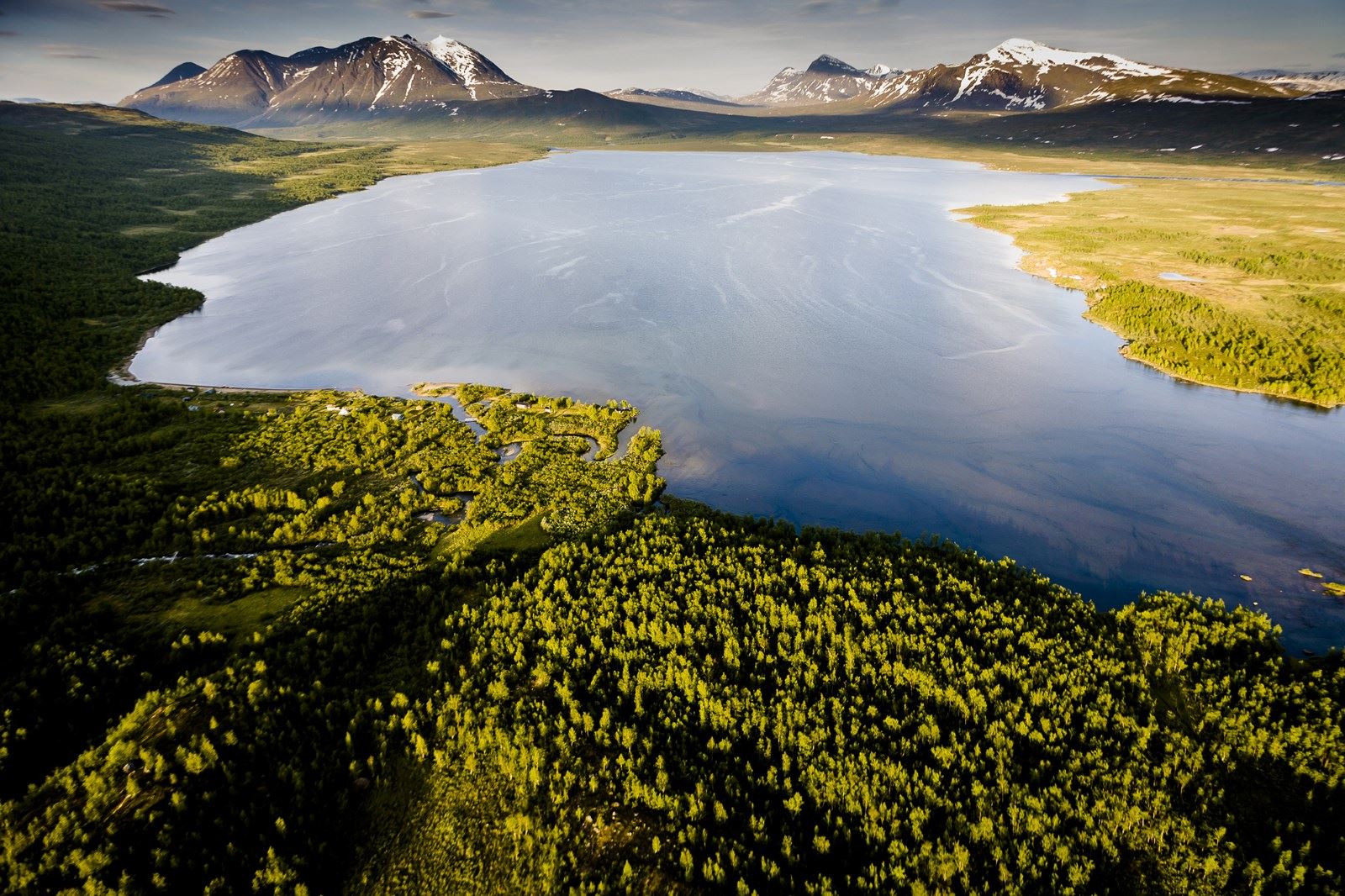
Sarek National Park
Sarek National Park is located next to Stora Sjöfallet National Park in high mountains on the border region between Sweden and Norway. The highest peaks in Sarek rise above 2000 meters/6560 feet. There are more than 100 glaciers in the national park (sverigesnationalparker.se).
Sami people and their reindeer have roamed in the region for ages, but other than that, Sarek is complete wilderness, faraway from civilization. There are no services in Sarek after the Kvikkjokk Fjällstation (mountain station). The nearest information center, Laponia Naturum, is located in Stora Sjöfallet National Park.
The road ends in Kvikkjokk, a few kilometers/miles south of Sarek. From there on, visitors continue by foot or on skis, depending on the season. The road to Kvikkjokk branches from E45, 7 km/4.3 miles north of Jokkmokk. Kvikkjokk Fjällstation (kvikkjokkfjallstation.se/en) provides rooms and meals for visitors in the spring (March-April) and in the summer (mid-June – late September).
Stora Sjöfallet
Stora Sjöfallet is a high mountain national park next to Sarek and Padjelanta National Parks. Gällivare and Jokkmokk are the gateway towns to this park. All together, they make up a vast region that is reserved for wildlife and Sami lifestyle in Swedish Lapland. High fells, lakes, swamps, forests, and wildlife dominate the landscape in Stora Sjöfallet. The Kungsleden trail, as well as many other trails, attract hikers and skiers into the park.
The road that branches from E45 halfway between Gällivare and Jokkmokk leads all the way into the park. Stora Sjöfallet Fjällstation (mountain station, www.storasjofallet.com/en) is the central place for visitors who wish to explore the national park. Fjällstation provides hotel, hostel, cottage, caravan and camping accommodations.
Laponia Naturum information and exhibition center was opened in Stora Sjöfallet in 2014.
Stora Sjöfallet. Photo by Carl-Johan Utsi.

Skiers at Stora Sjöfallet. Photo by Carl-Johan Utsi.
Vadvetjåkka
Vadvetjåkka National Park features a glacier, limestone caves and a delta, which attracts a variety of bird species to the area. The park is located north of Abisko. It is a 10 kilometer/6.2 mile hike from the nearest road to the park. The nearest places to find services are Abisko, Björkliden and Riksgränsen. There are no maintained trails or facilities in this national park.
Everyman's Rights in Scandinavia
The concept for Everyman's Rights is an old tradition in Scandinavian countries, but practices vary slightly in each country.
In Sweden, the rights are known as Allemansrätten. The general concept is that everyone is allowed to roam on private lands in the countryside and travel in waters owned by others. Wild berries and mushrooms can be picked from private land.
The general rule is that everyone is allowed to walk (no vehicles without permission) across private lands, but hikers must stay at a reasonable distance from houses, farms, yards and gardens. Visitors have to show consideration for landowners. They can’t trespass on cultivated land, or damage any plants or animals. If a landowner has put up a sign that forbids visitors from entering his property, the landowner's right to do so must be respected.
More information on the public access rights and practices in Sweden: www.swedishepa.se.
In Norway, the Everyman’s right (Allemannsretten) applies to the open countryside, which means uncultivated land or open country. It includes most of Norway’s lakes, shores, bogs, forests and mountains that are not fenced off. Small uncultivated areas within cultivated land are not regarded as open country. Cultivated or built-up land includes fields, meadows, pastures, gardens, courtyards, building plots and industrial sites.
You are allowed:
To freely move around on foot and on skis.
Rest and camp overnight, but no campfires in forests or anywhere near woodlands between April 15 and September 15.
Ride a bicycle on trails and roads.
Swim, canoe, row and sail in rivers, lakes and sea (motorized boats or vehicles are not covered by Everyman’s Right).
Pick berries and mushrooms for your own consumption.
Take notice:
In order to fish in inland waters, you need a fishing permit from the landowner.
Dogs must be kept on a leash between April 1 and August 20.
Tidy up your picnic spot or campsite, and take litter away with you.
Here is a document from Norwegian Environment Agency with more details: www.miljodirektoratet.no.
In Finland, Everyman’s Rights are known as Jokamiehen oikeudet. Large forests and wilderness areas, along with sparse population of Finland allow fairly generous public access rights. Everyman’s rights are granted, guided or restricted by various laws, but they are very similar to the rest of Scandinavia. You may:
Walk, ski or cycle freely, except near homes, or in fields and plantations.
Camp out temporarily at a reasonable distance from homes.
Pick wild berries and mushrooms.
Fish with a rod and line.
Boat (without a motor), swim or bathe in inland waters and the sea.
Walk, ski, or fish on frozen lakes, rivers and the sea.
You may not:
Damage property or the environment.
Disturb reindeer, game, breeding birds, their nests or young.
Let pets off leash.
Cut down or damage trees.
Collect moss, lichen or fallen trees.
Light an open campfire without permission, except in an emergency.
Disturb other people's privacy by camping too near them, or making noise.
Leave litter.
Drive motor vehicles off road without landowner's permission.
Hunt or fish with nets, traps, or a reel and lure without permits.
More details on Everyman’s Rights and also information on using wilderness huts here www.nationalparks.fi.
About wilderness cabins
Along the long trails in remote areas, cabins are available in many national parks for trekkers in Lapland. Some of them are open for anyone on first come-first-served basis, some cabins are locked and have to be booked in advance, and others must be rented.
If all resting places in an open cabin are occupied when you arrive, you may set up your tent in the yard or continue to the next cabin (which is usually quite a long way away).
In Finland, consult the respective national park's nature center or local visitor center for types of cabins available along your planned route. These nature and visitor centers also manage cabins reservations, fees and keys if required.
An important Finnish word to learn is "tupa". It means a hut or a cabin with one room that has all the simple functions needed for staying overnight (except for bathroom, which is a separate tiny building). Variations of the word, such as autiotupa, erätupa, and päivätupa define the type of the wilderness cabin. The word "mökki" (mökkejä in plural) refers to cabins in camping sites and to rentable cottages anywhere.
In Norway, Den Norske Turistforening (The Norwegian Trekking Association) maintains wilderness cabins. Both open cabins and places that require advance booking are available. Find locations and booking information at english.dnt.no/routes-and-cabins.
Important words in Norway are "hytte" (hytter in plural) that means any cabin or cottage, also in wilderness. "Fjellstue" is a specific word for a cabin on mountains, but it can refer to other cabins as well.
In Sweden, Laponia Naturum Visitor Center manages wilderness cabins in Lapland. View details at laponia.nu/en/experience/cabins. Abisko has its own web pages stfturist.se.
A useful Swedish word to learn is "stuga" (stugor in plural) which means any kind of cabin, hut or cottage.
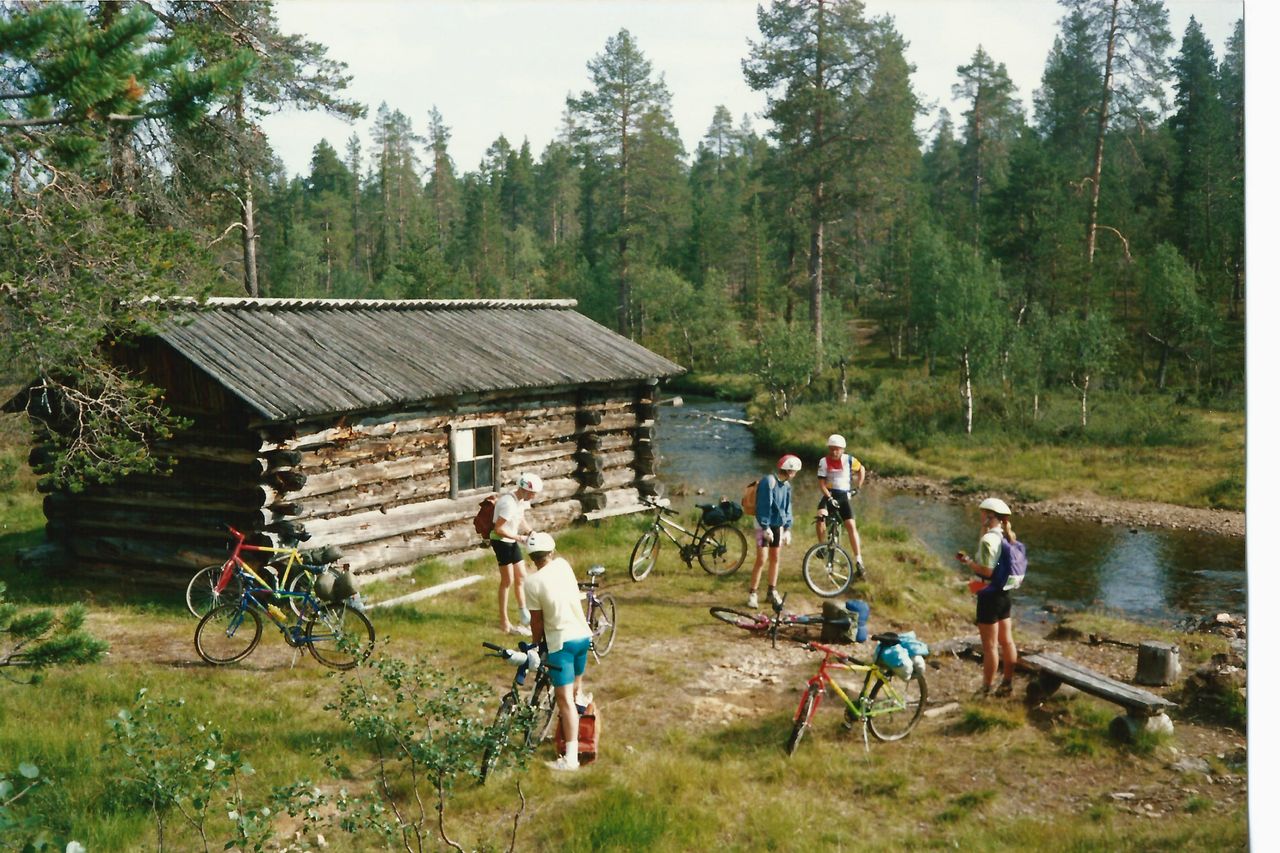
A group of mountainbikers taking a break at a wilderness cabin.
Rules for Open Public Cabins in Finland
The following list was prepared by Finnish authorities, but similar rules apply across Lapland. Each cabin has its own set of rules written down somewhere inside the cabin.
The cabins are intended for hikers and skiers as resting places and for overnight stays, but only for one or two nights at a time.
Large groups (more than five people) should use their own tents.
Pets are not allowed in cabins. You can set up a tent in the yard and enjoy cooking facilities in the cabin.
Please make room for visitors arriving after you. Be considerate of other visitors.
Cabins tend to be small, and large backpacks should be left outside.
Smoking is not allowed in cabins.
Do not use a gas cooker for warming the hut.
Spare firewood.
Keep the hut and its surroundings tidy.
Before leaving bring chopped firewood inside for next visitors.
Empty the water bucket, and remove ashes from the stove. Usually, there is a metal container outside which is meant for ashes.
Follow the cabin rules for waste management.
When you leave, close the doors and windows properly.
(nationalparks.fi)