Larapinta – from the Aboriginal name for the Finke River, Lherepirnte, meaning “salty river” or, alternatively, “permanent water”
No matter how much I read about the Dreaming, the confidence that I understand it never quite takes root in my mind. To me it is on a par with, say, quantum mechanics, or string theory – ideas you think you grasp until you have to explain them. Each time I attempt it, I have to feel my way into it again, and I am never sure of my ground.
—ROBYN DAVIDSON, “No Fixed Address: Nomads and the Fate of the Planet” (2006)
* HIKING RULE 3: If you see smoke along the trail, take it seriou sly. It may be part of a controlled burn set by park staff, but it could also be a bushfire. Wildfires can sweep through with frightening speed in dry conditions and can be extremely dangerous for walkers. If you are threatened by fire, head for an open, bare area. Try to find a rocky outcrop that offers protection from radiant heat. If you are wearing synthetic clothes, replace them with wool or cotton if possible.

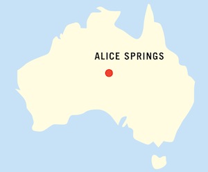
Located in the desert country of Australia’s Red Centre, the Larapinta Trail extends for 232 km (144 mi.) along the spine of the West MacDonnell Ranges from Alice Springs to the summit of Mount Sonder. The landscape is rugged, almost primordial, with vast, sweeping views from the ridgetops broken by a series of deep gorges shaped by ancient rivers. The trail is contained almost entirely within the West MacDonnell National Park, where it follows some of the important Dreaming tracks of the local Arrente people and passes several of their sacred sites. Although not well known outside Australia, the track is considered one of the country’s classic long-distance walks, often occupying a prominent position on the “bucket list” of many serious Aussie hikers.
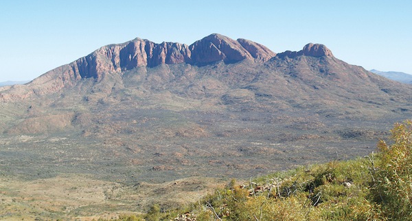
Mount Sonder is the prize at the end of the Larapinta Trail.
COLIN MANN
The trail begins at a base altitude of 600 m (1,968 ft.) near the Overland Telegraph Station north of Alice Springs and heads west, following the rugged ridges and gorges of the West MacDonnell Ranges. (The MacDonnell Ranges is the name given to the ridges and mountain chains of the Chewings, Heavitree and Pacoota Ranges.) Over the course of the trek, the track rises above 1000 m (3,281 ft.) a number of times before culminating in the ascent of Mount Sonder. At 1380 m (4,528 ft.) it is the fourth highest peak in the Northern Territory. Although the elevation gains and losses may sound moderate, don’t underestimate the Larapinta. It is an extremely challenging walk over rugged and remote terrain.
This is a strenuous, physically challenging hike that should not be undertaken unless you are a fit and experienced trekker. You must be prepared to deal with steep, rocky, uneven terrain and the potential for walking in cold water up to your waist for much more than just a few metres. Even in winter you should plan for the possibility of daytime temperatures that can promote heat stress or hyperthermia, by ensuring adequate supplies of water and regular rest stops. It is not uncommon for people to die on this trail because they run out of water.
Snake bites are rare since most snakes are nocturnal and will flee any sign of humans. Nevertheless snakes deserve much respect and you should never attempt to handle or threaten one. Bushfires can occur in dry conditions and are capable of covering large distances with alarming speed. Conversely, flash floods can very quickly turn a dry creekbed into a raging torrent. However, once the rain stops, the water will normally recede as quickly as it rose, so waiting it out is often the best choice rather than risk a dangerous crossing.
There are still plenty of feral camels throughout the Red Centre. Although we never saw any along the route, we certainly saw their tracks. When asked about what to do on a trail encounter, the locals tended to laugh off yet another silly tourist question. I haven’t seen camels mentioned as trail hazards, but knowing their unpredictable nature, I would give them a wide berth, especially if there were any females with calves.
|
Getting there: Australia is serviced by a number of major airlines or their partners, including, among others, Air Canada, Air New Zealand, British Airways, Qantas, United and Virgin Atlantic. Qantas is the main carrier to Alice Springs. Depending on your departure point within Australia, travelling by bus may be an alternative. Although the distances can be huge and you can easily spend several days on the road, Australia has an excellent and efficient bus system. Check www.greyhound.com.au for detailed information. Anyone interested in a train trip of a lifetime may want to consider The Ghan, which runs from Adelaide to Darwin with a stop in Alice Springs. The train takes its name from the Afghan cameleers who helped forge a permanent trail into the Red Centre over 150 years ago. For many years the tracks ended at The Alice, but in 2004 the final extension to Darwin became operational, making this one of the most famous transcontinental train journeys in the world. Check www.gsr.com.au for details. |
|
Currency: Australian dollar, or AUD, or AU$. 1 AUD = 100 cents although the smallest denomination now in circulation is the five-cent coin. For current exchange rates, check out www.oanda.com. |
|
Special gear: Make sure you have good, sturdy waterproof hiking boots that are well broken in. They must be able to withstand the rigours of walking on uneven, rocky trails and wading through water well above ankle depth without falling apart. (Unfortunately, it will be too rough underfoot to take your boots off for water crossings.) Hiking poles are highly recommended to maintain balance on the many steep ascents and descents. Sun hats and water bottles aren’t optional, but rain gear should also be on your list. Consider gaiters for protection from prickly vegetation such as spinifex, especially if you are hiking in shorts. The trail is usually done in mid-winter when daytime temperatures are moderate for hiking. However, the nights often go below freezing at this time of the year, so warm clothing is essential. When I did the trip in late July, our group awoke to frost-covered tents on several mornings.It is possible to do this trek as a backpacking trip where you take on the responsibility of planning the entire logistics of the expedition. But this is really only an option for backpackers with considerable experience. See the “How to do the hike” section for a discussion of this alternative. Of course, choosing this option means you will need to have all your own cooking gear, tents and other equipment in addition to appropriate first aid supplies. This is harsh, unforgiving territory and you must be prepared to deal with all it can throw at you. The safest and best choice in my opinion is to book through a reputable outfitter. They will supply all your food, water and camping gear in addition to providing highly skilled guides and all the necessary transport. Then all you will need to carry is your daypack, while your personal gear is transferred between camps. If you are lucky, this will include a swag, or Australian bedroll, supplied by the outfitter. |
Officially opened in 2002, the Larapinta Trail follows the “backbone” of the ancient MacDonnell Ranges heading west from the Overland Telegraph Station, just north of Alice Springs, to the summit of Mount Sonder. From the Station, the track crosses the railway line that runs from Alice Springs to Darwin and heads up to the crest of Euro Ridge, before passing close to Wallaby Gap and Simpsons Gap with fine views of the Heavitree Range. From here the trail heads onto open plains to skirt the impressive rocks of Arenge Bluff, famous for its sunset colours, and easy walking through mulga woodland to Mulga Camp with its welcome shade. Excellent views of the Chewings Range are a highlight before reaching the campsite at Jay Creek.
Not far along Jay Creek the trail passes Fish Hole, a permanent water hole with particular sacred significance to the local Arrente tribe. Soon hikers have the choice between the Ridge Route and the Lower Route. Spectacular views are the reward for the sharp climb up the Ridge Route to Loretta’s Lookout, the highest point on the Chewings Range, followed by a steep descent to Miller’s Flat. From the Flat it is hard going over rocky, often steep terrain before emerging onto private Aboriginal land close to Standley Chasm. The Chasm is accessible by vehicle and is a popular stop for tourists who come to see the sheer, vertical red rock walls briefly illuminated by the sun at midday.
From Standley Chasm the trail climbs to Brinkley Bluff, one of the highest points on the Larapinta, then descends steeply on a rough track to Stuart’s Pass and easy valley walking to Birthday Waterhole. Expect more hard going through Spencer Gorge and up to wonderful views from Razorback Ridge, before descending to the valley floor at Fringe Lily Creek. The scramble through Hugh Gorge is long and can require wading through cold, waist high water before the trail emerges to the welcome relief of the Alice Valley. The track zigzags to Alice Valley View before descending to Ellery Creek, then continues across a series of low ridges and hills crossing Aboriginal land to Serpentine Gorge. A long climb and hard ridge walking are rewarded with sweeping views of the West MacDonnells from Counts Point finally descending through mulga woodland to Serpentine Chalet Dam.
A tough section follows to spectacular Ormiston Gorge, through the sacred Inarlanga Pass, with good views on the approach to Waterfall Gorge. More climbing to Giles Lookout gives panoramic views to the west before descending to follow the base of the Heavitree Range to Ormiston Gorge, a registered sacred site. From here the trail climbs to more rewarding prospects from Ormiston and Rocky Bar Lookouts. Then it’s a relatively easy stage to Redbank Gorge across spinifex-covered plains, with Mount Sonder dominating the landscape. The track ends with the final challenging climb to the summit of this sacred mountain, where sweeping vistas are a fitting reward for all your efforts.
Over the course of the hike, the path climbs and descends rugged mountain ridges, winds its way through spectacular rocky gorges and crosses arid, spinifex-covered open plains. Located deep in the heart of the continent, the MacDonnells are some of the oldest mountains in the world. The Larapinta follows them as they march in a succession of red ridges from east to west, traversed by a series of wild, mysterious gorges. The landscape is harsh and demanding, but there is a stark, primal, almost spiritual beauty to this ancient remote land that can only be experienced on foot.
The going is tough, but your efforts will be infinitely rewarded with vast ridgetop views and stunning displays of rich reds, subtle oranges and deep purples magnified to an intense clarity by the clear, desert air. Carved by ancient rivers heading south to the Simpson Desert, the gorges shelter rare ferns and cycad palms as old as 1,000 years within their moist dark shadows. Birds flourish along the trail, with over 150 known species – everything from tall, flightless emus to honeyeaters and tiny finches. And with over 600 superbly adapted plant species, there is an astonishing variety of vegetation, from stately River Red Gums to the brilliant red blooms of Sturt’s Desert Pea to the ubiquitous and prickly spinifex grass.
Without a doubt, this is a challenging hike. It is also one of the world’s classic long-distance treks through an arid untouched land of unparalleled beauty.
The cooler months from April to September are the best times. Daytime temperatures are generally in the 20 to 25 Celsius range (68 to 77 Fahrenheit) making it ideal for walking. Expect cold nights during winter, often dipping below freezing. Summer months are far too hot and not suitable for such a trek. Although the MacDonnell Ranges are located close to deserts, they are not desert ranges. In fact, they receive fairly significant rainfall throughout the year, with a yearly average of about 275 mm (11 in.). However, it is unpredictable and sporadic, and can fall at any time. So there is a good chance you will encounter rain at some point along the trail.
Central Australia really has two stories. The first is the story of the Aborigines. At least 50,000 years ago, they crossed land bridges from eastern Asia and sailed in small boats to a vast, empty continent. Their migration was made possible by an ice age that lowered sea levels. When the ice eventually melted, they were locked away by the rising waters, isolated from outside human contact for thousands of years.
As they spread out across the land, they became superbly adapted to the harsh environment, living in a symbiotic relationship that allowed them to take what the land could give without damaging it. In the process they developed the world’s oldest continuous culture and religion with spiritual roots tied to a creation story called The Dreaming or The Dreamtime.
Although Arrente dreaming stories are strongly connected to the creation of the MacDonnell Ranges and the area around Alice Springs, modern geologists provide a more mundane explanation based on massive earth movements beginning about 350 million years ago. The stratified metamorphic rock was gradually pushed up into a series of parallel steep-sided ridges that were thought to have reached a height of 4570 m (15,000 ft.) before erosive forces over millions of years eventually wore them down to expose the distinctive “sandwich-layered” rock strata we see today. North-south flowing rivers then exploited the softer rock layers forming the spectacular gorges, gaps and chasms that are such a highlight of the Larapinta Trail.
The permanent water holes hidden within many of these gorges meant the region was of particular significance to the nomadic hunter–gatherers who depended on them for survival. And it was the promise of permanent water that eventually began the second chapter of the region’s story – bringing the white man and his modern inventions to a stone-age culture that was shattered by the onslaught. The meeting of these two civilizations has been likened to an encounter of inhabitants from different planets.
By the early 1800s, settlers began spilling into the grazing lands west of the Blue Mountains prompting explorers and adventurers to turn their sights on the great white space still left on the map of Australia. It was called “the ghastly blank.” It was a tantalizing unknown in the centre of the continent that many speculated held a vast freshwater inland sea and the prospect of fertile land ideal for settlement. The mystery was sparked by the puzzling “problem of the rivers” that flowed inland from the Dividing Range with no apparent coastal outlet. The puzzle prompted a series of epic and often ill-fated journeys in search of the answer.
The debate was partially settled in 1844, when the South Australian government sent Captain Charles Sturt off to find the mystic sea. In addition to 30 bullocks, 200 sheep and provisions for a year, the group was optimistically equipped with a boat. In fact, they faced one of the most brutal summers on record, with temperatures soaring to 69°C (157°F). By the time he stumbled back to Adelaide in 1846, Sturt was convinced that no such sea existed. (He was so emaciated his wife is said to have fainted when she saw him.) The question was resolved once and for all when John McDouall Stuart, (a protégé of Sturt), made the first successful crossing of the continent from south to north in 1862, proving in the process that the “ghastly blank” was in fact a vast, arid and hostile land. There was no inland sea.
Stuart may have returned with bad news about the mystic sea, but he had also accomplished the Herculean task of crossing and mapping the centre and returning to tell the tale. In the process he established a practical route from Adelaide to Darwin, producing meticulous accounts of permanent waterholes and timber access along the way. His route would be followed closely by Charles Todd, the superintendent of telegraphs in South Australia, and his team of builders as they set out to construct the overland telegraph. The route also became a guide for the railway to Alice Springs and the Stuart Highway from Adelaide to Darwin.
The arrival of pastoralists and gold seekers inevitably led to confrontations with the Aboriginal population over permanent water sources. They were powerless to withstand the push from a white society that forced them to abandon their ancestral lands and to survive in ever more remote locations. The disintegration of a culture built over 50,000 years was the inevitable result. It wasn’t until 1967 that a constitutional referendum gave Aborigines full Australian citizenship and voting rights. Land rights have gradually been restored to Aborigines in many parts of the country. In 2009, title for the West MacDonnell National Park was transferred to the traditional Aboriginal owners. It was then leased back to the government under a joint management agreement allowing them significant input into the Park’s operation.

The trail was designed with 12 stages to be completed over an average of 20 days. This is generally based on the assumption that you are backpacking the trail from end to end, which requires organized food drops and assured water access. If you choose to use an outfitter, then you will be fully supported with food, water, transport and camping equipment and will only need to carry a daypack. This allows the trip duration to be shortened, although it involves several long days of hiking. The day-to-day descriptions of the trail that follow are based on the 14-day itinerary I followed with World Expeditions. (See the “How to do the hike” section for more details.)
The trail was planned to be walked from east to west, which is generally more scenic and is the direction in which the cumulative kilometre posts are marked. In places where there is no defined trail, large blue triangular markers are often attached to trees. However, if you are backpacking, walking from east to west can create logistical problems with food drops and access. Although walking from west to east can make planning simpler, some of the climbs are even steeper.
This is a very challenging hike over difficult, uneven terrain, increasing the risk of injury. I will confess up front that unlike every other hike in this book, I did not complete the entire length of the trail, due to an injury from a fall that required a trip to the Alice Springs hospital. Fortunately, because of the nature of a fully supported trip, this did not mean the end of my hike.
Take a close look at the map and you will see the trail is never very far from the main road back to The Alice, although not every stage has vehicle access. Logistically, this allows an outfitter to return to town for fresh supplies almost daily, so I was able to tag along to the hospital and rejoin the group the same day. It’s just another reason to use an outfitter. One of the guides said that in the many times he has walked the trail, he has never had an entire group finish the entire route, and that was true for us as well. Of the five guests who started out, only two completed every day of the hike. You can’t underestimate the physical and mental resources you will need to draw on in order to deal with all this trek can throw at you, which is considerable. There are no stages rated easy, with the majority graded either hard or very hard. I can safely say it is the toughest long-distance hike I have ever undertaken, but also one of the most rewarding.
The hike begins at the Overland Telegraph Station just north of Alice Springs, following a rough vehicle track that was the original road connecting Alice Springs to Darwin. Parallel to the road are some of the old telegraph poles and wire that linked Australia to the world. The trail passes under the concrete Geoff Moss Bridge and then crosses the railway tracks. With any luck you may catch a glimpse of the famous Ghan on its journey from Adelaide to Darwin. Then it’s a steady climb to the crest of Euro Ridge and fine views of Alice Springs and Mount Gillen, the high point of the Heavitree Range, before descending through mulga woodland to Wallaby Gap.
Desert bloodwoods and tall ironwoods are a highlight before the trail climbs steeply to Rungutjirba Ridge and good views from Hat Hill Saddle. Then it’s downhill to Simpsons Gap.

Euro Ridge.
COLIN MANN
The trail crosses open, grassy, eroded flats, the legacy of cattle overgrazing from 1872 until farming ceased in the 1970s. The area has been slow to recover, partly due to plenty of introduced buffel grass, an invasive weed that was used as saddle padding by Afghan camel drivers and later planted for cattle feed. The track skirts Arenge Bluff, rising above Rocky Creek to give good views of the bluff before heading to the shady mulga trees at Mulga Camp. (Arenge Bluff is another important Euro Spirit Ancestor for the local Arrente.) The next section marks the last of relatively easy going as you pass through Spring Gap and on to good ridge views of the Chewings Range, then descend through mulga woodland to Jay Creek.
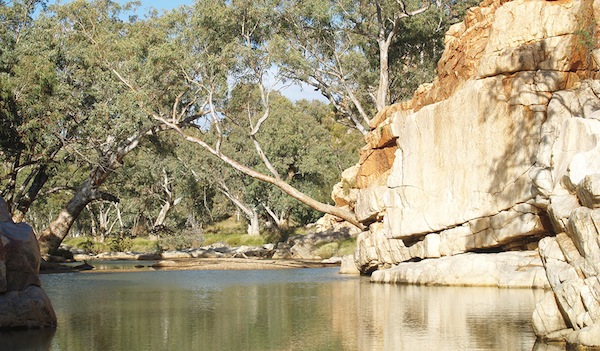
Fish Hole.
COLIN MANN
This is a tough section, especially if you take the Ridge Route. But it is well worth the effort for the spectacular views from Loretta’s Lookout. The walk follows the rocky creekbed, with wonderful river views to a waterhole called Fish Hole. The area is a sacred site where a serpent is said to have found a passage through the Chewings Range. Walking is restricted to the creekbed and camping is prohibited at Fish Hole.
Above Fish Hole the track follows a historic path constructed for camel trains travelling between Hermannsburg and Hamilton Downs homestead. Then it’s on to Tangentyere Junction and a choice between the Ridge Route and the Lower Route.
The Ridge Route involves hard, steep climbing and descending but is highly recommended for the compensating panoramic views at the top.
Both trails meet at Miller’s Flat, followed by a series of hard, rocky scrambles before the taxing final section around the western side of Standley Chasm. The chasm, which cannot be seen from the trail, is easily accessed by car and is a popular spot for visitors who take the short walk along the rocky floor to see the sheer vertical walls at mid-day when the sun turns them a fiery red. The area is owned by the Aboriginal community of Iwupataka, but its English name honours Ida Standley, who in 1914 became the first school teacher in Stuart or, as it is now called, Alice Springs.
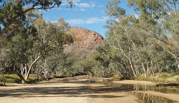
Brinkley Bluff in the distance.
COLIN MANN
Another tough section, graded very hard. Along this stage you will see an unexpected variety of plant life, all superbly adapted to their environment – everything from Finke River mallees to hill mulga – clinging to the exposed ridges, to cycads, native figs and corkwoods. The trail follows an old track used for horseback tours, climbing to a small saddle and a short detour to Bridle Path Lookout. From here, ridgeline walking leads to more outstanding views from Reveal Saddle, offering a brief glimpse of Brinkley Bluff, then dips down before the long climb (and several annoying false summits), on to the summit of the bluff with its cairn and logbook. Stunning vistas in all directions are the reward for some hard going.
Ahead is a long, rugged descent to the valley below and Stuart’s Pass, named in honour of John McDouall Stuart, who used the pass on three of his attempts to cross the continent. In April 1860, Stuart scaled the bluff, calling it the most difficult hill he had ever climbed.
Now you face the test of descending the bluff into the valley on a very steep and rocky trail that many walkers regard as one of the hardest parts of the trek. Take your time and exercise caution on the descent. Once you reach the valley, the walking is relatively easy to Birthday Waterhole Junction. It’s a short detour off the trail to the waterhole, but it’s a lovely spot for camping with a fringe of Red River Gums and lots of bird life.
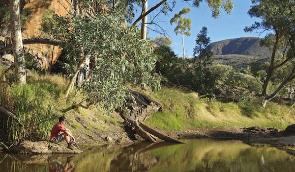
Birthday Waterhole is worth the short detour off the trail.
TOURISM NT
This is another section rated very hard, with your first introduction to some serious gorge walking. The day starts with relatively easy hiking along creekbeds before it enters Spencer Gorge and slow going over boulders and rocks. Subsurface water sources ensure the survival of moisture-loving plant species such as black teatree and native pines. You might even spot the bright red blooms of hill wallflower poison. The scramble up to Windy Saddle can be slow going, followed by another steep climb to Razorback Ridge and the crest of the Chewings Range. The trail heads west along the ridge’s rocky spine, with wide views along the range. It narrows in places and caution is required on the loose, slippery rocks on the ridge as well as on the descent to Fringe Lily Creek.
Then it’s more climbing up to Rocky Saddle, with its views back to Razorback Ridge, before the descent along Linear Valley to Hugh Gorge, one of the longest and deepest in the area. There is no defined track here, so you need to rockhop and scramble over boulders to find the best route. In several places you must be prepared to wade through cold, waist-deep pools in order to navigate your way through. Our group encountered several such pools along the length of the gorge, making it a chilling and hard end to a long but rewarding day. You can’t take your boots off and carry them because the rocks underfoot are slippery and uneven and the water is very cold. (I always carry spare newspaper with me to stuff into my boots at the end of a wet day. It sops up an amazing amount of moisture by morning. Assuming you don’t encounter more water the next day, they will generally finish drying out as you walk.)

The going is easy across the Alice Valley.
COLIN MANN
This stage is a welcome relief with the going rated medium as you cross the hill country separating the Chewings and Heavitree Ranges. The trail winds through mulga and witchetty bush, rising to Hugh View and good vistas back to Hugh Gorge and the Chewings. From here the trail follows undulating hill country to Ghost Gum Flat and an impressive ghost gum with three large burls on its trunk.
The trail continues over rocky hills and rough, broken terrain, with the Heavitree Range looming in the distance, to a final descent into Rocky Gully. We encountered rain along this portion of the trail and it was
very cold. We were layered up with wool hats and gloves and every bit of clothing we had. It was a good reminder how conditions can change from sunny to freezing cold very quickly, and the need to be prepared.
The journey continues across the Alice Valley over rolling hills toward the escarpment of the Heavitree Range, climbing to unrestricted panoramas from Alice Valley View. From here the track continues west, eventually swinging southwest and south toward a high saddle. The trail ascends steeply over loose rock before heading down through rolling valleys and ridges to Ellery Creek. The Aboriginal name for Ellery Creek Big Hole is Udepata, an important gathering point along several Dreaming trails passing through the area.

The spectacular view west from Counts Point.
COLIN MANN
This is a relatively short but hard section as the trail follows along the south side of the Heavitree Range over a long series of ridges and hills and many ups and downs. A highlight of this stage is the different rock types of the Bitter Springs Formation that were formed under a shallow sea 800 million years ago, forced up by massive earth movements and then exposed by subsequent erosion. Along the trail you will see white calcrete, dramatic dark outcrops of dolomite, purple mudstone and orange-red ironstone. The track crosses the Roulpmaulpma Aboriginal Land Trust, climbing to good views at Trig Point, eventually descending into mulga woodland before emerging onto a vehicle track. The side trip up to the fenced lookout provides a spectacular view of the upper portion of the gorge, which is said to be protected by Wedge-Tailed Eagle and Water Serpent Ancestors of the Arrente people.
The trail crosses low hills with wonderful views of Serpentine Gorge before you begin the long, hard climb up to Eagle Landing at the top of the Heavitree Range. (According to the Arrente, the Wedge-Tailed Eagle Ancestor patrolled the area between Serpentine Gorge and the Ochre Pits during the Dreamtime.) Once you make it up, the track follows the almost level ridge, providing vast, sweeping views all the way to the junction with Counts Point. The Point is a not to be missed side trip. The vista looking northwest to Mount Sonder is generally regarded as one of the best on the entire trail.
The trail descends a series of steps into Lomandra Gully (named for the rare irongrass found here), to the base of the range, swinging west across undulating foothills to Serpentine Chalet Dam. The dam was built in 1960 to service an ill-fated tourist venture, the ruins of which are located south of the trail.

Inarlanga Pass.
COLIN MANN
This is the longest, most challenging day of the trek and one I did not complete in its entirety, due to severely bruised ribs from an earlier fall on the trail. I walked to Inarlanga Pass, took the 4 km (2.5 mi.) detour to the Ochre Pits, then hopped a ride to Ormiston Gorge for more walking. Because the side trip to the pits is on such a long day, it is almost always bypassed, but provides outstanding views west to Mount Sonder and a chance to explore the pits.
Inarlanga Pass has ritual significance to Aboriginals, but walkers are allowed access. (Inarlanga is the Arrente word for echidna, or spiny anteaters.)
As you follow the gorge, expect to see cycads and thickets of spearwood, used by the Arrente to make spear shafts. The gorge opens into a wider valley, eventually heading west over three saddles before descending into the creek junction above Waterfall Gorge.
From here it’s a tough climb to a spectacular viewpoint at Giles Lookout overlooking a 160 km (99 mi.) stretch along the West MacDonnells, followed by a trek along the ridgetop with open expansive views along the entire way.
The trail eventually zigzags down to a spot appropriately called Base of the Hill, then turns west through the foothills to Ormiston Gorge.
This is a special day. Not only is it short and relatively easy, but there is the added promise of a well-deserved shower at the end of it – the first one in well over a week. The trail winds through a series of rolling ridges with good views of the mountain ranges, eventually climbing to Ormiston Lookout, sometimes called Hilltop Lookout. Although it’s not particularly high, it provides a wide panorama, with the Heavitrees and Ormiston Gorge to the north and Mount Sonder to the west.
From here you gradually descend over undulating ground to the Finke River and the junction to Glen Helen Resort. We made a wild camp along the Finke River. The water attracts a wonderful variety of birds and wildlife making it a special place to relax and enjoy the show.
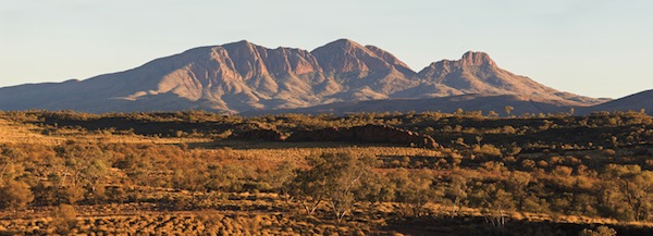
Mount Sonder.
WORLD EXPEDITIONS
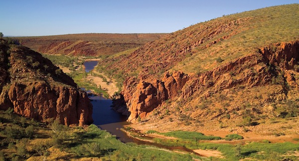
Glen Helen Gorge.
BARRY SKIPSEY, COURTESY OF GLEN HELEN RESORT
This is a short, relatively easy section, crossing low, spinifex-covered hills and a plain with mulga trees before tackling a long, steep climb to the summit of Rocky Bar Lookout (another one sometimes referred to as Hilltop Lookout). Here you get more good views of Mount Sonder, looming ever closer, while a look back east reveals the route already traversed. Then it’s another steep descent before reaching Rocky Bar Gap. Our group did this hike in reverse, driving to Rocky Bar Gap, then returning to our wild camp on the Finke River.
Only one more hard day and today isn’t one of them! The trail follows the foothills of Mount Sonder, heading to the final, challenging climb on the last day. The massive mountain dominates this section as you pass through mixed shrubland of mulga and mallee and spinifex-covered plains, finally emerging at the carpark near the entrance to the gorge.
The mountain – called Rwetypme by the Arrente – has substantial religious significance. Although camping and fires are strictly prohibited, day hikers are allowed access. Many climbers will begin the hike up Mount Sonder in the pre-dawn in order to catch the sunrise at the top. The hike is demanding, (sometimes described as arduous), so be prepared to take your time. The trail winds into the foothills before it begins the longest climb on the entire trail to the highest point on the trail. Once you reach the saddle, the ascent slackens somewhat before the final uphill stretch to the cairn and the lookout. Hope for good weather as a reward for your efforts, because the view out over the West MacDonnells and the surrounding plains is not only the highest but arguably the best on the trail. From here it’s downhill all the way as you retrace your steps back to Redbank Gorge and the end of one of Australia’s finest treks.
Option 1, guided hike: There are two well-known Australian outfitters who specialize in the end-to-end version of the Larapinta Trail: World Expeditions www.worldexpeditions.com, and Trek Larapinta, www.treklarapinta.com.au. Both offer fully supported, all-inclusive versions where all you need to carry is your daypack.
I travelled with World Expeditions. They were the first to offer guided and supported Larapinta trekking, beginning with the route’s initial construction in 1995. Development progressed to completion in 2002, and World Expeditions has remained the premier operator along the trail. I would have absolutely no hesitation in recommending them. The entire trip was exceptionally well organized, with two extremely knowledgeable and competent guides, good equipment and amazing food throughout. Hikers can also choose from a three- or six-day option if the full 14-day trek seems too much to tackle.
Option 2, self-guided, independent group: In addition to organizing and carrying all your own food and gear, you will need to book the necessary permits, food drops and transportation. You must be a very experienced backpacker to consider undertaking this trek. The Northern Territory Parks and Wildlife Commission provides comprehensive planning information about the trail on their website at www.parksandwildlife.nt.gov.au/parks/walks/larapinta.
You may think you have come to an English-speaking country, but Australian, or “Strine,” can be a bewildering language for the uninitiated. It might be worthwhile to pick up one of the books listed below to help with the translation (and I’m not joking, either). Just when you think you understand the basics of the jargon, along comes another tricky bit of lingo to leave you guessing. There are literally hundreds of examples, but here are a few of my favourites:
The hill, as I approached, presented a most peculiar appearance,… When I got clear of the sandhills, and was only two miles distant, and the hill, for the first time, coming fairly into view, what was my astonishment to find it was one immense rock rising from the plain… Seeing a spur less abrupt than the rest of the rock, I left the camels here, and after walking and scrambling two miles barefooted, over sharp rocks, succeeded in reaching the summit, and had a view that repaid me for my trouble … This rock is certainly the most wonderful natural feature I have seen.
—WILLIAM GOSSE, July 1873
Explorer Ernest Giles had seen the wondrous rock in 1872. But it was not until the next year that surveyor and adventurer William Gosse actually scaled it, along with his Afghan camel driver, Kamran, naming it after Henry Ayers, the premier of South Australia.
We now know it as Uluru, the colossal blood-red monolith rising almost ominously from the sandy plains of the Australian desert about 460 km (286 mi.) southwest of Alice Springs.
There is certainly plenty to see and do around Alice Springs before or after you’ve done the Larapinta, but the relative proximity (in Australian terms) of this astonishing landmark makes it an absolute must-see if you can make it work. It is possible to travel from The Alice on a one-day excursion, but it really deserves more time if you have it.
If you decide to go, there is an extensive list of tour operators offering everything from all-inclusive camping to resort accommodation at the nearby service village of Yulara, or there’s always self-drive if you are up for it. You can choose from scenic flights, camel rides or full walking/cultural tours around the base that provide a much more intimate view than you can ever get from the top. The question of climbing the rock always arises, but in my view, that shouldn’t even be considered. The sacred site has deep spiritual significance to the local Anangu tribe. Aside from the very real danger of tumbling off the side to an almost certain death, climbing this rock would be akin to trooping into a church and setting up a picnic lunch on the altar. It just shouldn’t be done, out of respect for the deeply held beliefs of the rock’s custodians.
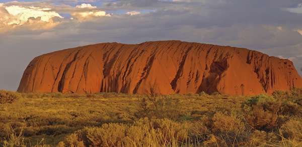
Uluru-Kata Tjuta National Park, a World Heritage area.
TOURISM NT
Australia remains a land where real men don’t eat quiche. Meat still reigns supreme here, especially in the outback regions of Central Australia, where steaks will often be served flopping over the edge of the plate, accompanied by a huge plate of chips (French fries) and “dead horse,” the inexplicable term for tomato sauce or ketchup. But there is plenty of variety if you want something other than beef, including crocodile, camel and sweet, tender, purple-red kangaroo fillets. In Alice Springs some restaurants offer an urbanized version of bush tucker, using native Australian ingredients like wattle seed and the red berries of the quandong. You might even have a go at witchetty grubs, which have an unsettling resemblance to large maggots.
There seems to be an unending variety of classic Australian slang terms for edibles – words like bum-nuts for eggs, moo juice for milk, rat coffin for a minced meat pie and snags, snorkers or mystery bags for sausages are particularly colourful. Probably no other Australian food elicits such strong reactions as the salty, dark-brown paste called Vegemite. You either love it or you hate it. I tend to be on the love side. Made from brewer’s yeast extract, the stuff is a by-product of beer manufacturing and is commonly spread on crackers or toast. Vegemite was invented in 1919 by Cyril Callister when shipments of a similar spread called Marmite that was imported from Britain, were disrupted by the war. Apparently there is no risk that it will fall out of favour – the billionth jar was produced in October 2008.
Hygiene standards on the trail were good and we had no concerns about food preparation. When it comes to eating out in Alice Springs and other Australian towns and cities, standards are generally high.
Tipping is not expected, but is considered a matter of choice.
Vegetarians may have trouble getting enough protein on the trail. You may want to forget it’s meat you are eating and just make sure your protein levels are high enough to meet the demands of the trek. As far as vegetarian restaurants, these are few and far between in a culture where meat is still the name of the game, but most menus will offer a vegetarian option.
There is a wealth of Australia information available on the Internet. Here are a few reliable sites to get you started:
www.parksandwildlife.nt.gov.au/parks/walks/larapinta, is the official Larapinta Trail site, maintained by the Parks and Wildlife Commission, Northern Territory.
www.travelnt.com, is produced by the Northern Territory Tourist Commission.
www.australia.com, the official site of Tourism Australia.
www.centralaustraliantourism.com features a comprehensive guide to Central Australia.
A Town Like Alice – Nevil Shute – a very popular novel also made into a film.
A Traveller’s History of Australia – John H. Chambers – with good sections on Aboriginal culture.
Alice Springs: Its History and the People Who Made It – Peter Donovan – just what it says.
Australia: A New History of the Great Southern Land – Frank Walsh – a new take on an old story.
Australia: Beyond the Dreamtime – Thomas Keneally, Patsy Adam-Smith, Robyn Davidson – three leading modern Australian writers present their personal view of the country.
Australian Slang Dictionary – John Blackman – a fair dinkum and humorous approach to translation with wonderful illustrations.
Evil Angels – John Bryson – an old story but one that still gets headlines. It recounts the story of Lindy Chamberlain, who claimed her daughter Azaria was taken by a dingo at what was then Ayers Rock. She was eventually charged and convicted of murder but subsequently exonerated.
Going Bush: Adventures Across Indigenous Australia – Catherine Freeman and Deborah Mailman – good insights into Aboriginal culture.
Fatal Shore – Robert Hughes – somewhat dated but still an excellent history of Australia.
In a Sunburned Country – Bill Bryson – Australia as only well-known travel writer Bryson can reveal it.
Larapinta Trail – John and Monica Chapman – the definitive stage-by-stage guide to the trail, filled with plenty of practical and historical information plus details of flora and fauna and excellent maps. Written by two bushwalkers who helped develop the trail, the book includes trail descriptions from east to west and west to east. Available for order online at www.osp.com.au and highly recommended.
Larapinta Trail Package – produced by the Northern Territory Parks and Wildlife Commission, including fact sheets, visitor guide and 12 waterproof, virtually indestructible section maps with detailed notes. Available for order online (see “Internet resources”) and highly recommended.
Lonely Planet: Australian Language & Culture – this pocket-sized gem will help you translate Aussie lingo into English. Includes a comprehensive section on indigenous languages.
Lonely Planet: Northern Territory & Central Australia – a comprehensive guide to the region.
Outback – Thomas Keneally – a personal journey providing a fascinating glimpse into the heart of Australia by one of the country’s most accomplished authors.
The Australian Outback: The World’s Wild Places – Ian Moffitt – a personal journey through the history and natural history of the outback.
The Singing Line – Alice Thompson – the story of the Overland Telegraph, written by the great-great-granddaughter of Charles Todd.
The Songlines – Bruce Chatwin – an account, both real and fictional, of Chatwin’s experiences with central Australian Aboriginal people.
Tracks – Robyn Davidson – the classic account of one woman’s solo trek across the Australian Outback to the Indian Ocean.
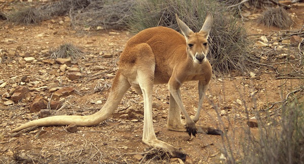
Red kangaroo.
TOURISM NT