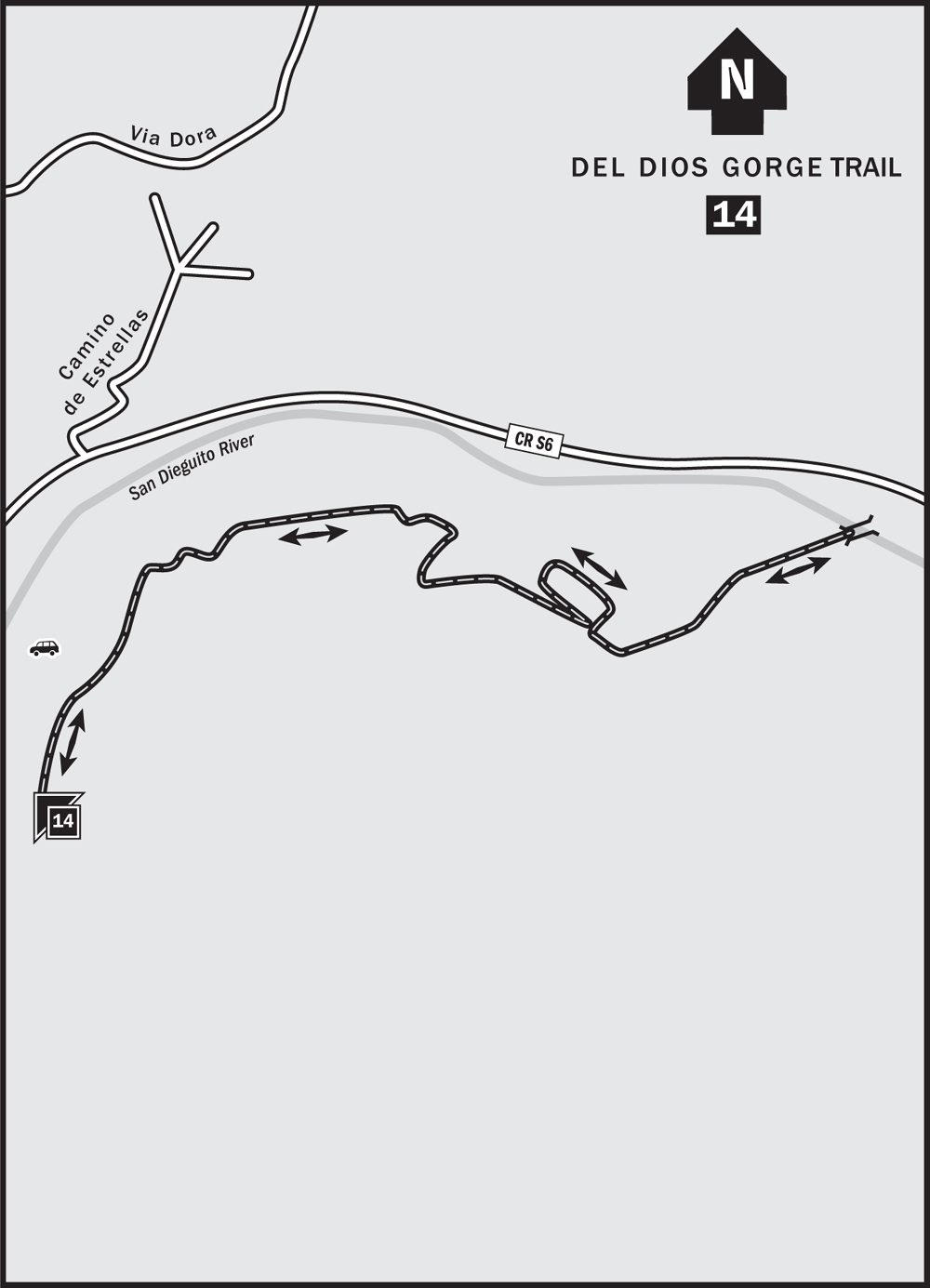
14 Del Dios Gorge Trail
OVERVIEW
LENGTH: 2.2 miles round-trip
CONFIGURATION: Out-and-back
SCENERY: Views of water, chaparral
EXPOSURE: Open to sun
TRAFFIC: Light
TRAIL SURFACE: Silty soil
HIKING TIME: 0.75 hours
ACCESS: Free
MAPS: PDF downloadable at www.sdrp.org/archive/Trail%20Maps/Santa%20Fe%20Valley-Del%20Dios%20Gorge%20(map%20side)%20FINAL.pdf
FACILITIES: None
SPECIAL COMMENTS: This wide, easy path is well-maintained and leads to the 180-foot Del Dios Gorge truss-style bridge. The trail is part of the Coast to Crest system of trails, which when finished, will stretch from the sea inland for more than 50 miles.
SNAPSHOT
Listen for the twanging call of red-winged blackbirds that inhabit the San Dieguito River. Some water is usually present close to the parking area, and increases as you near the bridge on this meandering multiuse trail suitable for beginners and a favorite of hikers with dogs.
CLOSE-UP
Head uphill on the paved route (west) toward the gate you see at the top of the hill (an alternative entry to The Crosby residential community). Del Dios Gorge Trail entry (marked) is on the left. You’ll also spot the entry to the Santa Fe Valley Trail on the right. Although still closed as of this writing for bridge rebuilding due to the 2007 wildfires, check back for the Santa Fe Valley Trail’s reopening soon. Its 3.72 round-trip miles travel through mixed rocky and flat terrain with views of the surrounding valley, and are worth a look.

For now, head up the very gradual northerly grade of the Del Dios Gorge Trail, past a panel explaining about wildfires and how the land regenerates. You’ll see evidence of the 2007 wildfires here in charred stalks sticking upright from the otherwise bushy greenery of lemonadeberry, which is recovering nicely.
The path bends to the left, and settles into a nearly flat walk heading east. In spring, the spiky paddles of the prickly-pear cactus erupt in sunrise-pink blooms that appear to glow. Another thorny plant grows in abundance here: thistle, with purple blooms that dry as the year wears on, and eventually rustle in fall breezes. You’ll note the creamy spring blooms of California buckwheat, and the butterscotch-orange of California’s golden poppies. Even an occasional mariposa lily pops its pale-pink flower head from the dry brush.
At approximately 0.4 miles, the trail jogs to the right and then back again a couple of times, and heads up slightly steeper slopes. In the hills across the Del Dios Highway, which is on your left, you’ll see the remnants of an old aqueduct system held up on trellis platforms—a reminder of days gone by.
At just under 0.8 miles, pole fencing defines the narrowing trail that turns suddenly to the right heading south off the wide path (which continues east). Pass the bat information panel that expounds on the benefits of these wild creatures that eat pests and get a bad rap as being spooky. At the top of the hill, you’ll go left—east again—down the hill.
Reach the truss bridge at 1.1 mile. Enjoy the view east and down to the reedy depths below. On clear days, the sky cuts a warm-blue swath into the surrounding hills as frame.
As of this writing (June 2009), the trail beyond the bridge is still under construction, so this is the stopping point. Upon completion, the trail will stretch clear to Lake Hodges and beyond. For now, linger above the water until, refreshed and renewed from your time in nature, you retrace your steps back to the starting point.
MORE FUN
Cielo Village just across the Del Dios Highway is a new retail area that might hold some interest. As with many new retail plazas, some flux has occurred with occupants. Otherwise, head east or west the way you came, back to the populated areas that hold your favorite eateries and pastimes.
TO THE TRAILHEAD
From I-5, take the Via de la Valle exit and head east approximately 7.5 miles. Turn right at an unmarked entry road across from the Cielo development. From I-15, exit at Via Rancho Parkway, drive west just less than 4 miles to Del Dios Highway, and turn left; then continue approximately 5 miles. Turn left just prior to the Cielo development (which is on the right). Or, take West Valley Parkway (west) which becomes Del Dios Highway after approximately 2 miles. Continue another 5 miles and turn left. The staging area is several hundred yards forward on the right.