Introduction
When the first version of this book was born just over three years ago, my hope was for it to be one book in a long and successful series that would educate, inspire, and even excite many people about using the Autodesk® AutoCAD® Civil 3D® software. In order to do this, I decided that each book in the series had to meet the following criteria:
- It should be basic enough to enable anyone to learn Civil 3D.
- It should be in-depth enough to enable a person to be productive using Civil 3D for basic tasks.
- It should foster understanding by associating the things you do in Civil 3D with familiar things you see every day.
- The examples and exercises should be based on the real world.
- The book should not simply demonstrate random software features, but should also teach the process of project completion using Civil 3D.
Since the first version of the book was released, I have received tons of great feedback about how well this book functions in many learning environments. I have also used the book myself to teach classes in a corporate environment, and I am very pleased with how it performs. I am confident that the goals I listed have been met, and for that reason I have held to the same writing style, format, and delivery that proved to be so successful in the previous versions.
As you work your way through the book as a teacher, a student, or an end user, you’ll find that the first two chapters, although very important, are more general and introductory. After that, you’re going to take a journey through the completion of a residential land development project—start to finish. In fact, the example project is based on a residential development that was built about 10 years ago, not far from my home. The topics are presented as though you have never touched a CAD program before; and wherever possible, there are sidebars and other forms of augmentation that relate what you’re doing to the real world.
You’ll also find that as I wrote this book, I tried to sympathize with future readers by thinking back to my college days when I was learning about surveying and civil engineering for the first time. There were many times when I felt frustrated and lost because I was learning new and foreign concepts and did not see how they related to the real world. I can remember being out in the field during my surveying class—looking through the survey instrument, writing down measurements, and having no idea why. That wasn’t an enjoyable feeling and isn’t one I want you to experience as you learn the new and foreign concepts in this book. Eventually I learned all about surveying, and now I have an in-depth understanding of how those measurements relate to designing and building roads, buildings, and other things—but it took many years. It’s my sincerest hope that this book gives you a head start on some of those types of concepts while at the same time relating them to Civil 3D in ways that hit home for you.
What’s New in This Book?
Changes have been made to AutoCAD Civil 3D 2015 Essentials so that it’s even better than last year’s version. Following are the details.
A New Look
If you already own AutoCAD Civil 3D 2014 Essentials, you’ll be happy to know that AutoCAD Civil 3D 2015 Essentials has been updated to address important changes in AutoCAD Civil 3D 2015. Probably the most obvious difference is the theme of the user interface, which has gone to a much darker color scheme in the 2015 version. All applicable images have been updated in this version of the book to account for this bold new look. In addition, all the exercises have been reviewed and modified to ensure that they are consistent with the 2015 release.
Defined Exercises
The structure of the book has been modified so there is greater distinction between the informational portions of the book and hands-on exercises. Exercises are numbered and shown in the table of contents. Each exercise stands on its own and doesn’t require the completion of a previous exercise (except in rare cases and where noted). Also, there is a Complete version of the exercise file(s) in each applicable case so you or your students can compare your results to what is expected.
More Efficient Exercises
If you’re familiar with previous versions of this book, you’ll notice a slight difference in the structure of the exercise steps. The information portions have been separated from the actual instructions describing the picks and clicks that you should be performing in the software. This makes it clearer which parts you should do versus those you should know. The result is a more direct, efficient, hands-on experience when completing the exercises.
Who Should Read This Book?
This book should be read by anyone who needs or wants to begin learning AutoCAD Civil 3D. It’s appropriate for ages ranging from high school to retirement, and although it’s intended for those who have no experience or skill with Civil 3D, it can also serve as a great resource for refreshing your knowledgebase or filling in any gaps. In addition, this book can be used as a resource for preparing to take the AutoCAD Civil 3D 2015 Certified Professional exam. See www.autodesk.com/certification for more certification information and resources. You can also refer to this book’s appendices to see which certification topics are covered and where they can be found in the book.
In addition to those pursuing a certification, here are some specific examples of individuals who would benefit from reading this book:
- High-school students following a design-related educational track
- College students learning to be designers or engineers
- Employees who have recently joined a company that utilizes Civil 3D
- Employees who work for companies that have recently implemented Civil 3D
- Experienced Civil 3D users who are self-taught and who want to fill in gaps in their knowledgebase
What You Will Learn
This book covers the basic skills and concepts needed to begin using Civil 3D to design land development projects. The concepts include those related to Civil 3D as well as those related to civil engineering and surveying in general. It doesn’t cover all topics or all Civil 3D features, but it provides a solid foundation you can use to perform basic tasks. This foundation can then serve as a stepping-off point as you learn more advanced skills and work toward an in-depth understanding of Civil 3D.
The first two chapters will give you a basic understanding of Civil 3D and help you to understand and appreciate how it “thinks.” The remaining 16 chapters will teach you how to use the tools that Civil 3D provides to complete a typical land development design project.
What You Need
Specific hardware requirements for running AutoCAD Civil 3D 2015 had not been released as this book went to press. See the Autodesk website (www.autodesk.com) for current requirements.
To perform the exercises in this book, you must have AutoCAD Civil 3D 2015 installed on your computer. It’s recommended that you use the default software setup with two exceptions: Change your drawing screen color to white, and dock the command line at the bottom of the screen. This book contains many screen captures of Civil 3D drawings, which were all produced with these distinctive changes to the user interface. Also, at times, the exercises refer to drawing entities by color, which is sometimes dependent on the background color.
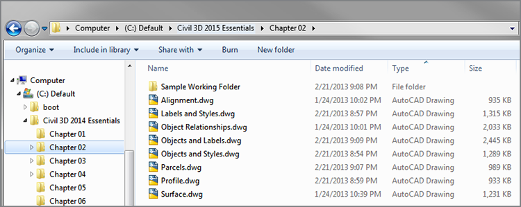
To complete the exercises, you’ll need to download the necessary files from www.sybex.com/go/civil3d2015essentials. Here you’ll find a list of Zip files, one for each chapter, which you should unzip to the local C: drive of your computer. This will create a folder named Civil 3D 2015 Essentials with the chapter folder inside it. As you unzip additional chapter files, simply merge the new Civil 3D 2015 folder into the old one. The resulting files and folders will appear similar to the following image:
Zip files are available in imperial and metric units. As you complete the exercises, metric values will be shown in parentheses. The imperial and metric values for a given item usually are not equivalent, to avoid using irregular values for the design. For example, the value for the width of a sidewalk would be shown as 3’ (1m) even though 3’ doesn’t exactly equal 1m.
Finally, be sure to check the book’s website for any updates to this book should the need arise. You can also contact me directly by email at CivilEssentials@gmail.com or visit my blog at http://ericchappell.blogspot.com to read even more about the book and Civil 3D in general.
Attention: Instructors
As you know, the best classes start with good preparation, and we’ve done most of the work for you by providing instructor materials to accompany this book. Please visit www.sybex.com/go/civil3d2015essentials to download the instructor materials, which contain suggested syllabi, PowerPoint files, additional exercises, and quiz questions that you can use to assist you in making your class a success.
What Is Covered in This Book?
AutoCAD Civil 3D 2015 Essentials is organized to provide you with the knowledge needed to master the basics of AutoCAD Civil 3D 2015:
- Chapter 1: Navigating the User Interface Familiarizes you with the Civil 3D environment so that you can navigate more easily in the software.
- Chapter 2: Leveraging a Dynamic Environment Demonstrates the dynamic Civil 3D environment to establish its importance and encourage you to take full advantage of it whenever possible. This chapter focuses on important relationships between different components of a typical design model.
- Chapter 3: Establishing Existing Conditions Using Survey Data Demonstrates how to convert survey field measurements into a Civil 3D drawing while focusing on the survey functions of Civil 3D. This chapter covers creating a survey database, importing data, and processing the data to create a map of the project.
- Chapter 4: Modeling the Existing Terrain Using Surfaces Demonstrates how to create a model of the existing terrain of the project while focusing on the surface functions of Civil 3D. This chapter covers creating a new surface and adding data to it to form a 3D model of the before-construction condition of the project.
- Chapter 5: Designing in 2D Using Alignments Demonstrates how to perform basic 2D layout while focusing on the alignment functions of Civil 3D. This chapter covers creating alignments, applying design criteria, and editing alignments.
- Chapter 6: Displaying and Annotating Alignments Demonstrates how to control the appearance of alignments and provide annotation while focusing on Civil 3D alignment styles and alignment labels. This chapter covers applying alignment styles, creating alignment labels, and creating alignment tables.
- Chapter 7: Designing Vertically Using Profiles Demonstrates how to design the vertical aspect of a linear feature while focusing on the profile functions of Civil 3D. This chapter covers creating profiles, applying design criteria, editing profiles, and displaying profiles in profile views.
- Chapter 8: Displaying and Annotating Profiles Demonstrates how to control the appearance of profiles and provide annotation while focusing on Civil 3D profile styles and profile labels. This chapter covers applying profile styles, creating profile labels, and object projection.
- Chapter 9: Designing in 3D Using Corridors Demonstrates how to design a 3D model of a linear feature while focusing on the corridor functions of Civil 3D. This chapter covers creating assemblies, creating and editing corridors, and creating corridor surfaces.
- Chapter 10: Creating Cross Sections of the Design Demonstrates how to generate and display cross sections of your design while focusing on the sample line and section functions of Civil 3D. This chapter covers creating sample lines, sampling various sources, and creating section views.
- Chapter 11: Displaying and Annotating Sections Demonstrates how to control the appearance of sections and provide annotation while focusing on Civil 3D section styles and section labels. This chapter covers applying section styles, creating section labels, and object projection.
- Chapter 12: Designing and Analyzing Boundaries Using Parcels Demonstrates how to design a lot layout for a residential land development project while focusing on the parcel functions of Civil 3D. This chapter covers creating and editing parcels.
- Chapter 13: Displaying and Annotating Parcels Demonstrates how to control the appearance of parcels and provide annotation while focusing on Civil 3D parcel styles and parcel labels. This chapter covers applying parcel styles, creating parcel labels, and creating parcel tables.
- Chapter 14: Designing Gravity Pipe Networks Demonstrates how to design underground gravity pipe systems for a residential land development project while focusing on the pipe network functions of Civil 3D. This chapter covers creating and editing pipe networks.
- Chapter 15: Designing Pressure Pipe Networks Demonstrates how to design underground pressure pipe systems for a residential land development project while focusing on the pressure pipe network functions of Civil 3D. This chapter covers creating and editing pressure pipe networks.
- Chapter 16: Displaying and Annotating Pipe Networks Demonstrates how to control the appearance of pipe networks (both gravity and pressure) and provide annotation while focusing on Civil 3D pipe styles, structure styles, fitting styles, appurtenance styles, and pipe network labels. This chapter covers displaying pipe networks in profile view, creating pipe network labels, and creating pipe network tables.
- Chapter 17: Designing New Terrain Demonstrates how to design a proposed ground model for a residential land development project while focusing on the feature-line and grading functions of Civil 3D. This chapter covers creating and editing feature lines and grading objects.
- Chapter 18: Analyzing, Displaying, and Annotating Surfaces Demonstrates how to perform surface analysis and display the results as well as annotate design surfaces. This chapter covers managing multiple surfaces, labeling surfaces, and analyzing surfaces.
- Appendix: AutoCAD® Civil 3D® 2015 Certification Provides information about AutoCAD Civil 3D certification as well as how this book will help you to prepare for the certification exams. This appendix includes specific certification objectives along with where related material appears in the book.
The Essentials Series
The Essentials series from Sybex provides outstanding instruction for readers who are just beginning to develop their professional skills. Every Essentials book includes these features:
- Skill-based instruction with chapters organized around projects rather than abstract concepts or subjects
- Downloadable tutorial files showing the start and end state of each exercise
- Digital extras so you can work through the project tutorials yourself. Please check the book’s web page at www.sybex.com/go/inventor2015essentials for these companion downloads

The certification margin icon will alert you to sections that are especially relevant to AutoCAD Civil 3D 2015 certification. See the certification appendix and www.autodesk.com/certification for more information and resources.