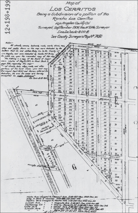
LOS CERRITOS SUBDIVISION MAP, 1906. Jotham Bixby created the Los Cerritos neighborhood in 1906 by subdividing a portion of the Rancho Los Cerritos. This survey, made by George W. Tuttle, shows the boundaries extended from Roosevelt Boulevard on the north to the intersection of Pacific Avenue and Thirty-sixth Street on the south. Cota Street on the map is today called Cedar Avenue; Nieto Street is now called Chestnut Avenue. Country Club Drive is shown on this map as Lincoln Avenue. All streets and parks were dedicated by the Southern Trust Company and Jotham Bixby Company for public use. (Courtesy of Rancho Los Cerritos.)
ON THE COVER: GOING TO LONG BEACH. This is a 1910 photograph of American Avenue (now Long Beach Boulevard) between Wardlow and San Antonio Roads. (Courtesy of the Long Beach Historical Society.)