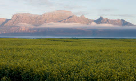
ABOVE: Rolling wheat fields and a mosaic of patterns and colours add to the allure of the Swartland.
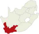
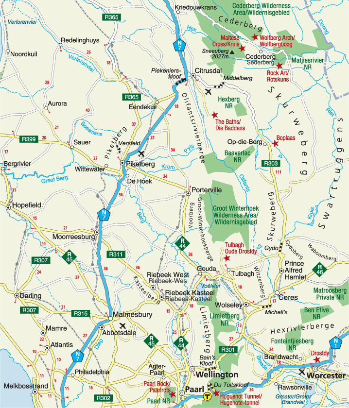
Situated along the inland margin of the lowlying coastal plains of the Sandveld in the west, the Swartland is separated from the interior plateau by the Groot Winterhoekberge in the east. Verlorenvlei River demarcates its northern boundary, which extends southwards to Malmesbury. The gently undulating plains are punctuated by low hills, as well as Kasteelberg and Piketberg, two island mountains.
The Swartland is a mosaic of rolling grain fields, vineyards, orchards, olive groves and islands of renosterveld, vegetation characterised by renosterbos and many species of the daisy, pea and thyme families. The colours of the countryside change from emerald green in winter to golden yellow in summer, and the textures also vary, such as symmetrical rows of newly ploughed soil in autumn and neat bundles of straw bales after the harvest.
The Swartland enjoys a Mediterranean climate with hot summer days that can be scorching midway through the season. Winters are cold and wet, but rainy spells are interspersed with clear blue skies and pleasant, sunny days. The high peaks of the Groot Winterhoekberge are occasionally covered by a blanket of snow in midwinter, causing temperatures to plummet below freezing.
The Swartland (‘black country’) is not named after the colour of the soil, but rather for the dull dark colour of the landscape in summer when the leaves of the renosterbos (‘rhinoceros bush’), so called because its colour resembles the hide of the black rhinoceros, turn black. This hardy shrub dominates the indigenous vegetation.
Because renosterveld grows in more fertile soils than other vegetation types, it is generally the first land to be cultivated. Sadly, isolated patches of renosterveld are all that are left after centuries of intensive cultivation, and the herds of large game species have disappeared as wheat fields have replaced renosterveld.
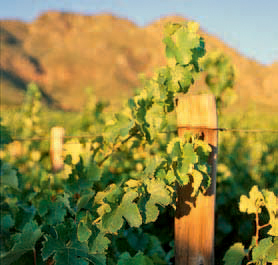
Sheep farming goes hand in hand with wheat farming, and peacefully grazing flocks are a familiar sight after the harvest has been brought in – usually by the end of October. Sheep are reared for meat and wool and although wheat is still the mainstay of the Swartland’s agriculture, other crops such as oats, barley, lupine and canola are also grown. In recent years, farming has diversified to include wine, table grapes, deciduous fruit and olives.
Protea, erica, reeds and rushes dominate the mountain fynbos vegetation of the Piketberg, and the Olifants River and the Groot Winter-hoekberge to the east, where clusters of red disa cling to stream banks in summer.
Blue crane, capped wheatear, several lark species (including the Cape clapper lark and the Cape long-billed lark), black harrier and Cape longclaw are among the endemic fynbos birds to keep an eye out for.
San hunter-gatherers roamed the mountains before the Dutch established a refreshment station at the Cape in 1652. Rock paintings in the mountains are a testimony to these people, most of whom were dispossessed, killed or enslaved soon after the arrival of the white settlers.
The region was also home to the pastoral CochoQua, a group of indigenous Khoekhoen who grazed their herds on the plains between Saldanha Bay and present-day Malmesbury. Several expeditions were dispatched into the interior by the first commander at the Cape, Jan van Riebeeck, to obtain cattle from these herders for the fledgling settlement at the Cape and for the supply of meat to passing ships.
Corporal Jan Wintervogel reconnoitred the Swartland in March 1655 and turned back after reaching the area where Malmesbury was later established. He was followed five years later by Jan Danckaert, whose expedition encountered a herd of elephants to which the Olifants River owes its name.
In 1661, an expedition led by Corporal Pieter Cruythoff set off from the Cape in search of the Namaqua, as the local Khoekhoen had told the Dutch of a wealthy tribe further north and they hoped to establish trade with them. Their interest was further stimulated by the copper bangles of the local herdsmen that originated from the Namaqua people and the hope that these people would lead them to the fabled Empire of Monomotapa. The Cruythoff Memorial at the foot of Kasteelberg (‘castle mountain’), northeast of Malmesbury, is a reminder of the expedition that honoured their commander at the Cape by naming the 946-m-high mountain Riebeeck’s Kasteel (‘Riebeeck’s castle’).
Cruythoff set off again the following year – this time in search of the Vigiti Magna, the river believed to be the frontier of Monomotapa. Early maps (based on reports of trade in gold along the east coast by Portuguese mariners) showed that Monomotapa, a kingdom believed to be extremely wealthy in gold, ivory and other goods, lay to the northeast of the settlement at the Cape. But the rugged mountain chain to the east of the Cape settlement presented a formidable barrier and explorers took the relatively easy route north – hoping that they could find a way around the mountains further inland. The expedition returned empty-handed to the Cape in 1663, but is at least remembered as the first to have used an ox-wagon.
Inevitably, Dutch expansion into the hinterland, combined with competition for grazing and water, sparked open battles between the Dutch and the indigenous herders, including a war between the settlers and the CochoQua that lasted from 1673 to 1677. Weakened by ongoing conflict, dispossession and the loss of cattle, subjugation to Dutch law and a devastating smallpox epidemic in the early 18th century, Khoekhoe society had all but disintegrated by the mid-1700s. Small groups of impoverished Khoekhoen roamed the countryside, worked as farm labourers or drifted to the mission stations established in the Cape from 1738 onwards.
The fertile, fine-grained clay soil and the climate of the Swartland were ideally suited to grain production, which gradually replaced cattle farming. By the middle of the 18th century, the Swartland was well known for its wheat and in 1795 the region was described as de graan magazyn der colonie (the grain store of the colony).
ABOVE: Allesverloren Wine Estate, on the slopes of Kasteelberg in the Riebeek Valley, has been producing wine since 1806.
Malmesbury, the largest town in the Swartland, was established on the banks of the Diep River in 1743. When it was officially proclaimed a town in 1829, it was named after the first Earl of Malmesbury in England – the father-in-law of the British governor of the Cape at the time, Sir Lowry Cole. The imposing neo-Gothic Dutch Reformed church, dating back to 1860, dominates Malmesbury’s skyline, and some fine Victorian houses have survived in the historic heart of the town. The Jewish synagogue dates back to 1911 when the Jewish community was large enough to warrant its own house of prayer, but over the years their numbers have dwindled. The building today houses the Malmesbury Museum, which has an interesting photographic collection of the town’s history and its Jewish community, and also depicts the story of bread.
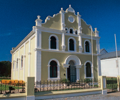
ABOVE: Malmesbury’s synagogue was built in 1911 when the town had a sizeable Jewish community. The heritage site now serves as a museum.
Enormous grain silos etched against the skyline of Moorreesburg are reminders of the importance wheat has for this town. A collection of utensils, equipment and machinery is displayed in the Wheat Industry Museum. One of only three such museums in the world, it is housed in the old Dutch Reformed mission church building.
Built in 1913, the Carnegie Library – now home to the Moorreesburg Tourism Office – features Doric columns, a barge-board gable and white plaster decorations around the windows.
The works of renowned South African artists such as Jacob Hendrik Pierneef, Maggie Laubser (who was born in the Malmesbury district) and Gregoire Boonzaier can be viewed in the Dirkie Uys Art Gallery. The collection was started years ago when matric classes donated paintings to the school on completing their secondary education.
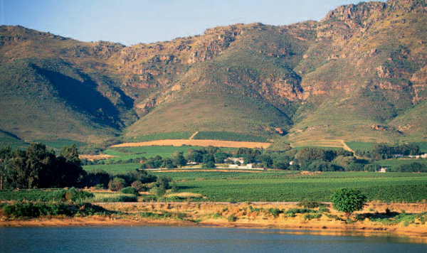
ABOVE: Piketberg, a relic of Table Mountain sandstone, rises like an island above the cultivated fields.
Laid out in the foothills of the Piket Mountain, the pleasant country town of Piketberg lies amid undulating wheat fields. The dressed sandstone Dutch Reformed church with its unusually ‘spiky’ decorative turrets and plastered panels was built in Cape Gothic style in the early 1880s. Woburn Lodge in Waterkant Street, the only surviving thatch pioneer-type house in the town, was the residence of Piketberg’s first magistrate. The town’s history is depicted in the Piketberg Museum which is furnished in Edwardian style.
Expansive views of the wheatlands unfold in the ascent of Versfeld Pass, which was originally built by hand in 1899. The cooler climate and higher rainfall on the plateau of the mountain, commonly known as Op-die-Berg (‘on the mountain’), is ideal for the cultivation of deciduous fruit and there are also several commercial wildflower farms here.
The rugged Olifants River Mountains and the Voorberg form a dramatic backdrop to the tranquil town of Porterville. Photographs and implements depicting the history of the town and the area are displayed in the Jan Danckaert Museum housed in the old magistrate’s office.
The Groot Winterhoek Wilderness Area, 33 km east of Porterville, is one of the eight separately protected areas of the Cape Floral Region, proclaimed a UNESCO World Heritage Site in 2004. The wilderness area, with its sandstone rock formations, rich diversity of proteas and several disa species, is a popular destination for outdoor enthusiasts.
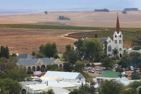
Set slightly off the main tourist track, the picturesque Riebeek Valley is a mosaic of vineyards and olive groves.
The decision to build a Dutch Reformed church at Riebeek Kasteel in 1854 caused such dissent among the congregation that a breakaway group built a church at Riebeek West in 1858, a mere 4 km away. Implements used in the cultivation of wheat and wine are displayed in the museum in the historic Oude Kerk (‘old church’) in Riebeek Kasteel.
Graceful Victorian houses line the streets of Riebeek Kasteel, a quaint country town with a square surrounded by art galleries, restaurants and coffee shops. The landmark Royal Hotel with its arched veranda dates back to 1862 and is the oldest hotel in South Africa.
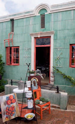
Attracted by the Riebeek Valley’s patchwork of colours and its tranquil atmosphere, a growing number of artists and crafters have settled here in recent years. Arts and crafts range from paintings, ceramics and pottery to furniture and jewellery.
The Short Street Fine Food and Wine Market is held on the last Saturday of every month in Riebeek Kasteel, while the Royal Hotel’s Farmers’ Market takes place on the last Sunday of every month. The Riebeek West Fresh Funky Market is held on the first Saturday of the month.
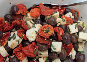
The Riebeek Valley plays host to two annual festivals: the Olive Festival in May and the Shiraz and Arts Festival in September.
Allesverloren, on the southeastern slopes of Kasteelberg, was the birthplace of Dr DF Malan, who in 1948 led the National Party to victory. Ongegund, 3 km northwest of Riebeek West, is the birthplace of one of South Africa’s most famous statesmen, Jan Smuts. The thatched-roof house in which he was born and the schoolroom, coach house, dairy and stables have been restored beautifully. An interesting collection of old photographs can be viewed in one of the outbuildings, which has been turned into a museum.
ABOVE: The spire of the historic Oude Kerk (‘old church’) towers high above the Riebeek Valley and the nearby Royal Hotel.
ACTIVITIES
• Cross-country paragliding and hang-gliding all across the Swartland
• Viewing sandstone rock formations, proteas and disas in the Groot Winterhoek Wilderness Area near Porterville
• Going to markets in Riebeek Valley, such as the Short Street Fine Food and Wine Market (last Saturday of every month), the Royal Hotel’s Farmers’ Market (last Sunday of every month) and the Riebeek West Fresh Funky Market (first Saturday of the month)
ABOVE: The Olive Festival of the Riebeek Valley has established itself as one of the top culinary celebrations in the Western Cape.
ROUTES AND TRAILS
• Various trails (2 days or longer) in the Groot Winterhoek Wilderness area
ABOVE: The rich colours, textures and tranquillity of the Riebeek Valley are an inspiration to the many artists who reside there.