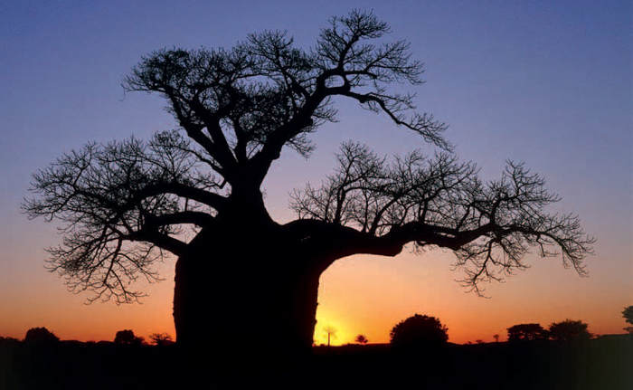
ABOVE: The iconic baobab tree is found all over the rugged Limpopo Bushveld region.
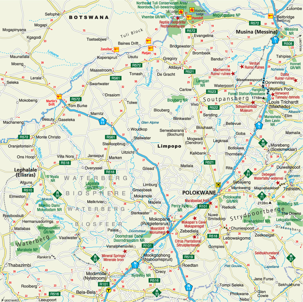
The Limpopo Bushveld is situated in the western part of Limpopo province. To the south is North West Province, to the north and west is Botswana, while the N1 highway makes up the eastern border. The terrain becomes more interesting further west, away from the N1, around the hills and valleys of the Waterberg, and in the rainforest of the Soutpansberg, in the far northern reaches of the province that push up against the Zimbabwe border.
This is hot and dry country with daytime temperatures spiralling upwards in the summer and remaining pleasant in the winter. Rain falls in summer and amounts to around 350 mm in the west and 600 mm in the northeast.
Shrub and tree species found in the Limpopo Bushveld include karee, boekenhout, acacia and combretum in the south, and mopane, knob thorn, tamboti and leadwood in the north. In the far north the baobab is common. Iron-wood, stinkwood and yellowwood are found in the well-watered Soutpansberg.
Animal life in the Waterberg can be experienced at a number of game lodges; a high point is a sighting of the endangered black rhino. Bird life is plentiful too, and aquatic birdwatching is recommended at the Nylsvley Nature Reserve, an official Ramsar site.
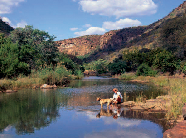
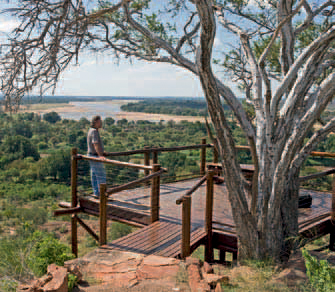
ABOVE: The tranquil Waterberg, just three hours from Johannesburg, is a perfect weekend getaway.
As in other parts of South Africa, the more recent history of Limpopo is closely associated with the turbulence and conflict that characterised the Difaqane and the arrival of Voortrekkers who had left the Cape in defiance of British rule. However, the area’s historical legacy extends much further back than that.
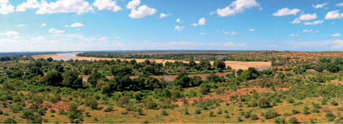
At the confluence of the Shashe and Limpopo rivers – where modern-day South Africa, Botswana and Zimbabwe meet – are the remains of an Iron Age settlement that thrived there for more than 300 years between 900 and 1300 CE.
The cultural heritage of Mapungubwe came to light in 1933, when a small party, led by one Ernst van Graan, discovered gold fragments on a hill on the farm Greefswald in the then northern Transvaal. Archaeological excavations at and near the site revealed gold, copper, iron, ceramic and ivory objects, shells, animal bone tools, and indigenous and glass trade beads. The glass beads originated from India, North Africa, Arabia and Asia and their discovery provides evidence that Iron Age communities were actively involved in Indian Ocean trade networks as early as the 10th century. In exchange for items such as glass beads and cloth, Mapungubwe exported gold, ivory and other goods.
Mapungubwe Hill has also been referred to as ‘The Lost City of Gold’ due to further discoveries that included a golden rhinoceros figurine, a golden sceptre and a golden bowl. These objects, along with more than 156 000 other artefacts found at the site, are now housed in the Mapungubwe Museum at the University of Pretoria.
The remains unearthed at Mapungubwe are proof of the existence and subsequent decline of an African state, which, at its height, was the largest kingdom in the subcontinent. In recognition of its historic and cultural importance the Mapungubwe Cultural Landscape was proclaimed a World Heritage Site in 2003. But the region’s history goes even further back: there is ample evidence of San occupation near the Limpopo–Shashe confluence. More than 150 rock-art sites, dating back some 5 000 years, have been found in the area.
The provincial capital, Polokwane (‘place of safety’), is a Voortrekker-founded town that took its former name, Pietersburg, from Petrus (Piet) Joubert. Today it is a centre of manufacturing and commerce, as well as the headquarters of the Limpopo Tourism & Parks Board. It offers a number of animal attractions, such as the Polokwane Game Reserve, Polokwane Bird and Reptile Park, Moletzie Bird Sanctuary and Chuene Crocodile Farm. Interesting museums include the Bakone Malapa Northern Sotho Open-Air Museum, the Polokwane Art Museum and the Hugh Exton Photographic Museum. There are also sites associated with Voortrekker history, the second Anglo-Boer War of 1899–1902 and the discovery of gold.
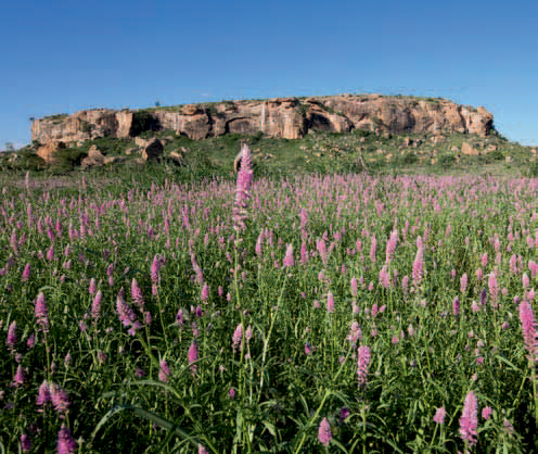
ABOVE: Mapungubwe National Park, in the remotest corner of Limpopo province, is one of the most pristine parks in the country.
ABOVE: Several golden treasures, dating back centuries, have been found in the ancient graves at Mapungubwe Hill.
ABOVE: Rustic accommodation at Mapungubwe National Park is designed to let nature play a starring role.
Musina (previously Messina) is South Africa’s northernmost town. The busy border at Beit-bridge, to the north, controls traffic in and out of Zimbabwe, while some 40 km to the southeast the sulphurous mineral springs of Tshipise (‘hot spring’) beckon in the grounds of a holiday resort.
Thanks to the mineral-rich Messina Fault, modern Musina thrives as a copper and diamond mining town, but its prehistory is also closely associated with mining and metal working in South Africa, for extensive Iron Age copper workings have been discovered in the area. Shafts or trenches, some reaching a depth of 25 m, were dug to follow the veins of ore, which, once excavated, were lifted to the surface in baskets. The ancient miners used hammerstones and chisels made of iron to break the ore, before melting it in furnaces. Copper was valued by Iron Age societies for its ornamental use and as a trade object.
Louis Trichardt, named after the Voortrekker leader who set up camp here in 1836, has a tinge of the ‘Wild West’ as it once attracted ivory hunters and traders, as well as gunrunners. It is also known as Makhado, after Chief Makhado of the Venda who took a dim view of these shenanigans and overran the town. This story is retold in exhibits at the open-air Schoemansdal Museum, west of the town.
Other attractions in the area include San rock art, Voortrekker heritage sites, the Manavhela Ben Lavin Nature Reserve and the Albasini Dam, which offers water sports and other recreational activities. Some 35 km south of Makhado on the N1 is a sign indicating the Tropic of Capricorn.
Mokopane is another town originally named for a Voortrekker leader (Piet Potgieter), later renamed after a local chief (Makapan) – in this instance the adversaries in a tragic tale. In 1854, a group of Voortrekkers resting in the area was set upon by Tlou warriors under chiefs Makapan and Mapela, and the entire party of 28 Boers lost their lives. Expecting a reprisal, Makapan led his 2 000-strong army into some limestone caves, now known as Makapansgat (Makapan’s Cave), where they planned to hide. They took grain with them, expecting the caves to yield an adequate water supply.
A Voortrekker commando led by Potgieter then laid siege to the caves for a period of 30 days, during which periodic skirmishes were fought and Potgieter was killed. Finally, when no further shots came from the cave, the Voortrekkers stormed in and found the bodies of 1 500 warriors who had succumbed to thirst and hunger. The remainder are believed to have escaped.
The caves have also revealed significant fossil finds of early humans and animals, and are today a heritage site. The Arend Dieperink Museum in Mokopane and nature reserves in the vicinity are other sites worth visiting.
This town in the Waterberg owes its existence not to a gold rush, but to the discovery of tin that resulted in an influx of prospectors and the start of a boom town. In 1925 platinum was discovered here too. The naboom tree (euphorbia) is a common sight, and the Nylsvley Nature Reserve is a good spot for aquatic birding, with some 470 species recorded.
The tale behind the establishment of this Waterberg town is intriguing: a group of Voortrekkers from Groot Marico decided that their best bet to escape British rule was to head as far north as possible ... all the way to the Holy Land. When they happened upon a river and a hill that resembled a pyramid they believed they had arrived in Egypt. The river, they assumed, was the Nile (Nyl), and they named their settlement Nylstroom (‘Nile stream’).
The town’s new name, Modimolle, means ‘the spirits have eaten’ and honours the local tribal tradition of offering food to the ancestors. Tourist highlights include churches and museums, and the entrance pillars of a second Anglo–Boer War concentration camp.
The therapeutic hot springs first discovered here by the Tswana 200 years ago, who named them Bela-Bela (‘the water which boils on its own’), are modern Bela-Bela’s biggest selling point. The Afrikaans name, Warmbad (‘warm bath’), was dropped in 2002 in favour of the original Tswana appellation. A holiday resort has grown up around the 53 °C springs, and if you can tear yourself away from the soothing mineralised waters and spa treatments, there are restaurants and shopping facilities at the waterfront in this town.
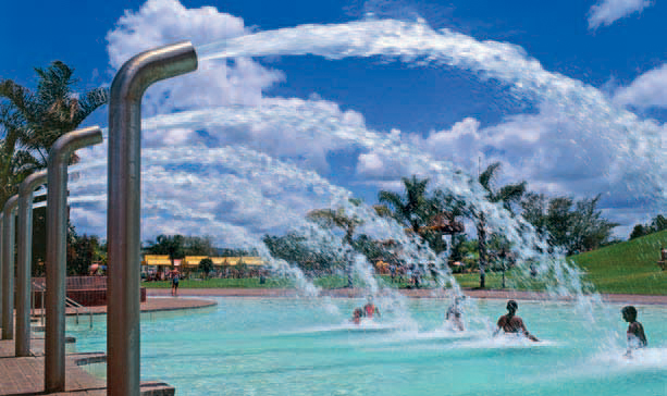
ABOVE: The hot springs at Bela-Bela are a popular family holiday destination, and there are a number of resorts catering to families travelling with children.
Life in the town of Thabazimbi revolves around the mining of iron ore. Some 10 km west is the Marakele National Park that boasts not only elephant, rhino and feline predators, but also one of the world’s largest remaining colonies of endangered Cape vulture.
Ellisras, named for its founders Patrick Ellis and Piet Erasmus, changed its name to Lephalale, meaning ‘heartbeat of the Bushveld’. This Waterberg town is the site of a large colliery. In its environs are a good number of game- and trophy-hunting farms. The Mokolo Dam is popular with anglers and the D’Nyala Nature Reserve is a choice picnic, hiking and birding spot.
ACTIVITIES
• Camping outside Mokopane
• Angling at Frikkie Geyser Dam and the Doorndraai Dam Nature Reserve near Mookgophong and the Mokolo Dam near Lephalale
• Birdwatching and picnicking at the Nylsvley Nature Reserve near Mookgophong
• Relaxing in the hot springs at Bela-Bela
• Game viewing at Marakele National Park near Thabazimbi
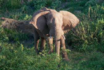
ABOVE: Mapungubwe National Park is not only of cultural importance, but also stocked with a great variety of wildlife.
ROUTES AND TRAILS
• Hanglip Trail (2 days) at Makhado from the Hanglip forest station, which includes a climb up a 1 700-m peak
• Horse trails (2 hours–1 day) in the Waterberg
• Two Kransberg nature trails (6 and 9 hours) outside Thabazimbi
• Three Wag ’n Bietjie hiking trails (2–6 hours) near Bela-Bela
• Vasbyt Hiking Trail (2 days) near Mookgophong