Accessibility: 
![]()
Geographic coordinates: 43° 46' 48" N 69° 39' 00" W
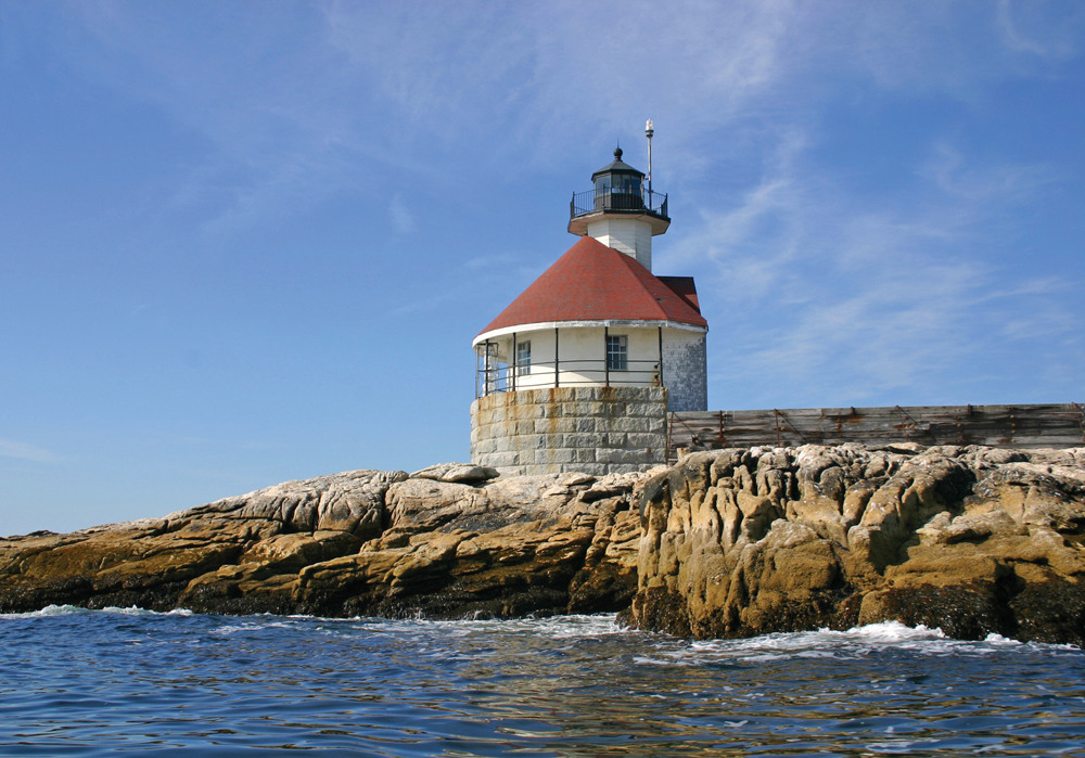
Nearest town: Southport. Located on a ledge off Cape Newagen, on the approach to Boothbay Harbor.
Established: 1892 (as fog signal station). Present lighthouse built: 1907. Automated: 1975.
Height of tower: 48 feet. Height of focal plane: 59 feet.
Earlier optic: Fourth-order Fresnel lens. Present optic: VRB-25.
Characteristic: Two white flashes every 6 seconds.
Fog signal: One blast every 15 seconds.
In 1890, a recommendation was made for a fog signal station on the ledges known as the Cuckolds, which were “much dreaded by mariners in thick weather.” The station was established in 1892 for about $25,000, with a steam-driven Daboll fog trumpet.
In January 1896, keepers Edward H. Pierce and Clarence Marr rescued the crew of the Canadian schooner Aurora by launching their dory in heavy seas and taking the three men to the fog signal station. The keepers were awarded silver watches by the Canadian government.
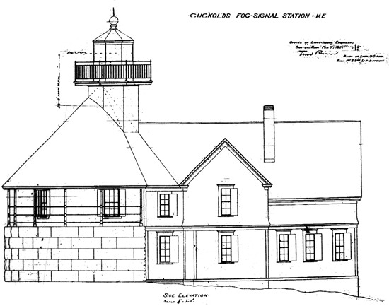
Local mariners believed a navigational light was called for, and the government agreed in 1907. The ledge was too small to build a separate lighthouse, so a small tower was built on the roof of the signal house. An attached two-story keeper’s dwelling was also built.
Coast Guardsman Kelly Farrin lived with his wife at the Cuckolds in 1969–70. He later wrote, “They say lighthouses are romantic, but I do know that this one had quite a reputation concerning the divorce rate. I would say it takes a sturdy relationship to endure that much togetherness. There is no time apart, unless the wife goes ashore alone.”
The keeper’s dwelling was demolished in 1977. In May 2006, ownership of the lighthouse was conveyed to a local nonprofit organization, the Cuckolds Fog Signal and Light Station Council (www.cuckoldslight.org). Reconstruction of the keeper’s dwelling began in the summer of 2011. All of the building materials for the project were donated by Hancock Lumber.
Views are possible from the town landing at the southern tip of Southport Island. From Route 1 in North Edgecomb, take Route 27 South for about 12 miles through Boothbay Harbor to Southport. At its southern end, Route 27 takes a left turn before its junction with Route 238. Instead of turning north onto Route 238, bear right onto a paved road at a Town Landing sign. Continue a short distance to the small parking area. The lighthouse can be seen about a half mile offshore to the southeast.
Closer views are available from cruises offered by the Maine Maritime Museum (207-443-1316, www.mainemaritimemuseum.org) in Bath, and by Cap’n Fish’s Whale Watch and Scenic Boat Tours (207-633-6605, www.boothbayboattrips.com) and Goddess of the Sea Cruises (207-649-2628, www.goddesscruise.com) in Boothbay Harbor.
Fascinating Fact 
A keeper’s wife was sewing near a second-story window in the keeper’s quarters one August day when a “freak wave” poured through the window, damaging much of the furniture.