Accessibility: 
Geographic coordinates: 44° 22' 57" N 68° 49' 07" W
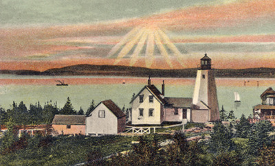
Nearest town: Castine. Located at the east side of the entrance to the Penobscot River.
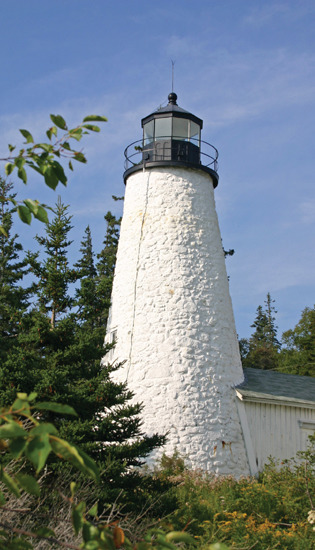
Established: 1828. Present lighthouse built: 1829. Deactivated: 1935.
Height of tower: 51 feet.
Earlier optic: Fourth-order Fresnel lens. Present optic: 250 mm.
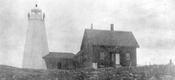
Dice Head Light served to guide mariners headed into the Penobscot River toward Bangor, a leading lumber port. First lighted in June 1829 by keeper Jacob Shelburne, the conical stone tower is lined with brick. In 1858, the entire tower was surrounded with a six-sided wooden frame. The frame was removed in the late 1800s.
Shipping in the area fell off, and in 1935 the light was discontinued and replaced by a skeleton tower by the edge of the water. The keeper’s house and surrounding property became the property of the town of Castine in 1937. In 1956, the lighthouse itself was turned over to the town. The keeper’s house is rented by the town to help pay for the upkeep of the property.
The tower lost some chunks of mortar over the years. Inspectors found interior disintegration in the lighthouse that could have eventually caused serious problems. A 1998 renovation involved a method called “slurry injection.” Slurry—clay or cement mixed with a liquid—was injected through holes in the tower.
In September 2007, a wind storm or “microburst” toppled the skeletal tower. A short time later, it was announced that the Coast Guard would install a new optic in the lighthouse tower, making it an active aid to navigation again after 72 years in darkness. A 250-mm optic went into service on January 1, 2008, exhibiting a white flash every 6 seconds.
Fascinating Fact 
Castine is one of America’s oldest communities. Beginning in the early 1600s, it was the site of trading posts, forts, missions, and permanent settlements of France, Holland, England, and colonial America.
Directions: From Route 1 in Orland, take Route 175 South. In about eight miles, Route 175 goes to the left. Continue straight onto Route 166. In approximately one mile, bear right onto Route 166A. At the next junction with Route 166, take Route 166 and continue into Castine. Take a right at a golf course onto Battle Avenue. Follow Battle Avenue past the Maine Maritime Academy for about a mile to the lighthouse on your right. There’s free parking, and a path leads around the tower, affording good views. The grounds are open to the public daily until sunset; be sure to respect the privacy of the residents of the keeper’s house.
SIDE TRIP: Fort Knox State Historic Site
Fort Knox, on the west bank of the Penobscot River, was built between 1844 and 1864. It’s a National Historic Landmark and one of the most beautifully preserved forts in New England. Visitors can stroll the scenic grounds and learn about the rich history of the site. The fort also features two complete Rodman cannons. Guided tours are available daily during the summer season.
Fort Knox State Historic Site
711 Fort Knox Road
Prospect, ME 04981
Phone: 207-469-7719
Web site: fortknox.maineguide.com