Accessibility: 
![]()
Geographic coordinates: 41° 43' 31" N 71° 20' 20" W
Nearest city: Barrington. Located on the east side of the entrance to the Providence River.
Established: 1828. Present lighthouse built: 1856. Deactivated: 1868.
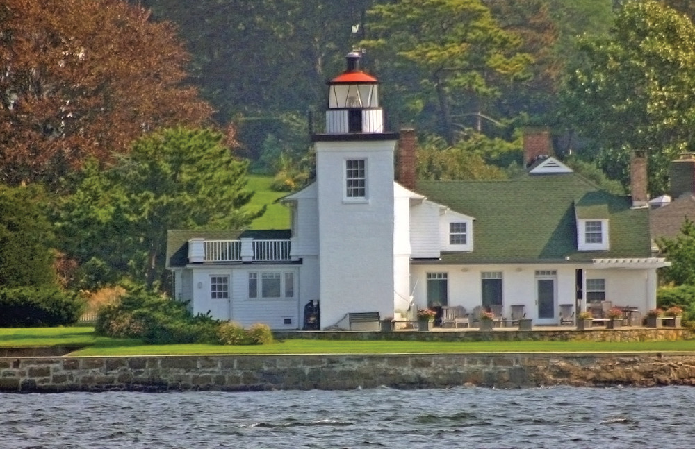
Height of tower: 25 feet. Height of focal plane: 31 feet.
Previous optic: Fourth-order Fresnel lens. Present optic: none.
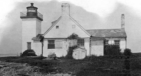
As Providence became a thriving center of commerce by the early 1800s, it became clear that a lighthouse was needed to guide vessels into the Providence River. Congress appropriated $3,500 for the lighthouse in May 1828. A 23-foot octagonal brick tower was completed along with a five-room, unattached stone dwelling. The tower wasn’t built well; the stairs were too narrow and the lantern was too small.
A severe storm in 1855 damaged the lighthouse. A new 25-foot, square-brick tower was completed in 1856. The tower exhibited a navigational light for only about a dozen years. A new granite lighthouse was established offshore to mark Conimicut Shoal, and the light at Nayatt Point was extinguished on November 1, 1868.
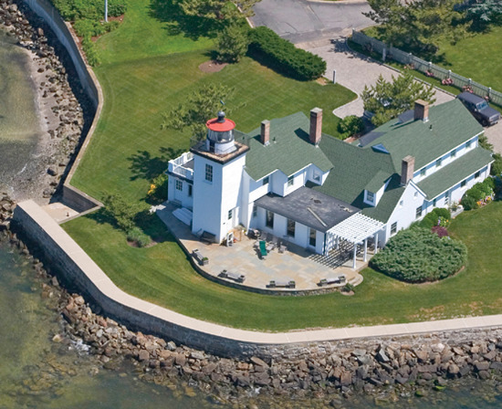
At first, the keepers lived at the old Nayatt Point dwelling and rowed to the new light. After a lighthouse with integral living quarters was built at Conimicut Shoal in 1883, the property at Nayatt Point was sold to a private owner. Len and Barbara Lesko owned the property in recent years. When severe weather threatened, the Leskos sealed up the building with heavy hatch covers over all the doors and windows. They never experienced any major storm damage, but they did find quahog clams on the roof after Hurricane Bob in 1991. The Leskos sold the property in 2001.
Fascinating Fact 
The keeper’s house here is the oldest one in Rhode Island.
The grounds are not accessible to the public. It is possible to get a view by walking about two miles on the Barrington Town Beach. The beach is open to town residents only from June to Labor Day, but it is open to everyone in the off-season. From Route 114, turn south onto Rumstick Road. Turn right at Nayatt Road, then turn left at Bay Road. Continue to the parking area for the beach. Walk west on the beach toward Nayatt Point. You will reach a close side-view of the lighthouse property, and you’ll also have a distant view of Conimicut Light offshore.
If you follow the directions above but continue on Nayatt Road to its end, you can get a view of the lighthouse property from the road. The view is somewhat obstructed. If you visit to photograph the lighthouse from the road or from the beach, be sure to respect the privacy of the residents.