Accessibility: 

Geographic coordinates: 41° 39' 03" N 70° 47' 44" W
Nearest town: Mattapoisett. Located at the north side of the entrance to Mattapoisett Harbor.
Established: 1838. Present lighthouse built: 1838. Automated: 1923. Deactivated: 1952. Relighted: 1961.
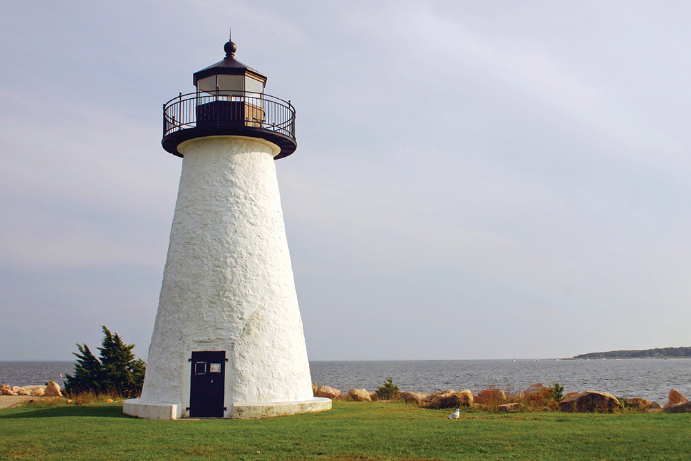
Height of tower: 39 feet. Height of focal plane: 41 feet.
Previous optic: Fifth-order Fresnel lens. Present optic: 250 mm.
Characteristic: White light; 3 seconds white alternating with 3 seconds darkness.
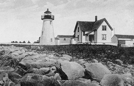
Congress appropriated $5,000 on March 3, 1837, for a lighthouse at Ned’s Point. A small stone dwelling was built close to the conical stone lighthouse. The original birdcage-style lantern was replaced by an octagonal lantern at some point before 1888, likely at the same time that a fifth-order Fresnel lens was installed in 1857. The present lantern was installed in 1896.
Zimri Tobias “Toby” Robinson became keeper at Ned’s Point in 1912. His granddaughter, Hildegard Saunders, later recalled pushing her doll carriage along the shore at Ned’s Point and popping corn on the furnace in the keeper’s house.
The Coast Guard decommissioned the light in 1952. In 1958, the site, except the tower itself, was sold to the town of Mattapoisett, and Veterans Memorial Park was developed with the lighthouse as the centerpiece. The light became active again with a new modern optic in 1961. In 1993, the local Coast Guard Auxiliary Flotilla adopted the lighthouse. Auxiliary members renovated the lighthouse in 1995–96. More work was completed on the tower in 2001.
Veterans Memorial Park is open to the public daily. Thanks to Coast Guard Auxiliary volunteers, the lighthouse has been open to the public on a limited basis. In 2011, the lighthouse was open in July on Thursdays, 10 a.m. to noon, and in August on Thursdays, 4 to 6 p.m., ending on August 18. Contact Bert Theriault at nedspointlight@comcast.net for the latest information.
To reach Veterans Memorial Park from Route 6 East, turn right onto Main Street at a traffic light. Main Street becomes Water Street, then Beacon Street as it continues uphill and bends right. Follow to Ned’s Point Road and follow to the parking area. From Route 6 West, where the road forks and Route 6 continues to the right, continue straight on Marion Road. Follow Marion Road to Ned’s Point Road and follow to the park. For further information on Veterans Memorial Park, call the Town of Mattapoisett at 508-758-4121.
Fascinating Fact 
In 1923, the keeper’s house at this station was loaded on a barge and floated across Buzzards Bay to Wing’s Neck Light in Bourne, where it is now a private home.