Accessibility: 
![]()
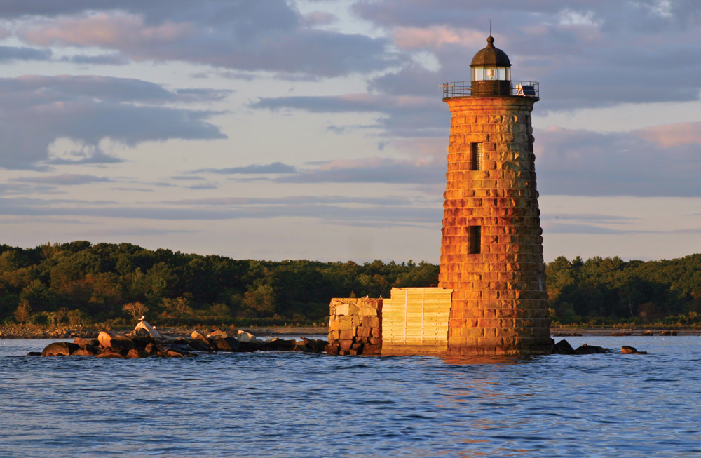
Geographic coordinates: 43° 03' 31" N 70° 41' 48" W
Nearest town: Kittery. Located on a ledge at the entrance to the Piscataqua River.
Established: 1830. Present lighthouse built: 1872. Automated: 1963.
Height of tower: 50 feet. Height of focal plane: 59 feet
Earlier optic: Fourth-order Fresnel lens.
Present optic: VLB-44 (LED)
Characteristic: Two white flashes every 10 seconds.
Fog signal: Two blasts every 30 seconds.
The first lighthouse on Whaleback Ledge leaked badly in storms and heavy seas. Some wooden sheathing was added around the tower in 1837. This apparently helped the problem of the tower leaking, but keeper Samuel E. Hascall reported that during one great storm on July 7, 1837, the shaking of the tower was so violent that “some of the small stones of the tower were shaken out and fell upon the floors of the rooms, and articles of furniture were displaced by the motion of the tower.”
In 1871, keeper Ferdinand Barr, a Civil War veteran, drowned in heavy seas while away from the lighthouse tending his lobster traps. He was about thirty years old and left his wife and three children.
A new tower was erected in 1872 for $75,000. The lighthouse was constructed of granite blocks dovetailed together in similar fashion to Minot’s Ledge Light in Massachusetts. In 1878, a new iron tower was constructed next to the lighthouse to serve as a signal house for a new Daboll fog trumpet. The iron tower, which was a little more than half the height of the lighthouse, no longer stands.
In 2007, under the provisions of the National Historic Lighthouse Preservation Act, the lighthouse was made available to a suitable new steward. The American Lighthouse Foundation and its chapter, the Friends of Portsmouth Harbor Lighthouses, submitted a successful application. See www.lighthousefoundation.org and www.whalebacklighthouse.org for more information.
Whaleback Light can be seen from Fort Constitution, Fort Stark, and Odiorne Point on the New Hampshire coast. The closest mainland view is from the Maine side, at Fort Foster in Kittery. From Route 1 in Kittery, head east on Route 103 for 3.4 miles. Bear right onto Chauncey Creek Road. In about a half mile, turn right on Gerrish Island Lane and cross a bridge, then bear right onto Pocahontas Road and follow to the park entrance. From Memorial Day to Labor Day, there’s a fee to drive into the park. The gate to the park is closed in the off-season, but you can park outside the gate and walk in. For more information, call 207-439-3800.
Fascinating Fact 
Surprisingly, although it’s on the Maine side of the border, this lighthouse is south of Portsmouth Harbor Lighthouse in New Hampshire.
The lighthouse can also be seen from cruises leaving Portsmouth offered by Portsmouth Harbor Cruises (603-436-8084, www.portsmouthharbor.com) and the Isles of Shoals Steamship Company (603-431-5500, www.islesofshoals.com), as well from cruises leaving Kittery Point (207-439-3655, www.capandpatty.com).