Accessibility: 
![]()
Geographic coordinates: 43° 07' 18" N 70° 28' 36" W
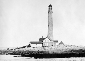
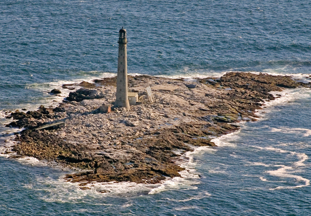
Nearest town: York. Located on a small island (approximately 400 square yards) about six miles southeast of Cape Neddick.
Established: 1811. Present lighthouse built: 1855. Automated: 1978.
Height of tower: 133 feet. Height of focal plane: 137 feet
Earlier optic: Second-order Fresnel lens. Present optic: VRB-25.
Characteristic: White flash every 5 seconds.
Fog signal: One blast every 10 seconds.
Before a lighthouse was established on this remote pile of granite off the southern Maine coast, shipwrecks on the island were not uncommon. The most famous was the wreck of the British ship Nottingham Galley on December 11, 1710. The survivors struggled to stay alive for over three weeks, finally resorting to cannibalism. After the Nottingham Galley disaster, local fishermen began leaving barrels of provisions on Boon Island in case of future wrecks.
An unlighted wooden 50-foot tower was erected on the island in 1799; a stone day beacon succeeded it in 1805. The island’s first lighthouse was completed in late 1811. The first keeper, after witnessing the vulnerability of the low island to storms, left after only a few weeks. The lighthouse was destroyed by a storm in 1831 and was soon rebuilt, with a light exhibited 32 feet above the sea. The present granite lighthouse was constructed between 1852 and 1854, along with a new dwelling. The tower’s second-order Fresnel lens went into operation on January 1, 1855.
Captain William C. Williams, a native of Kittery, served as keeper from 1885 to 1911. In an 1888 storm, Williams and the others on the island had to take refuge at the top of the tower for three days. One Thanksgiving, Williams and his assistants were unable to go ashore to buy a turkey. Providence intervened when a dozen black ducks smashed into the tower, providing the keepers with their Thanksgiving dinner.
The destructive blizzard of early February 1978 flooded the keeper’s house and scattered boulders around like they were pebbles. The Coast Guard keepers were forced to take refuge in the tower; on the following day they were removed by helicopter. The light was automated a short time later, and the remains of the keeper’s house were destroyed.
SIDE TRIP: Kittery Historical & Naval Museum
This small museum next to Kittery Town Hall displays items and artifacts that reflect Kittery’s rich past. Of special interest to lighthouse fans is the enormous second-order Fresnel lens that once served inside Boon Island Lighthouse. There are also ship models, old maps, scrimshaw, navigation instruments, a sea chest, a diving suit, and much more. The museum is open from June to Columbus Day, Tuesday through Saturday.
Kittery Historical & Naval Museum, Rogers Road Extension
P.O. Box 453
Kittery, ME 03904
Phone: 207-439-3080
In May 2000, the lighthouse was licensed by the Coast Guard to the American Lighthouse Foundation. On April 1, 2003, the “Republic of Boon Island” declared its (fictional) independence in an effort to raise funds for preservation by selling citizenships and political offices. For more information, visit the American Lighthouse Foundation web site at www.lighthousefoundation.org or call 207-594-4174.
Fascinating Fact 
This is the tallest lighthouse tower in New England.
The slender tower can be seen very distantly from locations on the coast of southern Maine, including Sohier Park in York. Better views are available from occasional lighthouse cruises leaving Portsmouth offered by the Isles of Shoals Steamship Company (603-431-5500, www.islesofshoals.com). Friends of Portsmouth Harbor Lighthouse also holds lighthouse cruises periodically; check www.portsmouthharborlighthouse.org for the schedule.