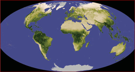
A desert is any large, extremely dry area of land with sparse vegetation. It is one of the Earth’s major types of ecosystems, supporting a community of distinctive plants and animals specially adapted to the harsh environment. According to some definitions, any environment that is almost completely free of plants is considered desert, including regions too cold to support vegetation—i.e., “frigid deserts.” Other definitions use the term to apply only to hot and temperate deserts, a restriction followed in this account. The unusually dry conditions and poorly developed soils of deserts lead to the distinctive landforms associated with these regions—for instance, bare rocky or gravelly plains or huge shifting sand hills known as dunes. Flat salt-encrusted depressions known as playas are frequently found. Life exists in extremely dry conditions, but only in delicate balance with an environment that is subject to harsh conditions. It is now clear that in several regions desert environments are expanding—a process called desertification. This process results from various factors, including climatic variation and human activities. In areas where the vegetation is already under stress, periods of drier than average weather may cause degradation of the vegetation. If the pressures are maintained, soil loss and irreversible change in the ecosystem may ensue, so that areas formerly under savanna or scrubland vegetation are reduced to desert.
Desert environments are so dry that they support only extremely sparse vegetation; trees are usually absent and, under normal climatic conditions, shrubs or herbaceous plants provide only very incomplete ground cover. Extreme aridity renders some deserts virtually devoid of plants; however, this barrenness is believed to be due in part to the effects of human disturbance, such as heavy grazing of cattle, on an already stressed environment.
The desert environments of the present are, in geologic terms, relatively recent in origin. They represent the most extreme result of the progressive cooling and consequent aridification of global climates during the Cenozoic Era (65.5 million years ago to the present), which also led to the development of savannas and scrublands in the less arid regions near the tropical and temperate margins of the developing deserts. It has been suggested that many typical modern desert plant families, particularly those with an Asian centre of diversity such as the chenopod and tamarisk families, first appeared in the Miocene Epoch (23 million to 5.3 million years ago), evolving in the salty, drying environment of the disappearing Tethys Sea along what is now the Mediterranean–Central Asian axis.
Deserts also probably existed much earlier, during former periods of global arid climate in the lee of mountain ranges that sheltered them from rain or in the centre of extensive continental regions. However, this would have been primarily before the evolution of angiosperms (flowering plants, the group to which most present-day plants, including those of deserts, belong). Only a few primitive plants, which may have been part of the ancient desert vegetation, occur in present-day deserts. One example is the bizarre conifer relative Welwitschia in the Namib of southwestern Africa. Welwitschia has only two leaves, which are leathery, straplike organs that emanate from the middle of a massive, mainly subterranean woody stem. These leaves grow perpetually from their bases and erode progressively at their ends. The Namib also harbours several other plants and animals peculiarly adapted to the arid environment, suggesting that it might have a longer continuous history of arid conditions than most other deserts.
Desert floras and faunas initially evolved from ancestors in moister habitats, an evolution that occurred independently on each continent. However, a significant degree of commonality exists among the plant families that dominate different desert vegetations. This is due in part to intrinsic physiologic characteristics in some widespread desert families that preadapt the plants to an arid environment; it also is a result of plant migration occurring through chance seed dispersal among desert regions.
Such migration was particularly easy between northern and southern desert regions in Africa and in the Americas during intervals of drier climate that have occurred in the past two million years. This migration is reflected in close floristic similarities currently observed in these places. For example, the creosote bush (Larrea tridentata), although now widespread and common in North American hot deserts, was probably a natural immigrant from South America as recently as the end of the last Ice Age about 11,700 years ago.
Migration between discrete desert regions also has been relatively easier for those plants adapted to survival in saline soils because such conditions occur not only in deserts but also in coastal habitats. Coasts can therefore provide migration corridors for salt-tolerant plants, and in some cases the drifting of buoyant seeds in ocean currents can provide a transport mechanism between coasts. For example, it is thought that the saltbush or chenopod family of plants reached Australia in this way, initially colonizing coastal habitats and later spreading into the inland deserts.
Deserts are varied and variable environments, and it is impossible to arrive at a concise definition that satisfies every case. However, their most fundamental characteristic is a shortage of available moisture for plants, resulting from an imbalance between precipitation and evapotranspiration. This situation is exacerbated by considerable variability in the timing of rainfall, low atmospheric humidity, high daytime temperatures, and winds.
Average annual precipitation ranges from almost zero in some South American coastal deserts and Libyan deserts to about 600 mm (24 inches) in deserts in Madagascar, although most recognized deserts have an annual rainfall below 400 mm (16 inches). Some authorities consider 250 mm (10 inches) the upper limit for mean annual precipitation for true deserts, describing places with a mean annual rainfall of between 250 and 400 mm as semideserts. Regions this dry are barely arable and contribute to human food production only by providing grazing lands for livestock.
The arid conditions of the major desert areas result from their position in subtropical regions to either side of the moist equatorial belt. The atmospheric circulation pattern known as the Hadley cell plays an important role in desert climate. In areas close to the Equator, where the amount of incoming solar energy per unit surface area is greatest, air near the ground is heated, then rises, expands, and cools. This process leads to the condensation of moisture and to precipitation. At high levels in the atmosphere, the risen air moves away from the equatorial region to descend eventually in the subtropics as it cools; it moves back toward the Equator at low altitudes, completing the Hadley cell circulation pattern. The air descending over the subtropics has already lost most of its moisture as rain formed during its previous ascent near the Equator. As it descends it becomes compressed and warmer, its relative humidity falling further. Hot deserts occur in those regions to the north and south of the equatorial belt that lie beneath these descending, dry air masses. This pattern may be interrupted where local precipitation is increased, especially on the east sides of continents where winds blow onshore, carrying moisture picked up over the ocean. Conversely, deserts may be found elsewhere, as in the lee of mountain ranges, where air is forced to rise, cool, and lose moisture as rain falling on the windward slopes.
Rainfall in deserts is usually meagre. In some cases several years may pass without rain; for example, at Cochones, Chile, no rain fell at all in 45 consecutive years between 1919 and 1964. Usually, however, rain falls in deserts for at least a few days each year—typically 15 to 20 days. When precipitation occurs, it may be very heavy for short periods. For instance, 14 mm (0.5 inch) fell at Mash’abe Sade, Israel, in only seven minutes on Oct. 5, 1979, and in southwestern Madagascar the entire annual rainfall commonly occurs as heavy showers falling within a single month. Such rainfall usually occurs only over small areas and results from local convectional cells, with more widespread frontal rain being restricted to the southern and northern fringes of deserts. In some local desert showers, the rain falling from clouds evaporates before it reaches the ground. Regions near the equatorial margins of hot deserts receive most of their rain in summer—June to August in the Northern Hemisphere and December to February in the Southern Hemisphere—while those near the temperate margins receive most of their rainfall in winter. Rain is particularly erratic and equally unlikely to occur in all seasons in intermediate regions.
In some deserts that are located near coasts, such as the Namib of southwestern Africa and those of the west coasts of the Americas in California and Peru, fog is an important source of moisture that is otherwise scarce. Moisture droplets settle from the fog onto plants and then may drip onto the soil or be absorbed directly by plant shoots. Dew also may be significant, although not in deserts in the central parts of continents where atmospheric humidity is consistently very low.
In most desert regions atmospheric humidity is usually too low to permit formation of fog or dew to any significant extent. Potential evaporation rates (the rate of evaporation that would occur if water were continually present) are correspondingly high, typically 2,500 to 3,500 mm (100 to 140 inches) per year, with as much as 4,262 mm (168 inches) potential evaporation per year having been recorded in Death Valley in California. Winds are not unusually strong or frequent in comparison with adjacent environments, but the general lack of vegetation in deserts exacerbates the effect of wind at ground level. Winds can induce the erosion of fine materials and the evaporation of moisture and thereby help determine which plants survive in the desert.
Hot deserts, as their name indicates, experience very high temperatures by day, especially in summer. Absolute maximum air temperatures in all hot deserts exceed 40 °C (104 °F), and the highest value recorded, in Libya, is 58 °C (136.4 °F). The temperature of the soil surface can rise even beyond that of the air, with values as high as 78 °C (172 °F) recorded in the Sahara. However, night temperatures can fall dramatically, because the same lack of cloud cover that admits high levels of incoming solar radiation during the day also allows rapid loss of energy through long-wave radiation to the sky at night. Absolute minimum temperatures, except in desert areas close to the sea, are generally below the freezing point. Typical mean annual temperatures are between 20 °C (68 °F) and 25 °C (77 °F).
Temperate or cold deserts occur in temperate regions at higher latitudes—and therefore colder temperatures—than those at which hot deserts are found. These dry environments are caused by either remoteness from the coast, which results in low atmospheric humidity from a lack of onshore winds, or the presence of high mountains separating the desert from the coast. The largest area of temperate desert lies in Central Asia, with smaller areas in western North America, southeastern South America, and southern Australia. While they experience lower temperatures than the more typical hot deserts, temperate deserts are similar in aridity and consequent environmental features including landforms and soils.
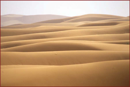
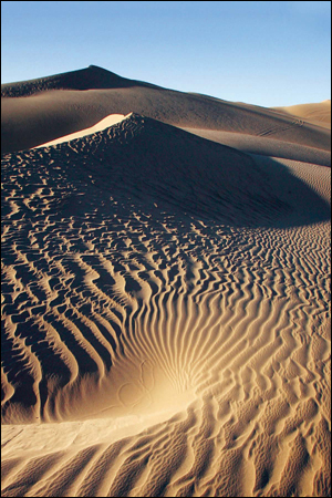
The peculiar climatic environment of deserts has favoured the development of certain characteristic landforms. Stony plains called regs or gibber plains are widespread, their surface covered by desert pavement consisting of coarse gravel and stones coated with a patina of dark “desert varnish” (a glossy dark surface cover consisting of oxides of iron). Rocky, boulder-strewn plateaus cut by dry, usually steep-sided valleys called wadis are also found in deserts in many parts of the world. The local topographic and microclimatic variations produced by this rugged surface, and the opportunities for runoff—and in a few places surface accumulation—of rainwater, are important in providing localized habitats for plants and animals. Large areas of loose, mobile sand provide the harshest and poorest of the major desert habitat types.
Desert soils are mainly immature, weakly developed in terms of their soil profiles, and mostly alkaline. Sands, sandy or gravelly loams, shallow stony soils, and alluvium (material deposited by rivers and streams) and scree-derived deposits (rocky material at the base of cliffs) predominate. Although almost always dry, these soils may support well-developed microbial communities, particularly in association with roots. Domestic animals, however, can have a deleterious impact by trampling and compacting the soil; this activity can reduce the infiltration of water and damage vegetation, leading to erosion and redistribution of soil materials.
In most cases floristic links among desert regions are indicated by the presence of related species; it is unusual for identical species to be found in more than one region, except where they have been introduced by humans. (One notable exception is the prickly saltwort [Salsola kali], which occurs in deserts in Central Asia, North Africa, California, and Australia, as well as in many saline coastal areas.) Floristic similarities among desert regions are particularly obvious where no wide barriers of ocean or humid vegetation exist to restrict plant migration. Floristic links can be observed across the great expanse of desert from the Sahara to Central Asia, despite climatic contrasts between the hot environments in areas in and around North Africa and the much colder, though still dry, regions to the northeast. Floristic links are also pronounced from north to south in Africa and the Americas. As expected, the more isolated Australian desert flora has fewer similarities to the floras of other regions.
The daisy family is the most diverse plant family in deserts overall; it is especially numerous in Australia, southern Africa, the Middle East, and North America. However, except for the widespread Artemisia (wormwood) and Senecio, which are ubiquitous, different genera in this family are found in different desert regions. Although grasses predominate in the deserts of Iran, the Sahara, and the Thar Desert of India, members of the daisy family are almost as diverse here also. Another family well represented in deserts and other vegetation types is the bean family.
More locally significant plant families in deserts include the ice plant and lily families in Africa; the cabbage family from the Sahara to Iran; the carnation family in the Middle East; and the myrtle, protea, and casuarina families in Australia. All families also occur in other vegetation types in those same regions and represent elements of regionally prominent groups that have adapted to arid environments.
Members of some other plant families are common in desert vegetation but are not prominent components of other vegetation types. The best example is the chenopod or saltbush family, which is varied and diverse in arid and semiarid regions of Australia, North America, and from the Sahara to Iran, India, and Central Asia but scarce in other ecosystems. The cactus family is very prominent in deserts in the Americas but absent elsewhere. Another example is the smaller and generally less well-known family Frankeniaceae, which is typical of salty habitats and reaches its greatest diversity in deserts from North Africa to Central Asia and in western South America.
Trees and large shrubs are found in desert environments, although they are not often prominent, at least in the driest deserts and in many regions in which they have been virtually eliminated through human action. These desert species commonly belong to the bean family (such genera as Acacia and Cassia in most regions), with conifers being more locally distributed (such as Pinus in North America, Callitris in Australia, and Cupressus in North Africa and the Middle East). Tamarisks (Tamarix) are particularly important on sandy soils in Central Asia and also occur abundantly as introduced plants in parts of the North American and Australian deserts.
Smaller shrubs include Artemisia and Ephedra in Central Asia and North America, Atriplex in both these regions and also Australia, and Larrea in North and South America. Artemisia includes many species in deserts in the Northern Hemisphere, especially in temperate deserts where they dominate the vegetation across very large areas; this genus has not spread to any of the southern deserts.
Perennial grasses occur in most deserts. In the Northern Hemisphere, species of Aristida and Panicum are present in most hot deserts, and Stipa is found in temperate deserts. In Australia, spinifex grasses (Plectrachne and Triodia) are widespread.
A few large, common, conspicuous plants provide deserts with much of their regional character. In North America, the Sonoran Desert of northwestern Mexico and the adjacent areas of California and Arizona are dotted with large cacti, especially the tall saguaro (Cereus giganteus), while to the north in the cooler Mojave Desert the characteristic Joshua tree (Yucca brevifolia) is found. The creosote bush (Larrea tridentata) is common in both areas. The spiny, hummock-forming spinifex grasses typify Australian deserts, while fleshy, cactuslike species of Euphorbia are conspicuous in deserts located in parts of southern and eastern Africa.
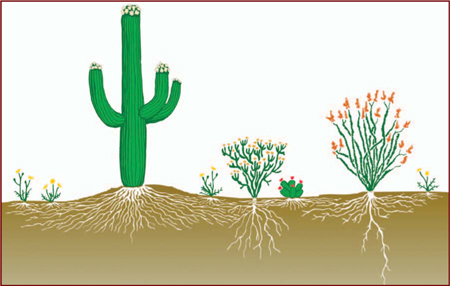
Vegetation profile of a desert. Encyclopædia Britannica, Inc.
The larger animals of deserts are more regionally distinct than are the plants. Australia—geographically the most isolated continent—is most distinctive. The Australian desert fauna is marked by a very high diversity of reptiles, in comparison with other regions, and fewer mammals, a situation shared in some degree with the South American deserts. Many Australian mammals that are not rodents—the most diverse group of mammals in other deserts—are marsupials. Marsupials include a wide range of kangaroos, wallabies and their relatives, bandicoots, and the burrowing marsupial mole. Many smaller Australian desert mammals have recently become rare or extinct. A common animal in many Australian desert areas today is the European rabbit, which was introduced by humans. Various native species of rabbit and hare are typical occupants of most other desert regions. Camels have been introduced and are also well established in Australian deserts; this region is now the only place where camels occur in a totally undomesticated state.
In the hot deserts of the Old World, most large, herbivorous mammals at the present time, including camels, donkeys, goats, sheep, and horses, are domesticated. Wild species such as gazelles, ibexes, and oryxes are generally rare. Smaller burrowing rodents are more common and varied, as are reptiles. Large carnivores include foxes, hyenas, and several cat species, such as leopards and lynx, although the largest species, the lion, has become extinct there.
Many desert birds are nomadic, a habit that enables these creatures to relocate to areas in which rain has fallen recently and which provide a temporary abundance of food. Seed-eating finches and pigeons are among the typical birds of many desert regions; Australia is again the exception in having few finches but many desert parrots instead—for example, the budgerigar (Melopsittacus undulatus). Carnivorous birds can depend on their prey for water, but seedeaters need to drink and sometimes fly considerable distances to locate surface water.
Desert plants and animals have many peculiar adaptations that enable them to survive long periods of moisture shortage and to take maximal advantage of short, infrequent wet periods.
Perennial plants commonly survive dry times by becoming physiologically inactive. In some cases they remain alive but are desiccated until water becomes available, at which time they rapidly absorb moisture through aboveground parts, swelling and resuming physiological activity. Some plants can absorb dew, which for many is the main water source. Mosses and lichens adopt this strategy, as do some flowering plants, which are sometimes called resurrection plants.
Other desert plants survive dry periods through underground organs such as bulbs, tubers, or rhizomes. These structures are inactive, requiring and using little water until triggered to grow by rain soaking into the soil. They then grow rapidly, using food reserves stored within, flowering and setting seed before soil moisture becomes substantially depleted once more.
Certain plants, including large woody plants and some herbaceous perennials, can remain physiologically active to some extent through dry periods. Plants employ several strategies to carry this off: water storage organs, such as the succulent stems of cacti, euphorbias, and ice plants, hold water until it is needed; very deep root systems reach soil moisture at depth; and certain features, such as leaves of reduced size or hairy or reflective leaves, reduce water loss.
Another typical feature of desert floras is their large proportion of ephemeral plants, which survive dry periods as resistant, dormant seeds. After a rain, the seeds germinate at once and the plants grow quickly, flower early, and complete their reproduction within a few weeks before the soil dries out again. It is primarily plants with this response that cause the deserts to bloom after infrequent storms.
Desert animals show many comparable adaptations to infrequent moisture availability in deserts, resulting in little activity during the usually dry times and intense activity in the brief, infrequent wet periods. During dry conditions many desert animals remain underground in holes or burrows in which the air is relatively cool and humid; more than half of desert animals are subterranean in their habits. Some, such as snails, may remain dormant for long periods, while others, such as burrowing mammals, emerge to feed only at night when conditions are cool and much less dehydrating. Reproduction may cease altogether in years of extreme drought, as it does in some lizards.
In the highly stressful desert environment, biological productivity is generally very low; however, it is also highly variable from time to time and from place to place. Temporal variations are caused by the occasional input of moisture; this allows the vegetation to grow for only a short period before arid conditions resume. Spatial variations are due in part to the structural patchiness of the vegetation itself, as surface soil beneath shrubs is several times more fertile than it is between shrubs. Shrub roots contribute to this process by retrieving nutrients from the deep soil and depositing them in litter on the soil surface beneath the shrub canopy. Windblown litter that accumulates around shrubs and the microbial flora found in soil shaded by the shrub canopy also create patchy, fertile areas. Because human disturbance of desert vegetation commonly involves the partial or total removal of the shrub cover, the impact of human disturbance on these ecosystems is significant.
Playas, also called pans, flats, or dry lakes, are flat-bottom depressions found in interior desert basins and adjacent to coasts within arid and semiarid regions. Named from the Spanish word for “shore” or “beach,” playas are periodically covered by water that slowly filtrates into the groundwater system or evaporates into the atmosphere, causing the deposition of salt, sand, and mud along the bottom and around the edges of the depression.
Playas are among the flattest known landforms. Their slopes are generally less than 0.2 metre per kilometre (1.06 feet per mile). When they are filled with only a few centimetres of water, many kilometres of surface may be inundated. It is the process of inundation that develops and maintains the near-perfect flatness so characteristic of these arid-region landforms.
Playas occupy the flat central basins of desert plains. They require interior drainage to a zone where evaporation greatly exceeds inflow. When flooded, a playa lake forms where fine-grained sediment and salts concentrate. Terminology is quite confused for playas because of many local names. A saline playa may be called a salt flat, salt marsh, salada, salar, salt pan, alkali flat, or salina. A salt-free playa may be termed a clay pan, hardpan, dry lake bed, or alkali flat. In Australia and South Africa small playas are generally referred to as pans. The low-relief plains of these lands contrast with the mountainous deserts of North America, resulting in numerous small pans instead of immense playas. The terms takyr, sabkha, and kavir are applied in Central Asia, Saudi Arabia, and Iran, respectively.
Saline flats are specialized forms located adjacent to large bodies of water, as, for example, along coasts, lakeshores, and deltas. They flood during storms, either with surface runoff or with surges from the nearby body of water. The saline crusts of saline flats are quite similar to those that develop in playas.
Enclosed basins of salt and clay accumulation may originate from numerous causes. Tectonic causes include faulting, as in the East African Rift Valley and Death Valley, and warping, as in Lake Eyre in Australia, Lake Chad in central Africa, and Shaṭṭ al-Jarīd (Chott Djerid) in Tunisia. Wind deflation can produce shallow basins with downwind dunes, as in southeastern Australia. Even very large basins, such as the Qattara Depression of Egypt, have been ascribed to deflation. Local cataclysmic disruptions of drainage (e.g., volcanism, landslides, and meteorite impacts) may produce playas in desert regions.
Modern playa surfaces are not passive receptors of sediment as they were once believed to be. They serve as important sources of dust and salts, which are blown to the surrounding uplands. Complex assemblages of minerals and sediments occur on the playa surfaces. These directly reflect their environment of deposition and may be used to interpret ancient environmental conditions.
Two broad classes of playas may be defined on the basis of past histories. One type develops from the desiccation of a former lake. Sediments in such a playa are primarily lacustrine, rather than derived from modern depositional processes. The second type of playa has no paleolacustrine heritage. Small salt pans in South Africa, called vokils, are of this type.
The supply of material, basin depth, and duration of accumulation all contribute to variations in the thickness of playa deposits. Very thick playa sequences may have alternating layers of lacustrine clays and salt beds. The former generally reflect periods of high floodwater runoff into the closed basins, perhaps induced by higher rainfall (so-called pluvial periods). Saline sediments or pure evaporite beds reflect arid climatic phases. The precise climatic interpretation of paleolacustrine playa sequences, however, can be problematic.
Playas affected by occasional surface floods are usually dry. Their surfaces consist of silt and clay deposited by the floodwaters that enter closed basins during the occasional flow events. Salts develop as ponded floodwater in the centre of such a basin gradually evaporates. Water also can be supplied to closed basins by groundwater flow. In basins dominated by groundwater inputs, sediment influxes are minimized, and saline crusts dominate. Moist areas may persist as groundwater flows to the lowest portion of playas. Very large playas may exhibit dry, sediment-dominated sections and moist, salt-dominated sections.
The salt deposits of a salt pan are zoned like bathtub rings, with less-soluble sulfates and carbonates at the outer margin and highly soluble sodium chloride (table salt) at the centre. The crystallization of these salts can be compared with the evaporation of brine in a dish. The first precipitates from the evaporating brine are calcium carbonate (CaCO3) and magnesium carbonate (MgCO3). These form the outer “bathtub ring.” The next ring consists of sulfates of calcium and sodium (CaSO4 and Na2SO4, respectively). If sufficient calcium is present, gypsum (CaSO4·2H2O) will form. If less calcium is present, thenardite (Na2SO4) and sodium carbonate (Na2CO3) may be deposited. The last remaining brines of exceptionally high salinity precipitate highly soluble chlorides of sodium, calcium, magnesium, and potassium.
Another kind of zoning occurs in saline playas with respect to the hydration of different minerals. Dehydrated minerals, such as anhydrite (CaSO4), occur on surface areas protected against flooding and in wet saline areas.
Some playas also contain exotic minerals. The Death Valley playa is famous for borate minerals, including borax (Na2B4O7·10H2O) and Meyerhofferite (Ca2B6O11·7H2O).
Surface properties of playas depend on sediments (sand, silt, and clay) and salts. Near-surface groundwater may give rise to evaporite crusts formed by rigorous evaporative concentration. Thick salts may form rugged crusts, as at Devil’s Golf Course in Death Valley. Regular flooding of evaporative layers may form a very smooth surface, as at Bonneville Salt Flats in Utah. For thick, soluble crusts, dissolution may occur during fluctuations of a high water table. Solution cavities in the crust can produce a salt karst topography.
The muds deposited on playas are subject to drying and shrinking. The amount of volume change varies with the clay minerals present. Smectite clays experience the greatest shrinkage on drying. The presence of salts enhances the effect, since deposition and crystallization of salts in the cracks creates a polygonal network of salt wedges.
Some clay-rich playas have experienced unusually deep drying and sediment contraction during prolonged droughts. Giant desiccation polygons formed under these conditions are as large as 90 metres (100 yards) across. Individual cracks more than one metre wide (about 3 feet) and 15 metres (about 50 feet) deep have been observed.
Playas are exceptionally sensitive to environmental change. They have been most profoundly influenced by changes in hydrologic regimen induced by the climatic variations of the Quaternary Period (i.e., the past 2.6 million years). All have experienced episodes of expanded lake levels in the past. Such predecessors are often called pluvial lakes, thereby implying periods of increased rainfall. It is also possible, however, that lakes could have expanded because of other factors, including increased groundwater inflow and/or decreased evaporation/transpiration.
Modern geochronologic techniques, such as radiocarbon dating, permit the comparison of fluctuations in the paleolakes that were predecessors to many modern playas. In northern Africa lakes were at a moderately high level from 30,000 to 22,000 years ago. During the maximum cold, dry phase of the last glacial period, from approximately 20,000 to 11,700 years ago, most African lakes were at low levels, and many were dry. From 10,000 to 8,000 years ago, lakes rose to maximum high levels. Lake Chad expanded to the size of the modern Caspian Sea. Small volume lakes, however, are more sensitive to climatic change, recording higher frequency oscillations in the hydrologic balance. Since about 4,000 years ago, the North African lakes have fallen to the range of their modern lows.
Pluvial lakes in the southwestern United States, including Lake Lahontan in western Nevada and the lakes of eastern California draining to Death Valley, seem to have achieved their most recent high levels between 14,000 and 11,000 years ago. The period from 30,000 to 24,000 years ago was marked by low lake levels. Another low was reached about 7,000 years ago. Many of the lakes of the southwestern United States, however, seem to have been not quite in phase with one another.
Playas and saline flats are particularly susceptible to wind action. Clays and salts form crusts that curl and flake upon drying. The flakes and curls are readily deflated, and these wind-eroded sediments are then deposited leeward of the playas and saline flats from which they were removed. This process is increasingly recognized as a source of dust hazard, as studies around Owens Lake, California, and in western China have shown.
In Australia many playas have large transverse crescentic foredunes on their leeward side. Because of their silt and clay composition, these features are sometimes called clay dunes. In Australia they are known as lunettes. James M. Bowler, an Australian Quaternary stratigrapher, produced a precise chronology of playa development and associated eolian activity in the desert of western New South Wales, Australia. There, numerous small lakes reached their maximum extent 32,000 years ago, approximately coincident with the age of the first human remains in Australia. From about 26,000 years ago, the lakes fell to low levels. Playas formed roughly 16,000 years ago at a time when eolian (wind) activity peaked. High lakes again occurred about 9,000 to 5,000 years ago, but playas were reestablished after that.
The present association of playas, lunettes, and linear dunes in the Australian deserts may imply a causative association. C.R. Twidale proposed that the linear dunes developed as lee-side accumulations of sand trapped by the growth of lunettes. Climatic change is critical to the association.
Desertification (also called desertization) is the process by which natural or human causes reduce the biological productivity of drylands (arid and semiarid lands). Declines in productivity may be the result of climate change, deforestation, overgrazing, poverty, political instability, unsustainable irrigation practices, or combinations of these factors. The concept does not refer to the physical expansion of existing deserts but rather to the various processes that threaten all dryland ecosystems, including deserts as well as grasslands and scrublands.
Roughly half of Earth’s ice-free land surface—approximately 52 million square km (about 20 million square miles)—is drylands, and these drylands cover some of the world’s poorest countries. The United Nations Environment Programme (UNEP) notes that desertification has affected 36 million square km (14 million square miles) of land and is a major international concern. A 2007 report by the United Nations University maintains that the lives of 100 to 200 million people are affected by desertification. The report also notes that this phenomenon may cause the displacement of about 50 million people by 2017, making it one of the most severe environmental challenges facing humanity.
Africa is the continent most affected by desertification, and one of the most obvious natural borders on the landmass is the southern edge of the Sahara desert. The countries that lie on the edge of the Sahara are among the poorest in the world, and they are subject to periodic droughts that devastate their peoples. African drylands (which include the Sahara, the Kalahari, and the grasslands of East Africa) span 20 million square km (about 7.7 million square miles), some 65 percent of the continent. One-third of Africa’s drylands are largely uninhabited arid deserts, while the remaining two-thirds support two-thirds of the continent’s burgeoning human population. As Africa’s population increases, the productivity of the land supporting this population declines. Some one-fifth of the irrigated cropland, three-fifths of the rain-fed cropland, and three-fourths of the rangeland have been at least moderately harmed by desertification.
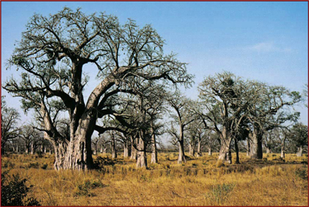
Baobab trees growing in the wooded-grassland area of Senegal in West Africa. K. Scholz/Shostal Associates
In general, desertification is caused by variations in climate and by unsustainable land-management practices in dryland environments. By their very nature, arid and semiarid ecosystems are characterized by sparse or variable rainfall. Thus, climatic changes such as those that result in extended droughts can rapidly reduce the biological productivity of those ecosystems. Such changes may be temporary, lasting only a season, or they may persist over many years and decades. On the other hand, plants and animals are quick to take advantage of wetter periods, and productivity can rapidly increase during these times.
Since dryland environments are used for a variety of human purposes (such as agriculture and fuelwood collection), the various activities undertaken in them can exacerbate the problem of desertification and bring about lasting changes to dryland ecosystems. In 1977, at the United Nations Conference on Desertification (UNCOD) in Nairobi, Kenya, representatives and delegates first contemplated the worldwide effects of desertification. The conference explored the causes and contributing factors and also possible local and regional solutions to the phenomenon. In addition, the delegates considered the varied consequences of desertification, such as crop failures or decreased yields in rain-fed farmland, the loss of perennial plant cover and thus loss of forage for livestock, reduced woody biomass and thus scarcity of fuelwood and building materials, a decrease in potable water stocks from reductions in surface water and groundwater flow, increased sand dune intrusion onto croplands and settlements, increased flooding due to rising sedimentation in rivers and lakes, and amplified air and water pollution from dust and sedimentation.
To better understand how climatic changes and human activities contribute to the process of desertification, the consequences listed above can be grouped into four broad areas:
1. Irrigated croplands, whose soils are often degraded by the accumulation of salts.
2. Rain-fed croplands, which experience unreliable rainfall and wind-driven soil erosion.
3. Grazing lands, which are harmed by overgrazing, soil compaction, and erosion.
4. Dry woodlands, which are plagued by the overconsumption of fuelwood.
Nearly 2,500,000 square km (about 970,000 square miles) of croplands are irrigated (that is, about 15 percent of Earth’s total agricultural land). Over 60 percent of these irrigated areas occur in drylands. Certainly, some dryland areas have been irrigated for millennia, but other areas are more fragile. Of the irrigated dryland, 30 percent (an area roughly the size of Japan) is moderately to severely degraded, and this percentage is increasing.
The main cause of declining biological productivity in irrigated croplands is the accumulation of salts in the soil. There is an important difference between rainwater and the water used for dryland irrigation. Rainwater results from the condensation of water evaporated by sunlight. Essentially, rainwater is distilled seawater or lake water. In contrast, water used for irrigation is the result of runoff from precipitation. Runoff percolates through the soil, dissolving and collecting much of the salts it encounters, before finding its way into rivers or aquifers. When used to irrigate crops, runoff evaporates and leaves behind much of the salts that it collected. Irrigated crops need an average of 80 cm (about 30 inches) of water annually. These salts can build up in the soil unless additional water is used to flush them out. This process can rapidly transform productive land into relatively barren salt flats scattered with halophytes (plants adapted to high levels of salt in the soil).
Most salt-degraded cropland occurs in Asia and southwestern North America, which account for 75 and 15 percent of the worldwide total, respectively. In Asia, Iraq has lost over 70 percent of its irrigated land to salt accumulation. In Russia, much of the irrigated land located where the Volga River runs into the Caspian Sea may last only until the middle of the 21st century before the buildup of salts makes it virtually unusable. Such losses are not restricted to developing countries. In the United States, salt accumulation has lowered crop yields across 50,000 square km (19,000 square miles), an area that is about a quarter of the country’s irrigated land.
Drylands also support rain-fed crops. Before cultivation, such areas were often vast grasslands. They now cover about 5 million square km (about 2 million square miles) and account for roughly one-third of all croplands worldwide. They receive less than 60 cm (about 24 inches) of rain each year, and thus they are at the margin of what farmers can use for crops without at least some irrigation. Rainfall can vary considerably from one year to the next, so those lands may experience droughts that often lead to crop failure. Globally, more than 2,000,000 square km (about 770,000 square miles) of rain-fed croplands are moderately to severely degraded, and each year about 1 percent of those lands is abandoned.
The crops grown on drylands are annuals; each year they emerge from seed, mature, and die. Grains such as wheat and corn (maize) are annuals that account for roughly 85 percent of global food production. After these grains are harvested, the lands are left uncovered until the next planting season. During this time, the soil is vulnerable to erosion by wind and rain. Wind can whip up the unprotected topsoil to create severe dust storms. Such dust storms often transport the soils, along with the nutrients they contain, over long distances. Rainfall is scarce in drylands, but when it does come it can be torrential. Heavy downpours often wash away the soils on bare ground or deplete them of their nutrients. In contrast, native grasslands contain a mix of mainly perennial species that inhibit erosion. Perennials live from year to year, have deeper roots to bind the soil, and do not leave the soils exposed for months on end.
Desertification also occurs in rangelands. Typically, the damage in those environments can be separated into damage to soil and damage to vegetation. The former is more important than the latter; however, large areas experience both. The process of soil damage and loss often begins with the activities of grazing animals. Grazing livestock sometimes consume plants down to the ground. This activity weakens the individual plant; with a reduction in tissues capable of photosynthesis, its growth is greatly inhibited. In addition, livestock herds may trample and kill vegetation by walking to and from permanent water sources. Trampling destroys plant roots that bind the soil together. When rains come to those grazing lands, rivulets often form along the walking paths and wash away unprotected topsoil. Also, the repeated movement of herds over one section of the landscape can compact the soil, hindering the development of plant roots.
Livestock can substantially alter plant communities. It may be obvious that these animals reduce plant populations through their grazing activities, but livestock can also change the composition of the plant community by consuming some species and leaving others alone. The grazing pressure placed on grasses and other edible species gives a competitive advantage to cacti and other inedible species. For example, in the southwestern United States, mesquite (Prosopis glandulosa) is a native shrub; however, it can increase its range considerably when cattle overgraze grasslands. The resulting plant community supports few livestock and is a persistent one—that is, the extensive thickets of mesquite often prevent grasses from recolonizing their former range.
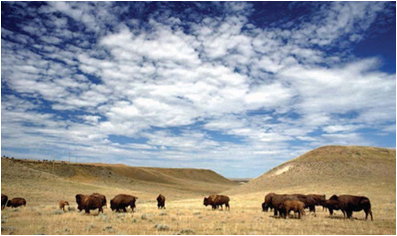
Buffalo grazing on rangeland in Crook County, Wyoming. Ron Nichols/U.S. Department of Agriculture (Image ID: 94cs4147)
Rangeland is any extensive area of land that is occupied by native herbaceous or shrubby vegetation and that is grazed by domestic or wild herbivores. The vegetation of ranges may include tallgrass prairies, steppes (shortgrass prairies), desert shrublands, shrub woodlands, savannas, chaparrals, and tundras. Temperate and tropical forests that are used for grazing as well as timber production can also be considered rangeland. Rangelands thus occupy about 40–50 percent of the land area of the Earth.
Rangelands are distinguished from pastureland by the presence of native vegetation, rather than of plants established by human societies, and by their management principally through the control of the number of animals grazing on them, as opposed to the more intensive agricultural practices of seeding, irrigation, and the use of fertilizers. The tallgrass prairies of the North American Great Plains, the Ukraine, and parts of Argentina and Hungary formerly made ideal rangelands but were too well-suited to cultivated crops to be left for grazing purposes. Rangelands are thus more generally confined to areas of marginal or submarginal agricultural land or to areas that are entirely unsuited to permanent cultivation.
Fire is an important regulator of range vegetation, whether set by humans or arising from lightning. Fires tend to burn or kill off trees, shrubs, and brush and to permit the more quickly recovering grasses to flourish without excessive competition from the former. The artificial elimination of periodic fires from desert shrublands, savannas, or woodlands frequently invites the dominance of trees and shrubs to the near exclusion of the grass.
Range management is a professional field whose aim is to ensure a sustained yield of rangeland products while protecting and improving the basic range resources of soil, water, and plant and animal life. Besides producing forage for domestic and wild animals, a range can provide timber, minerals, natural beauty, and recreational opportunities. Modern range management utilizes the concept of multiple use, which requires that all the resources of a rangeland be managed simultaneously, using constant monitoring and adjustments to provide a mix of material products and intangible assets that best satisfy the needs of both landowners and the general public. Range management depends for its effectiveness on range science, which is a body of knowledge drawn from the botanical and zoological sciences as well as from ecology, climatology, pedology (soil science), hydrology, and so on. The responses of rangeland to grazing and other uses are predicted from range science’s accumulated knowledge of the functioning of rangeland ecosystems, which in turn has been aided by computer-simulated mathematical models.
In concrete terms, range-management practices centre on the regulation of the number of animals allowed to graze on a given range, along with the duration and season of their grazing. The stocking of a range must be carefully regulated so that the existing grasses are not depleted or exhausted from overgrazing. Indeed, the most pernicious and chronic problem in the management of ranges is overgrazing. Overgrazing of the vegetation reduces the production of forage; exposes the soil to sealing, baking, and erosion; reduces the infiltration of water into the soil; increases water runoff and flooding; and induces unfavourable changes in the botanical composition of the vegetation. Overgrazing has practically denuded vast areas of rangeland in nearly every continent, and in the Sahel region of sub-Saharan Africa, for instance, overgrazing has led directly to the southward expansion of the Sahara over distances of many miles. The degeneration of range condition has become one of the most serious problems in the agriculture of many developing countries.
The fourth area of desertification is dry woodlands, which are greatly affected by the overconsumption of firewood. Across large areas of Asia and Africa, the principal raw material for cooking and heating is wood. Firewood in these areas is often converted to charcoal in earthen kilns before it is used, because charcoal gives off less smoke than wood. The conversion process is often inefficient, however, with about 75 percent of the wood’s heating potential lost. In Africa and Asia a very rough estimate of the per capita consumption of firewood is about half a ton per year. Across large areas of dryland where total plant production is roughly two tons per hectare per year, a family of four would have to clear a hectare of land or more per year. Very often, such deforested areas are not replanted. As human population densities increase, one can imagine that they might consume more wood than the land could support and create a “fuelwood crisis.”
The struggle against desertification can occur at several levels. Since regional variations in climate are the main causes of the loss of dryland productivity, it is important to understand the influence of global warming in specific dryland regions. According to some models of climate change, many grasslands in western North America, for example, are predicted to be at greater risk of drought due to projected increases in summer temperatures and changes to existing rainfall patterns. Many authorities argue that since desertification and global warming are so closely related, one of the main solutions to the former may be the implementation of effective economic policies (such as carbon trading) and technical measures (such as carbon sequestration) that reduce the production of greenhouse gases.
At local scales, however, desertification is often the result of unsustainable land and soil management. To maintain the biological productivity of the land, soil conservation is often the priority. A number of innovative solutions have been devised that range from relatively simple changes in how people grow crops to labour-intensive landscape engineering projects. Some of the techniques that may help ameliorate the consequences of desertification in irrigated croplands, rain-fed croplands, grazing lands, and dry woodlands include:
1. Salt traps, which involve the creation of so-called void layers of gravel and sand at certain depths in the soil. Salt traps prevent salts from reaching the surface of the soil and also help to inhibit water loss.
2. Irrigation improvements, which can inhibit water loss from evaporation and prevent salt accumulation. This technique involves changes in the design of irrigation systems to prevent water from pooling or evaporating easily from the soil.
3. Cover crops, which prevent soil erosion from wind and water. They can also reduce the local effects of drought. On larger scales, plant cover can help maintain normal rainfall patterns. Cover crops may be perennials or fast-growing annuals.
4. Crop rotation, which involves the alternation of different crops on the same plot of land over different growing seasons. This technique can help maintain the productivity of the soil by replenishing critical nutrients removed during harvesting.
5. Rotational grazing, which is the process of limiting the grazing pressure of livestock in a given area. Livestock are frequently moved to new grazing areas before they cause permanent damage to the plants and soil of any one area.
6. Terracing, which involves the creation of multiple levels of flat ground that appear as long steps cut into hillsides. The technique slows the pace of runoff, which reduces soil erosion and retards overall water loss.
7. Contour bunding (or contour bundling), which involves the placement of lines of stones along the natural rises of a landscape. It helps to capture and hold rainfall before it can become runoff. It also inhibits wind erosion by keeping the soil heavy and moist. Contour bunding is similar to terracing.
8. Windbreaks, which involve the establishment of lines of fast-growing trees planted at right angles to the prevailing surface winds. They are primarily used to slow wind-driven soil erosion but may be used to inhibit the encroachment of sand dunes.
9. Dune stabilization, which involves the conservation of the plant community living along the sides of dunes. The upper parts of plants help protect the soil from surface winds, whereas the root network below keeps the soil together.
10. Charcoal conversion improvements, which include the use of steel or mud kilns or high-pressure compacting equipment to press the wood and other plant residues into briquettes. Conversion improvements retain a greater fraction of the heating potential of fuelwood.