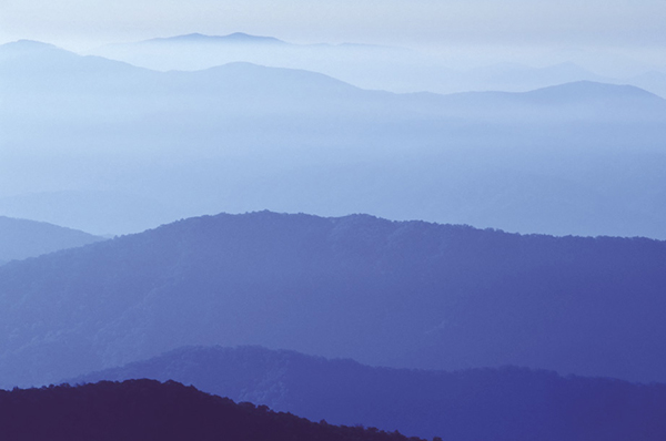
Early morning view from Andrews Bald.
52 Andrews Bald
On the open and grassy Andrews Bald grow flame azaleas and Catawba rhododendron, both peaking their blooms sometime around mid- to late June. If you’ve been to Gregory Bald (Hikes 24 and 63), you might be a little disappointed in Andrews. Andrews Bald is like a smaller cousin to Gregory—fewer azaleas, restricted views, and with more encroaching vegetation. But don’t let that stop you from coming. This is one of the finest day hikes in the park. On a clear day the views east into the Noland Creek watershed and southwest toward Fontana Lake are superb. And the azalea show on Andrews is the finest in the park except for Gregory.
(See map for Hike 51: Clingmans Dome.)
Start: Forney Ridge Parking Area for Clingmans Dome
Distance: 3.6 miles out and back
Hiking time: About 3 hours—day hike
Difficulty: Strenuous, due to very rocky trail
Trail surface: Rocks—lots of them
Best season: Second half of June for azalea and rhododendron bloom
Other trail users: Hikers only
Maps: Clingmans Dome USGS quad; Trails Illustrated #229 Great Smoky Mountains; Trails Illustrated #317 Clingmans Dome Cataloochee; Trails Illustrated #316 Cades Cove Elkmont
Special considerations: Clingmans Dome Road is closed Dec 1–Mar 31. This hike is extremely popular, especially in June when the azaleas bloom. A great option for avoiding the crowds is to arrive at the Forney Ridge Parking Area early and watch the sunrise from the parking lot. After sunrise you can hike to Andrews Bald before most people are stirring.
Other: The parking lot is huge, but it’s often not big enough to accommodate weekend traffic. Flush toilets are located at the parking area. A visitor center is located near the start of the hike.
Finding the trailhead: At Newfound Gap turn west onto Clingmans Dome Road and drive 7.0 miles to the Forney Ridge Parking Area at the end. Forney Ridge Trail begins on the far western end of the parking area. The paved path to Clingmans Dome Tower goes to the right, while Forney Ridge Trail drops down off of it to the left. GPS: N35 33.409' / W83 29.772'
The Hike
You’ll follow Forney Ridge Trail all the way to Andrews Bald. The first 0.2 mile is a steep descent to the junction with Clingmans Dome Bypass Trail. You need to cut sharply back to the left (south) to remain on Forney Ridge Trail. In the past, heavy rains (common here) turned this rocky trail into a creek bed, but new trail construction has made this situation much better.
Early morning view from Andrews Bald.
Descend for a little more than a mile and in a small clearing reach the junction with Forney Creek Trail on the right. Stay straight (south) on Forney Ridge Trail. The forest here is darker and denser than you see in many other spruce-fir areas. The mature Fraser firs are dead, but there are more young trees here than in some places. The forest here provides a hint at what once covered these mountaintops. After a moderate ascent you exit the woods and descend to the bald.
Miles and Directions
0.0Start from the western end of the parking area on Forney Ridge Trail.
0.2At the junction with Clingmans Dome Bypass Trail, turn sharply back to the left (south) to remain on Forney Ridge Trail.
1.1Junction with Forney Creek Trail on the right. Continue straight (south) on Forney Ridge Trail.
1.8Arrive at Andrews Bald. Return the way you came.
3.6Arrive back at Forney Ridge Parking Area.
Option: The hike to Andrews Bald is the first 1.8 miles of Hike 53, so you can do both of these hikes on the same trip.