
t A light waterfall creating a shallow stream at Caverna Maruaga
g The Amazon g Contents
Presidente Figueiredo is a small town linked to Manaus by a relatively good road. More than 100 waterfalls are dotted around the town, as well as some caves. Tours can be booked from Manaus or directly with local guides through the tourist information office located at the bus stop.
One of the best waterfalls is the Pedra Furada, where the water gushes out of a hole in the rocks. The waterfalls Cachoeira Iracema, Pedra da Lua Branca, and Natal are on the Rio Urubuí and only accessible by boat.
Located east of Presidente Figueiredo, off the AM-240, is Caverna Refúgio do Maroaga, and nearby, another attractive cave is Caverna Maruaga, which has shallow river running over its floor. Permission to visit the caves has to be obtained from the tourist information office in Manaus.
t A light waterfall creating a shallow stream at Caverna Maruaga
One of South America’s least visited regions, the Rio Negro area possesses distinctive flora created by its acidic waters and soil type. There is a lower density of wildlife here than any other area along the Rio Negro. There are few towns and even fewer tourist facilities along the river, which stretches right up to the Colombian and Venezuelan borders.
Ilhas de Anavilhanas is a biological reserve and the largest group of freshwater islands in the world. Tours here are offered from Manaus or from Novo Airão. There are over 250 uninhabited islands stretching for more than 187 miles (300 km). Depending on the season and time of day, it is possible to see caimans, sloths, snakes, and a range of bird species. Sprawled across 1,350 sq miles (3,500 sq km) of protected rainforest on the left bank of the Rio Negro, the Estação Ecológica de Anavilhanas (Ecological Station of Anavilhanas) is part of the Anavilhanas islands. Created in 1998 and named after the Archipelago dos Anavilhanas, it has several species in great danger of extinction, including jaguars and night monkeys.
A day-and-a-half’s journey from Ilhas de Anavilhanas, Barcelos, the only town of any size along the river, is an interesting place to start a jungle expedition. Another two days upriver is the town of São Gabriel Da Cachoeira, a beautiful place deep in the Amazon with stunning jungle scenery and wildlife.
The small town of Novo Airão is located on the western side of the Rio Negro, opposite the Archipelago dos Anavilhanas. Pleasant, yet laid-back, with only a handful of attractions, the town draws tourists mainly for the pink dolphins that come to a floating platform at Novo Airão’s small port. They are fed fish every hour and visitors can see these friendly creatures up-close as they venture to the surface. Some visitors, however, may prefer to see the dolphins out in the wild by taking a boat tour.
The area neighboring Novo Airão is home to a number of interesting sights, such as Airão Velho, the overgrown ruins of the old town center, with prehistoric spiral and figure-like petroglyphs. The beautiful and peaceful Igarapé do Mato Grosso, a forested section of a tributary river nearby, makes a great place for a walk or a swim in fresh water. The Parque Nacional Jaú is a two-day trip from Novo Airão, and is a wonderful opportunity to visit virgin Amazon rainforest. A permit, from the Ibama office in Manaus, is required to visit here, and the trip is best done with a registered tour operator.

t The reflective waters of the Rio Negro at Novo Airão
§ (92) 3365 1345
⌂ Rua Ministro João Gonçalves de Souza s/n, Manaus § (92) 3878 7102
Male Amazonian pink river dolphins can weigh up to 350 pounds (160 kg).
One of the main tours offered from Manaus, the Encontro das Aguas (Meeting of the Waters) is where the Rio Solimões joins the Rio Negro. The relatively creamy and alkaline lightbrown water of the Solimões (Amazon) river takes several miles to absorb the dark, acid water coming in from the Rio Negro. The Solimões is light because it starts mainly in the Andes and brings plenty of silt with it. The Rio Negro wells up primarily in the swamplands and smaller hills of the northeastern Amazon and contains much more decomposed plant life than it does soil or silt.
Small boats go out from Manaus allowing people to take photographs and to see the clear line between light brown and black running down the middle of the river. The best time to visit is between 7am and 10am.

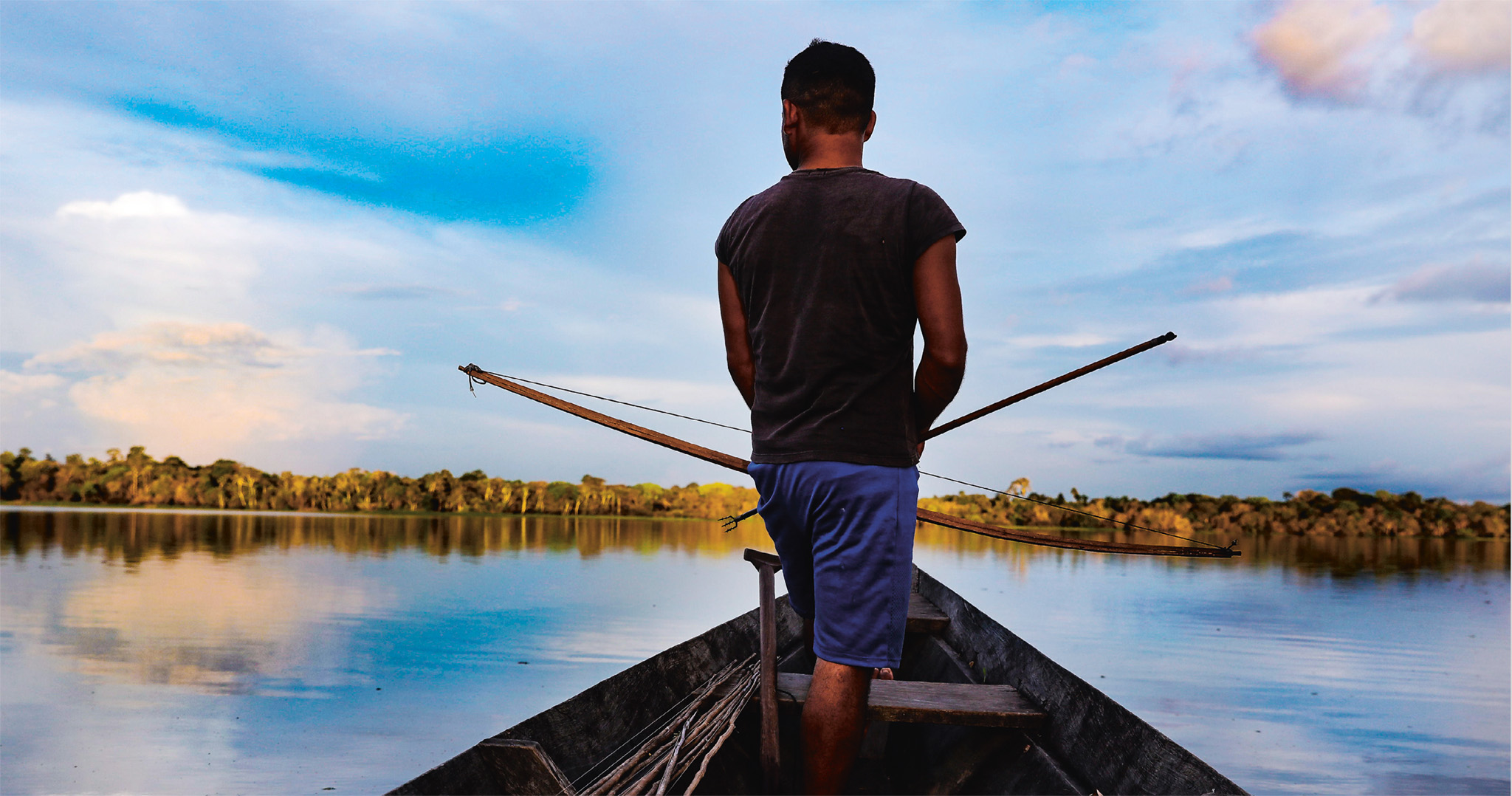
t Local people traveling on a boat across the Amazon river
A five-hour boat ride from Manaus, the backwater lake of Manaquiri is best entered first via the Rio Solimões, then upstream to a tributary that leads to the lake. Its waters rise and fall with the seasons. Relatively isolated, the Lago Manaquiri is usually a good spot for seeing waterbirds, including the great egret (Casmerodius albus) and fish eagles. It is not unusual to see caimans and large Amazonian alligators on the sandy shore.
The lake provides sustenance to the small fishing town of Manaquiri, and the local economy depends more on this sector than on tourism. In 2005, however, both were hit by the worst drought in many years, when the lagoons evaporated, and thousands of dead fish lay on the bed of the dried-up lake.
The changed climatic conditions continue to deplete fish in the area. Nonetheless, fishing remains the main activity, and there are many tour operators based in Manaus offering budget fishing packages. It is always best to book your trip through a travel company registered with the Brazilian Tourism Bureau. Some of the tour agencies provide typical Amazon riverboats, which may come fully equipped with kitchen, dining area, bathroom, shower, and canopied sundeck.
Fishing is best in the dry season, which usually lasts from August to December or January.
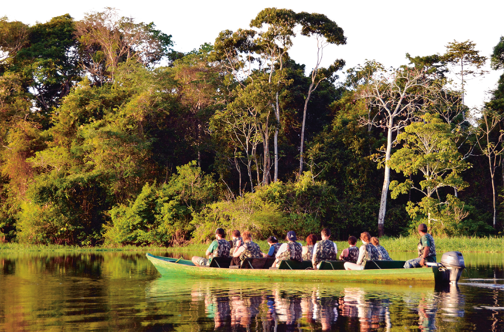
Easily accessible by road and boat from Manaus, the elongated and breathtaking Lago Mamori is located in a lush rainforest setting. Much of it is surrounded by narrow creeks, hidden among forests full of sloths, monkeys, and colorful, noisy tropical birds. The river and lake offer the opportunity to see both pink and gray river dolphins, as well as to go piranha fishing. Nearby, the Lago Arara is great for fishing, and home to a pink dolphin feeding ground.
The local caboclo people, have been here for generations and live in scattered riverside communities, occasionally coming together for celebrations. They earn their living by producing farinha (manioc flour), rearing cattle, and fishing.
Visits to the caboclo homes can be organized by Amazon Gero Tours. Run independently by English-speaking Gero Mesquita, the company can book hotels, arrange transport, and meticulously plan tours.
Farther upstream and deeper into the forest from here, the Rio Juma region offers better access to wildlife, but requires expedition-type preparation and several days.
Amazon Green Tours, a tour company based in Manaus, can arrange expeditions in Amazônia, offering short package tours, as well as longer safaris.
It is possible to stay either in a floating lodge, or in one of the many jungle lodges along the Rio Juma. Most of them offer jungle hikes, piranha fishing, and caiman spotting at night.
'
⌂ Rua Tapajós 27, Centro, Manaus ∑ amazongero.com
'
⌂ Rua 10 de Julho 718, Manaus ∑ amazongreentours.com.br
t On the water in the Mamirauá Sustainable Development Reserve
Located at the confluence of two rivers, the Rio Solimões and Rio Japurá, the Mamirauá Sustainable Development Reserve covers an area of 5703 sq miles (14,770 sq km). Since 1990, when it was declared an ecological station, the Mamirauá Reserve has been one of Brazil’s most prized ecotourism spots. Splendid and luxuriant, its várzea (seasonally flooded) vegetation offers plenty of opportunity for spotting abundant wildlife, including endemic species such as the white uakari monkey and the black-headed squirrel monkey. The annual flood transforms the life of the whole region. During the high-water season (May–July), fish invade the flooded forest and disperse seeds as they move about. More than 300 species of fish have already been catalogued in the reserve. Mamirauá is also home to pink river dolphin, great egret, and the rare scarlet macaw. The neotropic cormorant, whose diet consists mainly of fish, can be spotted swimming and feeding in large, noisy flocks.
During the dry season (September–November) people can walk on trails, but when the rainy season comes, canoes must be used to travel through the watery terrain. The preserve’s ecotourism program features a range of activities, which includes nature expeditions in the lakes and trails in the forest.
The preserve also offers comfortable and ecologically sound accommodation at the floating Uakari Lodge – which is close to forest trails, jungle lakes, and caboclo communities. Book through a Manaus tour company, or directly with the Instituto de Desenvolvimento Sustentável Mamirauá in Tefé, 16 miles (25 km) to the south.
Experience The Amazon
|
STAY Uakari Lodge Set deep in the jungle, Uakari Lodge floats within Brazil’s largest protected area, the lush Mamirauá Sustainable Development Reserve. The complex is designed to have a minimal impact on the environment and the lodge champions conservation projects.Uakari can host 24 guests at a time. ⌂ Mamiraua Reserve ∑ uakarilodge.com.br \\\ |
t Exploring the waters of the Mamirauá Reserve by boat
A large jungle town, Parintins was originally the refuge of a caboclos community, who were escaping Portuguese slave traders.
Today, Parintins is best known for its popular Festa do Boi Bumbá. The festival is celebrated across three days in late June, when the town gets so packed that visitors often stay on boats.
Though there is little else to see in the town, besides the well-preserved colonial architecture, Parintins is known for its rich indigenous culture, and the array of local handicrafts make particularly unique souvenirs.
The flea markets, which include one conveniently located near the port, sell a wide range of items including trinkets, intricate lace, beadwork, masks, and fine mahogany carvings.
During the dry season, boat trips can be arranged from the town to explore the nearby lakes and river beaches.
Coca-Cola ads are red and blue at the Festa do Bumba Meu Boi in support of the rival dance teams.
Experience The Amazon
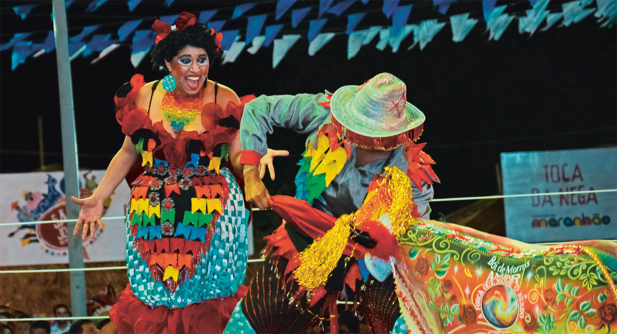
The Festa do Bumba Meu Boi involves two teams of performers competing to deliver the most impressive dance recounting the death and rebirth of a legendary boi (ox). Originating on the 18th-century northeast plantations, the festival arrived in Parintins almost 100 years ago with the Cid brothers (who moved here in search of work). They brought with them the Bumba Meu Boi musical influence, steeped in the rhythms of the northeast.
Experience The Amazon
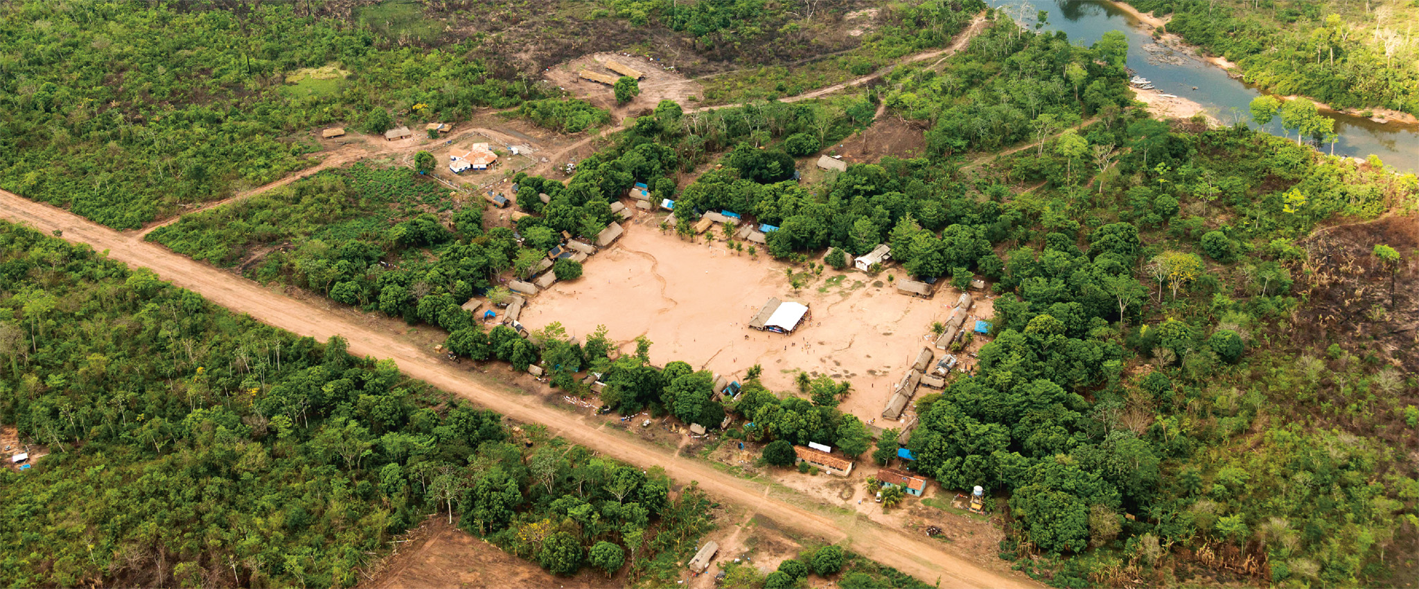
t Aerial view of Moikarako village, and its chief
t Raoni Metuktire, delivering a speech
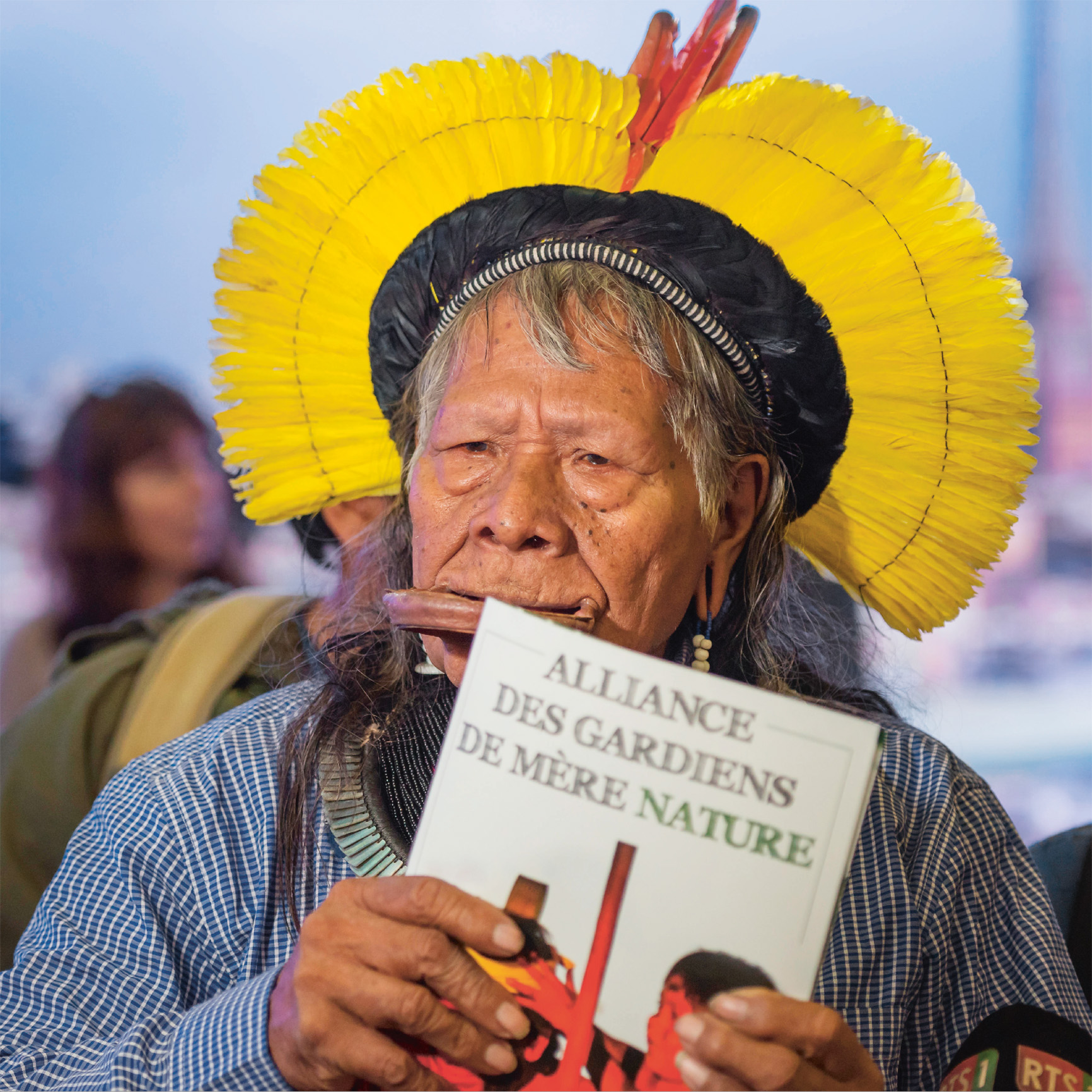
Today, around 900,000 indigenous people from 240 groups live in Brazil, each with its own unique dialect and language, mythology, arts, and culture. The majority are seminomadic and live by hunting, gathering, fishing, and migratory farming. Many of the Amazon’s indigenous people live in close harmony with the rhythms of the rainforest, and their exposure to western society varies greatly.

t Indigenous leaders at the first Great Assembly of the Alliance of Mother Nature in 2019
The Yanomami people live in the rainforests of southern Venezuela and northern Brazil. One of the most recently contacted groups in Amazônia (from a Western perspective; the Yanomamis have had continuous contact with neighboring communities throughout history), they number around 26,000 today. The Yanomami people live off agriculture and are known for being fierce warriors. The group consists of four subdivisions, each with its own language, including Yamomae and Sanima.
The name Tukano is used for a number of ethnic groups, including Arapaso Tariana, living in northwestern Brazil along the Rio Uapés. Individual groups live in communal houses, which are spaced out along the river at a distance of several hours by canoe. Together with their neighbors, Tukano members are a part of a socially and politically open-minded society towards other groups where visitors, trade, intermarriage, and ritual feasts are common. In the Barasana and Desana sub groups, members need to marry people from other groups and who speak a different language.
Around 12,000 Kayapós – also known as Mebêngôkres – live in the Amazon river basin with villages along the banks of Rio Xingú. One of the group’s main symbols is the circle; traditional Kayapó villages are formed by a circle of houses built around a plaza. The shape represents the course of the sun and moon, and the villages are considered the center of the universe. One of the Kayapó people’s most prominent political figures is Raoni Metuktire, an environmental activist who has been fighting to preserve Kayapó territory against dam projects and deforestation for over 40 years. Metuktire can be recognized in western media wearing the distinct lip disc, symbolizing a group member’s warrior status and right to speak.
2,000 native Brazilian women took part in the country’s first Indigenous Women’s March in 2019.
In the depths of the Amazon there are still communities uncontacted by Western society. The dense Amazonian forest and the Vale do Javari Reserve bordering Peru to the west are thought to be home to the largest concentration of indigenous groups with no contact this is known of with modern society. In 2011, aerial footage, taken by FUNAI (Brazil’s National Indian Foundation), was released to the world media, of an isolated community living in the rainforest near the Brazilian-Peruvian border. In 2014, seven members of an isolated group in Peru made contact with an indigenous Brazilian village in Acre, the first official contact by such a group since 1996.
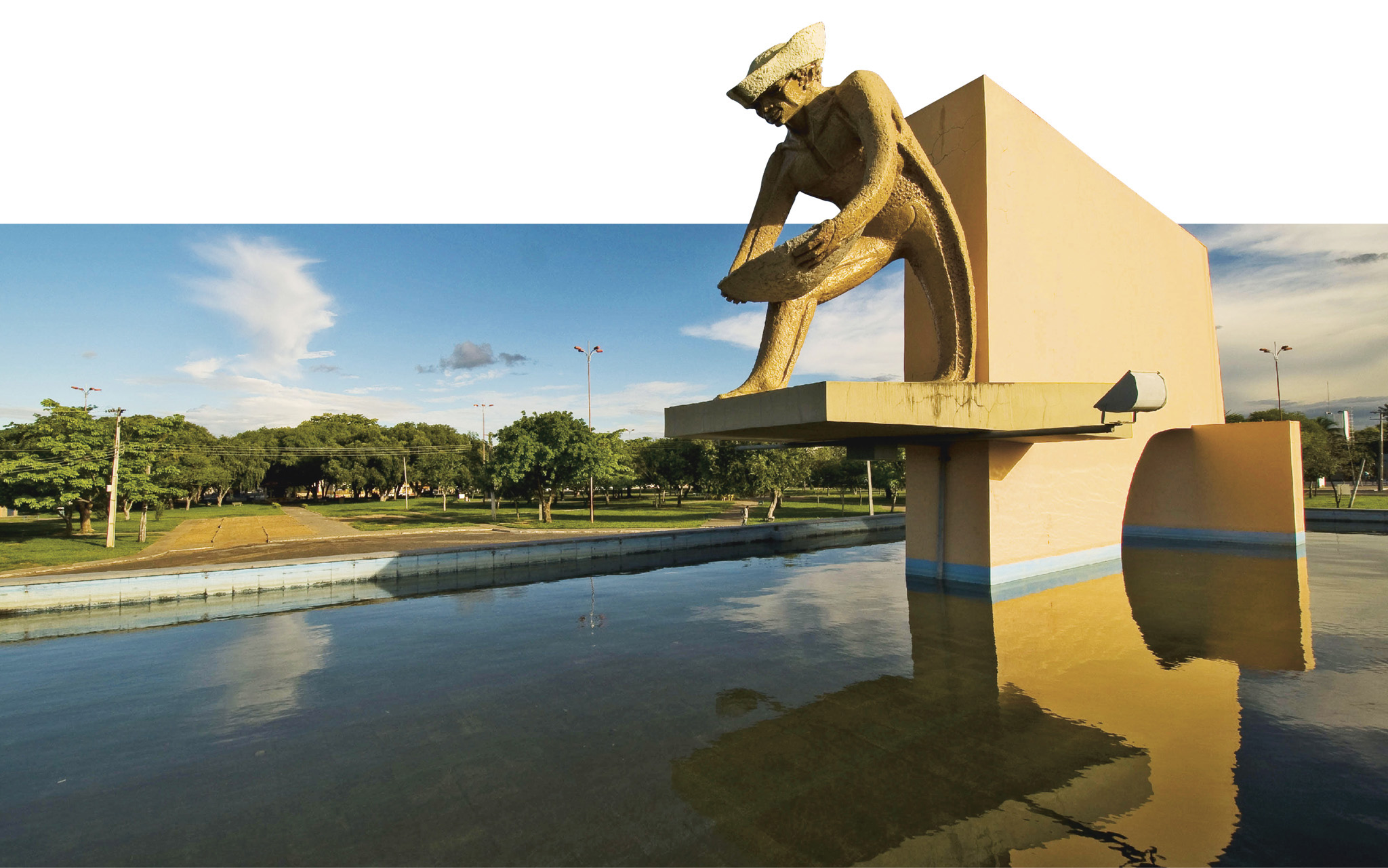
t A striking monument to the gold miners in Boa Vista
Created in 1991, Roraima is one of Brazil’s newest states, and Boa Vista is its capital city. The surrounding savannas are important cattle-ranching territory, but the area also profited from the gold rush of the 1980s.
The Praça Civica forms the heart of the town’s arch-shaped street layout. The modern Paláçio Municipal is here, beside the Monumento ao Garimpeiro, a local monument honoring the gold miners who brought wealth to the state.
There are good swimming beaches on the Rio Branco, 15 minutes by bus from Boa Vista. The sandy beaches in the town center offer excellent swimming when the river is low.
Boa Vista is blessed with lush tropical rainforest, endless stretches of savanna plains, and beautiful river beaches. Though ecotourism is still in its initial stages, organized camping tours with companies such as Roraima Adventures are fairly developed.
Boa Vista is easily connected by bus to the Venezuelan town of Santa Elena de Uairén, located 147 miles (237 km) north. The route from Boa Vista to Santa Elena is dotted with interesting sights, including the ecological island preserve of Ilha do Maracá, known for its species preservation and biodiversity, and the enchanting Lago Caracaranã, fringed with groves of cashew trees.
'

Great View
This mystical tabletop mountain is 14 km (9 miles) wide and 2,772 m high (9,094 ft), and is where Brazil borders Guyana and Venezuela. The peak inspired Sir Arthur Conan Doyle’s The Lost World. The 6– to 8- day trek to the top is worth the breathtaking views.

t The graceful Neo-Classical Palácio Rio Branco in Rio Branco
Another relatively new state, Acre was annexed from Bolivia in the early 20th century by a pioneering army of Brazilian rubber-tappers.
Acre’s capital, Rio Branco has shaken off much of its brash image. The Parque de Maternidade has transformed from a small-town water canal into a long, green city walk. In the town center stands the Palácio Rio Branco. Though restored, the building maintains its original Neo-Classical facade, with four columns at the entrance. It was built in the 1930s as a headquarters for the state government and houses the largest painting in Brazil, which depicts a scene in homage to the revolutionary heroes who liberated Acre from Bolivia. The palace also contains several large rooms dedicated to the prehistory and history of the region. The main focus of these rooms is on Acre’s 20th-century history, and there is a superb room dedicated to indigenous culture, displaying some finely crafted feather headdresses.
A few blocks north, the Museu da Borracha (Rubber Museum) focuses on the fascinating local culture, as well as rubber-tappers and ayahuasca churches – known for their ceremonial use of hallucinogenic herbs.
The river's south bank, the Rio Acre, was a focal point during the rubber boom but has now been modernized with hotels, bars, movie theaters, and merchants’ stores, along with the new north-based commercial center, which emerged in the mid-20th century, all of which makes for a lively atmosphere. The promenade, La Gameleira, hosts the perfect location for a riverside walk.
The Parque Ambiental Chico Mendes (Chico Mendes Environmental Park) is located in the former rubber plantation at Itucumã near Vila Acre, 6 miles (10 km) south of Rio Branco. It contains virgin forest areas, some replica malocas (indigenous longhouses), rubber-tapper dwellings, a zoo, and a memorial to Chico Mendes.
⌂ Praça dos Seringueiros § (68) 3223 9241 # 8am–6pm Tue–Sun
⌂ Av Ceará 1441 § (68) 3223 1202 # 8am–6pm Tue–Fri, 4–9pm Sat & Sun
⌂ Rodovia AC-40 Km 7, Vila Acre § (68) 3221 1933 # 7am–5pm Tue–Sun
A very fast-growing jungle city, Porto Velho, has rapidly developed in the last 100 years from a few streets near Rio Madeira into Rondônia’s capital. River trips to the nearby beach of Santo Antônio are popular for freshly cooked fish at a waterside restaurant.
The star attraction, here is the Madeira-Mamoré Museu Ferroviário, where several steam locomotives, some under cover, still symbolize a rusting industrial vision in the middle of the Amazon jungle. In the main museum shed, there are interesting exhibits from the turn of the 19th century, when the railway was being built. Unfortunately, its inauguration in 1912 was just in time to witness the collapse of Brazil’s rubber industry.
Guajará-Mirim is located on the Bolivian border, some 187 miles (302 km) from Porto Velho. From here, it is possible to visit the lonely jungle fort, the Forte Príncipe da Beira, which was built by the Portuguese in 1773.
The Reserva Biologica do Guaporé near Costa Marques, which is 282 miles (454 km) south of Porto Velho, is known for its diverse bird species.
"
⌂ Praça Madeira-Mamoré ¢ For refurbishment § (69) 3901 3651
⌂ Av Cabixi com Limoeiro 1942 § (69) 3651 3782
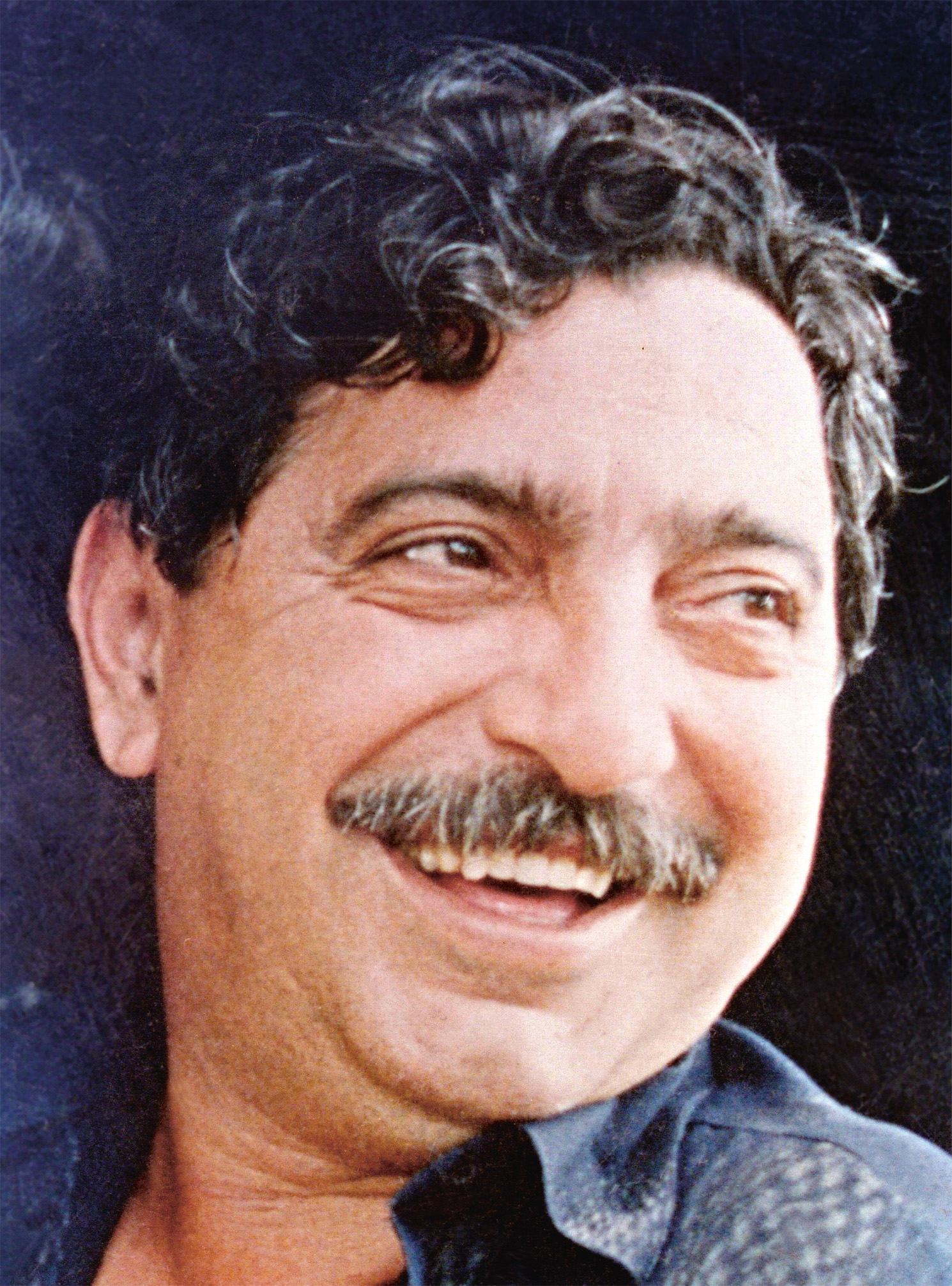
A rubber-tapper union leader and environ-mental activist, Chico Mendes helped estab-lish the National Council of Rubber Tappers. He fought to preserve rubber reserves and won recognition from the UN in 1987, with a Global 500 award. He received another award from the Better World Society, before his assassination in December 1988.
The town of Salinópolis, locally known as Salinas, is just about as far east as the Amazon river delta reaches. Very much the traditional summer resort for city folk, Salinas has plenty of beaches fringed with beach huts and second homes. The busiest beach is the central Praia do Maçarico, which has several bars and restaurants. More pleasant still, there is the Praia do Atalaia, not far from the center of town, backed by sand dunes and well provided with barracas (palm-roofed stalls) for food and drink. A continuation of this beach, the Praia do Farol Velho, is thickly lined with beach houses, and is popular during July.
About 19 miles (30 km) west of Salinópolis is the relatively sleepy fishing settlement and beach resort of Algodoal. The resort lies on the western edge of Ilha de Maiandeua, just a 40-minute boat ride away. There are no motorized vehicles in the village nor on Maiandeua island, adding to the remote and idyllic feel.
The main beach for the village is the Praia da Vila do Algodoal. More popular, however, is the palm-fringed Praia da Princesa do Farol, a stretch of sand secluded from the main beach by a short walk at low tide or a canoe ride. There are trails on the island, offering the opportunity to spot wildlife and explore the area around an inland lake. It is advisable to carry cash to visit the island, as there are no banks or ATMs.
The population of water buffaloes in Ilha de Marajó, the largest in Brazil.

INSIDER TIP
Ilha de Marajó’s rainy season is a great time to go boating down scenic waterways and spotting river-dwelling wildife. Plan your trip during the dry season if jungle hiking or sunbathing is more to your liking.

t Boating past the Amazon’s mangrove forests near Souré
The world’s largest river island, Ilha de Marajó covers over 18,533 sq miles (48,000 sq km) and is mostly home to cattle ranches, or fazendas. The island is famous for having the biggest and finest buffaloes in Brazil. Their meat, leather, and dairy products are widely available to purchase. Ilha de Marajó was also the ancient home to the indigenous culture of the Marajoaras, notable for their exquisite ceramic burial and ceremonial urns.
The unofficial capital of the island is Souré, which has the most shops and restaurants, but the ferry port is Porto Camará, some 16 miles (27 km) south of Souré. Located between Porto Camará and Souré, the best and most secluded beach is at the small town of Joanes, some 3 miles (5 km) off the main road. There are good beaches at the other town on the island, Salvaterra, where there are also several hotels and pousadas.
During the peak rainy season (February–May) many of the roads are inaccessible for long periods; this includes the road to Joanes and Salvaterra at times. Boats for moving around the island can be found easily at Souré, Salvaterra, and Porto Camará.
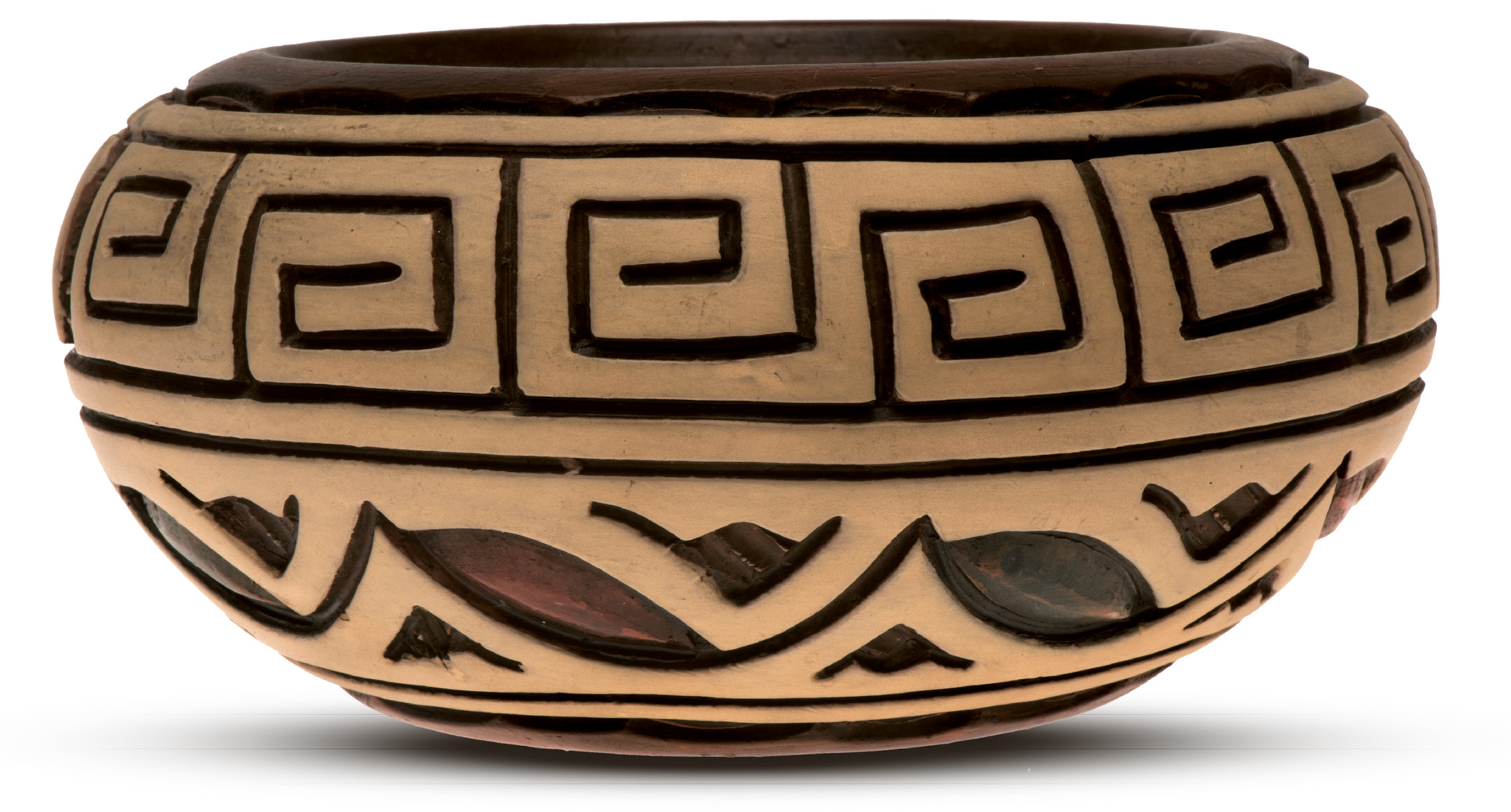
t MARAJOARAS CERAMIC URN
The ancient inhabitants of Ilha de Marajó, the Marajoaras, left behind not only burial mounds, but also some very fine ceramics, leading archaeologists to believe that between the 5th and 13th centuries there were sophisticated societies living along the banks of the Amazon river. Excavations reveal the dead were buried in line according to their social ranking, with larger urns indicating higher status. Most of these ceramics, representing abstract feminine figures, demonstrate the matrilineal nature of this early Amazonian society. Some excellent examples of the urns can be found in the Museu Goeldi in Belém.
t The well-preserved Fortaleza de São José de Macapá, illuminated at dusk
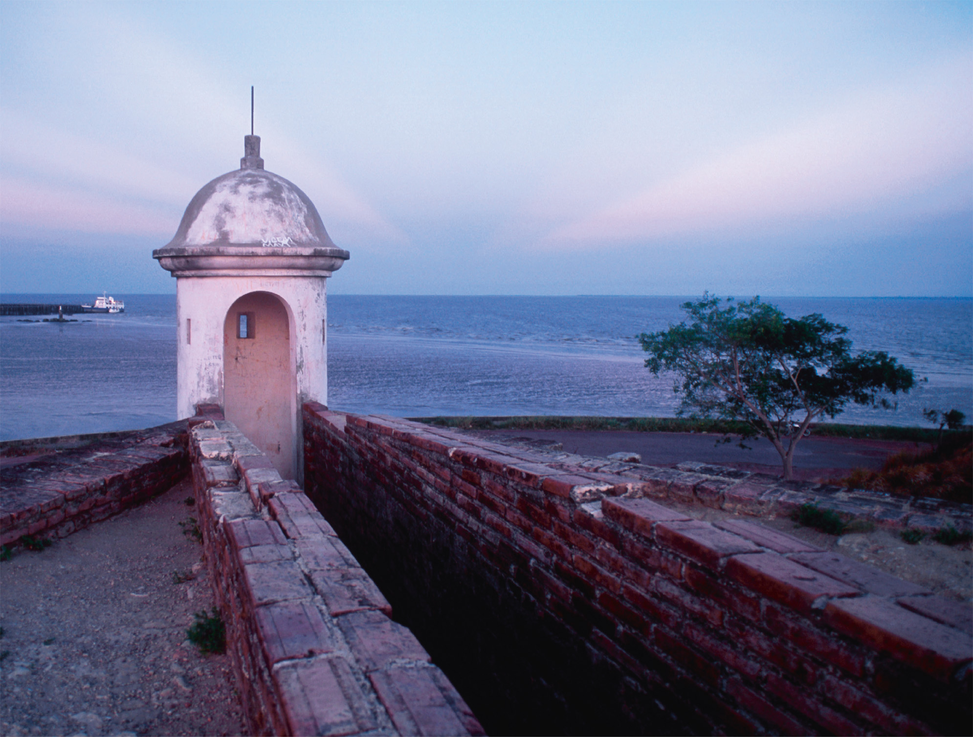
Split in two by the equator, Macapá is hot and humid all year round. The city, Amapá’s capital, is located on the northern bank of the Amazon river, very close to the giant river’s mouth. It is rather isolated, with mostly air and boat transportation.
The city’s history is rich and varied. Several European countries, including England and France, attempted to take it over from the Portuguese, but the Portuguese established their hold here by completing the grand Fortaleza de São José de Macapá in 1782, after almost 20 years of construction by slave labor. The bricks used were brought over from Portugal as ballast on the ships.
These days, Macapá is the capital of a progressive state. Following the election of the environmentalist João Capiberibe as state governor in 1995, successive governors have kept the spirit of environmentalism alive. One such project is to connect the state’s protected areas with wildlife or biodiversity corridors. Macapá is also home to the Museu SACACA, or Museum of Sustainable Development, a short distance south of the town center, which offers tours of replica ribeirinho (river-dweller) houses.
The Marco Zero monument, a large obelisk-cum-sundial, 4 miles (6 km) southwest of the city center, marks the equatorial line.
'
⌂ Rua Cândido Mendes 1611 § (96) 3212 5118 # 8am–5pm Sun–Fri, 9am–6pm Sat
'
⌂ Av Feliciano Coelho, 1509 § (96) 3212 5361 # 9am–6pm Tue–Sun
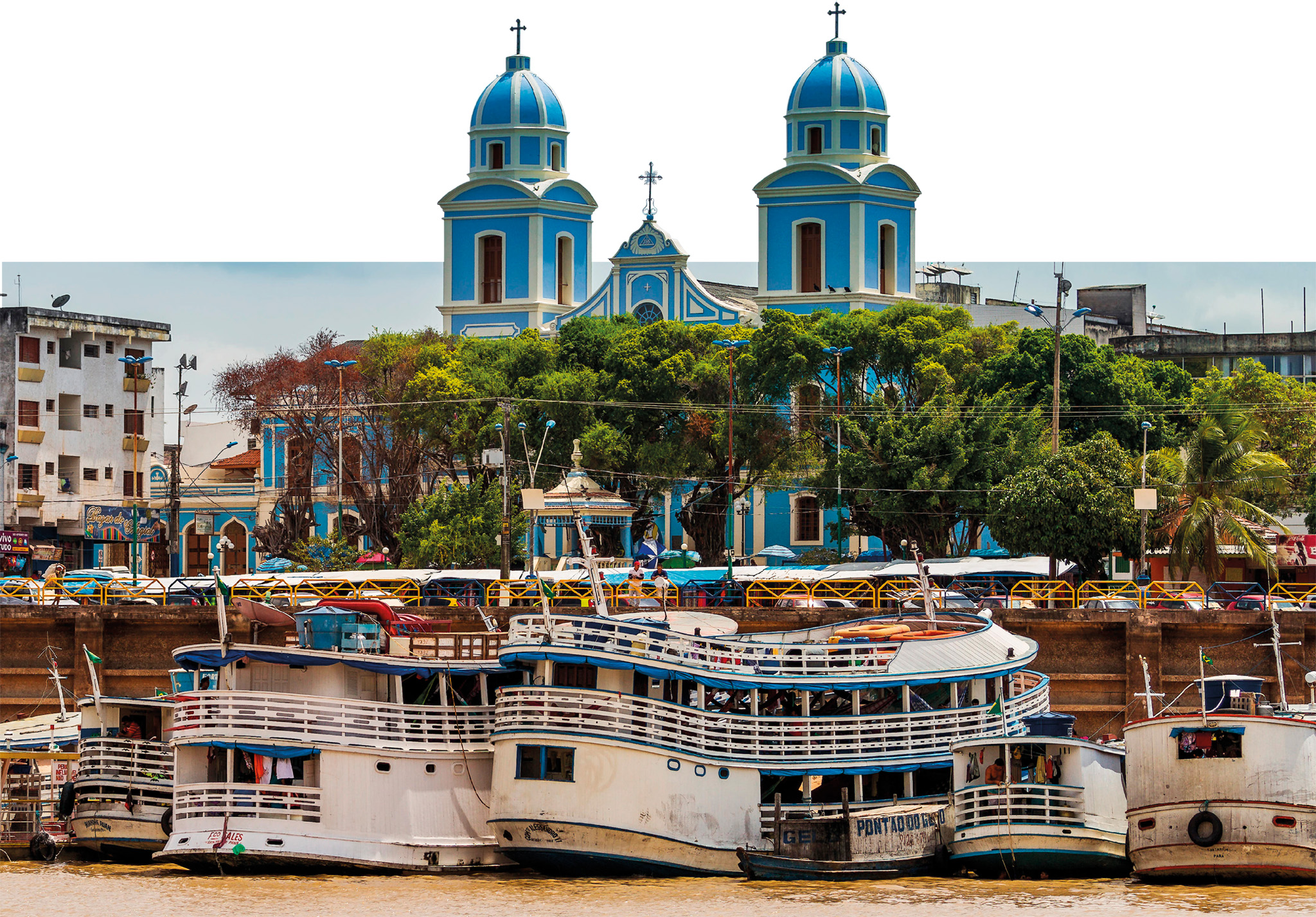
t Santarém’s striking blue church, viewed from the river
Amazônia’s fourth-largest city, Santarém sits at the mouth of the Rio Tapajós, surrounded by brilliant white sandy beaches. Modern Santarém began in 1661 as a Jesuit mission to a Tapuiçu Indian settlement which was originally located here. Later, in 1867, there was an influx of ex-Confederates from the USA, a handful of whose descendants still survive.
Santarém’s rubber boom and strategic position as a pit stop en route along the Amazon river turned the town into a buzzing commercial center during the 19th century. In the latter part of this century, Henry Wickam, an English settler in Santarém, smuggled rubber tree seeds out to establish rubber plantations in Asia. Within 40 years, Asian rubber plantations were rapidly outproducing the Brazilian Amazon.
The local economy is still based on rubber, as well as logging, soya, Brazil nuts, and new influx of tourism. Colorful boats and the frantic movement of produce at the port and along the attractive riverfront are typical today.
One of the highlights of this vibrant city is the Museu de Arte Sacra de Santarém, which has a noteworthy collection of religious art. The Museu de Santarém is also worth a visit; it showcases the city’s distinct Santarém Phase Pottery. The exhibits here prominently feature burial urns, reputed to be among the oldest in South America. Also known as Centro Cultural João Fona, the museum has a particularly striking interior which was painted by João Fona, an artist from Pará.
⌂ Rua Siqueira Campos 439, Centro § (93) 3523 0658 # 10am–1pm, 2–6pm daily
"
⌂ Rua do Imperador § ( 93) 2101 5100 # 8am–5pm Mon–Fri
The real gateway to the deeper Amazon, Óbidos marks the narrowest section of the Amazon river valley. It was created 40 million years ago, when a massive inland lake burst through to the Atlantic at this point, where the Guyanan Shield meets the Brazilian Shield.
The pretty waterfront has some beautifully tiled buildings and the 17th-century Forte Pauxias. You can also visit the Museu Integrado de Óbidos, which features archaeological and historical exhibits.
⌂ Rua Justo Chermont 1826, Centro #8am–8pm Mon–Sat
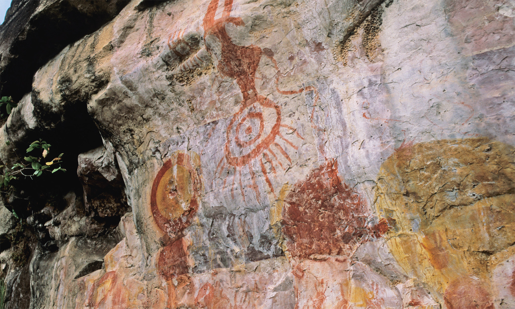
t The rock paintings of Serra Paytuna are easily visited from Monte Alegre
Located impressively on top of a small hill beside the Amazon river, the town of Monte Alegre was one of the first places on the river to be colonized by Europeans. A band of English and Irish sailors were the earliest to settle here, in the 1570s, though they were soon to be expelled by the Portuguese. Over the last 200 years, Monte Alegre has benefited from ranching and the rubber industry. It is best known for the rock paintings of Serra Paytuna and Serra Ererê, located 19 miles (30 km) out of town. Estimated to be 10,000 years old, the paintings feature abstract patterns, mostly geometric in form, and some stylized representations of human and animal figures. It is obligatory to hire a guide and a vehicle to visit them.
In addition, Monte Alegre is renowned for scenic waterfalls and its wealth of birdlife, for which a local guide and a canoe will also be required.
Experience The Amazon

Revered by surfers, the Pororoca is a legendary wave, over 16 ft (5 m) tall, that regularly rolls up the Amazon river. The name Pororoca comes from a local Tupí phrase meaning “great destructive noise.” Predicted to occur twice daily during full moons between January and April every year, the wave comes in from the Atlantic causing some devastation along the riverbanks. Following a low tide in the rainy season, the force of the mighty river against the turning tide creates the large and powerful wave that rolls, unstoppable, up the Amazon. The surfing record so far is 37 minutes in time and 7 miles (12 km) in dis-tance; the tidal waves are known to travel over 12 miles (20 km) per hour at times.