On the road up Mars Hill, there’s a pull-off where you can look out over Flagstaff 2 [map]. The railroad tracks weave a steel ribbon through the middle of town. Famed Route 66 parallels the tracks, and sturdy brick and stone buildings line the road. From this vantage point, Flagstaff looks for all the world like a toy railroad town, just like those miniature cardboard villages that came with your model train set.
And so it should, for the railroad made Flagstaff and has been its beating heart for more than a century. Freight trains rumble through like clockwork all day long, their whistles echoing through town, and Amtrak’s passenger train, the Southwest Chief, stops twice a day, eastbound in the morning, westbound at night.

The Clark Telescope at Lowell Observatory.
Richard Nowitz/Apa Publications
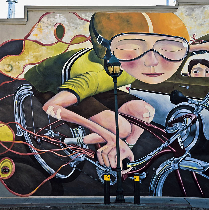
A street mural in Flagstaff.
Richard Nowitz/Apa Publications
In the 1850s, government surveyors plotted a railroad route along the 35th Parallel. By the early 1880s, loggers rolled their big wheels into the ponderosa pine forests of northern Arizona, felled the tall trees, then sawed and stockpiled nearly a half million ties for the rails, as they blazed west. A spring at the base of Mars Hill furnished precious water for advance crews, and in 1882 the Santa Fe Railway arrived there at the first depot, a boxcar. The steep uphill grade soon mandated a move back to flatter terrain a half mile east, from Old Town to what soon became known as New Town. Across the street, a thirsty man could find not only a cup of water but stronger brew as well in this wild and woolly newborn burg.
Crossroad town
A few Anglo-Americans had preceded the railroad. The Boston Party, a group of colonists who undertook an arduous westward journey in response to claims of good, cheap farmland, celebrated the nation’s centennial in 1876 by hoisting the flag up a pine tree on the Fourth of July. Though their patriotic act gave Flagstaff its name, few of the immigrants stayed. Disillusioned, they discovered that the glowing promises of agricultural possibilities were so much promotional puffery.
Stockmen found the grasslands fine, though. A handful of them, such as Thomas McMillan and John Clark, settled in. Another pioneer, merchant P.J. Brannen, had faith in the railroad. He erected his store across from the New Town depot. Soon thereafter came five brothers from Cincinnati, Ohio, by the name of Babbitt. Through their efforts, and others, Flagstaff was on its way to becoming an established town.
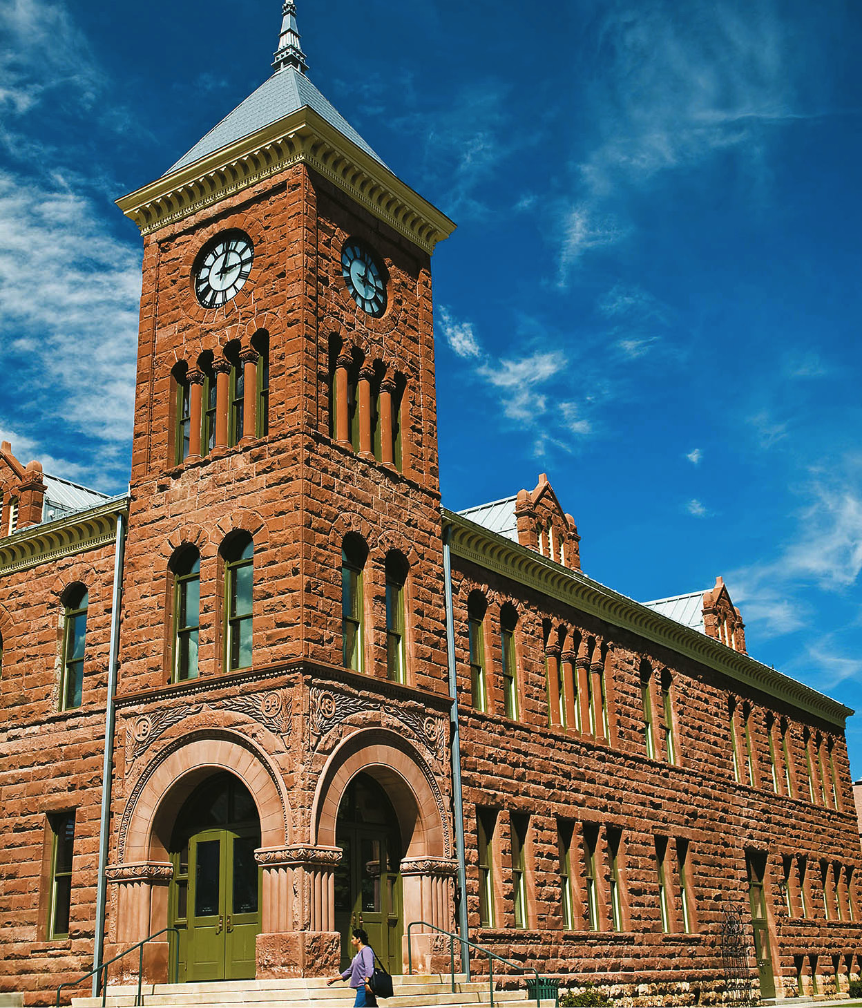
The Coconino County Courthouse in Flagstaff was built in 1894.
Richard Nowitz/Apa Publications
Now a small and growing city of an estimated 68,667 residents (2013), Flagstaff hosts a lively, eclectic mix of small business owners, students, writers and artists, travelers, cowboys, river runners and Rastafarians, and old-timers and newcomers. It’s been characterized as a crossroads and a destination. Millions from all over the world pass through on their way to the Grand Canyon each summer. Big-city folks (many with second homes in Flagstaff) travel up regularly on weekends to enjoy the small-town feeling. Students stay for a few years to obtain an education at Northern Arizona University. The rest – hearts captured by the town’s friendliness and the surrounding beauty of forests, mountains, and canyons – find themselves permanent Flagstaffians.

Art and history
Downtown Flagstaff is a good place to start a visit. At its center is Heritage Square A [map]. This outdoor plaza features a small amphitheater where concerts are presented nearly every weekend summer through fall. Nearby is the elegant landmark Weatherford Hotel, opened by Judge John Weatherford on New Year’s Day in 1900. Like many downtown structures, the hotel is built of locally quarried sandstone called Arizona Red. The present owners have faithfully restored the hotel’s original face, including a balcony that wraps around the second story; it’s a perfect place to sip a cold drink and view the parade of humanity on the sidewalk below. Downstairs, Charley’s Grill is a popular eatery.
For an in-depth look at downtown’s other turn-of-the-century stone buildings, pick up copies of Flagstaff Historic Walk and Stone Landmarks. They are available at the Visitor Center B [map] (tel: 928-213-2951; www.flagstaffarizona.org; Mon–Sat 7am–6pm, Sun 7am–5pm), in the train station a block from the Weatherford Hotel, or at local bookstores.
Lowell’s legacy
A trip up to Lowell Observatory C [map] (tel: 928-774-3358; www.lowell.edu; June–Aug daily 9am–10pm, call for days and hours rest of the year) just west of downtown affords that toy-town view of Flagstaff from Mars Hill. Wealthy Bostonian Percival Lowell chose the hill as the site for his observatory, where he ordered a telescope erected to view the planet Mars. Lowell arrived in 1894 in time to make those observations and lived part-time there for the rest of his life. The planet Pluto was discovered at the observatory in 1930, and astronomers continue to make significant contributions in their various specialties. The Steele Visitor Center and the Slipher Building contain fascinating interactive exhibits on the work of astronomers and the history of the observatory. With the clear, dark sky bursting with stars, it is a distinct treat to attend a night-time viewing through Percival’s original Clark telescope.
Flagstaff is also a center of other scientific pursuits. A branch office of the US Geological Survey is located in Buffalo Park, north of downtown, where the late Eugene Shoemaker founded the discipline of astrogeology. A 10-day Festival of Science is held each fall, with a constant round of public events. Recognizing the area’s botanical diversity, the Arboretum at Flagstaff D [map] (tel: 928-774-1442; www.thearb.org; Apr–Oct daily 9am–5pm) features native plant gardens, nature walks, and other activities on the grounds on Woody Mountain Road, 4 miles (6.4km) southwest of town, off Route 66.
Southside
Immediately south of the tracks, along South San Francisco and South Beaver streets in downtown Flagstaff, is what’s known as Southside – a funky neighborhood of ethnic restaurants, coffee shops, dance studios, sport shops, youth hostels, historic churches, and modest homes.
Southside has always been the working-class side of town. Its residents claim a mixture of Mexican, Basque, and African-American heritage. Their ancestors moved here between the 1870s and 1930s to escape revolution in Mexico and to find jobs, mostly as shepherds and mill workers. They built modest stone cottages and frame bungalows and gathered at Zaragosa Hall on South San Francisco for dances and boxing matches. Billiards and handball played at a traditional Basque pelota court (which still stands on South San Francisco Street) provided other pastimes.
Today, the grandchildren of those early pioneers still live in the same houses and run family businesses. On most days, some of the 15,000 students at Northern Arizona University pedal and skateboard through this down-home neighborhood, which relishes its individuality and history. The streets are filled with the scent of fresh tortillas and roasted coffee. Several historic buildings have been revamped as microbreweries, hip delis, pizzerias, and farm-to-table restaurants. This gentrifying neighborhood is one of the most dynamic in Flagstaff.
The Arizona Historical Society’s Pioneer Museum E [map] (tel: 928-774-6272; Mon–Sat 9am–5pm) displays interesting artifacts from Flagstaff’s past. To visit, follow Highway 180 (Fort Valley Road) north until you reach a white stone building on the right, originally the county hospital, that locals once called “the poor farm.” Along with housing the small staff, the hospital had room for about a dozen patients. In 1908, the local newspaper described the new building as “a substantial one of stone, fitted up with hot and cold water in each of the airy rooms, situated among the pines on a small hill overlooking the rich little valley to the south.”
Outside the museum stands old Number 12, a shiny black steam locomotive put into service in the Northwest woods in 1929 and used in the Flagstaff area in the 1950s. Inside, individual rooms contain artifacts of early medicine, logging, and transportation in northern Arizona. A display of old dolls, games, children’s books, tea sets, quilts, and more – called Playthings of the Past is held each holiday season. The museum’s two big events each year are the Wool/Fiber Festival on the first weekend in June, and the Independence Day Festival marking the Fourth of July, with live demonstrations at each.
Immediately behind the Pioneer Museum is the Coconino Center for the Arts F [map] (2300 N Fort Valley Road; tel: 928-779-2300; Tue–Sat 11am–5pm), exhibiting the work of local artists and providing a venue for live music and other programs. Next door is the Art Barn, location for classes and opportunities for resident artists.
Flagstaff Arts and Crafts
Northern Arizona University has an exciting program of dance performances, readings, lectures, plays, and concerts by the Flagstaff Symphony, as well as art shows in the NAU Art Museum. Coconino Center for the Arts (for more information, click here), showcases local and regional artists and musicians. It has intimate concerts and the annual Recycled Art Show in April and the It’s Elemental Fine Crafts exhibit in December.
During the popular First Friday Art Walk, when galleries stay open 6–8pm, visitors can meet local artists producing fine art and crafts in glass, wood, cloth, and other media. Heritage Square is a good place to meet. Live music concerts are offered every Thursday in summer, and almost nightly in the nearby historic Orpheum Theater.
March’s Arizona Archeaology Month and September’s Festival of Science bring archeaology enthusiasts and science lovers of all ages to dig at Elden Pueblo; view Mars, Jupiter, and other planets at Lowell Observatory; and attend talks and lectures at the Museum of Northern Arizona, Northern Arizona University, and the United States Geological Survey.
In summer, a Labor Day county fair and horse races and many different types of arts and crafts festivals are held at the huge Fort Tuthill County Park, south of town, while the Zuni, Hopi, and Navajo juried shows at Museum of Northern Arizona attract international connoisseurs and collectors of Indian arts and crafts.
Family treasures
A mile farther, on the left, is the Museum of Northern Arizona G [map] (tel: 928-774-5213; www.musnaz.org; Mon–Sat 10am–5pm, Sun noon−5pm). Dr Harold Colton, his wife Mary-Russell Ferrell Colton, and other community members founded this institution in 1928. This gem of a museum, standing amid ponderosa pines beside the Rio de Flag, shares the wealth of geology, biology, and culture of the Colorado Plateau, the geologic province in which Flagstaff is located. Rotating exhibits showcase some of the museum’s extensive collections of basketry, pottery, paintings, and kachina carvings. Mrs Colton, an accomplished artist in her own right, encouraged American Indian artists. Her legacy continues at the museum to this day, with a series of shows and marketplaces in summer and early fall featuring some of the best arts and crafts produced in the region.
Back in town near Northern Arizona University, another piece of Flagstaff’s history has been preserved in a state park. Riordan Mansion State Historic Park H [map] (tel: 928-779-4395; www.azstateparks.com/parks/rima; May–Oct daily 9.30am–5pm, Nov–Apr Thu−Mon 10.30am–5pm; hourly tours start at 11am,10am in summer, reservations recommended) was the home of businessmen and brothers Michael and Timothy Riordan.

Museum of Northern Arizona.
Richard Nowitz/Apa Publications
Tip
Amateur archaeologists can help excavate Elden Pueblo, a Sinaguan ruin in Flagstaff. Educational programs include site tours, lab work, and excavation techniques. Call 928-527-3452 for information.
The 40-room, 13,000-sq-ft (1,200-sq-meter) house, designed by Charles Whittlesey, architect of the Grand Canyon’s El Tovar Hotel, was built in 1904. Stone, plank, and shake construction was used; some of the wood was scrap ponderosa pine from the nearby Arizona Lumber and Timber Company mill, which the Riordans owned. The two brothers married the Metz sisters, and each family had separate living areas in the mansion, connected by a common space called the “cabin room.” The Steinway piano, Tiffany stained-glass windows, velvet upholstered seats, and six-car garage show what life was like for the “upper crust” in Flagstaff in the early years. But the Riordans weren’t immune to grief. In daughter Anna’s bedroom is her hoop dress, which she wore as a young woman. On the night of her engagement party in 1927, she was stricken with polio and her life was cut short.
Sacred peaks
The San Francisco Peaks 3 [map] sweep up behind Flagstaff, a small range as far as mountains go but an extremely captivating one. The Peaks are sacred to all who come under their spell, in particular local Hopi, Navajo, and other tribes. The Peaks are the highest mountains in Arizona – 12,643ft (3,854 meters) at the windswept tundra atop Humphreys Peak. A trio of separate summits complete their impressive profile: Agassiz, Doyle, and Fremont.
Franciscan friars who saw the mountains from the Hopi Mesas in 1629 named them in honor of their founder, St. Francis. Early travelers headed for the springs that issue from them, and a fledgling Flagstaff relied on those water sources for the town’s sustenance. Now people flock to the mountains for recreation and inspiration. They hike the trails in summer, gawk at golden aspens in the fall, sled and ski in winter, and watch for the first candytuft to bloom in spring. Botanists search the alpine tundra for rare plants, hunters scan the ridges for elk, and woodcutters load up logs for their stoves.
Geologists classify the Peaks as a “stratovolcano.” Numerous explosions piled layer upon layer of lava, cinders, and ash to an elevation of nearly 16,000ft (4,800 meters) about 400,000 years ago; on the north side, the mountain collapsed into a huge bowl called the Inner Basin.
Mountain wilderness
The uppermost reaches of the San Francisco Peaks are protected as the Kachina Peaks Wilderness Area. While no motorized or wheeled vehicles are allowed, hikers walking the wilderness may be rewarded with the sights and sounds of gray fox, Mexican owls, and bugling elk. Two popular trails, the Humphreys and Kachina, can be reached by driving to the Arizona Snowbowl (tel: 928-779-1951; daily 9am–4pm) 17 miles (27km) from town, off Highway 180. The Humphreys Trail ascends steeply through dense evergreen forest to the rocky tundra of the highest summit. The Kachina Trail is a gentler path that follows the lower slope. Northward stretches the grassy expanse of Hart Prairie, home to a Nature Conservancy preserve with rental cabins. Forest Road 151, accessible from Highway 180, is a scenic unpaved drive that gives unending views of the Peaks.
Fact
Percival Lowell believed in Martian life, based on his observations of lines radiating from the planet’s surface, which he thought was a network of canals. He suggested that Mars had an atmosphere, thin and cloudless but adequate to support life.
Ski country
With the first dusting of snow on the Peaks in early winter, Flagstaffians rejoice at the prospect of downhill skiing. The sport arrived here in 1915. That winter, with 6ft (2 meters) of snow on the ground, Ole and Pete Solberg strapped on homemade wooden skis and swooshed down Mars Hill. Townsfolk gathered to watch, and the local paper exclaimed, “They call it ‘skiing!’” In the 1930s a local ski club was formed to foster the sport, and the first lodge was built at what is now the Arizona Snowbowl. It’s music to skiers’ ears when the snow report reads “67 inches of packed powder at Midway, all runs open.” The Snowbowl’s five lifts serve beginner to advanced skiers. (In summer, one lift operates as a scenic skyride, taking riders to an elevation of 11,500ft/3,500 meters.)
Without snow-making equipment, the Snowbowl depends on mother nature. In dry years the season can be short; but in average years, with 260ins (660cm) of snow possible, the slopes are open from mid-December through March.
For a more low-tech experience, the Flagstaff Nordic Center (tel: 928-220-0550; daily 9am–4pm winter only) is the place to go. On Highway 180, 8 miles (13km) past Snowbowl Road, the center offers a variety of groomed cross-country and snowshoe trails through the forest and meadows. Cross-country skiers will also find a nearly endless supply of backroads, most of them closed in winter, in Coconino and Kaibab National Forests that provide a wealth of possibilities for winter trekking.
During the entire month of February, a kind of cold-weather mania grips Flagstaff during Winterfest. All manner of snow-related activities are scheduled, including skiing, dogsledding, snowshoeing, ice skating, and skijoring (a cross between cross-country skiing and dogsledding), not to mention the Snowball Slide and Icicle Walk and Gawk. An array of music, food, and dance events complements the more vigorous endeavors.

Snowshoeing at the base of the San Francisco peaks.
iStock
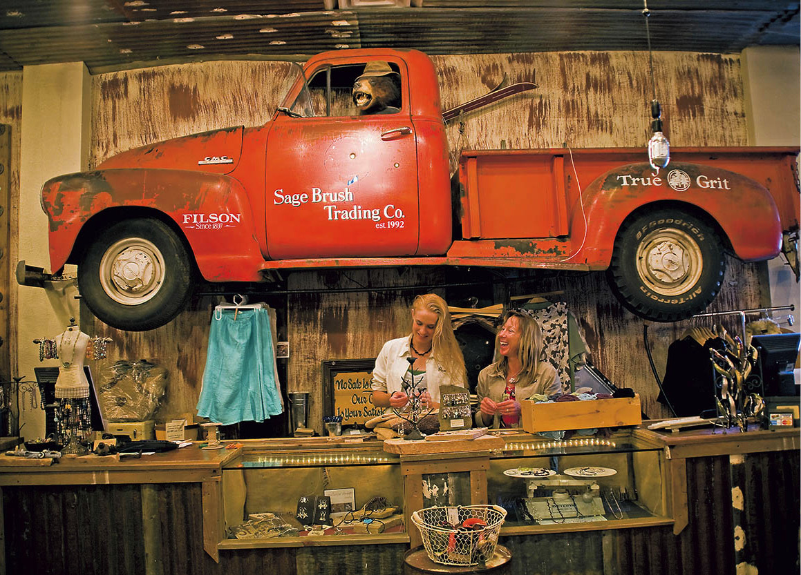
A shop in downtown Flagstaff.
Richard Nowitz/Apa Publications
Volcanic origins
The San Francisco Peaks are part of the 1,152,000-acre (466,200-hectare) San Francisco Volcanic Field, a young, still active volcanic field that has shaped the landscape. Some 600 cinder cones are scattered throughout the grassy plains surrounding Flagstaff. And though some of the cones date back several million years, Sunset Crater Volcano National Monument 4 [map] (tel: 928-526-0502; www.nps.gov/sucr; daily May–Oct 8am–5pm, Nov–Apr 9am–5pm) is less than 1,000 years old. This black 1,000ft (300-meter) -high cone was formed when hot ash and lava exploded from a vent around AD 1064–65. It continued erupting for 150 years or so, pouring out fiery lava and other volcanic debris that has frozen into a black, jagged moonscape.
To see Sunset Crater up close, travel 12 miles (19km) north of Flagstaff on Highway 89 and turn at the national monument sign. After a stop at the visitor center, continue on the loop road at the base of Sunset Crater. Though the crater itself is now off-limits to hikers due to erosion, you can walk around it on the mile-long Lava Flow Trail. Along the way you’ll see the many byproducts of the eruption – football-shaped volcanic bombs, upturned slabs of lava descriptively called squeeze-ups, and the entrance to an ice-filled lava tube.
After the eruption
When the volcano first erupted, the people living in the vicinity must have thought the world was coming to an end. But the fine cinder mulch the volcano deposited, along with a favorable period of precipitation after the eruption, lured them back. Harold Colton, founder of the Museum of Northern Arizona, named these people the Sinagua, which means “without water,” for their arid homeland. He and other archaeologists believed the “new” volcanic farmland lured thousands of settlers into northern Arizona.
Ancestral Pueblo people were probably among them. Their stunning architectural stonework is on display at Wupatki National Monument 5 [map] (tel: 928-679-2365; www.nps.gov/wupa; daily sunrise to sunset), 22 miles (35km) beyond Sunset Crater on the loop road. Several beautiful pueblos have been excavated and are open to visitors. The largest is namesake Wupatki Pueblo. From the visitor center, a half-mile self-guiding path leads through this four-story dwelling built of sandstone slabs set in mud mortar. Some of the masonry resembles that of Chaco Canyon in New Mexico. Wupatki Pueblo’s more than 100 rooms ramble without any apparent plan, and recent work suggests it was built in several phases from the mid- to late 1130s through the early 1200s. Cached in several rooms were remains of such tropical birds as scarlet macaws and thick-billed parrots. These and other finds have led archaeologists to suggest that Wupatki was a site of high political or spiritual significance. Other intriguing sites in the park – Wukoki, the Citadel, and Lomaki – certainly support this theory.
Wupatki is located in the high-desert valley of the Little Colorado River. For a real backroad trip, take a ride to the Grand Falls 6 [map] of the Little Colorado. The river’s muddy brown waters tumble over a 185ft (56-meter) ledge, a virtual Niagara in the desert. Keep in mind, however, that Grand Falls flows only seasonally, when the river is running with springtime snowmelt or summer storm water, and requires quite an undertaking to reach.
Take Highway 89 just north of Flagstaff, turn right onto the Townsend–Winona Road, go 8 miles (13km) to Leupp Road, turn left and go another 15 miles (24km) to the boundary of the Navajo Nation. Turn left (north) onto Navajo Route 70, a good gravel road when dry, but impassable when wet. In another 9 miles (15km), you’ll spot picnic ramadas and find yourself at Grand Falls.
Relics of the past
Returning to Flagstaff, head east on Interstate 40 for 10 miles (16km) to the area’s third national monument – Walnut Canyon 7 [map] (tel: 928-526-3367; www.nps.gov/waca; daily May–Oct 8am–5pm, Nov–Apr 9am–5pm). The Sinagua lived here too, though in a totally different setting than Wupatki. They tucked their living quarters beneath limestone ledges in a deep canyon. Descend the Island Trail to the small rooms and smoke-blackened walls of their abodes. A host of plants along the streamcourse, on the drier hillsides, and on the forested rim sustained them with wild foods and material for clothing and other utilitarian items. By building small rock dams across gullies, the Sinagua gathered pockets of soil where they grew corn, beans, and squash. Some of these are visible along the Rim Walk, a fine place to gaze into Walnut Canyon or up into the sky for soaring hawks and eagles.
Continuing on Interstate 40 another 25 miles (40km), there’s a big hole in the ground about 6 miles (10km) south of the highway that interests many people. And well it should. About 50,000 years ago, a chunk of iron traveling at about 40,000 mph (65,000 kmh) hit the Earth. With the force of about 20 million tons of TNT, it blew out a depression known as Meteor Crater 8 [map] (tel: 800-289-5898; www.meteorcrater.com; daily May–Sept 7am–7pm, Oct–Apr 8am–5pm). This natural landmark – 4,000ft (1,200 meters) across and 560ft (170 meters) deep – is open for guided tours, or the crater can be viewed through windows at the fine museum on the rim.
Another 25 miles (40km) beyond Meteor Crater is the railroad town of Winslow 9 [map], once a bustling Indian Country destination accessed by rail, plane, and Route 66. Beside the tracks stands La Posada (303 E. Second Street; tel: 928-289-4366; www.laposada.org), a grand hotel that was the last of the Harvey Houses designed by architect Mary Jane Colter in 1930. Hands-on owners with a passion for historic preservation, community, and the arts have superbly restored the huge Mission-style structure over two decades. It is worth stopping in Winslow just to tour the public spaces, galleries, and grounds of the gorgeous La Posada (or arrive by train), as well as dine in the award-winning Turquoise Room restaurant. La Posada is the linchpin of a growing arts scene in Winslow that is bringing new life to the town.
A Growing Winslow Arts Scene
In 1994, California sculptor Dan Lutzick moved into a former storefront in Winslow, attracted by space and cheap rent. He was joined in 1997 by artist Tina Mion and her husband, entrepreneur Allan Affeldt, after the three college friends bought the derelict 1930 La Posada hotel from the railroad. Living onsite, they slowly restored Mary Jane Colter’s masterpiece to its former glory, then invited British-born California restaurateur John Sharpe to recreate a classic Harvey House restaurant for the modern era.
Now a popular destination for those who love fine regional dining, gardens, art, historic buildings (and, of course, trains), La Posada is filled with Tina Mion’s paintings, carved wooden beds by her brother Keith, and work by local artists. It also displays beautiful wrought-ironwork by master craftsman John Suttman, who moved his studio to Winslow in 2014. Another California refugee, artist Paul Ruscha (brother of Ed), recently renovated the old Harvey Car warehouse across the street into El Gran Garage, a live-work studio.
Along with light artist James Terrell, whose landscape art installation inside Roden Crater is nearing completion, the friends have formed Winslow Arts Trust to promote the arts. Their latest venture is a Route 66 Art Museum, to be housed in the old railroad depot.
The Snowdrift Art Space, the live/work space that Lutzick now shares with wife Ann-Mary, director of the Old Trails Museum, is a popular rendezvous for visitors.
A few miles north of town is Homolovi Ruins State Park ) [map] (tel: 928-289-4106; www.azstateparks.com/parks/horu; daily 8am–5pm). Situated atop high mounds overlooking the Painted Desert are 14th-century pueblos. Certain Hopi clans claim Homolovi as the home of their ancestors, the Hisatsinom, who made this their last stop before arriving at present homes on the mesas about 60 miles (100km) to the north. Homolovi sites I and II are accessible to visitors. Hiking trails, a campground, picnic areas, and a chance to watch archaeologists at work are features of the park. Check at the visitor center for the latest information.
Reach for the Stars
Dry air and dark skies produce what astronomers call “good seeing,” attracting both professional and amateur skywatchers to Arizona.
Three major observatories are located in southern Arizona, each atop a mountain peak far from the glare of city lights and the dust and moisture that tend to settle at lower elevations. A fourth, older facility, Lowell Observatory, is in Flagstaff and has been engaged in fundamental research for more than a century.
Kitt Peak, the best known of the state’s observatories, stands at an elevation of about 6,900ft (2,100 meters) in the Quinlan Mountains 56 miles (90km) southwest of Tucson. The ridge bristles with the largest array of telescopes in the world, including three major night-time telescopes and the facilities of consortia that operate 19 optical telescopes and two radio dishes on this site. The largest is the 13ft (4-meter) Mayall reflector, which is housed in an 18-story dome. About half a mile away, the white angular housing of the McMath Solar Telescope rises from the mountain’s south end, looking more like a modern sculpture than an astronomical instrument. At the top of the structure is a 6.5ft (2-meter) mirror that collects the sun’s rays and reflects the light down a 530ft (162-meter) -long diagonal shaft into an underground laboratory.
To the east, in the Pinaleño Mountains outside Safford, Mount Graham International Observatory is operated by Steward Observatory, the research arm for the Department of Astronomy at The University of Arizona. Tours depart from Discovery Park, a visitor center at the base of the mountain, followed by stargazing through the 20in telescope in the evening.
Fred Lawrence Whipple Observatory, in the Santa Rita Mountains 35 miles (56km) south of Tucson, offers a visitor center (Mon–Fri 8.30am–4.30pm) and 6-hour bus tours (tel: 520-670-5707; mid-Mar–Nov). The highlight is a close-up look at the Multiple Mirror Telescope which combines the light from six 6ft (1.8-meter) mirrors constantly realigned by laser sensors.
Lowell Observatory (for more information, click here) welcomes visitors with numerous interactive exhibits, informative tours, viewing programs and special workshops. Best known for Percival Lowell’s obsessive search for Martian life, the observatory is also credited with Clyde Tombaugh’s discovery of Pluto and observations that led to the discovery of the expanding universe.
Today, astronomers at Lowell conduct research on the planets, stars, galaxies, comets, and asteroids. One project locates and tracks objects that could collide with Earth, causing the same ecological catastrophe believed to have wiped out the dinosaurs.
The stargazing tour continues at Tucson’s Flandrau Science Center and Planetarium, where visitors can see a 200lb (90kg) chunk of the Barringer iron that blasted out Meteor Crater, take in a planetarium show, and gaze through a 16in telescope in a rooftop observatory. Nearby is the Steward Observatory’s Mirror Laboratory, which produces optics for some of the world’s biggest telescopes.
Star parties are a great way for travelers and amateur astronomers to mingle and enjoy stargazing through several telescopes specially set up for the occasion. One of the best star parties is the annual Grand Canyon Star Party in June, which takes place over several nights at the edge of the abyss.
