4 Calder and Strzelecki
Frenchman’s Cap displays from its quartzose summit scenery of Pyrenean character, unequalled elsewhere in Van Diemen’s Land.
James Erskine Calder, a former soldier turned surveyor, sailed from England in 1929 to start a career on the other side of the world. Stepping ashore at Hobart Town as an eager 21 year-old, Calder’s first impressions of the place may have caused him to question the wisdom of accepting the position of assistant surveyor in the new colony. The streets were rough and dirty, and crime was rampant. Hobart Town greeted him with the depressing sight of long lines of chained convicts dressed in dull yellow uniforms.
‘My first impression of the place,’ Calder wrote in later life, ‘was that there was nothing beautiful about it except Mount Wellington, and the clear blue sky overhead.’19 Nor did things improve when he reported to Government House next morning to meet Lieutenant Governor Arthur. An icy reception coloured Calder’s opinion of the governor from that time forth.
… the cold glance emitted from his clear sharp eye, for he was a good looking man, was much too repelling and expressive of impatience at the very slight interruption I had caused him not to be understood; so delivering my credentials, I quitted his presence far more hastily than I had approached it, with a firm resolve that never left me, to enter it, voluntarily, no more.20
‘
The most powerful, skilful and ruthless figure in the colony’. Lieutenant–Governor George Arthur. (Tasmanian Archive and Heritage Office)
Despite this bleak introduction to his new home, Calder fitted in well. Over the next few years he established himself as a valuable member of the survey department, exploring extensively throughout the west and south-west.
Calder was a tall man with a strong physique that served him well for arduous bush work. He also possessed great reserves of both energy and enthusiasm, and pushed himself to the very limits of physical endurance in the field. Calder’s reports stand today as a model of survey and exploration work: accurate, detailed and always presented with well-thought through recommendations. He was, in every respect, the complete explorer.

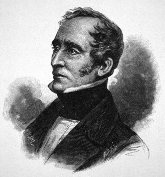
James Calder. A photograph taken in later life. (Tasmanian Archive and Heritage Office)
Two events took place which directly affected the direction of Calder’s work. Governor Arthur may have been a ruthless martinet, but he was unquestionably a skillful administrator, and when he sailed away from Hobart Town in 1836 he left behind a healthy economy and a sound administration, providing solid foundations for his successor, Sir John Franklin.
Two years later Surveyor General George Frankland, the leading light in exploration in the colony, died suddenly at the age of 41. At the same time the demand for more land —provided by exploration — dried up when many settlers moved from Van Diemen’s Land to the new colony at Port Phillip (later Melbourne). The only new exploration to be carried out was in the west. Calder, now the most experienced member of the survey department, was given the task of cutting a track from Lake St Clair to Macquarie Harbour for Sir John Franklin’s party.
Calder’s Track
Calder began work on the track in early December 1840. It was part of an ambitious plan conceived by the Governor to open up the west ‘to enterprising settlers’. One of the biggest challenges Franklin faced as governor was the complete reorganisation of the convict system in Van Diemen’s Land. The long-standing system of assigning convicts to colonists was soon to be replaced by one where they could work only in labour gangs, away from the settled areas in outlying probation stations.
Franklin was considering reopening Macquarie Harbour (which had been closed in 1833) as a probation station, from which supervised gangs of convicts could be usefully employed on public works. Calder’s track would allow the governor to personally inspect both the western country and the penal station to see if the twin aims of his plan were feasible.
No exploration had been carried out near Frenchmans Cap since Sharland visited the region in 1832. Over the hot and sultry summer of 1840 Calder began work on the track, ably assisted by seven convicts, ‘all recent arrivals from Port Arthur ... of whom it is unnecessary for me to say anything except that better men were never placed under a master’.21
The track took thirty-two weeks to complete and Calder recalled it 19 years later as a ‘dreary and almost heart breaking task ... ’22 The track went over Mount Arrowsmith, crossed the Franklin River, and continued around the eastern slopes of Mount Mullens. From here Calder was able to look down on the Loddon Plains.
I at first called it the Valley of the Frenchman, from its close proximity to the Frenchman’s Cap mountain; but I afterwards named it the Valley of the Loddon, from the beautiful river that drains it. This is formed of three streams, each 12 or 15 yards wide. It flows over a gravelly bottom, with very moderate velocity, and finally enters the Franklin. Unlike the majority of our rivers, it is not a brawling mountain torrent, dashing over cataracts and waterfalls, but has all the gentleness of the course of an English stream. I called it the Loddon from a fancied similarity to that stream.23
Here, Calder refers to the River Loddon, a tributary of the River Thames. In England, the River Loddon rises near Basingstoke and flows for 45 km across the counties of Berkshire and Hampshire. It joins the River Thames near the village of Wargrave.
Calder’s party spent an anxious Christmas Eve huddled beneath a large overhanging rock, which they named Christmas Rock. A spectacular lightning storm turned night into day, and a lightning strike set fire to the button grass, causing the party no little concern before it was extinguished by a timely downpour. Calder named the region ‘Lightning Plain’ (sic).
Beyond Lightning Plains, Calder was blocked at every turn by a series of rivers, and by the impassable barrier of the Deception Range.
Macquarie Harbour is a very unapproachable place from the land, travel to it as you may. The mountain ranges of the Frenchman’s Cap being so contiguous to the part and shooting out its great branches everywhere like the arms of a polypus, leaves very little choice in the direction of a road. In whatever way you attempt to make the harbour in a direct manner you find yourself met by some inferior ridge of the mountain mass, to scale which is inevitable. High, steep and most difficult of passage are the hills which lie on the line for about five miles after leaving the Valley of the Frenchman, and are covered with a very heavy forest, often a dense and scarcely passable jungle. These heights are a great limb of the Frenchman’s Cap.24
In his determination to find a straightforward route to Macquarie Harbour, Calder twice descended to the bottom of a ‘hideous defile’ which he called the Great Ravine, only to be forced to retrace his steps. ‘A large and furious torrent flows through it, which collecting all the water that falls on a wide extent of mountainous country, emerges from the glen a large and beautiful river. I called it the Franklin.’25
By now it was clear to Calder that the impossible nature of the terrain would never support a road through to the west coast, let alone subsequent settlement. However, Calder’s persistent pleas to the governor to abandon the project fell on deaf ears. Franklin remained determined in his quest to see the country for himself. Calder was still working on the final stages of the track when he received instructions to return to Lake St Clair to meet Sir John Franklin’s party.
Strzelecki visits Frenchmans Cap
Just before Calder returned to Hobart in the late autumn of 1841, his new track received its first visitor. To this day, Sir Paul de Strzelecki’s little known attempt to climb Frenchmans Cap stands as one of the mountain’s great unsolved mysteries. Penetrating the peak’s outer defences, Strzelecki not only recorded Frenchmans Cap’s height (using a field barometer provided by Sir John Franklin), but was able to describe an accurate and far-reaching panorama. This suggests, but does not prove, that Strzelecki may have been the first white man to reach the summit.
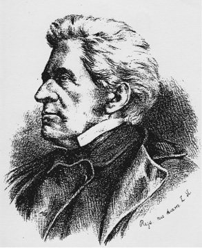
Sir Paul de Strzelecki—an early charismatic visitor to Frenchmans Cap. (Lech Pazskowski)
When Strzelecki stepped off Emma at Launceston in July 1840 he was a celebrated and seasoned traveller who had devoted five hectic years to ceaseless world travel. More recently he had just completed several epic journeys on mainland Australia. Of these, the first ascent of Australia’s highest peak, Mount Kosciuszko, assured a place for Strzelecki in Australia’s history. On his arrival in Van Diemen’s Land an unexpected letter of welcome was waiting for him from the Governor himself, details of which he revealed in a letter to his long time ‘beloved’, Adyna Turno.
If I could forward you a letter received from Sir John Franklin, famous for his discoveries in the north, now governor of Van Diemen’s Land, you would be surprised to note that I, a modest person, have become the object of admiration and attention. He writes me from Hobart Town, the capital, that he has issued orders to all authorities, organisations and the army to aid me.26
Not only was Franklin’s a generous gesture, it also marked the beginning of a strong friendship between the two men. ‘You will I know be enchanted with him,’ Lady Jane Franklin informed her sister. ‘Everybody is so without exception, he is so gentlemanlike, elegant, so very clever, so accomplished, so full of fire and vivacity and withal so amiable, only a little bit satirical, but not too much so. He will be the brightest star in your galaxy of worthies.’27
It was no doubt through the largesse of Franklin that Strzelecki was able to make use of Calder’s track. Strzelecki’s diary Mon Journal is missing, so the route taken to the Cap by Strzelecki and his two companions remains unknown. One clue is suggested by ‘Strzelecki Rivulet’, a name bestowed on today’s Vera Creek by W. A. Tully eight years after Strzelecki’s journey.28
Strzelecki recorded the height of Frenchmans Cap at 3,801 ft (1158 m), well below its official height of 4,744 ft (1446 m). James Calder made this comment in the Hobart Town Courier of 21 September 1850:
… it is known to the writer that Count Strzelecki visited this quarter, and ascended the Frenchman, during very stormy weather; and I suppose on reaching what may in general terms may be called the mountain top, he fancied himself on its highest point, and took observations which led to an erroneous result. But there is nothing more difficult than finding one’s way on the top of a rocky mountain in stormy weather (such as the Count experienced here), when everything is enveloped in clouds.29
What is clear is that Strzelecki climbed at least as high as the Main Range, probably near Sharlands Peak. Writing in his book, Physical Description of New South Wales and Van Diemen’s Land, Strzelecki gives a broad description of what he saw.
The [spur] which divides King’s River [Franklin River]30 and the Gordon, and which is crowned by Frenchman’s Cap, displays from its quartzose summit, scenery of Pyrenean character, unequalled elsewhere in Van Diemen’s Land ... Below ... stretches the whole scrubby and barren tract between Macquarie [Harbour] and Port Davy [sic], a great part of the western coast, and the northern and eastern eminences of the lake country.31
Strzelecki’s description could only have been obtained in fine weather. As Frenchmans Cap is such a prominent peak it is difficult to imagine how he only ‘fancied himself on its highest point’. Strzelecki claimed to have walked the full length of Calder’s track. Perhaps he returned later and climbed the peak in fine weather, without Calder’s knowledge. Interestingly, Strzelecki’s ‘table of heights’ differed markedly from the results of James Sprent’s trigonometrical survey a decade later. This is puzzling because Strzelecki was always fastidious in the field, going to particular lengths to ensure the accuracy of his observations. Later, it was revealed that the mountain barometer supplied by Sir John Franklin was an old one, faulty and quite inaccurate.32
Did Strzelecki manage to scramble to the summit of Frenchmans Cap and claim the priority of first ascent? If he approached the mountain along Pickaxe Ridge and followed the broken ridgeline of the Main Range, it is entirely likely.
The truth of the matter may never be known, and without Strzelecki’s diary there is simply not enough evidence to point to a successful ascent. Meanwhile, the riddle of Strzelecki’s activities in the region continues to add to the mystery and intrigue of the story of Frenchmans Cap.