
Plan your walk |
|
 |
DISTANCE: 3½ miles (5.6km) TIME: 1¾ hours START/END: SK301571 Cromford car park near TERRAIN: Easy / Moderate; one 530ft (162m) climb MAPS: |
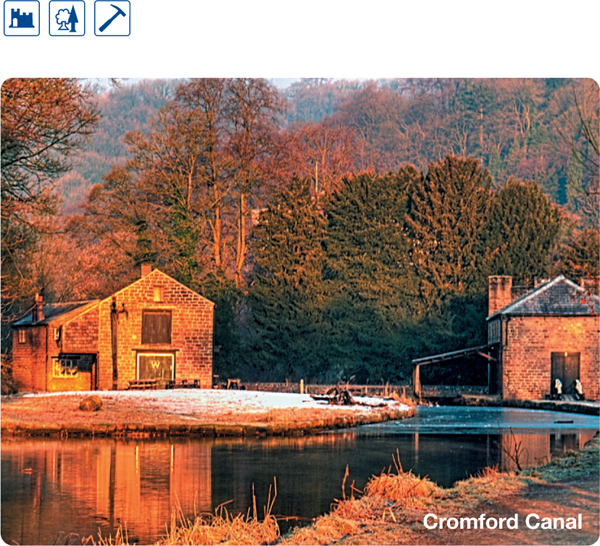
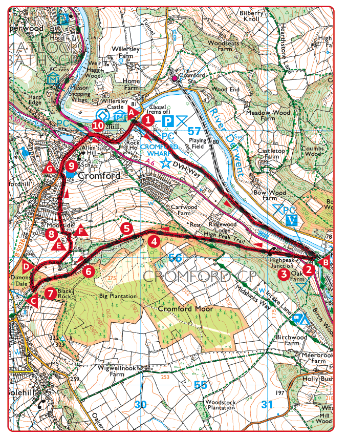
 Follow the towpath from Cromford Wharf away from the car park. 1½ miles (2.4km).
 The canal, built in 1793, gave Arkwright’s mills a link with the developing Midlands. It ran for 14½ miles (23km) from Cromford to the Erewash Canal and included four tunnels and 14 locks. The 6 mile (9.7km) long section between Cromford and Ambergate is now a Site of Special Scientific Interest.
 Cross the canal at the swing bridge and go to the right behind a low brick building. Climb the High Peak Incline. The climb is steep but trees offer plenty of shade on a hot day. 1¾ miles (2.8km).
 High Peak Junction. The junction is between railway and canal. Here, there are the oldest railway workshops in the world and a visitor centre.
 Sheep Pasture Incline. A plaque on the wall of the repair shop at the foot of the incline briefly explains the history of the 33 mile (53m) High Peak Railway. The line was opened in 1831 and was introduced as a means of connecting two canals – the Cromford and the High Peak, near Whaley Bridge. It was impossible to build a canal across the waterless limestone uplands but the railway was designed as though it was a canal. Rather than go round or through hills, the line climbs in a series of steep inclines, with motive power supplied by stationary winding engines on the steepest sections. The line climbed to Parsley Hay and went on to Hindlow, above Buxton, before dropping into the Goyt Valley and Whaley Bridge by a further three inclines. As an indication of the canal mentality, stations along the High Peak were always known as ‘wharfs’.

 Sheep Pasture Winding House. The tall building on the left of the track housed a steam-powered winding engine to haul wagons up the incline.
 Viewpoint looking north along the Derwent Gorge. Cromford is below and you can see Willersley Castle in its parkland. The A6 cuts through the rocks of much widened Scarthin Nick. Looking upstream, Matlock Bath surmounted by the wooded Heights of Abraham and the bare limestone face of High Tor opposite, carry the eye towards Matlock Moor.
 Viewpoint. Dene Quarry is opposite. Massive steps or ‘benches’ are cutting deep into the limestone hillside and gradually eating away Cromford Hill.
 Black Rocks. There was once an extensive lead mine beneath this point which is now marked by the overgrown spoil heaps and ruined buildings. A forest trail over the top of Black Rocks starts at this point.
 Go right at the side of the High Peak Trail car park. Walk downhill on a winding path through the tree-covered spoil heaps.
 Turn right in the clearing at the bottom of the wooded slope. Climb to the boundary wall and cross by a gap in the wall. Follow a field path, keeping to the left of the house.
 Go through a narrow gate and head left, downhill along an access lane, and bearing left for about 50yds (45m) where it meets another lane.
 Leave the lane by going through a squeezer stile on the right. Follow the narrow hedge-lined path down to the outer limits of Cromford.
 The lane is called Bedehouse Lane, an ancient way between Wirksworth and Cromford.
 At the road, turn right down Cromford Hill and walk through the village. Cross the main A6 and follow the side road past Arkwright’s Mill as far as the canal car park.
 North Street. The third storeys of the well-preserved cottages once accommodated handloom weavers frame knitters’ lofts.
 Cromford Mill. Richard Arkwright established the first successful water powered cotton mill on this site in 1771. The Arkwright Society has established a museum inside part of Cromford Mill which is dedicated to the father of the factory system. The mill is now part of the Derwent Valley World Heritage site.