Spring melt adds to the cascades of Lower Hadlock.
54 Lower Hadlock Pond Loop
This is a short loop that traverses counterclockwise around wooded and scenic Lower Hadlock Pond. The pond’s southern shore, near the end of the loop and by a pump house, offers a great look back at Parkman Mountain, Bald Peak, Gilmore Peak, and Sargent Mountain.
Distance: 1.6-mile loop
Hiking time: About 45 minutes to 1.5 hours
Trail surface: Forest floor, with lots of exposed roots in spots
Best season: Spring through fall
Other trail users: Local residents and anglers accessing Lower Hadlock Pond; hikers climbing Norumbega Mountain
Canine compatibility: Leashed dogs permitted
Map: USGS Acadia National Park and Vicinity
Special considerations: Chemical toilet at the carriage road parking lot near the Brown Mountain Gatehouse. No swimming or dogs are allowed in Lower Hadlock Pond, which serves as a public water supply.
Finding the trailhead: From Bar Harbor head west on ME 233 for 4 miles. Turn left (south) on ME 198 and continue another 3.9 miles, past Upper Hadlock Pond on your left, to a carriage road parking lot on the left (east) side of ME 198 just before the Brown Mountain Gatehouse. From the parking area walk south along the east side of ME 198 until you reach the foot of the Brown Mountain Gatehouse driveway. Cross to a gravel path on the other side of ME 198, and walk southwest along the gravel path to the first junction, where you turn right (west) onto a spur. You’ll see a blue blaze on a utility pole and you walk by a private residence on the left (south) as you head to the Lower Hadlock trailhead. Turn right (northwest) along Lower Hadlock Pond’s eastern shore to start the trail. The Island Explorer’s Brown Mountain line stops at the carriage road parking lot. GPS: N44 31.06' / W68 28.57'
The Hike
The picturesque views from the southern shore of Lower Hadlock Pond toward Parkman Mountain and Bald Peak are reminiscent of the Bubbles rising from Jordan Pond—but not quite. We call it a “poor man’s Jordan Pond view.”
From the gravel path directly across ME 198 from the Brown Mountain Gatehouse driveway, turn right (west) onto a spur at the first junction. Reach Lower Hadlock Pond’s eastern shore and the Lower Hadlock trailhead just beyond a private residence.
This section of trail on the pond’s eastern shore probably dates back to at least 1914. When it was recently restored, it made it easier to complete a circuit of the pond.
Head northwest along the pond with the woods to your right and the Norumbega ridge across the pond to your left (west). The trail rises over a swampy area and then goes through an eroded, rooty section.
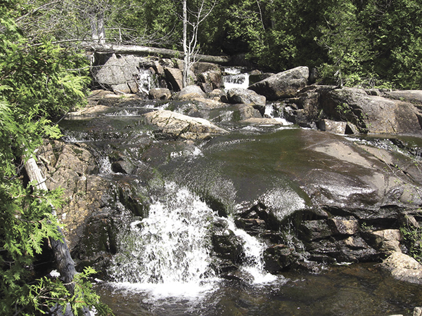
Spring melt adds to the cascades of Lower Hadlock.
The path turns to the right, passes a sandy beach, and then climbs along an inlet, taking you away from sight of the full length of Lower Hadlock.
At the farthest northern point of the pond, reach the intersection with the Hadlock Ponds Trail. Turn left (southwest) onto the Hadlock Ponds Trail to head along Lower Hadlock’s western shore. There’s a new log bridge near the bubbling mouth of the pond and some nice cascades along here that were reduced to a trickle during a late-August visit.
The trail climbs along Lower Hadlock through a cedar forest and to some huge boulders, tossed there by the glaciers. Be prepared for some up-and-down boulder hiking here as the trail hugs Lower Hadlock to its southern shore.
Reach the junction with the Norumbega Mountain Trail coming in on the right at 1.0 mile. We saw a loon diving for fish in Lower Hadlock Pond near here once (nearby Upper Hadlock Pond, across ME 198, is a loon nesting area). Continue circling around Lower Hadlock, past a pump house and over a dam via a modern footbridge.
This is where you get the “poor man’s Jordan Pond view.” You don’t get the pink granite on the shore and the Bubbles, but, like Jordan, you do get unforgettable views across the water of mountains rising in the near distance.
To the left you can see the Norumbega ridge. Looking north you see four mountains: Parkman Mountain to the left, the turgid and distinctive Bald Peak, the partly wooded Gilmore Peak, and finally the big one—Sargent Mountain.
To finish the loop, continue circling around the southern shore. Pass some old Village Improvement Society signs and reach a T-shaped intersection at 1.2 miles. Turn left here onto a gravel road. Continue around the pond, past a gate, and past a private drive at 1.5 miles.
Just beyond the private drive, turn left (north) onto a gravel path to complete the circle back to ME 198 and the Brown Mountain Gatehouse at 1.6 miles.

Miles and Directions
0.0Start at the gravel path across ME 198 from the Brown Mountain Gatehouse.
0.1Turn right (west) at first junction onto a spur past a private residence. Reach the Lower Hadlock trailhead, on the eastern shore of Lower Hadlock Pond. Turn right (northwest) at the shore.
0.5Reach the junction with the Hadlock Ponds Trail and the northern tip of Lower Hadlock Pond. Turn left (southeast) onto the Hadlock Ponds Trail to loop around the western shore of the pond.
1.0Pass the junction with the Norumbega Mountain Trail, coming in from the right (northwest). Circle around the pond’s southern shore, walking past the pump house and over the dam.
1.1Pass the junction with old village trails and continue circling the pond.
1.2At a T intersection with a gravel road, turn left (northeast) to continue around the pond.
1.5Pass a gate and turn left (north) after a private drive onto a gravel road to circle back toward the Brown Mountain Gatehouse.
1.6Cross ME 198 and return to the carriage road parking lot near the gatehouse.