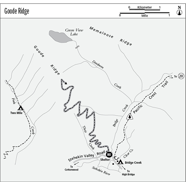
80 Goode Ridge
A day trip from the Stehekin Valley to an old fire lookout site atop Goode Ridge, 10 miles round-trip.
Best season: Late July to mid-October.
Elevation gain: 4,600 feet.
Elevation loss: None.
Maximum elevation: 6,760 feet at the old lookout site.
Topo maps: Goode Mountain, McGregor Mountain; McGregor Mountain.
Jurisdiction: North Cascades National Park.
Finding the trailhead: The trail, accessible by shuttle bus, leaves the Stehekin Valley Road on the west bank of Bridge Creek.
The Hike
This trail provides a challenging and rewarding day trip from the Stehekin Valley Road to the alpine crest of Goode Ridge. The trail begins by zigzagging upward through a loose woodland of Douglas fir, climbing at a measured pace. The forest understory is determined by soil moisture: Dry areas are dominated by snowberry and low-growing kinnikinnick, while wetter spots support thickets of Douglas maple and, higher up, mountain ash. Douglas firs are not as well-adapted to heavy snowfall as their higher-elevation cousins, and many of them have bent trunks known variously as “pistol butt” or “snow knees.” This condition results when young saplings are bent to the ground by snow that is creeping downhill. Growth hormones stimulated by sunlight cause the slender trunks to grow straight up from their prostrate position, resulting in the odd curvature at the base of the tree.
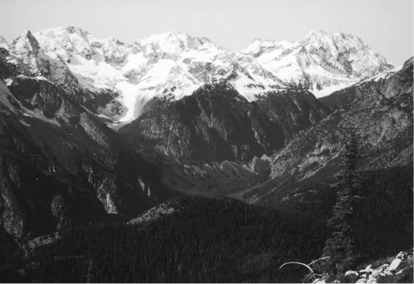
Early views feature McGregor Mountain to the southwest and the sharp horn at the end of Heather Ridge to the south. These views are soon joined by the Seven Sisters, which rise farther up the Stehekin Valley. The trail then rises above the trees into an old burn, revealing panoramic views of Bridge Creek and the rugged summits that surround it. The summit of Mount Lyall can now be seen to the south. The trail zigzags steadily up the slope, then emerges unexpectedly onto a gentle shelf shaded by mountain hemlocks.
The respite is a brief one, since steep and open slopes beckon above. Ever-expanding views reveal Flat Creek and the glacier-clad summits of Sentinel Peak and LeConte Mountain at its head. With increasing elevation, the trail faces up the Stehekin Valley for views of Trapper and Johannesburg Mountains and a crowd of lesser spires that rises between them. Nearing the summit, the trail reveals the blocky summit of Booker Mountain as well as Buckner Mountain with its sparkling glaciers.
The old lookout site occupies the summit of a long promontory that extends into the heart of the Stehekin Valley, with jagged peaks arrayed in all directions. Nearest of the peaks is Goode Mountain, with the long and rocky finger of Memaloose Ridge running southward from its base. The deep basin below bears Green View Lake, which can barely be seen, but the pretty waterfalls that descend from its outlet are in plain view. Grassy alpine swards fringed with larches beckon as picnic spots, but they are fragile; rest on the impact-resistant bedrock instead.
Miles and Directions
0.0 Trailhead just west of Bridge Creek bridge.
1.2 Trail crosses stream where water is sometimes available.
5.0 Trail reaches former site of fire lookout atop Goode Ridge.
Looking up the Stehekin Valley from Goode Ridge