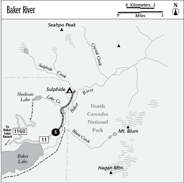
5 Baker River
A half-day hike along the Baker River to Sulphide Camp, 5.2 miles round-trip.
Best season: Mid-April to early November.
Elevation gain: 190 feet.
Elevation loss: 80 feet.
Maximum elevation: 900 feet.
Topo maps: Mount Shuksan; Mount Shuksan.
Jurisdiction: Mount Baker–Snoqualmie National Forest, North Cascades National Park.
Finding the trailhead: Follow Washington Highway 20 west from Concrete for 5 miles to the Baker River Highway (Forest Road 11). Follow this road north. The pavement ends after 20 miles, and at mile 25 there is an unmarked intersection. Turn left for the final mile to the trailhead.
The Hike
This trail penetrates a remote and forgotten corner of North Cascades National Park, offering an easy stroll through the ancient forests along one of the wildest rivers in the Cascades. The trail begins as an old road that wanders along the riverbanks, which are robed in a young forest of mountain hemlock, western red cedar, and red alder. Plentiful rainfall creates favorable growing conditions for club moss, which hangs like shrouding from the branches of the vine maples.
Soon there are views of the water. The Baker River is young in the geological sense of the word. As it brawls down its gravel-choked course, it splits into broad channels where floodwaters have built up new gravel bars and the water has sought a lower passageway. Watch for the glacier-clad fastness of Hagan Mountain, which peeks out above the steep foothills beyond the river.
As steep slopes crowd the riverbank, the trail threads its way among massive boulders covered with moss, and ancient cedars tower overhead. Gravel bars farther upstream have been colonized by groves of red alder, which invade flood-scoured riverbanks. Symbiotic bacteria in alder roots pump nitrogen into the soil, where it can nourish the seedlings of the shade-tolerant conifers that will eventually replace the alders. The trail soon splashes across several tributary streams. The largest of these is Lake Creek, and its alluvial fan supports a fine mixed forest of enormous cedars and moss-draped bigleaf maples.
After a final visit to the river’s edge, the path turns inland to bypass an extensive wetland created by beavers. This is an excellent spot to glass for waterfowl and other marsh inhabitants. Returning to the bottomlands, the trail leads onward across the shady floor of a closed-canopy hemlock forest. The understory is suffused with green: Mosses grow from every available surface. The trail reaches its end at a National Park Service camp beside Sulphide Creek. Visit the banks of this large tributary for northward views of Seahpo Peak at the end of Jagged Ridge.
Miles and Directions
0.0Trailhead at end of road.
1.5Trail crosses Lake Creek.
1.9Trail enters North Cascades National Park.
2.6Sulphide Camp (backcountry permit required).