11 Stetattle Creek
A day hike up Stetattle Creek, 2.8 miles to trail’s end.
Best season: Mid-May to late October.
Elevation gain: 1,260 feet.
Elevation loss: 60 feet.
Maximum elevation: 2,100 feet.
Topo maps: Diablo Dam, Mount Prophet; Diablo Lake, Ross Lake.
Jurisdiction: Ross Lake National Recreation Area, North Cascades National Park.
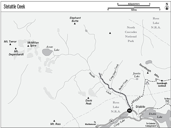
Finding the trailhead: From Newhalem, drive east on Washington Highway 20 to mile 126, where a spur road runs into the company town of Diablo. Park in the parking area beside the bridge, just within town. The trail starts on the opposite side of the road, between the first garage and a concrete outbuilding. Follow the creek to pick up the trail at the edge of the trees.
The Hike
Stetattle Creek is an ancient tribal boundary. To the Skagit people it marked the start of a dangerous hinterland, the domain of their enemies the Ntlakyapamuks or Thompson Indians. A major landslide occurred during the floods of 2003 at mile 0.7, highlighting the unstable nature of steep slopes in the Cascades, a modern reminder that this is still a geologically active region. Modern visitors can approach the lower reaches of the creek as an easy introduction to the coastal forests of the Cascades, or they can penetrate deeper into the hinterlands for a more challenging day trip.
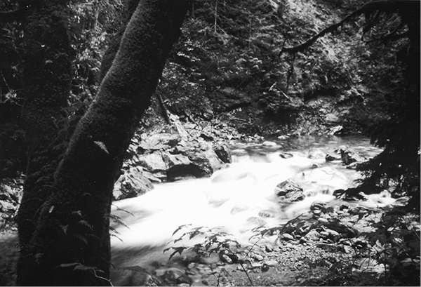
The first 0.8 mile of trail is an easy stroll along the streambank. As the houses of Diablo fall behind, a riparian woodland closes in around the stream. This diverse forest community includes mountain hemlock, western red cedar, bigleaf maple, and red alder. The damp climate provides superb growing conditions for epiphytes, plants that grow from aerial perches on the trunks or limbs of trees. Of these, club moss is particularly abundant, and licorice fern also can be found. Watch the boulders in the stream for the water ouzel, a tiny waterbird that dives into the current in a quest for aquatic insects.
Just after passing the landslide scar at mile 0.7, the bottomland sojourn ends with a series of breath-stealing switchbacks that carry hikers up the steep slopes east of the creek. The trail soon resumes its northward trek, crossing numerous tributaries. Some are no more than gurgling freshets that course through the moss, while others are quite substantial and hurry through stairstep cascades. The young forest of hemlock and lodgepole pine underlain by salal bushes arose following a forest fire in the early 1900s. Gaps in the trees reveal the towering east face of Davis Mountain. This young stand of trees is soon replaced by a mature forest underlain by a carpet of fern moss. The trail becomes more primitive after passing a large waterfall on Camp Dayo Creek, where sheets of water pour over a broad sill of Skagit gneiss. As the valley widens, a few huge and ancient cedars and hemlocks tower above their lesser neighbors. The trail ultimately peters out in this forest, where deer do more for trail maintenance than the National Park Service does.
Miles and Directions
0.0Trailhead in the settlement of Diablo.
0.7Landslide on opposite bank of Stetattle Creek.
0.8Trail leaves Ross Lake NRA, enters North Cascades National Park, and starts to climb.
1.6Trail crosses Bucket Creek.
2.4Trail crosses Camp Dayo Creek.
2.8Trail peters out.
Stetattle Creek