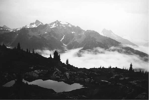
A view of Tomyhoi Peak from the Yellow Aster Butte trail
40 Yellow Aster Butte
A day hike through alpine meadows to the tarn-dotted divide below Yellow Aster Butte, 8.8 miles round-trip.
Best season: Late July to mid-October.
Elevation gain: 2,200 feet.
Elevation loss: 420 feet.
Maximum elevation: 5,800 feet.
Topo maps: Mount Larrabee (trail not shown).
Jurisdiction: Mount Baker Wilderness (Mount Baker–Snoqualmie National Forest).
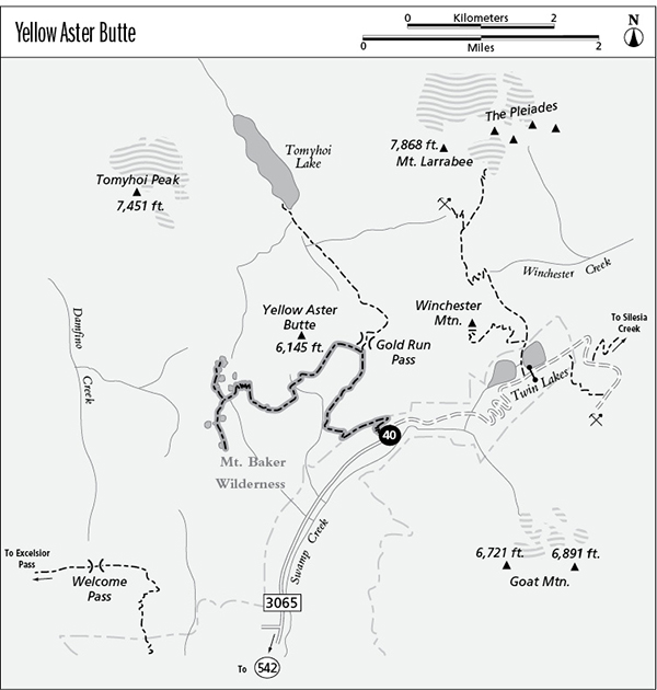
Finding the trailhead: From Glacier, drive east on Highway 542 to mile 46, where a major gravel road branches away beside a highway maintenance compound. Turn left on this road (Forest Road 3065) and follow it for 4.5 miles to the Gold Run Pass trailhead.
A view of Tomyhoi Peak from the Yellow Aster Butte trail
The Hike
This trail has been completely relocated and now begins on the trail to Gold Run Pass and Tomyhoi Lake, then traverses the high meadows of Yellow Aster Butte to approach the lake-studded saddle from the east. The result is a trail greatly improved in terms of scenic grandeur, wildlife viewing opportunities, and rate of climb. Use no-trace techniques as outlined at the beginning of this book when traveling or camping in the alpine zone; camping is allowed only in designated sites in the meadows at the end of the trail. The trail begins with a steady climb, switchbacking upward across brushy slopes that face southward toward Mount Baker. After a vigorous ascent, the path levels off and heads southwest. A mature stand of hemlock and silver fir shades the journey to a false pass on a ridgetop that divides Swamp Creek from a tributary stream that rises on the slopes of Yellow Aster Butte. The ridgetop is home to hemlocks that reach old-growth proportions.
The trail then climbs gently into subalpine parks that line the head of the tributary stream. The warning whistles of marmots can be heard from the slopes of Yellow Aster Butte, but the animals themselves are hard to spot without binoculars. The main path reaches its junction with the Yellow Aster Butte Trail in this basin. Turn left as the Yellow Aster Trail arcs across meadows densely carpeted with a diversity of wildflowers. Here, you can spot not only the yellow arnica, for which the Butte derives its name, but also American bistort, Sitka valerian, mountain anemone, and lupine, to name a few.
The path makes a level traverse around the next spur, then drops into an austere cirque, where heather blooms among strangely shaped outcrops of bedrock. Dipping low to avoid a persistent snowslip, the path crosses the outlet stream that drains the cirque and then climbs around the next promontory. Look back for eastward views of Mount Larrabee, while Goat Mountain rises across the valley and the loftier summits of Mounts Shuksan and Baker present a sparkling display to the south.
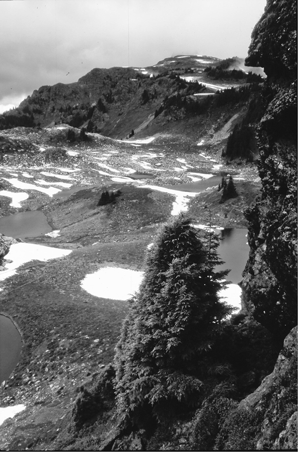
The trail continues a steady climb across the next bowl, where marmots tumble among the wildflowers, and then resumes its climb. The trail tops out at a trail junction about 400 vertical feet below the southernmost summit of Yellow Aster Butte. Here, a steep track heads upward toward the summit, while the main trail drops down an almost vertical slope via a series of tight switchbacks to reach a rock shelf strewn with alpine tarns. Here, the trail devolves into a series of informal footpaths that visit various ponds and designated camping sites.
Miles and Directions
0.0Gold Run Pass Trailhead.
0.6Trail enters Mount Baker Wilderness.
2.6Junction with trail to Gold Run Pass. Turn left.
4.2Trail reaches high point at junction with informal path to the western summit of Yellow Aster Butte. Turn left and descend into saddle.
4.4Hike ends in pond-studded alpine basin.
Goat Mountain from Yellow Aster Butte Trail