42 Excelsior Pass
A day hike or short backpack to Excelsior Pass, 8.4 miles round-trip.
Best season: Early June to mid-October.
Elevation gain: 3,538 feet.
Elevation loss: None.
Maximum elevation: 5,365 feet at Excelsior Pass.
Topo maps: Bearpaw Mountain; Mount Baker.
Jurisdiction: Mount Baker Wilderness (Mount Baker–Snoqualmie National Forest).
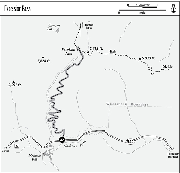
Finding the trailhead: Follow Washington Highway 542 east from Glacier to a pulloff at mile 41.2. The marked trail begins across the road.
The Hike
This trail presents a steady climb from the North Fork of the Nooksack River to the western end of the High Divide, where alpine meadows cover the rolling ridgetops. The trail receives heavy use from horse parties, which have severely impacted the fragile upper reaches of the trail. Hikers should be prepared to travel on deeply gullied trails and through broad mud pits. Most of the ferns native to the west slope of the Cascades can be found along the lower stretches of this trail.
The trek begins on an old logging road that climbs gently through second-growth timber of the valley bottoms. As steeper slopes rise ahead, a trail breaks away from the road and climbs to reach the wilderness boundary after 0.3 mile. Watch for an old bear den just beyond the boundary marker. The path approaches a substantial stream, then begins a long but moderate ascent to the east of it. The route leads upward through an old burn. The regenerating forest is just reaching the self-thinning stage, when less-vigorous saplings die from lack of sunlight and their more robust peers rise into the forest canopy. As the path rises above the burn, it passes onto slopes that were logged off circa 1915. Watch for sawed-off stumps that indicate lumbering activity.
The trail approaches the stream again at mile 1.6, and a single tent site occupies a trailside grove of conifers. The path continues its zigzagging climb for another 1,000 vertical feet, passing through heavy timber that is underlain by a diverse array of shade-tolerant wildflowers. Near the top of the grade, it finally emerges from the trees into brushy clearings. Mount Baker can now be seen to the south. Signs of heavy horse traffic soon become evident: Badly eroded trailbeds, mudholes, and multiple trails become the rule. Subalpine parklands beckon ahead, but hikers must first climb through a dense stand of silver fir and then a widely spaced grove of ancient, moss-hung mountain hemlocks.
The trail then enters a subalpine basin upholstered in a diverse array of blossoms: Pink monkeyflower, fireweed, arnica, aster, and lupine are all abundant. The trail arcs upward through the basin to reach Excelsior Pass, atop the High Divide. Views to the south are fantastic with the craggy summit of Mount Shuksan rising farther to the east and the glacier-clad cone of Mount Baker soaring skyward beyond the North Fork of the Nooksack. The Black Buttes are the dark pinnacles that rise from the eastern slopes of Mount Baker; they represent the ancient eruptive center of the volcano, long dormant and now whittled away by glaciers. From a signpost at the pass, trails run north to Damfino Lakes and east along the crest of the High Divide toward Welcome Pass.
Miles and Directions
0.0Excelsior Pass Trailhead.
4.2Excelsior Pass. Trails run north to Damfino Lakes and east along the High Divide.
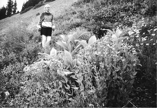
Flowers along the Excelsior Pass Trail