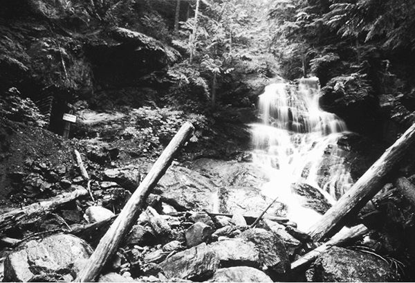
Waterfall and mine portal on Silverdaisy Creek
50 Skagit River Trail
A day hike or short backpack along a roadless reach of the Skagit River, 14.5 km (9 miles) one way.
Best season: Early May to late October.
Elevation gain: 216 m (710 feet) south to north.
Elevation loss: 122 m (400 feet) south to north.
Maximum elevation: 643 m (2,110 feet) opposite Silvertip Creek.
Topo maps: Skagit River–CGS.
Jurisdiction: Manning Provincial Park, Skagit Valley Provincial Park.
Finding the trailhead: To reach the trailhead, drive south from Hope for 42.5 km (29.8 miles) to reach an unmarked pulloff just beyond the Twentysix Mile Bridge. The trail ends at the Sumallo Grove picnic area, 12 km (8.4 miles) east of Manning Park’s West Gate on British Columbia Highway 3. Through-hikers will need to arrange a car shuttle.
The Hike
This trail follows the last wild and free-flowing stretch of the Skagit River, linking Manning and Skagit Valley Provincial Parks. The original route, known as the Whatcom Trail, was blazed in 1858 by Captain Walter DeLacy. Trail boosters hoped that they could avoid paying import taxes by bypassing the customs house in Vancouver, and thus make the town of Whatcom, on Bellingham Bay, the principal supplier for the goldfields of interior British Columbia. The route soon proved too steep and arduous for commercial transport, and it was abandoned after only two months. Today, hikers can follow in the footsteps of the explorers through a remote corner of the mountains that has changed little in two hundred years.
The trail begins in the broad valley where the Skagit and Klesilkwa Rivers mingle their waters. It initially follows an old roadbed across a fertile lowland of flood channels and river bars. Nearing the base of the mountains, the path climbs onto an old glacial terrace, where it meets the Centennial Trail. The Skagit River Trail runs north from the junction, passing through a sparse post-fire forest of lodgepole pine and Douglas fir. The Hozameen Range soon constricts around the Skagit River. The river is older than the range, and as the land rose, the water cut down through the ridges to form a narrow canyon through the mountains. At the mouth of the canyon, Pacific rhododendrons light the forest with their enormous pink blossoms.
Waterfall and mine portal on Silverdaisy Creek
Following the river into the canyon, the trail makes a short but steep ascent along an old talus slope that has been overrun by moss. Southward views on the way up feature the ranges that rise beyond the Klesilkwa, including the sharp horn of Whitworth Peak. From the heights, one can look across the river at the pinnacles and glaciers of Silvertip Mountain. The trail then drops into the lowland forest, following the eastern edge of the bottomlands. The Skagit occasionally loops across the lowlands to approach the trail, its translucent green waters sliding silently through smooth runs. The path climbs again opposite the mouth of Marmot Creek, this time to avoid a landslide scar. There are final views of the mountains before the trail descends into the forest for good.
The path now follows the riverbank, and soon the first stands of old-growth timber appear: giant red cedars that rise like stout pillars from the floodplain. The brush is initially heavy but lessens as the trail continues northward. Hemlocks now dominate the overstory. Shortly after crossing Twentysix Mile Creek, the trail reaches Delacey Camp in its sandbar grove of giant cedars. The forest reaches its climax in a stand of superb Douglas firs and cedars, and the river provides a noisy accompaniment as it churns through riffles and boulder-strewn pools.
The trail then swings away from the river, continuing northward along the edge of the valley. From the crossing of Silverdaisy Creek, a short jog to the east leads to a pleasant waterfall beside the mouth of an abandoned mineshaft; look eastward from the bridge to see a swath cut across the forested slopes of Silverdaisy Mountain. The swath once bore a tramway that served the old Silverdaisy Mine, which produced a moderate amount of high-grade copper ore between the turn of the century and 1938. After crossing the bridge, the Skagit Valley route soon passes its junction with the Silverdaisy Trail, and the mountains open out into the broad east-west valley that bears BC 3. A footbridge spans the Skagit River near its confluence with the Sumallo River, and soon the trail reaches its end at the Sumallo Grove day-use area.

Miles and Directions
kmmiles
0.00.026-Mile Bridge Trailhead.
0.90.5Junction with Centennial Trail. Turn left.
10.86.7Delacey Camp.
12.98.0Trail crosses Silverdaisy Creek.
13.58.4Junction with Silverdaisy Trail. Continue straight on old road.
14.38.9Trail crosses bridge over Skagit River.
14.59.0Old road reaches Sumallo Grove Trailhead.