63 Rainy Lake
A short, wheelchair-accessible trek on a paved trail to Rainy Lake, 1.8 miles round-trip.
Best season: Late June to mid-October.
Elevation gain: Minimal.
Elevation loss: None.
Maximum elevation: 4,800 feet.
Topo maps: Washington Pass; Washington Pass.
Jurisdiction: Okanogan National Forest.
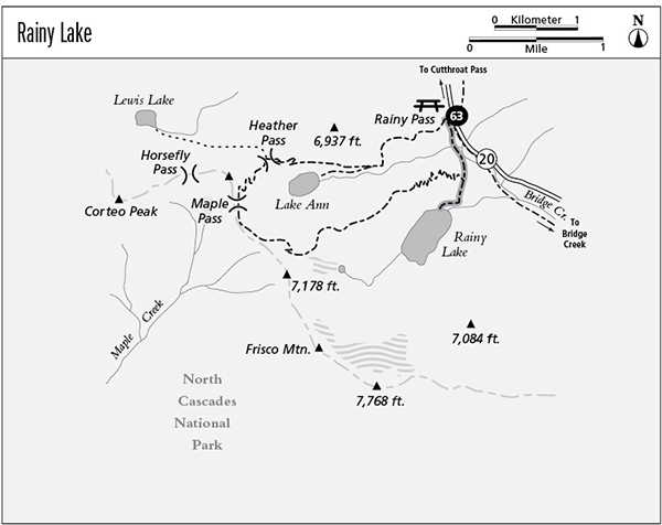
Finding the trailhead: The trail departs from the Rainy Pass picnic area at mile 157 on Washington Highway 20.
The Hike
This short, paved trail starts at Rainy Pass and contours along the mountainsides to enter the glacier-carved cirque that bears Rainy Lake. It is a short, level trek that is well suited to wheelchairs.
The trail begins in a series of subalpine bogs and meadows where Engelmann spruce have taken root in the cool, damp soil. As the trail nears the halfway point, a pleasant series of waterfalls tumbles down through the forest, draining the outflow from Lake Ann in a hanging valley high above. The forest is now dominated by silver fir and mountain hemlock; watch for fairy bells, violets, and queen’s cup lilies in the understory, as well as the delicate fronds of ferns.
At the end of the trail is a viewpoint at the foot of Rainy Lake. The lake’s brilliant turquoise waters are fed by an impressive waterfall that descends from Lyall Glacier. The towering crags of Frisco Mountain rise above the head of the basin. There is a fine population of good-size cutthroat trout in the lake, but the brushy lakeshore makes fishing difficult without a boat.
Miles and Directions
0.0Rainy Pass picnic area.
0.5Maple Pass loop trail junction.
0.9Rainy Lake.

Rainy Lake