75 Blue Lake
A half-day hike to Blue Lake, 4.4 miles round-trip.
Best season: Mid-July to mid-October.
Elevation gain: 1,050 feet.
Elevation loss: None.
Maximum elevation: 6,250 feet.
Topo maps: Washington Pass (trail not shown); Washington Pass.
Jurisdiction: Okanogan National Forest.
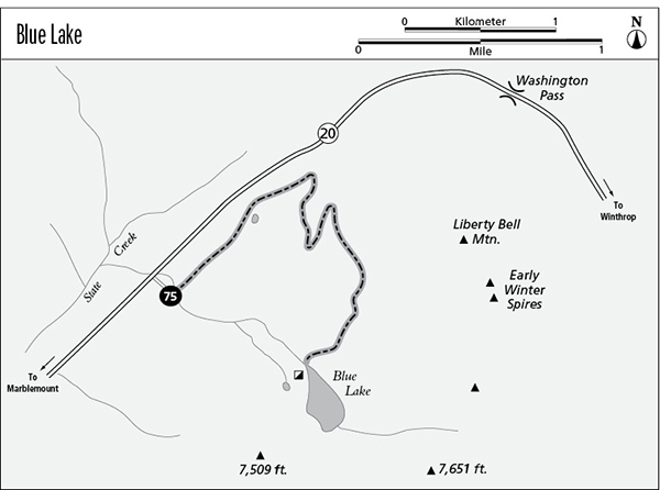
Finding the trailhead: The trail leaves from a parking area to the south of Washington Highway 20 at mile 161, 1 mile west of Washington Pass.
The Hike
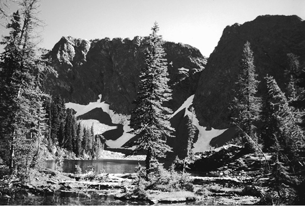
This trail offers a short and modest trek in the vicinity of Washington Pass, climbing into the larches at timberline to reach a deep lake surrounded by impressive walls and pinnacles of granite. The trail begins by running eastward through subalpine forest beside the highway. It soon turns south, climbing moderately through a sparse growth of large mountain hemlocks. Gaps in the trees offer early peeks at Cutthroat Peak on the far side of Washington Pass. About halfway to the lake, the trail breaks out of the trees onto old rockslides mantled in meadows and fringed by subalpine larches. The surrounding peaks are now unveiled, stretching westward to include Mount Hardy and Black Peak.
The trail ascends gradually on a westward course, and the summit of Liberty Bell Mountain uncloaks itself to the east, flanked by the Early Winters Spires. Near trail’s end, a rushing stream leads upward to the rocky shores of Blue Lake. This deep alpine tarn is guarded by imposing rock walls, and its translucent waters are home to abundant cutthroat trout. Camping is no longer allowed here due to the heavy impacts past visitors had on the fragile larch-heather community of the lakeshore.
Miles and Directions
0.0Blue Lake Trailhead.
2.2Blue Lake.
Blue Lake