A little-known marsh with a long, beautifully built boardwalk and fascinating interpretative posters.
LOCATION
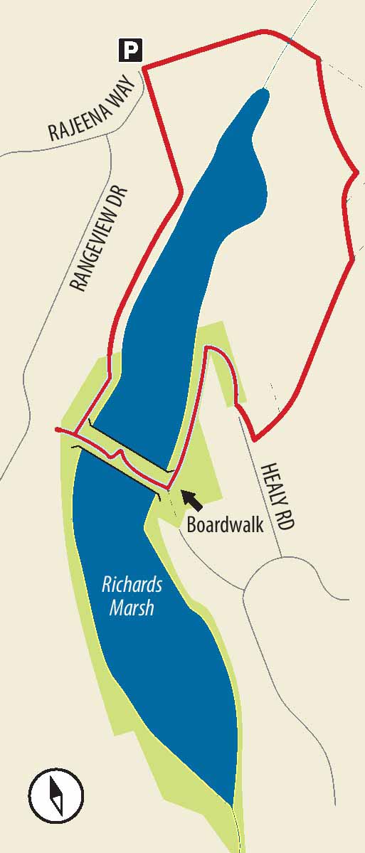
From Highway 19, south of Nanaimo, take the turn towards Nanaimo onto Highway 1 and drive for just under 500 m. If you’re approaching from Highway 1, look for South Gate Mall in Chase River. Extension Road is about 200 m south. Turn onto Extension Road and drive 1.2 km to Rajeena Way. Turn left and drive 500 m to the end of the road. Parking isn’t great here, but there are spots along the curb.
DISTANCE
2-km loop (1.2-km return without loop)
ELEVATION GAIN
30 m
DIFFICULTY
Easy, partly on groomed trails and boardwalk. The optional loop section is a dirt track that can get a little muddy in winter.
SEASON
All season. The water level in the marsh, of course, varies depending on how hot and dry the season has been, but an open body of water near the north end of the marsh (a great collecting spot for ducks and other water birds) remains throughout the year.
OF SPECIAL INTEREST FOR CHILDREN
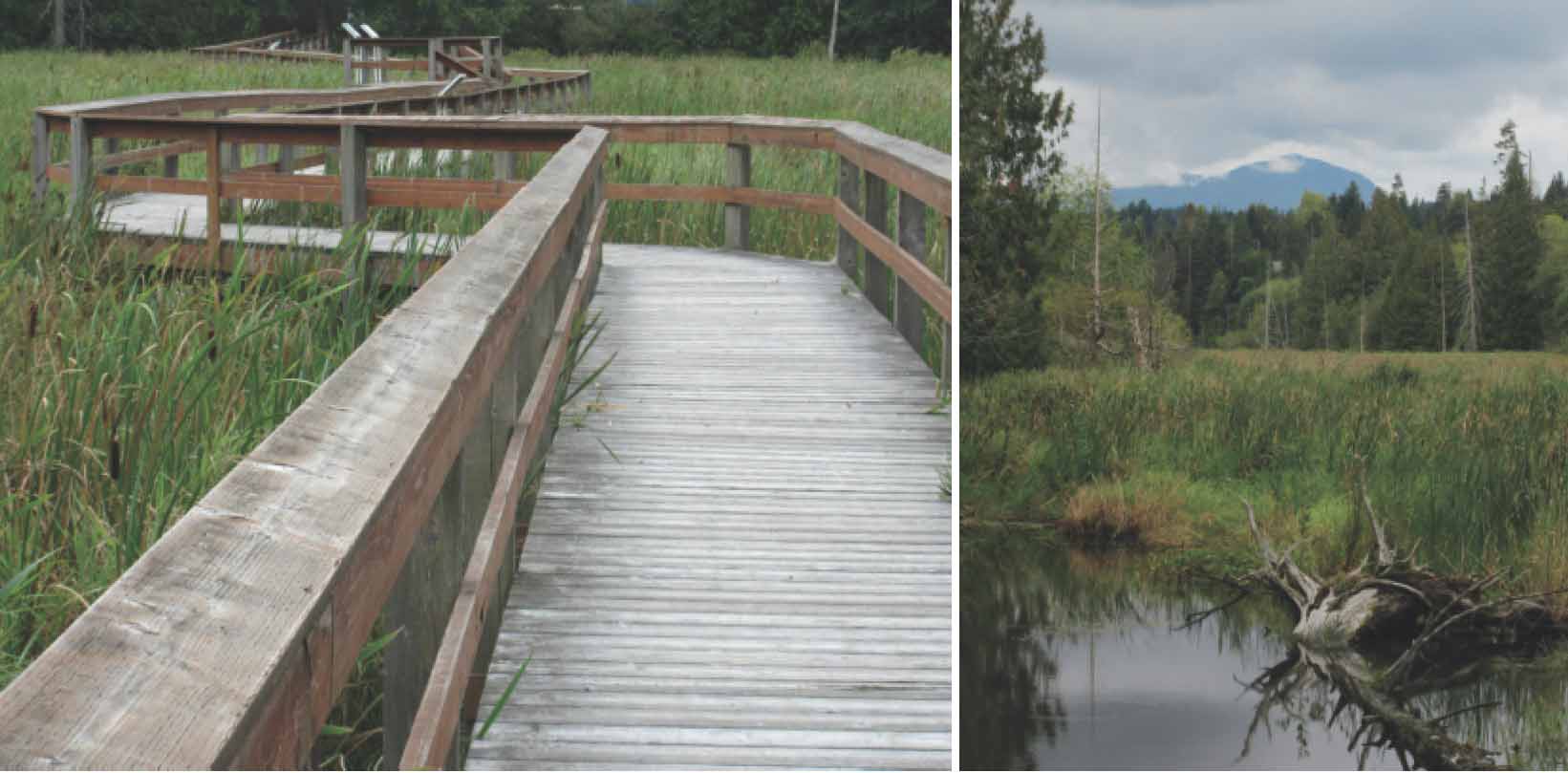
The long, snaking boardwalk suspended over the marsh and the colourfully illustrated signs should have an otherworldly fascination for most kids. The gauntlet of blackberry bushes towards the end of summer can be a tasty diversion.
1.From the concrete barriers at the end of the road you see two tracks: one to the left and one to the right. If you elect to do the full loop walk, your return track is on your left. At this point, though, turn right to walk behind a few houses towards the edge of the marsh. The first part of the marsh-side trail runs closest to the permanently open-water area, so take the time to peer through the trees at whatever mergansers or Virginia rails that happen to be visiting.
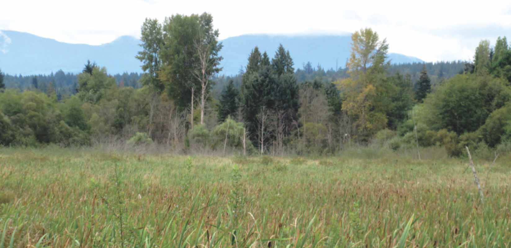
2.Pass a park boundary sign and, as the trail reaches a T junction, turn left to explore the most fascinating part of the park – the boardwalk. The views up and down the long, narrow marshlands, with foreground cattails and background forest and mountains, are unusual and striking. When the trees are in leaf, you may not be aware of the bevies of houses screened by the trees.
FROM LEFT The boardwalk gives a wonderful sense of being immersed in the marsh environment; a view of the marsh and Mt. Benson from the north end.
3.Cross to the end of the boardwalk and turn left to follow the east shore of the marsh. The next section of the loop is not through park but follows old tracks, primarily used by locals. You may, therefore, prefer to retrace your route rather than undertake the whole loop. The end of this trail can sometimes be under siege by invasive Himalayan blackberry bushes. Reaching the end of the trail, turn up the track to climb towards a cul-de-sac and a subdivision.
4.Before the nature-loving side of your personality is quite squashed, you can leave the subdivision behind. After passing four or five houses, pick out a bare dirt track on the left of the road winding into the alders. Follow this broad track through the small trees as it tends gradually downhill, roughly parallel to the (invisible) edge of the marsh. Ignore one small track to the left near the beginning. As you approach a significant turn to the left, pass another track to the right and, at the corner to begin your descent, two more.
5.Reaching the level of the marsh, cross a little bridge and pass yet another track leading to the right before climbing slightly to reach a kind of crossroads. A sharp left takes you a short distance back to your car.