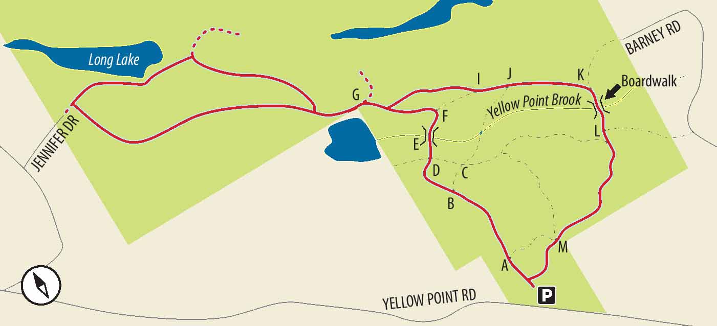
11. YELLOW POINT PARK & YELLOW POINT BOG ECOLOGICAL RESERVE
Showcases a spectacular camas lily display in late spring and a complex network of trails, partly through fir forest, partly running past small lakes and along the tops of mossy sandstone ridges.
LOCATION
Approximately 6 km north of Ladysmith, turn north onto Cedar Road. Drive 3 km and turn right onto Yellow Point Road. After slightly more than 4 km, look for the large sign for Yellow Point Park on your left.
DISTANCE
4.8 km, largely a double loop (shorter loops also well-signposted)
ELEVATION GAIN
60 m, cumulative, over rolling land
DIFFICULTY
Generally, very easy, except some very muddy spots in winter.
April is the absolute highlight for the astounding display of wild camas. The rest of the year is good too (except, of course, for the muddy spots in winter).
OF SPECIAL INTEREST FOR CHILDREN
The meticulous (and clever) way in which each of the many junctions is signposted with a letter means that children might enjoy scampering ahead to the next letter sign to wait for their trudging parents. For this route, that sequence is A, B, D, E, F, G, H. After the (unsignposted) loop through the ecological reserve, the sequence picks up from H, to G, I, J, K, L and M.
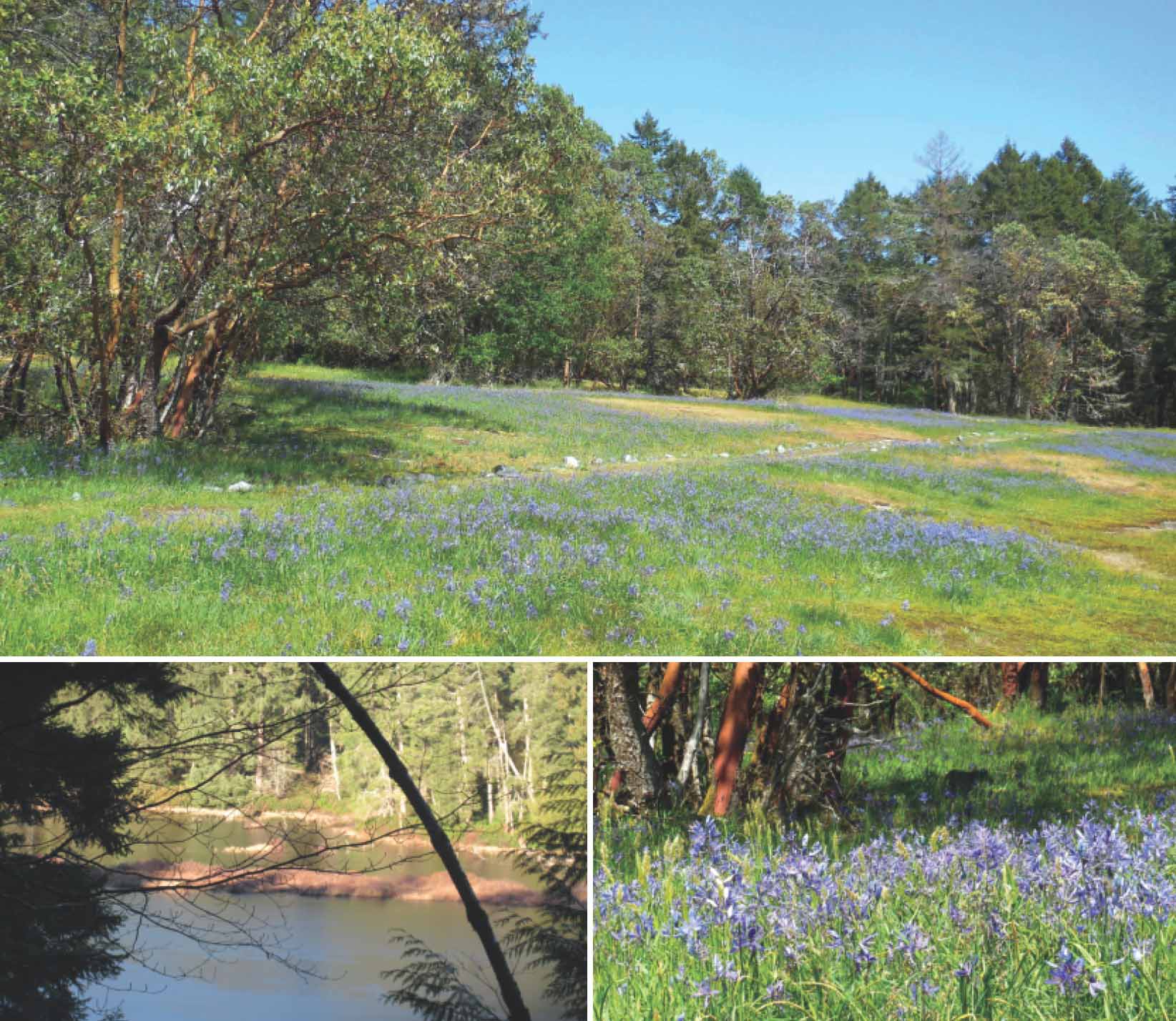
1.If you’re visiting in the latter part of April, you’ll want to linger in the camas fields. Glance meaningfully at (or put to good use) the picnic tables and outhouse, and head left to begin a clockwise sortie. Enter a forest largely of fir and salal. The trail rises a little over some slightly exposed sandstone and then makes a slight descent. In fact, the whole park (all Yellow Point, much of Nanaimo and most of the southern Gulf Islands) is composed of ridges of sandstone running northwest–southeast. During this trip, find yourself walking along nearly level, moss-covered, rounded shoals of sandstone or dropping down into the low spots between ridges.
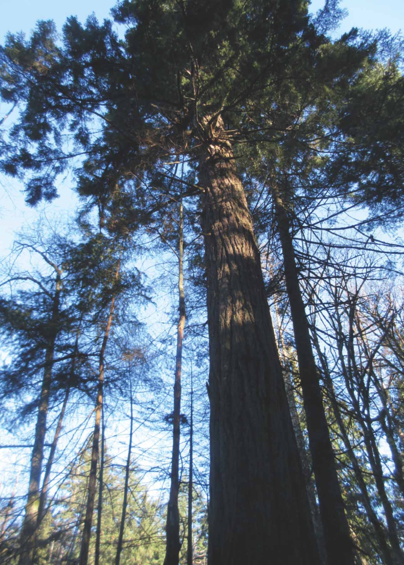
2.When you come to a sign with the letter B, and the words “You Are Here,” stop both to admire the planning that virtually eliminates the chances of becoming disoriented and to take a visual fix on the kind of signs to look for at many points. Fork left to drop down a ridge, and cross an occasionally wet area, to come to crossroads D. Going straight ahead, descend even more towards Yellow Point Brook (not much of a brook even at the wettest of times). Pause at the majestic fir on your right for a little hugging. The so-called Horse Crossing, removed for replacement, may still be missing when you arrive, so you may have to wobble your way across the brook on a few improvised planks.
CLOCKWISE FROM TOP Clouds of camas near the beginning of the trail; late April and early May are generally the season for the camas bloom; Long Lake glimpsed from the trail through the ecological reserve.
3.Climbing slightly to the fork, F, read the information sign for the ecological reserve ahead and turn left to take the mossy-ridge trail first to G, then H. At H, fork left and descend through small firs towards a little lake visible through the trees. Pass a sign for Jennifer Road and persevere parallel to the lakeshore through (or around) some spots that become ridiculously muddy during wet weather. Once across the seasonal mud, head left towards the comparatively narrow trail running immediately next to a fence. A side trail loops off this fence trail but rejoins at the top of the rise beyond the lake.
4.Arriving at a white gate in the fence to the left, breathe a sigh of relief as a broad and smooth trail opens out to your right. Although this trail narrows, it runs nearly straight along the mossy ridge. When you arrive at a T junction at the bottom of a dip, you may spot a broken signpost saying “Yellow Point.” A few steps up the trail to the left lies a public road. For your onward route, therefore, turn right. A short distance along, come to another fork and signpost for Yellow Point Park, pointing right.
5.Follow the subsequent traversing trail, running parallel to and slightly above Long Lake (a lake name much used all over Vancouver Island). At the end of the lake the trail drops and wanders through a seasonally squelchy area and climbs to a T junction. Turn right to join a trail, usually with lots of evidence of horse traffic, which continues to climb before passing over a ridge. (This well-used trail doesn’t appear on the posted maps in the area.) From the top of the ridge, drop and rise to the next ridge before swinging left. Within minutes you have completed the loop back to the first lake.
6.Retrace the trail by the fence until you come to sign H, back in the park. Take the right fork, towards G. Once again in new territory, take the left fork towards I, passing signpost J (towards Barney Road) and ignoring the trail signposted “Fern Gully Bridge.” Between J and K, enjoy a section of ridgetop mossy trail. At K, turn right towards L, crossing a sturdy boardwalk bridge and climbing significantly through thickets of salal before contouring along your last section of ridgetop mossy trail.
7.Once you are at L, the increasingly broad trail leads you more or less directly to M and across the camas meadows to the parking lot. Remember the outhouse and picnic table? If they weren’t useful before, they may well be now!