
A winding trail over arbutus bluffs in Stoney Hill Regional Park to a series of high-elevation views over Samsun Narrows and Salt Spring Island.
LOCATION
From the highway in downtown Duncan, at a set of traffic lights, turn east onto Trunk Road. After just over 1 km, continue along Tzouhalem Road for an additional 1 km. When you come to a roundabout, take the second exit for Maple Bay Road and drive 5.5 km. Turn right onto Genoa Bay Road and go just over 5 km until you see a sign for Stoney Hill on your left. Climb the newly paved road for about 1 km and come to a clearly marked parking area on the right.
DISTANCE
3.2-km loop
ELEVATION GAIN
Approximately 90 m, cumulative (217-m high point)
DIFFICULTY
A generally well-developed and graded trail. One end of the loop is signed as “moderate” and the other as “easy.” The moderate end is steeper and more irregular but otherwise not challenging.
SEASON
All season, but good weather makes for by far the best views. Some squelchy spots are bypassed by small, improvised trails.
OF SPECIAL INTEREST FOR CHILDREN
While nothing stands out as of special interest, most kids would vastly prefer this trail to simply a walk in the woods – the many viewpoints have enough of a clifflike gasp factor that most children should feel a thrill. Children who struggle to see the point in slogging uphill, too, will get maximum sense of elevation with minimum effort: the trail starts at a high point. Your kids’ pooch is welcome here – but only on leash. Most important, perhaps, are several perfect picnic spots.
1.Pass a sign saying “Temporary Entrance” (with no indication of when this might change) and begin a gradual ascent through firs on a broad, dirt track. Within a few minutes, you come to a T junction and signposts indicating blue (moderately difficult) left and green (easy) right. Begin the loop by turning right. A short way along, ignore a mossy roadbed to the right and follow the signposts left past a big old maple and lots of alders.
2.As you ascend gradually, pass some deep beds of moss before coming to a stack of small logs directly in front of a wet area, put there to direct you to a narrow bypass trail on the right, past a picturesque mossy bluff – the first of many ragged chunks of sandstone on and near the top of the aptly called Stoney Hill. Soon after, be aware of the trees on your right becoming increasingly sparse and allowing tempting viewpoints just off the trail. For whatever reason, however, a signpost insists that you don’t leave the trail to a viewpoint but, instead, that you “Stay on Trail” by swinging left and keeping inside a line of boulders.
3.Rewarding views await. After sauntering along a particularly lovely bit of open woods, a small pond and past another Stay on Trail sign, you come to some Ooh and Ahh views over Samsun Narrows and towards Salt Spring Island’s Mt. Maxwell. Even better, this is not the only view you’re going to get: though the trail starts to drop and lead away from the cliffs, it will bring you back to other viewpoints and, after winding through an amazing cluster of arbutus, to one particularly large bluff with sweeping views.
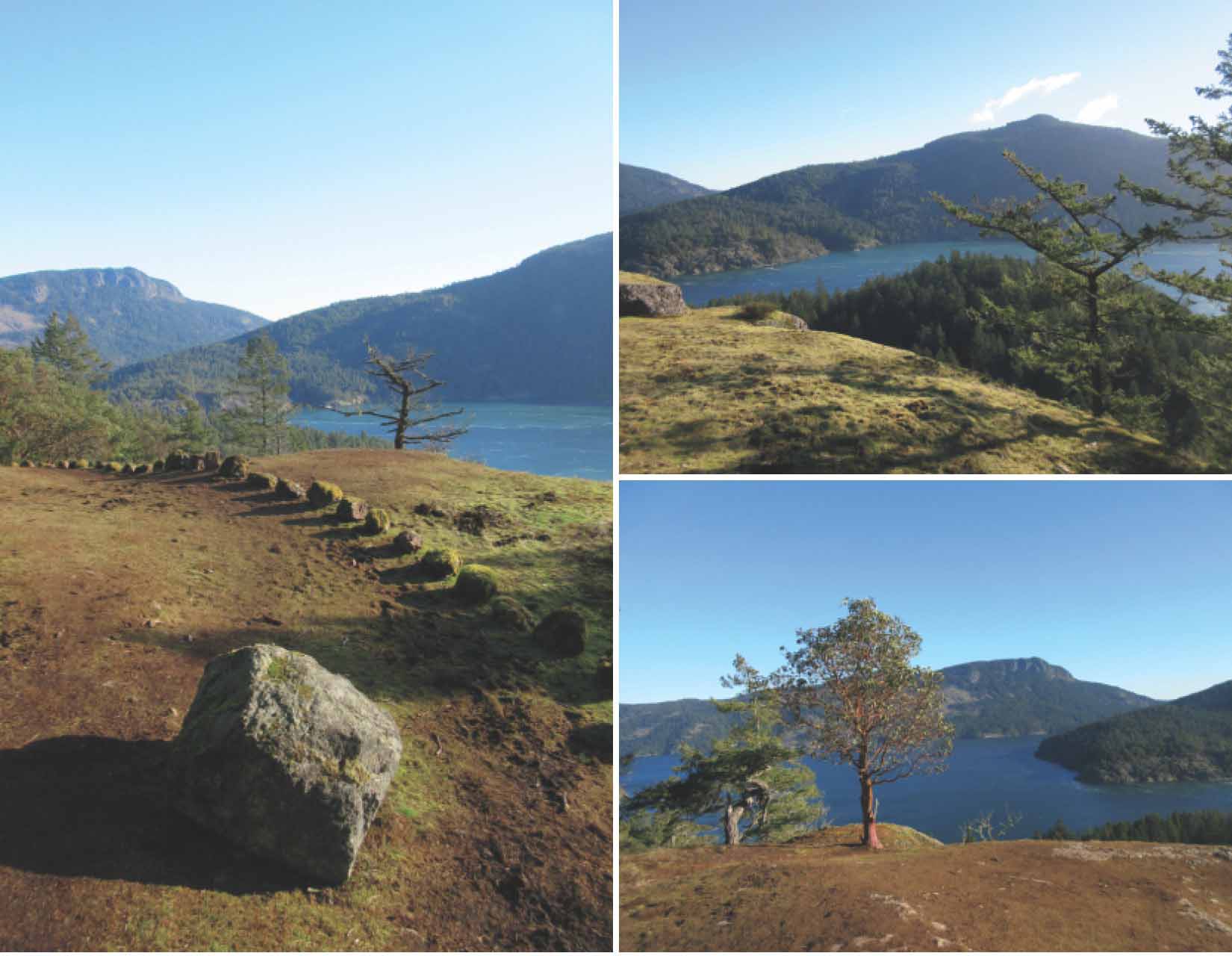
CLOCKWISE FROM LEFT The well-marked trail on the northeast side of the hill; the view over Samsun Narrows; Salt Spring Island and Mt. Maxwell.
4.From here the trail snakes through salal and firs towards and down an increasingly steep bank. Levelling out, it continues to amble through lovely open trees until the narrow trail becomes a broader track. A signpost points you left around a grove of (invasive but pretty) holly and bit of bog. In case you thought it was all downhill from here, you’re wrong. A slight climb over a crest, down and across a little bridge, around a potentially wet spot, and you’re back to the beginning of the loop.