
A well-used route through Cobble Hill Mountain Regional Recreation Area, amongst a network of trails starting in a rainforest ecosystem and ending at a high point of arbutus, rocky bluffs and views over the Gulf Islands.
LOCATION
Cobble Hill Road is a loop road off Highway 1 between Duncan and Mill Bay. If you are driving south on Highway 1, the road is prominently signposted at a set of traffic lights beside a shopping plaza (Valley View Centre) and Cowichan Bay Road. From this intersection, drive 2.5 km along Cobble Hill Road.
If you are driving north on Highway 1, look for a Petro-Canada station on your left as you leave Mill Bay and then turn left at the traffic lights onto Cobble Hill Road. Drive 4.4 km.
Driving from either direction, you see a park and parking lot right next to Cobble Hill Road. Turn onto Empress Avenue, nearly opposite Olde School Coffee. Drive a short distance up Empress Avenue and turn into the signposted park along Empress Road.
Park in the parking lot for Quarry Park, the farthest parking lot from Empress Avenue.
DISTANCE
5.4-km loop
ELEVATION GAIN
215 m
DIFFICULTY
Families regularly hike to the top, but be aware: some huffing and puffing is involved. A few spots near the top are a little slippery with loose dirt and pebbles, as well as dry arbutus leaves (mostly in July).
SEASON
All year, but as with any hill, note that if there is a sprinkling of snow at the bottom of the hill in winter, at the top of the hill there might be a little more than a sprinkling.
OF SPECIAL INTEREST FOR CHILDREN
An unusual feature of these trails is that they have been graded with cute little signs for various animals (primarily intended as guides for mountain bikers). Finding the next squirrel on the way up – and, on the way down, frogs, tortoises, and bunnies – can be huge fun. (Be aware: Not all these signs are always in place.) Other than that, there is a picnic table at a great viewpoint – and we all know what is best done at picnic tables! Although this trail is indicated as an easy mountain-biking trail, only older children with tough little legs and downhill skills will find it bike-able.
1.The first part of your route is in Quarry Nature Park. Head gradually uphill on a gravel service road until, after a very short distance, you see your friend, the squirrel, pointing your way to the right. This broad, well-tramped trail, though a little rooty in places, will take you through sword ferns and large cedars. When you come to a cross trail and a post with another squirrel image, you may (justifiably) be a little puzzled since it is not at all clear whether the sign indicates that you are to turn right or go straight ahead. To which trail does the sign apply? As it turns out, such signs, without arrows, mean go straight ahead. In a few steps, notice a sign indicating you have crossed into a regional district area, confirming you have made the right decision!
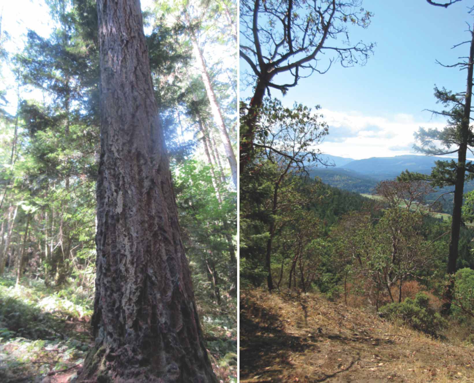
CLOCKWISE FROM ABOVE The view towards the Gulf Islands from the picnic table at the summit; looking south from the summit; an impressive old Douglas fir beside the first part of the trail.
2.In a few minutes, come to another junction, but this time the trusty wee squirrel has arrows indicating that, indeed, you go straight ahead. Yet another intersection a short distance on comes complete with choice of animals: ignore the poor salamander to your right and go left to follow Mr. Squirrel through two dramatic switchbacks. Don’t be so eager to find the next sign, however, that you go right past a particularly magnificent Douglas fir on the left of the path.
3.Eager as you may be to get to the top of the mountain, don’t turn onto the frog path at your next junction, even though the squirrel path seems to be not only levelling out but even taking you slightly downhill. Persevere past a park bench, and soon find your trusty squirrel, at a cross path heading almost directly uphill to your right. (This time, as it happens, the sign without benefit of directional arrows means that you turn onto a new trail.)
4.Winding through many turns up the slope, you soon find yourself increasingly into the arbutus-zone characteristic of the top part of the hill. Forge on ahead past an unsignposted trail marked with red paint splotches on trees. Passing more squirrel signs, note a frog sign as you pass it, since you do return to this point on your downhill route.
5.Watch your footing over some potentially slippery bits of the last part of the trail. Soon you pop out of the trees into an open area dotted with small trees and some exotic little manzanita bushes. Explore this area of glades a little, heading left to get the best views south towards Shawnigan Lake. Many trails wander temptingly off in various directions from here, but be warned: signposts are few here, and most of these trails lead to long, confusing loops that do, eventually, lead back to your starting point – but only eventually. For the picnic table and views of Salt Spring Island, wander your way to the north end of the summit area.
6.Ready to head home? Return the way you came until you come to the frog trail. Several sharp little switchbacks on the frog trail take you quickly down, out of the arbutus zone to join the squirrel trail you used on the way up. Turn right to repeat the next short section of traversing trail past the bench.
7.When you come to the cross trail this time, turn left to follow the turtle route, twisting and turning through several bends and increasingly large trees. Children who feel they have had enough of turtles may be surprised that a different kind of sign suddenly announces that – temporarily at least – the turtle trail has become the bear trail. The two animals are clearly in competition: farther along, you pass another turtle sign and, yes, another bear sign, this time as you pass a large water tank.
8.Turn down a broad, dirt road to an intersection where you pass a venerable chunk of logging equipment and, at an intersection, a sign for the rabbit trail. Possibly without your noticing, you have re-entered Quarry Nature Park. It is only a short rabbit-hop the rest of the way to the parking lot.
