One of the prettiest and most easily accessible of Victoria’s hills, complete with Garry oak meadows, spring flowers and views, views, views. Housing developments are creeping like mould up Mill Hill, but, blessedly, from most viewpoints, they don’t interfere with your experience of this lovely bit of wilderness in a sea of burbs.

LOCATION
Off Highway 1, near Langford, take the ramp towards Sooke and drive 0.8 km to Hoffman Avenue. Turn left. After 100 m, turn right onto Winster Road, drive for 160 m and go left again onto Atkins Avenue. Drive for 1 km, and, as you enter a stand of fir, pass the entrance to the Capital Regional District offices and, immediately afterwards, the large sign for the entrance to Mill Hill Regional Park.
DISTANCE
1.7-km loop (seems like more!)
ELEVATION GAIN
120 m
DIFFICULTY
There is a huff-and-puff factor, but the trail to the summit is mostly smooth and regular. The descent, via eroded Calypso Trail, can be challenging at a few spots for those with weak knees or short legs. An out-and-back walk is probably best for such walkers.
SEASON
All season, but April is the very best, both because the wet sections will have shrunk and the sea blush, camas and so on will be at their flowery finest. Remember, as with any hill, if there is even a sprinkling of snow or a light breeze at the bottom, life can be noticeably chillier at the top.
OF SPECIAL INTEREST FOR CHILDREN
For children who like the experience of being at the tippy-top, this hill has the double appeal of having a good 360° view and a circular plaque naming distant points. Rounded lumps of rock make perfect snacking perches.
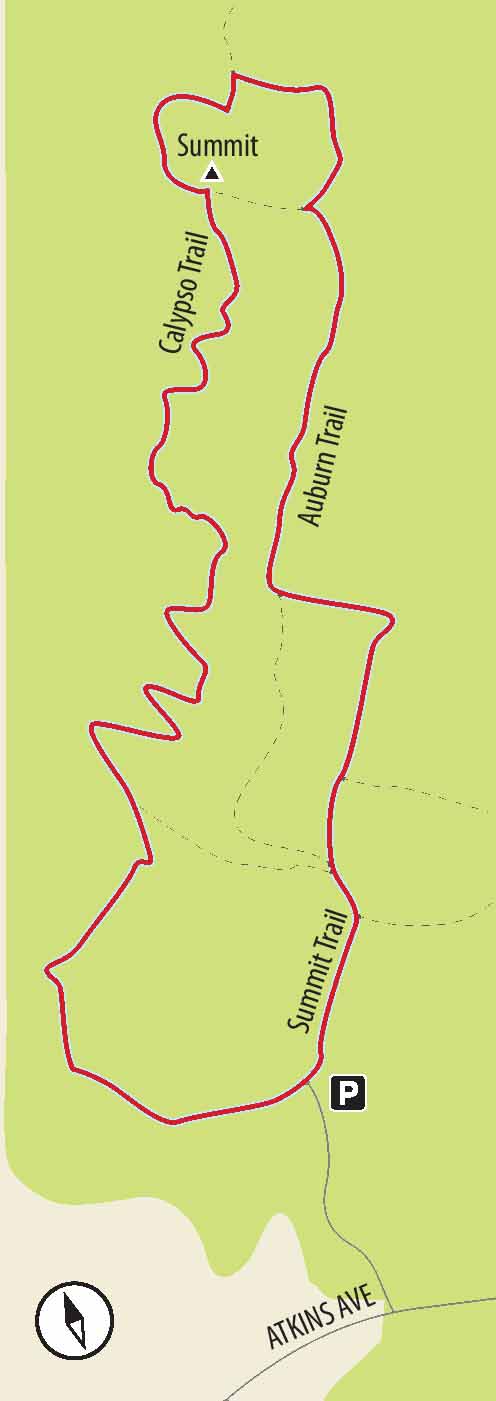
1.Straight ahead out of the parking lot, pass information signs and a signpost. Head more or less straight up the broad, crushed-gravel Summit Trail and, next, Auburn Trail, ignoring side trails (Calypso Trail and, a little later, Millwoods Trail) on your right. Take time to appreciate some of the large Douglas firs and cedars because within a very short distance you suddenly emerge into a completely different ecosystem.
2.Within minutes, notice the sign about the Garry oak ecosystem you are entering. This sign advises you to stay on trails to protect the ecosystem. Along this section of trail, you see only a few stunted and windblown Douglas firs, as well as arbutus and Garry oaks. The rounded rocky outcroppings are decorated with mosses, licorice root ferns and stonecrop. All is not well in paradise, though – expect to see lots of invasive species as well: broom, daphne and, a little more charmingly, large bounding grey squirrels. (On the bright side, volunteer “broom busters” have made it possible for the native vegetation to emerge, gasping, from under former thickets of broom.)
3.Passing some split-cedar fencing, turn right onto the viewpoint trail (ignoring the trail for the summit). From here, the views to Portage Inlet, Esquimalt Harbour and the distant Olympic Mountains are, let’s face it, little short of exquisite. If you’ve printed out a regional park map from the web showing the viewpoint trail to be a dead end, ignore it. Walk past the viewpoint on a well-trodden trail at some points lined with rocks.
4.Within minutes, reach a major trail labelled both “Summit Trail” and “Calypso Trail.” Turn right for only a few steps before branching off to the left to climb up to the rounded hump of the actual summit. From the summit you not only have a 360° view but also see an impressive cairn mounted with a brass info-wheel, indicating the exact direction and altitude of visible bumps – ranging from Race Rocks, a mere bump in the ocean, to Mt. Baker, 120 km distant and 3261 m high.
5.Passing over the hump and coming to a junction with concrete stepping stones beside a small pond (dry in summer), turn right down a small trail. Be warned, however: if you have small and/ or (endearingly) clumsy children, you are best off going straight ahead to rejoin the trail you used to climb the hill. Otherwise, be prepared for a little rough walking and head down the small trail. In spring (especially April), have both your camera and your Oohs and ahhs ready, since this trail descends through some gorgeous spreads of wildflowers.

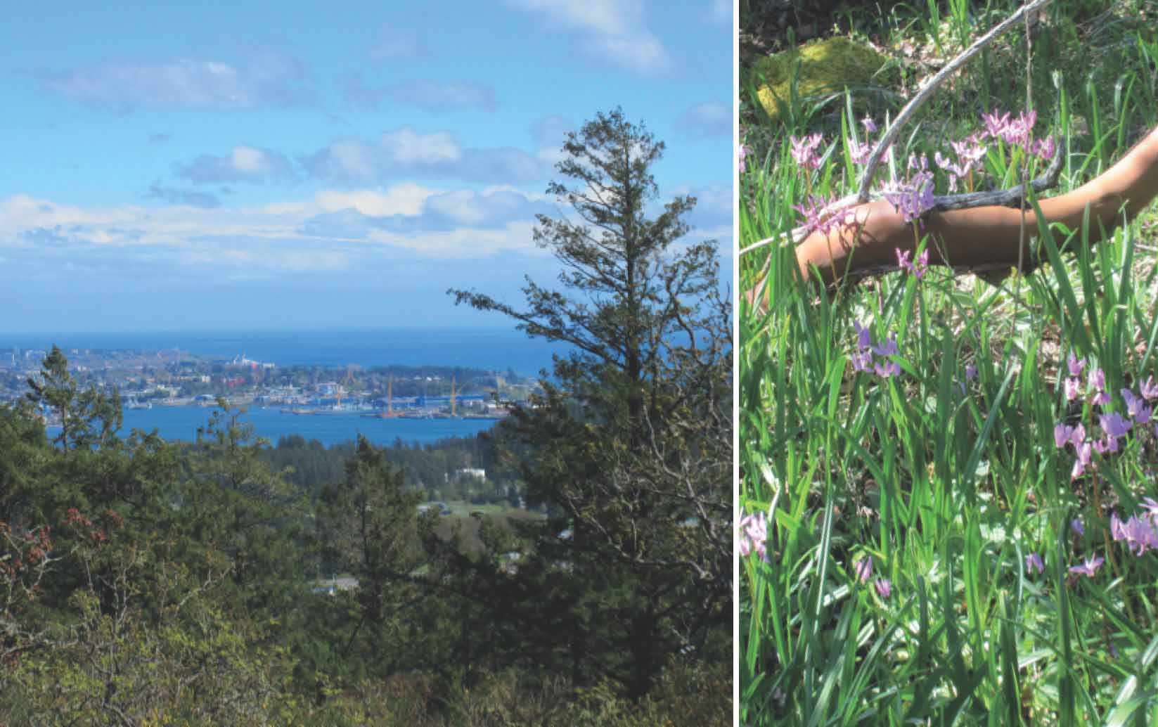
FROM LEFT Esquimalt Harbour and downtown Victoria from near the summit; one of many patches of shooting stars in April.
6.Though not dangerous, the heavily eroded trail does require a little care, even hands, as you descend some step-like chunks of rock.
7.With almost no transition zone, the trail plunges into heavy forest. Several switchbacks later, you pass a trail leading to your left. Forge straight ahead to visit some of the largest Douglas firs in the park (while ignoring the regional district offices increasingly visible ahead). Cross a small asphalt road to pick up the final bit of trail.