Feeling like a proper, rugged (little) mountain, Mt. Wells, with its double summits, is best suited to those wanting more than just a gentle walk.

LOCATION
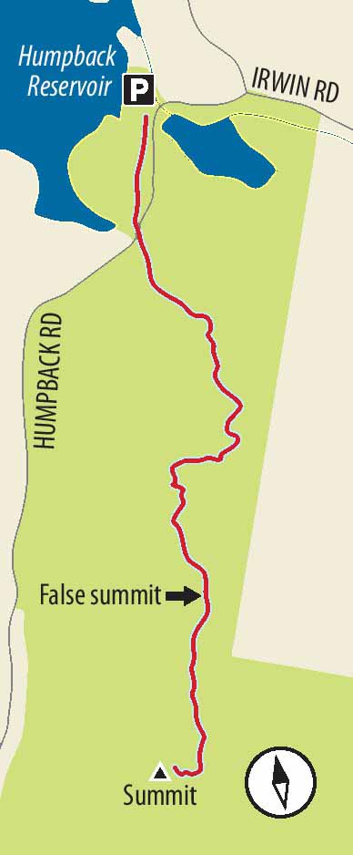
Follow the Trans-Canada Highway from Victoria towards Sooke, and turn left onto West Shore Parkway. After driving for 400 m, turn right onto Amy Road and go 800 m before turning left onto Sooke Lake Road. Drive for 350 m and turn left onto Humpback Road and drive for about 1.5 km. (Be careful. When you come to Irwin Road, stay right.) The signposted Mount Wells Regional Park entrance is on the right.
DISTANCE
2.6-km return
ELEVATION GAIN
240 m; climb up to 352 m altitude
DIFFICULTY
Moderately difficult, though those who are sure-of-foot, and in fine fettle, will not be phased by either the somewhat slippery and rough rock surfaces at some points or the elevation gain.
SEASON
All season, though there are a few muddy bits in winter, and, of course, if there is a little snow at the bottom in winter, there will be more at the top. Look for camas lilies in late April and early May.
OF SPECIAL INTEREST FOR CHILDREN
Even more than most other hills in the area, Mt. Wells can stir up those Sir Edmund Hillary self-images. At the base of the mountain, a small section of the Sooke Flowline can allow children to sample what could, on another venture, become a major outing. As for the picnic opportunities at either summit, well, enough said.
FROM ABOVE Weathered trees near the summit indicate how strongly winds can blow here; in winter the small mountain can seem higher and more remote than it is.

1.You may wish to look at the colourful signage before starting up the trail by the parking lot. First, climb the wooden steps over the fragment of this former waterline. The temptation is understandably strong to walk a short distance along the top of this concrete pipe (although the practice is not officially encouraged). Some adventure seekers walk along many kilometres of the long-distance pipeline. This first part of the trail is just an approach to the main mountain trail, as you see when you come to Humpback Road. Cross the road and walk via a second section of pipeline to wooden stairs and the proper trailhead.
2.Pass the sign saying “Warning. Steep Trail. Loose Gravel.” – and be glad you are wearing proper footwear and are reasonably sporty. The trail doesn’t waste any time in starting uphill, zigzagging and offering two equally good routes to a bit of a ridge, thick with lush moss. A little farther along, the irregular rock formations, heavy with moss beneath writhing arbutus, invite evocations of popular fantasy epics.
3.The atmosphere changes significantly as the trail drops into a salal-thick gully before beginning a series of switchbacks. With each leg to the left longer than the corresponding leg to the right, the trail goes increasingly into the forest until coming to a small trail leading to the left. A large Capital Regional District park sign saves the day: follow the trail to the right and towards the summit.
4.This is where the drama begins. Traversing to the right and climbing steeply, the trail delivers you to a bit of rope-assisted scrambling (with no precipitous drops to spoil the fun). As you emerge from the trees onto a moss-covered slope, a system of metal chains and posts keeps you to the straight and narrow, as much to protect the fragile vegetation as to assist you. Follow this fence to the left, over sections of gravel and exposed rock, to arrive at the false summit. Even from this high point, the sense of height created by the steep slopes, and the views both towards Esquimalt and the Malahat make this a good turnaround spot for those who are worried about biting off a little too much.

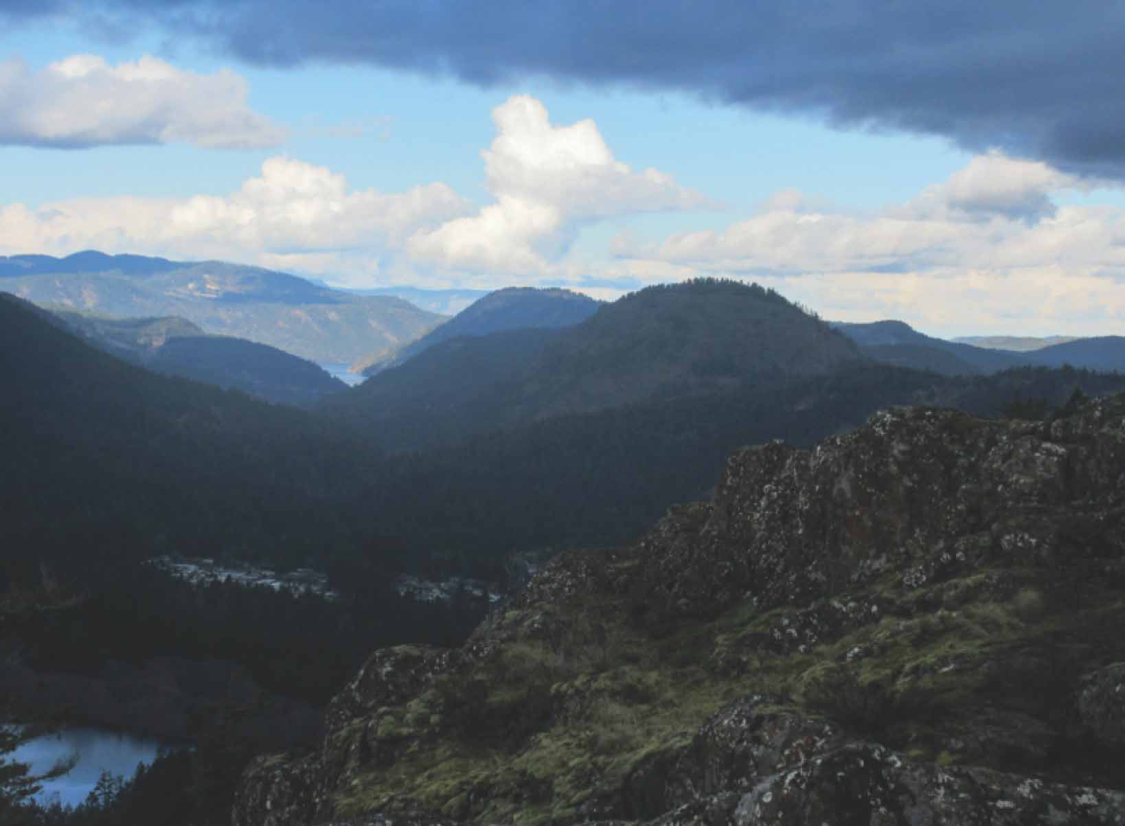
FROM LEFT Victoria Harbour viewed from near the summit; the trail passes through a fantasy-inspiring thicket of giant mossy boulders and twisted trees.
5.Bound for the true summit? Follow little blue markers across the flat, mossy area to descend steeply into a gully. Passing some especially picturesque arbutus, the trail climbs out of the gully and, after a small drop, begins crossing over the ridge so that, soon, the high ground is to the right. After wandering through a fir grove, the trail emerges to fine views towards Esquimalt. Now approaching the largely treeless summit, the trail, dotted with small blue markers, wiggles its way through fragile ground cover to the high point. Manzanita bushes and a few beautifully weathered firs and arbutus pose for dozens of photo possibilities.
6.The return route is the same as the outbound route. Be careful, though, as you stand thoughtfully on the high point, not to follow your nose back along the summit ridge. Doing so will get you to some small cliffs. Instead, therefore, swing back the way you came to follow the marked route back to the trees and the clearly designated trail.