CHAPTER 6
Weather and Living Water
All the patterns of soils and land cover (of moorland) have developed within the framework of a highly seasonal climate…a regime of low temperatures, severe wind exposure, very high precipitation, cloud and humidity, persistent winter frost and snow cover, a lack of sunshine, continual ground wetness from low evaporation rates, and often poor visibility.
Ian Simmons, The Moorlands of England and Wales, 2003
LATER, IN THE SAME BOOK, Simmons quotes John Hooker who wrote in the sixteenth century of Dartmoor specifically, ‘and this one thing is to be observed that all the yere through out commonly it raineth or it is fowle wether in that more or desert [sic]’. Both quotations have their drawbacks, but taken together they provide a summary of the Dartmoor climate – its ‘sum-total of weather conditions’. In Hooker’s favour the twentieth-century Dartmoor farming year was still ‘three months’ winter and nine months’ wet weather’ – and that was only a partial joke. Simmons was generalising about moorland early in his book and most farmers on Dartmoor in the twenty-first century would quibble with the word ‘persistent’ describing frost and snow, of which latter precipitation there has been no remarkable persistence for some years. But ‘continual ground wetness’ rings a bell, even if it makes the odd dry summer all the more singular. Hooker’s use of the word ‘desert’ is a perception of its time, presumably a comparison with settled, enclosed and apparent productive landscapes in the lowland about the Moor, but it also chimes with those modern ecologists who regard heather moorland particularly as a biodiversity desert. Harvey, the zoologist, hinted at it in 1953 but some contemporary plantsmen agree with him when faced with heather’s apparent popularity and its use as a measure of success in the ‘favourable condition’ stakes beloved of present-day conservation administrators.
To return to the climate, everyone seems to be clear, in the twenty-first century’s first decade, that it is changing. But it always has. We should remember in any relevant early discussion, that we are not as far in time from the end of the last glaciation as halfway through the last significant interglacial. I have already rehearsed prehistoric climatic change on the broad scale as far as we can discern it from the Dartmoor evidence to hand. But as a reminder, using immediately BC timing and building on it a little into historic time: from 1,900 BC there was a short drying, but at each of 1,500, 900 and 280 BC dates there were shifts to wetter conditions. The bulk of the Roman period was warmer and drier but deterioration ran from 300 AD until 700 and there was a wet phase late in the ninth century after which drying started and lasted until 980 AD or so. According to pollen, spores and wood fragments from the north of England it was wet in the twelfth century and became warmer but variable with noticeable dryness throughout the fourteenth, testate amoeba from Northumberland and Dartmoor however suggest wetter conditions developing towards the end of that same century. They also hint that a brief dry stage occurred in the sixteenth century and then wetter conditions set in until the twentieth. That last proposal may put all these variations into some sort of qualitative scale for the more senior reader. Our childhood was ‘wetter’ than much of the time from the mediaeval period until the sixteenth century despite the collective memory that all our school summer holidays were continuously hot and dry except when we went to the seaside. It is worth noting too that the ‘Little Ice Age’ began in 1500 and lasted until 1800 or so. We may have been in wetter times in the 1930s than 130 before, but we were also a bit warmer and that warmth seems now, to some, to be increasing.
Dartmoor’s extreme southwestern position, as far as British moorlands are concerned, is a major factor in any climatic consideration of it. Exposure to wind and weather directly off the Atlantic surface and to which the Moor offers the first real orographic uplift, brings it some relative warmth early and late and thus a longer growing season than northern moors. But, more significantly, those winds carry much moisture, and, given that uplift (Fig. 172), good reason for high precipitation on to western-facing slopes and the high tops. The average annual rainfall for the last decade of the last century at Cut Hill, as near the heart of the northern plateau as may be and 603 m OD, was 2,496 mm, but it reached 3,049 mm in 1994. As 1995 and 1996 were both dry years, which dragged the mean figure down, one might assume that 2,540 mm (100 inches) is a fair mean for the whole high plateau. Cut Hill after all is only 18 m lower than High Willhays, the peak of the plateau and the whole Moor and, with Hangingstone Hill, one of the two highest points of the main north–south watershed. That important line runs
FIG 172. Typical rain-bearing cloud mass, after Atlantic air rises over the northern plateau of Dartmoor.
south-southwestward from Cosdon through Hound Tor (the northern one) and Wild Tor to Hangingstone Hill, and then through the tiny triangular col between Taw Head, East Dart Head and Cranmere Pool. Here it turns due south to Black Hill and on to Cut Hill, a mile south of which it swings southwestward to Great Mis Tor, back to North Hessary Tor and on south through Nun’s Cross to the southern plateau. Then it picks up an eastward line through Crane Hill, Caters Beam to Ryders Hill, the summit of that plateau (after a diversion northward to round Avon or Aune Head), and finally southeastward through Pupers Hill to Dean Moor. This line cleanly separates the Teign and the Dart catchments which both exit the Moor eastwards, from all else, which flows, the Taw and the Okements excepted, west and south. It is worth underlining for the record that the Dartmoor summit, the High Willhays-Yes Tor ridge (Fig. 173), lies well within the moorland catchment of the two Okement rivers which join off the Moor, and that the very small moorland Taw basin, too, lies west of the watershed just described. For the moment, the more significant consideration is that that line on the whole separates the windward, orographic rainfall receptor from the rain shadow of eastern Dartmoor. Exceptionally, but quite close to it, even if still westerly, at Taw Head in the lee of Great Kneeset the rainfall is 150 mm below the mean and 60 mm below Cut Hill’s maximum. Well eastward of the line, at
FIG 173. The unmistakable saddle-like profile of the High Willhays-Yes Tor ridge, seen in the centre of the skyline from the far east (Pepperdon Down). Despite being the Dartmoor summit, it lies well west of the main north-south watershed whose northern end is on Cosdon at the right-hand end of the skyline here.
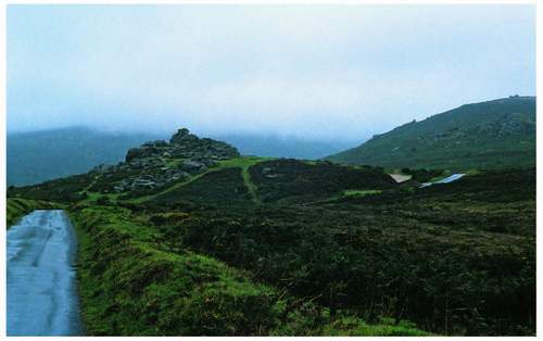
FIG 174. Low cloud enveloping Hameldon – here its base is seen beyond Bonehill Rocks.
Moretonhampstead (15 km), the average for the 1990s was 1,223 mm and at Yarner Wood above Bovey Tracey it was 1,202 mm, less than half of that only 17.5 km away to the west. The altitude of the rain gauges in each of these easterly sites is close to 200 m OD.
The Taw Head observation is nevertheless important because it is still high enough to show that, watersheds apart, the rivers which drain the plateau, and all their head-streams, are amply provided for by the rainfall – the 2,540 mm just quoted. That rainfall, and the lack of evaporation from the surface that goes with it and its parent low clouds (Fig. 174), have formed and still (just) maintain the blanket peat that stores the water from continuing rain and condensation and thus sustains the flow of ‘water-in-channels’ which feeds Dartmoor’s myriad rivers. We have seen already that those channels are shadows of their former selves, but they still occupy narrow meandering lines in the floors of valleys which were created some millions of years earlier by their forebear rivers. They were scoured by torrents of meltwater perhaps only 25,000 years ago when, momentarily in geological time, bare ground was the norm, and little or no vegetation and certainly no peat existed. But blanket peat began to form 7,000 years ago and now the East Dart, the Taw and the West Okement rise within a few hundred metres of each other in the extensive bog mostly just west of Hangingstone Hill but straddling the great watershed. The West Dart, the Tavy and the Cowsic rise within a few hundred metres of that line and from the same plateau blanket a little further south. The bog is their source now – if their valleys are as old as they seem to be, there has been at least the same rainfall as now, and perhaps a bog too, on a number of earlier geological occasions.
In addition to the rivers and their main headwaters met so far in this book, 11 all told, the northern blanket bog gives rise (literally) to 25 more named streams and some unnamed ones as well. The southern bog has 22 leaving its edge as well as its five main rivers. The stream pattern is dense, the norm over much of the land below the blanket bog boundary fits with the global temperate zone statistic of one kilometre of stream to one square kilometre of surface. But it is the long-profiles of the streams, their width, their volumetric discharge and the variability of all three that matter to the lives of all aquatic organisms and their predators. The same three characteristics offer to men scope for re-distribution of the water itself via leats (see above). The long-profile upstream detail of alternating riffles and pools proclaims habitat variation for all life up to salmon size and, as a spin-off, variations in current speed that accommodate more plant and animal species than would otherwise be the case. Greater gradient changes lower down, often marked by aits or islands, give scope for energy production, as does the general rapid fall from source to departure from the Dartmoor boundary. The leats
involved in that and those just mentioned as distributors have an ecological significance that has to be part of this chapter too.
But we also have to register that there are no natural ‘wide places in rivers’ within this National Park. That description of lakes is a nice one, but Dartmoor has never experienced the over-deepening of valleys by glaciers nor the dumping of their scourings as morainic dams that produced most of the natural upland lakes in Britain. Within the moorland, its ‘lakes’ are Devonian streams and its natural named ‘Pools’ – Cranmere and Raybarrow for instance – are actually bogs with time-limited water-filled central depressions. Its biggest ponds, Goat (or Goadstone) Pond near Sharpitor, Big Pond above the Black-a-Brook
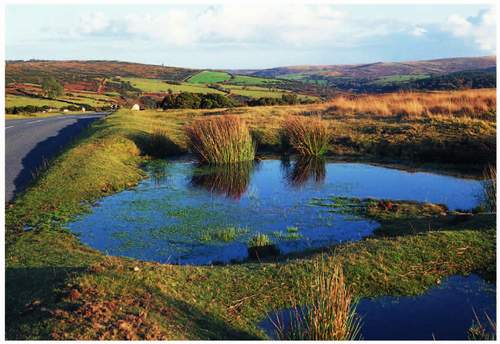
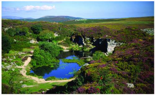
(the one that flows into the Plym just above Cadover Bridge) providing the head for the water monitors within the china clay pits, Harford Reservoir, a small domestic supplier on the Butterbrook, and the Wheal Jewel reservoir on Mary Tavy Common (now storing the energy for Mary Tavy (hydro-electric) Power Station) are the biggest deliberately made to hold water – in fact for four different purposes. Like the first of them (Fig. 175), there are many tiny unnamed ones, usually man-made, that would be called dew ponds on drier hills elsewhere. Most are close to roads, draught horses needed to drink as well as grazing sheep and cattle, like that on the summit of Merripit Hill, or the six on Dunnabridge Common (Fig. 176). Then there are water bodies in working china clay pits on Lee Moor, a number in the abandoned granite quarries – Blackingstone, Merrivale, Foggintor and Haytor – and small cleaner ones in the long-defunct clay pits at Brisworthy, Redlake, Leftlake and Petre’s Pit on the southern plateau. There, too, old holding ponds for mine workings at Crazywell (Clasiwell) and Cramber Pools also sit. Their northern parallels exist in tiny form at Vitifer near the Warren House, and Ockerton Court on the side of Okement Hill. Near Lydord there is a flooded abandoned railway line that supports the small red Ceriagrion tenellum and scarce blue-tailed Ischneura pumilio damselflies, both are nationally rare but
also happy at the Brisworthy ponds. The ‘Lydford Railway Ponds’ are notified as a Site of Special Scientific Interest (SSSI) on their account. The water bodies of the longest-abandoned pits are usually the richest in the ecological sense, the active china clay pits and most of their smaller inactive cousins suffer from dense physical pollution of clay in suspension, though the Brisworthy ones have cleared and are home to a fair selection of aquatic plants and animals as well as the rare damselflies just listed. The hard-rock quarry pools are, on the whole, vertical-sided and offer no scope for marginal emergent vegetation, their depth, too, inhibits plants with rooted footholds but floating leaves (Fig. 177). The (dew) ponds are cleanest and, if sheltered enough, harbour some water plants and accompanying invertebrates, Goat Pond is bleak and rarely without waves but even there floating sweet grass Glyceria fluitans persists.
Off the moor itself there are a small number of private pools, some with landscape garden lake-like pretentions, as at Blatchford near Cornwood, Canonteign near Hennock, below Bovey Castle off the B3212 and Bradford Pool near Shilstone in Drewsteignton parish, which also has flooded quarries at Blackaller. There are more of the latter near Christow, one at Scatter Rock alongside Christow Common and one at the old mine above Christow Bridge, two in South Tawton parish and one between the Meldon dam and Meldon Viaduct. None of these quarries are in the granite, some even have limestone associations and thus a higher pH with scope for different plants and animals.
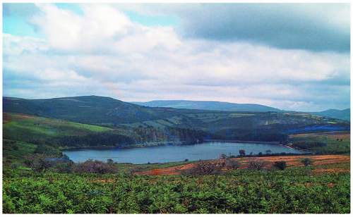
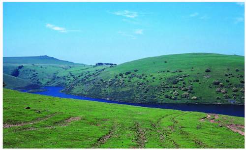
To complete the set of still-water bodies within the national park we have to turn to the major modern exploitation of Dartmoor’s deep, steep-sided, mid-course valleys which has been the construction of reservoirs for water storage for human consumption, most now off the open moor. Burrator was the first, in 1898, constructed by Plymouth’s city fathers in farmland in the upper Meavy catchment. Then the Kennick, Tottiford and Trenchford complex was build by Torquay Borough Council, followed by Venford on Holne Moor for Paignton Urban District in 1907 (Fig. 178). Torquay came back to build Fernworthy, starting in 1936 but finishing after some difficulties in 1942. The Avon was dammed above Shipley Bridge in 1956 and finally at Meldon on the West Okement, begun by the North Devon Water Board, and completed by the South West Water Authority in 1972 (Fig. 179). The last attempt at damming a Dartmoor river, on the Swincombe south of Princetown, was beaten off in Parliament by an alliance of amenity bodies and the National Park Committee of the day in the late 1960s. It would have been much bigger in area than either Venford or the Avon elsewhere in the southern plateau – wholly flooding Foxtor Mire, now an SSSI – and sapping further the other headwaters of the West Dart by doubling the width of the Devonport Leat already taking water across the main watershed. That alone would have diminished the Black-a-Brook, Cowsic and high West Dart discharges even more and created an unleapable barrier for livestock, their herdsmen, their shepherds and everyone else who walked that part of the Moor.
FIG 179. Looking into Meldon Reservoir from Longstone Hill in 1988. The steep sides of the West Okement gorge with scattered hawthorns plunge into the reservoir. The island nature reserve negotiated during dam-building by the Devon Wildlife Trust is clearly visible, as are the ruts caused by the carriage of fodder to stock on the common – now banned.
These reservoirs were clearly built with off-moor money and still largely supply the communities for which and by whom they were created. Most Dartmoor residents, whose original benefit was simply the price of the land (often including the catchment) to the lord of the manor or other landowner and perhaps some temporary labouring work, at least now draw their own water from their nearest water treatment works. These are associated with Meldon, at Prewley near Sourton, with Tottiford below its dam and Venford the same; the Avon has a treatment works above Shipley Bridge and one at Dousland treats Burrator water. Respectively these works supply the northern fringe of the Park, the east including Widecombe, Venford supplies the southeast around Ashburton and Buckfastleigh and the Avon feeds the extreme south. The west of the National Park including Princetown is all fed from Dousland. Fernworthy water is treated at Tottiford but also at a small works at North Bovey supplying the villages around it. The Taw contributes water from extractors in Taw Marsh, which at least avoided creation of another reservoir; and the Dart, whose whole moorland catchment has escaped any more dams since Venford, is tapped through its floodplain gravels just above the tidal limit at Totnes, well off the Moor. The meagre benefit referred to above was in some cases more than matched by disbenefits. Displacement for some, from home and fields, and for greater numbers from loss of common grazing especially at Burrator where the commoners were bought out of the entire catchment which then ceased to be common land and where the grazing is now let on a commercial basis.
Burrator, on the Meavy, is the lowest of these reservoirs in the landscape and the Avon the highest at 340 m OD, seen near the top of Figure 205, Fernworthy and Venford are at 290 m, Meldon 280 m and the Kennick, Tottiford and Trenchford complex ’s lowest dam is almost level with Burrator at 220 m. Six of the eight have all the disadvantages for aquatic life that high-level, steeply shelving and annually oscillating shorelines plunging quickly to considerable depth ensure. Of Meldon in the West Okement gorge – the last to be completed – it was said, early after flooding, that the side slopes above the water are so steep ‘even sheep fall in’. Only at the inflow ends of such ‘lakes’ can emergent plants and light-demanding submerged life find a foothold. But Burrator and Fernworthy have some less steep-to shores and the draw down of very dry summers reveals swards of shore weed Littorella uniflora extending out from the winter water mark (Fig. 180), joined quickly by terrestrial annuals and creeping perennials as the water level goes down. All but the Avon and Meldon sheets of water now have surfaces sheltered from prevailing winds, at least in some places, by the kind of tree planting (a conifer and rhododendron combination) that was
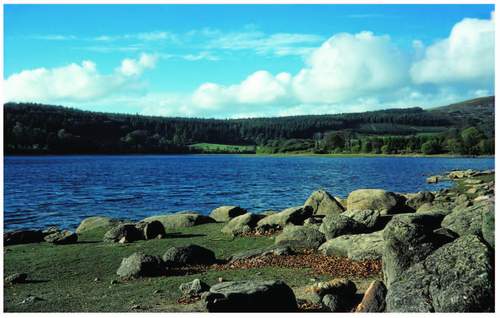
FIG 180. Burrator Reservoir in high summer (1976) with a littorella sward high and dry among the boulders.
fashionable among water companies when they were built. Odd breaks in the screen, and their dam-ends especially, still let breezes through when in the right direction. Avon and Meldon remain bleak, the latter’s host valley providing a funnel for the prevailing wind that can pin boats against its dam for long periods. One of the continuing effects on the highest-level water surfaces of exposure to the wind is the massing of ‘froth’ on the leeward shore produced from the fatty acids released from eroding peat anywhere around the circumference of the lake and often mistaken for detergent!
Burrator and other early twentieth-century reservoirs have been stocked at some time, primarily with rainbow trout, and thus there must be an invertebrate and small fish food supply available despite the ecological disadvantages already listed. Little work has been done on the invertebrates but copepods such as Cyclops and Canthocampus, Daphnia, mites and Oligochaete worms have been recorded in filters after extraction as the water is prepared for human consumption. The fish subsisting on these and doubtless more species are themselves preyed upon by herons Ardea cinerea, which have nested alongside Burrator and Venford in the recent past, by cormorants Phalacrocorax carbo and by wintering goosander Mergus merganser which now breed regularly on the West Dart and the Double Dart rivers in a number of places, a family is seen in Figure 181. In the last two decades breeding has also been proven on the Tavy and at Burrator. Goosander nest in holes usually in trees, and even tried a nest-box
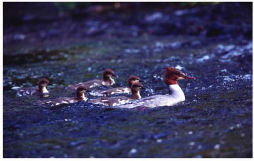
FIG 181. Female goosander and chicks on the Dart just above New Bridge. (C. Tyler)
FIG 182. The Devonport Leat at Princetown, passing below the Prison whose own leat is crossing below the quarry on the top right skyline.
(designed for an owl!) in Yarner Wood. Many other waterfowl call in at the older reservoirs, especially during dispersal after the breeding season, little grebe Tachybaptus ruficollis (carnivores) and coot Fulica atra (vegetarians) among them. Both suggest that on Burrator and Fernworthy at least the inflow ends provide available food in high summer. Moorhen Gallinula chloropus figures are very low but breeding on Fernworthy is fairly regular. Mallard Anas platyrhynchus inevitably breed here and are present all the year round. They are omnivorous and graze ashore, but need shallows as far as dabbling is concerned so also tend to feed at the upstream ends of the more mature lakes.
It is important to note that as well as the two variations on the extraction theme already mentioned, reservoir output itself is augmented direct from some rivers within the Park. At Prewley, water from the West Okement (the intake is near the Isle of Rocks) is also treated and in the south extractions are made from the Erme and the Yealm. Burrator water is supplemented by the Devonport Leat, which as we have already seen is fed by the headwaters of the West Dart (Fig. 182).
The rivers then are Dartmoor’s dominant natural water habitats and each for ecological consideration incorporates the whole channel system of its catchment including the leats within it. The granite ground source and the peat over most of that in all its forms – from thick blanket through valley mires to peaty
horizons in much of the soil cover – suggests an acid environment for their water source. Despite that, its pH regime is remarkably close to neutral at the highest altitudinal levels of recording within the last two decades. That being said there are recognisable variations among the main rivers and fairly low readings at the other end of the scale. In that time frame the biggest mean range has been recorded on the Plym at Cadover Bridge (pH 7.7. to 4.7, which last is very low), the Teign’s three main headwaters ranged from 7.9 to 5.8, the Bovey 7.7 to 6.8, the West Dart 7.5 to 5.3, East Dart (at Postbridge) 6.8 to 5.0 and the Tavy (at Denham Bridge in the latitude of Yelverton, but outside the Park) 8 to 7. Of those, the Bovey has tightest range or, if you like, varies least, and is the only one which does not rise in blanket bog (Fig. 183). The Tavy, with almost as tight a range,
FIG 184. The middle course of the Tavy flowing through the metamorphic aureole and much dolerite on the boundary of Mary Tavy and Peter Tavy parishes.
leaves the granite 24 km or so before it reaches Denham Bridge and half of that distance is through or alongside dolerite (near the basic end of the igneous rock spectrum) and its immediate catchment over the whole 24 km is peppered with outcrops of the same rock see the map at Figure 28, which may help account for its high mean pH (Fig. 184). The Plym’s lower readings may well be associated with china clay in suspension, which also has other effects on the fauna under the general pollution heading. The records from 1991 to the present also show a slight increase in acidity over time in all the rivers except the Teign (looking at the mean highest records per year) and the Plym (in the lowest records). Perhaps this last hints at a slight reduction in kaolin pollution since reduced working in the Whitehill Yeo Pit began in the last few years.
All the raw data, held by the Environment Agency, is based on monthly and sometimes bi-monthly readings over the last two decades, but the analysis, such as it is, is my own. The Agency has also registered pH readings in the past as low as 3.5 on the Okements when heavy storms after long dry periods appear to have flushed out water that has been held in the highest peat for longer periods and thus become, it is assumed, more acid than usual. The passage downstream of such acid water, however, temporary has dramatic results, fish kill is the most obvious symptom but the invertebrate fauna is also affected. Such incidents have been rare so far (since recording began) but if summers do get hotter and drier and more storms accompany that scenario then such flushing might become more common. Otherwise there is not enough evidence from these general figures to come to more concrete conclusions or establish firmer trends.
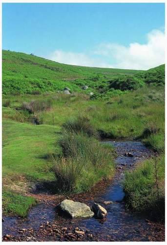
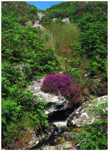
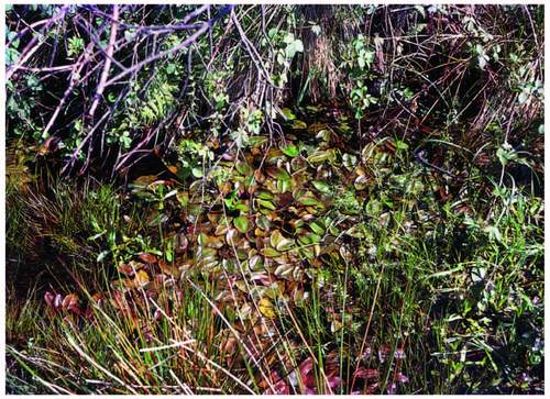
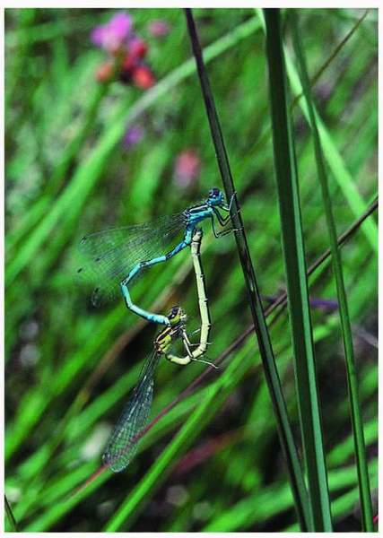
Together, the water chemistry and the physical nature of the tiniest headwaters of all Dartmoor streams provide an environment that encourages aquatic flowering plants not at all. Gradient, frequent torrential spate and a boulder/cobble/pebble bed mean that only algae and some tough mosses, notably Fontinalis, survive, providing little food and less shelter from the torrent for invertebrates. On the other hand the muddy seepages at the edge of bogs and mires and from ‘eyes’ and springs on gentle slopes carry starwort, Callitriche stagnalis with small leaves and white flowers, and where there is enough of a seep the bronze-green leaves of bog pondweed Potamogeton polygonifolius can cover the mud/water mixture (Fig. 186). Both these plants are common over Dartmoor’s shallowest waters and float off the mud when any water surface is provided. Aground or afloat they provide cover for some of the more rare insects such as the southern damselfly Coenagrion mercuriale which occurs at the downslope end of some seepages of the northwestern slopes of the plateau in the aureole where a higher pH seems to be the norm (Fig. 187). Both starwort and bog pondweed will inhabit some smaller leats provided they are shallow and slow enough. Many of the flowering plants of bogs, already listed in Chapter 5, will join these two widespread plants where conditions encourage them.
In the slacker currents between the riffles of the growing streams even where submerged and floating vegetation may still be absent a thin invertebrate fauna may be found. Mites Hydracarinae, shrimps Gammaridae, and the larvae of many ‘flies’: mayflies Baetis spp., stoneflies Plecoptera, a number of caseless caddis Rhyacophilidae goeridae and Hydropsyche among them, blackfly Simulium spp. and non-biting midges Chironomidae are here. Some water-surface bugs such as skaters Gerridae and beetles whirligigs Gyrinus spp. occur and odd flatworms Planarians and Polycelis lurk under some stones. Most of these taxa occur throughout the length of streams and rivers within the National Park and are joined by others or increase their own local membership as conditions ameliorate downstream.
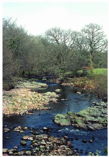
Moving in that direction, the first real change in invertebrate and plant niches occurs when currents are slackened to the extent of allowing finer material – of the calibre of most growan particles – to dominate the bed for at least some metres. Upstream from here there may well be small ‘beaches’ and shoals between the boulders, and such a mixture can recur right down the largest rivers especially where their gradient steepens and where stationary boulders of late periglacial dumping recur as dominant features of the channel, in the Dart near New Bridge and in the Teign at Fingle for instance. The washed growan provides a sub-angular gravel mostly under 2 cm in diameter which may be accompanied by pebbles up to 15 cm or so, but the mixture offers rootholds for a very dark olive-green, almost black, water milfoil Myrriophyllum alterniflorum and a very much brighter green water starwort Callitriche brutia. This pair of totally submerged plants, of such contrasted shades of green, stream along the bed with the flow, always close together, as though offering a drowning Ophelia a choice of wig, and they dominate all the streams with the same gravely substrate. The emergent hemlock water dropwort Oenanthe crocata can dominate the shallowest shoals and tower upwards as long as it survives felling by spate and driftwood. All three afford shelter for invertebrate larvae and the latter ‘ladders’ for their metamorphosed adults. In really slack water and at the edges of channels the acid-loving moorland water crowfoot Ranunculus omiophyllus will grow, its floating carpet of leaves and white flowers making a real change at the surface. Here pond skaters can be seen in ‘flocks’ in almost every backwater and on the downstream side of biggish boulders. Below such surfaces the water boatmen bugs Notonecta glauca and lesser water boatmen Corixidae occur. The former is carnivorous as is the pond skater, which takes other insects on the surface, particularly the terrestrial ones who miss their footing or whose uncontrolled leaps end up in, or on, an alien medium. I once saw a pond skater on Ruddycleave Water take a struggling froghopper Aphrophoridae spp. only to be snatched down itself by a water boatman in seconds. Lesser water boatmen are vegetarian and vulnerable to their big cousins if unwary.
Below some near channel-wide aits and weirs purposefully just downstream of leat intakes, much finer substrates of sand silt and clay verging on mud in places, may accumulate and here the populations of Oligochaete worms and the variety of leeches including Helobdella stagnalis increase substantially. The biggest of these river ‘pools’ are well downstream near the National Park boundary and here there are more species of mayflies, stoneflies and caddis. The black fly and Chironomid species populations also have their grand climax here as far as Dartmoor’s rivers are concerned. Although pools low on the Swincombe and the Black-a-Brook have yielded counts in samples in the last two decades of up to 2,000 individual Chironomids compared with 1,300 mayflies, 20 to 30 uncased caddis and 200 to 750 Oligochaetes at the same sites. Harvey, describing the pool above Steps Bridge on the Teign in the 1950s refers to the burrowing freshwater pearl mussel Margaritifera margaritifera and it was certainly seen up to the 1980s, but then only below the weir. The Dartmoor Biodiversity Action Plan (BAP) claims that it is probably extinct in the Natural Area which is a pity, for numbers of mollusc species are not common in these neutral-to-acid streams, though some small bivalves burrow in the finer substrates and the freshwater limpet Ancylastrum fluviatilis grazes the algal film on the downstream – and under-sides of boulders in the lowest reaches of tributaries and particularly in the main rivers. Here, as we saw on the Tavy, passage through some metamorphic rocks lessens the acidity and shell formation for molluscs may be just that bit easier.
The invertebrate population occupies more than one layer near the base of the freshwater pyramid of numbers, for the bigger carnivorous dragonfly larvae and adult beetles prey upon free-swimming and burrowing vegetarian larvae, worms, water fleas and the like. All of the population is potential food for fish, and despite the easily observed circular ripples of brown trout taking emerging mayflies in early summer, that is not their main feeding method. Brown trout, grayling, loach and bullheads take all or any invertebrates from the bottom all the year round and also feed on ‘drift’, especially in the spring and the autumn. Drift comprises all those organisms that find themselves floating downstream in mid-water having been dislodged from their safer niches by small changes in flow due to rain, say, or because they essayed a move too far of their own accord, or because, like my froghopper, fell in from a terrestrial loss of footing. Some will drift on the surface having mistimed their own attempt to lay eggs there or never properly emerged on metamorphosis. Even given this tripartite larder, acid-to-neutral streams do not produce huge volumetric amounts of food. Analyses of trout stomach contents, taken in bigger tributaries of the Dart like the Walla Brook, show all-age fish taking more stoneflies and caddis than anything else in winter and mayfly and Diptera in summer. But in a sample area of the channel an average of 300 first-year fish will have reduced to one or two in four years – the biggest loss being between the alevins and the yearlings, but still another substantial drop in numbers in the second year. Through this time of course the fish are themselves easy prey to others and even to big invertebrates. The survivors to the fourth year will not normally have tripled their length, whereas in a chalk stream the same brown trout will have tripled their length in three years. The actual measurements are more telling: 7.2 cm in the first year to 18.5 cm in the fourth in the Dartmoor stream; 11.3 cm in the first year to 38.8 cm in the fourth in the Kennet (chalky tributary of the Thames). Young brown trout in Dartmoor often find their way into the leats which are still running where physical hazards may be fewer and food as easy to come by, though the heron that finds a leat may have a field day if too many trout have followed each other in there.
Salmon Salmo salar also use Dartmoor’s rivers for spawning and thus breeding another carnivorous contributor to the pyramid. The adults feed little during their excursion into these river systems from the sea, but their progeny may stay in the river in which they hatch for up to two years, thus occupying a position in the food chain alongside the brown trout. Both species need similar stream-bed conditions to spawn though salmon on the whole deal in much coarser pebbly gravel. All the headstreams of the Dart provide good spawning grounds somewhere. At least 27 km of ‘redds’ or suitable gravel beds occur in total from the Black-a-Brook in the west to the East Webburn and including the Swincombe. Just above Dartmeet and below Huccaby Bridge on the West Dart are the downstream limits of these redds. They are the scene of much vigorous activity near the end of the year when females plough furrows with their lower abdomen and tail and release eggs into them as the attendant males release sperm. The pair then moves just upstream and repeats the process, which has the added bonus of sending gravel downstream to cover the earlier deposit. The Dart is known as a ‘spring’ river because the adults run up from the estuary then and wait around in pools until the late autumn to spawn. The Plym’s salmon enter the river as late as December, charge straight upstream, spawn and return while there is enough winter rainwater to allow that. It is suggested that abstraction on the Moor (in the case of the Plym system for both china clay working and human consumption on the Meavy) has reduced summer depths downstream over time to such an extent that only this early winter routine will work for the big fish. The Teign’s fish appear to do both, having spring and autumn ‘runs’ upstream. Salmon hatched and educated in the Dart return to it after their marine excursion, with all its adventure and good food, to attempt to spawn in the tributary where they were born, and this instinct seems to include memory of the seasonal routine, hence the particular reputation of any river. However artificial enhancement of the stock by game fishermen by the seeding of developing eggs into redds obviously may introduce fish genetically programmed differently from the true natives; and it is thought that this may account for mixed situations like that found on the Teign.
Fish are not the only exploiters of the invertebrate fauna of the Dartmoor rivers; two such are the birds which have normally characterised all the streams in their gorge mode – the dipper (Fig. 188) and the grey wagtail (Fig. 189) – and they have both penetrated upstream, especially through the enclosed landscapes of the middle Dart system, the Bovey and the Teign and the bigger streams of the western fringe. Both are almost wholly carnivorous, the dipper feeds mainly
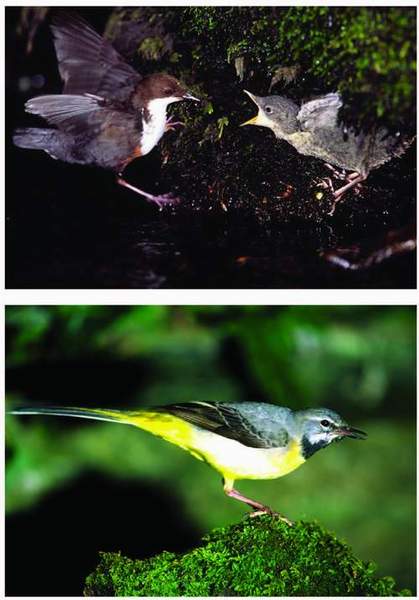
FIG 188. (top) Dipper feeding one of its fledglings on the edge of the Dart below Holne Woods; (above) Grey wagtail. (C. Tyler)
below the water surface, walking on the bottom and using wings like hydroplanes to stay down there, sometimes appearing to swim in search of any of the larvae already listed. Grey wagtails feed off the surface itself and snatch adult insects from emergent stones and vegetation, but seem to be tied as closely to the waterside and the line of the stream as the slightly more specialised dipper. The latter needs shallow swift water, tends always to be close to riffles and rapids and is often first seen resting on pebbles on the edge of midstream shoals or those at the inside of the bend. Always look as far up and as far downstream as possible when you come to a stream bank, for ‘their working eyes will see you long before your leisure ones sees them’ (I adapt Alasdair Maclean). Fortunately their territories are linear and no wider than the channel so a dipper driven to the end of its territory will fly up and turn back over the ‘driver’s’ head. That territory is usually not more than a kilometre in length on rich feeding streams – which means that on acid waters it may be a little longer, though studies of the Plym and the Meavy and of the Dart have produced figures of 1.5 pairs of dipper per km. The latter, in the mid-1990s, revealed 43 pairs on 65 km of the East and West Dart. Dippers have a strong instinct to nest within the sound of rushing water – in the extreme behind waterfalls, but also close above spate level over rapids. The moss-built nest is like that of a wren, domed with a side entrance but big enough for a blackbird, which is the size of a dipper though it is shorter and thus appears plump by comparison, and as often as not under some other shelter or overhang, which is why bridges provide many a nesting site. There are of course exceptions and exotic dippers have nested under eaves – at what was once the Angler’s Rest at Fingle Bridge – and in trees – near Postbridge. Numbers on the upper Bovey have declined in recent years, late-winter attempts at territorial establishment failing to run the full breeding course.
Grey wagtails also have a stable population on Dartmoor streams, and a similar density as dippers, about a pair per km across all the river systems. Their nests are open shallow cups so that shelter from above may be more important for them than for dippers; holes in walls and any other available cavity may be used. Their one advantage is their more catholic food source, they will include many terrestrial insects and larvae especially small caterpillars in their own and their nestlings’ diet and so are spared the difficulties experienced by dippers in times of persistent spate for instance.
The fish in their turn have their own predators, both mammals and birds. Otters have survived and seem to be increasing on Dartmoor streams – they may well move down as far as the coast in hard winters. They are well protected, but well out-numbered by mink. The Dartmoor mink were originally escapees from mink farms in the Teign valley established in the 1930s but now breeding away
on all the National Park’s rivers. They will prey upon waterside birds as well as fish, so dippers and grey wagtails suffer their presence less than gladly, indeed it is suggested that the dipper population of the West Webburn was decimated by the arrival of the mink in the third quarter of the twentieth century. Herons have found sufficient fish food in the recent past to nest alongside the West Dart at Beardown and the Venford Reservoir, they still do at Buckfast and in Lustleigh Cleave. Cranery Brook at Postbridge suggests that they were once there too. They nested at Archerton just northwest of Postbridge until the 1980s but their whole wood was blown down in the great storm of Burn’s Night 1990. As on the reservoirs they have been joined, as predators, by cormorants in winter on the longer pools of the Dart and the Teign and now by the handsome goosander which breeds on the Dart (see Fig. 181) in at least three places, causing game fishermen great consternation. ‘They fish in line, abreast, steaming upstream and cleaning out the river,’ said one in a meeting to discuss emerging biodiversity conservation difficulties for anglers. Herons, like grey wagtails, have the advantage of a greater range of food on offer and, if spate precludes an easy fish, resort to the bog where the same rain will have enlivened the frogs.
This chapter began with the weather, and the symptoms of accelerating climate change may of course modify the content of this account of water’s direct
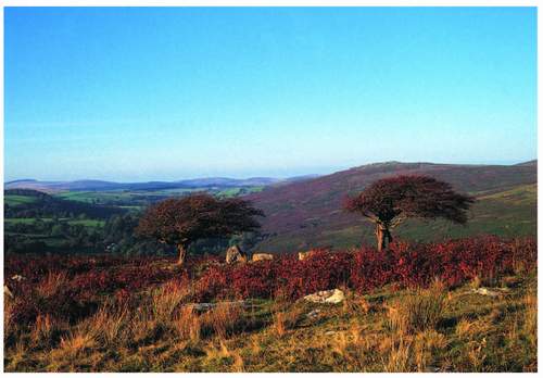
contribution to the wildlife of Dartmoor within the next decade or so. One set of those symptoms proposed is an increase in episodes of violent weather, and some think we have had more storminess that is not seasonally defined. Wind of course has always been a factor in wilder Dartmoor landscapes, as most exposed hawthorns will show (Fig. 190). But the extremely high-wind incidents in 1987 and 1990 have not been repeated in the intervening 18 years. The latter pure windstorm, there was no rain, laid low many Dartmoor trees, some like the Archerton drive beech avenue in spectacular fashion as Figure 191 shows. Princetown’s western sheltering plantation was also devastated. Chimneys came down in many villages and their entrance roads all blocked, however temporarily, by fallen trees. As always these events force re-thinking on land managers about what should now best replace what has been removed before its time, and in its way that is the kind if adaptation we have to contemplate in the face of any of the facets of weather change we may experience.
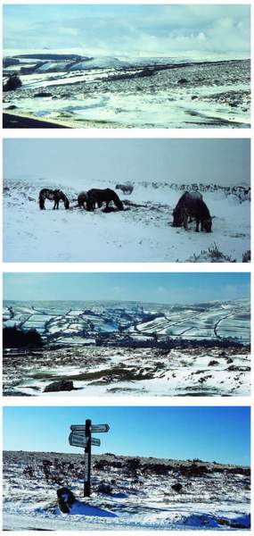
I hinted at casual observation of milder change at the outset, certainly winters seem less cold up here, if no less damp. Snow has been rare over the last decade though it seemed common enough up to the end of the 1980s (Fig. 192) – and pace a short dump in February 2009 – and frost days are apparently diminishing. Drier summers are still a laughable idea in moormen’s minds
FIG 191. Near Postbridge – the drive to Archerton, its beech avenue laid low by the windstorm of 25 January 1990.
(2008 being the wettest for decades), but higher average temperatures may just be beginning to affect Dartmoor, already earlier flowering of ling and western furze has been noticed in successive high summers. On the other hand the heather beetle attack of 2006 was evidenced by hectares of dead heather canopy, as the 2007 summer began, in Dartmoor’s most vigorous stand on Bush Down. Increasing dryness favours the beetle, say the Heather Trust. It also favours the arsonist and makes legitimate swaling a more complicated and burdensome business. Just outside the Dartmoor agreed date for ending swaling (31 March) in 2007 a fire began, or was begun, just east of Quintin’s Man 2 km west of Fernworthy Forest and burnt, thankfully swiftly in front of an east wind, across to Amicombe taking 1,552 ha of surface vegetation with it. A symptom of dryness, its speed meant that the peat, for this was mainly over blanket bog, was untouched by fire but the sphagnum in the wettest places was singed. By June the site was bright green with soon to be rampant purple moor grass. The Dartmoor Forest Commoners’ Association, recently trained and properly equipped for fighting wildfire, did a sterling job and contained the western front of the fire in due time but the whole burn perimeter was 31 km. This is probably the biggest fire on the Forest since 1984, seen in Figure 151, but it goes to show how what a persistent
FIG 192. Four scenes that were common in Dartmoor winters until the 1990s (top to bottom): looking northwest from Merripit Hill in 1979, the southern edge of the north plateau, at the skyline, under a real blanket; ponies scraping snow off potential feed in what shelter can be found; snow-covered fields around Widecombe – there is clearly more grazing available on the moor than in the in-bye; Cold East Cross living up to its name in February 1986.
spring and summer temperature increase might mean, and fire, or its risk, apart, it has implications for the solidity of the blanket bog, its volume and thus its water- and carbon-storage capacity. Re-wetting the bog, a formula for attempting to address those potential ills and already begun by Defence Estates and the Dartmoor Wildlife Action Group, will itself become more difficult if evaporation increases.
Winter rainwater may of course balance the equation for reservoirs and human needs but the side issues are obvious. Regulations about residual water below take-off points and over or through dams to keep streams and rivers in good fettle will be put under pressure. ‘Dew’ ponds and eyes have already dried out in recent springs, as have abandoned but still, until now, wet leats, for the first time in many local memories. It has happened before in historic time, if the available record is anything to go by, but the abandonment of villages in the late fourteenth century, Houndtor, Challacombe and Blackaton for instance, was not just a Black Death matter. Bracken galloped across fields, crops failed and the temperature had risen. Global trade and European and national governments’ inability to stabilise the purchase of public goods at a sensible price in the hills may yet be disastrous for the hill-farmer, but the predicted winter/summer changes will not help either. The combination could see an even less attractive scene and a duller habitat covering for the hill develop even more quickly. The attractiveness scale is as much a measure of an animal and plant combination, of a healthy ecosystem, as it is one of human delight. Both need to enjoy the present climatic regime while they may, even if the change proves to be temporary in geological terms.
