 The Wilburn Ridge Pony Association, founded in 1975, manages the pony herd in the Mount Rogers High Country, aiming for an annual herd of 120 animals, auctioning off excess for vet care and winter hay for the others.
36 Virginia Highlands Circuit
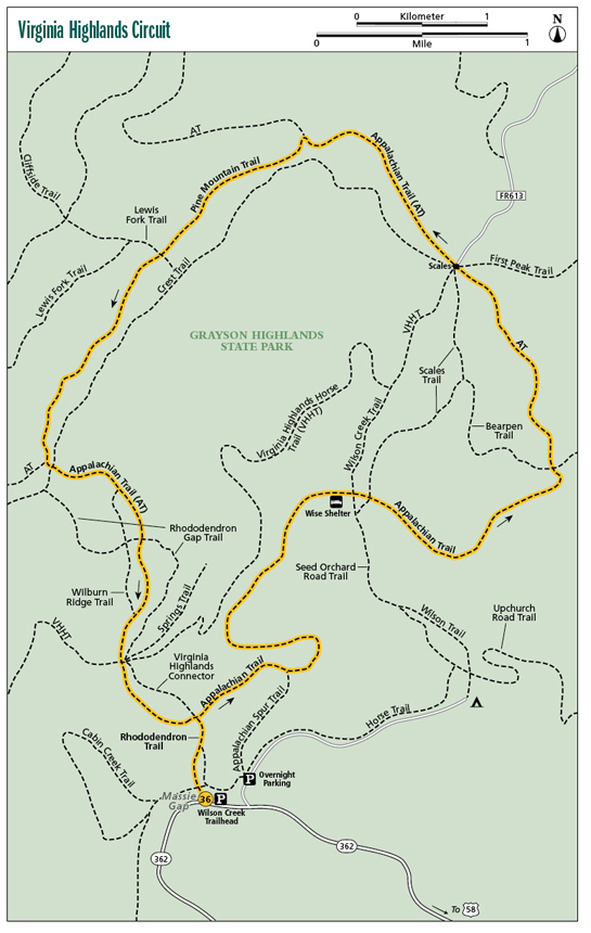
This hike explores Virginia’s highest terrain, traversing incredibly beautiful and historic topography. Start at Massie Gap, once a highland homestead and now part of Grayson Highlands State Park. Follow the Appalachian Trail (AT) through a mix of meadow and woodlands. Come to Scales, a gap where livestock grazers weighed and sold their cattle in days gone by. The AT takes you on to Pine Mountain. Here, enjoy excellent views opened by timber operations from yesteryear and see some of the wild ponies that help keep the mountain lands open. Rejoin the AT and cross over the open rocky terrain of Wilburn Ridge, named for an 1800s hunter, before completing the loop. Be apprised this high-country hike is subject to inclement weather, especially in winter.
Start: Massie Gap at Grayson Highlands State Park
Distance: 10.8-mile balloon loop
Hiking time: About 6–7 hours
Difficulty: Difficult
Trail surface: Natural-surface path, very rocky in places
Best seasons: Late spring through early fall
Other trail users: Equestrians in places
Canine compatibility: Leashed dogs permitted
Land status: Grayson Highlands State Park, Jefferson National Forest
Fees and permits: Parking permit required
Schedule: Open daily year-round, except for inclement weather
Maps: National Geographic Mount Rogers; USGS Whitetop Mountain, Trout Dale
Trail contact: Mount Rogers National Recreation Area, Route 1, Box 303, Marion, VA 24354; (276) 783-5196; www.fs.usda.gov/gwj
Finding the trailhead: From exit 14 on I-77 near Hillsville, take US 58 west for 48 miles to Grayson Highlands State Park. Alternate directions: From Damascus, take US 58 east for 26 miles. Enter the park on VA 362 and follow it 2.5 miles to reach Massie Gap on your right. Parking is along the road on the right. Trailhead GPS: N36 38.007' / W81 30.505'
The Hike
The hike begins at Massie Gap, a level swath of land 4,500 feet high in the Mount Rogers High Country. Mount Rogers is Virginia’s highest point at 5,729 feet, is part of an elevated massif with multiple mile-high peaks, and is home to wild ponies. This mountainous terrain was once cloaked in a contiguous spruce-fir forest, an evergreen mantle coveted by commercial timber operators. Logging began in the 1880s, and rare spruce-fir forest, which covers only 70,000 acres in the entire Southern Appalachians, was cleared out. After the Virginia highlands were stripped, treeless terrain was left. Farmers saw an opportunity to grow crops where the evergreens had once stood, including Lee Massie, who settled in the mists with his family. Farmers like Massie found out the very short growing season, inclement weather, and long distance to markets made farming nearly untenable and certainly unprofitable. But the open, well-watered ridges and valleys proved hospitable for cattle, and local farmers in the valleys began the practice of taking their herds to the highlands to graze and fatten during the warm season, simultaneously producing crops and hay in the lowland fields. Up top, the cool breezes kept insects at bay for the cattle, and their continuous feeding prevented the highlands from reforesting with the spruce and fir that once grew “thick as briers.” At the end of summer, the cattle would be taken off the mountain. Farmers learned their herds would bring better prices if weighed and sold before trundling down the mountain back to their farms, and thus cattle were weighed for sale at a place that came to be known as Scales.
Massie Gap is part of Grayson Highlands State Park, originally known as Mount Rogers State Park. It was established in 1965, around the same time the USDA Forest Service acquired the adjacent high country and rerouted the Appalachian Trail through it. Today, the open country is slowly growing in, despite the resident year-round wild ponies and seasonal cattle grazing. On your hike you will leave the state park and follow the AT, gaining incredible views of and from Virginia’s rooftop. Descend into historic Scales. Follow the AT from Scales, finally meeting the Pine Mountain Trail. This path walks among forests, rock outcrops, and meadows, finally rejoining the AT, which makes a three-quarter circle through the high country. Finally, follow Wilburn Ridge, named for bear-and-wolf hunter extraordinaire Wilburn Waters. Eye-popping vistas combined with rocky trail will make the final leg of your hike memorable.
The Wilburn Ridge Pony Association, founded in 1975, manages the pony herd in the Mount Rogers High Country, aiming for an annual herd of 120 animals, auctioning off excess for vet care and winter hay for the others.
Miles and Directions
0.0Leave Massie Gap parking area on the Rhododendron Trail north toward a fence line. Pass through a gate, climbing through open slopes of Wilburn Ridge on a grassy trail. Gaze back at the Pinnacles on the far side of Massie Gap.
0.3Merge with the Virginia Highlands Connector Trail, which has also come from Massie Gap. The two paths share the same wide, rocky treadway.
0.4Meet the AT. Turn right here, northbound. Climb open terrain with views down to the Wise Trail shelter, where you will be.
0.9The blue-blazed Appalachian Spur Trail leads right to the state park overnight backpacker parking area. Keep with the AT, curving toward Quebec Branch.
1.7Cross Quebec Branch on a foot log. Soon, cross a walk-over-type stile and head east (downstream) along a fence line that parallels Quebec Branch. Watch for a sudden right turn off a railroad grade you are following.
2.6Reach the Wise Trail shelter. This open-fronted wood structure stands in a meadow of grass, woods, and many blueberry bushes. Past the shelter, keep with the white blazes down to cross a stile, then span rhododendron-lined, boulder-laden Big Wilson Creek on a footbridge.
2.9The Wilson Creek Trail leads left just before bridging a tributary of Wilson Creek. Shortly intersect the Scales Trail.
3.0Cross a stile and enter the Little Wilson Creek Wilderness.
4.1Leave the Little Wilson Creek Wilderness and intersect the Bearpen Trail. Keep straight on the AT, clear a stile and enter the open slopes of Stone Mountain. Follow the blazed wooden posts to incredible views of Wilburn Ridge, Pine Mountain, and forested Mount Rogers. Occasional wind-sculpted trees add a scenic touch to the meadow.
5.2Reach the corral of Scales. Pass through the corral and several trail intersections. Here, the AT veers right, away from the corral, to enter a field broken by trees. Mostly climb away from Scales in a forest of northern hardwoods mixed with spruce that cloaks the slopes of Pine Mountain.
6.5Come to a stile and enter a field. Skirt the meadow’s edge for a couple of hundred yards before clearing another stile and intersecting the Pine Mountain Trail. Turn left on the Pine Mountain Trail. Walk amid a woodland of spruce, beech, and yellow birch accentuated by gray boulders.
6.9Open to a large meadow with great views of Wilburn Ridge and Mount Rogers, dead ahead.
7.2Cross a tiny stream before intersecting the Lewis Fork Trail. Stay straight with the Pine Mountain Trail.
7.5The trail twists and turns through rhododendron and rock. The brush canopy lowers, revealing views. More views open in occasional clearings and outcrops. Keep climbing.
8.2Intersect the AT. There is a very large outcrop to the right of this intersection that begs to be climbed. Otherwise, turn left here and resume northbound on the AT. Just past this, cross the wide Crest Trail. The AT climbs southeasterly up Wilburn Ridge. Climb a rocky knob for expansive views from over 5,500 feet.
8.7Pass the Wilburn Ridge Trail. Shortly, the AT comes to Fatman Squeeze, where the trail pinches between a rock wall and a huge boulder. The trail becomes very rocky beyond the squeeze, slowing progress.
9.2Cross the Rhododendron Gap Trail. Keep straight on the AT in open country.
9.5Intersect the south end of the Wilburn Ridge Trail.
9.8Intersect the Virginia Highlands Horse Trail just before crossing a step-over-type stile and entering Grayson Highlands State Park. Keep forward in the state park, following an old railroad grade through a field.
10.4Meet the Virginia Highlands Connector Trail, completing the loop through the Mount Rogers High Country. Turn right and backtrack toward Massie Gap.
10.8Reach Massie Gap, completing the hike.
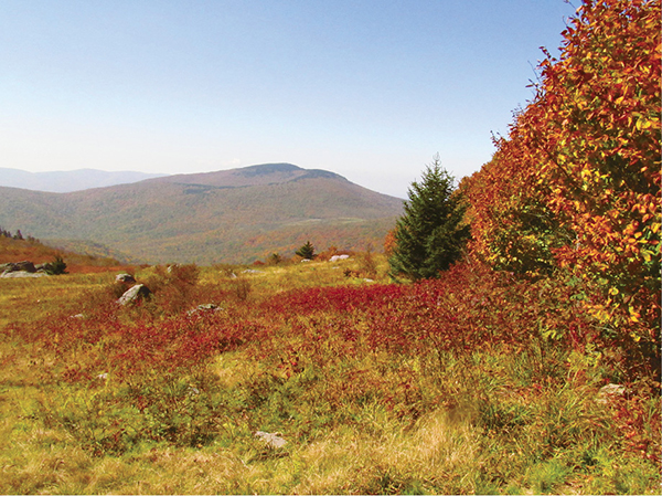
View Whitetop Mountain from the Virginia Highlands.