Yucatan in 1579 Showing the Pre-Spanish Maya Chiefdoms
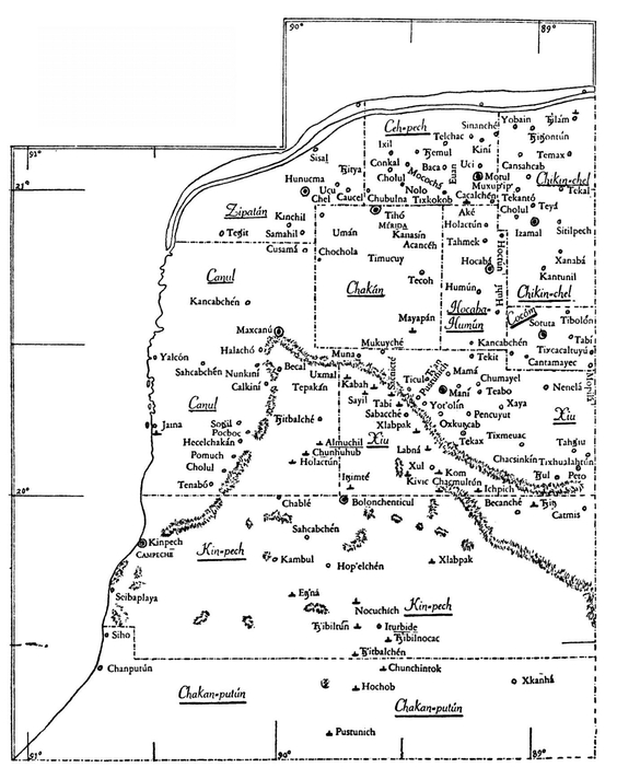
The above map, while actually one of northern Yucatan  as Landa left it,” and to be used particularly with the facts given in the Appendix to this volume, also shows quite clearly some of the different historical changes in occupation and population. The Eighth Century movement in the Sierra district, of which we knew almost nothing, appears in the concentration of ruined sites. The distinction between the East and West, involved in both the early
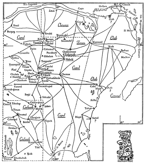
Mexicanization and later Hispanization of the West, with an outpost at Saci-Valladolid, and the Sacred Well, with its Xiu dominance, shows clearly. By 1579 the West had settled to the  Spanish form of government, as ordered on Juan Xiu, while in the East we have only the surviving trails, (taken from the Espinosa map), to suggest the ancient population and the seaward movement to the Honduras trade.’ The map thus shows, just as does the present volume, that we are not at the end but only the beginning of our historical Maya or Itza research.