Seven
YOUNGSTOWN AND RIVERSIDE TO DELRIDGE
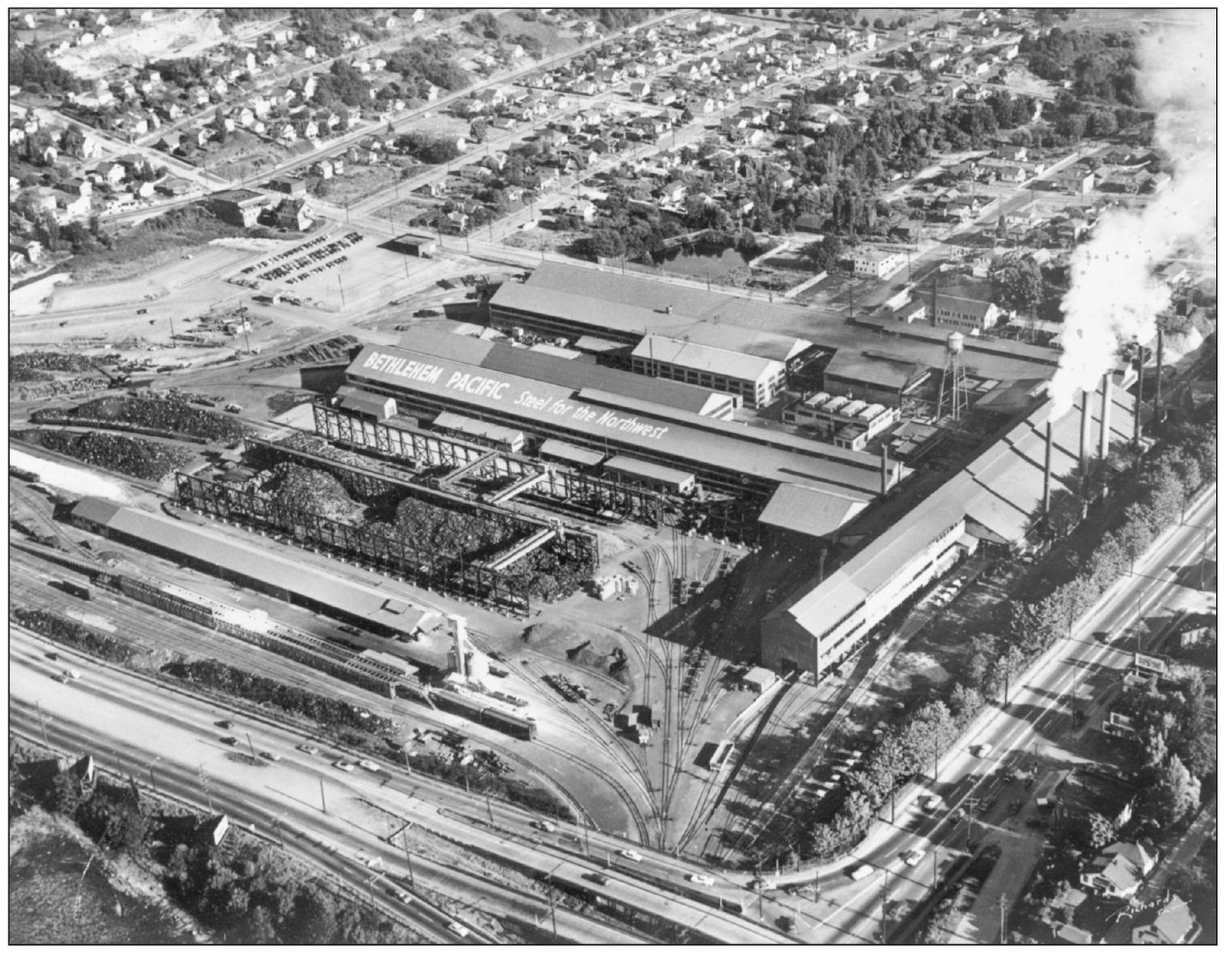
Located just south of SW Spokane Street, the Bethlehem Steel Plant opened in 1905 in the area known as Youngstown. It was originally the Seattle Steel Company and employed 140 workers. Rolling iron bars and rails, it began full steel production when an open-hearth furnace was installed in 1915. The “Youngstown” name was chosen to emulate Youngstown in Ohio, a city famous for its steel production.
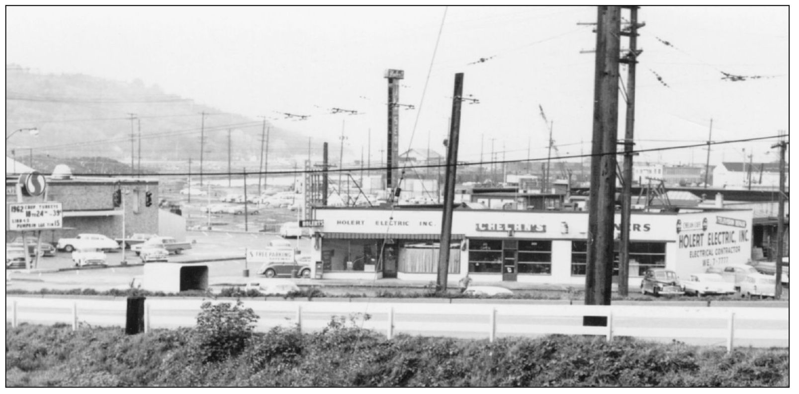
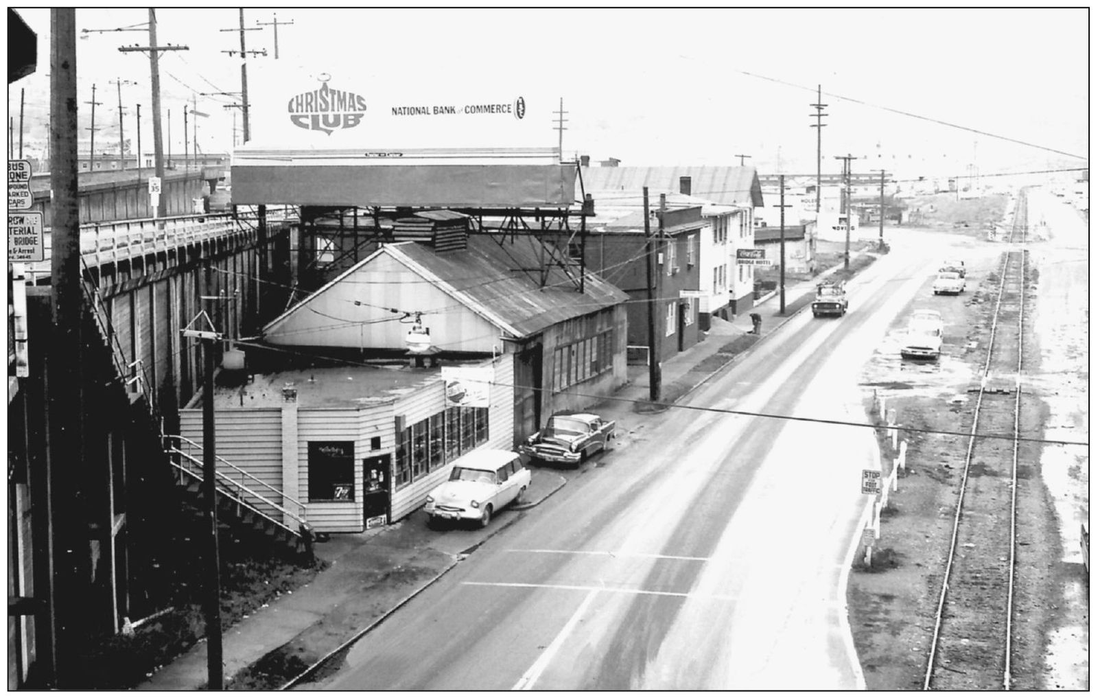
The Chelan Café, looking northwest near SW Spokane Street and Twenty-second Avenue SW around 1962, is the very last of what was once a bustling business district along SW Spokane Street. Most businesses were forced to move when the West Seattle Freeway was built in 1965. Today the Chelan Café has taken over the space shown occupied by Holert Electric.
Tucked up against the east side (left on the photograph) of Pigeon Point is the community of Riverside. Started as a residential community, many of the homes have made way for industry. Riverside had a large Croatian population who fished the nearby waters and was put on the literary map by northwest author Richard Hugo.
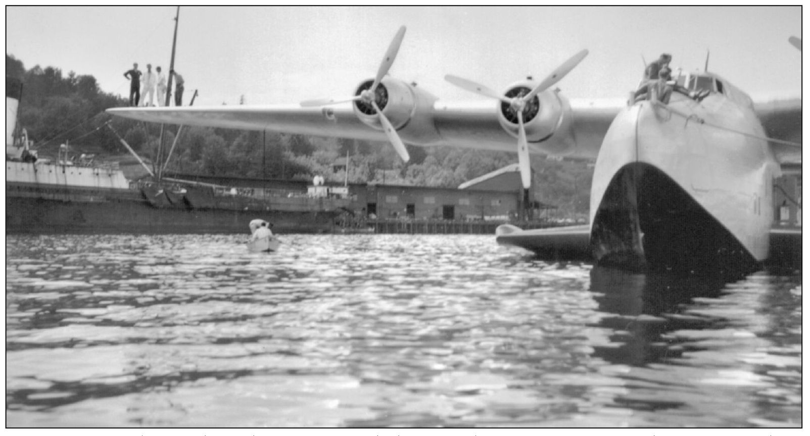
A Boeing 314 clipper flying boat is moored along Harbor Avenue SW in the 1930s. Built at Boeing’s Plant 1, the clippers were barged north on the Duwamish River (barely clearing the Spokane Street Bridge piers) for engine and taxi tests on Elliott Bay.
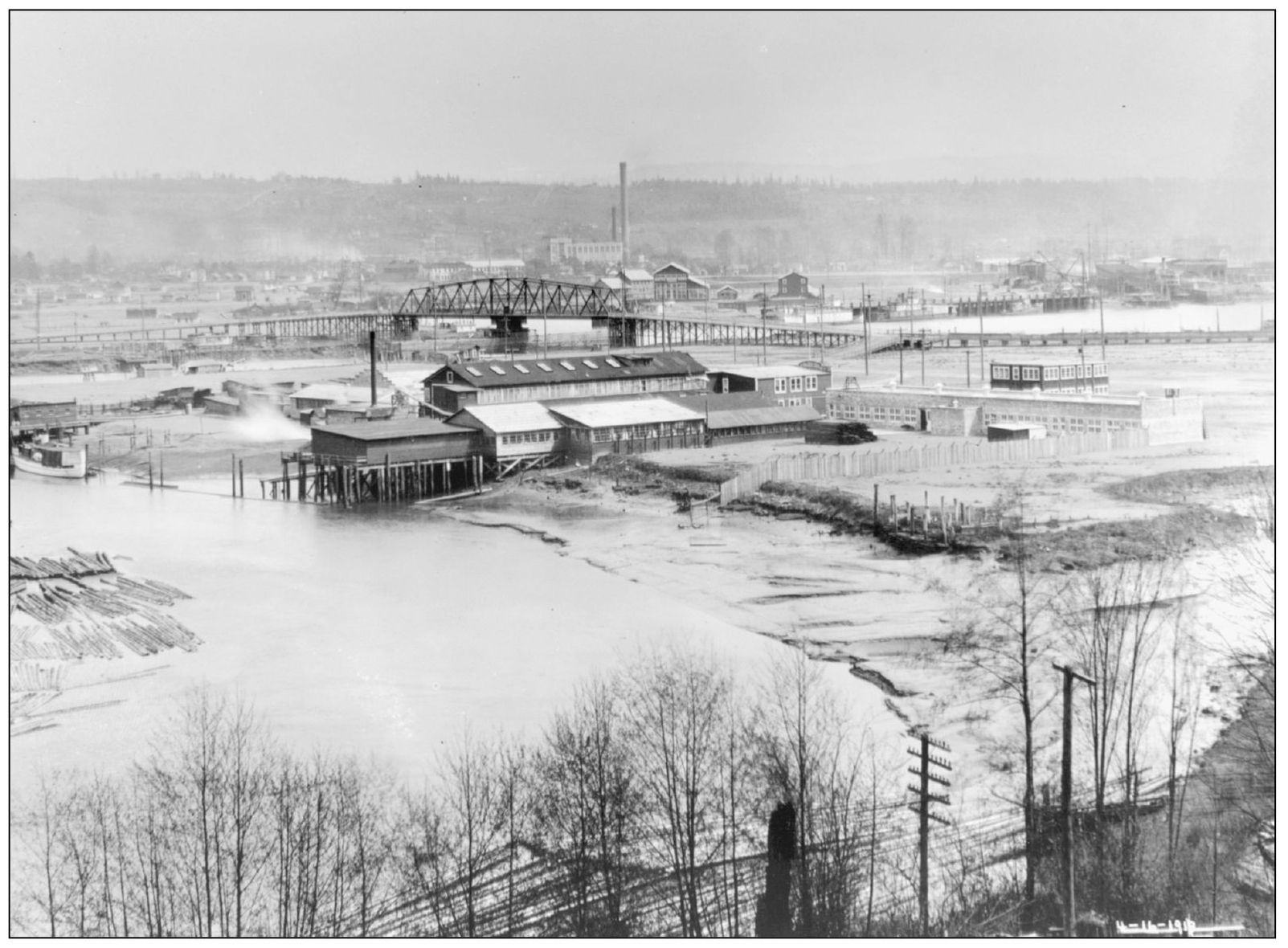
This is Boeing’s first plant on the Duwamish as it appeared on April 10, 1918, looking east from “Boeing Hill.” Originally the plant was called the “Oxbow” after its Duwamish River location. A World War I seaplane contract launched Boeing as a major military aircraft manufacturer. After World War I, and the loss of wartime business, non-aircraft items such as furniture and phonograph cases were manufactured to keep solvent. (Courtesy MOHAI, SHS17645.)

The Riverside Comrades Club was located on West Marginal Way SW. The building dates back to 1917, the time of the Russian Revolution and two years before the Seattle General Strike. This photograph is from the 1930s.
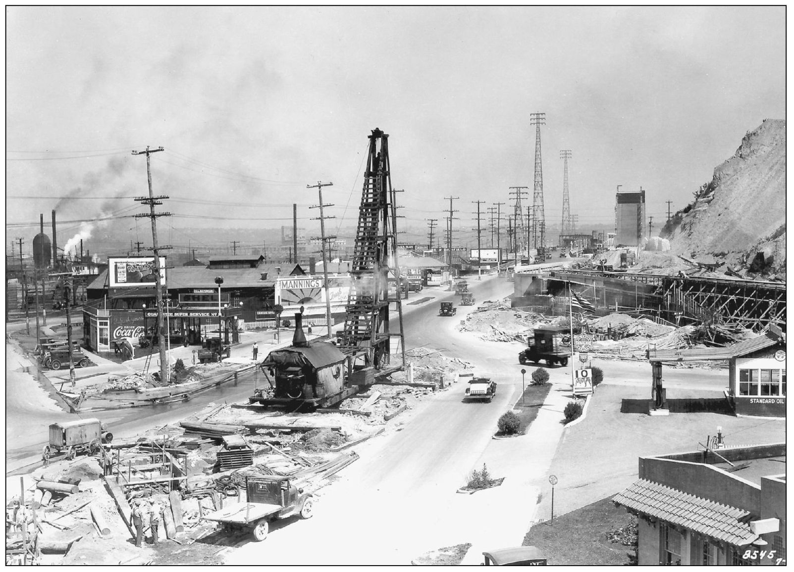
Construction on SW Spokane Street and Twenty-third Avenue SW is shown here in July 1930. On the right is the newly built Spokane Street Bridge No. 2, which was opened to vehicle traffic in September of that same year. The pile driver is constructing footings for a concrete streetcar viaduct that extended to the two Spokane Street bridges.
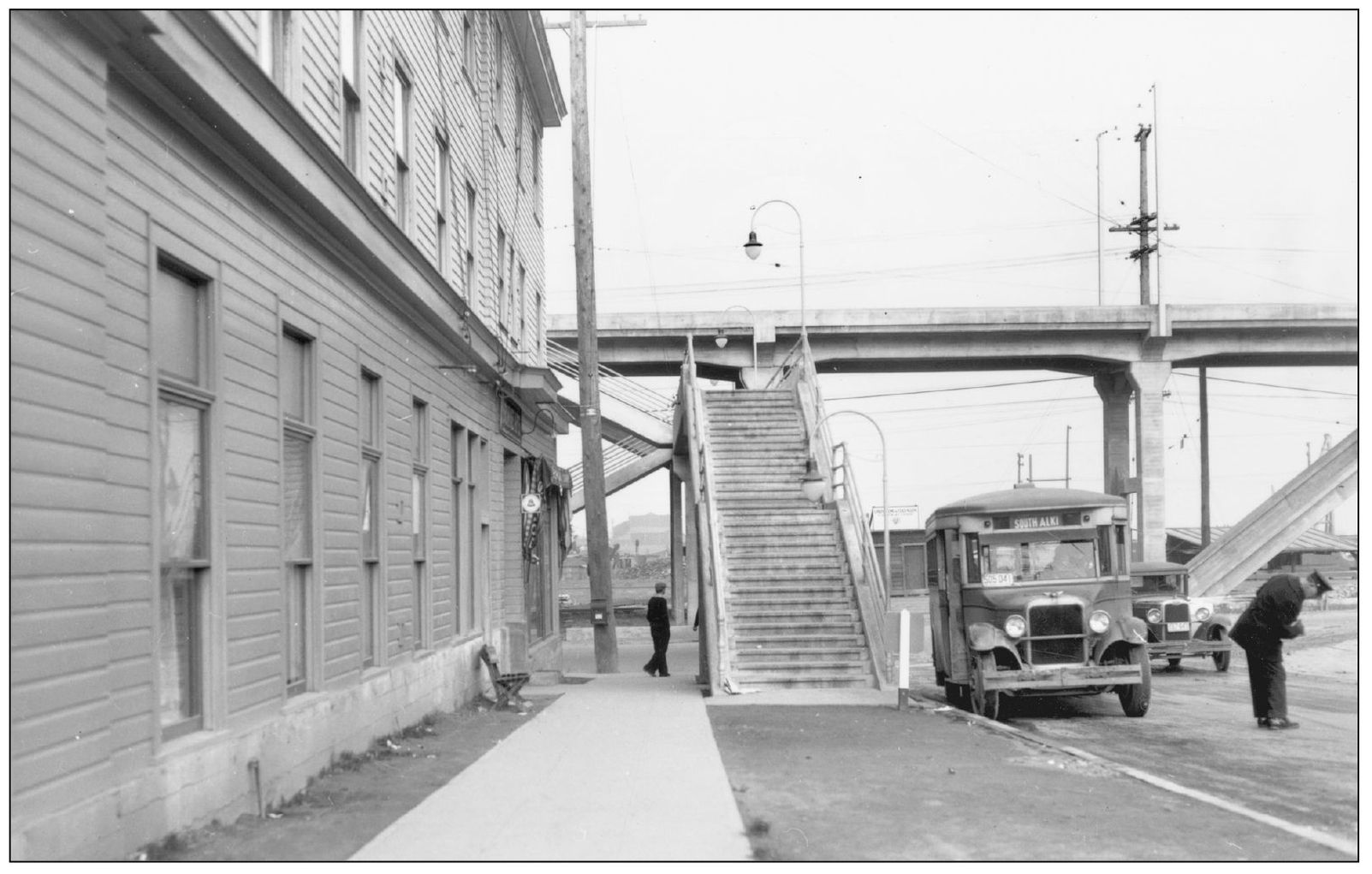
This is a view looking north on Twenty-third Avenue SW toward SW Spokane Street in November 1930. The stairs leading up to a pedestrian overpass connect to the streetcar station on the viaduct. Buses, such as the one in the photograph to South Alki, had begun transporting passengers to areas around Seattle that were not served by the streetcars.
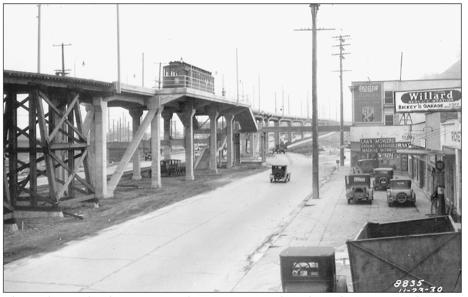
The newly completed Youngstown Place streetcar trestle is shown here in November 1930. Youngstown had a thriving business community up until the mid-1960s. The streetcar trestle avoided the traffic congestion caused by cars or trains on SW Spokane Street. In 1948, eight years after the last streetcar line serving West Seattle was discontinued, the viaduct was demolished.
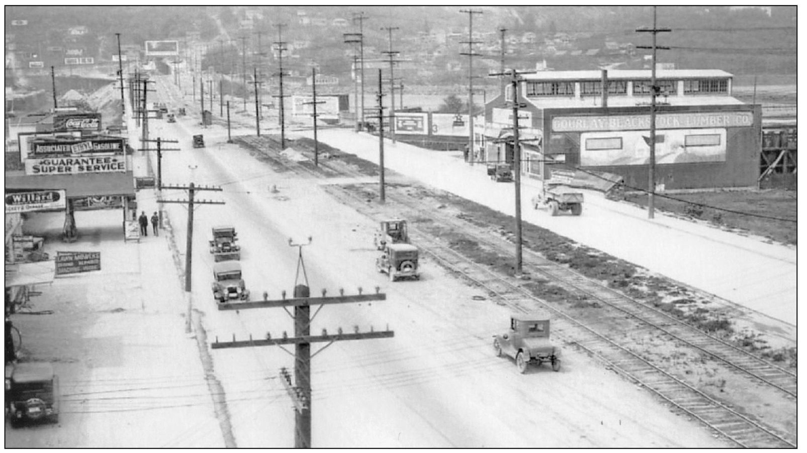
This view is looking west on SW Spokane Street from Twenty-third Avenue SW in Youngstown’s business district in April 1930. The Gourlay-Blackstock Lumber Company, which advertised they had “everything in lumber that you may need here in West Seattle,” is on the right.
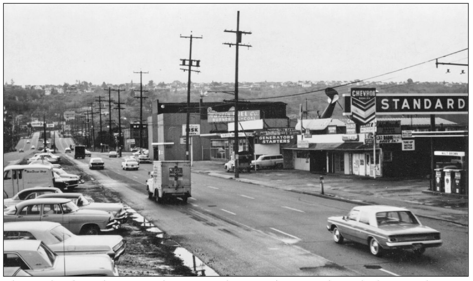
The north side of the SW Spokane Street business district is shown looking northwest in November 1962. Virtually all the businesses, such as Ace Auto Electric, Martin Fuel Company, and the Blackstock Lumber Company, no longer exist. In fact, the only business that remains from that era is the Chelan Café.
Stairs from the Spokane Street Bridge lead down to the National Tavern. In 1962, the Bridge Hotel was just up the street at 3525 SW Iowa Avenue. This business area no longer exists.
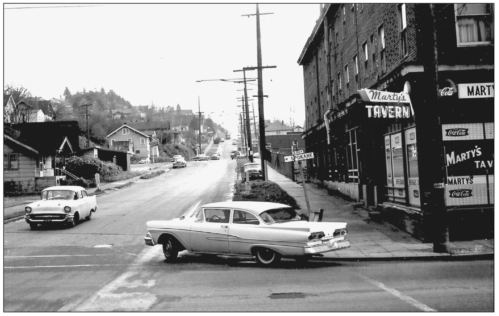
In November 1962, looking south from Twenty-third Avenue SW and SW Spokane Street, many of the businesses along SW Spokane Street, such as Marty’s Tavern, were later torn down to accommodate the new, elevated West Seattle Freeway. The new roadway was completed in 1965.
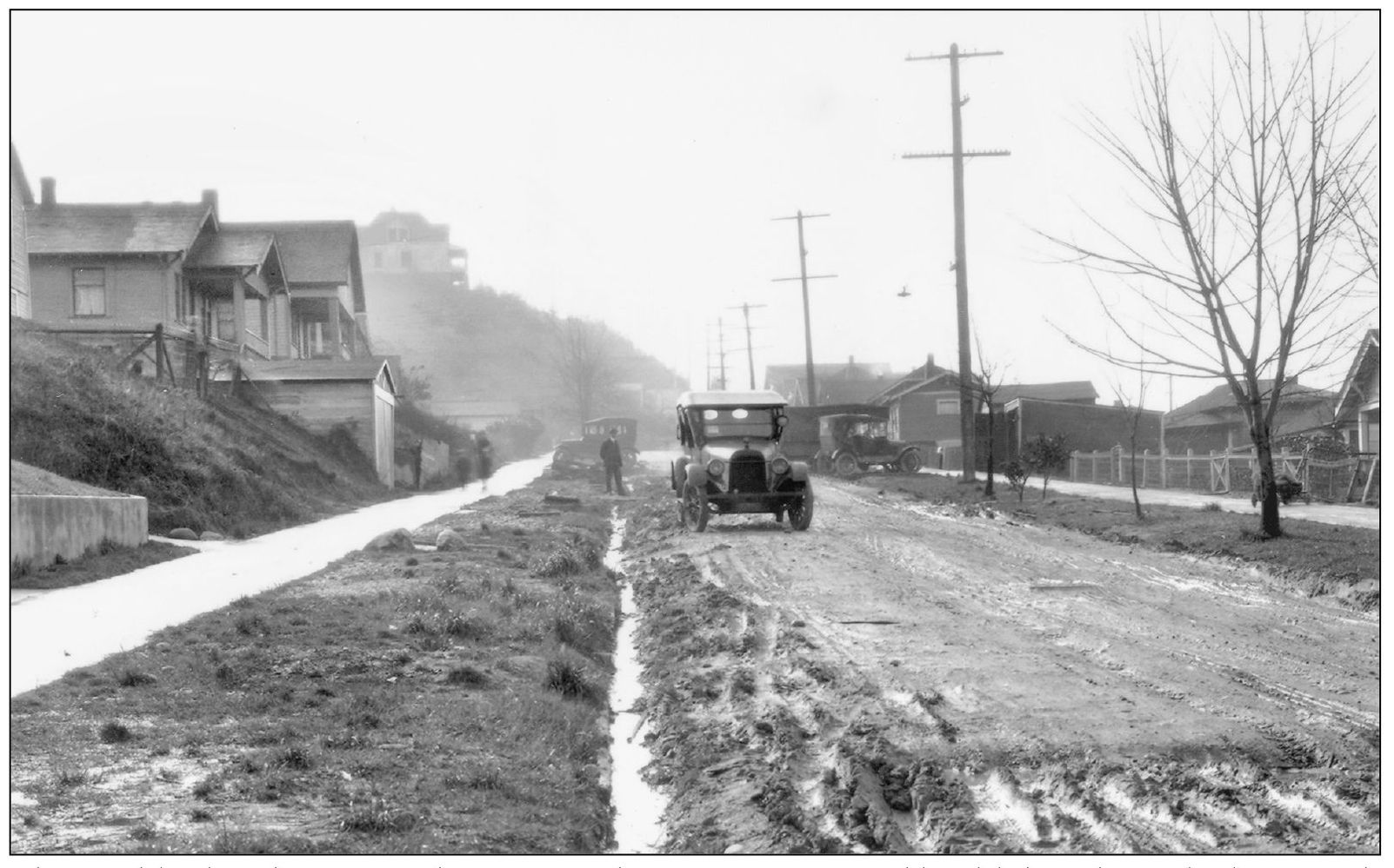
The neighborhood street condition after a heavy rainstorm and landslide is shown looking south on Twenty-second Avenue SW from Charleston Place (now SW Charleston Street) on February 8, 1926. This was a strong incentive for pavement. (Courtesy Seattle Municipal Archives, No. 2588.)

Opened by Saraca and Lydia Clemente in 1936, the Clemente Grocery was a community fixture. In 1938, they expanded their store and inventory as Depression-era waist-tightening eased. Neighborhood parents would send their children to wait for the school bus in front of the store under the watchful eye of Lydia, known affectionately by everyone as “Ma.” The building still stands at 4800 Delridge Way SW.
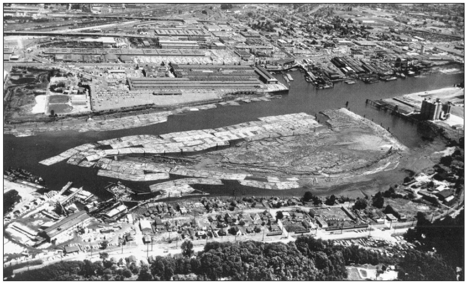
In this 1960s aerial view of south Riverside, with Kellogg Island visible in the background, the community shown along the river is now the site of T-107 Park. In the late 1970s, construction by the Port of Seattle was halted at the site when archaeological discoveries were unearthed. Several indigenous villages existed at the site from about 728 to 1758 AD, making T-107 important to the cultural heritage of the Duwamish people.
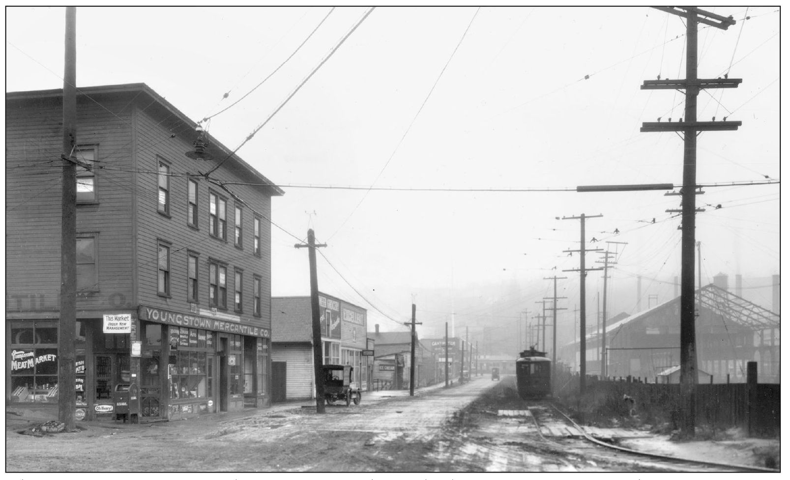
The Youngstown Mercantile Company is shown looking west on SW Andover Street from Twenty-sixth Avenue SW around 1918. It was built in 1911 and began as a general store in the Youngstown neighborhood. The streetcar on the right served the Alaska Junction to the west and ran through what is now the West Seattle Golf Course. The buildings on the right are part of the Pacific Coast Steel Mill. (Courtesy MOHAI.)
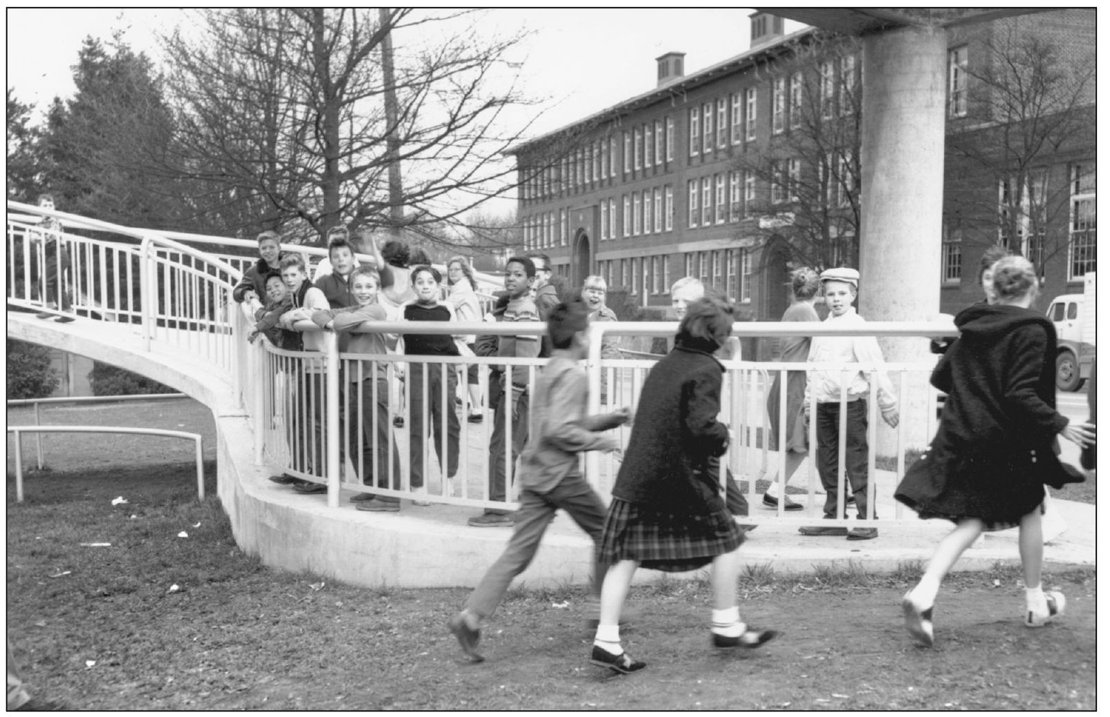
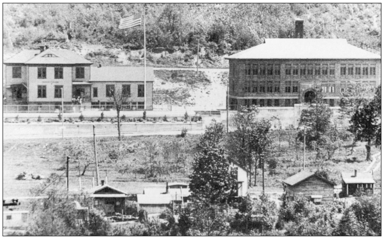
The Frank B. Cooper School, on Delridge Way SW, is shown in the photograph above in 1960. The first school in the Youngstown community opened in 1905 in a one-room building provided by the Seattle Steel Company and on its property because the majority of the children attending were from its workers’ families. The photograph below shows the Youngstown School (left), which was built by the Seattle School District; it opened in 1907. The third Youngstown School, the large brick structure on the right, opened in 1917. In 1939, the school was renamed in honor of Frank B. Cooper, a past superintendent of Seattle schools. The school closed in 1989, and in 1999, the building reopened as the Youngstown Cultural Arts Center.