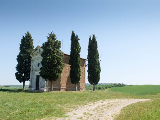
The iconic chapel at Vitaleta
The iconic chapel at Vitaleta
The Crete is a hilly crescent immediately south of Siena. Simply put, the landscape here is vast, empty and windswept – and starkly attractive. Colours are muted due to the pale grey clay terrain, sediment from an ancient Pliocene sea which covered the area 2–4 million years ago. High salt content combined with poor nutrient levels allows few plants to grow and anchor the soil, so dramatically eroded calanchi ridges are the result of ongoing weathering by rain and wind. Still, sheep manage to eke a living from the meagre grass that adds a hint of green in springtime. Under the care of Sardinian shepherds, the hardy flocks have been a good bet and are responsible for the renowned tangy pecorino cheese.
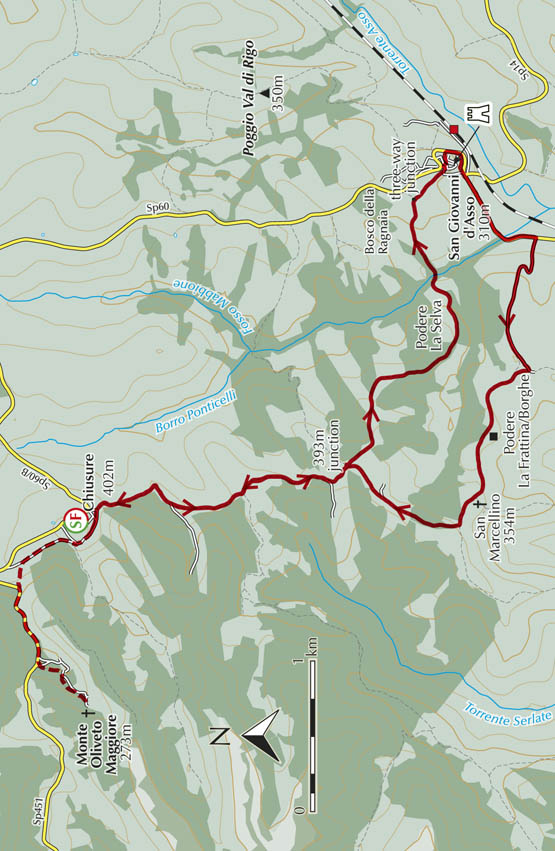
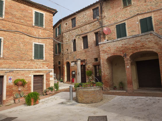
The tiny red-brick farming village of Chiusure, boasting 100 inhabitants, survives on a high ridge. Its existence is linked to the neighbouring 14th-century monastery Monte Oliveto Maggiore, whose position was adeptly described by Pope Pius II thus: ‘Ruinous crags that fall away sharply and very deep abysses, the sight of which cause you to shudder and instil horror, obstruct access from any direction but the narrow tongue of earth.’ Modern-day visitors venture safely along a narrow access road to purchase the monks’ herb liqueur and admire the Life of St Benedict fresco cycle by Luca Signorelli (www.monteolivetomaggiore.it). In the valley below lies San Giovanni d’Asso, dominated by a curious 13th-century castle. Walk 26 links these three special places, well off the main tourist trail.
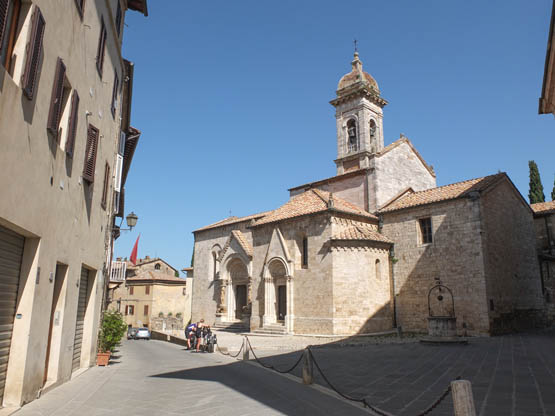
Piazza Chigi in San Quirico d’Orcia is lined with superb buildings (Walk 28)
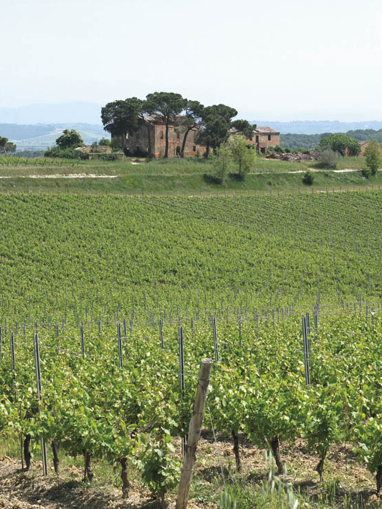
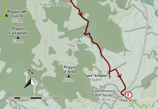
On more fertile land along the western flank of the Val d’Asso, the famous walled town of Montalcino can be seen from miles around on its lofty scenic ridge, overseeing the gentle hills planted with grapes dedicated to the production of Brunello di Montalcino. This renowned red wine, together with the younger Rosso di Montalcino, accounts for 1400 cultivated hectares of what, incidentally, also happens to be beautiful walking country. The captivating township is a pure medieval delight, with six gates leading into the centre, dominated by an imposing 14th-century fortress, the Rocca. Walk 27 leaves the town, heading downhill to the beautiful Romanesque abbey church of Sant’Antimo (www.antimo.it).
A short bus trip east is the beautiful UNESCO World Heritage landscape of Val d’Orcia. This is instantly recognisable from myriad postcards and calendars for its trademark cypress trees, like exclamation marks, punctuating rolling waves of ridges between isolated farmhouses. Extravagant transformations are wrought by the seasons, making for dramatic contrasts between fields that are dull and bare in winter and painted fresh green by the spring then flooded by rippling golden summer seas of wheat. A constant presence is the ancient volcano Monte Amiata, looming in the south. Utterly charming small towns here make good bases. One of the most central is laid-back San Quirico d’Orcia, a walled town boasting a fortress, historical garden and exquisite Romanesque church. Pienza is a tad more ‘serious’, with palaces housing an impressive collection of art works. Its architectural heritage dates back to the 15th century, when Pope Pius II had it redesigned, originally as a model town. Walk 28 links the two.
‘Timeless’ is a word easily applied to the historical spa Bagno Vignoni in lower Val d’Orcia. It has been renowned since Roman times for its hot curative waters – a total of 36 springs gush from a depth of 100m at a scorching 50°C. The village centrepiece is a remarkable open-air pool-cum-piazza, which owes its design to the Medici family who erected its elegant Renaissance porticoes. In cool weather, steamy vapours rise in clouds from the surface of the water, an eerie sight. While bathing is not permitted these days, the neighbouring spa hotels offer other choices. Walk 29 from San Quirico concludes at Bagno Vignoni, while Walk 30 loops around the village.
East beyond Pienza in perfect Tuscan countryside atop a lofty tufaceous outcrop stands beautiful Montepulciano, with paved streets winding past elegant Renaissance palazzos, piazzas and churches. The place is of course synonymous with top-class red wine. Needless to say, wine tasting is also the name of the game here – but only after you’ve completed Walk 31. Visitors in August are warned to watch out for 80kg wine barrels rolling down the precipitous streets in a madcap race, the Bravio.
The vineyards outside Montepulciano stretch as far as the eye can see (Walk 31)
Radicofani is never swamped with visitors. It perches on a high basalt spur, isolated in the southern part of Val d’Orcia and visible from great distances because of its landmark 12th-century Rocca, or fortezza, which is surprisingly reminiscent of a rocket – or a lighthouse. This belvedere par excellence is the highlight of Walk 32.
The town once played a strategic role on the Via Francigena pilgrim route to Rome, and was heatedly contested by counts, monasteries and republics from Siena to Orvieto and Monte Amiata to the Papal State. The history is further enlivened by the Robin Hood-like rebel-robber Ghino da Tacco, who made Radicofani his personal kingdom after being exiled from Siena. He has been immortalised in literature by both Boccaccio (in Decameron) and Dante (in Purgatorio).
Siena could be used as a base as it has an excellent bus network, although tiny Chiusure (buses from Asciano and the railway), San Giovanni d’Asso and larger Montalcino (bus from the railway at Torrenieri) are on the cards too.
San Quirico d’Orcia makes an excellent base, with good bus links to Siena and plenty of accommodation, while smaller Bagno Vignoni has high-range accommodation and occasional buses. Pienza is another good choice. It has bus links to the railway at Chiusi Scalo, and is not far from Montepulciano where there are many places to stay.
| Start/Finish | Chiusure |
| Distance | 12km |
| Ascent/Descent | 370m |
| Grade | 1–2 |
| Walking time | 3hr 20min + 1hr extension |
| Map | Kompass n.2440 Toscana 1:50,000 map 4 |
| Access | Occasional Tiemme buses from the railway at Asciano and Buonconvento come up to Chiusure. San Giovanni d’Asso, with services to Torrenieri, is an alternative start point. |
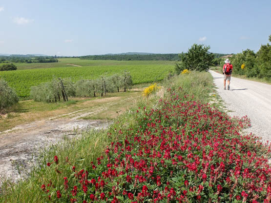
This is a great day out in the windswept Sienese Crete, with vast horizons and flocks of sheep whose tinkling bells betray their presence. The beauty of the start point, Chiusure, is its elevated isolated position; however, the red-brick village probably counts its blessings as a matter of habit when another day passes without it sliding into the awesome ravines at its feet. After dropping to the Asso valley to visit the castle-cum-village of San Giovanni, you loop back up to Chiusure. Don’t miss the extension to the atmospheric monastery of Monte Oliveto Maggiore.
Rather lengthy but very rewarding, this walk is inadvisable in midsummer as there is no shade and it is usually too hot. Both Chiusure and San Giovanni have eateries and shops.
Cosy Chiusure constructed with red bricks
From the bus stop at Chiusure (402m), walk S to the village, keeping L on Via Porta Senese into the cosy conglomerate of red-brick houses. Past the main square with café/restaurant Paradiso, continue along the road to where it forks. Go straight ahead on unsurfaced Strada del Fornacino, which keeps those leg muscles working with its unremitting ups and downs. Several properties are passed and turn-offs ignored.
After a stretch between calanchi ridges and gullies, the climb resumes, but don’t miss the fork L (400m) ‘Strada del Fornacino n. civici 27–29’. Over a rise, the lane (red-and-white n.5 waymarks) heads mostly S through rolling fields lined with masses of perfumed broom on an especially panoramic section. Montalcino can be admired to the south-west, then San Giovanni d’Asso to the south-east.
As the way bears R (SW), leave it at a low pole marker for n.515 (393m junction). A rougher track now plunges SE past a fenced enclosure before an olive grove and farm for a good lane in shady oak woods bright with cyclamens. A wide curve leads past Podere La Selva then down past an ancient pine. Across a stream is a jealously guarded poplar plantation and reserve for the renowned white truffle.
At a three-way junction with twin holm oaks, turn R to reach the foot of the towering red-brick walls of the village. At houses and a lone tree at the foot of the castle, turn L up Via Roma to a park and bus stop in Piazza Gramsci at San Giovanni d’Asso (310m, 1hr 20min).
Fork sharp R to the Museo del Tartufo (truffle museum). Continue up steps inside the curious rambling castle, now a hotel, and out the other side to a pretty square with a restaurant. Turn R to a belvedere terrace and R again down steps all the way to the roadside. Here it’s L then immediately R (SW) with care along the main road past a petrol station.
Some 2km along, leave the tarmac for the lane off R signed for Ferrano. This climbs gently W past properties. After a car park, it bears R (NW) for an open scenic stretch up to the twin houses of Podere La Frattina and Podere Borghe. The next useful landmark is the tiny off-road church of San Marcellino (354m) before a branch R – signed for Agriturismo Il Poderino. Stick with this through trees before emerging on lovely open fields looking over to Chiusure and Monte Oliveto Maggiore. After a house with gate columns made of bricks, it’s not far to the 393m junction passed earlier (1hr 15min).
Retrace your steps to Chiusure (45min).
From Chiusure, take the road in descent N. Soon after the cemetery, a clear signed path cuts the corner L. It rejoins the road below, where you keep L (W) along a high narrow ridge with dramatic views over deeply eroded gullies. Just after the car parks, take the lane below and parallel to the main monastery entrance road. This leads through woodland to where Monte Oliveto Maggiore (273m) is set among pine and olive trees (30min).
| Start | Rocca, Montalcino |
| Finish | Castelnuovo dell’Abate |
| Distance | 12km |
| Ascent | 250m |
| Descent | 380m |
| Grade | 2 |
| Walking time | 3hr |
| Map | Kompass n.2440 Toscana 1:50,000 map 4 |
| Access | Tiemme buses connect Montalcino with the railway at Torrenieri, and there’s a link with Castelnuovo dell’Abate, for the return. |
From marvellous Montalcino, the walk crosses woodland and beautiful open countryside with stunning 360-degree views on the way to the enchanting abbey of Sant’Antimo, close to the quiet medieval village of Castelnuovo dell’Abate.
En route, waymarking is a bit patchy so follow the directions carefully. Wide tracks are followed for the most part, with only the odd steep stretch on roughish terrain. The walking time given is one-way, with the return to Montalcino by bus. Check the timetable before setting out – the Montalcino Tourist Office is in the know.
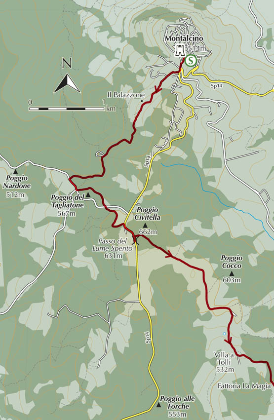
From the Rocca end of Montalcino (514m), go S on the road for Grosseto but take the first R, Via del Poggiolo (signpost for n.2). Downhill, the asphalt ends after the cemetery, and you keep straight ahead following signs for Il Palazzone wine estate. As this is reached, keep to the path L (SW) along a fence above the vineyard and down into damp moss-ridden woods. After a stream, the trees thin and lovely views are enjoyed. Keep L uphill at a fork and follow a wire fence to farm buildings where a gravelled lane leads SE past vineyards and out to a T-junction on the road.
Ignore the turn-off for Tavernelle and go L to a nearby intersection, where you leave the tarmac for a parallel rough lane L climbing through peaceful woods. Where it reaches the road again, cross straight over through oak and broom shrubs. At the entrance gate to a property, red-and-white markers send you L to rejoin the road for the final metres to Passo del Lume Spento (631m, 1hr 20min), with Le Ragnaie estate and a bus stop (634m).
Now SE, you follow signs for Villa a Tolli on a wide level way between fields alive with skylarks and through the woods that clothe modest Poggio Civitella. A gentle winding descent past Agriturismo Il Cocco and vineyards brings you to a prominent cross and fork at the historic hamlet of Villa a Tolli (532m, 30min).
Branch L into woodland bright with rock roses as far as the entrance for Fattoria La Magia. Here, signs point you L down a rough track between fragrant broom, olive groves and vineyards. The village of Castelnuovo dell’Abate soon comes into view on its isolated knoll, as does the perfect grey stone abbey of Sant’Antimo framed by trees. Towards the bottom of the hill, go L at two consecutive junctions and onto a lane following a willow-shaded stream. This concludes at the abbey of Sant’Antimo (318m, 50min), set among olive groves and cypresses. Time seems to stand still here.
Sant’Antimo was purportedly founded as a Benedictine monastery by the great Charlemagne, in gratitude for deliverance from an epidemic. Exquisite alabaster capitals and a curious bestiary of griffins, eagles and dragons can be admired to the accompaniment of Gregorian chants, courtesy of the resident monks.
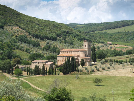
The enchanting abbey of Sant’Antimo
After an attentive visit, take the minor road SE up to the Montalcino road and bus stop, opposite friendly restaurant Osteria Basso Mondo at Castelnuovo dell’Abate (383m, 20min), the perfect place for refreshments. Time permitting, walk up into the old medieval centre, worth a visit in its own right, before riding the bus back to Montalcino.
| Start | San Quirico d’Orcia |
| Finish | Pienza |
| Distance | 7.7km |
| Ascent | 280m |
| Descent | 200m |
| Grade | 1–2 |
| Walking time | 2hr |
| Map | Kompass n.2440 Toscana 1:50,000 map 4 |
| Access | Tiemme buses between Montepulciano and Buonconvento serve the two towns, with ongoing links to Siena. |
A beautiful half-day’s ramble linking two modest yet perfect Tuscan towns that are quite different in character. All the Val d’Orcia trademarks accompany this walk, from wheat fields to olive groves and cypresses. The walking is straightforward on well-signed lanes and paths, although the terrain could be a bit slippery after rain.
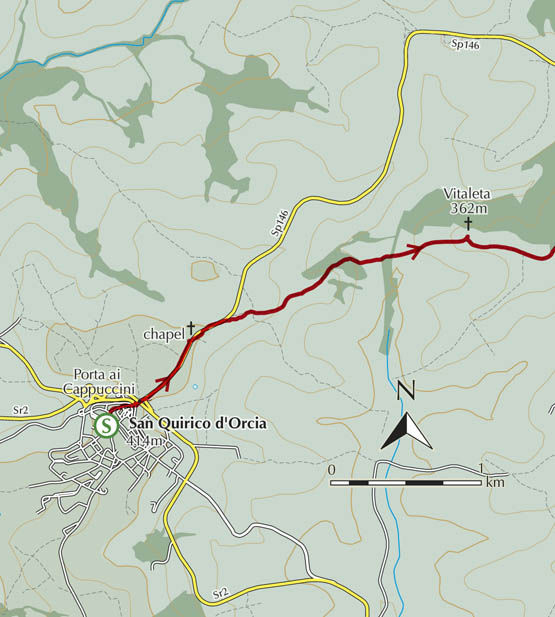
At San Quirico d’Orcia (414m), begin in central Piazza Chigi and walk E on characteristically narrow Via Poliziano past the Giardino Nilde lotti to exit the town walls via fortified Porta ai Cappuccini. At the main road, route signs appear; keeping an eye out for traffic, walk straight ahead past Hotel Casanova. You’re soon pointed L for a ramp then a stretch of old road behind the guard rail to the chapel of Madonna del Rosario, flanked by a hedge of rosemary. Soon you branch R on an unmade road NE with views over open countryside south to Monte Amiata as well as to Pienza ahead.
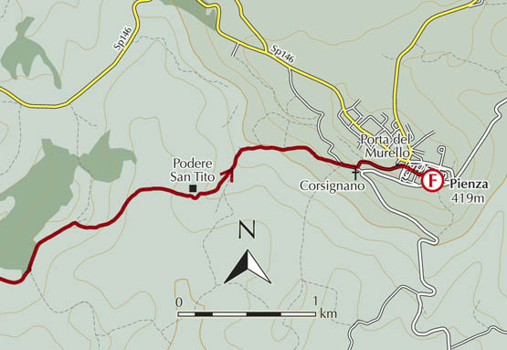
At the entrance to Agriturismo La Buca, keep L down a corridor of broom and across a stream. A lane gains Vitaleta (362m, 45min) and its iconic chapel. Continue on a level to a T-junction and keep L (NE) on to a ruined house where you’re pointed down a clay track with masses of broom. Another stream is crossed before derelict Podere San Tito (350m), with its own well and oven. Soon a good lane is joined, passing a string of farms to the beautiful Romanesque church of Corsignano, complete with a magnificent horse chestnut tree and benches.
Soon turn L up narrow Via Fonti, leading to a park and Piazza Dante Alighieri. This is where you enter Pienza proper via Porta del Murello (491m, 1hr 15min). For the bus stop, cross the square and turn L on Via della Madonnina.
Don’t rush away, but allow time for a wander around the wondrous town of Pienza. From the central square, Piazza Pio II, and the Duomo, detour to the right to a magnificent belvedere walkway.
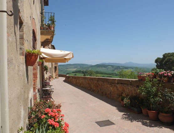
Pienza has a lovely belvedere terrace (Walk 28)
| Start | San Quirico d’Orcia |
| Finish | Bagno Vignoni |
| Distance | 6.5km |
| Ascent | 150m |
| Descent | 250m |
| Grade | 1–2 |
| Walking time | 1hr 45min |
| Map | Kompass n.2440 Toscana 1:50,000 map 4 |
| Access | Tiemme buses serve the start and finish. Check return times before setting out. |
Two charming places are linked by this easy, fairly well-marked route. Fit walkers with time to spare can combine it with the Walk 30 circuit above Bagno Vignoni. At the walk’s end, don’t miss the Parco dei Mulini and the path down to the river’s edge from a viewing platform. Otherwise spend time luxuriating at a spa, a relaxing way to conclude this lovely route.
From San Quirico d’Orcia (414m) and central Piazza Chigi, take Via Dante Alighieri leading W out of the town walls. Nearby is a batch of path signposts close to a bust of Tazio Nuvolari, a famous Italian racing driver. Head down the steps under the arches of the Ponti della Mille Miglia and take the strada bianca country lane W for Riguardo. Not far along, you fork L (sign for Casa La Noce) and pass pretty Podere Sant’Orsola, continuing uphill S to reach a crest where there are yellow poles for the metanodotto (gas pipeline).
Turn L then immediately R along a row of cypresses down towards a trout pond. Just before it, take the rough lane L uphill through olive groves. At a junction at the top, go L (SE) past a farm. Keep on and around the square house Podere Greppo Magni and out to an unsurfaced road where waymarks become more frequent.
Now it’s L and immediately R (E) past a farm and olives onto a clear path along the edge of fields. After a stream crossing in cool oak and juniper woods, you climb to Podere Schivanoia, forking R onto a lane.
At a power pole, the signed route ducks below the hamlet of Vignoni Alto, heading SE with views to Pienza. The clear if narrow path continues in gradual descent past properties such as Santa Maria where olives and grapes are lovingly cultivated. Fields alternate with woodland. The terrain becomes drier, with orchids and aromatic curry plant, on its way down to the entrance of the Adler Resort. Go R and straight through a park to the historic open-air baths of Bagno Vignoni (309m, 1hr 45min). The bus stop for the return to San Quirico is near the park.
An added attraction at Bagno Vignoni is the Parco dei Mulini (park of the mills), where hot water from the baths gushes along a channel down to the River Orcia. As of the 1400s, the flow operated four cereal mills set in caves and overhangs on the cliff side. However, little by little they were submerged by limestone precipitate, like thick icing dribbling down in slow motion, a fascinating sight.
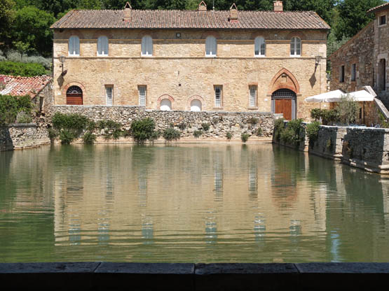
The marvellous historic pool at Bagno Vignoni
| Start/Finish | Bagno Vignoni |
| Distance | 9.4km |
| Ascent/Descent | 325m |
| Grade | 2 |
| Walking time | 2hr 45min |
| Map | Kompass n.2440 Toscana 1:50,000 map 4 |
| Access | Tiemme buses from San Quirico and Arcidosso serve Bagno Vignoni. |
Commencing and concluding at the spa resort of Bagno Vignoni, this rewarding well-marked circuit briefly visits the River Orcia before climbing to an immensely panoramic ridge. A further highlight is the minuscule hamlet of Vignoni Alto. The walk traverses woodland of Mediterranean species and broom-covered hillsides which fill the summer air with scent.
Go equipped with sustenance and liquid refreshment as there’s nothing en route. After the walk, find time to explore the fascinating Parco dei Mulini (described in Walk 29) on the river’s edge, or treat yourself to a soak in hot water at a spa.
This walk can be combined with Walk 29 by branching off to Podere Schivanoia just before Vignoni Alto.
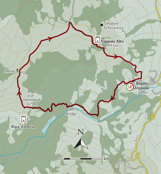
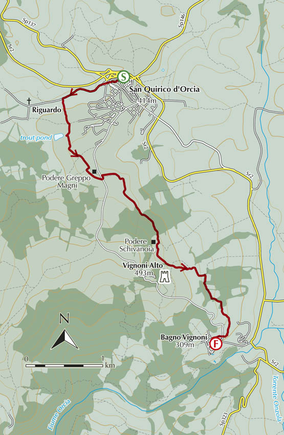
From the bus stop at Bagno Vignoni (309m), walk between Albergo Le Terme and the park to signposts for the Ripa d’Orcia circuit, pointing L along the end of the historic baths. The well-marked route soon forks uphill then across a field and through shady woods, bearing SW.
A wide lane leads down over rock slabs and fields to the River Orcia, where herons fish off rocks and an old suspension bridge hangs forlorn, its planks in tatters. Just before the bridge, you go R on a rough wide track, an old medieval way, winding and climbing its way W through shady woods. You emerge at a war memorial encircled by cypresses (429m, 1hr 15min).
Turn R (N) on the wide unsurfaced road, climbing gradually along the scenic open ridge past farms and a shrine, curving NE with unbeatable views of the rolling Crete hills, not to mention Montalcino on its ample hilltop, and Pienza, then conical Monte Amiata due south.
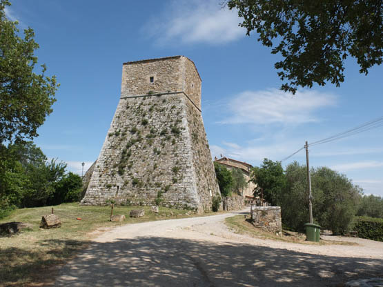
The fortified hamlet of Vignoni Alto in a world of its own
At a main junction, the road forks: take the R (SE) branch the short distance to the delightful tranquil hamlet of Vignoni Alto (493m, 1hr). A massive square-based tower dominates the cluster of restored houses, and vast panoramas are enjoyed.
Continue the leisurely descent on the unsurfaced road SE past a cemetery and properties, including scenic Agriturismo Le Querciole, all the way down to Bagno Vignoni (30min).
| Start/Finish | Bus station (Autostazione), Montepulciano |
| Distance | 17.2km |
| Ascent/Descent | 500m |
| Grade | 2 |
| Walking time | 4hr |
| Map | Kompass n.2440 Toscana 1:50,000 map 4 |
| Access | Tiemme buses link Montepulciano with Chiusi Scalo and the railway, and with Pienza and the Val d’Orcia. The bus station, where the walk begins, is below the north-eastern edge of town in Piazza Pietro Nenni. |
| Note | After the Salcheto wine estate on the return leg, a brief unclear section is encountered. This also entails a stream crossing that could be tricky after rain. If in doubt, bail out on the exit route given below to catch a bus from Terme di Montepulciano back to town – check the timetable beforehand. This reduces walking time to 2hr 40min. |
This walk leaves the commandingly positioned hill town of Montepulciano to venture out into the surrounding hilly countryside where its renowned wine is grown. In fact, vineyards are the flavour of the day.
Part of the Sentiero del Nobile is followed, but waymarking is not frequent. Another scarcity is shade, making it unsuitable in midsummer heat. Go equipped with water and food as there are no facilities en route. You walk on a mix of minor roads and strade bianche (unsurfaced country roads).
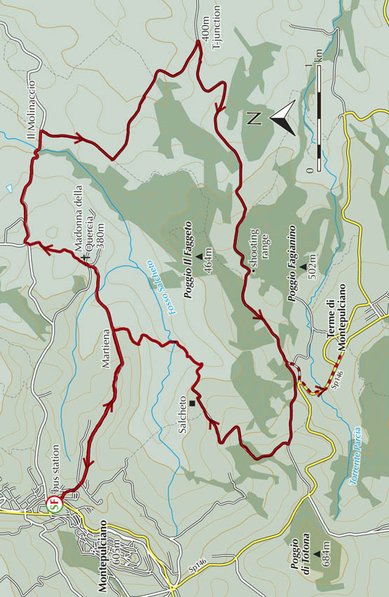
From the bus station (510m) at Montepulciano, take Via di Martiena downhill SE past tennis courts, then straight ahead at crossroads. A quiet narrow road leads past houses and olive groves along a marvellously panoramic ridge looking eastwards to Lago di Trasimeno. After a tiny church, the unsurfaced way veers L (ENE) between the vineyards of spread-out Martiena (20min). Further along, the lane dips around a shady corner and bears E up to a huge Mediterranean oak tree. Follow arrows to the church of Madonna della Quercia (Our Lady of the Oak Tree, 380m), constructed by Jesuits in the 1700s.
The walk follows unsurfaced country roads through vineyards
Waymarks lead around the building onto a track past grapevines, climbing to tarmac. Soon you join the minor road Via dell’Antica Chiusina, heading E through wheat fields. Not far past an old mill, now Il Molinaccio property, you leave the tarmac for a strada bianca R, signed for Argiano. This is a lovely gentle climb S with vineyards as far as the eye can see. Follow the well-signed way, veering SE and on to a 400m T-junction (1hr 10min).
Here, branch R (W) past ruined buildings for a pleasant flat unsurfaced road with occasional bits of tarmac. Apart from a patch of woodland, it’s grapes, grapes and more inspiring grapes. You pass a house and signs for Fattoria del Cerro, then ignore a fork R for Fattoria del Faggio before reaching a shooting range with welcome benches. Modest cliffs accompany descent SW in view of a residential area on the main road. At a junction (1hr), it is possible to bail out as follows.
Turn up to the main road then go L carefully as far as the spa hotels of Terme di Montepulciano and a bus stop (10min).
To complete the walk and return to Montepulciano on foot, branch R at the junction, following signs for walking route n.3 and Agriturismo Il Gonzeto. It’s steadily uphill in the company of yellow poles marking a metanodotto (gas pipeline) and past the access lane to Il Gonzeto near a conifer knoll. Up at a Y-junction, keep R (signed for Salcheto) on a beautifully panoramic stretch NNE with Montepulciano straight ahead. Further on is a fork at the Del Giorgio estate. From here, a direct route back to town is unfortunately blocked by private property. Keep R (NE) and on to the Salcheto vineyards (30min) and the car park.
Below the buildings, a lane veers R then plunges NE to a rusty shed. As it begins to climb, leave it for a faint lane R that soon fords a stream (Fosso Salcheto). Up at a power pole and vineyard, bear R on a rutted lane. This climbs steadily N through shady woods to reach the avenue of cypress and pines leading through to Martiena (30min).
Turn L and retrace the outward route back to Montepulciano (30min).
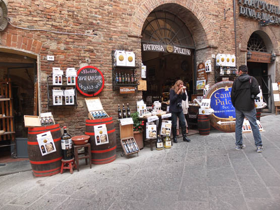
Wine boutiques line the streets of Montepulciano
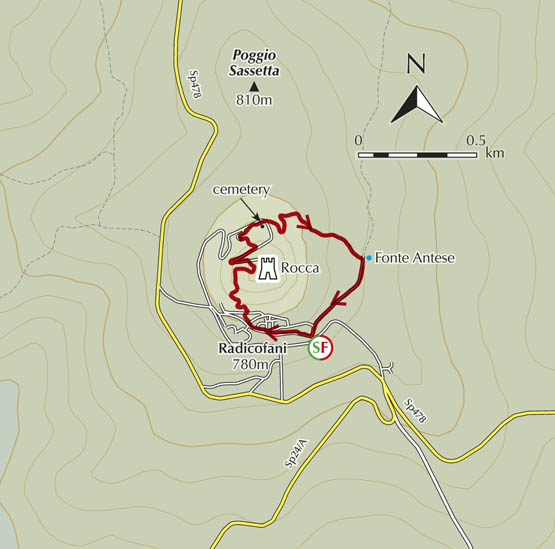
| Start/Finish | Tourist Office, Radicofani |
| Distance | 2.6km |
| Ascent/Descent | 150m |
| Grade | 1–2 |
| Walking time | 1hr |
| Map | Kompass n.2440 Toscana 1:50,000 map 4 |
| Access | Tiemme buses come up here from Sarteano. The walk start is near the south-eastern entrance to town. |
This short walk around the laid-back town of Radicofani is definitely worth the trip up. Its isolated Rocca fortress, arguably the best lookout in the whole of Tuscany, has amazing views over the Val d’Orcia. The lovely town itself, built in dark volcanic stone from nearby Monte Amiata, is a pleasant place to enjoy a drink at one of the al fresco cafés. Allow extra time to explore the Rocca premises too.
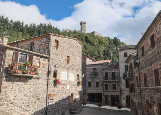
The Rocca looms high above Radicofani
From the Tourist Office just outside the walls, walk through the arched entrance for the old part of Radicofani (780m). You head up cobbled Via Roma past shops and well-kept houses. After Piazza Ghino da Tacco, the way steepens through Piazza Vittorio Tassi then Piazza San Pietro with a dark stone church and scenic park. Not far up is Via della Ripa, where you go R under a covered passageway. Follow signs carefully up to a stepped path climbing in woodland. Puff! You emerge at a superbly located café and the entrance to the Rocca (896m, 30min).
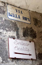
The walk turns up Via della Ripa
For even better vistas, a modest fee lets you into the heart of the Rocca fortress and battlements. From here, 360-degree views encompass the volcanic cone of Monte Amiata to the north-west, Monte Cetona to the east, the vast expanse of Val d’Orcia, the towers of Siena, and if the sky’s clear, what feels like the whole of Tuscany!
From the entrance, cross R to the road in descent on the opposite side of the knoll. After a curve, leave the tarmac for the path L down to the cemetery. Here, turn down the road and keep R (ENE) at the next fork below the tall stone walls of the Rocca. Not far around, instead of curving uphill, fork L (SE) onto a track lined by bushes where hazelnuts abound. Wide curves lead downhill in woodland, concluding at a minor road at an old fountain, Fonte Antese.
Now turn R up Via Fonte Antese for the gentle climb. As you reach houses, keep L to the WC and Tourist Office near the entrance to Radicofani (30min) where you started from earlier.
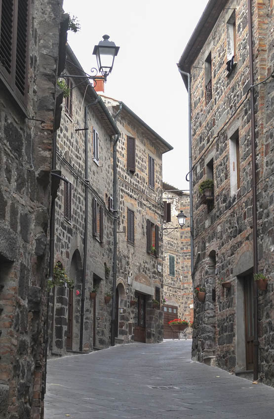
The dark paved streets of Radicofani